


ARCHIVE
Today in the Alps - November 2019
Read about current weather and snow conditions in the Alps
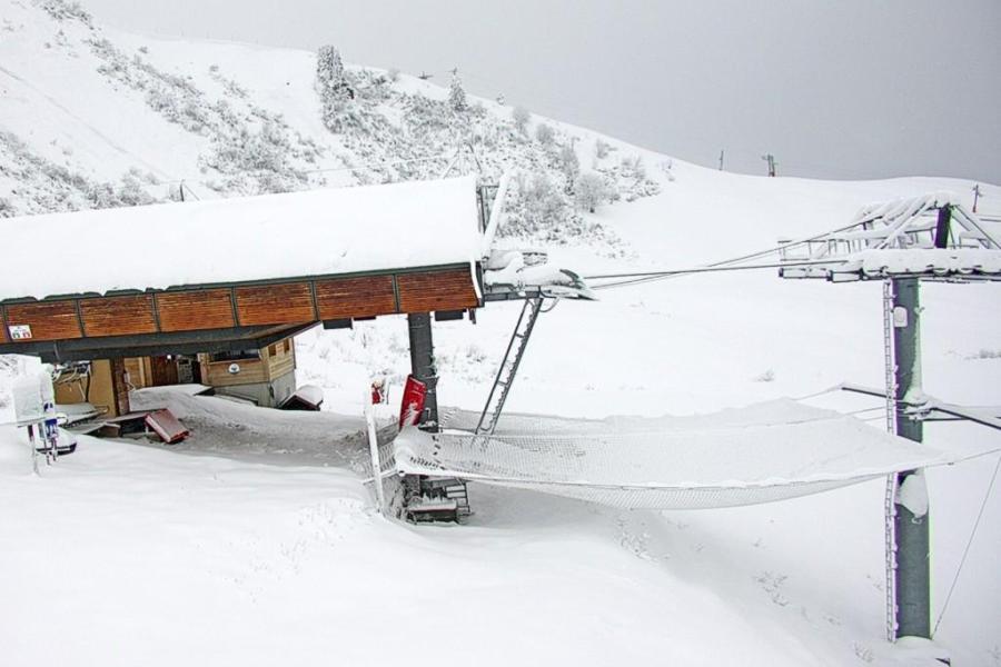
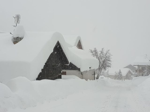
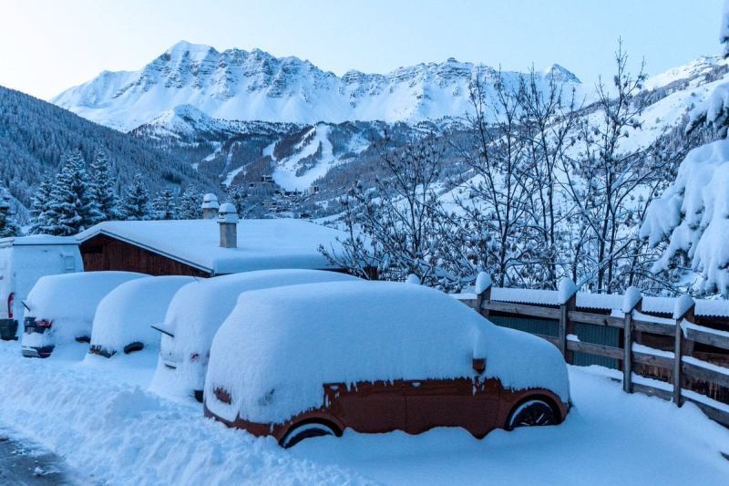
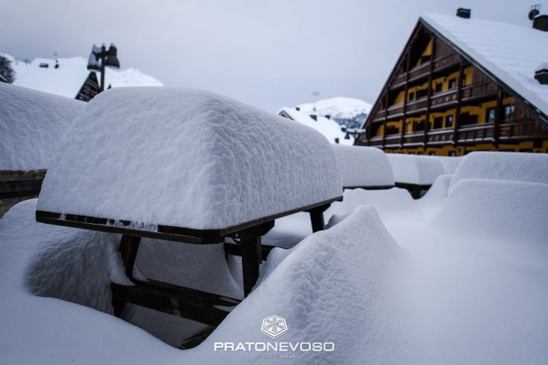
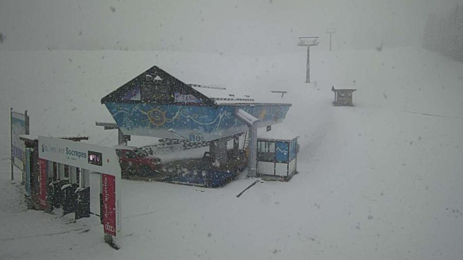
Updated: 9.45am Monday 30 November 2019 - Superb snow conditions for many parts of the Alps…
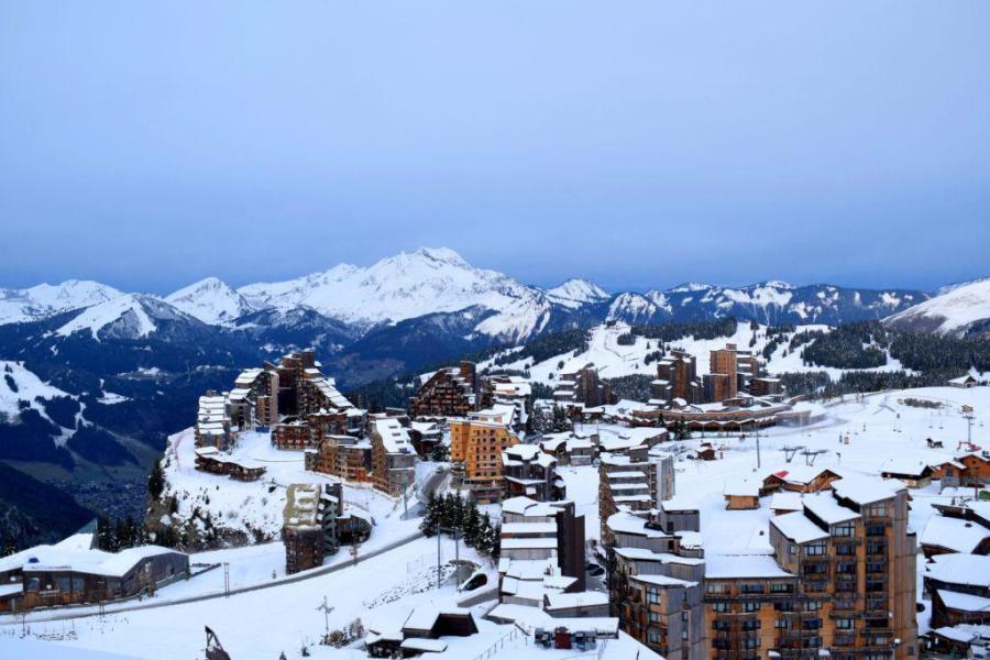
Many resorts are opening for the first time this season today, including Val d’Isère, Les 2 Alpes and Avoriaz (the latter albeit only for the weekend).
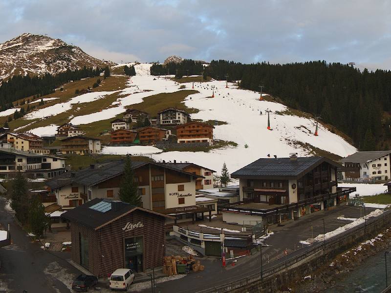
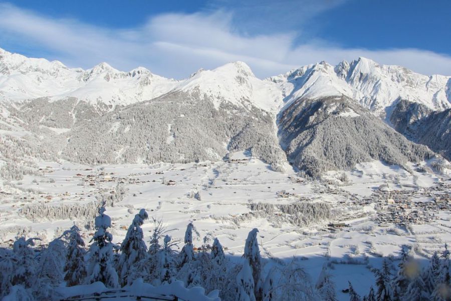
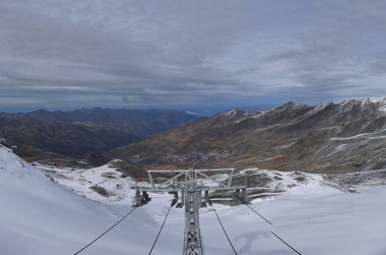
 Superb opening day in prospect for Avoriaz – 30 November 2019 – Photo: avoriaz.com
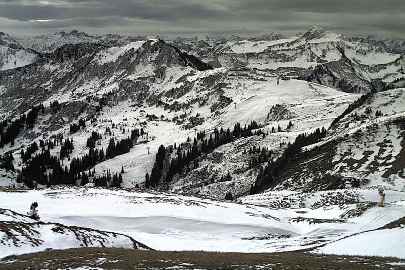
Snow conditions are generally excellent for the time of year, particularly in the higher resorts of the north-western Alps (e.g. Val d’Isère, Val Thorens, Avoriaz, Chamonix) where between 40cm and 70cm of new snow has fallen since Wednesday, with up to 80cm on the northern side of Mont Blanc.
Most other northern parts of the Alps have also seen fresh snow from this latest storm, but any precipitation has been patchier the further south and east you are, with many places (e.g Dolomites) having stayed dry in recent days.
After a largely sunny day today, a new storm will approach the Alps tonight and deliver significant snow to the south-western Alps tomorrow. This time it will be the likes of Serre Chevalier, Isola 2000 and Sestriere that will do best.
Updated: 9.45am Friday 29 November 2019 - More snow for the north-western Alps!
It has now been snowing almost continuously (above 1500m or so) since Wednesday night in some north-western parts of the Alps, and will continue to do so today, with a rain/snow limit gradually lowering towards 1000m.
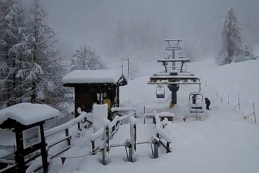
 Lots of new snow at altitude in the northern French Alps. This is Praz-sur-Arly, near Megève – 29 November 2019 – Photo: prazsurarly.com
Areas affected include the northern French Alps (Savoie, Haute Savoie, parts of the Isère), the Swiss Alps away from the south, and the far western Austrian Alps (Vorarlberg far west of Tirol).
By far the heaviest and most persistent snow has fallen in the east of the Haute-Savoie and adjacent border areas in Switzerland (e.g. Chamonix, Flaine, Portes du Soleil). By the end of today, these areas will have seen 48-hour storm totals (above 1800m) in the region of 40-60cm. Elsewhere in the north-western Alps, totals will be closer to 15-40cm.
The further south and east you go in the Alps, the less precipitation there has generally been from the latest storm cycle, with parts of the south-east (e.g. Dolomites) having missed out completely this time around.
After something of a reprieve tomorrow, a new storm will reach the Alps on Sunday but this time the heaviest snow will fall in the southern French Alps (e.g. Serre Chevalier, Isola 2000) and the western Italian Alps (e.g. Sestriere).
Updated: 8.50am Thursday 28 November 2019 - More snow, mostly in the north-western Alps…
The weather in the Alps remains very unsettled with more rain and snow in places, heaviest in the north-western Alps.
 New snow in Val d’Isère this morning – 28 November 2019 – Photo: radiovaldisere.com
The heaviest snow will fall in the northern French Alps today, especially in the Haute-Savoie (e.g. Chamonix, Flaine, Avoriaz) where we can expect 20-30cm of new snow above 1800m. It won’t be particularly cold though, with a rain/snow limit between 1400m and 1600m.
Other parts of the French Alps (away from the far south), the northern and western Swiss Alps (e.g. Verbier, Mürren, Crans Montana, Engelberg) and the far west of Austria (e.g. Lech, St Anton) could also see some moderate snowfalls (10-20cm) at altitude today.
Generally, though, the further south and east you are, the lighter and patchier any precipitation will be. Indeed, the far southern French Alps (e.g. Isola 2000), the eastern Italian Alps (e.g. Dolomites) and the southern Austrian Alps (e.g. Nassfeld) should stay completely dry.
The weather will remain unsettled on Friday, with further snow across the north-western Alps. This time the heaviest falls will also extend further east, affecting not only the northern French Alps but much of Switzerland and the northern and western Austrian Alps too. It will also be a bit colder, with the rain/snow limit falling to between 900m and 1300m.
After something of a lull in the weather on Saturday, the next storm will bring snow to the southern and western Alps on Sunday.
Updated: 9.50am Wednesday 27 November 2019 - New storm in the Alps…
A new storm reached the western Alps early this morning and will move east to reach most parts of the Alps during the course of the day.
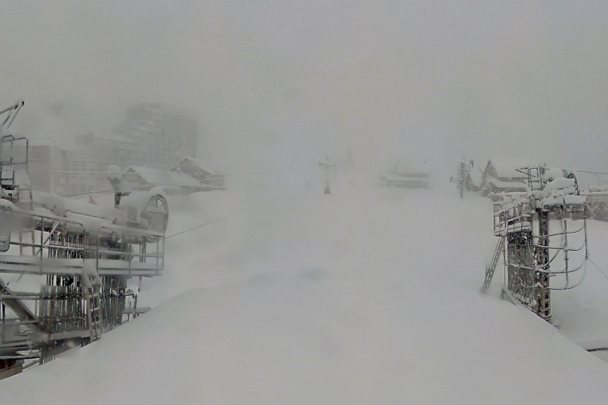
 It’s snowing this morning in Val Fréjus – 27 November 2019 – Photo: facebook.com/valfrejus
The most persistent precipitation is already moving away from the French Alps where 5cm to 20cm of snow has fallen above 2000m with a rain/snow that started quite high but fell to around 1500-1700m early this morning.
During the course of the day, most other parts of the Alps will see at least some snow at altitude but it will generally be heaviest in the west. The rain/snow limit in the central and eastern Alps will be in the range of 1600-2100m (so expect rain lower down), dropping a bit later. Meanwhile, behind the main band of precipitation, further showers (snow 1600m) will reach the western Alps as the day progresses.
Thursday and Friday will see further storms reach the Alps with the heaviest precipitation in the north-west, including the northern French Alps (roughly north of Grenoble), most of the Swiss Alps (away from the far south) and the far west of Austria (e.g. Arlberg). The rain/snow limit will gradually lower to around 1100-1300m in most of these regions by Friday.
Resorts and areas that should see a decent amount of snow at altitude from the latest storm cycle include L’Espace Killy, 3 Valleys, Paradiski, Grand Massif, Chamonix, Portes du Soleil, Jungfrau Region, Engelberg, Lech and St Anton. These should all see in the region of 20-40cm of new snow above 2000m by Friday, but any precipitation will mostly be rain below about 1200m.
Updated: 9.30am Tuesday 26 November 2019 - Mostly dry today, with new weather fronts from the west tomorrow…
Many parts of the Alps will get away with a dry day today, even if there is plenty of cloud around. It will be mild with freezing levels typically between 2000m and 2500m in the eastern Alps and as high as 3000m in the western Alps.
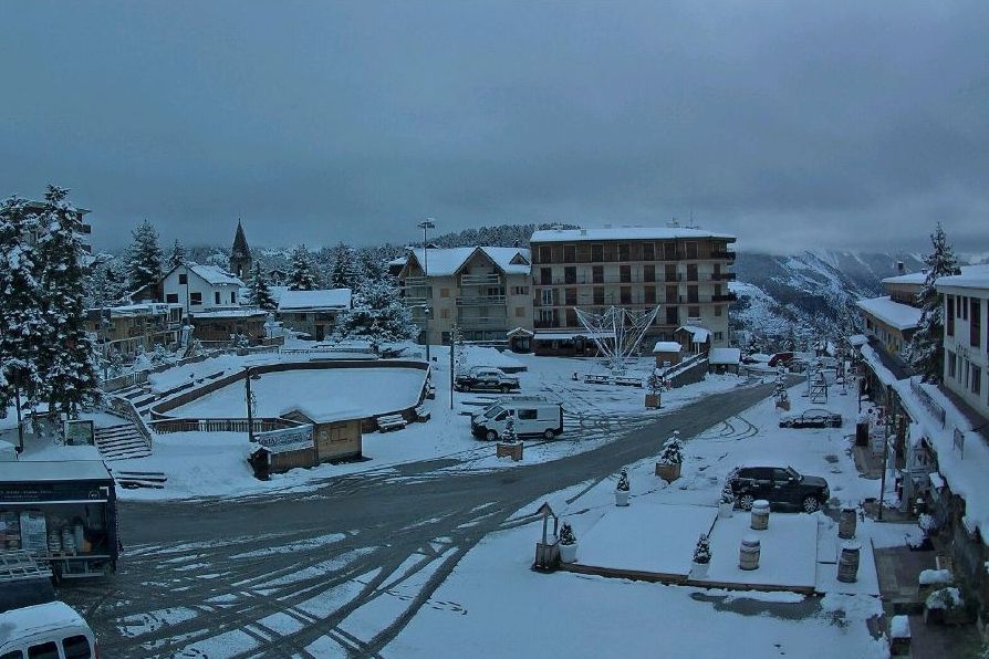
 Fabulous snow conditions in the southern French Alps. This is Vars – 26 November 2019 – Photo: facebook.com/varslaforetblanche
Over the next few days the weather will turn very unsettled again as a series of storms move into the Alps from the west. This time it will be the western Alps that will see the most snow, though it won’t be particularly cold, with a rain/snow limit typically between 1500m and 2000m at first, dropping towards 900-1200m later in the week.
Expect between 20cm and 50cm of new snow above 2000m over the next two to three days in the northern French Alps (e.g. 3 Valleys, Chamonix, Avoriaz), as well as the western Swiss Alps (e.g. Jungfrau region). By the end of the week the north-eastern Swiss Alps (e.g. Laax) and Austrian Arlberg (e.g St Anton) should also see some significant snow at altitude. The southern Alps will generally see less precipitation this week, but may get in on the action again this weekend. Watch this space…
Snow conditions in the Alps are currently far superior in the south, by which we mean:
- all Italian resorts;
- the southern French Alps (roughly from Alpe d’Huez/Les 2 Alpes southwards);
- the far southern Swiss Alps in a triangle from Zermatt up to Andermatt and back towards St Moritz; and
- the southern Austrian Alps (e.g. Obergurgl, Nassfeld).
 Many northern parts of the Alps have seen their snow cover decimated by the Foehn. This is Lech – 26 November 2019 – Photo: lech.com
Snow conditions in the northern Alps are much more hit and miss, although there are some exceptions, such as Val d’Isère/Tignes where cover is very good. However, snow cover is generally very patchy again at low (and even medium) altitudes thanks to the Foehn conditions last weekend.
For further details check out our detailed snow report later today…
Updated: 12pm Monday 25 November 2019 - Temporary lull in the Alpine weather…
There are still a few residual showers in the western Italian Alps this morning, but for all intents and purposes the big weekend storm is over and many parts of the Alps will enjoy a temporary lull in the weather today.
 Beautiful morning across many parts of the Dolomites. This is Campitello – 25 November 2019 – Photo: fassa.com
The south-western Alps have seen a huge amount of snow at altitude over the past two to three days, with the biggest snowfalls in the southern French Alps close to the Italian boarder (e.g. Queyras, Isola 2000), the far south-east of the French Savoie (e.g. Val d’Isère, Bonneval-sur-Arc, Val Cenis), the Italian Piedmont (e.g. Sestriere, Prali, Alagna), the northern and eastern Aosta valley (e.g. Cervinia, Champoluc, Pila), parts of the far south of Switzerland to the east of Zermatt (e.g. Saas-Fee) and Ticino (e.g. Bosco Gurin).
These regions have seen between 60cm and 120cm of new snow above 2500m since Friday, with 150cm or more in places, with a rain/snow limit generally between 1200m and 1800m.
 Well over 1m of new snow in Isola 2000 this weekend – 25 November 2019 – Photo: nicematin.com
The central Italian Alps (e.g. Livigno) and the far south-eastern Swiss Alps (e.g. St Moritz) also saw some significant snow but, this time around, precipitation in the Dolomites (e.g. Selva) and the south of Austria (e.g. Nassfeld) was patchier.
The northern Alps did not fare as well over the weekend, with a strong Foehn reaching 200 kph in places on Saturday. As expected, this melted much of the snow at lower altitudes and scoured or blew any unconsolidated snow off the mountain higher up.
As for the weather in the Alps this week, except for the odd shower here and there, Monday and Tuesday will be mostly dry and mild with some sunny spells. Some more organised precipitation is then expected to move in from the west mid-week, with snow above 1300-1800m.
The heaviest is likely to be in the northern French Alps (e.g. Portes du Soleil, Grand Massif, Chamonix), albeit falling as rain lower down. Later in the week the wind will swing more into the north-west, with any snow falling to increasingly lower levels.
Updated: 11am Sunday 24 November 2019 - Extreme snowfall in some south-western parts of the Alps!
As forecast, there have been huge snowfalls in the last 24 to 48 hours across many south-western parts of the Alps, especially at altitude. In the north, however, a strong Foehn wind has damaged the snowpack in many resorts.
 Serious snowfall in Saas-Fee – 24 November 2019 – Photo: facebook.com/SaasFee
Regions that have seen the most snow include:
- the southern French Alps close to the Italian border (e.g. Isola 2000 where they are reporting more than 1 metre of new snow this morning);
- the Italian Piedmont (e.g. Sestriere, Alagna);
- parts of the Aosta valley (e.g. Cervinia, Monte Rosa); and
- parts of southern Switzerland, mostly to the east of Zermatt (e.g. Saas-Fee), including the Simplon area and Ticino (e.g. Bosco Gurin).
These areas have seen between 50-100cm at altitude in the last couple of days, with up to 150cm in some high border areas. The rain-snow limit this weekend has sat between 1200m and 1800m, but a touch lower in some internal valleys under the heaviest precipitation.
The further east you go across the southern Alps, the less new snow has fallen. The central Italian Alps (e.g. Livigno) have still seen significant snow from this latest storm, but snowfall has been patchier in the Dolomites.
The northern Alps have generally seen little if any snow in recent days. One notable exception is the far south-east of the French Savoie, where Val d’Isère has at least 70cm of new snow on its Pisaillas glacier and nearby Bonneval-sur Arc and Val Cenis have seen well over 100cm up top. For the most part, however, the Foehn has been the dominant story here, melting much of any lower-lying snow and scouring the cover higher up.
 A good example of the damage that the Foehn can cause. This is Mellau in the Austrian Vorarlberg – 24 November 2019 – Photo: mellau.at
The week ahead looks as if it will remain unsettled, but turning milder, with some fresh snow mostly only above 2200-2600m and in the western Alps (e.g Chamonix, Verbier), at least to start with.
Later in the week and especially towards the back end of next weekend it should turn significantly cooler with snow showers falling to lower levels, especially in the north and west. By the week after, the north-east (most of Austria) might also see some new snow to low levels. That is a long way off though, so watch this space…
Updated: 10.15am Saturday 23 November 2019 - Stormy!
The latest storm to hit the Alps is in full swing, with heavy rain/snow on the southern (and particularly south-western) side of the Alps, and a Foehn storm further north.
 Heavy snow in Prali in the Italian Piedmont – 23 November 2019 – Photo: facebook.com/prali
So today is not the best day to be trying to ski in the Alps, with most high lifts shut due to the wild weather. The areas that will see the most snow today are:
- The far southern French Alps, especially close to the Italian border (e.g. Isola 2000);
- parts of the Italian Piedmont, especially the north (e.g. Alagna);
- parts of the Aosta Valley, especially the north and east (e.g. Cervinia); and
- the far south of Switzerland, around and to the east of Zermatt and Saas-Fee, especially around the Simplon region.
These areas could see storm totals of between 50cm and 100cm at altitude, with a rain/snow limit between 1300m and 1800m.
The south-eastern Alps (e.g. Dolomites) will see bits and pieces of rain/snow, but not as much as the south-west.
 Blizzard in progress in France's Isola 2000 – 23 November 2019 – Photo: isola2000.com
With some exceptions (e.g. Val Cenis, Val d’Isère) the northern Alps will see little if any snow from this storm. Instead they will be battered by a vigorous Foehn wind that will accelerate the thaw at lower altitudes.
On Sunday the last of the rain/snow will die away from the southern Alps, with plenty of sunshine across the northern Alps before it clouds over again later in the day from the west.
The rest of next week will remain unsettled, but it will be the French and western Swiss Alps that will see the most precipitation as the new storms come in from a more westerly direction. These could bring significant snow at altitude (e.g. Chamonix, Verbier) mid-week, but also some rain lower down.
By early December we might see the wind swing towards the north, which will benefit the northern Swiss Alps (e.g Jungfrau) and much of Austria. This is a long way off though, so can’t be confirmed until nearer the time!
Updated: 9.45am Friday 22 November 2019 - New “southern-westerly” storm underway…
As expected, a new storm is currently affecting the Alps, bringing significant snow to the south-west over the next couple of days, especially on Saturday.
 Some new snow in Auron with more expected later today and tomorrow - Photo: auron.com, 22 November 2019
Areas affected by this storm include parts of the southern French Alps closest to the Italian border (e.g. Isola 2000, Queyras), the Italian Piedmont (e.g. Prato Nevoso, Sestriere, Alagna), parts of the Aosta region (e.g. Cervinia, Pila, Champoluc) and parts of the far south of Switzerland (e.g. Zermatt, Saas-Fee, Bosco Gurin).
These areas could see between 30cm and 80cm of new snow at altitude by Sunday morning, with over 1m in places, but with most of it falling tomorrow rather than today. The rain-snow limit will vary, but will typically sit between 1200m and 1800m, sometimes a bit lower under the most intense areas of precipitation.
By contrast, with one or two exceptions (e.g. Val d’Isère, Val Cenis), the northern half of the Alps will be mostly dry over the next couple of days, if rather cloudy at times. There will also be an increasingly strong Foehn wind (peaking on Saturday) which will melt much of the lowest lying snow.
If you are planning on skiing in the Alps over the weekend, Saturday will not be a great day due to high winds and, to the south of the main alpine ridge (especially in the south-west), bad visibility and precipitation.
The weather will quickly improve on Sunday, but it may take some of potentially best ski areas (e.g. Cervinia, Saas-Fee) a while to open due to all the new snow. Monday looks like a better (if not perfect) weather day for most of the Alps.
Updated: 12pm Thursday 21 November 2019 - New storm for the south-western Alps…
The next storm is approaching the south-western Alps and will deliver significant snow here over the next few days, notably on Friday and Saturday.
 Snapshot of where the most snow will fall over the next few days – Image: bergfex.at, 21 November 2019
The first effects of this storm are already being felt today, with cloud and a few showers (snow 1100-1500m) streaming into the southern French and western Italian Alps. The further north and east you are, the better chance there is of some sunshine, at altitude at least.
On Friday and particularly on Saturday, the precipitation will intensify in the southern French Alps, especially close the border (e.g. Isola 2000), and in the western Italian Alps (e.g. Sestriere, Pila, Cervinia, Monte Rosa), also spilling over into parts of the northern French Alps (e.g. Val Cenis, Val d’Isère) and the southern Swiss Alps (e.g. Zermatt, Saas-Fee, Bosco-Gurin). By the time the storm clears on Sunday, these areas could see 30-70cm of new snow above 1800m, with close to 1 metre in places.
The south-eastern Alps (e.g. Dolomites) will also see lots of cloud over the next few days, but much less in the way of new snow this time around, while the northern Alps will see Foehn conditions - not good news, as it will melt a lot of low-lying snow.
Updated: 12pm Wednesday 20 November 2019 - New storm approaching southern Alps but…
The weather in the Alps has temporarily quietened down, even if there are still some showers in the eastern Italian and southern Austrian Alps (snow 1500-1900m) today. This relative lull won’t last long though, with a new storm set to deliver further heavy snow to parts of the southern Alps later in the week and over the weekend, especially in the south-west.
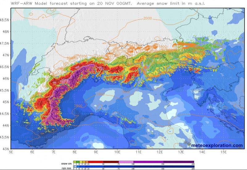 Accumulated snowfall forecast for the Alps between Wednesday 20 and Sunday 24 November 2019 – Image: meteoexploration.com
As the new storm approaches, the southerly airflow ahead of it will create a Foehn wind across the northern half of the Alps - starting tomorrow and peaking on Saturday - which will melt much of the lowest lying snow on the northern side of the Alps.
The southern side of the Alps will see the snow piling up again, however, this time heaviest in the western Italian Alps and some adjacent border regions.
Resorts that should see significant new snow between Friday and Sunday include Monte Rosa, Saas-Fee, Zermatt, Cervinia, Pila, Sestriere, Isola 2000 and possibly even Val d’Isère/Tignes, where the rain/snow limit will generally sit between 1200m and 1500m, or a bit lower under some of the more intense precipitation.
By contrast, freezing levels on the northern side of the Alps will be well in excess of 2000m (maybe even as high as 2500m) by the weekend.
Updated: 10am Tuesday 19 November 2019 - Yet more snow in the south!
Yet more snow has fallen across some southern parts of the Alps in the last 24 hours, this time heaviest in the far south-west, where ski resorts such as Isola 2000, Prato Nevoso and Limone have seen another 40-50cm!
 Huge quantities of snow in Saas-Fee – 19 November 2019 – Photo: facebook.com/SaasFee
Most other Italian ski resorts have also seen some new snow, albeit in more modest quantities this time around, as have some parts of central-southern and south-eastern Switzerland (e.g. St Moritz) and the far south of Austria (e.g. Nassfeld).
Today there will be further snow at times (1200-1700m) across many central-southern and south-eastern parts of the Alps – i.e. the Italian Alps roughly to the east of the Monte Rosa region, some areas in southern and south-eastern Switzerland (e.g. Engadin), the Austrian Osttirol and Carinthia, especially close to the border.
After a slight reprieve mid-week, a new storm will deliver further snow to the southern Alps towards the end of the week, this time heaviest in the western Italian Alps (e.g. Cervinia, Sestriere) as well as some adjacent border areas of both France (e.g. Val Cenis, Isola 2000) and Switzerland (e.g. Zermatt, Saa-Fee). By contrast, the northern Alps will see the Foehn blowing at times which will melt much of their lower-lying snow.
Needless to say, snow depths are currently exceptional across most of the central and southern Alps. Resorts that doing particularly well at the moment (not all of which are yet open) include Isola 2000, Tignes, Cervinia, Zermatt, Saas-Fee, Andermatt, St Moritz, Livigno, Sölden, Obergurgl, Passo Tonale and the entire Dolomite region.
However, we should also point out that the recent huge snowfalls have caused problems in some areas, with avalanches cutting off resorts and even entire communities, especially in the Sudtirol (Italy) and Osttirol (Austria).
The northern Alps generally still have less snow but with some exceptions. For more detail read our snow report updated later today…
Updated: 11am Monday 18 November 2019 - Exceptional snow depths for many southern parts of the Alps…
Yet more heavy snow fell across the southern Alps over the weekend, where snow depths are now exceptional for mid-November in many areas.
 Masses of snow in Saas-Fee, Switzerland – 18 November 2019 – Photo: facebook.com/saasfee
Right now, there is deep snow in:
- the southern French Alps (e.g. Isola 2000, Risoul);
- the Italian Alps, especially from Cervinia eastwards - including the Monte Rosa region, Lombardy (e.g. Livigno) and the Dolomites (e.g Madonna di Campiglio, Sella Ronda);
- the southern Swiss Alps, roughly from Zermatt eastwards - including Saas-Fee, Andermatt and St Moritz; and
- the southern Austrian Alps - including most of Osttirol and Carinthia (e.g. Nassfeld) but also the southern Tirol (e.g. Obergurgl).
All of these areas have between 1.2m and 2.5 m of settled snow at high altitude, with up to 3m reported in some places (e.g. close to Sulden in the Sudtirol).
 Exceptional snow depths in the Sudtirol. This is Sulden – 18 November 2019 – Photo: kachelmannwetter.com
Snow depths are generally still quite modest across the northern Alps - in areas such as Chamonix, the Portes du Soleil, the Bernese Oberland, the Arlberg and resorts of the northern Tirol and northern Salzburgland (e.g Zell am See) – but it should be stressed that there is nothing at all unusual about this, as it is only mid-November.
There are some exceptions in the north, such as the Tignes/Val d’Isère area which (thanks to snow spilling across the nearby Italian border) has well over 1m of snow at high altitude.
As for the forecast this week, there is going to be a bit more snow, again mostly across the southern Alps, especially later today and tomorrow. The northern Alps will generally stay dry with the Foehn blowing at times, however, meaning that most of any low-lying snow will melt by the end of the week.
Updated: 9.30am Friday 15 November 2019 - Another big dump for the southern Alps!
As expected, in the last 24 hours a huge amount of snow has fallen again across the southern Alps, also spilling a little bit further north in places too.
 Big snowfalls in the southern French Alps yesterday. This is Vars – 15 November 2019 – Photo: facebook.com/FrenchMountains
Areas that have benefited most this time around are:
- the whole of the southern French Alps (e.g. Risoul, Isola 2000) but also Val d’Isère/Tignes, Val Cenis and Bonneval-sur-Arc a bit further north;
- most of the Italian Alps, but especially the central-western Italian Alps (e.g. Monte Rosa); and
- the central and southern Swiss Alps (e.g. Zermatt, Saas-Fee, Aletsch Arena, Andermatt).
Roughly 30-70cm of new snow has fallen in these regions in the last 24 hours, with over 1m in places in the high border regions to the east of Zermatt/Saas-Fee.
 70cm of new snow in 24 hours in Prato Nevoso in the south-western Italian Alps – 15 November 2019 – Photo: facebook.com/PratoNevoso
Today the heaviest of the snow has spread a little further east to the central and eastern Italian Alps (e.g. Livigno, Dolomites), the south-eastern Swiss Alps (e.g St Moritz) and the Austrian Alps, especially in the south (e.g. Nassfeld), all of which already saw a lot of snow earlier this week.
This latest storm has also produced some snow across the northern Alps (e.g. Portes du Soleil, Bernese Oberland) but generally in much more modest quantities than further south.
 Fresh snow in Val d’Isère this morning – 15 November 2019 – Photo: Sebastien Truppa
Over the weekend another less potent storm will hit the southern Alps, then next week it looks like the weather will turn mild but remain unsettled, with further heavy snow possible at times across the southern Alps. By contrast, a Foehn wind is likely to develop in the northern Alps, which means that some of their lower-lying snow will start to melt later in the week.
As for where this leaves us in terms of snow conditions in the Alps, check out our latest detailed snow report out later today…
Updated: 9am Thursday 14 November 2019 - Yet more heavy snow for the southern Alps…
A huge amount of snow has fallen across some southern and eastern Alps since we last reported on Tuesday, with close to 1m in some of the higher resorts of the central and southern Austrian Alps (e.g. Stubai), and the Dolomites (e.g. Marmolada).
 A very wintry scene across the Dolomites. This is the Alta Badia region – 14 November 2019 – Photo: webtv.feratel.com
Today another weather front is approaching the Alps from the west, as a new storm is forming in the Gulf of Genoa which will deliver more heavy snow to the southern Alps later today and tomorrow.
This will firstly affect the western/north-western Italian Alps and some adjacent areas in France (e.g Bonneval sur Arc, Isola 2000) and Switzerland (e.g. Saas-Fee), before the north-eastern Italian Alps (e.g. Dolomites) and some adjacent areas in Austria (e.g. Obergurgl, Nassfeld) get in on the action again tomorrow.
 Lots of snow in Austria’s Obertauern – 14 November 2019 – Photo: obertauern.at
The extreme western Alps (e.g. the Vercors, Chartreuse, also the western Jura) will also see heavy snow today, but the northern Alps (e.g. Chamonix and the Bernese Oberland through to the northern Tirol and Salzburgland) will generally miss out.
Overall, we can say that this is a very promising start to the season for the Alps, although it is only mid-November and certainly not everywhere has deep snow yet.
The areas that are doing particularly well at this stage (especially at altitude) are the central, central southern, eastern and south-eastern Alps, including resorts such as Andermatt, St Moritz, Livigno, Obergurgl, Obertauern, Madonna di Campiglio and Arabba, to name just a few.
If we were to single out one country, it would now be Austria where a huge amount of snow has fallen in the more central and southern regions (e.g. Stubai, Hintertux, Obergurgl, Nassfeld). However, even the northern Austrian Alps (e.g. Kaprun) have also seen significant snow.
 Loads of snow in the Austrian Alps, especially the south. This is Virgen in Osttirol – 14 November 2019 – Photo: virgental.at
Although parts of the north-western Alps (e.g. Portes du Soleil, Bernese Oberland) have missed out on the heaviest of the recent snow, there is still some snow here, especially higher up, just not as much as in most other parts of the Alps.
Some south-western Italian resorts (e.g. Sestriere) are also still looking for their first killer dump of the season.
 Avoriaz has some snow but not in huge quantities yet – 14 November 2019 – Photo: avoriaz.com
Updated: 11am Tuesday 12 November 2019 - Remaining very unsettled across the Alps with the heaviest snow in the south…
The weather situation in the Alps is extremely complicated, with several storms set to hit the Alps over the coming days. What we can say for sure is that the southern Alps will see the most snow, with some extreme snowfalls in places.
 Snow conditions looking great in Ischgl – 12 November 2019 – Photo: facebook.com/ischgl.paznaun
Right now, the main driver of the weather in the Alps is a huge area of low pressure in the Mediterranean which is throwing weather fronts up northwards across its eastern flanks.
Over the last 24 hours, these fronts have produced further snow across the central and eastern Italian Alps (e.g. Livigno, Madonna di Campiglio), the eastern swiss Alps (e.g. Davos, St Moritz) and much of Austria, especially in the south (e.g. Obergurgl, Nassfeld). By contrast, the north-western Alps (e.g. Portes du Soleil, Chamonix) have seen little if any snow since yesterday morning.
Nothing will change much today, with drier conditions continuing in the north-west but further snow set to fall in the southern and eastern Alps, although there will be huge contrasts in the rain/snow limit - currently around 1700m in parts of the Dolomites and eastern Austrian Alps, but well under 1000m in the western Austrian Alps.
For the rest of the week the southern Alps will continue to receive further heavy precipitation. At first the emphasis will again be in the south-east (e.g. Lombardy, Trentino, Engadin, Ostirol, SudTirol, Veneto), but then a new storm will develop in the Gulf of Genoa which will allow the western Italian Alps (e.g. Sestriere, Monte Rosa) and some adjacent areas across the border in both France and Switzerland (e.g. Val d’Isere, Saas-Fee) to get in on the action.
Updated: 11am Monday 11 November 2019 - Remaining cool with further snow, mostly across the southern Alps…
The weather in the Alps will remain rather cold and unsettled this week with further snow in places, mostly across the southern Alps.
 Plenty of snow at altitude across the Alps. This is St Anton – 11 November 2019 – Photo: stantonamarlberg.com
The Alps are today sandwiched between a weak cold front moving down from the north-west and a and a more potent storm system anchored in the Mediterranean. The former will bring a dusting of new snow to the north-western foothills of the Alps (e.g. La Clusaz) tonight. The latter, however, will bring a bit more significant snow to some southern parts of the Alps, notably the central and eastern Italian Alps (e.g. Madesimo, Passo Tonale, Dolomites), with a rain/snow limit somewhere between 1000m and 1400m.
The weather in the alps will remain on the cold side for the rest of the week, with further snow at times across the southern Alps. Tomorrow the heaviest snow will fall in the Dolomites, with the south-western Alps (e.g. Piedmont) set to join in the action later in the week.
Although the northern Alps (e.g. Avoriaz, Engelberg, Lech) are unlikely to see any significant snow, it will still be cold, and many resorts have already fired up their snow cannons which will help to secure their base as the main season approaches.
There is already an encouraging amount of snow at altitude across most of the Alps. To find out more, check out our first main snow report of the season later today…
Updated: 9.30am Friday 8 November 2019 - Further snow in many parts of the Alps…
As expected, there has been further snow across many parts of the Alps over the last 24 hours. The heaviest snow has fallen in the southern and western Alps, while the north-eastern Alps (e.g. Salzburgland) have mostly missed out again.
 Heavy snow in the Dolomites this morning. This is Cortina – 8 November 2019 – Photo: dolomitisuperski.com
This morning, it is still snowing across a good portion of the central and south-eastern Alps including most of Switzerland, the northern Piedmont (e.g. Alagna), Lombardy (e.g. Livigno), the Dolomites (e.g. Cortina) and the southern Austrian Alps (e.g. Nassfeld). By contrast, the snow has largely stopped in the western Alps.
Snowfall totals over the past 24 hours are typically in the region of 5-20cm above 1500m across a wide swathe of the French, Swiss, Italian and southern/western Austrian Alps, with more in places. However, some central-southern and south-eastern parts of the Alps (e.g. Andermatt, Livigno, St Moritz and the Dolomites) have already seen 30cm or more at altitude, with more snow set to fall here for much of today.
 Fresh snow overnight in Bardonecchia - 8 November 2019 – Photo: bardonecchiaski.com
We can therefore expect storm totals in excess of 50cm in some favoured spots by the end of Friday, most likely in the central-southern Swiss Alps (e.g. Andermatt) and the eastern Dolomites (e.g. Cortina).
Over the weekend we will see a few further flurries here and there, heaviest in the far south-west (e.g. Isola 2000, Limone, Prato Nevoso) with most places expected to stay dry if rather cold. It will continue cold into next week too with the further chance of snow, notably from mid-week onwards and probably heaviest in the south-east (e.g. Dolomites).
Updated: 9.45am Thursday 7 November 2019 – The weather remains cool and changeable in the Alps…
The weather in the Alps will remain cool and changeable for the foreseeable future, with further snow forecast in some regions, heaviest in the south-eastern Alps (e.g. Dolomites) tomorrow.
 There is already snow in the Dolomites with plenty more forecast tomorrow. This is Alpe Cermis in the Trentino region – 7 November 2019 – Photo: alpecermis.it
Today we have a new storm approaching the Alps from the west. This will deliver some light to moderate falls of snow (typically 5-15cm above 1500m) across many parts of the Swiss, French and Italian Alps as the day goes on, with a rain/snow limit somewhere between 1000m and 1400m. The north-eastern Alps (e.g. Salzburgland) will again stay mostly dry.
Tomorrow we will see a significant intensification of snowfall across the central and eastern Alps (e.g. St Moritz, Obergurgl, Dolomites) where between 25-50cm of new snow is possible at altitude by Friday night.
After a relative lull in the weather on Saturday and first thing on Sunday, further snow will fall across some south-western parts of the Alps later in the weekend and on Monday, especially in areas close to the French/Italian border (from about Val d’Isère southwards). More widespread snow is then possible again in the Alps on Tuesday.
So, all in all the news is good as we draw nearer to the main winter season!
Updated: 11am Tuesday 5 November 2019 - Lots of snow at altitude...
As expected, lots of new snow has fallen across higher parts of the Alps over the last few days. The heaviest snow has fallen in the French Alps, where 30-60cm has been reported quite widely above 2500m, and well over 1m in some favoured spots such as in the Écrins region, just south of Les 2 Alpes.
 Significant new snow at altitude in the Tignes/Val d’Isère area – 5 November 2019 – Photo: tignes.net
Most other parts of the Alps have also seen some snow, though the north-east (e.g. Salzburgland) has generally seen less due to the Foehn. Today it is still snowing above 1600-2000m across some eastern parts of the Alps, notably southern Austria and the Dolomites. Further west, skies are brighter but further snow showers (1500m) are likely later in the day.
The weather will remain changeable and rather cool for the rest of the week, with the further chance of snow at times (and to relatively low levels), notably on Thursday/Friday, then again on Sunday/Monday.
So what does this all mean for the season ahead?
Well, still not much really as it is simply too early to guarantee that any warm spell won’t undo much of the early good work. That said, we are hopeful that a handful of high-altitude ski areas will now be able to hold on to their bases, especially in French resorts with plenty of skiing above 2400m (e.g. Tignes/Val d’Isère, Val Thorens and Les 2 Alpes).
With further top-ups likely, by this time next week these areas (and potentially others) should be more confident of a good start to the season.
Updated: 11.15am Monday 4 November 2019 - Turning increasingly wintry in the Alps…
As expected, many higher parts of the Alps saw some snow over the weekend, with the heaviest falls in the western Alps (France) and central Italian Alps (Lombardy, western Dolomites). The north-eastern Alps (e.g. Salzburgland) were protected by the Foehn and saw the least snow.
 Heavy snow in Tignes today with more likely later in the week – 4 November 2019 – Photo: tignes.net
Today it is snowing again in many western and some southern parts of the Alps, with a rain/snow limit between 1600m and 2200m. Accumulations are now becoming significant above 2500m, with 40-50cm expected by tonight on the Grande Motte glacier above Tignes, and perhaps as much as 80cm on the glacier above Les 2 Alpes.
Tomorrow, the heaviest of the snow will move further east, with the southern Austrian and north-eastern Italian Alps (e.g. Dolomites) most likely to be favoured. The rest of the week will then remain unsettled and relatively cool, with further snow at times, mostly in the southern and western Alps.
The improving snow situation in the Alps is welcome news after a dry and very mild October. It still doesn’t mean very much in terms of how the main winter season will pan out, but it does mean that most of the glaciers will be in excellent shape.
There is also hope that something of a base will now be put down above 2500m or so in resorts such as Tignes/Val d’Isère, Val Thorens, Les 2 Alpes, Cervinia, Verbier, Zermatt and St Moritz, given that the weather is forecast to stay relatively cool over the coming days, with the possibility of further snow, especially later in the week and into next week when some bigger storms are possible. Watch this space…
Updated: 12pm Friday 1 November 2019 - Significant snow coming for some parts of the Alps…
The weather in the Alps is becoming interesting, with a protracted storm cycle set to bring significant snow to some areas over the coming days, especially in higher parts of the western Alps.
 Still green lower down in Val Thorens, but this will change over the coming days – 1 November 2019 - Photo: bergfex.com
Over the next two to three days, the wind will predominately come from the west or south-west, creating a Foehn effect on the north-eastern side of the Alps. This will lead to very mild and mostly dry weather in the Austrian Alps (though still with a few showers here and there), but quite a lot of precipitation for the French Alps (e.g. Tignes, Les 2 Alpes), the western Swiss Alps (e.g. Verbier) and western and central parts of the Italian Alps (e.g. Passo Tonale). The rain/snow limit will initially sit well above 2000m but will drop steadily next week.
More generally, there is still lots of uncertainty as to how the weather in the Alps will pan out next week, as it will depend on the exact position of the jet stream, which will be meandering very close to or over the Alps.
One thing that is for certain is that the weather will remain unsettled, with current models still favouring the western Alps in terms of snowfall. The western Alps will also see the coldest temperatures, with snow possible to 1500m (or even lower) at times. Stay tuned!