


Updated: 10am Friday 27 April 2018 - End of a hot week in the Alps!
Pressure remains relatively high across the Alps. However, Atlantic weather fronts are trying to approach from the west with more changeable weather expected over the next few days, especially later on Sunday.
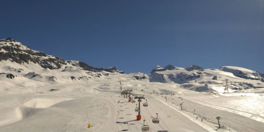
 Lots of snow still in Tignes! – 27 April 2018 – Photo: tignes.net
Today there is plenty of warm sunshine around with just a few areas of cloud (and the odd shower) in the south-western Alps (in the northern Piedmont, for example). Due to a slight Foehn effect, the highest temperatures will be across the northern and north-eastern Alps where 25°C is possible in some lower valleys.
Saturday will be broadly similar – generally warm with plenty of sunshine across the northern and eastern Alps. A few showers are possible further west, especially later in the day and in the south-west (snow 2400-2700m).
Sunday will see a more active cold front affecting the western Alps later in the day and overnight with heavier, possibly thundery showers. The rain/snow limit will start high but fall to below 2000m on Sunday night (locally even to 1000m). The bad weather will then move into the eastern Alps on Monday, but any rain/snow will become lighter.
The last week or so has been unusually warm in the Alps but there remains a huge amount of snow at altitude. Weather conditions will be a bit mixed this weekend but among the better options for a very late ski are Val d’Isère (closes 1 May), Tignes (closes 6 May), Val Thorens (closes 6 May), Cervinia (closes 6 May), Zermatt (open year-round), and Hintertux (open year round).
Val d’Isère has so much snow that they have even announced that (for the first time ever) some non-glacial summer skiing will be available on the Bellevarde mountain, starting on 3 June!
Updated: 10.30am Monday 23 April 2018 - Gradually turning more unsettled
The weather in the Alps will remain on the warm side early this week, but with an increasing risk of showers. By Thursday it should have turned significantly cooler with a little fresh snow in places.
 Cervinia remains a good bet in the hot weather due to the exceptional average altitude of its ski area – 23 April 2018 – Photo: cervinia.it
After several days of very warm and mostly sunny weather in the Alps, spring snow conditions rule. It is still possible to find some excellent skiing both on and off-piste, but good timing and local knowledge are key. Slopes facing east and south-east will soften up first, followed by south and west facing ones later in the day. High north-facing slopes will hold on to firm snow the longest, but in recent days only those above 3000m or so have been able to offer anything close to “wintry snow conditions” all day long.
Of the resorts still open, some of the best bets include Val d’Isèere, Tignes, Val Thorens, Cervinia, Zermatt, Obergurgl and Hintertux.
Updated: 10.20am Thursday 19 April 2018 – Hot!
The weather in the Alps has turned summery with lots of sunshine and increasingly high temperatures that will approach record levels (for mid-April) over the next couple of days.
 Fabulous spring skiing conditions in Cervinia this morning – 19 April 2018 – Photo: cervinia.it
We are already likely to see maximum temperatures of 25°C or so today in some of the lower valleys and by Saturday it could reach 28°C (in Sion, for example). Needless to say, spring-snow conditions will rule over the next few days, meaning hard or icy conditions first thing followed by a rapid softening up process, first on slopes facing east, then south, west, and lastly on those facing north.
By mid-afternoon only the very highest north facing slopes (above 2800-3000m or so) will retain anything like wintry snow, but with good local knowledge you can still experience some excellent skiing by following the sun around the mountain, at least until the early afternoon – and assuming you have enough altitude.
Recommended resorts at this time of year and in this “heatwave” type of weather include Val d’Isère, Tignes, Val Thorens, Zermatt, Cervinia and Hintertux (or indeed any glacier). Basically you want a resort with plenty of skiing above 2500m, ideally also with plenty above 3000m.
Updated: 2.15pm Monday 16 April 2018 - Increasingly summery!
Winter is well and truly on its way out now, with increasingly spring-like and even summery weather set to take hold in the Alps as the week progresses.
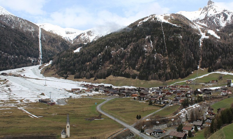 It will turn increasingly spring-like across the Alps this week. This is Kals in the Austrian Tyrol – 16 April 2018 – Photo: kals.at
There will still be some showers to contend with today, especially across the eastern Alps (i.e. Austria), with a rain/snow limit close to 2000m. The best of any brightness will be in the western Alps, though as the week progresses it will become increasingly warm and sunny right across the Alps with freezing levels soaring to 3500m or more by the middle of week, at which point we can expect daytime temperatures to reach the mid-twenties in the lower valleys.
There is still an awful lot of snow at altitude in the Alps but, needless to say, snow conditions will be very “spring-like” this week – i.e. hard in the morning (at least where skies have been clear overnight), followed by a rapid softening up process, first on east and south-facing slopes, then more generally across the ski areas later in the day. Only north-facing slopes above about 2800-3000m are likely to hang on to anything like “wintry” snow by mid-week.
If you are still planning on skiing in the Alps this season, picking a resort with plenty of terrain above 2500m is highly recommended. Examples include Val d’Isère, Tignes, Val Thorens, Zermatt, Cervinia, Obergurgl and Hintertux.
Updated: 8.30am Friday 13 April 2018 - Powder day, for some…
It’s a powder day for some lucky skiers today, but another ‘spring skiing’ day for others…
 Amazingly snowy for mid-April in Isola 2000 near Nice – 13 April 2018 – Photo: isola2000.com
One resort that has woken up to another decent overnight snowfall is Val d’Isère, which saw 16cm last night - adding to the 12-15cm of snow that fell overnight on Wednesday, when there was 60-70cm up top on the Pisaillas glacier close to the Italian border.
The higher parts of the south-western Alps have basically seen the lion’s share of new snow from this latest storm. By this we mean the southern French Alps (e.g. Isola 200, Auron) and the south-western Italian Alps (e.g. Prato Nevoso, Prali). These areas have seen as much as 1m at altitude over the last few days.
Some more northerly French resorts (including Val d’Isère as mentioned above) also benefited from significant snow spilling over the Italian border – but this was an exception, rather than the rule.
Elsewhere in the western Italian Alps, some Aosta valley and northern Piedmont resorts (e.g. Monte Rosa, Cervinia) have also seen moderate snowfalls. Some southern Swiss resorts (e.g. Zermatt, Saas-Fee) have also seen snow, but not as much as in the Italian Piedmont or southern French Alps.
Elsewhere in the Alps there has been much less or no snow at all. Indeed, with temperatures on the mild side, the atmosphere is positively spring-like at low altitude, especially across the northern and eastern Alps, including much of Austria.
Updated: 8.30am Wednesday 11 April 2018 - Mild, mixed weather, mixed snow conditions
The weather in the Alps is stuck in a bit of a rut, with a mild southerly airflow delivering plenty of snow (but also some rain) across the south-western Alps over the next couple of days.
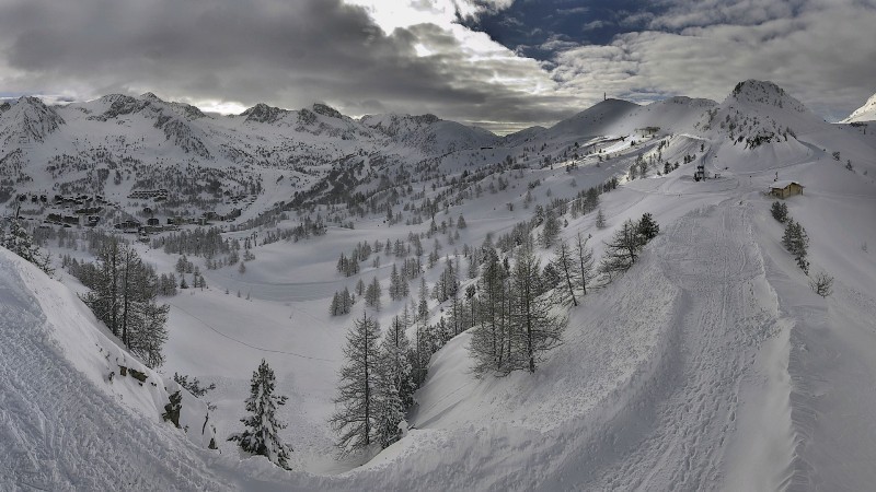
 Cloudy with the risk of showers today across the Monte Rosa region – 11 April 2018 – Photo: visitmonterosa.com
The heaviest precipitation will be in the western Italian Alps, especially in the Piedmont (e.g. Alagna, Sestriere, Prato Nevoso), the northern and eastern Aosta (e.g. Cervinia, Champoluc) and the southern French Alps close to the Italian border (e.g. Isola 2000). Some of these areas have the potential to see 50-80cm of new snow (locally even more) at altitude by the end of the week, with a rain/snow limit between 1200m and 1600m.
Some significant snow could also creep over the border into the northern French Alps (e.g. Val d’Isère, Val Cenis), as well as the far southern Swiss Alps (e.g. Zermatt, Saas-Fee). In these cases, the rain/snow limit may be that bit higher.
Elsewhere in the Alps, there will be plenty of dry weather over the next few days. A few showers will affect the western Alps from time to time but the further north and east you are (i.e. Austria) the more in the way of warm sunshine you are likely to experience.
Snow conditions in the Alps are therefore very mixed right now – generally poor at low altitude, with wet or heavy snow consistency. By contrast, there is the potential to enjoy some powder at altitude in the south-west over the next couple of days. We say “potential” as the off-piste situation is dangerous right now and a good guide, not to mention some luck with finding some breaks in the weather, are essential.
Updated: 12.50pm Monday 9 April 2018 - Mild, with significant snow for a lucky few
A mild southerly airflow is affecting the Alps right now and will remain in place for much of the week. This set-up will deliver a lot of snow (but also some rain) to some south-western parts of the Alps over the next few days.
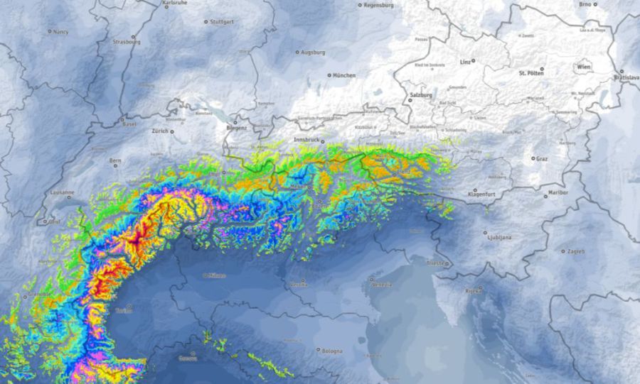 Expected snowfall across the Alps between Monday 9th and Friday 13th April 2018 (with red and dark purple showing areas with accumulations of over 1m, or more) – Image: bergfex.com
By contrast, the northern and especially north-eastern Alps (i.e. much of Austria) will be protected by the Foehn and remain dry and warm.
The areas that will see the most precipitation over the next few days are the high border areas between Italy and France (especially from about Val d’Isère southwards) and between Italy and Switzerland (especially between Zermatt and Lugano). Above 2200m these areas could see between 50cm and 100cm (locally more) of snow by the end of the week with a rain/snow limit around 1300-1700m, and a bit higher in parts of France and Switzerland.
Snow cover in the Alps remains good for early-mid April. However, snow conditions are highly variable, and generally poor below 2000-2300m, especially where cloud cover has prevented nightly refreezes.
At high altitude there is still some good skiing to be found though, with even some powder in prospect over the next few days for a lucky few (e.g. Val d’Isère, Tignes, Bonneval sur Arc, Val Cenis, Zermatt, Saas-Fee, Cervinia and Monte Rosa).
Updated: 9am Thursday 5 April 2018 – New snow for some
Weathertoski is currently in Flaine, courtesy of Ski Collection, where we have 10- 20cm of new snow this morning (depending on altitude) and it is still snowing!
 Fresh snow in Flaine this morning but it will be sunny and warm again by Friday – 5 April 2018 –Photo: weathertoski.co.uk
This morning, the snow showers (1300m) here in the northern French Alps are expected to die away slowly leaving a mostly dry afternoon with sunny spells. More generally, we will see flurries fading from the north-western Alps today, though they will hang on a bit longer further east – notably in Austria, where the rain/snow limit will be between 1300m and 1700m.
Snow cover across the Alps remains impressive for April with nearly 5m at 2500m here in Flaine, for example! Snow conditions are naturally more variable, however, given the changeable weather and strength of the sun.
Today there will be powder for some, especially in the French, southern Swiss and central Italian Alps. By Friday, however, it will be warm and sunny everywhere which means that spring snow conditions (i.e. freeze-thaw) will rule.
Updated: 2pm Wednesday 4 April 2018 – Storm incoming!
Weathertoski is currently in Flaine, courtesy of Ski Collection, where after a sunny morning the weather is on the turn once again.
 Sunny this morning in Flaine but rain and snow is expected later in the day – 4 April 2018 – Photo: weathertoski.co.uk
The change in weather is courtesy of an approaching Atlantic storm what will deliver a mixture of rain to western parts of the Alps this afternoon and this evening, spreading further east tonight and tomorrow. The rain/snow limit will start at around 2000m, falling to 1200m in the west later.
Snow showers (1200m) will clear the western Alps during the course of Thursday but will linger in the east (notably in Austria), before sunny and very mild weather returns to all parts on Friday and Saturday.
Snow conditions remain highly variable across the Alps. There will be some powder to enjoy in places tomorrow, especially at altitude and in the western half of the Alp, however spring snow conditions will prevail again by Friday.
Updated: 9am Tuesday 3 April 2018 – Very mild!
Weathertoski is currently in Flaine, courtesy of Ski Collection, where it is cloudy, windy and mild this morning.
 Mostly cloudy and very mild in Flaine this morning – 3 April 2018 - Photo: weathertoski.co.uk
There is still a huge amount of snow here in Flaine, nearly 2m at resort level and close to 5m up top! However, snow quality has deteriorated notably since Sunday (as it has done across many parts of the Alps) thanks to the significant increase in temperature.
This change in the weather has been brought about by southerly winds that are producing Foehn conditions across the northern Alps. In the case of the northern French Alps this means mild, gusty, cloudy, but mostly dry weather, with just the odd light shower (snow 2300m). By contrast, it is colder with snow (1200-1600m) on the Italian side of the border (especially in the Piedmont), and this snow is spilling across some border areas with both Switzerland (e.g. Zermatt) and France (e.g. Val d’Isère, Montgenèvre). The brightest weather today will be in the north-eastern Alps (i.e. Austria) but it will also be very mild.
Wednesday will start similarly to Tuesday before a spell of heavier and more persistent precipitation arrives from the west later in the day, with snow above 2000m then lowering to 1200m during the night.
On Thursday, the north-western Alps will see early snow (1000-1400m) moving east into Austria. The southern Alps should remain mostly dry with sunny spells. Friday should be warm and sunny everywhere.
Updated: 8.30am Sunday 1 April 2018 – More fresh snow in many places
Weathertoski is currently in Flaine, courtesy of Ski Collection, where there is 25cm of fresh powder snow this morning and the temperature is -4°C.
 25cm of fresh snow this morning in Flaine – 1 April 2018 – Photo: weathertoski.co.uk
The weather is expected to clear up today across the north-western Alps. However, snow showers will continue for a while (500-900m) elsewhere across the northern Alps, and all day perhaps in parts of Austria. The southern Alps will be mostly dry with good sunny spells.
Tomorrow it will turn milder again. Many places will be dry but cloudier conditions will affect the south-western Alps, with a few showers. On Wednesday and Thursday some more organised and heavier precipitation will affect the southern and western Alps with a rain/snow limit starting above 2000m, before dropping dramatically later.
Snow conditions are clearly going to be very mixed over the next few days but are excellent in many areas today, not least here in Flaine where it is cold, there is fresh snow and the base depth is 200/470cm depending on altitude!