


Latest snow report
Updated: 5.25pm Thursday 9 March 2023
Snow conditions in the Alps are all over the place this week due to the highly volatile weather. They are improving significantly at altitude in the north-west thanks to fresh snow, the heaviest of which is set to fall on Friday and Saturday. However, highly volatile freezing levels mean that rain has or will also be an issue in these areas lower down. With high winds also in the mix, the risk of avalanche will be sky-high off-piste, especially at altitude.
All in all, though, by the time the weather calms down and the runs are secured, the net result should be positive for resorts with plenty of skiing above 1800m in the north-western Alps. This includes the northern French Alps (including and north of Alpe d’Huez/Les 2 Alpes), the far north-western Italian Alps (e.g. Courmayeur, La Thuile), the northern and western Swiss Alps (e.g. Verbier, Gstaad, Jungfrau region, Engelberg) and, to some degree, the far west of Austria (e.g. Lech, St Anton). These areas will see the greatest storm totals this week and weekend, with the very highest totals in the northern French Alps (e.g. Val d’Isère, Chamonix).
The weather in the Alps has been less volatile the further south and east you are this week, resulting in more consistent snow conditions. The Dolomites, for instance, have escaped the worst of the weather and continue to offer some decent on-piste skiing at all levels even if snow depths are very modest.
Indeed, snow depths remain below average for early March just about everywhere in the Alps, and exceptionally low in parts of the northern French and Swiss Alps (e.g. Zermatt, St Moritz, Andermatt and the Portes du Soleil) thanks to an extended period of snow drought between late January and early March. However, the situation will be partially redressed by the time the current storm blows itself out.
Across the pond, yet another storm is hammering California, where snow depths are now close to 8m in Mammoth…
Austria
Snow conditions are still generally ok across much of Austria though natural snow cover is now quite patchy at lower altitudes.
Thanks to good piste management, piste skiing is still possible top to bottom in resorts such as Söll (30/70cm) and Zell am See (5/90cm). However, higher resorts such as Obertauern (110/170cm) and Obergurgl (45/85cm) are offering the most consistent snow quality.
The best of the fresh is high up in Arlberg though, with more snow to come in St Anton (75/165cm) over the next couple of days.
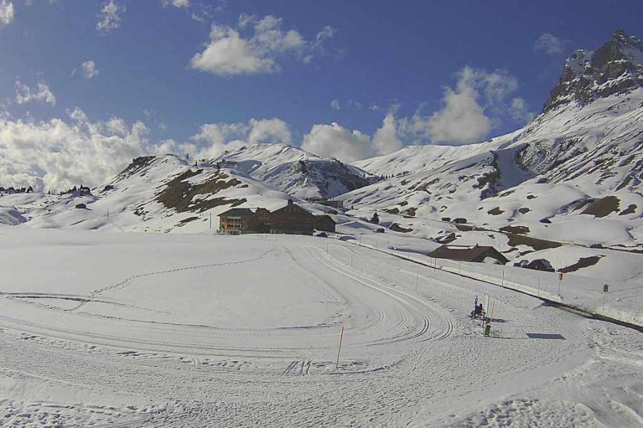 A weather window today in the Austrian Vorarlberg before the next storm arrives tomorrow. This is Warth – 9 March 2023 – Photo: warth-schroecken.at
France
Snow conditions are very mixed across the French Alps right now. With fresh snow at altitude, and a lot more to come over the next couple of days, northern resorts such as Tignes (100/295cm) and Val Thorens (95/145cm) will be in great shape once the weather settles down.
However, with rain also in the mix lower down, it is only the higher parts of resorts such as Megève (5/65cm) and La Clusaz (5/140cm) that will see any significant net benefit, despite some snow being set to fall at lower levels for a time on Friday.
For more consistent snow conditions, you need to head much further south, where Isola 2000 (100/130cm) has and will continue to avoid most of the impact of the current storm.
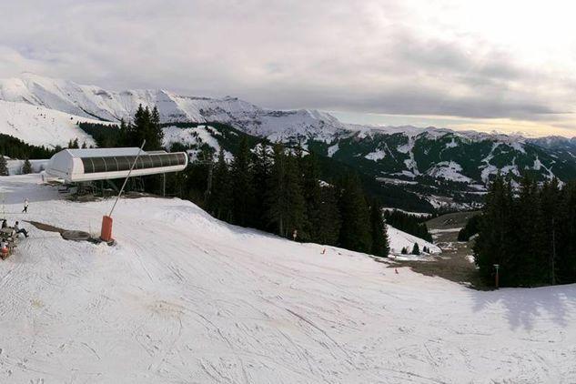 Modest snow depths in Megève, which is getting a mixture of rain and snow this week – 9 March 2023 – Photo: megeve.com
Italy
Snow depths are generally very modest across the Italian Alps right now. Fresh snow is improving conditions at altitude in the north-west, where La Thuile has a settled base of 40/170cm depending on altitude and Courmayeur has 50/100cm. These areas will see more heavy snow over the next couple of days which will further improve things higher up, but there is also a risk of rain lower down, especially on Saturday.
Elsewhere in the Italian Alps, the Milky Way resorts like Sauze d’Oulx (30/110cm) can also expect a moderate fall of snow (higher up at least) to end the week but, further east, Cortina (10/40cm) will stay mostly dry. Snow depths here may be very modest but the relatively benign weather is allowing for more consistent snow conditions, and there is still some enjoyable skiing to be had, on-piste at least.
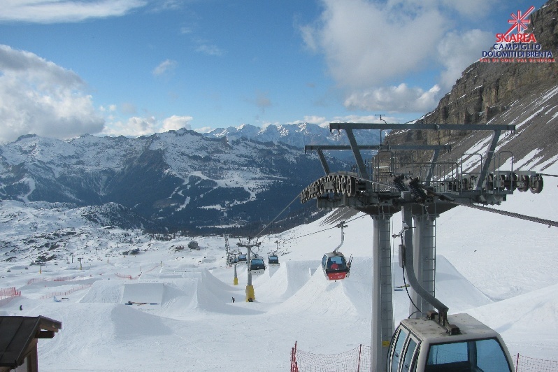 Consistently good on-piste snow conditions in Madonna di Campiglio this season – 9 March 2023 – Photo: funiviecampiglio.it
Switzerland
Snow depths are very modest indeed across most Swiss resorts for early March, even in the higher ones like Zermatt (5/75cm) and St Moritz (30/50cm). That said, there is still some perfectly decent on-piste skiing available in both resorts and, with snow in the forecast, conditions should improve considerably over the next couple of days, especially in Zermatt.
Of the major Swiss resorts, Verbier (30/90cm) is as well placed as any to see really significant snowfall from the current storm cycle. However, even here, the snow will be wet at times lower down and the risk of avalanche will increase considerably at higher altitudes.
Elsewhere in the Swiss Alps, lower-lying resorts such as Villars (5/90cm) and Adelboden (0/50cm) are experiencing a mixture of rain and snow this week, with only the highest runs therefore likely to see any major improvement.
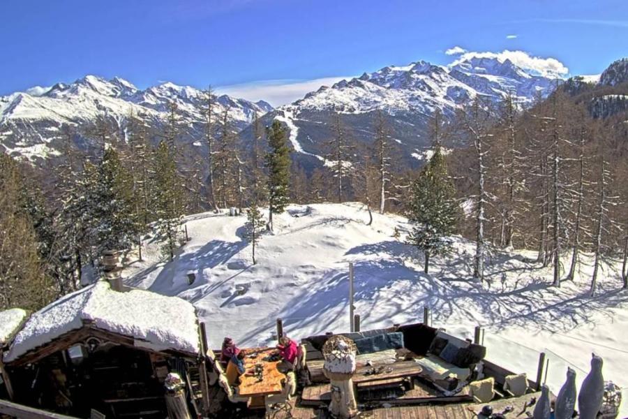 Sunny skies this afternoon in the Upper Valais. This is Torbel – 9 March 2023 – Photo: snoweye.com
Rest of Europe
There is still plenty of snow across the higher resorts of the Pyrenees. This weekend it will turn very warm for a time in Andorra’s Granvalira (50/110cm) but there will still be some good piste-skiing on offer, on-piste at least. Temperatures are set to cool down again next week.
Up in Scandinavia, most Norwegian resorts haven’t seen significant fresh snow for a little while now, but resorts are generally still in excellent shape with base depths of 65/110cm in Geilo, for example, and a bit of snow forecast for next week.
Snow conditions in Scotland have improved in the east, with top to bottom skiing now possible in Cairngorm even if snow depths are still very modest. Further west, there is still not enough snow for any lift-served snowsports in Glencoe and Nevis Range though.
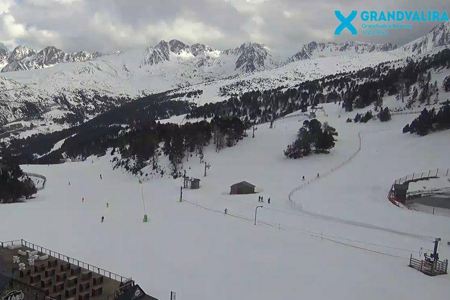 Good skiing is still possible on-piste in Andorra’s Granvalira. This is Soldeu – 9 March 2023 – Photo: granvalira.com
USA
Storm after storm continues to pound California, where upper snow depths in Mammoth are now approaching 8m! Utah’s exceptional snow season is also continuing, with another 15-20cm of snow in Snowbird where the mid-mountain base is around 370m.
Further east, snow depths are more on par in Colorado, but you can still find some very enjoyable piste-skiing in both Vail (175cm upper base) and Breckenridge (130cm upper base).
 No issues with snow in Mammoth, California, where the upper base is nearly 8m deep – 9 March 2023 – Photo: facebook.com/MammothMountain
Canada
Whistler (234cm mid-mountain base) has seen 34cm of snow fall in the last week and is offering plenty of good skiing right now. The forecast is also promising, with moderate snowfalls to relatively low altitudes due both over the weekend and into next week.
Further inland, Big White (254cm upper base) is skiing as good as anywhere, with some light snow set to freshen things up over the weekend. A more substantial fall is also in the forecast for early next week.
Our next full snow report will be on
Friday 17 March 2023
If you enjoy reading our updates - please feel free to support us: