


Updated: 10am Sunday 31 January 2021 - The sun is back, albeit temporarily!
The weather is better across most of the Alps today, although a lot of cloud is still lingering in the east (especially in Austria) with some showers or flurries (700-1000m) here and there. Tonight, a new Atlantic storm will reach the western Alps, with a rain/snow limit around 1000-1200m, albeit lower at first in some enclosed intra-alpine valleys.
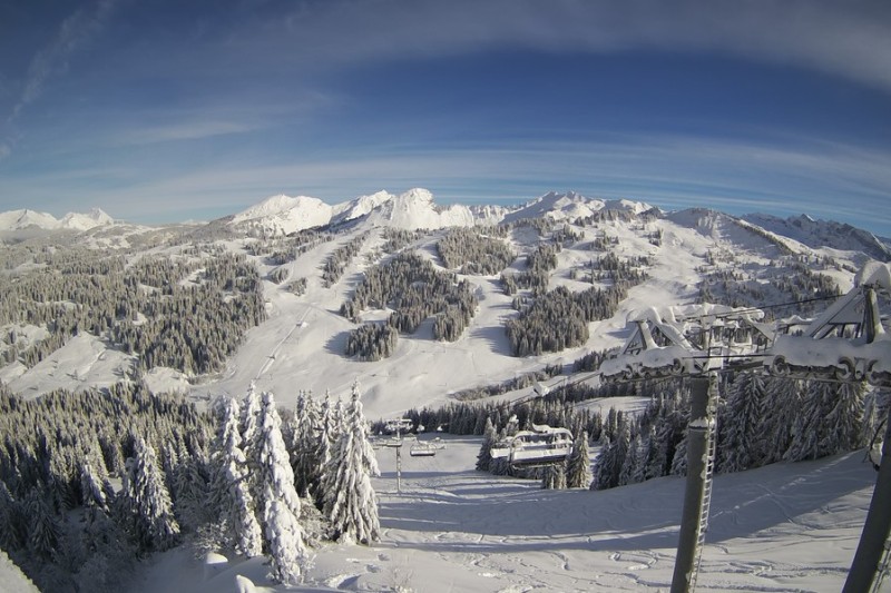
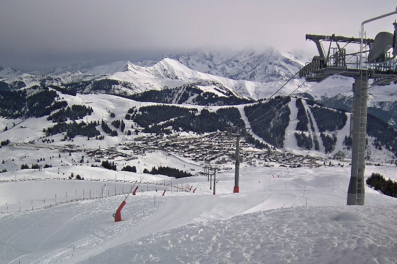
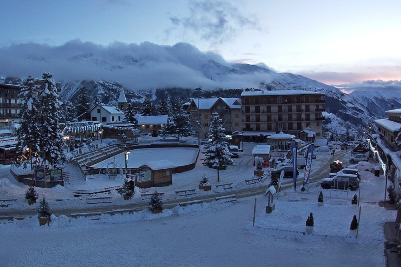
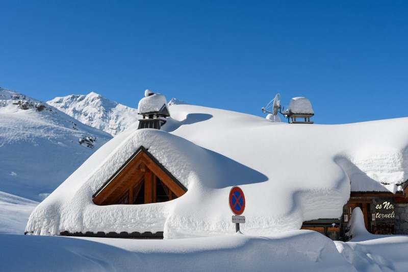 The sun is back to reveal huge snow depths in Val Thorens – 31 January 2021 - Photo: facebook.com/ValThorens.resort
The weather in the Alps is then set to remain unsettled for the first half of next week at least, although there won’t be nearly as much precipitation as last week. The French and Swiss Alps (away from the far south) will see the worst of the weather, with between 10cm and 30cm of snow expected above 2000m between tonight and Wednesday.
The southern and eastern Alps will only see very light and patchy precipitation, with some places staying completely dry. The rain/snow limit will generally sit between 1000m and 1600m tomorrow, before rising to between 1500m and 2000m on Tuesday.
Following last week’s wild weather, snow depths are now way above average across the north-western Alps (e.g. Tignes, Val Thorens, Chamonix, Verbier, Zermatt, Mürren, Engelberg, Laax), especially at altitude where three-day storm totals (between Wednesday and Saturday) were between 1m and 1.5m above 2200m, with even more in places.
Indeed, all parts of the Alps currently have excellent snow cover, though we do appreciate that publicly accessible lift-served skiing is still only possible in Austria and Switzerland.
If skiing in the Alps does become more accessible to greater numbers of people later on this season, even if that means skiing in the Alps beyond the “normal” season (i.e. later in spring or in summer) then there is plenty to be optimistic about, from a snow perspective at least…
Updated: 10am Friday 29 January 2021 - The big storm continues…
The big “westerly” storm continues, bringing further spells of heavy rain and snow to many western and northern parts of the Alps today. Temperatures have temporarily cooled though, with the rain/snow limit set to fall from around 1600m to 1200m as the day progresses.
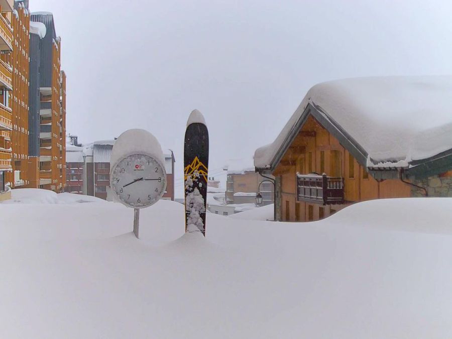 Huge snowfalls in Val Thorens with lots more to come! – 29 January 2021 – Photo: facebook.com/valthorens.resort
Today alone we could see another 25-40cm of new snow above 1800m in the north-western Alps, including in resorts such as Val d’Isère, Chamonix, Verbier and Mürren. The southern and eastern Alps will be less affected, with just a few showers or flurries getting through here and there.
Saturday will see yet another wave of precipitation moving across the western and northern Alps with the rain/snow limit rising again towards 1800m, before falling to 1000-1400m later in the day. After a brief respite on Sunday, yet another weather front will arrive from the west on Sunday night/Monday.
In the last 48 hours over 1m of new snow has fallen above 2000m in many north-western parts of the Alps, with close to 150cm at 2500m in places. By Monday this figure is certain to be above 200cm in some “favoured areas”. To complicate matters further, the rain/snow limit is all over the place.
Yesterday it rained to 2000m or higher in the north-western Alps, but today it will lower again temporarily before a wedge of milder air returns tomorrow. So, not only will the avalanche risk remain sky high in these northern and western areas, but there will also be an ongoing problem with flooding and landslides lower down.
Stay vigilant, stay informed and never be tempted to enter closed areas either as a skier or as a pedestrian! They will always be closed for a good reason.
Updated: 11.40am Thursday 28 January 2021 - Major new storm cycle well underway!
The new storm cycle is well underway, with a “warm” westerly airflow set to last for several days, bringing copious quantities of rain and snow to the western and northern Alps.
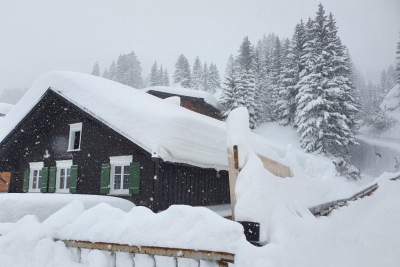
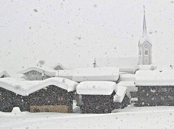 Heavy snow in the Goms valley in Switzerland this morning – 28 January 2021 – Photo: astoria-obergoms.ch
During powerful “warm” storms such as these, the areas that see the greatest snowfall are the higher intra-alpine resorts of the western Alps - ski areas set deep in the mountains and backed by high mountains, such as Val Thorens, Val d’Isère, Tignes and Chamonix in France, and Zermatt and Andermatt in Switzerland.
Indeed, Zermatt has already seen 55cm of new snow at resort level in the last 24 hours, a very rare occurrence in this relatively dry part of the Alps. There is also already 80cm+ of new snow in the Goms valley to the north-east of Zermatt. By the end of Sunday, we could easily see between 100cm and 150cm (and perhaps even close to 2m in places) of new snow in the high intra-alpine resorts of the western Alps above 2200m.
However, the rain/snow limit is rising. It started low yesterday, as it often does when warm fronts bump into colder air in situ over the Alps but has already risen to around 1800m in some exposed parts of the western Alps, and will more generally rise to between 1500m and 2000m (locally 2200m in north-western foothills of the Alps) later today and overnight, before falling a fraction again tomorrow.
Needless to say, all this precipitation will cause problems in the north-western Alps. Not only is there a marked increase in the risk of avalanche, but there is also a risk of flooding lower down.
Over the next few days, the southern and eastern Alps (i.e. Italy and Austria) will be less affected by this storm, with the exception of some areas close to the French and Swiss borders (e.g. La Thuile, Cervinia, Vorarlberg) where there will also be significant rain or snowfall.
Updated: 10am Wednesday 27 January 2021 - Huge snowfalls due for the northern and western Alps, but there will also be some rain…
A new storm cycle is affecting the Alps, this time involving warm fronts and very mild subtropical air. This will deliver huge snowfalls at altitude across the northern and western Alps over the next few days, but also a lot of rain lower down.
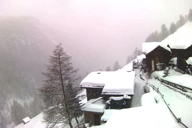 It’s snowing this morning in Zermatt, with significant falls expected at altitude over the next few days – 27 January 2021 – Photo: zermatt.ch
Given that these warm fronts will be bumping into cold air already in situ over the Alps, the rain/snow limit will initially start very low, and stay low for some time in the intra-Alpine or internal Alpine valleys (such as the Haute-Tarentaise and Valais). However, bit by bit, the warmer air will win out, especially in the north-western Alps where the rain/snow limit will rise to between 1500m and 2000m by tomorrow.
By the end of Saturday, between 100cm and 150cm of new snow is expected above 2200m in some favoured spots of the north-western Alps. In these ‘warm front’ situations, areas seeing the most snow are usually the high intra-alpine resorts “backed” by high mountains, such as Val Thorens, Tignes, Val d’Isère and Chamonix. Swiss resorts such as Verbier, Zermatt, Crans Montana, Mürren and Engelberg will also see a lot of snow, though not quite as much as in their French counterparts. The storm will generally have a lesser impact the further east and south you are, though the longer the cold air will hang on.
Areas that will see the most rain are the northern French Alps (e.g. Portes du Soleil), the northern and western Swiss Alps (e.g. Villars, Gstaad, Jungfrau region), and (later on) the western Austrian Alps (e.g. Arlberg region). However, as these areas already have lots of snow (even lower down), the rain should not cause too much of a problem in the long term. Note that French and Italian resorts currently remain closed due to measures taken to stop the spread of Covid-19 for the time being in any event.
Updated: 3pm Tuesday 26 January 2021 - Up to 1m of new snow forecast for some north-western parts of the Alps…
It was a mostly dry day in the Alps today, aside from a few lingering flurries across the north-eastern Alps, mostly in Austria, with the sunniest skies the further south and west you were. It’s all change again tomorrow though, with a new storm system set to arrive from the west.
 Lovely day in Méribel today, though lots of snow is expected (with some rain lower down) over the next few days – 26 January 2021 – Photo: merinet.com
This new storm cycle will last several days and bring a lot of snow to some parts of the north-western Alps. However, due to mild sub-tropical air being in the mix, it will also turn milder with the rain/snow limit reaching 1500-1800m at times.
Between Wednesday and Saturday, as much as 1m of snow is expected to fall above 2200m in the high French resorts, such as Val Thorens, Val d’Isère and Tignes. Some western Swiss resorts could also see a lot of snow, including Verbier, Zermatt and the resorts of the Val d’Anniviers, though generally the further east and south you go, the less of an impact this storm will have.
The lower resorts of the north-western Alps, such as Megève, Morzine, Gstaad, Villars and Grindelwald, will see plenty of rain, though this is unlikely to be much of a problem in the long term as all these resorts have very healthy bases. Note that lift-served publicly accessible skiing is not open in France for the time being anyway.
Updated: 10am Monday 25 January 2021 - Remaining unsettled but turning milder later in the week…
It is a very cold day in the Alps today, with further snow showers across some northern and north-western areas, heaviest closest to the foothills. The southern Alps will be drier and brighter with the best of any sunshine in the far south of the French Alps (e.g. Isola 2000).
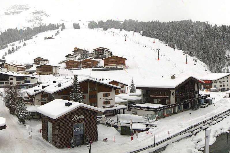
 It’s snowing again in Lech this morning – 25 January 2021 – Photo: lech.com
A few snow flurries will linger to low levels across the north-eastern Alps (especially in Austria) on Tuesday, while most other regions can look forward to a sunny, if still rather cold, day.
The weather will then remain unsettled during the second half of the week, with further snow at times, especially in the northern and western Alps. It will also turn milder though, with the rain/snow limit rising to 1500m or more in places.
Snow cover in the Alps is generally quite impressive right now, most regions having average or above average snow depths for the time of year. However, measures taken to combat the spread of Covid-19 mean that the only publicly accessible lift-served skiing in the Alps is in Switzerland and Austria.
Resorts in both of these countries have plenty of snow at all levels, with the best of the fresh in the northern Swiss Alps (e.g. Engelberg, Mürren) and north-western Austrian Alps (e.g. Lech, St Anton).
Updated: 5.40pm Saturday 23 January 2021 - Yet more snow for the Alps but turning much milder later next week…
There has been yet more snow across many parts of the Alps in the last 24 hours, with the greatest accumulations in the Dolomites, where as much as 70cm has fallen at altitude in some favoured spots.
 Snowing again in Les Gets this afternoon – 23 January 2021 – Photo: lesgets.com
Snow showers have lingered for much of the day today across the eastern and south-eastern Alps although there was some sunshine further west this morning before new weather fronts moved in from the west this afternoon. This evening these fronts have brought snow to low levels across many western parts of the Alps (especially in France), and they are set to move a little further east overnight, albeit losing their intensity as they do so.
Sunday will start dry in many places, but even more snow will reach the western Alps later in the day with snow lingering across the northern half of the Alps on Monday. Tuesday will be a better weather day, but it will then turn much milder from mid-week onwards with the risk of rain in places, especially in the northern and western Alps.
Updated: 12pm Friday 22 January 2021 - Further snow for many over the coming days…
The weather in the Alps remains very unsettled, with significant snow due for many southern and western parts of the Alps later today and tonight.
 It’s snowing today in the south-western Italian Alps. This is Bardonecchia – 22 January 2021 – Photo: bardonecchia.it
The north-eastern Alps (i.e. Austria) will be mostly dry today, with snow set to arrive from the west tonight. Tomorrow will see some snow linger across the eastern and southern Alps while the western Alps see a drier spell of weather in the morning, although a new weather front will bring further snow back into the western Alps later in the day.
With milder air in the mix, the rain/snow limit will rise to around 1000-1300m later today before dropping sharply again tomorrow. By the end of Saturday, between 20cm and 50cm of new snow will have fallen above 1500m across many southern and western parts of the Alps, with more in the region of 5cm to 25cm in the north and east.
Updated: 10am Thursday 21 January 2021 - Foehn in the north, snow in the south…
The weather in the Alps remains unsettled, with Foehn conditions right now across many northern Alpine valleys (such as the Jungfrau region) due to the wind blowing from the south-west, while some southern regions (especially Lombardy) are seeing fresh snow.
 Foehn conditions in the Lenk-Adelboden region – 21 January 2021 – Photo: adelboden.ch
Over the next few days, the weather will remain very changeable, with a series of Atlantic storms moving across the Alps from the west to the east. All regions will see at least some snow by the end of the weekend, with the western and southern Alps most favoured.
As different air masses are in the mix, the rain/snow limit will vary between 600m and 1600m before dropping uniformly to very low levels later in the weekend.
Snow depths remain impressive across most of the Alps although the Foehn as temporarily affected the quality of the snow in some northern regions (e.g. Jungfrau, Engelberg, Laax, Arlberg).
Updated: 10am Monday 18 January 2021 - Latest “northern” storm peters out…
There are still some flurries to low levels across the north-eastern Alps today, otherwise most regions are dry with the best of the sunshine the further south and west you are.
 The sun is back in the northern French Alps. This is Hauteluce – 18 January 2021 – Photo: lessaisies.com
After a fine day across the board tomorrow, cloud will increase on Wednesday in the south-western Alps (e.g. Isola 2000, Bardonecchia), with the chance of a few flurries later in the day. Thursday will see more widespread showers across the southern Alps with some moderate falls of snow possible at altitude. It will be milder though, especially across the northern Alps where the Foehn will be blowing.
Snow conditions across the Alps are generally excellent right now, although publicly accessible lift-served skiing is still only possible in Switzerland and Austria. Both ski touring and cross-country skiing are possible in all Alpine countries though note that the risk of avalanche is currently very high across the northern half of the Alps.
For more detail on snow conditions across the Alps and beyond please check out our latest detailed snow report…
Updated: 12.20pm Saturday 16 January 2021 - The sun is back!
After three to four days of near continuous snowfall across many northern parts of the Alps, the sun is back today and the Alps are looking particularly magnificent!
 Magnificently wintry above Les Gets this morning – 16 January 2021 – Photo: lesgets.com
Areas seeing the greatest snowfall totals have been the eastern Swiss and far western Swiss Alps, roughly in a line between Andermatt and St Anton, including resorts such as Disentis, Braunwald, Laax, Klosters, Schrunns, Damüls and Lech. These areas have seen at least 150cm of new snow above 1800m since Tuesday, and possibly even close to 200cm in one or two favoured spots.
Some north-western parts of the Swiss Alps (e.g. Mürren) and the French Haute Savoie (e.g. Flaine, Chamonix, Avoriaz, La Clusaz) have also done very well, with nearly 1m of new snow at altitude over the last three days. More generally, the northern half of the Alps has seen between 40cm and 90cm above 1500m.
Whatever the case, note that the risk of avalanche is very high and that any off-piste or ski touring should be treated with the utmost caution.
Tomorrow, the northern half of the Alps will see further snow, but not in quite the same quantities as in the previous storm, likely with around 10-30cm for most areas.
For more detail on snow conditions across the Alps and beyond please check out our latest detailed snow report…
Updated: 10am Friday 15 January 2021 - Big “northern” storm cycle is coming to an end…
It is still snowing this morning across many north-western parts of the Alps, with the heaviest falls in the north-eastern Swiss Alps (e.g. Laax, Flumserberg) and western Austrian Alps (e.g. Lech, St Anton).
 1.5m of new snow has fallen in the Arlberg since Tuesday. This is Lech – 15 January 2021 – Photo: lech.at
This snow will become lighter and patchier as the day progresses before dying out completely tonight. The southern Alps will, however, remain mostly dry today with variable cloud and some sunny spells here and there.
This latest storm cycle has dropped some very impressive quantities of snow across the northern and north-western Alps. The areas most affected have been the north-eastern Swiss and far western Austrian Alps, roughly in a line between Andermatt and St Anton (via Flims and Klosters), where more than 1.5m of new snow has fallen since Tuesday.
 Very snow scenes in Les Gets this morning – 15 January 2021 – Photo: lesgets.com
More generally, between 30cm and 90cm of snow has fallen across the northern half of the Alps over the last few days. With one or two exceptions, most southern parts of the Alps have only seen light and patchy snow, with some places remaining completely dry.
After a mostly fine day tomorrow, further snow will return to the northern Alps on Sunday, again heaviest in the north-eastern Swiss and western Austrian Alps.
Updated: 10am Thursday 14 January 2021 - Huge snowfalls across the northern Alps…
As expected, it has been snowing heavily across the northern Alps with over 1m of new snow in places and plenty more to come!
 Big snowfalls in the Austrian Vorarlberg, where over 1.5m of new snow is possible by the end of the week. This is Warth-am-Arlberg – 14 January 2021 – Photo: warth-schroecken.at
The heaviest snow has fallen in the Austrian Arlberg region (e.g. Lech, St Anton, Warth-Schröcken) and the north-eastern Swiss Alps, which have seen over 1m of new snow above 1500m since Tuesday. Elsewhere across the northern Alps (e.g. Avoriaz, Mürren, Engelberg, Laax) there has been 30-80cm of new snow in the last 24 hours. This latest storm has also seen a little snow get through to the southern Alps, but many southern regions have stayed dry.
Today will see further snow across the northern half of the Alps, heaviest (again) in Switzerland and western Austria with a rain/snow limit typically between 600m and 1000m.
After a slight reprieve on Friday and Saturday, there will be further snow in the north on Sunday, by which time snowfall totals clocked up since Tuesday could be in excess of 150cm in some northern parts of the Alps, notably in the Arlberg.
Updated: 11am Wednesday 13 January 2021 - Big snowfalls for the north-western Alps…
The Alps are currently under the influence of a cool and unstable north to north-westerly airstream that will continue to affect the weather for the rest of the week. The northern (and especially north-western) Alps should expect plenty of fresh snow, while the southern Alps will see little, if any.
 Fresh snow this morning in Lech, with much more to come over the next couple of days – 13 January 2021 – Photo: lech.com
There has already been significant snowfall in the last 24 hours, with 20cm to 50cm above 1500m in the northern French Alps (e.g. Portes du Soleil), northern Swiss Alps (e.g. Jungfrau Region, Engelberg, Laax) and the western Austrian Alps (e.g. St Anton).
After a slight lull during the course of today, heavy snow will return to these north-western regions tonight and tomorrow, heaviest in the Austrian Arlberg (e.g. Lech, St Anton) where an additional 50-80cm of snow is possible. The rain/snow limit will sit between 700m and 1300m, highest closest to the north-western foothills.
Storm totals in the Arlberg should be well in excess of 1m by Friday morning, though totals at altitude across the northern half of the Alps will more generally be in the region of 40cm to 90cm.
As for the southern Alps, while some regions will see moderate falls of snow over the next couple of days, especially in the north-western Italian Alps (e.g. Courmayeur, Cervinia, La Thuile) , generally there will be little, if any.
Due to Covid-related restrictions, lift-served publicly accessible skiing in the Alps is still only possible in Austria and Switzerland. French resorts had hoped to open their ski lifts last Thursday but this has now been put back indefinitely. It is still possible to cross country ski and ski tour in both France and Italy right now though.
Snow depths are relatively modest in the northern Alps (e.g. Wengen, Laax, St Anton, Seefeld, Kaprun and Kitzbühel), but will improve significantly with all the new snow this week.
For now, the most impressive snow cover (in open ski areas) is still in the far south-east of Switzerland (e.g. St Moritz) and the south of Austria (e.g. Nassfeld), where snow depths are considerably above average for the time of year.
Updated: 9am Tuesday 12 January 2021 - New storm arriving from the north-west…
The weather in the Alps is on the change again thanks to fronts moving in from the north-west, with significant snow expected over the next few days across the northern half of the Alps, especially in the north-west.
 Cloud is thickening in the northern French Alps, with snow expected later. This is Les Saisies – 12 January 2021 - Photo: lessaisies.com
Today will start dry in most areas, but showers will reach the north-western foothills of the Alps this morning, spreading right across the northern Alps later in the day. The rain/snow limit will start low – with major cities such as Geneva and Zurich even seeing a few centimetres of snow.
Milder air will then raise the snow line to between 500m and 900m later in the day, and up to 1000-1300m in some exposed areas close to the northern and north-western foothills of the Alps (such as the Aravis) tonight. It will probably also continue to snow to low levels into the evening in the more internal valleys (e.g. Sion).
There will be little if any snow in the southern third of the French Alps (e.g. Alpes Maritimes), the far south of the Swiss Alps (e.g. Ticino), the far south of the Austrian Alps (e.g. Carinthia) and much of Italy (away from the north-western border areas).
For the rest of the week, a northerly or north-westerly flow will continue to bring further snow at times, chiefly to the northern half of the Alps. The rain/snow limit will fluctuate, from all levels to 1400m.
By Saturday, over 1m of new snow is likely to have fallen above 1800m in some favoured parts of the northern Alps, including the Arlberg region (Lech, St Anton) and the northern Swiss Alps (Jungfrau region, Engelberg, Laax). The rest of the northern Alps will generally see more in the region of 30cm to 80cm at altitude.
Due to Covid-related restrictions, lift-served publicly accessible skiing in the Alps is still only possible in Austria and Switzerland. French resorts had hoped to open their ski lifts last Thursday but this has now been put back indefinitely. It is still possible to cross country ski and ski tour in both France and Italy right now though.
Snow depths are relatively modest in the northern Alps (e.g. Wengen, Laax, St Anton, Seefeld, Kaprun and Kitzbühel), but will increase significantly by the end of the week.
For now, the very best snow conditions in open ski areas are still in the far south-east of Switzerland (e.g. St Moritz) and the south of Austria (e.g. Nassfeld), where snow depths are considerably above average for the time of year.
Updated 9.30am Monday 11 January 2021 - All eyes are on the north!
High pressure is currently in charge of the weather in the Alps, meaning that today will be another fine day for most regions. However, from tomorrow until Friday the northern Alps are in for a very snowy spell of weather.
 Snowfall accumulations in the Alps between now and Saturday and expected to be close to 1m in parts of the north – Image: bergfex.com, 11 January 2021
Areas in the northern Alps set to see significant snowfall include:
- the French Alps north of Grenoble (e.g. 3 Valleys, Flaine, Chamonix, Avoriaz);
- most of the Swiss Alps (e.g. Verbier, Gstaad, Wengen, Engelberg, Laax, Klosters) excluding some parts of the southern Swiss Alps (e.g. Ticino); and
- the western, central and northern Austrian Alps (e.g. St Anton, Ischgl, Saalbach, Kitzbühel) but NOT the province of Carinthia (e.g. Nassfeld) and most of the Osttirol (e.g. Lienz).
Most of the Italian Alps is outside of the “northern Alps” meteorologically speaking though some border areas, especially in the north-west (e.g. La Thuile, Courmayeur, Cervinia), can still get significant snow when heavy snow is forecast for the “north”.
These regions will generally see between 30cm and 80cm, with the heaviest snowfalls in the north-eastern Swiss Alps (e.g. Laax) and western Austrian Alps (e.g. Lech). Some favoured areas such as the Austrian Arlberg (e.g. St Anton, Lech) could even see over 1m of new snow above 1800m by the end of the week.
Due to Covid-related restrictions, lift-served publicly accessible skiing in the Alps is still only possible in Austria and Switzerland. French resorts had hoped to open their ski lifts last Thursday but this has now been put back indefinitely. It is still possible to cross country ski and ski tour in both France and Italy right now though.
Snow depths remain relatively modest in the northern Alps (e.g. Wengen, Laax, St Anton, Seefeld, Kaprun and Kitzbühel) but will increase significantly by the end of this week.
For now, the very best snow conditions in open ski areas are still to be found in the far south-east of Switzerland (e.g. St Moritz) and the south of Austria (e.g. Nassfeld), where snow depths are considerably above average for the time of year.
Updated: 11.40am Friday 8 January 2021 - Mostly dry but still cold…
Today will be another fine day for most of the Alps, although low cloud will plague some of the lower valleys, especially close to the northern foothills. The north-eastern Alps are generally cloudy, particularly the northern and western Austrian Alps, though this should slowly thin as the day progresses.
 Looking great in Alpe d’Huez right now, though they are forbidden from opening the lifts for the time being – 8 January 2021 – Photo: alpedhuez.com
Over the weekend the weather in the Alps will remain mostly fine and cold, with some sunshine but also some significant areas of cloud drifting around. The far south-western Alps (e.g. Isola 2000, Prato Nevoso, Limone) may see a few snow flurries, especially on Sunday.
Due to Covid-related restrictions, lift-served publicly accessible skiing in the Alps is still only possible in Austria and Switzerland. French resorts had hoped to open their ski lifts yesterday, but this has now been put back indefinitely. It is still possible to cross country ski and ski tour in both France and Italy right now though.
For anyone lucky enough to be able to ski in Austria or Switzerland over the next couple of days, snow conditions should be very good. Snow depths are relatively modest in the northern Alps (e.g. Wengen, Laax, St Anton, Seefeld, Kaprun and Kitzbühel) but, with the current fine weather, there will still be plenty of enjoyable on-piste skiing to be had.
The very best snow conditions in open ski areas are currently in the far south-east of Switzerland (e.g. St Moritz) and the south of Austria (e.g. Nassfeld), where snow depths are considerably above average.
Updated: 3pm Thursday 7 January 2021 - Still cold, but mostly sunny today in the Alps…
Today is a much better weather day in the Alps, with plenty of sunshine and just a little patchy cloud in places. It remains cold though, with maximum temperatures below freezing in most ski resorts.
 Fabulous cross-country skiing in Chamrousse near Grenoble today – 7 January 2021 – Photo: chamrousse.com
The weather will stay mostly cold but dry over the next couple of days, with some sunny interludes but more low cloud in places, especially close to the northern foothills of the Alps.
Due to Covid-related restrictions, lift-served publicly accessible skiing in the Alps is still only possible in Austria and Switzerland. French resorts had hoped to open their ski lifts today, but this has now been put back indefinitely. It is still possible to cross country ski and ski tour in both France and Italy right now though.
For anyone lucky enough to be able to ski in Austria or Switzerland over the next couple of days, snow conditions should be very good. Snow depths are relatively modest in the northern Alps (e.g. Wengen, Laax, St Anton, Seefeld, Kaprun and Kitzbühel) but, with the current fine weather, there will still be plenty of enjoyable on-piste skiing to be had.
The very best snow conditions in open ski areas are currently in the far south-east of Switzerland (e.g. St Moritz) and the south of Austria (e.g. Nassfeld), where snow depths are considerably above average.
Updated: 10am Wednesday 6 January 2021 - Still cold, but perhaps milder next week…
The weather in the Alps will remain cold over the next few days but there will not be any significant widespread new snowfall. It should turn a little milder next week though there is still a lot of uncertainty as to exactly how things will play out.
 A very wintry picture in Méribel today, although snow depths here are below average for January – 6 January 2021 – Photo: merinet.com
There is still a lot of cloud across the Alps today, with a few light flurries to very low altitudes here and there. That said, some areas will also see sunny spells, especially at altitude in the central Alps. Over the next couple of days, the Alps will see increasing amounts of sunshine though it will remain on the cold side.
Lift-served publicly accessible skiing in the Alps currently remains confined to Switzerland and Austria, with French resorts awaiting a decision on whether they can re-open tomorrow.
Snow conditions in the Alps are generally good, although snow depths do vary hugely from area to area. On the whole, the southern Alps have deeper snow than the northern Alps, with exceptionally deep cover in the south-east (i.e. southern Austria and the Dolomites).
By contrast, with a few exceptions, snow depths are generally below average across the northern Alps. With snow right down to the lowlands it still feels very wintry though, but snow cover in resorts such as Méribel, Verbier, Wengen, Laax, Lech, Kaprun and Kitzbühel is on the thin side for early January.
Updated: 11.40am Monday 4 January 2021 – Cold, with more snow for some…
The weather in the Alps remains cold and unsettled, with further snow falling in places. Most of today’s snow will fall in the western Italian Alps (Piedmont) and the southern French Alps, close to the Italian border (e.g. Isola 2000). Some snow will also spill over the border into the south-eastern Savoie (e.g. Val d’Isère, Val Cenis), but it will be mostly dry elsewhere in the Alps, with the sunniest skies the further north and east you are.
 Deep snow in St Veit in Defereggen in the southern Austrian Alps – 4 January 2021 - Photo: foto-webcam.eu
Over the last few days, the south-eastern Alps have seen the most snow with further disruptive snowfalls in the southern Austrian Alps (e.g. Lienz area, Nassfeld) where another metre or more has fallen since Friday. Indeed, Nassfeld now has settled snow depths of 3.5m at 2200m, a truly extraordinary figure this early in the season. Snow depths are also exceptional now in the Dolomites (e.g. Madonna di Campiglio, Alta Badia, Cortina).
Many other Italian resorts, French resorts (especially those in the south like Risoul and Isola 2000) and south-eastern Swiss resorts (e.g. St Moritz) also have above average snow depths. By contrast, the northern Swiss Alps (e.g. Wengen, Flumserberg) and the northern Austrian Alps (e.g. Zell-am-See, Kitzbühel) have more “normal” or even below average snow depths for the time of year, despite looking and feeling quite wintry thanks to a low snowline.
Right now, publicly accessible lift-served skiing in the Alps is only available in Austria and Switzerland. In the Pyrenees, where they also have a lot of snow, it is only the Spanish side that is offering to the public.
Updated: 11.30am Sunday 3 January 2021 - Looking and feeling very wintry across most of the Alps…
The weather in the Alps is currently under the influence of a large area of low pressure centred over the south coast of France, which will bring further cold (and, in places, snowy) weather over the next couple of days, with most of the snow set to fall in the southern French and western Italian Alps.
 A very snowy scene at first light in Auron in the southern French Alps – 3 January 2021 – Photo: auron.com
Today the heaviest of any snow is likely to fall in the Piedmont region of Italy (e.g. Alagna) and the far southern French Alps (e.g. Isola 2000). The rest of the Alps also have a lot of cloud but mostly dry weather, with just a few flurries here and there. The best of any sunshine will be at altitude in the eastern Alps (i.e. Austria). Monday will see broadly similar weather, remaining cold with further snow showers in the south-western Alps.
Snow conditions in the Alps are generally excellent for the time of year, although Covid-related restrictions mean that lift-served publicly accessible skiing is still only possible in Switzerland and Austria. The last few days have again seen big snowfalls in the south-eastern Alps – i.e. the southern Austrian Alps (e.g. Nassfeld) and the Dolomites (e.g. Alta Badia) – with over 1m in places, meaning that snow depths here remain exceptional, and even record-breaking in places.
Most of the French Alps also have above average snow depths, especially in the south (e.g. Risoul, Isola 2000) but also, notably, in the lower resorts close to the northern and western fringes of the Alps such as Les Gets, La Clusaz and Villard-de-Lans, which in recent years have struggled early on in the season.
Although it also looks very wintry, elsewhere in the Alps snow depths are generally more normal, and sometimes even below average for early January, especially in the northern Swiss Alps (e.g. Flumserberg) and northern Austrian Alps. (e.g. Kitzbühel).