


ARCHIVE
Today in the Alps - December 2017
Read about current weather and snow conditions in the Alps
Updated: 1pm Sunday 31 December 2017 - Sun!
What a difference a day makes! After yesterday’s heavy rain and snow it’s a much brighter picture in the Alps today with lots of sunshine and exceptionally mild temperatures (freezing levels around 3000m).
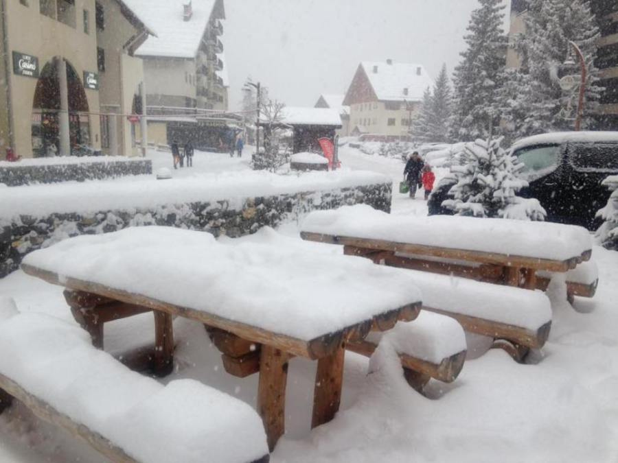
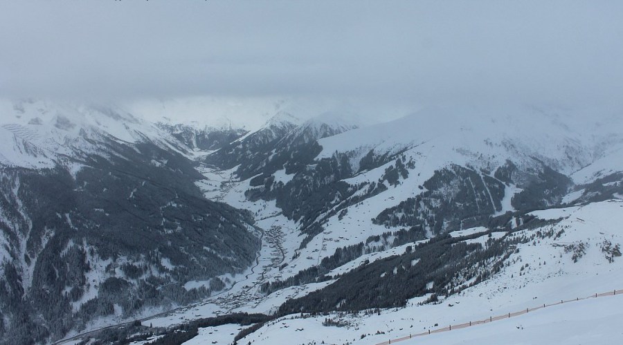
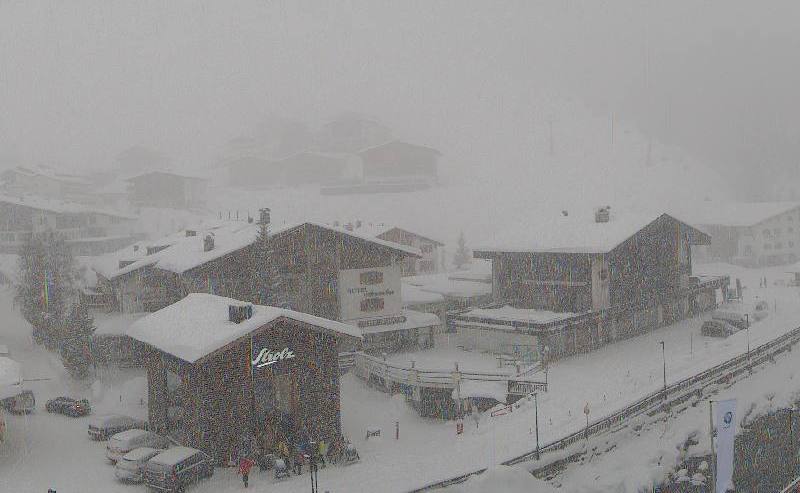
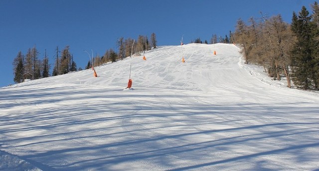
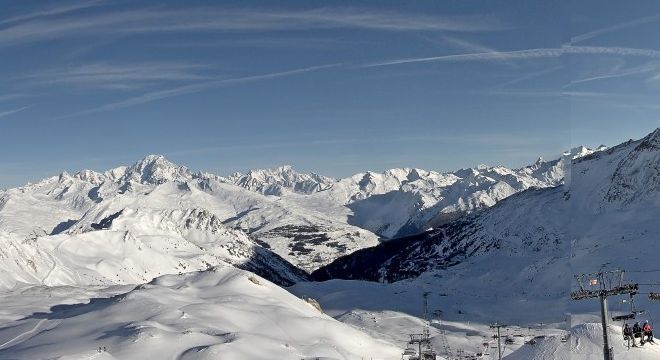 Mild and sunny in the Alps today but the week ahead will be another very unsettled one. This is Les Arcs – 31 December 2017 - Photo: lesarcs.com
Today’s sun follows the 40-70cm of new snow that fell yesterday across much of the French Alps (away from the far south), with as much as 90cm reported in Val d’Isère. Generally speaking the Swiss Alps saw between 20cm and 50cm, with the heaviest snow falling in the west (e.g. Verbier, Zermatt). Rain was also a problem, however, falling as high as 2200m in the French and western Swiss Alps later in the day. With one or two exceptions, any precipitation in the Swiss and Austrian Alps was less significant than elsewhere.
The next storm will hit the western Alps tonight, heralding the start of another wild week with high winds, heavy snow and fluctuating temperatures, meaning more rain for some, especially mid-week. The heaviest precipitation will be in the western Alps with another 100-150cm of snow possible above 2000m by Thursday in resorts such as Val d’Isère, Tignes, La Rosière, Chamonix and Verbier. The eastern and southern Alps will again mostly miss the heaviest of the precipitation.
Updated: 7pm Saturday 30 December 2017 - Huge snowfalls (but also some rain) in western Alps
The heaviest of the precipitation is now over for the French Alps, where 40-70cm of new snow has fallen in the last 24 hours alone. In the western Swiss Alps 24-hour storm totals are 30-50cm.
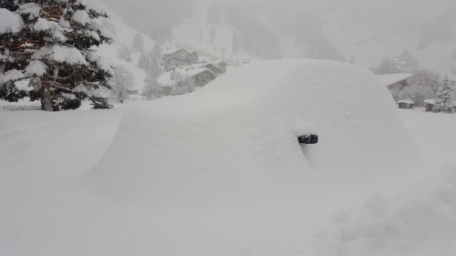
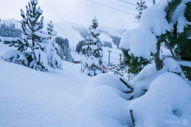
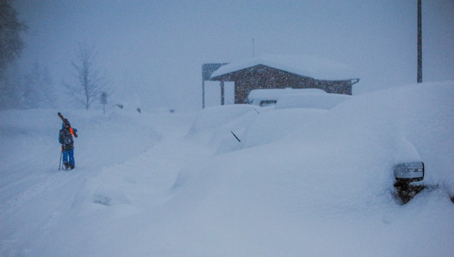
 Huge snowfalls burying cars in Courchevel this morning – 30 December 2017 – Photo: facebook.com/Courchevel
As expected, the rain/snow limit rose steadily during the day surpassing 2000m in most places by late afternoon, while the bad weather caused a lot of trouble for travellers, particularly in the northern French Alps where there have been numerous road closures.
The good news is that the weather will improve significantly tomorrow, though it will be exceptionally mild (with freezing levels around 3000m) and still very windy at altitude.
A new storm will then arrive in the western Alps on Sunday night heralding the start of another very unsettled week in the mountains. Indeed, by next Thursday five-day storm totals could be in the order of 2-3m in some western parts of the Alps such as the upper slopes of Chamonix, La Rosière and Val d’Isère. This is something we need to keep a very close eye on as the already high risk of avalanche could become critical.
There will be further rain at times lower down, especially mid-week. Tune in for further updates on the increasingly extreme weather situation in the western Alps tomorrow…
Updated: 8am Saturday 30 December 2017 - Huge snowfalls (but also some rain) in western Alps
As expected, many western parts of the Alps are waking up to some serious snowfall this morning, particularly in the northern French and western Swiss Alps.
 Huge overnight snowfalls in Val d’Isère – 30 December 2017 – Photo: facebook.com/HenrysAvalancheTalk
At 8am this morning we have already seen close to 50cm of new snow in the Val d’Isère and Zermatt areas, with plenty more to come today. Indeed, by the end of Saturday some parts of the western Alps will have 24 hour snowfall totals (above 2300m) of close to 1 metre. Areas where this is likely include Val d’Isère/Tignes, La Rosière, the Chamonix valley and Zermatt.
With the exception of parts of the Aosta valley (e.g. Courmayeur, La Thuile), snowfall will generally be less significant across most of Italy and Austria.
It’s not just snow we have to contend with though - the rain/snow limit will gradually rise to between 2000m and 2300m in some exposed parts of the western Alps, but it will remain lower in some enclosed valleys, particularly in the central Alps (e.g. Saas-Fee, Andermatt).
We’ll keep you updated on just how much has fallen and where later on today…
Updated: 10.45am Friday 29 December 2017 – All eyes on a difficult transfer day in the north-western Alps tomorrow
It’s a fine if rather chilly morning across most of the Alps. Make the most of it though, as high cloud is already streaming back into the west, heralding the arrival of further snow for the French and western Swiss Alps later this afternoon.
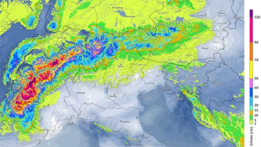 Extreme snowfall expected across the north-western Alps between 29 December 2017 and 3 January 2018 - Image: bergfex.com
This snow, courtesy of an occluded front, will move further east tonight but will lose some of its intensity. The rain/snow limit from this front will start very low but will rise to between 600m and 1000m tonight.
This will be followed tomorrow by a more active warm front which will cause problems for some northern and western parts of the Alps. First there will be a lot of snow, initially to quite low levels, especially in the more enclosed valleys (e.g. the Haute Tarentaise on the way to Val d’Isère) where the cold air hangs on for longest. In the foothills of the Alps, however, any snow will quickly turn to rain, with a rain/snow limit rising to as high as 2300m in the more exposed resorts of the north-western Alps such as the Portes du Soleil, Megève, Villars and Gstaad.
Between now and Saturday evening, the areas set to see the heaviest precipitation are the northern French Alps (roughly north of Alpe d’Huez, Les 2 Alpes), the western Swiss Alps (west of a line between Zurich and the Italian border) and perhaps the extreme north-west of Italy (Courmayeur, La Thuile). These areas could see 40-70cm of windblown snow above 2200m. Below this level we know that there will be a lot of rain in the mix but, as mentioned earlier, certain enclosed valleys will hang on to snow much longer than others.
In short, we are looking at a very messy picture on a major transfer day. Take note if you are travelling to the high western and north-western resorts (such as Val d’Isère, Tignes, Val Thorens, La Plagne and La Rosière, to name just a few) and make sure you have the correct equipment for winter driving in the Alps.
Note that during this period, any precipitation will be lighter and patchier the further south and east you are in the Alps. The Dolomites, for example, will see little if no rain/snow over the next 36 hours.
Sunday will see a return to mostly fine but very mild weather in the Alps before the next series of storms roll in from the west on Sunday night and continue into next week. Expect further heavy snow and extreme avalanche danger, especially in the north-western Alps.
Indeed, over the next week, we could see an extreme situation developing with 2-3 metres of new snow possible at altitude in some French and western Swiss resorts.
Updated: 9.10am Thursday 28 December 2017 - Very snowy but turning much milder over the weekend
It has been a very snowy 24 hours across the Alps and it is still snowing in places this morning, especially in the Austrian and northern Swiss Alps.
 Big snowfalls in Livigno – 28 December 2017 – Photo: @Livigno
The great thing about this latest storm is that it dumped snow across a very wide portion of the Alps, both north and south, west and east. Some of the biggest snowfalls have been in the Dolomites where 40-80cm of snow has fallen quite widely across resorts such as Cortina and the Alta Badia, with over 1m of new snow reported on the Marmolada glacier.
The central and southern Austrian Alps have also seen a lot of snow, with 60cm of fresh reported on the Stubai glacier and 80cm at altitude in Nassfeld. Elsewhere in the Alps there has been 60cm of new snow on the Diavolezza glacier just south of St Moritz, 40cm in both Avoriaz and Les 2 Alpes, and 35cm at altitude in Verbier.
 Very snowy in the Dolomites right now. This is Madonna di Campiglio – 28 December 2017 – Photo: funiviecampiglio.it
This morning there are still snow showers to low levels in many northern parts of the Alps, especially in Switzerland and Austria where they will continue for much of the day.
By contrast, it should brighten up nicely in the southern and western Alps (i.e. France, Italy) though it will be very cold in all areas with a biting northerly wind, especially at altitude.
 Significant new snow in the southern French Alps too. This is Auron – 28 December 2017 – Photo: facebook.com/Auron.officiel
As to the next few days, Friday will start sunny for most but the next weather front will soon arrive from the west bringing snow to the French and western Swiss Alps by the afternoon. The rain/snow limit will start very low but rise to 700-100m later.
On Saturday another active front will approach the northern and western Alps, this time a warm front which will send the rain/snow limit towards (or even above) 2000m in parts of the French and Swiss Alps as the day progresses. More on this in our next detailed snow forecast tomorrow…
Updated: 9.45am Wednesday 27 December 2017 - Snow!
It’s an extremely unsettled picture in the Alps today. Most areas will see significant snow over the next 24 hours, heaviest in the south and west.
 Heavy snow in the Lombardy region of Italy today – 27 December 2017 – Photo: pianidibobbio.com/artavaggio
The most snow is likely to fall in parts of the French, southern Swiss, southern Austrian and central/eastern Italian Alps, with 30-50cm possible in resorts such as Flaine, St Moritz, Passo Tonale, Arabba and Nassfeld. The rain/snow limit will start at around 800-1200m but will fall to just about all levels later today/tonight as an active cold front moves through the Alps.
More snow is expected in places tomorrow, this time favouring the north-eastern Alps (i.e. Austria, away from the south), with the best of any sunshine in the south and south-west.
It will remain very unsettled later in the week with further snow in places. However, with milder air in the mix, some rain is also likely at times lower down, especially in the west.
Updated: 12.40pm Tuesday 26 December 2017 - All change again!
After a mild and generally sunny Christmas Day, the weather in the Alps is on the change again as fronts approach from the west.
 The weather in the Alps is changing again with significant snow expected in Livigno over the next couple of days – 26 December 2017 – Photo: livigno.com
The first weather front (a relatively weak one) will bring a little snow to the western and southern Alps today, heaviest in the central southern Alps (e.g. Madesimo). The second much more active front will bring more widespread and significant snow to the Alps on Wednesday and Thursday.
The western and southern Alps, especially the south-east (e.g. St Moritz, Livigno, Dolomites) will see the heaviest snow on Wednesday, while the northern Alps will be most affected on Thursday.
Tune in tomorrow for a more detailed assessment of current weather and snow conditions in the Alps…
Updated: 10.15am Sunday 24 December 2017 - Sunny and mild for Christmas, then all change…
The Alps are enjoying a mostly sunny and very mild spell of weather, at least above any lowland mist and fog patches.
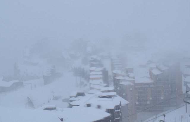
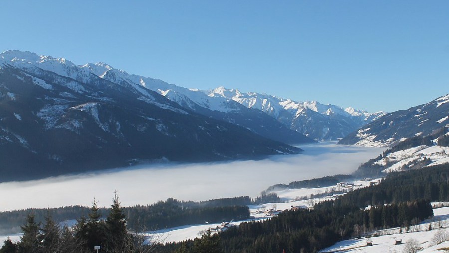 Fog trapped under a temperature inversion in the Pass Thurn area near Kitzbühel – 24 December 2017 - Photo: foto-webcam.eu
Freezing levels will reach 3000m in many places today, and higher still in the western Alps. However, as we have been banging on for some time now, this won’t be nearly as problematic for the snow as it sounds. Humidity is very low right now and, coupled with the weak sun at this time of year, will have very little effect on the snow-pack.
Anyone skiing in the Alps may also notice the strong temperature inversions in place which means that it is far colder in the valleys (at least in the shade) than on the higher slopes, where it will feel very pleasant. This fine weather will last through Christmas Day, before a major new Atlantic storm starts to take affect from Boxing Day (26 December) onwards.
The trajectory of the new storm means that most of the Alps will see significant snow between Boxing Day (Tuesday) and Friday 29 December, with the western and southern Alps seeing the most - particularly the French Alps (e.g. Alpe d’Huez, Flaine, Avoriaz), the central/eastern Italian Alps (e.g. Passo Tonale, Cortina), the far south-eastern Swiss Alps (e.g. St Moritz) and the southern Austrian Alps (e.g. Nassfeld). These areas have the potential to see well in excess of 50cm (locally 80cm+) by 29 December.
The good news is that there will be far less mild air mixed in with this storm than feared a few days ago. On Tuesday and Wednesday, the Foehn will temporarily raise temperatures across some northern parts of the Alps, especially Austria, but the rain/snow limit will generally be relatively low, falling to all skiing levels by Thursday.
Happy Christmas!
Updated: 11am Saturday 23 December 2018 – Will there be fresh snow in the Alps on Christmas Day?
Technically speaking it will not be a “white Christmas” for the vast majority of Alps. Yes, there is plenty of snow on the ground, but most places will not see anything actually fall out of the sky on 25 December. The only possible exceptions are parts of the southern Alps where the odd light shower is possible later in the day.
 Sunny skies in Kronplatz today with lots more sunshine expected over the next 3 days – 23 December 2017 – Photo: kronplatz.com
So what will the weather in the Alps be like over the next few days? To sum it up, sunny and mild. The milder conditions will be especially noticeable at altitude, where freezing levels will climb towards 3000m, and higher still in the western half of the Alps. Due to temperature inversions, it will feel much colder in shady valleys, especially under any lingering mist or low cloud.
As for snow conditions, they won’t be quite as epic as they have been over the last week or so but, with a low sun angle and increasingly dry air mass, snow quality will hold up much better than you would think given the high freezing levels.
Looking a bit further ahead, a new storm cycle is set to begin after Christmas with widespread snow likely on 27 December. Thereafter, it is likely to remain very changeable (but never particularly cold) with further snow at times but also the possibility of rain at low altitude.
Updated: 8.30am Friday 22 December 2017 - Winter takes a back seat
A huge area of high pressure is sitting to the west of France allowing mild Atlantic air to flood into the Alps across its northern flank. Weather fronts associated with this Atlantic air will continue to affect the northern Alps today.
 Colourful skies in the southern French Alps this morning but it will stay dry here today. This is St Jean de Montclar – 22 December 2017 – Photo: montclar.com
The northern French Alps should stay dry but the northern Swiss Alps, especially the north-east and the northern Austrian Alps will see some showery precipitation. The rain/snow limit will be around 1300/1500m in Switzerland and 800/1300m in Austria. This means that resorts such as Wengen, Engelberg, Seefeld and Kitzbühel will see a little rain close to resort level but also a few centimetres of snow at altitude.
By contrast, most the southern half of the Alps (e.g. the Italian Alps) will stay dry with sunny spells.
Over the weekend it will turn fine everywhere but will remain very mild with freezing levels approaching 3000m in places. This may sound dramatic but won’t actually have much effect on the snow pack, given the increasingly dry air and very low sun at this time of year. The most of any damage will be done by the moist Atlantic air affecting the northern Alps today.
Looking a bit further ahead, it should remain mild and mostly sunny on Christmas Day before a new storm cycle gets going on 26/27 December. This new cycle will bring some significant snow at altitude to the southern and western Alps in particular. However, with some milder air still in the mix, there could also be some rain low down.
Updated: 10.15am Thursday 21 December 2017 - Turning milder
The weather in the Alps is starting to change as a warm front introduces milder Atlantic air from the north-west.
 Cloudier with showers for much of Austria today. This is the Tux valley – 21 December 2017 – Photo: foto-webam.eu
This morning there is already some precipitation across the northern and eastern Austrian Alps (e.g. Salzburgland) with a rain/snow limit somewhere between 600m and 1100m. This precipitation will extend towards the northern and eastern Swiss Alps tonight with the snow level rising to between 1300 and 1800m later. The southern and western Alps will stay dry today with good spells of sunshine.
Tomorrow there will be further precipitation for the northern and eastern Alps, mostly from the Bernese Oberland eastwards with a rain/snow limit between 1300m and 1800m in Switzerland, 800m and 1400m in Austria.
The French and Italian Alps, some western and southern parts of Switzerland, and the far south of Austria will see little or no precipitation. The weekend will be mostly fine everywhere but very mild, especially at altitude.
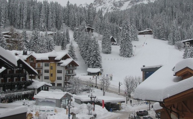
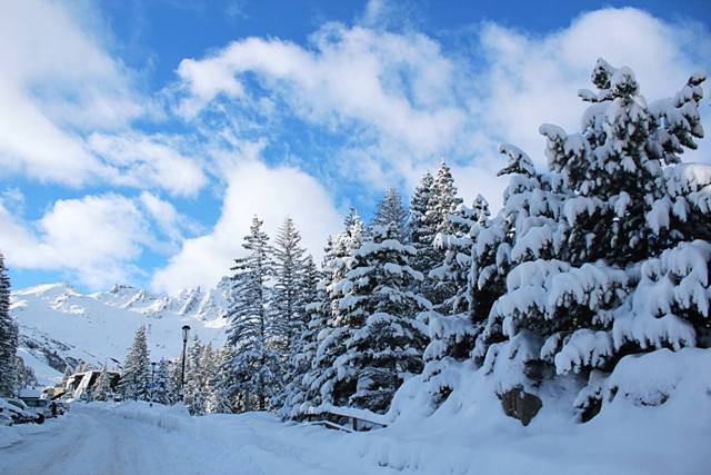
 Perfect snow conditions in Courchevel yesterday – 20 December 2017 – Photo: weathertoski.co.uk
Snow conditions in the Alps remain very good for mid-December, even exceptionally good in places, especially in the north-western Alps. Weathertoski has just returned from Courchevel where the snow quality was superb at all levels with not a pebble or patch of ice in sight, even on the very lowest runs.
The milder weather over the next few days will lead to a slight deterioration in snow conditions in places, mostly in the lower resorts of the Austrian Tirol and Salzburgland where it will rain for a time. However, during this milder spell any changes in snow quality in areas where it will remain mostly fine (e.g. the French and western Italian Alps) will be less marked.
Updated: 7.15am Tuesday 19 December 2017 – Skiing perfection?
Weathertoski is in Courchevel 1850 (courtesy of Hotel La Sivolière) where, following another 15cm top-up yesterday, skies have cleared overnight and snow conditions are expected to be just about perfect across the 3 Valleys today.
 Outstanding early season snow conditions here in Courchevel - 19 December 2017 – Photo: weathertoski.co.uk
Indeed, snow conditions across the northern Alps are simply incredible right now with masses of fresh snow even to low levels. It is difficult to highlight any particular area, but it is probably the smaller resorts of the north-eastern Swiss Alps (e.g. Amden, Flumserberg, Mythen) that have seen the most snowfall, with 1m or more of new snow in the last few days.
The southern Alps, in particular the Italian Alps, have seen much less new snow in recent days but even here there is plenty of very good skiing to be had, particularly on-piste.
This week it will be quieter with lots of fine weather and just a few bits and pieces of snow in the eastern Alps (mostly in Austria).
Updated: 12.20pm Sunday 17 December 2017 - Another powder day across many northern parts of the Alps
Yet more snow has fallen across many northern parts of the Alps in the last 24 hours. The heaviest falls have been in the north-eastern Swiss Alps where 20-40cm has fallen quite widely, with as much as 60cm of new snow very locally in some resorts to the east of Zurich.
 Masses of new snow in the north-eastern Swiss Alps. This is Toggenburg – 17 December 2017 – Photo: scek.ch
The Arlberg has also done well with 35cm of new snow in Lech, for example, as have the far northern French Alps the likes of Avoriaz and Flaine have seen 20-30cm.
Generally speaking, the further south you are the less new snow there has been over the last few days, with little if any across many parts of the Italian Alps. That’s not to say that there isn’t still lots of great skiing here - there is! It’s just that the deepest freshest snow is further north.
On Monday a new storm will bring another 10-20cm to many northern parts of the Alps, especially the French and Swiss Alps (away from the far south), but with a few bits and pieces for Austria and parts of Italy too.
Updated: 9am Saturday 16 December 2017 – Further flurries for northern Alps
It’s another cold day in the Alps, with further flurries across the north while the south stays mostly dry with good sunny spells.
 It’s snowing again today in the north-eastern Swiss Alps. This is Amden – Photo: amden-weesen.ch
Today’s flurries will affect the northern French Alps (e.g. Portes du Soleil), the northern Swiss Alps (e.g. Wengen, Engelberg, Flumserberg), and the northern and western Austrian Alps (e.g. St Anton). Snowfall totals over the next 24 hours in these regions are expected to be in the range of 10-30cm.
The further south you are in the Alps, however, the less snow there will be. The southern Alps will see plenty of sunshine, especially away from the border areas.
Updated: 10.45am Friday 15 December 2017 - Yet more snow for the northern and western Alps!
A lot of snow has fallen AGAIN across the north-western Alps, especially the northern French Alps (e.g. Val d’Isère, Avoriaz), the northern Swiss Alps (e.g. Wengen, Engelberg), and western Austria (e.g. Lech, St Anton).
 Powder day in Méribel – 15 December 2017 – Photo: facebook.com/3Vallees
These regions have seen another 25-50cm of new snow in the last 24 hours alone, with as much as 60cm recorded in some north-eastern parts of the Swiss Alps (e.g. Flumserberg). Generally speaking, the eastern and southern Alps have seen less snow, with some places missing out altogether.
Not surprisingly, we can safely conclude that snow conditions in the Alps are excellent for mid-December, even exceptional in some areas, especially across the northern and western Alps including most of France, Switzerland and western Austria. Overall, Italy now has the least snow (on average) but it’s all relative and the skiing is also mostly still excellent.
Updated: 10am Thursday 14 December 2017 - Yet more snow, mostly in the north-western Alps
The weather in the Alps remains unsettled, with further snow (and some rain) mostly affecting the north-western Alps today.
 Dumping again in Lech this morning – 14 December 2017 – Photo: lech.com
By the north-western Alps we mean the French Alps roughly north of Alpe d’Huez, through Switzerland (away from the far south – i.e. away from Ticino and Engadin) and western Austria (e.g. Arlberg). These areas will see occasional precipitation today, which will become heavier and more organised from the west this evening as a cold front moves through. The rain/snow limit will sit at around 900-1300m for most of the day before lowering to 600-800m tonight.
By this time tomorrow, there is likely to have been between 20cm and 40cm of new snow above 1500m across resorts such as Courchevel, Flaine, Avoriaz, Verbier, Wengen, Engelberg, Lech and St Anton. The southern and eastern Alps will see less snow, with some places missing out altogether.
Over the next few days there will be further snowfall across parts of the Alps, always favouring the north-west but extending further east to reach most of Austria too (away from the far south). The southern Alps will miss most of the action again, though bits and pieces will get through, especially into the north-western Aosta (e.g. Courmayeur, La Thuile) today and tomorrow.
Snow conditions are now above average for mid-December across most of the Alps, especially in the west, though France has now overtaken Austria as having the best overall snow. Find out more in our detailed snow report published later today…
Updated: 9.45am Wednesday 13 December 2017 – The Alps just keep on giving!
It’s a cold and sunny morning with superb snow conditions across much of the Alps, even if some of the top lifts remain closed due to wind and the huge amount of snow that has fallen in the last few days.
 Fabulous snow conditions in Courchevel, as is the case across most of the Alps – 13 December 2017 – Photo: facebook.com/LesAirellesCourchevel
As the day progresses the next storm will begin to make its presence felt across the western Alps, with snow reaching much of the French Alps (away from the far south) and the western Swiss Alps (e.g. Verbier) by this evening, and continuing to move further east overnight. The rain/snow limit will start low but rise to between 900m and 1400m overnight.
Over the next few days it will remain unsettled with further precipiation at times, always heaviest in the north-western Alps – that is to say roughly north of an imaginary line drawn between Grenoble in France and Innsbruck in Austria. Generally speaking, the southern Alps will see less snow, except perhaps for the Dolomites and the far south of Austria where a more significant fall is likely on Friday. The rain/snow limit will start around 900-1400m this week, but will fall to very low levels again towards the weekend.
Between now and Sunday we can expect another 30-60cm of new snow quite widely across these north-western parts of the Alps (e.g. Courchevel, Flaine, Avoriaz, Verbier, Mürren, Engelberg, Lech) with up to 1m of additional snow in a few favoured spots!
Generally speaking snow conditions are excellent for mid-December with most of the weak spots now ironed out. Indeed one of the areas of concern, the southern French Alps, have seen particularly huge snowfalls over the last few days with 1.5m of new snow or more in places (e.g. Parc national des Écrins).
Updated: 9.40am Monday 11 December 2017 – Wild!
The weather situation in the Alps remains extremely complex today, with huge variations in both temperature and precipitation depending on where you are and when.
 Huge snowfalls in Tignes over the weekend – 11 December 2017 – Photo: planetski.eu
Over the weekend we saw lots of snow in places especially in the French and western Swiss Alps (e.g. Val d’Isère, Val Thorens, Verbier) but also in some of those (relatively) snow starved parts of the Italian Alps (e.g. Cervinia, Monte Rosa) that were crying out for a big dump.
This morning the entire Alps are now in the warm sector of a major storm. A strong south-westerly airflow means that heavy precipitation is affecting much of the southern Alps, especially Italy, but also parts of the southern and western French Alps, southern Swiss Alps and southern Austrian Alps.
Meanwhile on the northern side of the Alps, especially in the north-east (Austria), there will be a violent Foehn wind with gusts reaching 150kph or more in places. It may be drier here but expect widespread lift closures in any area with a bit of altitude. The Austrian glaciers, for example, are highly unlikely to offer any skiing today.
As the day progresses, a cold front will introduce a new area of precipitation to the western Alps moving slowly east later. The rain/snow limit in the western Alps (e.g. Avoriaz, Alpe d’Huez) will start around 2000m but drop towards 1000m this evening. In the southern Alps (e.g. Serre Chevalier, Livigno, Madonna di Campiglio) the rain/snow limit will be between 1500m and 2000m.
To sum things up:
- There will be a lot of snow at altitude in the southern and western Alps today.
- The northern and especially north-eastern Alps will be exceptionally windy.
- It will start mild everywhere but become colder from the west later in the day.
- It will not be great weather day to be hitting the slopes with lots of lift closures at altitude.
Updated: 9.50am Sunday 10 December 2017 - Major storm affecting western Alps today
A major new storm is affecting the western Alps today bringing serious snowfall to much of the French Alps, the south-western Swiss Alps and parts of the western Italian Alps.
 Heavy snow in Avoriaz this morning – 10 December 2017 – Photo: avoriaz.com
We can expect between 30cm and 60cm of snow (above 1800m) across most of these regions today, and more still in some favoured spots. The rain/snow limit initially started very low, and will remain low for a time in some of the more internal valleys, but will rise to 1200-1500m then perhaps 1800m in more exposed western parts of the Alps later in the day.
Resorts that will see a lot of snow today include Val d’Isère/Tignes, Les 2 Alpes, La Thuile, Cervinia and Zermatt. The eastern Alps (e.g. Austria) will see little or no snow, with mild and Foehny conditions in the north and north-east (e.g. Salzburgland).
On Monday the heaviest snow will be focussed more across the central southern Alps (e.g. St Moritz, Livigno, Passo Tonale and Madonna di Campiglio). These regions could see 40-70cm of new snow at altitude tomorrow alone.
Other parts of the Alps will also see some precipitation but, generally speaking, it will be lighter and patchier the further north and east you are. It will also be mild for a time, with some rain in the mix below 1800m, especially in the northern half of the Alps. Later tomorrow temperatures and snow levels will begin to fall again.
It will continue unsettled for the rest of the week with further snow for many at times.
Updated: 10am Friday 8 December 2017 – It’s going to be a rollercoaster ride in the Alps over the next few days!
The weather situation in the Alps has become extremely complicated. There will be a lot of snow over the next few days, but also some rain, thanks to the increasingly southerly nature of the wind flow later on Sunday/Monday, something that has only really crept into the forecasts over the last couple of days.
 Heavy snow in Engelberg today – 8 December 2017 – Photo: titlis.ch
Today there is showery precipitation across many northern parts of the Alps, heaviest in the north-west (e.g. Avoriaz, Verbier, Engelberg and across towards the Arlberg). These regions should see between 20-40cm of new snow above 1500m, with a rain/snow limit descending to very low levels as the day progresses. The further south and east you go, the lighter and patchier any precipitation will be, at least with this first storm.
Saturday will be cold with a few residual snow flurries across the northern Alps and plenty of sun further south. Then on Sunday we await the arrival of a much bigger storm from the west. This is the complicated one, as it will bring with it a warm sector that will temporarily raise freezing levels to above 2000m.
This storm will deliver serious quantities of snow to the western and southern Alps later on Sunday and on Monday, but also some rain for a time lower down. The areas in line for the most precipitation are the French Alps, especially the south (e.g. Serre Chevalier), the Italian Alps (e.g. Courmayeur, Livigno), the southern Swiss Alps (e.g. St Moritz) and the southern Austrian Alps (e.g. Nassfeld.
This is excellent news for those areas that still haven’t seen much snow this winter, namely the Aosta valley (e.g. Courmayeur), Lombardy (e.g. Madesimo) and parts of the southern French Alps (e.g. Serre Chevalier). The fine details keep changing but these areas could see anywhere between 50cm and 100cm of new snow above 2000m between Sunday and Tuesday. By contrast, some low resorts, especially those across the northern Alps will suffer something of a thaw early next week, albeit only temporary. Stay tuned!
Updated: 9.40am Thursday 7 December 2017 – Major change in the weather imminent
There will be another fine day in the Alps today, but it’s all change tomorrow, with a spell of much more unsettled weather on the cards for the foreseeable future.
 Another beautiful day in the Austrian Alps. This is Bad Kleinkirchheim – 7 December 2017 – Photo: badkleinkirchheim.com
Today will be mostly sunny with just a few high clouds arriving in the north-west later. It will also be quite mild, with freezing levels typically close to or just below 2000m. It will then turn much colder on Friday and Saturday, briefly milder late on Sunday/Monday, then probably cold again for the rest of next week.
In the first instance the heaviest snow will be reserved for the north-western Alps – i.e. the northern French Alps roughly north of Grenoble, much of Switzerland (away from the far south) and western Austria. However on Sunday and Monday, the western Alps generally seem to be in the firing line. This is important, as it means significant snow for those areas that currently have the least – in particular the Aosta valley (e.g. Cervinia, Champoluc) and parts of the southern French Alps (e.g. Serre Chevalier).
In the meantime, anyone out and about in the Alps today should make the most of the fine weather. By contrast, anyone heading to the slopes this weekend or next week should prepare for some “proper” winter weather, which means reduced visibility at times, wind and the risk of lift closures.
If you are lucky enough to be in a resort with trees, make the most of them. Whatever the case, wrap up warm and don’t venture off-piste unless you fully understand the risks or are with an experienced guide – preferably both!
Updated: 10am Wednesday 6 December 2017 - A couple of mild days then winter returns!
High pressure is currently in charge of the weather in the Alps. There is some low level cloud in places today but at altitude it is sunny more or less everywhere, with freezing levels expected to be close to 2000m.
 A beautiful day in in the Alps. This is the Berghotel Rudolfshütte in the central Austrian Alps, just north of the Grossglockner – 6 December 2017 – Photo: alpinzentrum-rudolfshuette.at
It will continue mostly fine again on Thursday with the highest temperatures on the northern side of the Alps, due to a light Foehn effect. However, the weather will change radically on Friday with the arrival of a cold front from the north-west. This front will bring snow to many places, heaviest in the north-western Alps (roughly to the north-west of a line drawn between Grenoble in France and Landeck in Austria). The further south and east you are of this line, the lighter and patchier any snow will be, except perhaps for the eastern Dolomites (e.g. Cortina) that may also catch a substantial fall.
The weather in the Alps will remain cold and unsettled over the weekend and into next week, with further snow for many.
In the meantime, snow conditions remain good for early December across most of the Alps though not, as yet, exceptional as some are making out. Resorts that have got off to a particularly good start this year include Engelberg, where settled snow depths are 40/305cm depending on altitude, Warth-Schröcken (90/105cm), and Obertauern (120/150cm), but there are many more besides.
By contrast, more snow is still needed in the Aosta valley (e.g. Cervinia), parts of Lombardy (e.g. Madesimo) and parts of the southern French Alps. These areas can still offer reasonable piste skiing (where they choose to be open) but artificial snow is still a major factor.
Updated: 10.25am Tuesday 5 December 2017 - Becoming mostly fine and milder for a time
There are still some snow showers (500-700m) in the eastern Austrian Alps this morning (e.g. Schladming, Obertauern) however, these will gradually die out later. Elsewhere in the Alps it is mostly fine and quite a bit milder, at altitude at least.
 Great early snow cover in Avoriaz, which opened for a special preview last weekend – 5 December 2017 – Photo: avoriaz.com
It will remain mostly fine on Wednesday and Thursday and become even milder (most noticeable at altitude) before winter returns on Friday. Between Friday and Sunday we are expecting a lot of snow across the north-western Alps, especially the northern French Alps (e.g. 3 Valleys, Flaine, Chamonix, Portes du Soleil).
Much of the Swiss Alps, away from the far south (e.g. Verbier, Wengen, Engelberg), will also see some significant snow as well as western Austria (e.g. St Anton). However, as a general rule, the further south and east you go the less snow you will see this weekend.
In the meantime, snow conditions are already very favourable for early December across most of the Alps. The main exceptions remain parts of the southern French Alps (e.g. Orcières), the Aosta valley (e.g. Cervinia, Champoluc) and western Lombardy (e.g. Madesimo). These regions can still offer some reasonable piste skiing but snow cover remains thin, and artificial help is more or less essential.
Updated: 10.50am Monday 4 December 2017 – Snow transfers to north-eastern Alps
It’s snowing again across some eastern parts of the Alps today, mostly in Austria and heaviest to the east of Innsbruck, where 5-20cm of new snow is expected.
 Courchevel is more than ready for its official opening this weekend – 4 December 2017 – Photo: facebook.com/Courchevel
Except for a few flurries in the eastern Swiss Alps, most other areas will be dry with the best of the sunshine the further south and west you are. Tomorrow will see further light snow for some north-eastern parts of the Alps (e.g. Salzburgland) otherwise most areas will again be fine. Sunny weather is expected right across the Alps on Wednesday.
The next significant snow in the Alps will be later on Thursday and Friday with the heaviest falls due in the northern French Alps, Switzerland (away from the far south) and western Austria.
In the meantime, snow conditions in the Alps remain excellent for early December in most places. The main exceptions are some parts of the Aosta valley (e.g. Cervinia), western Lombardy (e.g. Madesimo) and parts of the southern French Alps away from the Italian border, although some decent skiing is still possible in these regions on a mixture of natural and man-made snow.
Updated: 9.35am Sunday 3 December 2017 - Great early season snow conditions continue for most
The weather in the Alps remains changeable. Today will be mostly dry and cold with just a few flurries moving into the far north-eastern Alps later.
 Fabulous wintry scenes today in Turracher Höhe in the southern Austrian Alps – 3 December 2017 –Photo: turracherhoehe.at
Monday and Tuesday will see more prolonged snow showers across parts of the eastern Alps, heaviest to the east of Innsbruck. Most other parts of the Alps will be fine and increasingly mild, at least at altitude. The next significant widespread snow is due on Thursday and Friday when a major winter storm will roll in from the north-west.
In the meantime, snow conditions remain excellent for early December across most parts of the Alps, the main exceptions being parts of the southern French Alps and the Aosta valley. These regions are still able to offer some skiing but snow cover remains thin and artificial help is very much on the agenda.
Updated: 8.30am Saturday 2 December 2017 - Snow shifts to south-western Alps
After the northern Alps bagging most of the snow showers in recent days, today it is the south-western Alps that are seeing all the action, with heavy snow in the southern Piedmont and parts of the southern French Alps, particularly the Alpes Maritimes.
 Great snow conditions across much of Austria, even at low altitudes. This is the Saalbach-Hinterglemm – 2 December 2017 – Photo: facebook.com/skicircus
Resorts benefiting from today’s heavy but relatively localised snowfall include Sauze d’Oulx, Sestriere, Prali, Bardonecchia, Prato Nevoso, Limone, Isola 2000 and the resorts of the Queyras. A little snow could also spill over the French border further north into resorts such as Bonneval sur Arc, Val Cenis and even Val d’Isère. Elsewhere in the Alps it will be mostly dry with the best of any sunshine the further north-east you are (i.e. Austria).
Snow conditions in the Alps are generally excellent for early December. The main exceptions being the Aosta valley in north-western Italy and parts of the southern French Alps though, even here, many resorts are working hard with the snow cannons.
 Big snowfalls today in the far south-western Alps. This is Prato Nevoso – 2 December 2017 – Photo: facebook.com/Pratonevoso
A couple of areas that deserve a mention today are the Jura (north of Geneva) and the Vercors (west of Grenoble). Both of these areas are low - most of the skiing in the Jura is between 800m and 1500m - but have seen really big dumps in the last two to three days (40-80cm), which should set them up nicely in the run up to Christmas.
Back in the Alps, dozens more resorts have just opened or will be opening this weekend, perhaps the most significant among these being those of the Arlberg (St Anton, Lech, Warth etc.) which opened yesterday with fabulous early season snow conditions.
Looking a bit further ahead, it will turn milder in the Alps for a time next week. It won’t last long, however, as a very potent storm is expected to move down from the north-west on Thursday/Friday, bringing with it further significant snowfalls. Watch this space…