


ARCHIVE
Today in the Alps - November 2017
Read about current weather and snow conditions in the Alps
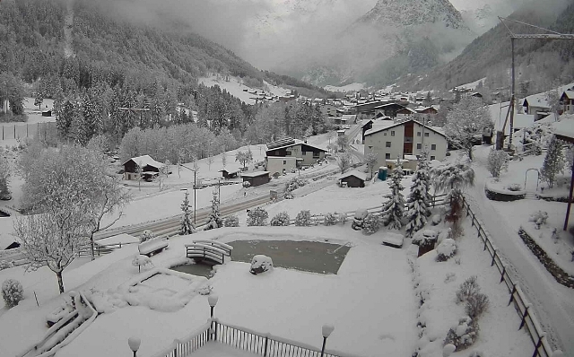
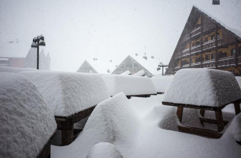
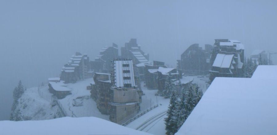
Updated: 10.40am Thursday 30 November 2017 - Remaining wintry in the Alps
It remains cold in the Alps with further snowfall in places. In the last 24 hours most of the snow has fallen in the northern and eastern Alps (including the eastern Dolomites).
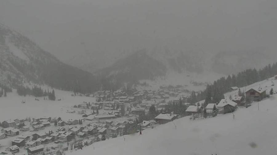
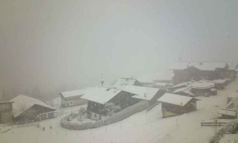
 It’s very snowy across much of the Austrian Alps right now. This is Brand – 30 November 2017 – Photo: zimba-brand.at
Resorts that have seen significant fresh snow in the last couple of days include Avoriaz, Wengen/Mürren, Engelberg and pretty much anywhere in Austria! The areas that have again missed out are the Aosta valley (e.g. Courmayeur, Cervinia, Champoluc), the northern Piedmont (e.g. Alagna) and Lombardy (e.g. Madesimo).
Later today, further light to moderate snow is expected across a wide swathe of the northern Alps while tomorrow the north-western Italian Alps (e.g. Cervinia, Monte Rosa) might finally see something worthwhile. Then on Saturday we are expecting a big snowfall in the south-western Italian Alps (e.g. Prato Nevoso, Limone, Sestriere), which will spill over the border into parts of the southern French Alps (e.g. Isola 2000) and possibly even a bit further north into Val Cenis and Val d’Isère.
Looking a bit further ahead, it will turn milder for a time next week but this is not expected to last too long and nothing can now change the fact that snow conditions in the Alps in early December will be vastly better than they have been for the last three seasons.
Updated: 10.20am Wednesday 29 November 2017 - Remaining cold with further snow in places, mostly in the northern Alps
Winter is firmly established across the Alps. Not everywhere is seeing significant snow, but it is cold, and will remain so for some time to come.
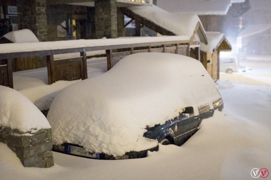
 Plenty of snow to low levels in the Swiss Vaud region. This is Les Diablerets – 29 November 2017 –Photo: lesdiablerets.ch
As expected, there has been some fresh snow across the Alps in the last 24 hours, mostly in the north. Areas that have benefited from several centimetres of new snow to low levels include the Portes du Soleil, Villars, Wengen/Mürren, Engelberg, Lech and Saalbach, to name just a few. Generally speaking, the further south you go, the less snow there has been, with many places missing out altogether.
A couple of areas that still don’t have much snow at all are the Aosta valley (e.g. Cervinia, Courmayeur, Champoluc) and parts of the southern French Alps (e.g Les Orres, SuperDévoluy). However, with temperatures as low as they are, many of these resorts are furiously making snow and will continue to do so for the foreseeable future.
There is further snow in the forecast over the next few days, mostly across the northern Alps but also in the south-western Italian Alps (e.g. Prato Nevoso, Limone and perhaps as far north as the Milky Way) by Saturday.
All in all, except for the Aosta valley, parts of Lombardy and parts of the southern French Alps away from the Italian border, it is shaping up to be a very good start to the season.
Updated: 11.20am Tuesday 28 November 2017 - Cold week ahead with further snow in places
It’s a cold week in store for the Alps. There will also be some snow around though not generally in any great quantity, but it will fall to low levels which will add to the wintry feel.
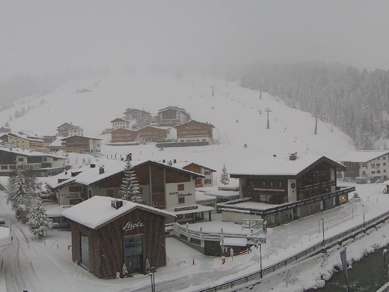
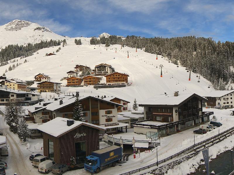 Fine this morning in Lech but further snow is expected tonight – 28 November 2017 – Photo: lech.com
The first light snows have already reached the Jura, north of Geneva, and will continue to move slowly south to reach the north-western fringes of the Alps (e.g. Portes du Soleil) later this afternoon. Overnight many other northern parts of the Alps will also be affected, with a rain/snow limit around 500-700m, dropping later.
Over the next few days further mostly light snow will continue to affect many northern parts of the Alps, particularly the north-west, with snow down to the lowlands at times. Examples of resorts that will benefit most this week include Morzine, Villars, Wengen, Engelberg, St Anton and Garmisch. These resorts should see 20-40cm of new snow by the end of the week, perhaps even more.
Generally speaking, the further south you go the less snow you will see. Resorts such as Val d’Isère, Zermatt, St Moritz and Obergurgl, which have a more internal Alpine location, are likely to see in the range of 10-20cm over the next few days. Indeed some parts of Italy and the southern Italian Alps may see next to nothing, at least in the first instance. Remember that it will be very cold though, which means that snowmaking will be at full capacity.
Updated: 9.50am Monday 27 November 2017 - Winter tightens its grip on the Alps
As expected, we saw snow across many parts of the Alps this weekend, with generally just a few centimetres in the south but between 10cm and 30cm (locally 40cm) above 1500m in the northern half of the Alps.
 Great early snow conditions in Val d’Isère – 27 November 2017 - Photo: valdisere.com
The rain/snow limit started at around 1700m on Saturday but fell to below 1000m on Saturday night, then lower still on Sunday.
Today will see more in the way of sunshine across the Alps before further weather fronts arrive from the north-west on Tuesday. It will then remain unsettled and cold for the rest of the week with further snow at times in all regions.
Generally speaking, snow conditions are good to very good for late November, though there are some exceptions. One of these is the Aosta valley where resorts such as Courmayeur, Cervinia and Champoluc are lagging behind other parts of the Alps and only have patchy snow cover, even at altitude. Parts of Lombardy (e.g. Madesimo), the central-southern Swiss Alps (e.g. Bosco-Gurin) and the southern French Alps away from the Italian border (e.g. Super-Devoluy) are also very short of snow, though let’s not forget that some of these resorts are not scheduled to open yet anyway.
Most of the rest of the Alps now have a decent base at altitude, and in some cases lower down too. Generally speaking it is the northern and eastern Swiss Alps and Austria that are doing best right now. A few recommended resorts for good snow this week include Val d’Isère/Tignes, Val Thorens, Engelberg, Davos, Obergurgl, Obertauern, Ischgl, Kaprun, Kitbühel and Schladming.
Check out our latest detailed snow report later today for further details about snow conditions in the Alps…
Updated: 10.50am Friday 24 November 2017 - Turning very cold next week!
The weather in the Alps is looking decidedly interesting as we approach December, a refreshing change to the unseasonably warm early season conditions of recent season.
 Milder weather has melted some of the low-lying snow in Austria but the cold is about to return. This is Grossarl in the Salzburgland – 24 November 2017 – Photo: grossarltal.info
After a few days of mild weather, it will turn colder and more unsettled again from the north-west. There will be some moderate snow in places, heaviest in the central and northern Alps, and lightest (generally speaking) in Italy though the Dolomites may also see a moderate fall. Most of the snow will fall on Saturday, with 20-30cm quite likely above 1500m in resorts such as Chamonix, Verbier, Wengen, Engelberg, Laax, Klosters, Lech, St Anton and Kaprun.
Next week it will turn colder still with further snow at times, even down to the lowlands. It is difficult to say at this stage just who will get how much snow but we can confirm that, at the very least, the snow cannons will be able to operate at full capacity.
We will update our detailed weather forecast for the Alps later today. You can also read our latest snow report to find out more about snow conditions in the Alps and beyond.
Updated: 8.10am Thursday 23 November 2017 - Two more mild days before winter returns
It’s another mild day in the Alps which means further thawing of any low-lying snow. However, winter is still on track to return by the weekend, with further snow in places.
 Another fine day for the Austrian Alps. This is Heiligenblut – Photo: wallackhaus.at
The big news today is the opening of Ischgl in Austria. Snow conditions are excellent here for the time of year and, with 166km of pistes to play on, it easily usurps Obergurgl as the most extensive ski area in the Alps right now.
Looking a bit further ahead, next week looks very interesting for the Alps as a mass of very cold and potentially quite snowy polar air is set to descend from the north.
Updated: 11.50am Wednesday 22 November 2017 - Snow upgrade for the weekend!
The current mild spell of weather in the Alps will last until Saturday, at which point a series of weather fronts will introduce colder and snowier weather from the north-west.
 Good snow cover at low altitude across the northern Austrian Alps right now but some of this will melt over the next three days. This is Hochkönig – 22 November 2017 – Photo: hochkoenig.at
Before that happens we have three days of mostly dry and quite warm weather to get through which will melt a lot of the snow below about 1400-1600m, especially on the north-eastern side of the Alps (e.g. Salzburgland) where the Foehn will be at its strongest. However, due to temperature inversions, some low shady valleys will keep some snow, especially in the central Alps.
Above 1800m or so, most (though by no means all) of the Alpine ski resorts have a decent base, which will survive the mild spell. However, a couple of areas that still don’t have very much snow are the Aosta valley (e.g. Cervinia) and parts of the southern French Alps away from the Italian border (e.g. Serre Chevalier). Snow cover in these regions is still quite patchy, even at altitude.
This weekend we will then see quite a lot of snow across the Alps, certainly more than we suggested in yesterday’s forecast. The snow will be heaviest in the north but will also affect some southern areas, especially the central and eastern Italian Alps (e.g. Lombardy, Dolomites).
Longer term the prospects look even better, with further widespread snow likely next week.
Updated: 9.20am Tuesday 21 November 2017 – Milder in the Alps
Warm fronts will skirt the north-eastern parts today bringing some showers, notably in Austria (away from the south). The rain/snow limit may start quite low in some of the enclosed valleys, but will gradually rise towards 1600-1900m as the day progresses.
 Wet snow is likely to turn to rain later today in Lech – 21 November 2017 – Photo: lech-zuers.at
The eastern Swiss Alps will also be rather cloudy with a few showers at first but it should brighten later. Other regions will be mostly fine, with lots of sunshine in the French and Italian Alps, particularly in the western Italian Alps. It will be milder than in recent days in all regions.
The rest of the week will continue mild but mostly fine which means a rapid thaw of any low-lying snow. However, this warmer spell won’t last long as it turns colder and potentially snowy again over the weekend.
The weather models disagree over the medium forecast, but right now the chances are that November will end on wintry note with further significant snow for most. Watch this space…
Updated: 10.30am Monday 20 November 2017 - Turning warmer, but not for too long…
As expected, last weekend saw snow falling across the northern half of the Alps, heaviest in parts Austria where up to 40cm was recorded (e.g. Lech-Zürs).
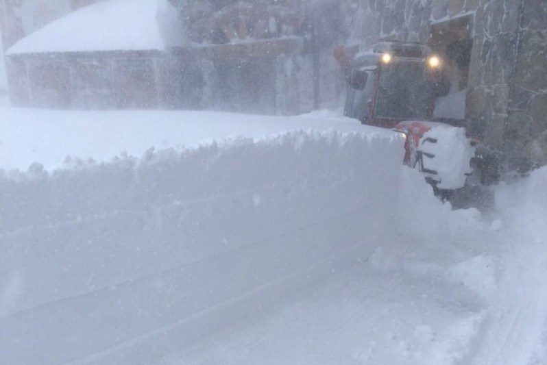
 Significant fresh snow in Lech this morning – 20 November 2017 – Photo: facebook.com/LechZuers
More generally, between 5cm and 25cm of new snow fell above 1200m with a dusting as low as 300m in the northern foothills (e.g. on the German/Austrian border). The northern French Alps (e.g. Portes du Soleil) only saw a few centimetres at best. The southern Alps also largely missed out this time around.
The weather will turn milder over the next few days with Foehn conditions developing across the northern Alps leading to a thaw of low-lying snow. It doesn’t look like lasting too long, however, with colder and potentially snowy conditions set to return to the Alps by next weekend.
Updated: 10.50am Sunday 19 November 2017 – Snow across many northern parts of the Alps
As expected, it is snowing (500-800m) this morning across many northern parts of the Alps, heaviest in Austria. The southern Alps are mostly dry, however.
 Snowing this morning in the Gastein valley – 19 November 2017 – Photo: gastein.at
By the end of the day we are expecting between 5cm and 30cm of new snow across a wide swathe of the northern Alps from about the Bernese Oberland eastwards, with 40cm+ locally (in parts of the Austrian Salzburgland, for example). The northern French Alps will only see a dusting.
Monday and Tuesday will see a few showers/flurries lingering across the Austrian Alps but it will generally be dry. From mid-week onwards everywhere will be fine and increasingly mild.
Updated: 8.40am Saturday 18 November 2017 - More snow for some northern and eastern parts of the Alps tomorrow
Saturday will be mostly dry in the Alps with plenty of sunshine to start with, at least above any low valley fog/cloud.
 A beautiful morning across the eastern Swiss Alps but snow is expected here tomorrow. This is Biel-Kinzigag – 18 November 2017 – Photo: biel-kinzigag.ch
Snow will reach the northern Alps tonight and continue for much of Sunday, heaviest from the central-northern Swiss Alps (e.g. Engelberg) eastwards through into Austria (away from the far south).
In the northern French Alps (e.g. Portes du Soleil, Chamonix) we might not see more than a dusting from this latest storm. The same goes for the western Swiss Alps (e.g. Villars, Verbier). However from about Engelberg eastwards a moderate fall of snow (5-20cm) is expected across the likes of Braunwald, Flumserberg, Lech, Kaprun, Schladming and Obertauern (to name just a few), with a bit more here and there. It will also turn colder with any snow falling to relatively low levels (400-900m).
Next week will begin unsettled in the north-eastern Alps with further showers on Monday and Tuesday (mostly in Austria). However, the weather will settle down everywhere by mid-week.
Updated: 12.40pm Friday 17 November 2017 - More snow on Sunday, mostly for the north-eastern Alps
The weather in the Alps is on the change again with more snow on its way on Sunday. However, it won’t be as widespread as last time with only the eastern Swiss and Austrian Alps (away from the far south) seeing any significant snow.
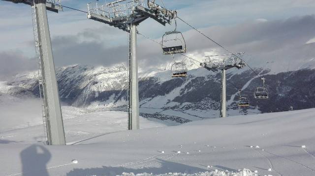
 Val Thorens is open to the public tomorrow! Here are the main lifts that will be operational – Photo: facebook.com/Valthorens.resort
In the meantime it’s another fine day across most of the Alps though there is some thicker cloud across some eastern areas, notably in the central and eastern Austrian Alps.
After a mostly dry day on Sunday, it will snow across some northern and eastern parts of the Alps later in the day and on Monday. The northern French and western Swiss Alps (e.g. Avoriaz, Verbier) will only see a dusting of snow.
Resorts in the central Swiss Alps (from about Engelberg) and eastwards through Austria (away from Carinthia and Osttirol) will see between 5cm and 30cm of new snow (locally more) with the greatest falls likely to the east of Innsbruck.
More and more ski resorts in the Alps are opening all the time with perhaps 40+ areas partially operational this weekend. The biggest opening is Val Thorens, where 70% of the lifts will be up and running on Saturday. It will join Obergurgl as the two most extensive areas of skiing currently available in the Alps.
Among the unscheduled openings this weekend are Champéry-Les Crosets in the Portes du Soleil and Grimentz in the Val d’Anniviers, but there are many more besides.
Updated: 9.50am Wednesday 16 November 2017 - Fine today, but snow for some northern and eastern areas over the weekend
It’s another glorious day across most of the Alps, at least if you are above the stubborn low cloud/fog which is plaguing some of the valleys, especially in the north. It will also feel quite mild in the sunshine but, with humidity relatively low, any thawing will be limited.
 Snow cover to relatively low levels across much of Austria right now. This is Hochkönig – 16 November 2017 – Photo: hochkoenig.at
The next snow is still due at the weekend and will mostly affect the northern Alps, but won’t amount to much in the north-west (e.g. Portes du Soleil, Verbier). However, from about central-northern Swiss Alps eastwards (e.g. Engelberg) it will be more significant, especially in Austria where it will continue to snow into the first part of next week.
This means that resorts such as Lech, St Anton, Kitzbühel, Saalbach, Kaprun, Obertauern and Schladming (to name just a few) could see between 20cm and 40cm of new snow by the end of Monday. It will also turn colder which means that any snow will stick to relatively low levels.
Updated: 8.10am Wednesday 15 November 2017 - More resorts open
Recent snowfall has prompted several resorts to consider an early opening, including Courchevel which made the snap decision to open a handful of runs today.
 And they’re off! Courchevel makes the snap decision to open today thanks to recent snowfall – 15 November 2017 - Photo: courchevel.com
Courchevel’s decision to open was helped by the good forecast, with fine weather expected to last across the Alps until Friday. Over the weekend, a weak cold front will bring a little snow to the northern and north-eastern Alps (mostly in Switzerland and Austria), but not generally amounting to very much.
Right now at least 30 resorts are partially open across the Alps with the most extensive skiing still on the Austrian glaciers – especially Sölden, Stubai, Kitzsteinhorn and Hintertux. However, non-glacial Obergurgl opens tomorrow and could well eclipse all of the above, in terms of the extent of available terrain.
Note that the Pyrenees have also had snow, with Spain’s Baqueira Beret expected to open around 25km of runs on Saturday.
Updated: 9.40am Tuesday 14 November 2017 - Current storm cycle ends
The latest storm cycle is now over, and those lucky enough to be skiing in the Alps right now can enjoy potentially excellent early snow conditions, with 40-100cm of fresh snow at altitude across the northern Alps (e.g. Tignes, Engelberg, Lech).
 Lots of snow in the Austrian Vorarlberg. This is Golm – 14 November 2017 – Photo: golm.at
We say potentially as there are some caveats. Firstly, there have been some very high winds over the last few days which means that the snow has been deposited in an irregular fashion – some high slopes are scoured and the off-piste is often dangerous.
All the same, the overall situation is an encouraging one for mid-November with good snow cover above 2000m just about everywhere. Right now most areas also have snow to much lower altitudes, especially across the northern and north-eastern Alps. However, the next few days will be mostly fine and increasingly mild, meaning that some of the recent snow will melt as temperatures rise.
Towards the weekend the temperature will drop again with the arrival of a cold front from the north. This is likely to bring some more snow to the northern Alps, though not much for France and western Switzerland, but some moderate falls are possible for the central/eastern Swiss Alps (e.g. Mürren, Engelberg, Klosters) as well as much of Austria away from the far south. Watch this space…
In the meantime, there are at least 30 partially open ski areas across the Alps with the greatest extent of open slopes in Sölden (67km) and Hintertux (45km). However, this is likely to change with the opening of non-glacial Obergurgl on Thursday, with a potential 100km+ of pistes on offer.
Updated: 9.40am Monday 13 November 2017 - Lots of new snow!
It has been an eventful weekend of weather in the Alps with rain, snow, violent winds and (eventually) a dramatic drop in temperature.
 Masses of new snow in Val Thorens – 13 November 2017 – Photo: facebook.com/3vallees.France
The main action kicked off on Saturday with the arrival of a warm front that delivered plenty snow (above 1800-2000m) but also a lot of rain lower down, especially across the north-western Alps (e.g. Portes du Soleil, Bernese Oberland).
Sunday started mild and showery before an active cold front delivered a more persistent spell of precipitation across many parts of the Alps (but always heaviest in the north) as well as a brutal drop in temperature, which meant that by Sunday evening it was snowing below 1000m in most places.
 Still snowing today in Lech – 13 November 2017 – Photo: lech.com
This morning there are still plenty of snow showers (to low levels) across the northern Alps, especially in a line from the Haute-Savoie (e.g. Avoriaz), through the Bernese Oberland (e.g. Mürren), across the central and eastern Swiss Alps (e.g. Engelberg) and into Austria. These snow showers will very gradually ease with plenty of dry, fine and increasingly mild weather in prospect from tomorrow onwards.
In the last 48 hours we have seen between 30cm and 60cm of new snow above 2000m across a wide swathe of the northern Alps, with up to 100cm in a few favoured spots. With one or two exceptions, the southern Alps have seen less snow.
So what, in this situation, do we mean by the northern Alps? Roughly speaking we define the northern Alps as anywhere north of Grenoble in France, most of Switzerland away from the far south (especially away from Ticino) and most of Austria away from Carinthia and Osttirol. Italy is mostly exempt, with the exception of some border areas, particularly in the far north-west (e.g. Courmayeur).
 Lots of new snow on the Grand Motte glacier above Tignes! – 13 November 2017 – Photo: @TignesOfficiel
Resorts (albeit not necessarily open yet) that have done particularly well from this latest storm include Tignes, Val Thorens, Verbier, Engelberg, Davos and Lech, but there are many more besides.
We will bring you more on snow conditions in the Alps and beyond in our detailed snow report later today…
Updated: 9.30am Saturday 11 November 2017 - Lots of snow at altitude in the northern Alps this weekend
There will be a lot of snow at altitude across the northern Alps (particularly the north-western Alps) this weekend but also some rain lower down.
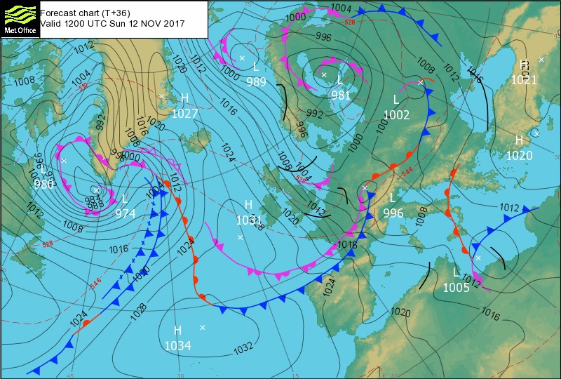 Arrival of the cold front on Sunday 12 November, which will lower the rain/snow limit very quickly – Image: metoffice.gov.uk
This morning rain has already reached the Jura and the northern foothills of the Alps, with some snow above 1500m-1700m. The rain will slowly spread to other northern parts of the Alps as the day progresses, intensifying this evening and overnight.
So what, in this situation, do we mean by the northern Alps? Roughly speaking we define the northern Alps as anywhere north of Grenoble in France, most of Switzerland away from the far south (especially away from Ticino) and most of Austria away from Carinthia and Osttirol. Italy is mostly exempt, with the exception of some border areas, partic ularly in the far north-west (e.g. Courmayeur).
The rain/snow limit will rise overnight to between 1700m and 2000m, highest in the far north-western Alps (e.g. Portes du Soleil), and will remain quite high for a while on Sunday before falling dramatically later in the day with the arrival of the cold front. By Sunday night it should be snowing across the northern Alps to below 1000m, and as low as 400-600m in places on Monday.
Between now and Monday we can expect 60-90cm (locally 100cm) of new snow above 2200m in some favoured parts of the north-western Alps, such as the Massif du Mont Blanc, the Bernese Oberland, Engelberg and far as the Arlberg (e.g. Lech).
More generally speaking we can expect 20-60cm of new snow above 2200m. The southern Alps will see less snow with some places missing out altogether though, as always, there will be the odd exception. We are, for example, expecting a lot of snow at altitude in the north-western Aosta region (e.g. Courmayeur).
Right now, weather permitting, it is possible to ski in about 30 resorts across the Alps with lots more due to open in the few days. Perhaps the most significant imminent non-glacial opening will be that of Obergurgl on Thursday 16 November.
Updated: 11am Friday 10 November 2017 - Next major storm incoming
Yesterday saw further snow in the far south-western Alps (e.g. Isola 2000, Prato Nevoso, Limone). Otherwise, except for the odd flurry here and there, most places were dry with lots of valley cloud but plenty of sunshine at altitude.
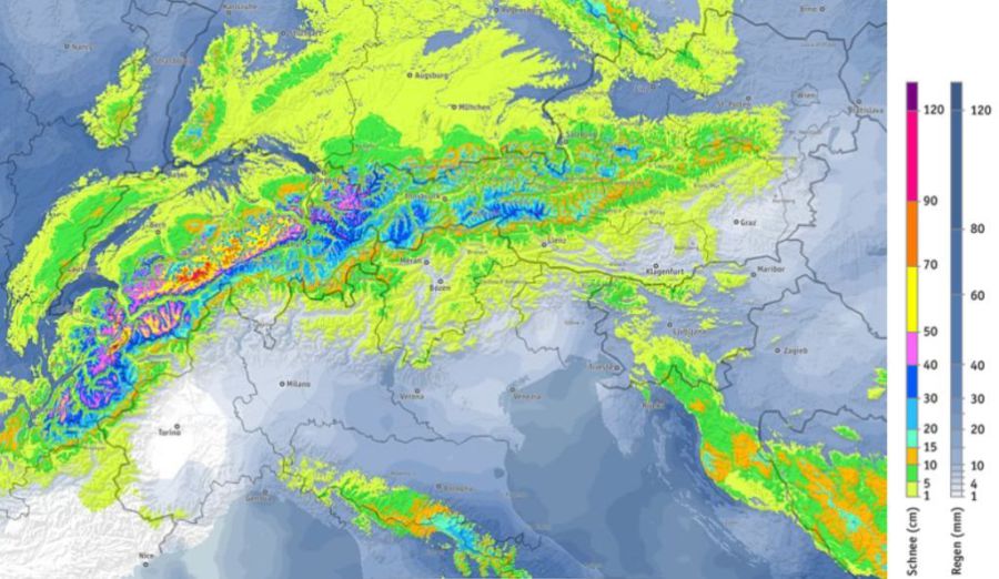 Expected snowfall totals in the Alps (cm) between now and Monday 13 November – Image: bergfex.com
All eyes are now on the weekend when a new storm will deliver significant snow (and for a time some rain) mostly to the northern half of the Alps. The first weather front will be a warm one which will raise the rain/snow limit to between 1600m and 2000m for a time on Saturday (highest close to the northern foothills of the Alps). On Sunday, however, a cold front will help lower this limit back down to 1500m, then eventually to under 1000m.
Snow showers will continue to low levels across the northern Alps into the early part of next week before high pressure starts to reassert itself from the west.
So what, in this situation, do we mean by the northern Alps? Roughly speaking we define the northern Alps as anywhere north of Grenoble in France, most of Switzerland away from the far south (especially away from Ticino) and most of Austria away from Carinthia and Osttirol. Italy is mostly exempt, with the exception of some border areas, particularly in the far north-west (e.g. Courmayeur).
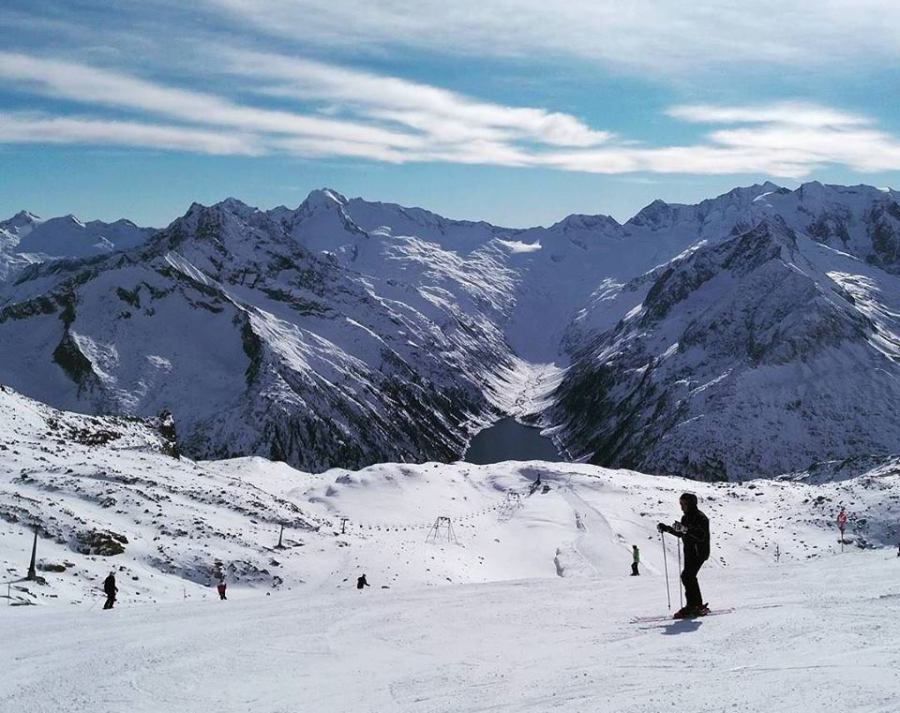 Fabulous snow conditions on the Hintertux glacier right now – 10 November 2017 – Photo: facebook.com/Hintertux.Glacier
Over the next few days we are expecting 20-50cm above 1800m across a wide swathe of the northern Alps, with 60cm+ in a few favoured locations including high up in the Mont Blanc region and perhaps in the Bernese Oberland (e.g. Mürren), Engelberg, and Lech/St Anton.
Right now it is possible to ski in about 30 resorts across the Alps, with lots more due to open in the next couple of days. Some of the best options are Hintertux, Stubai, Sölden, Engelberg and Zermatt, but there are some entirely non-glacial areas operating too (e.g. Davos, Sulden am Ortler).
Updated: 10am Thursday 9 November 2017 - Further significant snow this weekend, mostly in the northern Alps
The weather in the Alps is fairly calm today with plenty of sunshine at altitude but also a lot of low cloud in the valleys.
 Lots of valley cloud in the Alps today. This is the Tux valley in Austria – 9 November 2017 – Photo: foto-webcam.eu
After another mostly dry day tomorrow, active weather fronts will then arrive from the north-west over the weekend. The first front will be a warm one, sending the rain/snow limit towards 1800m in places before a cold front crosses the Alps on Sunday, returning the snow level to 1000m or lower.
Monday will then be very cold, with further snow showers across the northern Alps, especially in the north-east.
By the northern Alps, we mean the French Alps north of Grenoble, most of the Swiss Alps expect the far south (Ticino in particular belongs to the southern Alps, meteorologically speaking) and most of Austria (except Carinthia and Osttirol). Italy is normally considered as the southern Alps though some border regions, especially the far north west (e.g. Courmayeur), can tap into “northerly” set-ups to some extent.
So between Saturday and Monday we can expect 15-40cm of new snow above 1800m across a wide swathe of the northern Alps, with 50cm+ in a few favoured areas such as the Arlberg (e.g. Lech). The southern Alps will only see a “bits and pieces” of snow here and there with some places missing out altogether.
More details on Friday…
Updated: 9.35am Wednesday 8 November 2017 - Remaining cool, more significant snow in places this weekend
It’s a rather cool and cloudy picture this morning in the western Alps, with some light flurries (800-1200m) here and there though not amounting to very much. In the eastern Alps (i.e. Austria) there will be some good sunny breaks.
 Excellent early snow cover in the Dolomites, unlike in recent years. This is Arabba – 8 November 2017 – Photo: dolomitisuperski.com
Although most of the Alps now have a decent covering of snow at altitude, there were two main sweet spots from the recent storm. The first was in the southern Austrian Alps, south of Innsbruck, where the likes of Hintertux and Stubai saw between 80cm and 100cm of fresh snow at around 3000m. This particularly snowy zone also extends over the border into parts of the Dolomites.
The second was in the southern Piedmont in the south-western Italian Alps, south of the Milky Way, where resorts such as Prato Nevoso also saw around 100cm of new snow, even as low as 1800m.
 Looking wintry in the Ski Circus area. This is Leogang – 8 November 2017 – Photo: saalbach.com
Generally speaking though, the Alps have seen somewhere between 10cm and 50cm of new snow above 2000m, with the French and far north-western Italian Alps (e.g. Courmayeur) seeing the least.
Although some of the lower lying snow is already starting to disappear, it is important to note that unlike last year there is no extended period of warm weather on the near horizon, which means that at altitude at least there is a better chance that some, if not most, of this snow will stick around.
Obergurgl and Ischgl, for example, are two entirely non-glacial resorts that are now pretty much set for the early part of the season.
 Snow even down to valley level in the southern Austrian Alps. This is Lienz – 8 November 2017 – Photo: foto-webcam.eu
Over the next few days there will be a few light flurries here and there, but the next significant snow is due in the northern Alps this weekend, especially later on Sunday and Monday. Areas that are likely to be benefit include Avoriaz, Mürren, Engelberg and Lech.
Updated: 9.45am Tuesday 7 November 2017 - The Alpine landscape is transformed…
The weather in the Alps has eased somewhat though there are still some flurries in places today, notably in the Dolomites as well as the southern Piedmont (e.g. Prato Nevoso).
 100cm of new snow and counting in Prato Nevoso in the Italian Piedmont – 7 November 2017 – Photo: @PratoNevoso
The Alpine landscape has been transformed by the snow over the last two or three days, and for some higher resorts there is already enough snow for a good early base.
A word of caution though - for most resorts we are not there yet, and further significant snowfalls are still needed before we can call for anything like a bumper early season.
 Looking good in Livigno – 7 November 2017 – Photo: facebook.com/Carosello3000
The heaviest snow from the recent storm fell in the Austrian Alps close to the Italian border and south of Innsbruck (e.g. Obergurgl, Stubai, Hintertux), as well as the far south-western Italian Alps (e.g. Prato Nevoso).
Indeed Prato Nevoso and the Stubai glacier both claim around 100cm of new snow, while the Hintertux glacier claims around 80cm.
 100cm of fresh snow on the Stubai glacier! – 7 November 2017 – Photo: facebook.com/schifahren.stubaiergletscher
Other areas that have done very well with 40-80cm of new snow at altitude include the Dolomites, Livigno, and parts of the Engadin in south-eastern Switzerland. More generally, the Alps saw between 10cm and 40cm of new snow above 2000m.
Glaciers aside, Obergurgl is looking an excellent early bet right now. It opens on 16 November and has enough snow to open the majority of its area. Ischgl (opening 23 November) is also on track for a solid start to the season.
 Great snow cover in the Tux valley – 7 November 2017 – Photo: foto-webcam.eu
What’s more, it will stay cool this week with further flurries at times and some more significant snow for the northern half of the Alps (e.g. Kitzbühel, St Anton, Engelberg, Mürren, Avoriaz) over the weekend.
More details tomorrow...
Updated: 10.15am Monday 6 November 2017 - The big storm delivers
As expected, lots of snow fell across the Alps yesterday and it is still snowing in places today. The great thing about this storm is that just about everywhere saw some significant snow, at least at altitude. What’s more there is more in the forecast over the next few days.
 80cm of new snow on the Hintertux glacier – 6 November 2017 – Photo: facebook.com/Hintertux.Glacier
The biggest snowfalls have been in the central and eastern Italian Alps (e.g. Dolomites, Passo Tonale, Livigno) and the Austrian Alps south of Innsbruck (e.g. Hintertux, Nassfeld). These areas have seen between 50cm and 100cm of new snow above 2300m.
 35cm of new snow in Livigno, with 60cm up top – Photo: twitter.com/Livigno
Most other parts of the Alps have seen between 15cm and 50cm of new snow at altitude, with modest accumulations to below 1000m in places, especially across the northern half of the Alps where the cold air was first to bite.
 30cm of new snow in Avoriaz this morning – Photo: avoriaz.com
Today there are still plenty of mostly light snow showers across the Alps, but with some heavier falls in the south-western Italian Alps (e.g. Sestriere, Prato Nevoso).
 Fresh snow in Sestriere, with plenty more forecast today – Photo: vialattea.it
This week will remain cool and changeable with a little snow here and there and more significant snow again possible at the weekend, this time more concentrated in the northern Alps. Watch this space…
Updated: 10.45am Sunday 5 November 2017 - The big storm arrives
The much anticipated “big storm” has arrived in the Alps, though it will take a while for the milder air to be completely displaced and the snow to reach lower levels, especially in the south-eastern Alps.
 Snowing in Avoriaz this morning – 5 November 2017 – Photo: avoriaz.com
Right now (10.45am) it is raining or snowing across a wide swathe of the Alps, though some eastern areas (e.g. large parts of Austria) are still dry. The rain/snow limit is around 1400m in the north-western Alps (e.g. Portes du Soleil) but still over 2000m in the south-eastern Alps (e.g. Dolomites). This limit will continue to drop today to reach under 1000m in most parts by the early hours of Monday.
As has been predicted for some time, the greatest snowfalls will be at altitude in the central southern and south-eastern Alps where between 50 and 80cm (locally over 100cm) of snow is possible above 2000m in the likes of St Moritz, Madesimo, Livigno, Passo Tonale, Val Gardena, Alta Badia, Nassfeld and Obergurgl, to name just a few.
Most other parts of the Alps will also benefit from a useful fall of snow by the end of Monday, typically 10-50cm above 2000m, with some modest accumulations to below 1000m here and there.
We will have a full round up of the snow tomorrow morning…
Updated: 11.50am Saturday 4 November 2017 - Significant snow for many parts of the Alps over the next 48 hours
The weather in the Alps is changing - dramatically. Today, there are already a few showers across the western Alps (with a little snow above 2300m) but it won’t be until tonight that things really kick off with the arrival of a very active cold front from the west.
 Predicted snowfall in the next 48 hours showing the heaviest snow in the south-eastern Alps – Image: bergfex.com
Cold polar maritime air from this front will interact with the warm Mediterranean sea to form a strong Genoan Low, which will intensify and throw moisture-laden air back north towards the southern side of the Alps where it will snow intensively on Sunday.
The Southern Alps may see the heaviest snow, but just about all areas of the Alps will get in on the action to some degree. The rain/snow limit will start well above 2000m on Saturday, lowering to below 1000m on Sunday, first in the north-western Alps (e.g. Portes du Soleil, Bernese Oberland), last (on Sunday night or Monday) in the south-eastern Alps (e.g. the Dolomites).
Further snow is expected at times on Monday, to low levels, especially in Austria as well as the far south-western Italian Alps (e.g. Prato Nevoso).
Generally speaking, the biggest snowfall totals over the next 48 hours are expected to be in south-eastern Switzerland (e.g. St Moritz), the central and eastern Italian Alps (e.g. Livigno, Passo Tonale, Dolomites) and the southern Austrian Alps (e.g. Obergurgl, Nassfeld). Above 2000m these resorts are forecast to get well in excess of 50cm of new snow, with 80-120cm in some places.
Most other parts of the Alps can expect somewhere between 10cm and 40cm, with 50cm+ locally above 2000m. However, some snow will also temporarily stick to below 1000m, especially in the north-western Alps (e.g. Morzine, Wengen).
Looking a bit further ahead, the weather pattern is a relatively cool and unsettled one with further snow at times both next week and the week after. It’s too early to be calling for a bumper early season just yet, but things are certainly starting to move in the right direction. Watch this space…
Right now skiing is still mostly confined to the glaciers, the greatest choice being in Austria (e.g. Hintertux, Stubai). However, there are also one or two non-glacial options (e.g. Sulden in the Südtirol) with more expected to open over the next couple of weeks. The first proper big name non-glacial opening is expected to be Obergurgl on 16 November.
Updated: 10.30am Friday 3 November - All eyes on Sunday!
The first really significant snow of the autumn is due in the Alps on Sunday. This doesn’t necessarily mean that we will have a bumper start to the season - it’s simply too early for that - but for some high resorts it will at least be enough for a lasting base.
 The calm before the storm. The Swiss Engadin is expecting big snowfalls on Sunday – 3 November 2017 – Photo: scuol.ch
So where will the snow fall and how much will there be?
All parts of the Alps will see some snow, at least at altitude. However, the most snow will be in the central and eastern Italian Alps (e.g. Livigno, Bormio, Passo Tonale, Madonna di Campiglio, Val Gardena, Alta Badia, Cortina), the central, eastern and south-eastern Swiss Alps (e.g. Andermatt, St Moritz, Klosters) and the southern and south-western Austrian Alps (e.g. Ischgl, Obergurgl, Nassfeld).
By Monday these areas should have in excess of 50cm of new snow above 2000m, with some areas seeing 100cm or more, especially close the Italian border regions.
Other parts of the Alps will also see snow but more generally in the 10-40cm range (with up to 50cm locally) above 2000m. The rain/snow limit will start quite high but drop generally to 1000m or lower by Sunday night. After a brief respite, further snow is expected in many places by Tuesday or Wednesday next week.
Right now skiing is still mostly confined to the glaciers, the greatest choice of which is in Austria (e.g. Hintertux, Stubai). There are, however, also one or two non-glacial openings (e.g. Sulden in the Südtirol) with more expected over the next couple of weeks. The first proper big name non-glacial opening is expected to be Obergurgl on 16 November.
Updated: 11.20am Thursday 2 November 2017 - Big snow for some on Sunday
It’s on! The models have upgraded further over the last day or two and many parts of the Alps will see significant snow on Sunday and Monday, especially in the south.
 Met office surface pressure chart for Sunday 5 November 2017 showing the Genoan Low and associated fronts bringing snow to many parts of the Alps – Image: metoffice.gov.uk
This change in the weather will start with fronts moving in from the north-west late on Saturday. However, the big player will be the formation of a “Genoan Low” on Sunday, caused by cold polar maritime flowing over the warm Mediterranean sea. This will send moisture-laden air back up towards the southern Alps where it will snow intensely later in the weekend.
The regions likely to see the most snow are the central and eastern Italian Alps (e.g. Livigno, Passo Tonale) and the Dolomites (e.g. Selva, Arabba). We will also see big snowfalls in the eastern and south-eastern Swiss Alps (e.g. St Moritz, Arosa) and the south-western Austrian Alps (e.g. Ischgl, Obergurgl). These areas could see in excess of 50cm of new snow above 2000m by Monday, with close to 1 metre in one or two favoured spots.
Other parts of the Alps will also see snow but not quite in the same quantities. The least snow is expected to fall in the French Alps, the far western Swiss Alps (e.g. Villars), the far northern Austrian Alps (e.g. Kitzbühel) and the western Italian Alps (e.g. Milky Way). However, even here, 5-30cm is still possible at altitude. What’s more there is likely to be further snowfall at times next week so all in all it’s an encouraging situation as we approach winter.
We will bring you further details on the weekend storm tomorrow…
Updated: 9.50am Wednesday 1 November 2017 - Next significant snow on Sunday
At this time of year, all most skiers are concerned about is when it is going to snow next? The answer is this weekend, especially on Sunday.
 Predicted snowfall (in cm) on Sunday 5 November 2017 – Photo: bergfex.com
The snow comes courtesy of some Atlantic weather fronts moving in from the west/north-west. The situation will be complicated by an area of low pressure that will form in or around the Gulf of Genoa drawing up warm moist air from the Mediterranean.
This will result in snow for many parts of the Alps, most significant close to the main Alpine Ridge in south-eastern Switzerland, south-western Austria and adjoining border areas in Italy. Resorts that could do very well from this storm (30-50cm above 2000m) include Andermatt, St Moritz, Ischgl, Obergurgl and Sulden.
So what does this mean for the Alps?
For the glaciers it will be another useful top-up, with the greatest falls in the east (e.g. Hintertux, Stubai) and the south (e.g. Val Senales, Passo Stelvio). It will also be significant for some non-glacial resorts such as Obergurgl and Ischgl which already have a thin base at altitude. The extra snow means that their bases should now last until opening time later in November. For the majority of resorts, however, it is still too early to be getting excited.
We will bring you more details on how things develop as the week goes on...