

Latest snow report
Updated: 12pm Thursday 17 February 2022
Snow conditions in the Alps are highly variable right now, having deteriorated markedly in the last day or two in the north-western Alps, especially at low altitude, thanks to a series of warm fronts that have seen rain falling to 2000m or so.
The north-western regions commonly impacted by the kinds of warm fronts and high rain/snow limits that we are experiencing right now include the northern French Alps roughly north of Les 2 Alpes (including resorts such as Méribel, La Plagne, Flaine, Chamonix and Avoriaz), the northern and western Swiss Alps (including the likes of Verbier, Villars, Crans Montana, Wengen and Engelberg), the far west of Austria (e.g. St Anton) and the far north-west of Italy (e.g. Courmayeur). Most of these areas still have plenty of snow, but the snowpack is now very humid below about 2000-2300m, and you will need to get above about 2600m to find dry powdery snow consistency.
Snow conditions are generally better the further east and south you are, where they have (as is usually the case) been less affected by the warm and humid air masses, so have better less humid weather and the snow quality is generally superior. Resorts that are skiing well right now include Obertauern, Obergurgl, Sölden, Hintertux and Livigno.
The weather in the Alps will remain changeable over the next few days, with further rain or snow at times, chiefly across the north-western Alps. It will turn cooler though, especially early next week with the rain/snow limit descending to much lower levels.
Across the pond the Banff/Lake Louise area continues to offer some of the best snow conditions in North America…
Austria
The mild damp weather that has affected the north-western Alps has extended into some western parts of Austria. The Arlberg region, for example, does have a lot of snow, though snow quality in Lech (140/265cm) has temporarily deteriorated over the last day or two, with some rain at lower levels.
For more consistent snow quality you need to head further south or east. Obergurgl (70/175cm) is still skiing very well right now, as is Obertauern (185/235cm) in the eastern Austrian Alps.
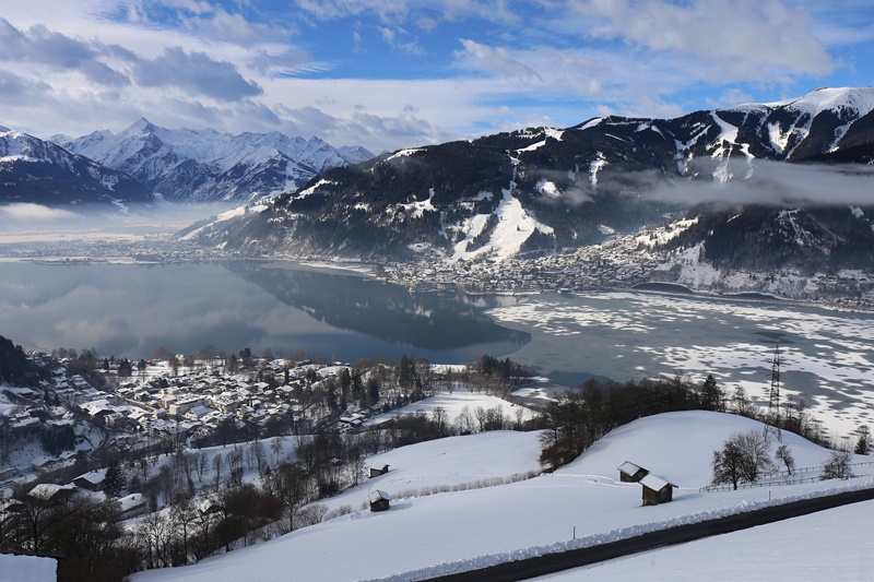 Good snow cover at all levels in Zell-am-See – 17 February 2022 – Photo: foto-webcam.eu
France
Snow conditions have deteriorated in the French Alps this half-term, after what had been a promising start to the week. There is still plenty of snow in most resorts, though the warm damp weather has led to a saturation of the snowpack at mid to lower altitudes, especially in the northern Alps. Les Arcs, for example, has decent snow depths of 75/250cm but you need to be at 2500m or higher for the snow to be even remotely “dry” right now.
In the short term, the best snow conditions are currently to be found in the higher resorts of the southern Alps such as Isola 2000 (85/100cm). Snow depths may be more modest here but snow quality is better due to the area having avoided the damp rainy weather that has plagued resorts further north.
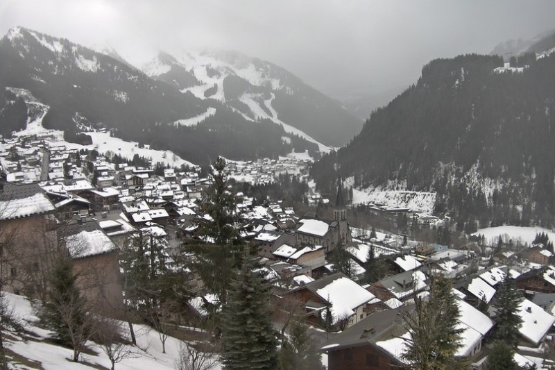 Mild and damp today in Châtel – 17 February 2022 – Photo: chatel.com
Italy
On the whole, Italian ski resorts have escaped the worst effects of the current warm spell with the most consistent snow conditions to be found in the far south-west, in resorts such as Prato Nevoso (40/90cm), and also further east in the Alta Badia (40/100cm).
However, the damp and (at times) rainy weather that has affected the north-western Alps over the last couple of days has reached some north-western Italian resorts, including Courmayeur (50/80cm), where the snow is a bit humid.
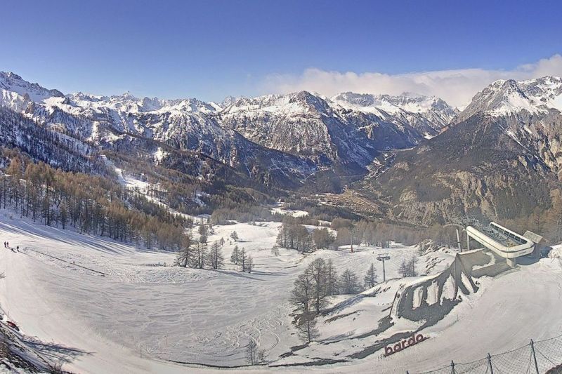 Good piste skiing today in Bardonecchia, despite relatively modest snow depths – 17 February 2022 – Photo: bardonecchia.it
Switzerland
Snow conditions are highly variable across the Swiss Alps right now. The last couple of days’ mild and rainy weather has mostly affected the north and west, where the snowpack is now very humid in resorts such as Villars (50/130cm) and Wengen (35/95cm).
For the best snow conditions you need to head further south and east, where resorts such as St Moritz (50/100cm) and Saas-Fee (65/205cm) have avoided the worst effects of this temporary warmer spell.
 Still cloudy and mild across much of Switzerland. This is Bellwald – 17 February 2022 – Photo: snoweye.com
Rest of Europe
There is plenty of snow in the major resorts of the Pyrenees right now even if milder weather is leading to variable snow quality. Andorra’s Soldeu has settled snow depths of 75/120cm, depending on altitude, and Spain’s Baqueira Beret has 135/235cm. Both resorts have snow in the forecast on Friday night.
Snow has been gradually accumulating in the Scottish ski areas although wild weather has been a major challenge and any openings remain partial.
It is better news in Norway though, where fresh snow has fallen in most resorts, particularly in Voss where base depths are now an impressive 130/165cm.
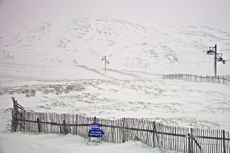 Snow is gradually accumulating in the Scottish ski resorts, but wild weather is hampering lift operations. This is Glencoe – 17 February 2022 – Photo: winterhighland.info
USA
New snow has fallen across many western US resorts with great conditions right now in Wyoming’s Jackson Hole (60/170cm) and Montana’s Big Sky (60/130cm).
Further south, Winter Park (60/124cm) is also in good shape with more snow in the forecast.
Canada
Whistler hasn’t seen any significant snow in the last week but there is still plenty of good skiing to be had, with healthy upper mountain snow depths of 230cm.
Snow conditions are even better further inland where the Banff/Lake Louise (144/217cm) area continues to enjoy what is turning out to be an exceptional season.
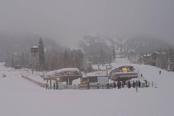 Good skiing on the upper slopes of Whistler this week – 17 February 2022 – Photo: facebook.com/WhistlerBlackcomb
Our next full snow report will be on
Thursday 3 March 2022
If you enjoy reading our updates - please feel free to support us: