


ARCHIVE
Today in the Alps - December 2020
Read about current weather and snow conditions in the Alps
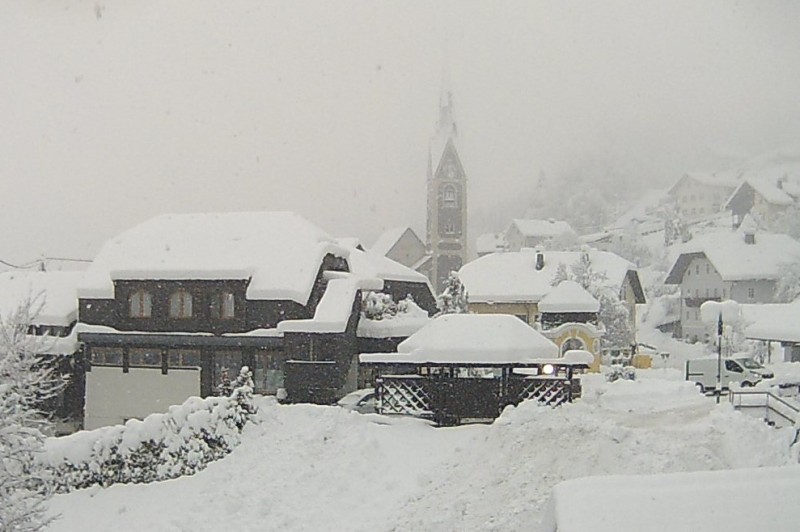
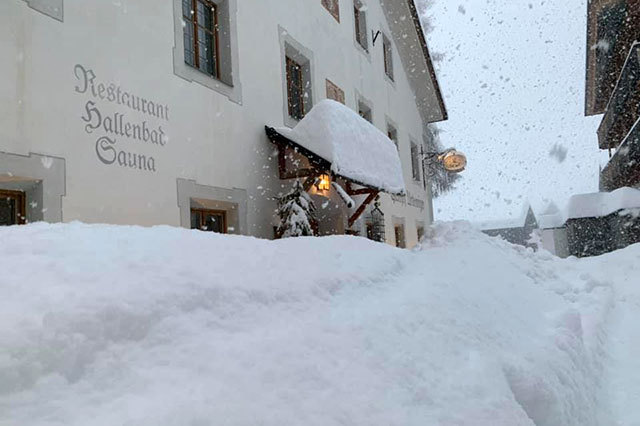
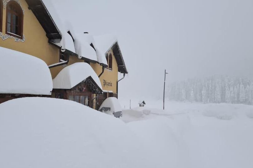
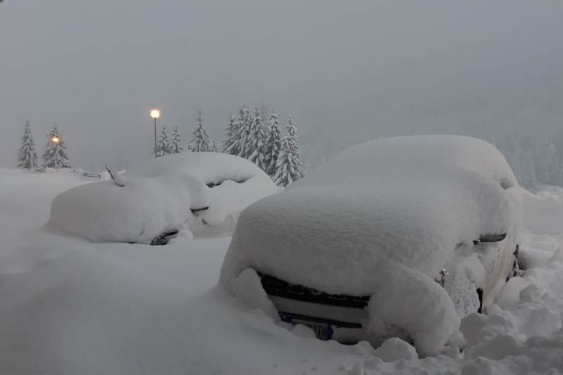
Updated: 10.30am Thursday 31 December 2020 – Cold with further snow at times…
The weather in the Alps remains cold and unsettled, with further snow due to fall at times over the next few days. Indeed, the weather looks like it will remain wintry in the Alps for the foreseeable future, with some extreme cold temperatures possible towards the second week of January.
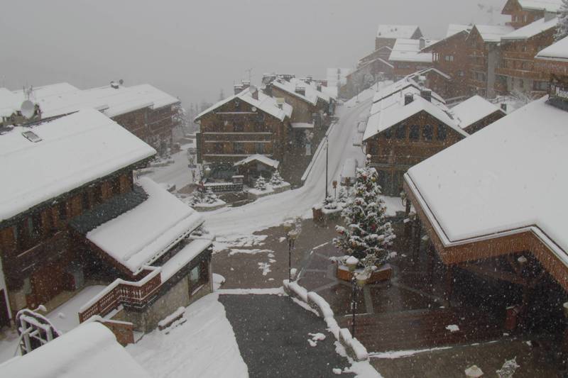
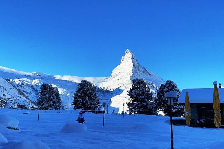
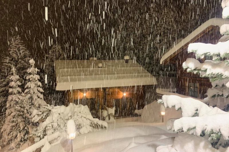
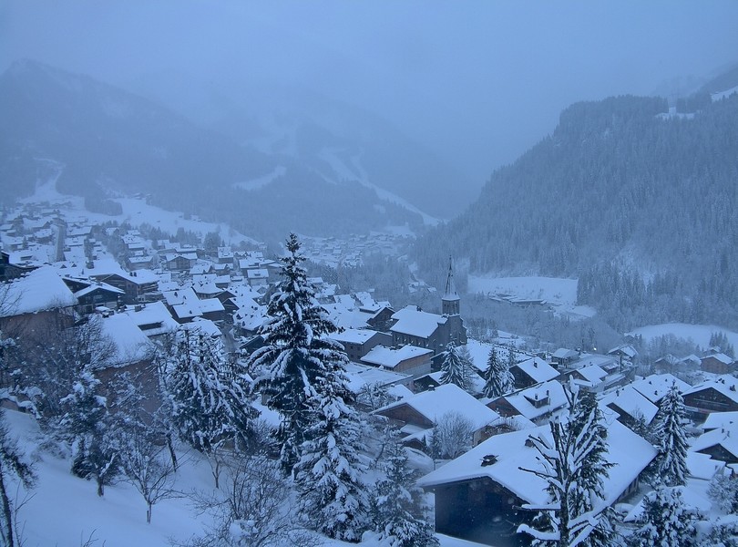 Very wintry looking scenes in Châtel in the Portes du Soleil – 31 December 2020 – Photo: chatel.com
Today, the French Alps will see flurries or longer spells of mostly light snow, these will push slowly east into western Switzerland and north-western Italy, intensifying for a time tonight. The eastern Alps will remain mostly dry with sunny spells. It will be cold everywhere, with the rain/snow limit typically around 300m to 600m.
Tomorrow, snow flurries will tend to die away from the French Alps but will continue and intensify in both the western Italian Alps and areas close to the Swiss/Italian border. The eastern and north-eastern Alps, including most of Austria, will again see the best of the weather, though it will remain cold in all regions.
Further snow is forecast for the Alps on Saturday, most of which will fall in the southern Alps – i.e. the Italian Alps, the southern Swiss Alps (e.g. Saas-Fee) and the southern Austrian Alps (e.g. Nassfeld).
Snow conditions have improved immensely across most of the Alps in recent days, although Covid-related restrictions mean that Austria and Switzerland are the only Alpine countries currently offering any lift-served skiing to the public.
The deepest snow (height for height) is still to be found in the south-eastern Alps (e.g. Passo Tonale, Arabba, Cortina, Nassfeld), while the thinnest snow cover is currently in the north-eastern Alps (e.g. Salzburgland) but it still feels wintry, even here, with snow on the hills to low levels.
Areas that we rarely mention but that are unusually snowy right now, and to very low levels, are the lower French mountain ranges, including:
- the Vosges (in north-eastern France),;
- the Jura, especially in the west (just north of Geneva);
- the Massif Central (in the centre of France); and
- the Vercors (south-west of Grenoble), technically in the foothills of the Alps.
The Pyrenees also have well above average snow depths to very low levels right now. Unfortunately, as in the rest of France, none of these areas are currently offering any lift-served skiing to the public.
Updated: 10.30am Tuesday 29 December 2020 - Remaining cold with further snow in places…
It’s a better weather day today in the Alps, although there are still a few snow showers around, mainly in the north-western Alps (e.g. Portes du Soleil) and the south-eastern Alps (e.g. Cortina). Most areas are dry though, with variable cloud cover and the best of any sunshine in the northern Austrian Alps.
 A wintry looking scene in the Wilder Kaiser area of the northern Austrian Alps, though the base here is still quite thin – 29 December 2020 – Photo: foto-webcam.eu
The weather in the Alps will remain cold over the next few days with more snow in places. Most of the snow will initially fall in the western Alps (i.e. France), albeit not in large quantities. Later in the week and over the weekend it looks like the southern Alps will be most favoured. Over the next few days, the northern Austrian Alps (e.g. Salzburg region) will again miss most of the snow.
Skiing in the Alps is currently only possible in Switzerland and Austria (albeit under certain Covid-19 restrictions) but remains suspended in Italy and France.
On the whole, snow conditions are not bad for late December even if the base remains thin in the northern Alps (e.g. Jungfrau region, Arlberg, Salzburgland).
By contrast, snow depths are exceptional across the south-eastern Alps, including the Austrian provinces of Carinthia and Osttirol, and the Dolomites, all of which have seen further heavy snowfalls in the last 24 hours.
Updated: 12.30pm Monday 28 December 2020 - Fresh snow for many parts of the Alps…
It’s a complicated looking weather picture across the Alps today, with snow falling to low levels across many regions, heaviest in the south-eastern Alps (e.g. Dolomites, southern Austria).
 Dolomites. Heavy snow in southern Austria today. This is Berg-am-Drautal in Carinthia – 28 December 2020 – Photo: snoweye.com
The best of today’s weather (during daylight hours at least) will be in the south-western Italian Alps (e.g. Bardonecchia) and the north-eastern Austrian Alps (e.g. Schladming).
The weather in the Alps will remain cold for the rest of the week, with further bits and pieces of snow in places and perhaps a return to some heavier snow across the southern Alps later in the week.
Skiing in the Alps is currently only possible in Switzerland and Austria (albeit under certain Covid-19 restrictions) but remains suspended in Italy and France.
On the whole, snow conditions are not bad for late December even if the base remains thin in the northern Alps (e.g. Jungfrau region, Arlberg, Salzburgland).
By contrast, snow depths are exceptional across the south-eastern Alps, including the Austrian provinces of Carinthia and Osttirol, and the Dolomites.
Updated: 3.30pm Sunday 27 December 2020 - Significant snow is on its way to the southern and western Alps…
The weather remains unsettled, with further snow due for many areas over the next few days, heaviest in the southern and western Alps.
 New snow has improved conditions across the northern Alps in recent days. This is Schröcken (1200m) in the Austrian Vorarlberg – 27 December 2020 – Photo: warth-schroecken.at
Today there is a lot of cloud across the western Alps, with an increasing chance of rain or snow later in the day and overnight in the French Alps, the western Swiss Alps and the central and western Swiss Alps. The rain/snow limit will sit between 800m and 1100m in the more exposed mountains of the western Alps (e.g. Alpe d’Huez), but close to or in the valley bottoms in the more internal valleys (e.g. Val d’Anniviers).
Snow will continue to fall in many western parts of the Alps tomorrow and will also spread across the southern Alps to reach the Dolomites and southern Austria. The north-eastern Alps (e.g. Salzburgland) will be least affected by any snow over the next 36 hours. The weather in the Alps is then set to remain unsettled for the rest of next week, with further snow falling to low levels at times.
Snow conditions in the Alps are improving fast after a long mild spell which saw a significant loss of snow cover at low altitude, especially in the northern Alps. The deepest snow cover, and most solid base, remains in the south-eastern Alps (e.g. Dolomites).
The northern Alps (e.g. Wengen, Laax, Lech, Kaprun) now look much better than a few days ago, but could still do with another round of heavy snow to secure a lasting base, especially lower down.
Updated: 4pm Thursday 24 December 2020 - New snow for many over the next few days…
After a couple of weeks of very mild weather and a deterioration of snow conditions lower down (especially in the northern Alps), the weather in the Alps has now turned colder again.
 Snowing in Les Gets this evening – 24 December 2020 – Photo: lesgets.com
This colder weather will also be accompanied by the return of snow. Some places had a sprinkling last night, but heavier snow will return to the northern Alps tonight and tomorrow. The rain/snow limit will lower to all levels by Friday morning.
By the end of Friday, another 15-30cm of snow is expected above 1500m across many parts of the Alps, including in resorts such as Avoriaz, Mürren, Engelberg and Lech. Some snow is also getting (or will get) through to parts of the southern Alps (e.g. Cortina) but it will generally be the north that will see the most from this particular storm.
After a drier interlude on Saturday, the weather will turn very unsettled again in the Alps later in the weekend and into next week, with the heaviest snow this time more likely in the southern Alps. Watch this space!
Snow cover in the Alps generally remains good at altitude, and excellent at all levels in the south-east (e.g. Dolomites). Although the recent warm weather has led to a thaw lower down across the northern Alps, new snow over the next day or two will improve things here again.
Updated: 4pm Tuesday 22 December 2020 - Up to 40cm of fresh snow for some north-western parts of the Alps for Christmas…
After yesterday’s rain in the north-western Alps, the weather has been drier today, still with plenty of cloud around but also some good sunny spells, the best of which have been in the southern Alps.
 Mostly fine weather today in Méribel, with the next snow forecast for Thursday – Photo: merinet.com, 22 December 2020
Wednesday will be very mild and mostly fine before some active weather fronts introduce much colder air with snow to increasingly low levels in the northern, and especially north-western Alps on Thursday and Friday.
The rain/snow limit will begin around 1800m on Wednesday night before falling to between 700m and 1000m on Thursday. It will then fall to all levels by Friday morning. By the end of Friday we can expect 15cm to 40cm of new snow above 1500m across a wide swathe of the north-western Alps, including resorts such as Les Arcs, Flaine, Avoriaz, Verbier, Wengen, Engelberg and Lech. The French Haute-Savoie resorts of Avoriaz and Flaine are likely to see the most snow, with around 30-40cm at altitude.
These new snowfalls should restore much of the damage inflicted by Monday’s mild and rainy weather in the north-western Alps, while the southern Alps will miss most of the snow. The south could see some really big snowfalls early next week though. Watch this space!
Updated: 12pm Monday 21 December 2020 – Turning colder just in time for Christmas!
The weather in the Alps remains mild, with a warm front approaching from the west today bringing rain or snow which will spread across the northern and especially north-western Alps later today and overnight. The rain/snow limit will rise to between 2000m and 2400m in most places by tonight but will remain lower in some enclosed valleys.
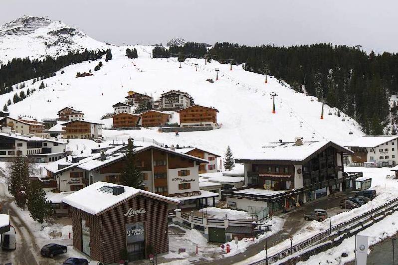 Cloudy and increasingly mild in Lech, with the approach of a warm front, but winter will return on Thursday – 21 December 2020 – Photo: lech.com
In terms of snowfall accumulation, around 5-20cm of new snow is expected above 2400m in areas such as the Mont Blanc and the Jungfrau region. The southern Alps (most of Italy for example) will remain dry, however, with variable cloud.
The weather will continue to be mild on Wednesday, with variable cloud and still the chance of the odd shower across the northern Alps, while the southern Alps continue to see the best weather. On Thursday, a new storm will approach from the north-west, bringing snow (mostly to the northern Alps) to increasingly low levels later in the day and into Christmas Day.
By the end of Friday, we can expect between 15cm and 40cm of new snow above 1500m in areas such as the Portes du Soleil, Villars, Mürren, Engelberg, Laax, St Anton and Kitzbühel. Once again, the southern Alps (e.g. Serre Chevalier, Sestriere, Livigno, Val Gardena) will see little if any new snow this week, however, current forecasts suggest that some serious snow may fall here early next week.
Lift-served skiing in the Alps is still only possible in Switzerland. We appreciate that this option is unlikely to be available to most of our UK readers right now given the restrictions on international travel, compounded by today’s announcement that anyone who has recently arrived in Switzerland from the UK must now self-isolate.
If you are lucky enough to be able to ski in Switzerland right now, about 70 ski resorts are open today. Snow cover is generally pretty good for the time of year, and very good in the south-east (e.g. St Moritz). Snow conditions are deteriorating a little in the north (e.g. Villars, Wengen) with mild weather and rain later today, but they will pick up again radically from Thursday when snow is set to fall to increasingly low altitudes.
Updated: 3pm Sunday 20 December 2020 - Fresh snow for Christmas possible in the northern Alps…
The weather in the Alps is currently very mild and will remain so until Christmas Eve. There is a lot of cloud across the western Alps today, with a few showers here and there (snow 1500-1800m) principally in the western foothills and the high border areas between Switzerland and Italy. The best of any sunshine is in the eastern Alps.
 Plenty of snow right now, but no-one to ski on it in the Austrian Vorarlberg. This is Mellau – 20 December 2020 – Photo: mellau.at
Late on Monday and early on Tuesday, a warm front will affect the northern alps with a rain/snow limit rising to above 2000m. Around 10-15cm of fresh snow is expected above 2400m close to the northern fringes of the Alps, in areas such as Glacier 3000 and Engelberg. The weather in the southern Alps will stay mostly fine throughout this period.
A cold front is then set to reach the northern Alps on Thursday bringing showers and some snow, initially above 1700-2000m but lowering into the valley bottoms on Thursday night and into Friday.
By the end of Friday, around 10-30cm of new snow is expected above 1500m in the northern and north-western Alps, in resorts such as Avoriaz, Engelberg, and St Anton.
Updated: 9am Saturday 19 December 2020 - Mild weather in the Alps but turning colder by Christmas…
With the Alps currently under the influence of a mild south-westerly airflow, today will be mostly dry with plenty of sunshine for most regions, but with some cloud cover increasing in the western Alps later in the day with a few showers (snow 1800-200m) close to the French/Italian and Italian/western Swiss border.
 Good snow cover in medium altitude Les Saisies, though lift-served skiing is not possible in France for now – 19 December 2020 – Photo: lessaisies.com
Sunday will again be cloudy in the western Alps with a few showers here and there (snow 1400-1800), with the driest, sunniest weather the further east you are.
On Tuesday and Wednesday, further weather fronts are set to affect the north-western Alps, but with a rain/snow limit rising to 2000m or above.
Temperatures will then turn colder again on Christmas Eve and Christmas Day, with snow returning to increasingly low altitudes in the northern and north-eastern Alps.
Looking even further ahead the weather could become very stormy with some significant and widespread snow in the run up to New Year. Watch this space!
Snow cover in the Alps is generally pretty good for the time of year, and is exceptional in the south-east, including in both the Dolomites and southern Austria.
Switzerland currently remains the only country in the Alps to be offering lift-served skiing to the public. However, if you are a UK passport holder, be warned that, due to efforts to contain the spread of Covid-19, Switzerland has now joined the other Schengen Zone countries in confirming that when the Brexit transition period ends on 1 January 2021, UK tourists will no longer be allowed to enter the Schengen Zone while the UK remains categorised as a ‘high-risk country’.
Updated: 10am Thursday 17 December 2020 – Mostly fine, snow for some later this weekend…
It is a dry and mild day in the Alps today, with a few areas of cloud drifting around but plenty of sunshine for most. It will remain mostly fine until Sunday, when a weather front will cross the Alps from west to east bringing some snow in places.
 Lots of snow in the Brenta Dolomites in Madonna di Campiglio, which hopes to open early in the New Year – 17 December 2020 – Photo: funiviecampiglio.it
Looking a bit further ahead and it looks like next week will start mild again. However, there are indications that it will turn much colder later in the week with a chance of some significant snow for the Alps around Christmas – watch this space!
Lift-served skiing in the Alps is still only possible in Switzerland, where at least 40 resorts are open today, most of them still on a very limited basis. Among the more extensive options are St Moritz, where around 120km of pistes are available across the two main areas (Corviglia and Corvatsch), and Zermatt where 87km of pistes are open.
Early season snow conditions are good across most Swiss resorts, with the next significant snow due on Sunday, heaviest in the south-east (e.g. St Moritz).
Elsewhere in the Alps, skiing is currently suspended until the New Year, but snow depths are also generally healthy for mid-December, especially so on the south-east (Dolomites, southern Austria) thanks to the historic storms early last week.
Updated:1pm Monday 14 December 2020 – Mostly dry and mild in the Alps…
It is a mostly dry and relatively mild day in the Alps today, with plenty of sunshine for most. Later in the day, cloud will thicken up across the French, western Swiss and western Italian Alps, heralding the arrival of some weak weather fronts that will affect the weather in the Alps tomorrow.
 Good early season snow cover in Les Gets, which hopes to open early in the New Year – 14 December 2020 – Photo: lesgets.com
Tuesday will therefore see more in the way of cloud across the Alps, especially in the west where a few showers or flurries are likely at times, especially later in the day. Accumulations of snow will generally be modest, typically with 2-5cm of snow in the higher French resort, such as Les 2 Alpes and Tignes.
This weak front will move further east overnight on Tuesday, bringing a sprinkling of snow at altitude here and there across the eastern Alps, though it will again not amount to anything significant.
For the rest of the week, the Alps will remain in a mild and faintly unsettled south-westerly airflow with plenty of dry weather but also some showers or flurries (1600-2200m) from time to time in places, courtesy of the occasional weak weather front. Significant widespread snow is NOT expected this week.
Early season snow cover is generally above average for the time of year, and even exceptional in the south-east (Dolomites, southern Austria) thanks to the massive dumps here early last week.
Skiing in the Alps is currently still only possible for the public in Switzerland, where around 40 resorts are open today. Over 60 resorts were open in Switzerland over the weekend.
Updated: 11am Sunday 13 December 2020 – Lots of new snow for the western Alps…
There are still some snow showers (800-1200m) across the north-eastern Alps this morning (i.e. Austria), but these will die away during the course of the day. Elsewhere in the Alps, the weather is either brightening up or is already sunny.
 Fresh snow and sunny skies this morning in Alpe d’Huez – 13 December 2020 – Photo: alpedhuez.com
The northern and western French Alps have been favoured by this latest storm, which began on Friday, with between 40 and 50cm above 1500m in places, such as Flaine and Avoriaz.
More generally, the French Alps (away from the far south), the western Swiss Alps (e.g. Villars) and the far north-western Italian Alps (e.g. Courmayeur) have seen 20-40cm. A few centimetres have also fallen across the eastern Swiss Alps and parts of Austria, but the south-eastern Alps (e.g. Dolomites) have remained mostly dry this time around.
Next week, the weather in the Alps will turn milder with plenty of sunshine, but there will also be some areas of cloud and a few showers (snow 1600-2000m) in some north-western parts of the Alps early in the week.
Snow cover in the Alps is generally impressive for mid-December, and exceptional even in the south-east (i.e. Dolomites, southern Austria). For the time being, though, it is still only possible for the public to ski in Switzerland, where around 60 resorts have been at least partially open this weekend.
Updated: 2pm Saturday 12 December 2020 - Fresh snow for the western Alps…
It has been snowing on and off across the north-western Alps today, with a rain/snow limit between 700m and 1200m. Areas affected include the northern French Alps (e.g. 3 Valleys, Grand Massif, Portes du Soleil), the western and northern Swiss Alps (e.g. Verbier, Gstaad, Mürren) and the far west of Austria (e.g. Warth-Schröcken). By contrast, it has been dry across most of Austria, the far south-east of Switzerland and most of Italy (away from the far west).
 Fresh snow in Méribel today – 12 December 2020 – Photo: merinet.com
It will continue to snow (800-1200m) in these north-western areas tonight. Some snow will also make it further east into Austria but generally in very modest quantities. Most of the Italian Alps (away from the north-western border areas with France and Switzerland) will again stay dry.
On Sunday, a few early flurries are possible across some parts of the northern Swiss and northern and western Austrian Alps, otherwise most places will be dry with increasing amounts of sunshine.
Snowfall totals from this storm are greatest in the French Alps, with 40-50cm likely by the end of tonight above 1500m in parts of the Haute-Savoie (e.g. La Clusaz, Avoriaz).
Next week, the weather in the Alps will turn milder, with plenty of sunshine but also some areas of cloud and a few showers (snow 1600-2000m) affecting some north-western parts of the Alps early in the week.
Snow cover in the Alps is generally impressive for mid-December and exceptional even in the south-east (i.e. Dolomites, southern Austria). For the time being, though, it is still only possible to ski in Switzerland where around 60 resorts were at least partially open today.
Updated: 10.30am Friday 11 December 2020 – New storm, this time for the western Alps…
A new storm is approaching the Alps, with the French Alps set to see the most snow. The south-eastern Alps, which saw huge falls earlier in the week, will remain mostly dry.
 Clouding over in Les Gets this morning where 30-40cm of new snow is expected at altitude between now and tomorrow night – 11 December 2020 – Photo: lesgets.com
Snow will reach the western French Alps later this morning, spreading to the rest of the French, western Swiss (e.g. Verbier) and far western Italian Alps (e.g. Courmayeur) later in the day. The snow will continue on and off tonight and tomorrow, heaviest and most persistent in the northern and western French Alps.
With a lot of cold air already in situ over the Alps, the rain/snow limit will begin very low, rising to between 1000m and 1300m in some places later but remaining lower in some enclosed valleys. Between now and Saturday night we are expecting between 15cm and 30cm of new snow above 1800m across most of the French Alps (e.g. 3 Valleys), but 30-50cm in parts of the Haute-Savoie (e.g. Portes du Soleil, Val d’Arly).
The western Swiss and far western Italian Alps will see between 5cm and 30cm of new snow, while the eastern Swiss Alps (e.g. Davos) will see 5-20cm. A few centimetres will also fall in the far west of Austria (e.g. St Anton), but most of Austria as well as the central and eastern Italian Alps will see little if any new snow.
For those lucky enough to be able to ski in the Swiss Alps today – ski areas in other Alpine countries still being off-limits to the public due to Covid-19 – snow conditions are wonderful. Around two dozen resorts are now partially open, with the greatest variety and extent of open terrain currently in Zermatt where all three of its sectors are now open (Sunnegga and Gornergrat having been open since last weekend) with 63km of pistes to play on.
Updated: 10.20am Thursday 10 December 2020 – The sun is back!
The historic storm cycle that dumped more than 3m of snow across some south-eastern parts of the Alps has now come to an end. There is still quite a lot of cloud and a few light flurries across the far eastern Alps this morning, but elsewhere it is largely sunny, if still rather cold.
 Perfect weather and snow conditions in Zermatt today. This is the Matterhorn, viewed from Riffelalp – 10 December 2020 – Photo: @RResort2222
This fine weather will not last long though, with new weather fronts set to push into the western Alps tomorrow. This time the snow will be heaviest in the French and far western Swiss Alps with accumulations of between 20cm and 50cm of new snow likely by the end of Saturday.
Other parts of Switzerland, western Italy and the far west of Austria will also see a few centimetres of snow, but any snowfall in the eastern Alps (i.e. Austria) will be very modest and some south-eastern parts of the Alps (e.g. Dolomites) may stay completely dry this time around.
For those lucky enough to be able to ski in the Swiss Alps today – ski areas in other Alpine countries still being off-limits to the public due to Covid-19 – snow conditions are wonderful. Around two dozen resorts are now partially open, but the greatest variety and extent of open terrain is in Zermatt where all three of its sectors are now open (Sunnegga and Gornergrat having been open since last weekend) with 63km of pistes to play on.
Other good options are Saas-Fee and St Moritz, but numerous small resorts are also now open near Zurich, ideal for those living in or around Switzerland’s largest conurbation.
Updated: 11am 9 December 2020 – Still snowing in the eastern Alps…
Further snow is falling across the eastern Alps today, extending beyond the south-eastern regions that have already seen historic quantities of snow in recent days to fall more generally across the Austrian, eastern Italian and eastern Swiss Alps, where another 5-20cm is expected today.
 Still snowing in the eastern Alps today. This is Berg-am-Drautal in Carinthia – 9 December 2020 –Photo: bergfex.com
Some flurries are also possible across the western half of the Alps, though they will also see plenty of dry weather with a higher chance of sunshine overall. Temperatures will remain cold across all parts of the Alps, with any snow falling to low levels (typically 300-600m).
After a mostly fine day across the Alps tomorrow, snow will return to the western Alps on Friday and Saturday, with 10-30cm expected across many French resorts as well as parts of western Switzerland and western Italy.
Since Friday, between 1.5m and 3m of snow has fallen at altitude across many parts of the south-eastern Alps including in Carinthia (e.g. Nassfeld), Osttirol (e.g. Lienz-Zetterfeld), Veneto (e.g. Cortina, Arabba, Sudtirol (e.g. Alta Badia), Trentino (e.g. Madonna di Campiglio) and eastern Lombardy (e.g. Livigno).
The central-southern and south-eastern Swiss Alps (e.g Andermatt, St Moritz), as well as some western parts of Austria (e.g Obergurgl), have also impressed with more than 1m of snow since Friday. More generally the western Alps (i.e. France and most of Switzerland) have seen between 20cm and 70cm of new snow. The least snow has fallen in the north-eastern Alps (e.g. Salzburgland), although it is snowing here today.
Updated: 2.30pm Tuesday 8 December 2020 – Still snowing in the south-eastern Alps!
It is still snowing in the south-eastern Alps, continuing to fall heaviest in the Dolomites and the far south of Austria where there remains considerable disruption to local infrastructure. Elsewhere in the Alps, there is a mixture of sun and some clouds today, with a few flurries in places.
 Still dumping today across many south-eastern parts of the Alps. This is Obertilliach in Osttirol – 8 December 2020 – Photo: wetteronline.de
Since Friday, between 1.5m and 3m of snow has fallen at altitude across many parts of the south-eastern Alps, including Carinthia (e.g. Nassfeld), Osttirol (e.g. Lienz-Zetterfeld), Veneto (e.g. Cortina, Arabba, Sudtirol (e.g. Alta Badia), Trentino (e.g. Madonna di Campiglio) and eastern Lombardy (e.g. Livigno).
The greatest accumulation in a ski area that has been officially corroborated by a meteorologist from this storm is 250cm at Ravales (2600m) in Cortina. Some media reports of 4-5m of snow would therefore appear to have been grossly exaggerated, though it remains to be seem what final figures will emerge, and no doubt some places will have seen well in excess of 3m.
The central-southern and south-eastern Swiss Alps (e.g Andermatt, St Moritz) as well as some western parts of Austria (e.g. Obergurgl) have also impressed with more than 1m of snow since Friday. More generally, the western Alps (i.e. France and most of Switzerland) have seen between 20cm and 70cm of new snow. The least snow has fallen in the north-eastern Alps (e.g. Salzburgland).
Today’s storm will continue overnight, delivering a further 30-50cm of snow (locally 70cm+) to the Italian provinces of Veneto e.g. (Arabba), Sudtirol (e.g. Alta Badia), Trentino (e.g. Madonna di Campiglio) and the southern Austrian provinces of Carinthia (e.g. Nassfeld) and Osttirol (e.g. Sillian).
Snow will then spread to other eastern parts of the tomorrow, though it will be lighter than it has been in the south-eastern Alps over the last few days. It will be cold in all areas, though the western Alps will be drier and brighter.
After a relative reprieve on Thursday, significant snow is then forecast to return to the western Alps (especially to France) on Friday and Saturday.
Updated: 10.30am Monday 7 December 2020 - Yet more snow to come for the southern Alps!
It is still snowing today across many southern parts of the Alps, where storm totals (since Friday) have reached 3m in some higher parts of the Dolomites and southern Austria.
 Huge snowfalls in the Dolomites – 7 December 2020 – Photo: Centro Meteo Dolomiti
Although today’s snow will be lighter and more sporadic than it was over the weekend, it will add to the chaos in the south-eastern Alps where there is already significant disruption to transport and local infrastructure. The snow is also forecast to intensify tomorrow, with another 50cm to 80cm possible in the Dolomites as well as the southern Austrian provinces of Carinthia and Osttirol.
Elsewhere in the Alps, a few flurries are possible in the west (e.g. France) today though the northern Alps, especially the northern Austrian Alps, will be mostly dry with sunny spells.
Between 1.5 and 3m of snow has fallen at altitude over the last 72 hours across many parts of the south-eastern Alps, including Carinthia (e.g. Nassfeld), Osttirol (e.g. Lienz-Zetterfeld), Veneto (e.g. Cortina, Arabba), Sudtirol (e.g. Alta Badia), Trentino (e.g. Madonna di Campiglio) and eastern Lombardy (e.g. Livigno).
The central-southern and south-eastern Swiss Alps (e.g Andermatt, St Moritz), as well as some western parts of Austria (e.g Obergurgl), have also over 1m of snow. More generally, the western Alps (i.e. France and most of Switzerland) have seen between 20cm and 70cm of new snow. The least snow has fallen in the north-eastern Alps (e.g. Salzburgland).
Updated: 11.15am Sunday 6 December 2020 – Chaos in the southern Alps!
Massive, potentially historic snowfalls have been affecting the south-eastern Alps this weekend causing power cuts, road closures and avalanches.
 1.5m has of fresh snow has been reported in Livigno this morning – 6 December 2020 – Photo: Météo Franc Comtoise, 6 December 2020
The worst affected areas have been the Dolomites, Veneto (e.g. Cortina), Sudtirol (e.g. Alta Badia), Trentino (e.g. Madonna di Campiglio), Lombardy (e.g. Livigno), Carinthia (e.g. Nassfeld) and Osttirol (e.g. Lienz). These areas have typically seen between 1.5m and 2.5m of new snow above 1800m since Friday, with 3m or more in places. There have even been reports that 1.9m of snow fell in the village of Kornat in Carinthia in just 24 hours, which would be a record for Austria.
There has also been a lot of snow (often more than 1m) in the western Austrian Alps, particularly near the Italian border (e.g. Obergurgl), and in the south-eastern Swiss Alps (e.g. St Moritz). Other parts of the Swiss Alps, as well as the French Alps, have seen between 20cm and 70cm. The one area to have missed most of the snow is the north-eastern Austrian Alps (e.g. Salzburgland), due to having been protected for longer by the Foehn.
The risk of avalanche from all this fresh snow has been further heightened by a wedge of warmer air which entered the far south-eastern Alps yesterday, pushing the rain/snow limit to as high as 1800-2000m for a time in some parts of the Dolomites.
There will also be further heavy snow at times in the south-eastern Alps today, especially later in the day, with a rain/snow limit somewhere between 1000 and 1800m. Precipitation will be more sporadic further north and west, in the Alps precipitation will be more sporadic but the rain/snow limit will also be much lower, typically 400 to 800m in France and much of Switzerland.
Updated: 10am Saturday 5 December 2020 – Snow is piling up in the southern Alps!
As expected, a lot of snow has fallen snow across certain parts of the Alps in the last 24 hours, especially in the south and west.
 60cm+ has already fallen at valley level in Arabba this morning, with lots more snow to come – 5 December 2020 – Photo: Arpa Veneto
This morning it is still snowing heavily across the central and eastern Italian Alps (e.g. Livigno, Passo Tonale, Kronplatz, Cortina), the south-eastern Swiss Alps (e.g. St Moritz), and the southern Austrian Alps. It is also snowing across western Austria (e.g. Ischgl) but is largely dry in the north-eastern Austrian Alps (e.g. Salzburg region). The western Alps are generally also dry, including France, most of the Swiss Alps away from the south-east and the western Italian Alps (e.g. Courmayeur, Sestriere).
We are still on course for some truly huge snowfall totals across the south-eastern Alps, where it will continue to snow for much of today and into tomorrow. The very heaviest snow will fall in the Dolomites and the southern Austrian Alps (e.g. Cortina, Arabba, Madonna di Campiglio, Nassfeld, Lienz, Sillian) where between 1.5m and 2m of new snow is likely at altitude by the end of the weekend, with even more in places!
These sorts of snowfall totals are extreme by any standards and are likely to cause disruption in places. We will have a full report on the big storm tomorrow…
Updated: 11am Friday 4 December 2020 - Southern Alps on high alert with huge, potentially disruptive snowfalls imminent…
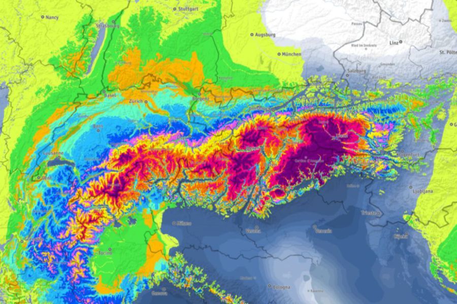
This weekend all eyes are on the southern Alps, where huge potentially disruptive and even life-threatening snowfall totals are expected in some areas over the next two to three days.
 The biggest accumulated snowfall totals (whites and purples) over the next three days are forecast for southern Austria and the Dolomites – Image: kachelmanwetter.com, 4 December 2020
The areas that will be the worst affected are:
- the southern Austrian provinces of Osttirol (e.g. Lienz, Sillian) and Carinthia (e.g. Nassfeld);
- the Italian provinces of Veneto (e.g. Cortina, Arabba), Sudtirol (e.g. Alta Badia, Val Gardena), Trentino (e.g. Madonna di Campiglio) and eastern Lombardy (e.g. Passo Tonale); and
- some parts of southern and south-eastern Switzerland (e.g. St Moritz).
These areas will generally see 1-2m of new snow at altitude by the end of the weekend, but some weather models are predicting more than 2.5m in certain locations. This quantity of snowfall has the potential to cause considerable disruption to local infrastructure, with an increased risk of avalanche in areas not normally affected, in some cases including populated areas.
This extreme snowfall is being generated by a powerful southerly airflow that is picking up moisture from the relatively warm Mediterranean sea before being pushed up against the southern side of the main Alpine ridge, where it will release huge quantities of precipitation.
By contrast, the Foehn is blowing strongly in the northern Alps (e.g. Bernese Oberland, Vorarlberg, Salzburgland) which will keep these areas mostly dry and mild, but very windy, for most of today. Some snow will eventually arrive here tonight or tomorrow though.
As for the French Alps, the western Swiss and western Italian Alps, weather fronts will bring snow to many areas during the course of the day, though some Foehn-affected areas (e.g. Swiss Valais) will probably stay dry until this evening.
 The weather is brighter in the northern Alps than in the south thanks to the Foehn. This is Zell-am-See – 4 December 2020 – Photo: zellamsee-kaprun.com
In summary, everywhere will see some snow during the next couple of days with the most snow set to fall in the south-eastern Alps and the least in the northern/north-eastern Alps.
Rain/snow limits will be all over the place during this storm but will broadly start quite low (400-1000m) due to the reservoirs of cold air already in place over the Alps. However, a wedge of milder air could raise the snow limit to 1500m on Saturday in some south-eastern parts of the Alps (e.g. Dolomites).
If the weather had been more settled, we would have expected a dozen or so Swiss resorts to be open for skiing today. However, given the increasing wind, only Davos-Klosters, Arosa and St Moritz have managed to open any pistes this morning. Any openings over the weekend will be highly dependent on the weather.
Updated: 11am Thursday 3 December 2020 – Extreme snowfalls expected across some southern parts of the Alps!
Today there will be a few flurries here and there in the Alps, chiefly in the south and the far east, otherwise it will be mostly dry (if rather cold) with some good sunny spells. On Friday and Saturday, we are expecting some major snowfalls across the southern Alps, which will be extreme in places.
 Accumulated snowfall forecast in the Alps between now and Monday 7 December 2020, showing extreme totals (pinks and purples) in some southern parts of the Alps – Image: bergfex.com, 3 December 2020
This extreme snowfall comes courtesy of an increasingly vigorous southerly current that will pick up plenty of moisture from the relatively warm Mediterranean before pushing up hard against the southern flanks of the Alps. By Sunday morning, resorts that could see between 1m and 1.5m of fresh snow at altitude include Passo Tonale (Lombardy/Trentino), Madonna di Campiglio (Trentino), Arabba and Cortina (Veneto), Nassfeld (Carinthia), Lienz-Zetterfeld and Heiligenblut (Osttirol).
Most other parts of the Italian, French, Swiss and western Austrian Alps are also expected to see significant snow on Friday and/or Saturday, but there will be less snow in the north-east (e.g. Salzburgland). The rain/snow limit during this period will generally be quite low (typically 500-1000m) but could rise to around 1500m in some south-eastern parts of the Alps on Saturday.
Nine resorts are open for skiing in Switzerland today, these being Zermatt, Saas-Fee, St Moritz, Glacier 3000, Laax, Engelberg, Arosa, Andermatt and Davos/Klosters. Of these, Zermatt and Saas-Fee continue to offer the greatest extent and variety of terrain. No other Alpine country is currently offering skiing to the public due to Covid-related restrictions.
Snow conditions will improve in these Swiss resorts over the next few days, thanks to the fresh snow, but there may be lift closures at times due to deteriorating weather conditions. Of the open Swiss resorts, St Moritz and Andermatt are likely to see the most snow from this incoming storm, and Engelberg the least.
Updated: 10.50am Wednesday 2 December 2020 – Wintry, with extreme snowfalls expected across some southern parts of the Alps by the weekend!
After a relatively dry and very mild November, the weather in the Alps has now turned colder and more unsettled. Yesterday we saw a moderate fall of snow (typically 5-20cm) across some parts of the Alps, mostly in the north-west (e.g. Portes du Soleil, Bernese Oberland, Arlberg). Most of the Alps will see more snow over the next few days, with extreme snowfall totals expected across some southern regions, especially Carinthia (Austria) and the Dolomites (Italy) on Friday on Saturday.
 Looking more wintry today in La Plagne following yesterday’s snow – 2 December 2020 – Photo: facebook.com/laplagne
Snow flurries (to relatively low altitudes) will affect some southern parts of Alps today, though accumulations will be modest, with just a few centimetres here and there (e.g. in the Dolomites). Most other areas will be dry, with variable cloud and the best of any sunshine in the north-west.
Thursday will be mostly dry with good sunny spells for many (especially in the north). However, some southern parts of the Alps will again be cloudier with the chance of some flurries, especially later in the day.
The real fun though is reserved for Friday and Saturday when a lot of snow is expected across the southern Alps, especially in the southern Austrian Alps (e.g. Nassfeld) and the Dolomites (e.g Cortina, Arabba) where between 1m and 1.5m of new snow is possible at altitude.
The western Alps (i.e. the French Alps and much of Switzerland, especially the south and west) will also see significant snow on Friday and Saturday (20-50cm) but not as much as further south. The area likely to see the least snow from this storm will be the northern Austrian Alps but, even here, a few centimetres are expected.
All in all, with the rain/snow limit expected to be relatively low and snow cannons also in operation, this is all very good news for the Alps. While there are obviously still considerable restrictions as to where you can ski (currently only on Switzerland), in terms of getting a base going for the season in general, we are certainly now moving in the right direction.
Updated: 10am Tuesday 1 December 2020 – Winter incoming!
After a month of little or no new snow, the weather pattern in the Alps is on the change, starting with snow in the north-west today. Extreme snowfalls are then expected across some southern parts of the Alps at the end of the week, especially in the Dolomites and southern Austria.
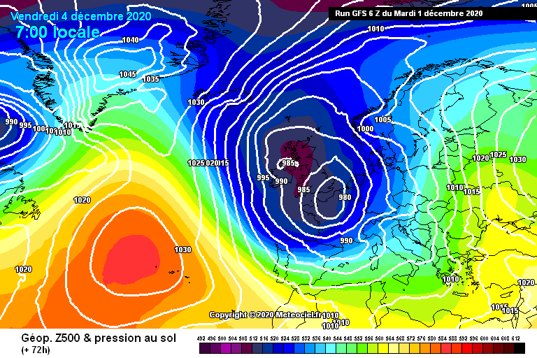 The forecast for Friday 4 December shows a favourable set-up for snow in the southern Alps – Image: meteociel.com, 1 December 2020
This morning it is snowing (or has already snowed) across most of the north-western Alps (e.g. Portes du Soleil, Jungfrau region, Arlberg region), with a rain/snow limit falling to between 400m and 700m. These north-western regions are expected to see about 10-20cm of new snow at 1500m today, with a little more in some favoured parts of the northern Swiss Alps.
While most of the southern Alps will stay dry to start with today, some snow will get through to the south-western Alps later, heaviest in the far south-west tonight and early tomorrow (e.g. Prato Nevoso), thanks to the formation of a secondary area of low pressure in the Gulf of Genoa. The south-eastern Alps (e.g. Dolomites) should also see some snow late on Wednesday.
As for the weather in the Alps for the rest of the week, Thursday will see further flurries in some southern parts of the Alps while the north stays mostly fine.
On Friday and Saturday we are then expecting a major storm to hit the southern Alps, with the heaviest snow in the far south of Austria and the Dolomites where the likes of Cortina and Nassfeld could see a metre or more. Further snow is also possible across some northern parts of the Alps at the end of the week, albeit generally in more modest quantities than further south.