


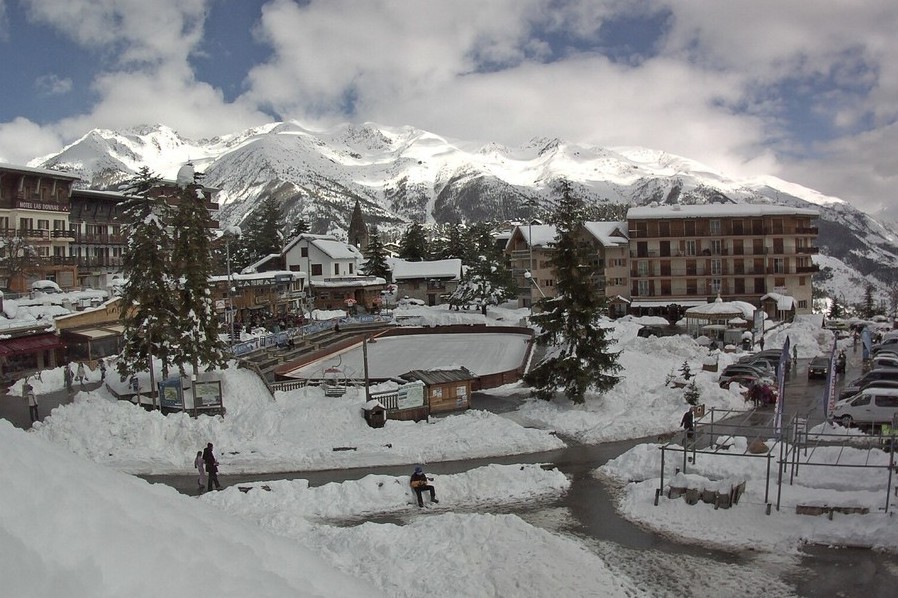
Updated: 12pm Thursday 28 March 2024 – Very snowy easter for some…
Spring continues to be unsettled in the Alps with further snow falling, today heaviest in Austria, before the south-west again bears the brunt of the storms this weekend.
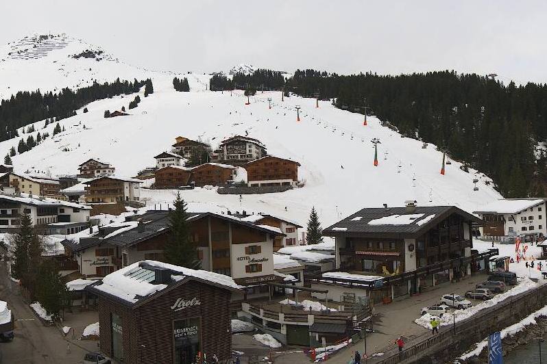
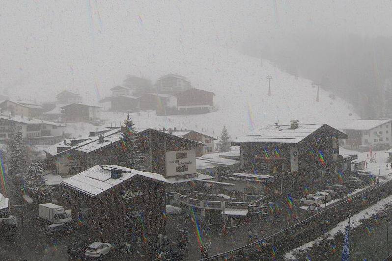 Heavy snow this morning in Lech, though it is actually the south-western Alps that have seen the bulk of the recent snow – Photo: lech.com, 28 March 2024
Over the last few days, the areas that have seen the most snow have been the higher parts of the south-western Alps, including Isola 2000, Montgenèvre, Sestriere and the Monte Rosa region. Many other regions have also seen at least a bit of snow, with a more general band set to cross the Alps from west to east today.
It will remain unsettled tomorrow and over the weekend with the heaviest snow returning to the south-western Alps. Indeed, Cervinia and the Monte Rosa region could see up to 1m or more by Sunday night.
For anyone off to the Alps over the next week or so, conditions look very promising in the high resorts, especially in the south-western Alps which have seen the biggest storm totals in recent days.
Lower down though, any new snow is mostly only of aesthetic value as there is little, if any, natural base below about 1600m in the western Alps (even on north-facing slopes), and below 1200m in some eastern parts of the Alps.
Updated: 11am Monday 25 March 2024 – In between storms in the Alps!
It’s a mostly fine day in the Alps today, but cloud is already thickening in the west, heralding the start of a new storm cycle. This will influence the Alps for several days and be most active in the south and west.
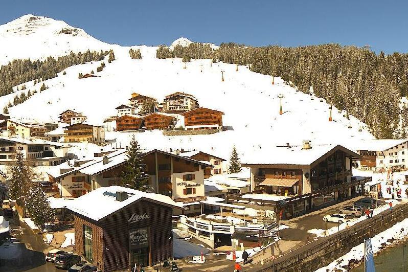 Sunny in Lech today, with fresh snow having fallen at the weekend – Photo: lech-zuers.com, 25 March 2024
Last weekend saw significant snow in some northern and eastern Alpine regions, including much of Austria, at least at higher altitudes. Lower down, any natural base is now long gone across most of the Alps.
Over the next two to three days, between 20-50cm of snow can be expected in many southern regions, including the likes of Isola 2000, Sestriere, Monte Rosa and the Dolomites, with a rain/snow limit varying between 800m and 1500m.
The northern Alps will also see a bit of snow at times though it will generally be lighter and patchier, with perhaps 10-20cm for the likes of Avoriaz, Engelberg and Lech. In Switzerland and Austria most of the precipitation will fall on Wednesday.
Updated: 12pm Saturday 23 March 2024 – Colder in the Alps, with snow for some!
After an exceptionally mild week of weather in the Alps, it is now turning colder this weekend with snow for some, especially in the north.
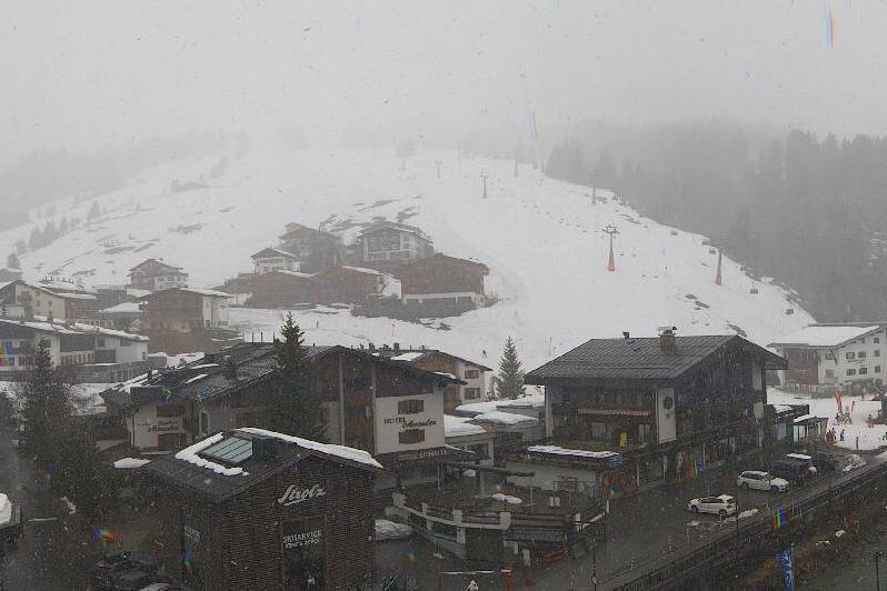 Rain is just starting to turn to snow at midday today in Lech, where as much as 40cm of new snow is possible at altitude by the end of Sunday – Photo: lechzuers.com, 23 March 2024
Over the weekend, between 5-15cm is expected above 1800m quite widely across the northern Alps, with 30-40cm possible in parts of eastern Switzerland and western Austria (e.g. Lech/St Anton).
The southern Alps will generally see little, if any, precipitation, except for the south-east which later today will see some potentially quite heavy rain/snow in the eastern Italian Alps (e.g. Dolomites) and far south of Austria, produced by a secondary area of low pressure forming over Mediterranean.
Today the rain/snow limit will start at around 2000m but quickly fall to 1000-1400m later this afternoon, before falling further to 500-900m tonight, at least in the northern Alps. The rain/snow limit will drop more slowly in the south-east (e.g. Dolomites), probably settling at around 1000-1300m overnight.
Updated: 10.30am Thursday 21 March 2024 – Colder weather within sight!
The weather in the Alps remains mild, with showers or longer spells of rain today in the northern Alps, with snow falling only above 2000m or so in the east, and 2300m in the west. The southern Alps will be drier with some sunny spells.
 Mild and damp in the northern Austrian Alps today, but winter will return this weekend. This is Lofer – Photo: snoweye.com, 21 March 2024
After a mostly fine and, again, very mild day tomorrow, it will start to turn colder over the weekend with some snow in places. Most of the snow will fall in the northern Alps, especially in Austria, but some central and eastern Italian resorts could also see a useful top-up.
Snowfalls totals this weekend across the northern Alps are likely to be in the region of 10-20cm above 1500m in the northern French and western Swiss Alps (e.g. Tignes, Verbier), but 25-50cm (and more in places) in the central and eastern Swiss Alps (e.g. Engelberg) and Austrian Alps (e.g. St Anton, Kaprun, Obertauern). The rain/snow limit will fall sharply, reaching about 800m in the north-western Alps late on Saturday and 500m further east.
Right now, snow conditions are very spring-like across much of the Alps, and you need to be skiing above 2500m or so to ensure wintry snow conditions for all or most of the day. This weekend’s colder weather will improve snow conditions considerably, even in the areas that won’t see much new snow (south-western Alps). That said, there is no natural base at lower altitudes (even to quite high levels in places) so you should still aim high if you are planning to ski this easter.
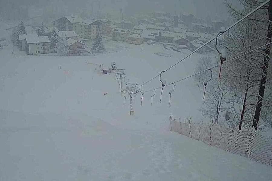
Updated: 9.30am Monday 18 March 2024 – New storm in the Alps, but still very mild…
A new storm has reached the Alps today but, with temperatures remaining mild, any snowfall will again be confined to relatively high altitudes.
 Heavy snow at high altitude in Engelberg this morning, but it’s raining lower down – 18 March 2024 Photo: titlis.ch
The northern half of the Alps will see the most precipitation today with typically 5-15 cm of new snow above 2200m, but 30cm or more at high altitude in a few spots like the Bernese Oberland region of Switzerland and the Arlberg/Vorarlberg regions of Austria. It will rain though at lower altitudes, thanks to a rain/snow limit between 1700m and 2100m.
Any precipitation in the southern Alps will be lighter and patchier, though there will also be a lot of cloud, at least to start with. The weather will then start to clear up more generally in the western Alps later in the day.
As for snow conditions, they remain generally poor at low altitudes thanks to the continually mild and sometimes quite damp weather. At high altitudes most resorts still have lots of snow, though the quality is variable.
If you want your snow to remain “wintry” all day long, you will generally need to be skiing above 2500m for much of this week, and even higher at times on south-facing slopes.
Updated: 11.30am Friday 15 March 2024 – Mild weather in the Alps, with a little snow due across some northern regions tonight…
Pressure remains relatively high over the Alps, meaning plenty of dry fine weather today, especially in the south. Further north, there is more in the way of cloud with the risk of a few showers or flurries (1800-2100m), especially later in the day.
 Plenty of snow in Lech still but cloudy and mild today – 15 March 2024 – Photo: lech.com
Showers will become more persistent tonight across the northern Alps with a rain/snow limit falling to around 1500m later. Around 5-10cm snow can be expected above 1800m in the likes of Kaprun, St Anton, Engelberg and Avoriaz, while the southern half of the Alps will stay mostly dry.
This weekend will be very mild across the northern Alps with variable cloud cover and a few light showers (flurries 2000-2400m). The southern Alps will remain dry with plenty of sunshine.
Updated: 11.40am Thursday 14 March 2024 - Mild in the Alps, with a bit of snow forecast for some higher northern areas over the next few days…
It’s a mostly fine and mild day across the Alps today, with plenty of sunshine but also some areas of cloud drifting around, notably in Austria.
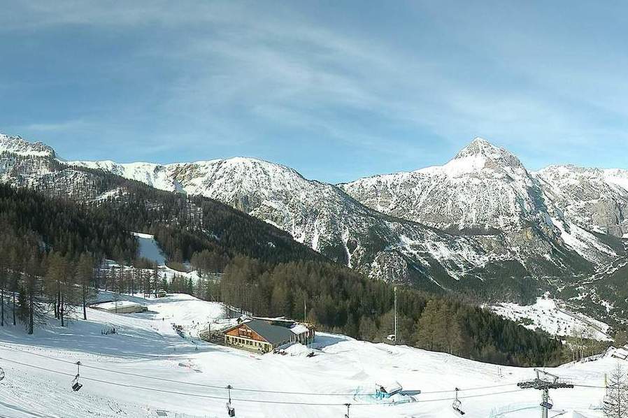 Good snow cover in Bardonecchia right now thanks to multiple big snowfalls over the last couple of weeks – Photo: bardonecchia.it, 14 March 2024
Tomorrow it will remain fine and mostly sunny across the southern Alps, though thickening cloud will bring showers to the northern Alps later in the day. These will linger overnight, delivering a few centimetres of new snow above about 1800-2000m in places (e.g. Avoriaz, Engelberg, St Anton).
Weather fronts will continue to brush the northern Alps between Sunday and Tuesday (especially on Monday), however, these will only bring fresh snow above about 2000m and in relatively modest quantities.
Snow conditions remain very mixed across the Alps. Conditions are generally good at high altitude, especially in the south-western Alps (e.g. Monte Rosa, Cervinia, Montgenèvre, Isola 2000) which have seen so much new snow in recent days. Lower down though, the lack of snow is very noticeable in many regions, with the thaw set to accelerate over the next few days, and particularly next week.
Updated: 8.30am Monday 11 March 2024 – Latest “south-western” storm comes to an end…
Weathertoski is currently in Morzine where it is a bright start to the day with just a few banks of innocuous mid-level cloud. Later in the day we are expecting thicker cloud to bring a few light snow flurries with a rain/snow limit close to 1200m.
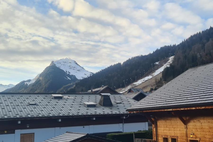 Bright skies over Morzine this morning but some light showers or flurries are expected later on today – Photo: weathertoski.co.uk, 11 March 2024
This follows a wet day yesterday, which saw rain at resort level, but snow above 1300-1400m, with around 10cm of fresh on the higher slopes above Avoriaz.
The big snow story though is once again in the southern Alps, where 50-100cm of snow has fallen over the weekend (with more in places) in some south-western areas, including Isola 2000, the Milky Way and the Monte Rosa region. Some more northern French resorts close to the Italian border, such as Val Cenis and Val d’Isère, also saw significant snow, as did parts of southern Switzerland, including Zermatt, Saas-Fee and the Aletsch Arena.
In general, the further north-east you are, the less snow you would have seen from this latest storm cycle, with little if any snow at all in many Austrian resorts.
Snow conditions remain very mixed across the Alps, with incredible skiing on offer in some areas, notably in the south-western Alps (e.g. Monte Rosa, Sestriere, Isola 2000).
However, many low areas continue to struggle further north and east. Here in Morzine, you can still find some decent piste-skiing above about 1600m but there is no natural base lower down.
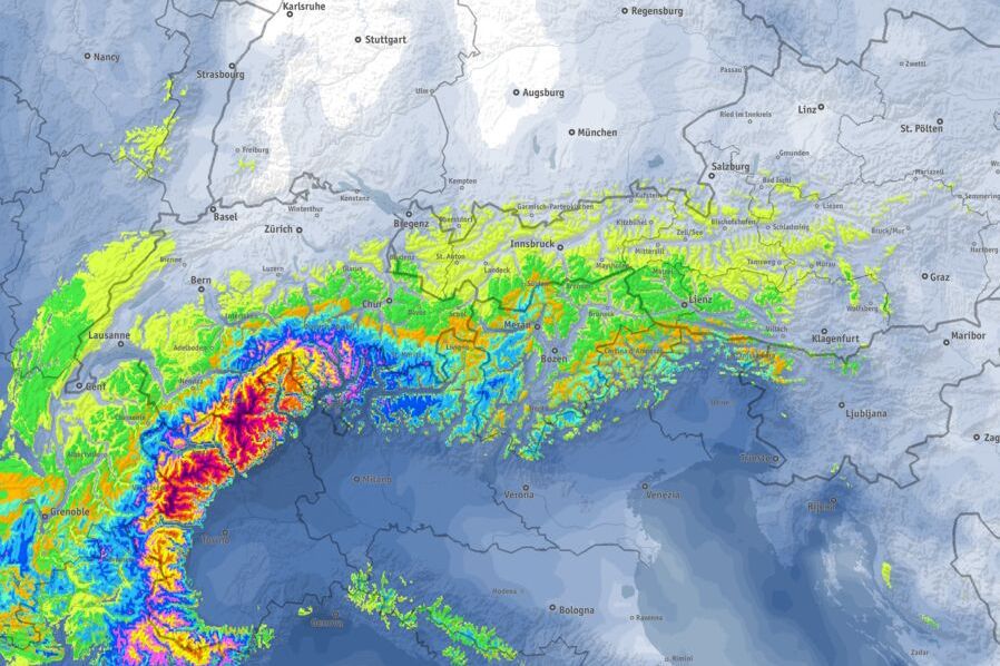
Updated: 10am Thursday 7 March 2024 - Further big snowfalls this weekend for some south-western parts of the Alps…
A new storm is approaching the Alps from the west, with big snowfalls forecast again for the south-western Alps between Friday and Sunday.
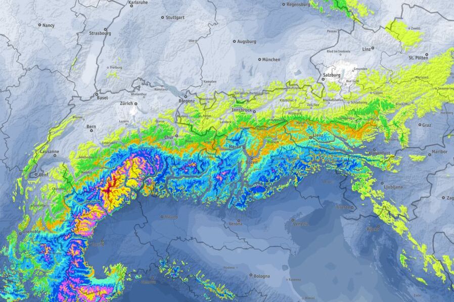 Between now and Sunday 10 March 2024, the most snow (the brightest colours) is again expected to fall in the south-western Alps – Image: bergfex.com, 7 March 2024
Meanwhile, it’s a fine day today across most of the Alps. Tomorrow will also see plenty of sunshine, especially the further north and east you are. In the south-west, however, cloud will thicken with some snow due in places later in the day, especially close to the southern French-Italian border (e.g. Isola 2000, Sestriere) and north-western Italian-Swiss borders (e.g. Cervinia, Monte Rosa).
Over the weekend there will be further pulses of potentially heavy snow for parts of the south-western Alps, with the Monte Rosa region likely to see the most, where storm totals could be in the region of 50-80cm by Sunday.
As happened last weekend, some significant snow could also spill over into the south-east of the French Savoie (e.g. Val Cenis, Val d’Isère) and into parts of the southern Swiss Alps (e.g. Zermatt, Saas-Fee). However, for most other parts of the Alps, any snowfall will be lighter, patchier or even non-existent - areas most likely to miss out completely being the far northern and north-eastern Alps.
Between Friday and Sunday morning , there will also be a strong Foehn (mild, gusty wind) blowing across many central and northern parts of the Alps, which may hamper lift operations in places.
Updated: 3.45pm Monday 4 March 2024 – Huge snowfall totals for some south-western parts of the Alps…
The storm that hit the south-western Alps over the weekend has delivered some staggering snowfall totals in places, far greater than originally predicted.
 Around 80cm of new snow has fallen over the weekend in Auron in the southern French Alps – Photo: auron.com, 4 March 2024
The regions that saw the most snow were the Italian Piedmont and far eastern Aosta (e.g. Prali, Sestriere, Monte Rosa, Macugnaga), close to the Italian border in the southern French Alps (e.g. Isola 2000, Queyras), and in the Haute- Maurienne (e.g. Bonneval sur Arc). These areas have seen between 1- 2m of new snow in the last three days, and in some cases 1m or more in just 24 hours alone.
Other areas that have done very well, but with slightly less extreme figures, include Montgenèvre, Val d’Isère (although over 1m has fallen on the Pisaillas glacier), Zermatt and Saas-Fee.
Note that, as is normal with a ‘Retour d’est’ type situation, these huge snowfalls were quite localised, with huge differences between one valley and the next. For example, while this storm delivered over 1m of snow to the far southern end of Val d’Isère, Tignes only received 25cm, Les Arcs just 5cm and most of the northern French Alps saw little if anything. More generally, the northern and eastern Alps (including Austria) also missed most of the action this time around.
The good news, though, is that the next storm which is due to hit the Alps on Tuesday/Wednesday will favour those areas that missed out this weekend – namely the northern half of the Alps – although it is only forecast to deliver a more moderate 10-30cm of new snow.
All in all, it’s turning into an interesting March in the Alps, after what has been a rather disappointing season so far, at lower altitudes at least.
Updated: 8am Sunday 3 March 2024 - New storm in the south-western Alps!
A new storm has hit the Alps, though its trajectory means that it will only really favour the south-western Alps, with snow not extending nearly as far north and east as was previously hoped.
 Heavy snow in Prali today where up to 90cm is possible by tomorrow morning – Photo: praliskiarea.com, 3 March 2024
Over the next 24 hours, the region that will see the most snow is the southern French Alps, including areas close to the Italian border like Isola 2000, the Queyras and Montgenèvre, and as far north as Val Cenis and Val d’Isère. By tomorrow morning these regions will have seen 30-50cm, with even 60cm+ in the Queyras and Isola 2000.
On the Italian side, resorts that will do well include Prato Nevoso, Bardonecchia, Prali, Sestriere and the Monte Rosa region, especially the eastern end (Alagna). These areas will also see at least 30-50cm of new snow by tomorrow morning, with as much as 90cm possible in Prali!
The rest of the French Alps, the south-western Swiss Alps (e.g. Zermatt) and the western Aosta (e.g. La Thuile) will see some snow, but probably only in the 5-15cm range at best. The rest of the Alps (i.e. the northern and eastern Swiss Alps, the eastern Italian Alps and all of Austria) will miss out on this storm.
Snow conditions are now exceptional across some south-western regions (or at least will be once the storm clears) including in Isola 2000, Bardonecchia, the Milky Way and the Monte Rosa region. with With some exceptions (like Val d’Isère) conditions are more average elsewhere in the Alps, and poor at lower altitudes where natural snow cover remains patchy or non-existent.
Updated: 9.20am Friday 1 March 2024 - The weather in the Alps remains changeable, with further snow forecast this weekend, heaviest in the south-west…
A weather front is moving east across the Alps today, which for most regions won’t produce more than a few centimetres of snow here and there. Some central/southern areas (notably between Zermatt/Saas-Fee and the Italian Lakes) will see significant snowfall however. Of the better-known ski areas, the Monte Rosa region is likely to do best, with 50cm+ possible above 1800m by tonight. The rain/snow limit will generally sit between 1200m and 1700m, but perhaps a little lower during the heaviest precipitation.
 Predicted snowfall between now and Monday 4 March 2024, with the brightest colours showing the deepest falls, with some south-western areas seeing up to 1m, notably close to the Swiss/Italian border – Image: bergfex.com, 1 March 2024
Over the weekend a new storm will arrive from the west bringing further significant snow to some south-western regions. Between Saturday morning and Monday morning, as much as 50-90cm of new snow could fall in areas including Isola 2000, Sestriere, Cervinia, Zermatt, Saas-Fee and the Monte Rosa region. The rest of the southern French Alps, especially resorts close to the Italian border (e.g. Montgenèvre) and as far north as Val d’Isère, will also see significant snow. The northern French Alps (e.g Portes du Soleil, Chamonix) will see less, with perhaps closer to 10cm.
Generally, during this weekend’s storm, the further north-east you are in the Alps the less snow you will see, with very little (if any) in the northern Swiss Alps (e.g. Engelberg) and more generally in Austria.
Snow conditions in the Alps are now best (or, at least, soon will be) in the higher resorts of the southern and south-western Alps, including Livigno, Monte Rosa, Cervinia, Zermatt, Saas-Fee, Sestriere, Montgenèvre and Isola 2000. Thanks to also catching snow spilling over the Italian border in these types of set-ups, Tignes/Val d’Isere and Val Cenis (among others) can also be added to this list.
More generally, there remain considerable weaknesses at low altitude across the Alps due to a proper base not ever having formed this season, including in Megève, Morzine, Gstaad, Grindelwald and many of the lower Austrian resorts (e.g. St Johann in Tirol). While these resorts are able to offer some reasonable piste-skiing higher up, they have little if any natural base lower down.
Our next full snow report will be on Friday 22 November 2019,
but see Today in the Alps for regular updates