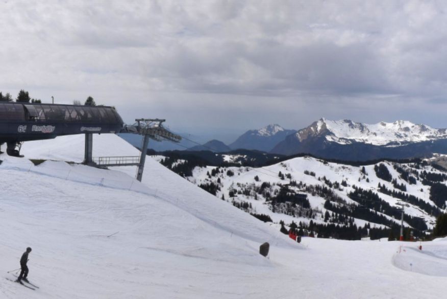
It has been an exceptionally hot summer so far in the Alps, and one of the hottest ever in the western Alps – including the French Alps, western Switzerland (e.g. the Valais) and north-western Italy (e.g. Aosta valley).


Got a burning question about weather or snow conditions in the Alps?
Contact us and we'll do our best to answer it...
Updated: 12pm Saturday 25 June 2026 – New heatwave incoming!
It has been an exceptionally hot summer so far in the Alps, and one of the hottest ever in the western Alps – including the French Alps, western Switzerland (e.g. the Valais) and north-western Italy (e.g. Aosta valley).
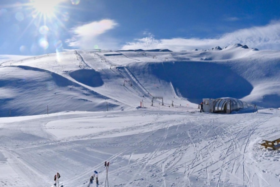
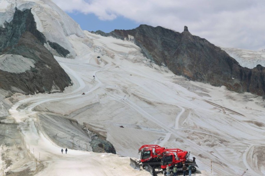 Snow conditions on the Alpine glaciers are less than ideal. This is Saas-Fee, one of just three remaining options for skiing in the Alps right now – 25 July 2026 – Photo: saas-fee.ch
The good news is that the weather in the Alps will turn noticeably cooler over the and into the . The bad news, however, is that this cooler incursion will be very transitory, with the heat returning on .
Indeed, by most of the Alps will again be under “heatwave” conditions, meaning temperatures into the mid-, and sometimes even high 30°Cs in the lowlands, with freezing levels approaching 5000m!
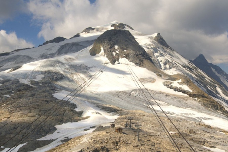
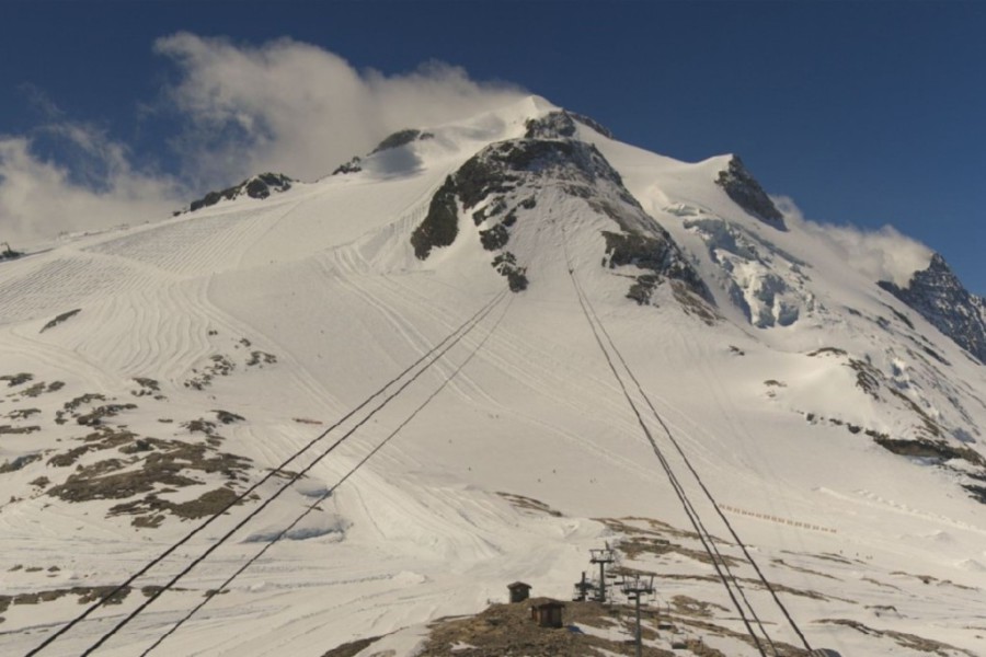
Needless to say, snow conditions on the few glaciers currently open for summer skiing are less than ideal, with Hintertux having closed , a week earlier than its scheduled finish.
and might see a very temporary improvement in snow conditions, with the highest glaciers even seeing a little fresh snow from the showers and storms forecast this . Fundamentally though, the glaciers are in very poor condition for late July, with no guarantee that those scheduled to remain open for the rest of the summer will be able to do so.
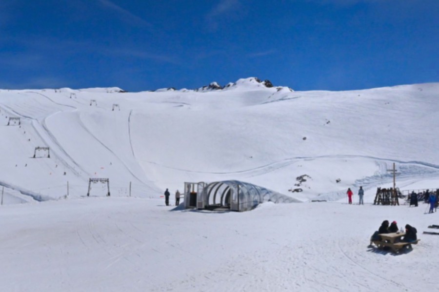
For now, there are just three summer ski options in the Alps – four if you separately count Cervinia (Italy) and Zermatt (Switzerland), which share a glacier. The only other possibilities are Saas-Fee (Switzerland) and Passo Stelvio (Italy). All the alpine options are extremely limited.
Our snow reports & snow forecasts will be back in autumn...

If you enjoy reading our updates - please feel free to support us:


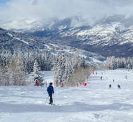
Skiing is still possible in the Alps throughout June, though options are now limited to a handful of high-altitude glacier ski areas. Here are the resorts that remain open...

The 2024-25 North American ski season saw slightly below average snowfall overall, but the Northeast had its snowiest season since 2016-17.
Read our full review of the 2024-25 ski season, and find out who got the most snow in North America...
The 2022-23 alpine ski season was relatively snowless and exceptionally mild, although some resorts fared better than others.
Read our full review of the 2022-23 ski season and find out who got the most snow in the Alps...
Bad Gastein: 5 reasons to visit this 'forgotten' Austrian gem
23 March 2024
Bad Gastein dropped off the radar for a while with British skiers but is now making a comeback. Here are 5 reasons why you should consider it for your next ski trip...
Top 5 pistes in Les Arcs
8 June 2022
Les Arcs boasts some of the finest and most famous pistes in the Alps. Here are five of our favourites...
Top 5 early season ski resorts - Italy
22 October 2020
Here are our top 5 ski resorts for an early season ski holiday in Italy...
Snowfall patterns in the French Alps
16 September 2020
Ever wondered why some areas of the French Alps get more snow than others?
Updated: 10am Friday 17 June 2026 – The intense heatwave is easing in the Alps...
The intense heatwave, that has affected the Alps for several weeks now, is finally easing as slightly cooler air moves down from the north.
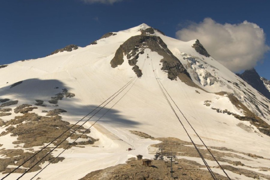
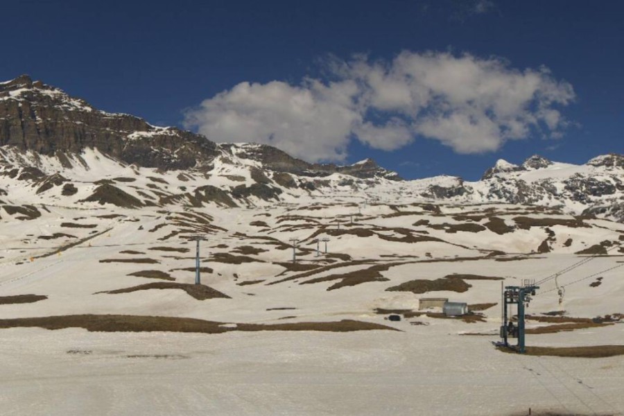
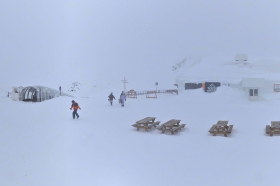
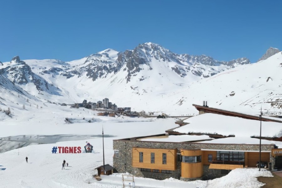
 The Grande Motte glacier in Tignes today, showing how much snow has been lost over the last month due to the heatwave– Photo: tignes.net, 17 July 2026
That said, the weather in the Alps will remain very warm over the next few days, it will just lose the extreme heat that has not only affected the Alps but also much of western Europe.
Not surprisingly, snow conditions on the Alpine glaciers have deteriorated significantly since we last reported, as shown by our images of the Grande Motte glacier above Tignes taken less than one month apart. It is not surprising that Tignes closed its summer skiing operation a few days early, on Wednesday, as snow conditions here became increasingly marginal.
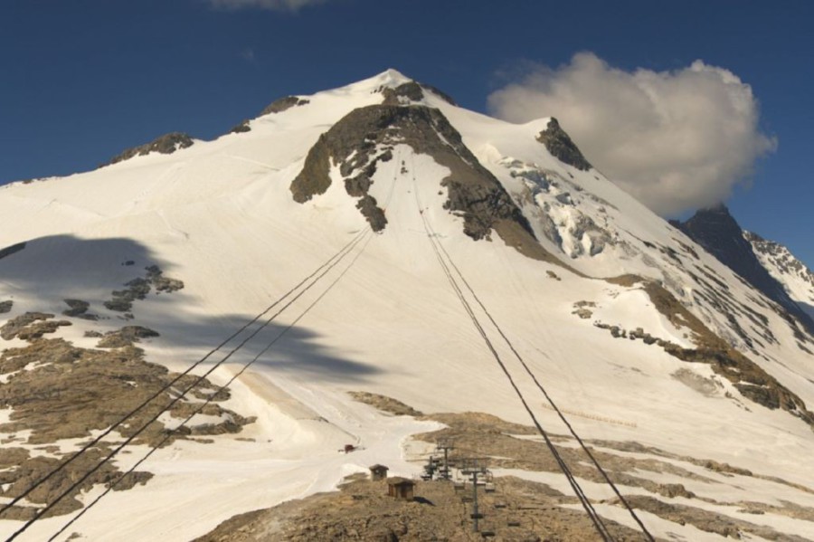
 The Grande Motte glacier in Tignes on 18 June 2026, before the heatwave took its toll on the snow – Photo: tignes.net, 18 June 2026
Elsewhere in the Alps, you can still ski on the glacier above Zermatt/Cervinia, although the lift operations are closed today due to adverse weather last night when heavy rain affected the area.
The other options for summer skiing are Passo Stelvio, Hintertux and, from tomorrow, Saas-Fee. However, none of these areas are in good shape and unscheduled early closures remain a possibility, especially if the intense heat returns.
Updated: 10am Thursday 18 June 2026 – Intense heat returns to the Alps!
Following an exceptionally hot end of May, the weather in the Alps became more “normal” in early June. However, over the last few days, temperatures have been soaring again as another exceptional heatwave engulfs much of western Europe!
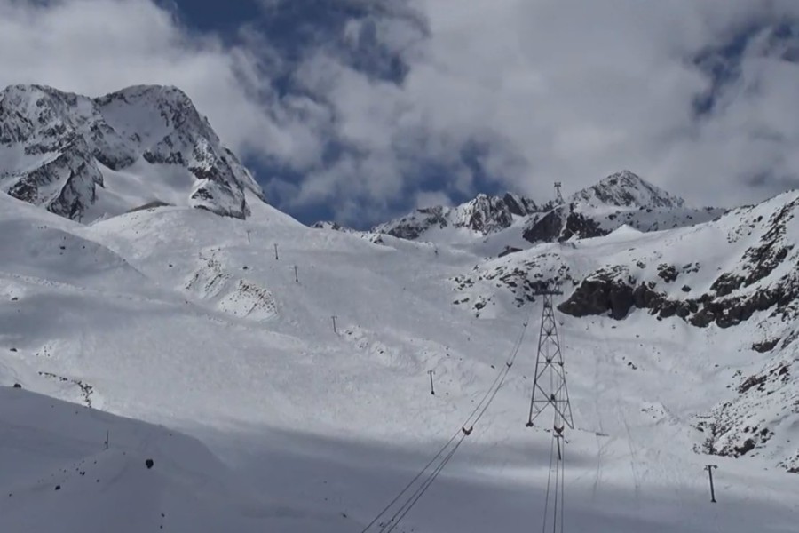
 The Grande Motte glacier above Tignes (opening 20 June 2026) remains in reasonable shape for now but, with heatwave conditions forecast in the western Alps, snow conditions are likely to become increasingly challenging over the coming days – Photo: tignes
Although it will be hot across all parts of the Alps, as in late May it will be the western Alps that will see the most extreme temperatures, with 35°C+ commonplace in the lower valleys over the weekend and especially early next week. Some areas (e.g. Grenoble) could see temperatures even approaching 40°C with freezing levels as high as 4500-4800m.
There remains some uncertainty as to exactly how long the extreme heat in the Alps will last, however, most models agree that heatwave conditions are likely for at least a week and, quite likely, much longer.
This second bout of exceptionally hot weather in the Alps is obviously not good news for the glacier where, after a generally good spring and early summer skiing season, snow conditions have started to and will continue to deteriorate at increasing pace over the coming days.
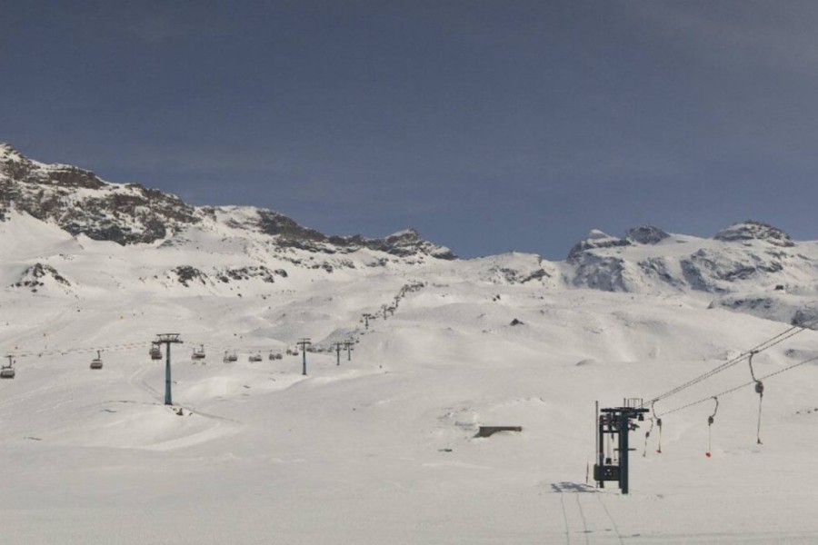
Right now, summer skiing is possible in 5 to 6 resorts in the Alps, depending on whether you count Zermatt and Cervinia (with their shared glacier) as one or two. The other options are Les 2 Alpes, Hintertux, Val d’Isère and Passo Stelvio.
Tignes is set to join the action this weekend, with its Grande Motte glacier area (pictured) just about holding up for now. However, you can expect ice to be showing through here soon as is also likely on other glaciers elsewhere.
Thanks to climate change, summer heatwaves in the Alps have become much more frequent and severe in recent years. This has forced summer ski areas to reconsider how they operate, with many bringing their seasons forward to concentrate on spring and early summer, rather than attempting to remain open through the hottest months.
Check out our revised and updated blog for everything you need to know about skiing in the Alps in June.
Updated: 11am Monday 1 June 2026 – The heatwave in the Alps is over...
Following an exceptionally hot couple of weeks in the Alps, with record-breaking temperatures in places, the weather is now starting to cool down.
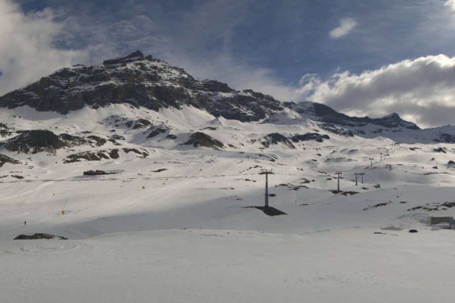
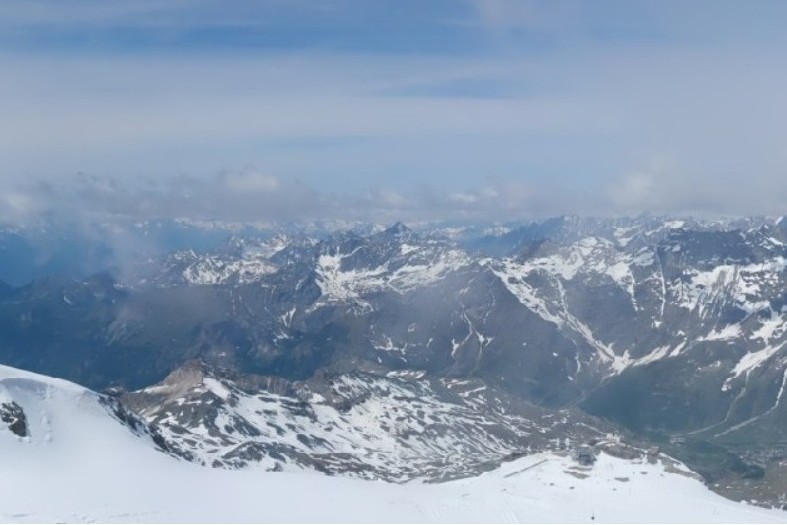 View from the top of the Klein Matterhorn this morning, in Zermatt’s summer ski area – 1 June 2026 – Photo: zermatt.ch
That said, it certainly won’t be cold, but temperatures will just be closer to what is expected at this time of year, with average freezing levels nearer 3000m rather than 4000m, as has been the case over the last couple of weeks, at least in the western Alps. There will also be some thunderstorms around, especially on Tuesday when they could be quite violent in places.
Later next weekend and into next week it will probably become hotter again, but how long this will last is too early to say at this stage.
Skiing options in the Alps in the first few days of June have dwindled to five, which are Les 2 Alpes, Hintertux, Cervinia, Zermatt and, as of today, Passo Stelvio in Italy.
Updated: 8am Thursday 28 May 2026 – Alpine heatwave to ease next week...
The weather in the Alps will remain exceptionally hot until the weekend, after which cooler air will slowly move in from the west.
 Good summer skiing on the Hintertux glacier this week – 28 May 2026 – Photo: Facebook.com/hintertuxergletscher
This historic spring heatwave, in place for nearly a week now, has most impacted the western Alps where freezing levels have been around the 4000m mark, and temperatures in the lower valleys often exceeding 30˚C. This would be considered hot even for the middle of summer but, for May, it is exceptional - unprecedented even in places, especially in the French Alps.
After a cool and, at altitude, quite snowy start to May, it is hardly surprising that snow conditions in the few ski areas still open have rapidly reverted to “full summer mode”. This doesn’t mean that there isn’t still some good skiing available, but the window of opportunity is narrow (early to mid-morning). By the middle of the day, the slopes become unpleasantly slushy, even at glacial altitudes.
Right now, you can ski in 5 resorts across the Alps:
Read our blog for more on where to ski in the Alps in May...
Updated: 9am Monday 25 May 2026 – Unprecedented spring heatwave in the Alps...
The Alps are currently experiencing an extraordinary spring heatwave, with little sign of any significant cooldown anytime soon.
 Rapid loss of snow above Cervinia but some non-glacial skiing is still possible for now – 25 May 2026 – Photo: cervinia.com
After a relatively cool start to May (and, at higher altitudes, quite a snowy one) conditions turned much warmer early last week, with freezing levels reaching or exceeding 4,000m across most of the Alps for several consecutive days. At lower altitudes, this has brought temperatures of 30°C or more.
While temperatures like these are not unprecedented in themselves, the persistence of the heat, combined with the fact that it is still spring, makes this Alpine heatwave particularly noteworthy.
Right now, you can still ski in 5 areas in the Alps, these being Les 2 Alpes in France, Cervinia in Italy, Zermatt in Switzerland, and Hintertux and Mölltal in Austria. Some non-glacial terrain still available in all of these ski areas except Mölltal.
Although early spring snow conditions in the Alps were excellent, the current heatwave has created very marked freeze-thaw conditions (mostly thaw), with the snow quickly softening in the strong sun, and becoming very slushy by late morning, even above 3000m.
For now, snow coverage on the glacier ski areas is still good, however, resorts planning to be open in the middle of summer (e.g. Zermatt, Saas-Fee, Passo Stelvio) will no doubt be monitoring the situation with some concern.
Updated: 8am Wednesday 20 May 2026 – Great snow conditions on the glaciers, but temperatures in the Alps are about to soar...
Following a cooler than average first half of May with significant fresh snow at altitude, snow conditions up on the alpine glaciers are currently excellent.
 Excellent snow conditions up on the glacier in Les 2 Alpes but it will soon turn much warmer – Photo: Les2Alpes.com
However, the weather in the Alps is on the change, with high pressure bringing increasingly hot and sunny weather over the next few days. Indeed, temperatures will hit or surpass 30˚C in many of the lower valleys from onwards, with freezing levels above 4000m.
This will change snow conditions on the glaciers from relatively wintry (as seen in the last week or two) to more typical of mid-summer, with early hard snow quickly softening as the morning progresses, and plenty of slush by the middle of the day.
Right now, you can ski in 6 areas in the Alps, namely Les 2 Alpes, Zermatt, Cervinia, Kitsteinhorn, Hintertux and Mölltal.
Of these, Les 2 Alpes, Cervinia and Hintertux still have notable non-glacial terrain open, but for how long remains to be seen…
Updated: 1pm Sunday 17 May 2026 – Excellent snow conditions on the glaciers but warming up next week...
Following an unusually cold and snowy few days in the Alps, snow conditions on the glaciers are excellent right now, with significant fresh snow in all the open ski areas.
 Excellent snow conditions today on the Stubai glacier although this is sadly its last day of the season – 17 May 2026 – Photo: stubai-gletscher.com
Although it is mostly dry again , a new wave of showers is set to arrive from the west . These will be heaviest later in the day and in Austria, where another 10-15cm of snow is possible at altitude. The rain/snow limit will be around 1500-2000m.
From onwards, an area of high pressure will start to establish itself across the Alps bringing increasingly fine and warm weather to all regions. Indeed, by the end of temperatures could reach into the high 20˚Cs at low altitude.
For now, though, snow conditions in the Alps are excellent in the few areas still open, all of which involve glacier ski areas. These are:
However, with summer weather returning later , and very warm temperatures likely to be set in for some time to come, there is no guarantee that snow conditions will still be as favourable a few weeks down the line…
Updated: 11am Wednesday 13 May 2026 – More snow forecast for the Alps!
After an exceptionally dry and warm April, the weather in the Alps has proved much more interesting in May, especially this week, with significant snow having already fallen in places and plenty more to come between tonight and Saturday night.
 Great snow conditions still in Cervinia, even below the glacier here to 2550m in the Plan Maison area – 13 May 2026 – Photo: cervinia.it
In terms of the ski areas that remain open, this fresh snow has (so far) most benefited Les 2 Alpes, Cervinia and Zermatt. However, between and , it will be the eastern Alps that will see the most snow, with 50cm+ possible for the Austrian glaciers, while Les 2 Alpes and Zermatt / Cervinia will see more in the range of 5-20cm. The rain/snow limit will also be very low for May, typically between 1300m and 1700m, but as low as 1000m in places.
Needless to say, all this new snow is great news for the Alpine glaciers, many of which risked looking very threadbare early in the summer after what had, until now, been an exceptionally dry spring.
This late wintry spell will delay the thaw at altitude, but it does not by any means guarantee that snow conditions on the few glaciers planning to be open mid-summer (e.g. Saas-Fee, Zermatt) will be in great condition. Indeed, it looks likely that the weather in the Alps may turn hot again later with above average temperatures locked in for some time. Watch this space…
For now, weather-permitting, skiing in the Alps is possible in the following areas:
Updated: 11am Monday 11 May 2026 – Significant snow for some parts of the Alps this week...
The weather in the Alps will be very unsettled this week with generally below average temperatures and snow to 1000m or lower in places!
 Les 2 Alpes has the best snow conditions in the Alps right snow, with more snow in the forecast this week – Photo: les2alpes.com, 11 May 2026
, bands of showers are crossing the Alps from west to east, heaviest later and , and in the north, with some rumbles of thunder in places. The rain/snow limit will start at around 2000-2300m before dropping to between 900m and 1500m in the northern Alps .
On , any rain or snow (1000m) will die out from the western Alps but continue for a time in the eastern Alps with snow falling to as low as 800m in some northern parts of the Austrian Alps. Although the southern Alps will also see showers over the next 24-hours it will be the northern Alps that see the heaviest precipitation, with 10-30cm of fresh snow above 2200m, and 40cm+ in places.
After a relative reprieve , new weather fronts will bring more rain or snow to the Alps late on and on , again heaviest in the north and with snow again falling to 1000m or lower in places.
This week’s snow forecast is great news for the alpine glaciers, nearly all of which have lower than average snow depths for the middle of May but will see much-needed top-ups over the next few days. Les 2 Alpes will also see these top-ups, but stands out as an exception, already having above-average snow depths on its glacier area.
Read our blog for more on where to ski in the Alps in May...
Updated: 9.30am Thursday 7 May 2026 – Epic snow conditions in some parts of the Alps today...
The main winter season is over, but there is still plenty of good skiing on offer in the Alps. This is especially true in France’s Les 2 Alpes, which arguably has the best snow conditions in Europe right now.
 Blue skies and fresh snow at altitude in Les 2 Alpes – 7 May 2026 – Photo: les2alpes.com
So, why are snow conditions in Les 2 Alpes this good? The answer is due to a big storm earlier this week that mostly affected the western and south-western Alps (to various degrees). Les 2 Alpes sat right in the sweet spot (especially on Tuesday), collecting at least 50-70cm of snow at altitude! What’s more, the sun is back today and not only is the glacier in pristine condition, but you can also still ski on non-glacial terrain back down to 2600m.
The only other area in the Alps that is comparable right now is Zermatt/Cervinia, which also saw significant new snow this week, and where you can also still ski below glacier level – especially on the Italian side.
Elsewhere in the Alps, you can ski on the glaciers at Hintertux, Stubai, Kaunertal, Kitzsteinhorn, Mölltal and Val Senales. However, the snow conditions and variety of terrain available in these areas are currently not comparable to Les 2 Alpes and Zermatt/Cervinia.
Updated: 9am Wednesday 6 May 2026 – Heavy snow for parts of the Alps!
The main winter ski season may be over, but snow has returned to some parts of the Alps, especially the west.
 Heavy snow falling this morning in Tignes, although skiing here is not scheduled to reopen until late June – Photo: tignes.net, 6 May 2026
Indeed Les 2 Alpes, one of the few resorts still offering skiing right now, reported 50cm of fresh snow on its glacier yesterday, with further snow forecast today.
Many other parts of the Alps have also seen a least a bit of snow at altitude in the last day or two, heaviest in the west where the rain/snow level could dip below 2000m today.
For the rest of this week, the weather in the Alps will remain unsettled with further showers in places. However, with temperatures rising again, any snowfall will be increasingly confined to glacial altitudes.
Weather-permitting, around eight ski areas in the Alps are open this week, all of them on glaciers.
Updated: 1pm Sunday 3 May 2026 – Last “proper” day of the Alpine season...
It’s the final day of what many call the “ski season proper” in the Alps, with resorts like Val d’Isère, Tignes, Val Thorens and Ischgl all closing today. After today though, most skiing will be limited, or almost entirely limited, to glacier ski areas.
 Most Alpine ski resorts may be closing today, but you can still ski in Slovakia! This is Jasná – 3 May 2026 – Photo: jasna.sk
Despite April having been exceptionally dry and warm, leading to a rapid melting of much of the lower-lying snow across the Alps, at higher altitudes, solid base depths and predominantly fine weather have provided excellent spring skiing in recent weeks. That said, overall snow depths are now below the norm for early May, which does not bode particularly well for the summer skiing season.
If you are planning to ski in the Alps this summer, May and June will generally offer the most options. Skiing in the Alps any later in summer is becoming increasingly uncertain these days.
Elsewhere in Europe, you can (believe it or not) still ski in Scotland’s Cairngorm, albeit on a very limited basis. Slovakia’s Jasná is also open, reportedly until 10 May. A handful of ski resorts also remain open in Scandinavia, as is usual at this time of year.
Spain’s Sierra Nevada also deserves a special mention. It may be closing today, but it has enjoyed an exceptionally snowy season and still has plenty of snow all the way down to resort level.
Updated: 11am Thursday 30 April 2026 – Good skiing still possible in a handful of high ski resorts in the Alps, despite a very warm April...
The weather in the Alps is warm and slightly unstable with plenty of sunshine, especially in the northern and eastern Alps, but with the risk of a few showers or thunderstorms in the south-west.
 Still plenty of good snow at altitude in Tignes, especially here on the Grande Motte glacier – 30 April 2026 – Photo: tignes.net
More broadly, April has been a very dry and warm month across the Alps which has led to a rapid loss of snow at lower altitudes. That said, there remains plenty of snow higher up where some good spring skiing is still possible in the likes of Val d’Isère, Tignes and Cervinia, just a couple of the options with more extensive terrain among the two-dozen or so ski areas in the Alps still open.
Weather models are suggesting that we may see some significant snow across parts of the Alps next week. However, after this weekend, skiing in the Alps will become much more limited and mostly confined to glacier areas.
Updated: 1pm Monday 20 April 2026 – The weather in the Alps is relatively cool, with a few showers...
TThe Alps are under the influence of a relatively cool and faintly unstable easterly airflow early this week. Most regions will be dry with some sunny spells, but there will also be some cloud bubbling up with the odd shower (snow 1800-2000m) or even isolated thunderstorm, mostly in the southern and eastern Alps.
 Les 2 Alpes is always one of the best resorts in the Alps for late season skiing – 20 April 2026 - Photo: les2alpes.com
The weather in the Alps will remain broadly similar until the middle of the week when it is set to turn increasingly sunny and warm from Wednesday onwards.
Approximately 34 ski areas remain open in the Alps. Among the better offerings in terms of extent of open terrain include Zermatt-Cervinia, Val d’Isère-Tignes, Val Thorens, Les 2 Alpes, Livigno and Ischgl.
Spring snow conditions should be expected although, the relatively cool temperatures for the time of year mean there will be plenty of firm snow on north-facing slopes, at altitude at least.
Updated: 10am Thursday 16 April 2026 – Spring skiing conditions rule in the Alps...
The weather in the Alps is fairly settled right now, although it is by no means entirely sunny today, with some area of cloud drifting around, especially in Austria. Temperatures are on the mild side, but not excessively warm for mid-April, with freezing levels typically around 2500-3000m (east to west).
 Still plenty of snow in Tignes which is always one of the best resorts in the Alps for late season skiing – 16 April 2026 – Photo: tignes.net
Over the next few days, the weather in the Alps will remain mostly fine, but will turn a bit more unsettled later in the weekend with a few showers in places (snow around 2300m), though this will not amount to any significant accumulations.
Right now, snow conditions in the Alps are typically spring-like, with hard snow early on (at least if skies have remained clear overnight) followed by a softening-up process – first on slopes facing east/south-east, then south, then west and finally north.
To ensure that the snow remains relatively wintry all day long, you now need to be skiing on north-facing slopes above about 2500-2700m. Otherwise, the best advice is to try and follow the sun.
If you still fancy a quick trip to the Alps this season, the options are starting to dwindle. Some of the better bets, though, include Val Thorens, Les 2 Alpes, Val d’Isère, Tignes, Zermatt and Cervinia.
Updated: 12pm Tuesday 14 April 2026 – Fresh snow for some parts of the Alps, mostly in the south-west...
Over the last day or two there has been some fresh snow across some parts of the Alps. The heaviest has fallen in the south-west, particularly in the Aosta and Piemonte regions (e.g. Cervinia, Monte Rosa) but also in the southern French Alps (e.g. Isola 2000) and the far south of Switzerland (e.g. high above Saas-Fee and towards the Simplon region).
 Sunnier today in Cervinia, with fresh snow – 14 April 2026 – Photo: cervinia.com
These regions have seen 20-40cm of snow above about 2200m over the last couple of days, but also a lot of rain below 1800m or so. Some other Alpine regions have also seen a bit of snow, but it has been more hit and miss, and generally not amounting to much.
Temperatures have also stayed a bit milder than originally forecast, meaning that very little snow has accumulated below 1800-2000m, with some exceptions like in the far western Alps (e.g. Vercors).
will see a few showers or flurries across the eastern Alps with a snowline between 1600m and 2000m (highest in the south-west). Otherwise, most of the rest of the Alps will be dry, with variable cloud cover.
The rest of will then be dry, but warmer with more in the way of sunshine.
Updated: 2pm Saturday 11 April 2026 – Very warm today in the Alps but turning colder from the north-west tomorrow...
The weather in the Alps will be exceptionally warm today, with temperatures hitting the mid or even high 20˚C’s in some of the lower western valleys. Tomorrow, a weak cold from will then move in from the west.
 Last day of the season in Les Gets, where it is very warm today – 11 April 2026 – Photo: lesgets.com
After today’s very warm (and in places still quite sunny) weather, tomorrow will be cloudier in the west with a few showers in the French, western Italian and south-western Swiss Alps with a little bit of snow above 2500m or so.
These showers will continue on Sunday night and on Monday, again only really affecting the south-western half of the Alps, with the rain/snow limit descending to 2000m or lower in places.
Most areas will not see any significant snow from this storm, with just a few centimetres at altitude here and there, however some parts of the eastern Aosta (e.g. Cervinia), the Piemonte (e.g. Sestriere, Alagna) and the border regions of the Haut-Valais (above Zermatt and Saas-Fee) could see 15-30cm of snow above 2200m between Sunday evening and Monday night.
Throughout this period, many northern and eastern Swiss resorts, most of Austria and the eastern Italian Alps will see very little if any precipitation. However, it will turn cooler here too.
Updated: 2pm Thursday 9 April 2026 – Still warm, much colder on Sunday...
The weather in the Alps remains unseasonably warm, with temperatures again reaching the mid-20˚C’s in some of the lower Alpine valleys, especially in the west (e.g. Grenoble), although it will be a bit cooler in the eastern Alps.
 Engelberg is in full spring-mode, but there is still plenty of snow higher up – 9 April 2026 – Photo: engelberg.ch
After a slight dip in temperatures on Friday, with some showers likely in the eastern Alps, Saturday will again be very warm. After this there will be a more decisive cool down in the Alps, first in the west on Sunday, then further east late on Monday, and on Tuesday.
There is also some snow in the forecast, mostly in the western and south-western Alps to start with (late on Sunday, and on Monday), then probably favouring Austria by Tuesday.
Updated: 11am Tuesday 7 April 2026 – Feels like summer in the Alps...
High pressure continues to dominate the weather in the Alps and, with the air coming from the south, it is also very warm, with temperatures more typical of summer than spring. Indeed, it could hit the high 20˚C’s in some of the lower valleys this week, which will continue to send the snowline scurrying up the mountain.
 Blue skies and high temperatures but still plenty of snow in Tignes – 7 April 2026 – Photo: tignes.net
Not surprisingly, spring-snow conditions are the order of the day, although the high temperatures mean that the overnight refreezing is weak or even non-existent at low altitudes, so you need to aim relatively high to avoid slush developing early in the day. With freezing levels well above 3000m, you must also be on north-facing slopes above about 2700m to ensure that the snow stays firm for most of the day.
The weather will turn cooler and more unsettled late this weekend and next week, with the chance of snow fresh snow in places, at this stage looking more likely to fall in the southern Alps.
If you are still planning to sneak a few days skiing in this season in the Alps, Val d’Isère and Tignes are your best bet in terms of snow conditions and quantity of terrain still open. Other suggestions include Val Thorens, Cervinia and Zermatt, all of which have lots of terrain over 2500m available.
Updated: 4pm Sunday 5 April 2026 – Spring returns to the Alps...
High pressure is now in charge of the weather in the Alps, which means that there will be no significant new snow on the cards any time soon. Most regions will see plenty of sunshine, although there will be some cloud bubbling up here and there. More importantly, it has turned much warmer across the Alps, with temperature surpassing 20˚C today in some lower valleys.
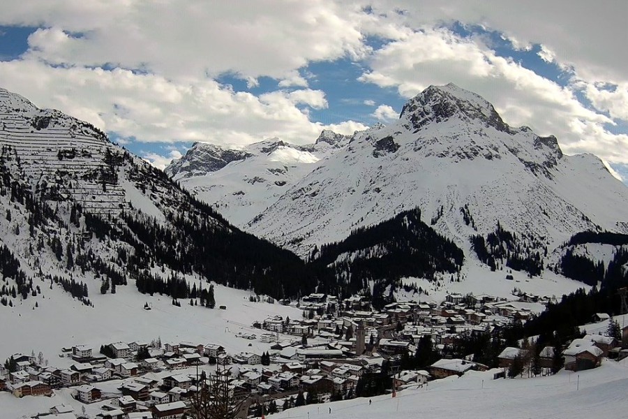 Typical spring weather in the Austrian Alps today, with sunny spells here in Lech, but also some clouds bubbling up – 5 April 2026 – Photo: lechzuers.com
This warmer spring-like weather comes in marked contrast to the last couple of weeks, which saw lots of fresh snow across the northern Alps, in particular, and persistently low temperatures. There is therefore a very healthy late season base in most high resorts, with good cover to relatively low altitudes in some northern areas too.
As for snow quality, any untracked powder is becoming harder to find – you will need a good local guide to seek out the remaining stashes on high north-facing slopes. Otherwise, you are looking at typical spring-skiing conditions, with east/south-east slopes catching the sun earliest in the day and softening first, followed by south- and later west-facing slopes.
North-facing slopes will soften last and, unlike last week when they remained firm above 1200-1500m or so all day long, this week you will need to be above 2500m or so to find consistently wintry snow surfaces.
If you are still thinking of skiing in the Alps this winter, some of the better options over the next couple of weeks include Val Thorens, Val d’Isère, Tignes, La Plagne, Les 2 Alpes, Cervinia, Zermatt, Verbier, Ischgl and Obergurgl.