


ARCHIVE
Today in the Alps - December 2018
Read about current weather and snow conditions in the Alps
Updated: 9.30am Saturday 29 December 2018 - Mostly dry today, with some snow in Austria tomorrow…
High pressure is still in control of the weather in the Alps, meaning plenty of dry fine weather at altitude but also some nuisance value low cloud and fog.
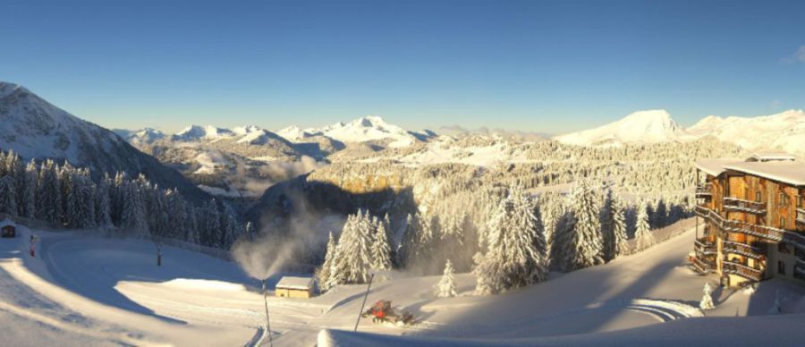
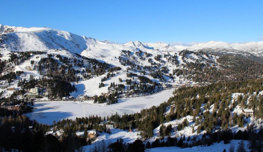 Lots of fine weather in the Alps today. This is Turracher Höhe – 29 December 2018 – Photo: turracherhoehe.at
It will remain dry with sunny spells across most regions on Sunday, however, the eastern Alps will be cloudier with some outbreaks of snow (700-1000m), mostly in Austria and heaviest in the eastern Austrian Alps (e.g. Schladming, Obertauern) where 20cm or so is possible.
Another disturbance is likely to bring further snow to parts of Austria around the middle of next week, this time to very low levels, but the southern and western Alps will again stay mostly fine.
Snow conditions are a bit mixed during this busy New Year week. There is plenty of good skiing to be had, especially higher up, but overall it is certainly not a vintage end to 2018. A lot of this is down to the mild and rainy spell that affected many northern and western parts of the Alps last weekend, which damaged the lower pistes and left them hard and icy.
If you want consistently good snow conditions you therefore need to be in a ski area where there is plenty of terrain above 2200m, such as Val Thorens, Val d’Isère/Tignes, Zermatt, Cervinia and Saas-Fee, to name just a few.
However, you can afford to go a bit lower the further south and east you go, as the rain/snow limit last weekend was that bit lower in the east, and the southern Alps avoided most of the rain in the first place. So while the Dolomites, for example, may be posting modest snow depths, their piste skiing is still better than most right now.
Updated: 8.45am Thursday 27 December 2018 - A mild end to 2018…
High pressure is dominating the weather in the Alps, with lots of sunshine for most regions, both today and over the next few days. One exception may be the far eastern Alps (e.g. Schladming, Obertauern), where some snow showers are possible next Sunday and Monday.
 Still reasonable snow cover in Avoriaz, although last weekend’s rain is often making the pistes quite icy – 27 December 2018 – Photo: avoriaz.com
Over the next few days it will not only be mostly sunny, but will also feel mild, even at altitude with freezing levels as high as 3000m in the western Alps (e.g. France). At this time of year, and in calm clear weather (as the Alps are experiencing right now), the impact of high freezing levels is not as severe as it might sound - the sun is low and the air is dry, meaning that snow melt is limited.
However, snow conditions in the Alps are generally very mixed right now, especially in the northern and north-western Alps where there was lots of rain (and high altitude snow) last weekend.
The “tricky” areas are in the north-western Alps (such as the Portes du Soleil, Flaine, Gstaad and Jungfrau region) where there was lots of rain on Sunday and Monday and where it only snowed very briefly above 1500-1800m right at the end of the storm. This means that there was a lot of damage to the pistes and those that survived will often be very icy, especially below 2000-2200m.
By contrast, across eastern Switzerland and Austria (e.g. Davos, St Anton, Ischgl) the rain turned to snow long before the storm was over, and right down to 1000m or less. The north-eastern side of the Alps is therefore in much better condition than the north-west right now.
In general, the southern Alps saw less precipitation from the recent storm, meaning that snow conditions are more consistent, especially in areas that stayed completely dry (e.g. Isola 2000).
Updated: 10am Monday 24 December 2018 - Over 1m of new snow in some higher parts of the northern Alps!
It is still raining or snowing heavily across the northern half of the Alps this morning, especially in Switzerland and Austria, but with slightly less intense precipitation in France. The rain/snow limit has fallen considerably across the eastern Alps this morning (already down towards 1000m in many parts of Austria) but is still quite high in the north-western Alps (typically 1800-2000m in France).
 The heavy rain has finally turned to heavy snow in the Arlberg his morning. This is Lech – 24 December 2018 – Photo: lech.com
During the day, the rain/snow limit will continue to descend, reaching 1200m or so in the French and western Swiss Alps and 600-900m in the Austrian Alps, before the precipitation finally dies out this afternoon. From Tuesday onwards there will be a return to drier brighter weather across most of the Alps, although there will be some cloud and fog trapped in some of the lower valleys.
Over the last couple of days we have seen a huge amount of new snow falling across many northern parts of the Alps, especially in the Swiss and western Austrian Alps. Resorts in these areas have typically seen 50-80cm above 2300m, but there has been well over 1m in some favoured spots such as the Austrian Arlberg.
Needless to say, the snowpack has taken a hammering from the rain lower down. This will prove most problematic in the north-western Alps (e.g. Portes du Soleil, Villars, Gstaad) where the rain/snow limit has remained higher for longer. Further east, the rain damage in resorts like Lech and St Anton will be less obvious, as they saw an earlier return to snow from rain than resorts further west, meaning that a significant covering is expected at resort level today before the snow finally dies out.
With one or two exceptions (e.g. Courmayeur, Cervinia) any precipitation across the southern Alps has been much less significant than in the north over the last couple of days, with some places staying completely dry.
 Still mild in the French Alps this morning with rain showers below 2000m. This is Méribel – 24 December 2018 – Photo: meribel.net
So where does this leave us for the rest of the Christmas week?
After today the weather will settle down, with sunny skies expected across most of the Alps for the rest of the week (at least away from any fog prone valleys).
Snow conditions will be most consistent in the southern Alpine resorts that have seen little or no precipitation over recent days, such as Isola 2000, Sestriere and ski resorts in the Dolomites. Further north, however, snow conditions will be highly variable, with masses of new snow at altitude (especially in Austria and Switzerland) but also lots of rain damaged snow lower down.
Wherever you are, we wish you a very merry Christmas!
Updated: 11am Sunday 23 December 2018 - Further heavy rain and snow for the northern Alps…
The weather situation in the northern Alps remains complicated, with lots more rain (and high altitude snow) to come over the next 36 hours, before the weather finally settles down on Tuesday.
 Rainy today in the Austrian Vorarlberg with snow only falling above 2000m, and even higher later. This is Schröcken – 23 December 2018 – Photo: warth-schroecken.at
The heaviest of the precipitation will fall across the northern Swiss and western Austrian Alps, where resorts such as Wengen, Mürren, Engelberg, Lech and St Anton could see well over 50-70cm of new snow above 2400m by the end of tomorrow, possibly with close to 1m in some higher parts of the Austrian Arlberg. Lower down there will be lots of rain though, with a rain/snow limit rising to 2000m-2400m on Sunday, but dropping back down to between 1000m and 1500m on Monday.
The southern Alps (e.g. Sestriere, Isola 2000, Cortina), by contrast, will remain largely dry over the next couple of days.
By Tuesday, high pressure will regain control of the weather in the Alps with sunny skies returning to most areas. It will also remain sunny, aside from some valley fog, for some days to come.
Updated: 9.25am Saturday 22 December 2018 – Very mixed weather and snow conditions across the Alps!
As expected, it has been a painful 24 hours across the lower ski resorts of the northern and north-western Alps, with rain falling to as high as 2400m in places. That said, these same areas have seen a lot of new snow at high altitudes, with at least 40cm above 2400m in the likes of Chamonix, Glacier 3000, Mürren and Engelberg.
 Mild and damp in Avoriaz this morning – 22 December 2018 – Photo: avoriaz.com
The problems started with the arrival of a warm front on Friday. As is often the case with warm fronts in the Alps in winter, it takes a while for the reservoirs of cold air to be shifted, so snow started by falling to relatively low levels (especially in the internal valleys, such as the Swiss Valais).
However, bit by bit, the snow-line rose with rain falling to between 2000m and 2400m in many parts of the north-western Alps (e.g. Portes du Soleil) later in the day. Further east (i.e. in Austria and eastern Switzerland), the rain/snow limit generally remained below 2000m.
It is still showery across the northern half of the Alps today, with a rain/snow limit somewhere between 1400m and 1900m. The southern Alps will be drier and brighter, as they have mostly been over the last day or two.
Then on Sunday and Monday, the focus for the heaviest precipitation will shift a little bit further east with some significant snow likely at attitude across the northern Swiss and Austrian Alps (e.g. Mürren, Engelberg, St Anton). The rain/snow limit will start high, but could descend to 1000m or so later on Christmas Eve.
 Brighter on the south side of the Alps right now. This is Bressanone (Brixen) in the Dolomites – 22 December 2018 – Photo: brixen.org
Beyond Christmas, it looks like high pressure will take control of the weather in the Alps which will mean plenty of sunshine but also some stubborn fog/low level cloud in the lowlands.
If you are skiing in the Alps over the next few days, altitude is key, especially in the northern half of the Alps where the snow quality (and quantity) has been affected by rain. At high altitudes (roughly above 2000-2200m) there will be plenty of powder around, but note that the off-piste situation will often be dangerous. Always take a good guide.
In terms of the southern Alps (e.g. Isola 2000, Sestriere, Dolomites), there has been little or no precipitation in recent days, meaning that snow conditions have been less erratic, even it has also been mild.
Updated: 10am Thursday 20 December 2018 - A mild run up to Christmas…
Snow conditions in the Alps have been pretty good this week but the weather is about to turn milder again, and will remain on the mild side until Christmas and even beyond. We will also have some rain to contend with, the worst of this due later on Friday across the north-western Alps.
 Great snow conditions across many parts of the Alps right now but it will turn milder over the next days. This is the Tux valley in Austria – Photo: foto-webcam.eu
Back to today and conditions are still generally good with fresh snow across many parts of the Alps. This morning there are still some snow showers across the Austrian Alps but it is brighter further west and this brighter weather will extend further east as the day progresses. At the same time, cloud may return to the western Alps (namely France) later in the day but without any significant precipitation.
On Friday, the next storm will move in from the west, bringing rain and snow to the northern French, Swiss and eventually western Austrian Alps later in the day and overnight. This storm will introduce milder air that will raise the rain/snow limit to 2000m or even higher in some north-western parts of the Alps, such as Chamonix, the Portes du Soleil, Villars, Gstaad, the Jungfrau region and Engelberg, However, these areas will see significant new snow above 2300m or so.
Over the weekend, the weather will remain rather unsettled across the northern fringes of the Alps with the bulk of the precipitation tending head into Austria (e.g. St Anton and Saalbach). It will remain mild with the rain/snow limit somewhere between 1300m and 2000m.
So while snow conditions in the Alps have been pretty good over the last few days, they are set to take a turn for the worse at low altitudes later tomorrow and over the weekend, particularly in the northern and north-western Alps.
Updated: 5.45pm Wednesday 19 December 2018 - Unsettled but turning milder…
Weathertoski is currently in Zermatt where, after a glorious day yesterday, it was cloudier today with a little snow later in the day. This latest storm has been most potent across the western Alps, with 20-30cm falling above 1800m today across some favoured parts of the French Alps (e.g. Les 2 Alpes).
 Cloudier in Zermatt today but the snow quality remained excellent – 19 December 2018 – Photo: weathertoski.co.uk
The rain/snow limit has been quite variable today – generally around 1200-1500m in the French Alps (though it did lower a bit this evening) but mostly below 1000m in the more enclosed Swiss valleys.
The storm will move further east tonight but will gradually weaken with only patchy precipitation getting through to the Austrian Alps. Tomorrow will be a better weather day in the western Alps, with broken cloud and some sunny spells developing. It shouldn’t be too bad elsewhere either, although some showers (snow 800m) may linger for a time across the northern and eastern Austrian Alps.
All eyes are then on the next storm, which is set to approach the western Alps on Thursday night. This one will not be as welcome though, as it involves a warm front and a rain/snow limit forecast to rise towards 2000m in many north-western parts of the Alps (e.g. Portes du Soleil, Gstaad) on Friday.
The weekend will remain very mild, with the threat of further rain (and high altitude snow) in places, but also some good sunny spells. We will bring you further details on this tomorrow…
Updated: 5pm Tuesday 18 December 2018 - Great snow conditions across the Alps today!
Weathertoski is currently in Zermatt where it was sunny today with fabulous snow conditions top to bottom - both here and across the border in Cervinia. Indeed most of the Alps have had fantastic weather today, but it’s all change again as a new storm approaches from the west.
 Fabulous snow conditions in Zermatt/Cervinia today – 18 December 2018 – Photo: weathertoski.co.uk
This new storm will deliver some moderate falls of snow (typically 10-20cm above 1800m) across many western parts of the Alps on Wednesday, especially in the French Alps, with a rain/snow limit initially around 1500-1700m but dropping later. The weather front will weaken as it moves eastwards, meaning that there will be little meaningful snow when it crosses the eastern Alps (i.e. Austria) on Wednesday night/Thursday.
Looking a bit further ahead, it is set to stay unsettled on Friday and Saturday but will turn milder again, with some high altitude snow but also an increasing threat of rain across the northern and western Alps.
Updated: 1pm Saturday 15 December 2018 – Fine for most today but snow from the west tonight…
It’s another lovely if rather cold day for most the Alps, however, a new storm is approaching from the west, with 15-40cm (locally more) expected tonight and tomorrow across the western Alps (e.g. Val Thorens, Tignes, Verbier and Zermatt).
 Lovely weather across most of the Alps today. This is Ischgl – 15 December 2018 – Photo: ischgl.com
The eastern Swiss Alps (e.g. Davos), western Austrian Alps (e.g. St Anton) and extreme north-western Italian Alps (e.g. Courmayeur) may also see a moderate fall of snow but, on the whole, the further south and east you are, the less snow there will be.
The rain/snow limit will be particularly difficult to forecast because a warm front is bumping into cold air sitting over the Alps, meaning that (to start with at least) it will snow to low levels, especially in the sheltered “intra-alpine” valleys where the colder air is more difficult to shift.
In the more exposed resorts of the western Alps (e.g. Alpe d’Huez) though, the rain/snow limit may rise to 1500m tomorrow morning for a time. Resorts that could see 30-40cm of new snow above 2000m in the next 24 hours include Alpe d’Huez, Les 2 Alpes, Val d’Isère, Val Thorens and Zermatt.
On Monday morning another weather front will bring further snow to the north-western Alps, before it turns sunnier everywhere later in the day. Tuesday is then expected to be a fabulous weather day for just about all parts of the Alps.
Updated: 8.15am Thursday 13 December 2018 – Next significant snow on Sunday…
It’s a magnificent morning across most of the Alps, although there is some low level stratus cloud trapped in some of the Alpine valleys. There is also some more general cloud pushing into the French (especially the southern French) and western Italian Alps, which will deliver a few flurries to these south-western parts of the Alps later in the day.
 Great snow conditions in the Tux valley in Austria – 13 December 2018 – Photo: foto-webcam.eu
After a mostly fine day on Friday and Saturday, a more organised set of weather fronts will push into the western Alps on Saturday evening, delivering some more widespread snow (and some rain) to the Alps on Sunday.
We are not expecting huge amounts of snow on Sunday but 5-20cm (locally a bit more) is possible across the northern French and western Swiss Alps (e.g. Avoriaz, Verbier). The rain/snow limit will start low but may rise to between 1200m and 1600m in places later in the day.
For more on snow conditions in the Alps check out our detailed country by country snow report out later today…
Updated: 9.40am Wednesday 12 December 2018 - Fantastic skiing in many areas…
There are still a few snow flurries to low levels across the eastern Austrian Alps this morning, but across the vast majority of the Alps it is gloriously sunny today. Not surprisingly, there is some fantastic skiing to be had, especially in areas that have seen significant new snow. Take care off-piste though, as the risk of avalanche is high, particularly across the northern half of the Alps. The lack of a low level base means that hidden obstacles are also an additional hazard.
 Blues skies and masses of new snow in Warth-Schröcken – 12 December 2018 – Photo: warth-schroecken.at
The recent storm delivered 40-80cm of new snow above 1800m across a wide swathe of the northern Alps, with over 1m in places. Resorts that have done really well include Tignes, Val Thorens, La Rosière, Chamonix, Avoriaz, Verbier, Crans Montana, Mürren, Engelberg, Laax, Klosters, St Anton, Lech, Saalbach, Kaprun and Obertauern, but there are many more besides.
In general, the southern Alps have seen less snow from this most recent storm, although some resorts that might technically be in the southern Alps but that are close to the main alpine ridge (such as Zermatt, Saas-Fee and Cervinia) have also seen significant fresh snow.
 Sunrise from Chamrousse near Grenoble – 12 December 2018 – Photo: chamrousse.com
So the balance between the southern Alps, which did better earlier this season, and the northen Alps has in many ways now been redressed. However, as there was very little or no base below 2000m or so (sometimes higher) across the northern Alps until this recent storm, skiing off-piste here is particularly hazardous at low altitude.
Looking a bit further ahead, the weather in the Alps will be relatively uneventful over the next few days, even if a few snow showers are possible later tomorrow in the southern French and western Italian Alps.
The next widespread (though not necessarily heavy) snow is likely to come later on Sunday/Monday but will be accompanied by an increase in temperature which means that some rain is also possible lower down – especially in the western Alps.
Updated: 11.45am Tuesday 11 December 2018 – Sunshine (for most) after the storm…
There are still some snow showers (to low levels) across Austria and the far east of Switzerland. These will gradually die away as the day progresses across all but the eastern Austrian Alps (e.g. Schladming, Obertauern) where they may linger all day. Elsewhere in the Alps we are expecting lots of sunshine today, which will make for some fabulous skiing conditions, especially where there has been fresh snow over recent days.
 Sunshine after the storm in Avoriaz – 11 December 2018 – Photo: avoriaz.com
Over the last two to three days we have generally seen between 40cm and 80cm of new snow above 1800m across the northern half of the Alps, with 1m or more locally. Resorts that have seen significant new snow include Tignes, Val Thorens, Chamonix, Avoriaz, Verbier, Crans Montana, Wengen/Mürren, Engelberg, Laax, Davos, St Anton/Lech and Saalbach.
Some resorts close to the main Alpine ridge such as Zermatt and Cervinia have also seen significant fresh snow, but the southern Alps have generally seen less.
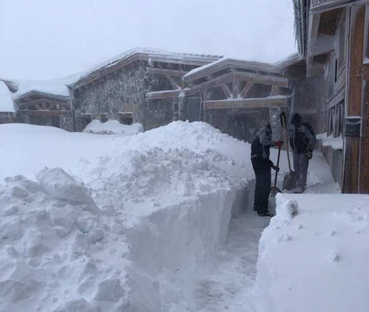
 Trying to clear up after big snowfalls in the Austrian Vorarlberg – 11 December 2018 – Photo: diedamskopf.at
Wednesday looks like being quite a decent weather day for most, though there will still be some cloud and the odd flurry around in the extreme eastern Austrian Alps. A new set of weather fronts will also approach the south-western Alps, which may bring a few flurries to the southern French Alps later in the day.
Looking at the Alps as a whole, snow conditions are pretty good for mid-December, and excellent in some areas. The main caveat right now is that while it many snowy in the lower resorts of the northern Alps, there was no base to speak of before this latest storm below 2000m or so, which is an extra hazard for anyone thinking of going off piste.
Updated: 11.40am Monday 10 December 2018 – Lots of new snow across the northern Alps!
We promised snow, and it has duly arrived! Significant quantities have fallen across the northern Alps (in resorts such as Tignes, Val Thorens, Verbier, Mürren, Laax, Davos and Lech), with 40-70cm of new snow above 2000m in the last 48 hours, and it is still snowing today.
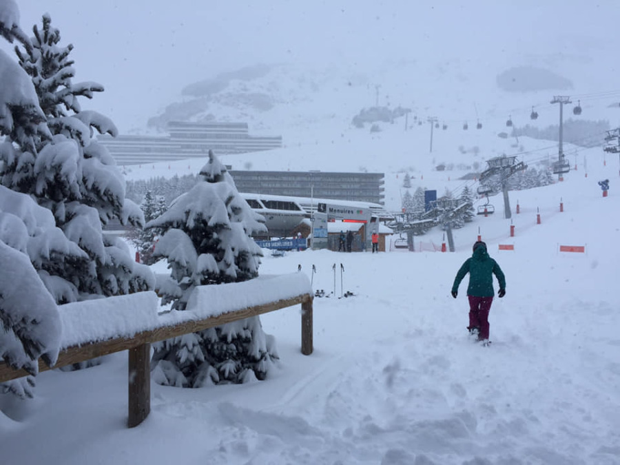 Lots of new snow in the 3 Valleys. This is Les Menuires – 10 December 2018 – Photo : maddogski.com
Some resorts close to the Italian border, such as Zermatt and Cervinia have also seen significant new snow but, on the whole, the southern Alps have missed the heaviest stuff this time around.
Snow showers will gradually die away from the northern French Alps today, but will continue all day across much of Switzerland and Austria (away from the far south). Indeed, it will probably still be snowing across some north-eastern parts of the Alps tomorrow morning.
 50cm of new snow in Lech, with plenty more forecast today – 10 December 2018 – Photo: lech.com
However, the sun will return tomorrow across the majority of the Alps, which will make for an incredible day on the mountain in resorts such as Val d’Isère, Tignes, Val Thorens, Zermatt and Cervinia, to name just a few.
Note that the risk of avalanche will be high, and that most resorts in the northern half of the Alps had little or no base below about 2000m before this latest storm. In short, treat any off-piste expedition with extreme caution and always take a guide, unless you know exactly what you are doing.
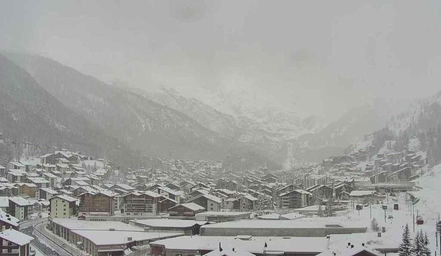 Significant snow down to resort level in Zermatt now – 10 December 2018 – Photo: zermatt.ch
Updated: 1.50pm Saturday 8 December 2018 - Winter is back!
As expected, a cold front crossed the Alps last night delivering a light to moderate covering of new snow (typically 10-20cm at 2000m) to many northern and western parts of the Alps (e.g. Tignes, Val Thorens, Flaine, Avoriaz, Verbier, Mürren, Engelberg, Laax and Lech). Generally speaking, the southern and eastern Alps saw less precipitation, with some places staying dry.
 Lots of new snow up top in La Rosière with plenty more on its way – 8 December 2018 – Photo: larosiere.net
There is still a scattering of showers in these same north-western regions today, which will tend to become heavier and more persistent again later in the day and overnight, with a rain/snow limit between 1000m and 1500m.
Sunday will see further showers or longer spells of precipitation with a rain/snow limit of around 1000-1300m, dropping to under 1000m later in the day. Once again the heaviest snow will be in the north-western Alps (roughly north-west of a line between Grenoble and Innsbruck).
Some significant snow will also get into the southern Alps, especially close to the Swiss-Italian border (e.g. Zermatt, Cervinia, Courmayeur) but, on the whole, any precipitation in the southern Alps will be lighter and patchier.
 Improving snow conditions in Lech – 8 December 2018 – Photo: lech.at
On Monday, the winds will switch more into the north which will favour the northern Swiss and Austrian Alps in terms of snow (e.g. Wengen, Mürren, Engelberg, Klosters, Lech, St Anton, Kitzbühel, Schladming). It will also turn colder with any snow increasingly falling into the lowest valleys.
We are still expecting snowfall totals from this storm cycle to be between 40cm and 70cm above 1800m in many northern parts of the Alps, with 1m or more in places.
The weather will temporarily improve mid-week before further snow arrives from the west on Thursday.
Updated: 12.30pm Friday 7 December 2018 - Last very mild day before winter returns with a vengeance…
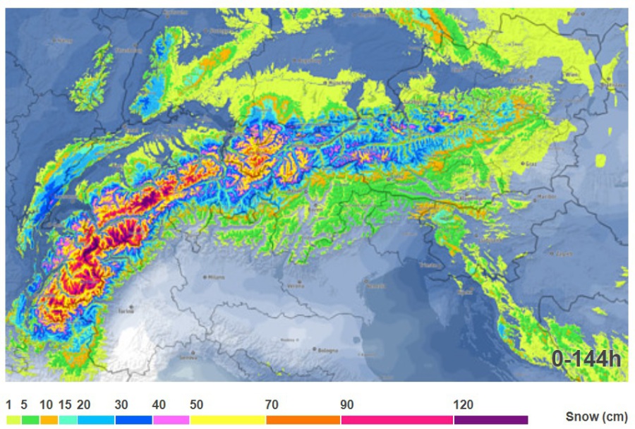
We have been talking up the weekend storms for some time now, and while the northern half of the Alps are still in for some big snowfalls between now and Monday, what has changed slightly is where is going to see the heaviest snow.
 Five day accumulated snowfall forecast for the Alps, with the lighter purples, then whites, being the areas seeing the greatest accumulations of snow – Image: meteoexploration.com, 7 December 2018
When we refer to the northern Alps, we very roughly mean the French Alps north of Les 2 Alpes/Alpe d’Huez, the Swiss Alps (away from Ticino and the southern Engadin) and the Austrian Alps (away from Carinthia and Osttirol).
Over the last 48 hours or so we have seen a (slight) downgrade in the overall snowfall quantities forecast in the northern French Alps (e.g. 3 Valleys, Grand Massif, Portes du Soleil), with the very heaviest snow now reserved for the Swiss Alps (particularly the Bernese Oberland and the northern Valais) and the Austrian Arlberg.
The first front to come through in this impending storm cycle will be a cold one, which will arrive in the French and western Swiss Alps this evening, pushing eastwards to reach the Austrian Alps later in the night. The rain/snow limit will start quite high (1500-1800m) but will drop to between 800m and 1000m later.
Above 1800m this first front will typically deliver 10-15cm of new snow by tomorrow morning in resorts such as Courchevel, Flaine Avoriaz, Verbier, Wengen, Davos and St Anton, and there may also be a dusting as low as 800-1000m in places. The southern Alps will see less precipitation, with some places remaining dry.
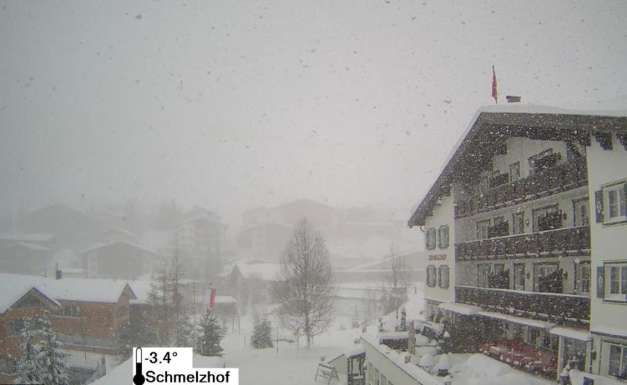
 Lots of snow needed in Lech, but it’s going to come big time over the next few days – 7 December 2018 – Photo: lech.com
Saturday will see further precipitation across the northern and especially north-western Alps. However, with the injection of some milder air, the rain/snow limit will rise from about 800m to 1100-1400m, even to 1600m in some areas exposed to the wind.
Then on Sunday a cold front will send the temperature tumbling again, followed by further fronts later in the day and on Sunday night that will drag even colder air across the Alps. Sunday will see lots more precipitation across the northern Alps with the rain limit starting at around 1000-1300m, but tending to drop later in the day, and especially overnight.
Monday will be very cold with snow showers packing into the northern Alps. These will be heaviest in the Swiss Alps (e.g. Mürren, Engelberg, Laax) and Austria (e.g. St Anton, Lech, Saalbach) with a rain/snow limit descending into the valley bottoms. The north-western Alps (e.g. Portes du Soleil, Villars) will also see a few snow showers, but these won’t be as heavy as further east.
Between now and Tuesday morning we can expect as much as 70-120cm of new snow above 1800m in some favoured parts of the northern Alps, such as Lech-Zürs. More typically we may see 40-70cm in resorts as diverse as Tignes, Avoriaz, Verbier, Wengen, Davos and Kitzbühel.
Some resorts close to or just south of the main Alpine ridge such as Zermatt, Cervinia and Courmayeur should also do quite well but, generally speaking, the southern Alps will see less snow with the extreme southern Alps (e.g. Isola 2000) seeing next to nothing.
There will be a bit of an improvement in the weather during the middle of next week, but further snow is expected in many areas towards the end of the week. Watch this space…
Updated: 8.45am Thursday 6 December 2018 – Lots of snow for the northern half of the Alps over the next few days
It’s a mild but damp morning across much of the northern Alps with bits and pieces of rain/snow here and there, and some heavier precipitation, currently across the northern French Alps (e.g. Portes du Soleil, Chamonix). The rain/snow limit is currently around 1500-1700m, but will tend to rise a little as the day progresses. The further south you are in the Alps today, the better your chances are of staying dry, though there is still quite a lot of cloud around in places.
 Snowing in Avoriaz this morning, though it is falling as rain below 1600m or so – 6 December 2018 – Photo: avoriaz.com
Friday will be a reasonable weather day for most of the Alps but the next set of fronts will reach the north-west later, spreading east across the rest of the (mostly northern) Alps on Friday night. The rain/snow limit may start quite high but will quickly drop to around 1000m on Friday night, maybe lower still on Saturday morning.
Saturday will see plenty of showers across the northern half of the Alps, especially in the north-west, with a rain/snow limit of between 700m and 1200m. By the north-western Alps we roughly mean the northern French Alps north of Grenoble, the Swiss Alps (away from Ticino and the southern Engadin), and the Austrian Vorarlberg and western Tirol.
It will remain very unsettled on Sunday with most of the precipitation again in the northern half of the Alps. The rain/snow limit will rise temporarily to between 1200m and 1800m before falling back towards 800-1000m again later in the day.
Monday will be much colder with snow showers to low levels across the northern Alps, this time favouring the northern Swiss and Austrian Alps.
 Raining in Lech this morning, though it’s falling as snow above 1600m or so! – 6 December 2018 – Photo: lech.com
So over the next few days there will clearly be plenty of new snow across the northern half of the Alps, which adds to the significant quantities that have already fallen at altitude (mostly above 2000-2200m) this week.
The difference this time though is that, even though freezing levels will yo-yo somewhat between now and Sunday, the trend is for it to get colder, which will allow significant snow to settle to increasingly low altitudes.
Indeed by Monday there could be a little snow right into the northern lowlands, especially close to the foothills of the northern Swiss and northern Austrian Alps.
Updated: 10.50am Wednesday 5 December 2018 – Winter is coming!
Get ready everyone - three more days of mild weather and then bang, winter will return with a vengeance. This time most of the snow will fall in the northern half of the Alps and not just in the mountains, as by Monday it will fall right down into the lowlands too!
 UKMO pressure chart for Monday 10 December 2018 showing a cold northerly airflow that will deliver lots of snow showers to the northern Alps – Image: meteociel.fr, 5 December 2018
In terms of today, most places will start dry with the best of any sunshine in the western and south-western Alps. By contrast, there is quite a lot of cloud floating around in the eastern Alps, especially in Austria. This evening and overnight a warm front will bring some rain (and a little snow above 2000m) to many northern parts of the Alps, lingering for a while in the eastern Swiss and Austrian Alps on Thursday, by which time the rain/snow limit will have lowered a fraction to between 1500m and 1800m.
Friday will then see plenty of fine and very mild weather before the weather deteriorates again in the western Alps later in the day. That night an active cold front will move across the Alps from the west, introducing a real change in the weather, with a rain/snow limit initially at around 1600-1800m, dropping to 1000m or lower by Saturday morning.
During the course of the weekend we will then see further weather fronts moving in from the west and north-west, with the rain/snow limit somewhere between 800m and 1300m. Later on Sunday, and into the first part of next week, the wind will swing more into the north and eventually even the north-east, introducing increasingly cold air and forcing the snow down into even the lowest valleys (at least across the northern Alps).
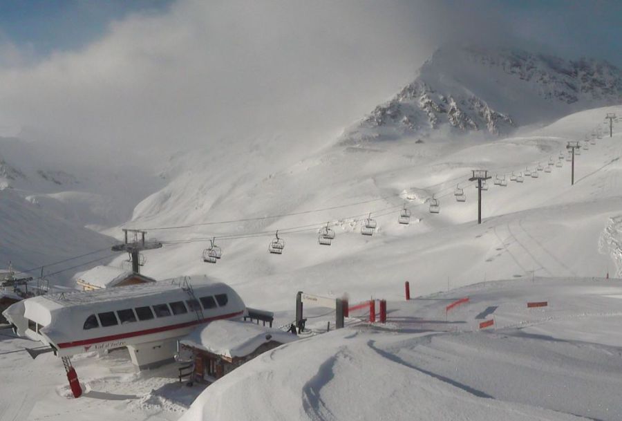
 Lots of snow already at altitude in Tignes! This was taken on Monday on the glacier above Tignes – 3 December 2018 – Photo: Restaurant Panoramique
As we have already mentioned, in terms of snow this upcoming period of wintry weather will most favour the northern half of the Alps, i.e. the French Alps roughly north of Les 2 Alpes, most of the Swiss Alps (excluding Ticino) and much of Austria (excluding Carinthia and the Osttirol).
By the end of Monday, we can expect 50-100cm of new snow above 2000m (with even more in places) in areas such as the 3 Valleys, Chamonix, Flaine, the Portes du Soleil, Zermatt, Verbier, Wengen/Mürren, Laax, Engelberg, Davos/Klosters and St Anton/Lech to name just a few. As mentioned earlier, there will also be a few centimetres of snow right down into the lowlands early next week.
During this period some snow will get through to parts of the southern Alps, especially the north-west of Aosta (e.g. Courmayeur, La Thuile, Cervinia), but on the whole the southern Alps will see much less snow this time around.
So if you are planning to be skiing this weekend - watch out! There will be some pretty wild weather around and it may be a little too early to benefit from the upcoming storms. The best conditions for skiing will probably be in the far southern Alps, from Isola 2000 in France through to the Dolomites in Italy.
But if you are in the Alps next week, especially later next week when the weather should improve, you could be in for a real treat with lots of powder across the northern half of the Alps.
Updated: 9.30am Tuesday 4 December 2018 - All eyes towards a return to winter this weekend…
There has been a lot of rain across the north-western Alps in the last couple of days. This has fallen as snow higher up, mostly above 2300m, but a little snow has also descended to lower levels this morning – to around 1800m in the north-western Alps, and to 1400m further east.
 Bergfex chart showing 5 day cumulative snowfall prediction for the Alps from 4 December 2018 – Weather to ski – Today in the Alps, 4 December 2018
Today, showers will die away from the northern French Alps but continue for a while across the northern Swiss Alps (e.g. Jungfrau region, Engelberg, Laax) as well as the northern and western Austrian Alps (e.g. St Anton). The rain/snow limit will be situated between 1400m and 1600m. On the southern side of the Alps it will be mostly dry with plenty of sunshine (e.g. Isola 2000, Sestriere, Livigno).
Over the next couple of days it will turn milder again with the arrival of another warm front. This will bring further rain to some northern and western parts of the Alps tomorrow and on Thursday, though it will not be as heavy or as damaging as the rain we have seen over the last couple of days.
Then, after a relatively benign weather day on Friday, it looks like “all hell will break loose” over the weekend, with the arrival of some active storms accompanied by a significant drop in temperature.
This is positive though as it means that there will significant and widespread snow across the Alps between Saturday and Monday. The heaviest snow will be in the northern French Alps (roughly from Les 2 Alpes northwards), much of Switzerland away from the far south (i.e. not in Ticino) and the western Austrian Alps.
 Lots of snow at altitude in Val d’Isère. This is close to the Col d’Iseran in the Le Fornet sector – 4 December 2018 – Photo: valdisere.com
These areas (including resorts such as Val d’Isère/Tignes, 3 Valleys, Chamonix, Verbier, Zermatt, Jungfrau Region, Engelberg, Laax, Davos, St Anton and Lech) could see 50-100cm of new snow above 1800m by early next week, by which time it should also be snowing right down into the lowlands.
As a rule, the southern Alps won’t get as much snow this time around. Some snow will get across the north-western Italian border into the likes of Cervinia and Courmayeur, but the south-eastern Alps (e.g. Dolomites) will probably miss most of the action.
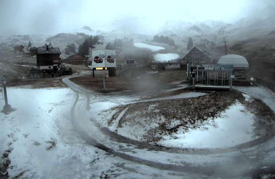 A bit of a mess in Champéry following two days of rain in the Portes du Soleil. Winter will return this weekend though – Photo: champery.ch, 4 December 2018
So, for those areas worried about the damage cause by the recent mild and in places very wet weather, there is plenty to be optimistic about, as this time next week it will all look very different.
The storms predicted for this weekend will also redress some of the imbalance we have seen so far this season between the southern and the northern Alps. Stay tuned for updates…
Updated: 9.30am Monday 3 December 2018 - Unsettled and very mild but a return to winter next weekend…
The Alps are under the influence of a strong but very mild westerly airflow which is delivering some high-altitude snow but also a lot of rain, particularly to the north-western Alps.
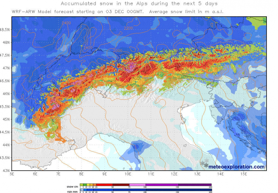 Predicted snowfall accumulations for the Alps over the next 5 days with the heaviest precipitation forecast across the northern French, Swiss and western Austrian Alps – Image: meteoexploration.com, 3 December 2018
Last weekend’s weather was very mixed, with a glorious day for most on Saturday when a lot of resorts opened for the first time this season. It was all change on Sunday, however, when heavy rain and snow fell across much of the northern western Alps, slowly spreading a bit further east. Initially the snow fell to quite low levels in some of the internal sheltered valleys but later rose to 2000m or higher across the board.
Today will see further bits and pieces of rain, mostly in the north-western Alps, turning heavier again this evening. The rain/snow limit will be between 2000m and 2500m, perhaps lowering a bit tonight. By the “north-western Alps” we roughly mean the French Alps north of Grenoble, most of the Swiss Alps (excluding Ticino and the southern Engadin) and the west of Austria (Vorarlberg, western Tirol).
It doesn’t mean that other parts of the Alps won’t see some precipitation, but it is the north-western Alps that will see the heaviest rain or snow.
It will continue to be mild and unsettled for most of the week, but with any precipitation generally becoming more intermittent and less intense. Then next weekend we are very confident that it will turn much colder from the north-west with some significant snow to much lower levels. Watch this space…
In the meantime, the current mild and damp weather is not ideal for snow conditions, especially in the north and west where most of any low-lying snow has been washed away. However, there is a lot of new snow above 2400m in the likes of Tignes, Chamonix, Mürren, Engelberg and St Anton.
On average, the most consistently good weather will be in the southern Alps, in resorts such as Isola 2000 in France or Kronplatz in the Dolomites.
 Better weather on the southern side of the Alps today. This is Kronplatz in the Dolomites – 3 December 2018 – Photo: kronplatz.com
Updated: 12.30pm Saturday 1 December 2018 - Fabulous day to be in the Alps but make the most of it!
The sun is out, there is some fresh snow around and it’s a wonderful day to be skiing in the Alps – probably the best day of the season so far, with lots of new openings to boot.
 It’s a magnificent day across many parts of the Alps. This is the Dristner mountain in the Austrian Zillertal – 1 December 2018 – Photo: foto-webcam.eu
But make the most of it! Tomorrow we are expecting a radical change in the weather with the arrival of some active Atlantic weather fronts. These will bring lots of precipitation to the north-western Alps on both Sunday and Monday, but also a rising rain/snow limit which will increase to between 2000m and 2500m.
By the north-western Alps, very roughly speaking, we mean the French Alps mostly north of Grenoble, most of the Swiss Alps away from Ticino and the southern Engadin, the west of Austria (i.e. the Vorarlberg and the western Tirol). Other parts of the Alps may also see some precipitation but it is the above areas that are likely to see the heaviest.
This unsettled and very mild theme will continue for most of the week before it turns potentially much more wintry next weekend. So expect a lot of snow at high altitude across the north-western Alps over the next week or so, but also plenty of rain lower down.
Back to today and among the bigger names to be opening for the first time this season are Alpe d’Huez and Les 2 Alpes in France, both of which saw 10-15 cm of new snow yesterday. Elsewhere in France you can also ski in Val d’Isère, Tignes, Val Thorens and Montgenèvre.
 And they’re off. Alpe d’Huez opens today (note Les 2 Alpes visible in the background) – 1 December 2018 – Photo: alpedhuez.com
In Switzerland the best bet remains Zermatt, not least because you can now ski in all three of its ski sectors. Another great option is nearby Saas-Fee you where you can now ski back to resort. Other partial openings in Switzerland include St Moritz, Davos, Andermatt, Mürren and Verbier.
In Austria, glaciers aside, Obergurgl and Ischgl are among the better bets though artificial snow is still heavily in the mix. Numerous other resorts are now also partially open (again with plenty of artificial help) including Saalbach, Lech, Nassfeld and Bad Gastein.
Italian ski resorst still have the best natural snow cover, especially the higher resorts of the central and western Italian Alps. Leading the way is Cervinia, as it has for several weeks now, where most of the area is now open and you can comfortably ski back to resort. Other good, albeit more limited, options include Passo Tonale, Val Senales and Madonna di Campiglio.