


ARCHIVE
Today in the Alps - February 2020
Read about current weather and snow conditions in the Alps
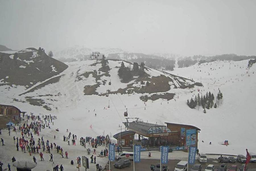
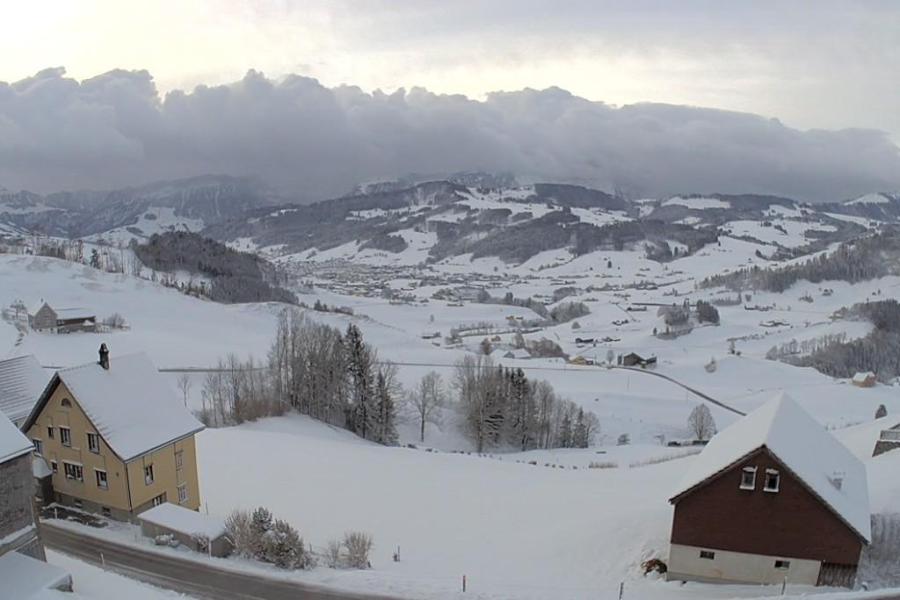
Update: 12pm Saturday 29 February 2020 - “Foehny” conditions in the Alps, with snow in the west later…
It was a bright start across most of the Alps this morning, however, cloud is thickening up in many areas, especially in the west where some rain/snow is expected later in the day.
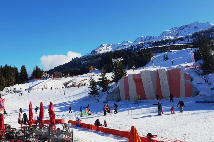
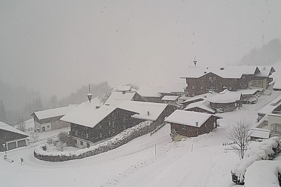
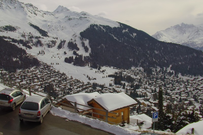 “Foehny” skies above Verbier this morning, ahead of a weather front that will bring some snow to the western Alps later today – 29 February 2020 – Photo: verbier.ch
The heaviest snow will fall this evening/overnight in the French Alps, with a rain/snow limit initially around 1600m falling to 1200m or lower later. Some French resorts could see in the region of 20-30cm above 1600m by tomorrow morning.
Other western parts of the Alps will also see some snow, both in the north and south, though any precipitation will be much lighter and patchier the further east you go (i.e. in Austria).
Another notable feature of today’s weather will be the wind, with the Foehn blowing strongly across the central and northern Alps in particular.
Updated: 10.40am Friday 28 February 2020 - The sun is back in the Alps today!
There are still some snow showers this morning across the north-eastern Alps (e.g. Salzburgland), but further west the sun is back, and this brighter weather will extend to all parts of the Alps as the day progresses.
 Lots of new snow in Val Thorens this morning – 28 February 2020 – Photo: facebook.com/valthorens.resort
A lot of snow has fallen across the north-western Alps over the last couple of days, with at least 70cm at altitude in some northern French and western Swiss resorts, and 20-60cm more generally across the northern half of the Alps. Much less has fallen across the southern half of the Alps.
Needless to say, snow conditions today will be great in the areas that have seen a lot of snow, however, the risk of avalanche will be high off-piste.
This unsettled weather will continue over the weekend and into next week, with the southern Alps set to see some widespread heavy snow for the first time in a while, both on Monday and later in the week.
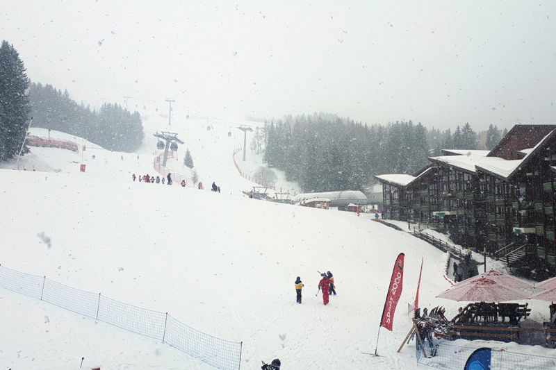
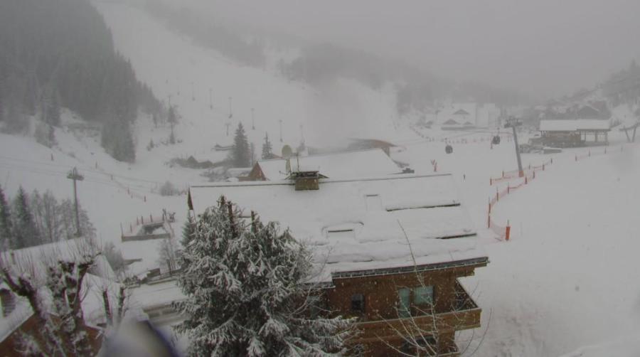
Updated: 12.45pm Thursday 27 February 2020 - New storm hits the Alps!
Another Atlantic storm is rolling from west to east across the Alps today, bringing further significant snow, especially (again) in the north-west. The wind also remains a factor meaning that further lift closures should be expected, particularly at altitude.
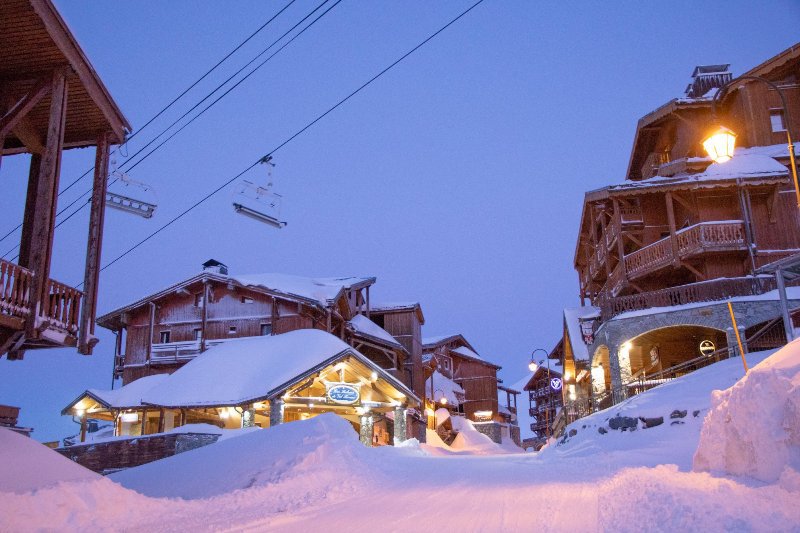
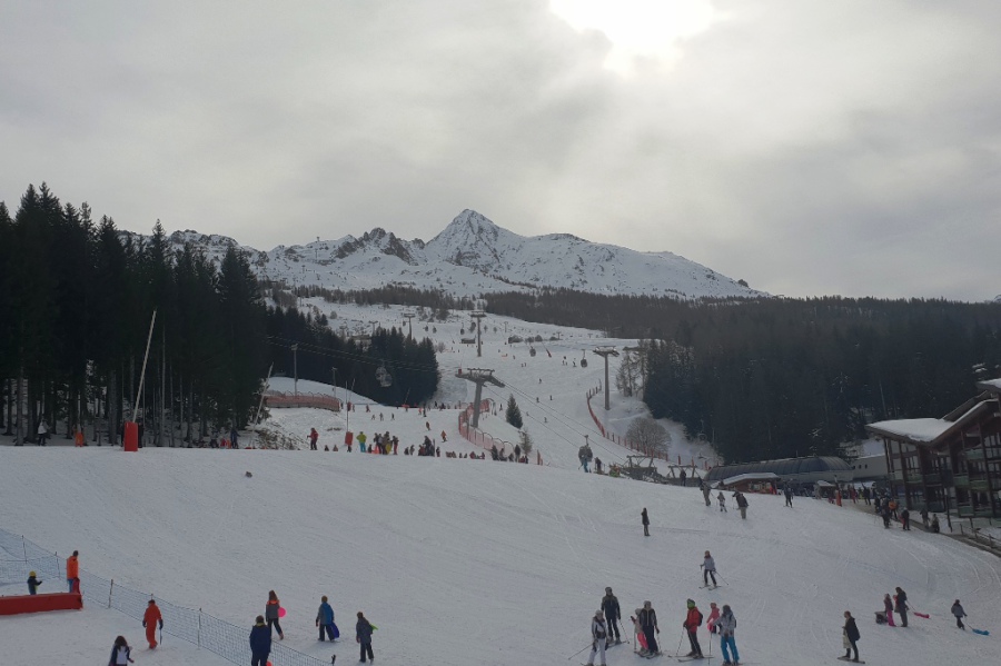
 Snowing again in the French Alps. This is Méribel – 27 February 2020 - Photo: meribel.net
By lunchtime today it was already snowing again across the northern two-thirds of the French Alps, the western Swiss Alps and the far north-west of Italy. This snow will transfer eastwards later today and tonight, always heaviest in the north-western Alps. With a few exceptions (notably close to the border areas) most of the southern Alps will again miss the heaviest of any precipitation.
The rain/snow limit will start very low today, remaining low in the more enclosed or internal valleys of the central Alps, but rising to between 1200-1500m in some exposed areas of the northern and western Alps, before falling again tonight.
Snowfall totals from this new storm are expected to be in the region of 25-40cm above 1500m in the north-western Alps (e.g. 3 Valleys, Paradiski, Chamonix, Villars, Mürren and Lech), but more generally 10-30cm across other northern parts of the Alps, and somewhere between 0cm and 20cm in the southern Alps - the 25cm mostly confined to the north-western Italian Alps (e.g. La Thuile, Courmayeur).
Bearing in mind that we also saw a lot of snow across the north-western Alps on Tuesday night and Wednesday, 72-hour snowfall totals in some parts of the northern French Alps (e.g. at altitude in the 3 Valleys, Paradiski, Chamonix, Grand Massif) will be in the order of 70-100cm by Friday.
Friday itself will see some early snow across the north-eastern Alps (mostly in Austria) before the weather becomes fine and relatively mild in all areas. Further weather fronts will then affect the Alps again this weekend, bringing some snow (and low-level rain).
Updated: 9.15am Wednesday 26 February 2020 - Winter returns to the Alps!
Winter has returned to the Alps, with lots of snow due in the north and west over the next couple of days, but also with some very strong winds at times.
 Heavy snow in the northern French Alps this morning. This is Les Saisies – 26 February 2020 – Photo: lessaisies.com
Today there are frequent snow showers to very low levels across the northern half of the Alps, with the heaviest snow in the northern French Alps (e.g. Avoriaz, Flaine, 3 Valleys, Paradiski) where 25-40cm of new snow is likely today alone.
Except for some sheltered southern valleys, most of Switzerland and Austria will also see some significant snow today, with snowfall totals in the order of 10-40cm. The southern French and Italian Alps will see less snow, although there will still be some useful falls in places (e.g. Courmayeur, La Thuile).
Another major factor today is the wind, which will be very strong at altitude leading to multiple lift closures. Any off-piste activity should obviously be treated with extreme caution, especially (but not exclusively) in the snowier areas of the northern and western Alps.
A new storm will roll into the Alps on Thursday bringing further heavy snow across the western and northern Alps in particular. This time the rain/snow limit will start very low but will rise to between 1000m and 1500m in places late in the day and overnight. However, many enclosed or internal Alpine valleys (e.g. the Swiss Valais) will see snow continuing to low levels well into Thursday night. The wind will then become very strong again later on Thursday, gusting to hurricane force at altitude.
The weather will improve for a time on Friday, by which point there will be snowfall totals in some northern French and western Swiss resorts in the region of 70-110cm, at least at altitude.
Looking a bit further ahead, the weather in the Alps will remain changeable with further snow for many areas late in the weekend and into next week.
Updated: 2pm Tuesday 25 February 2020 - Plenty of snow in the Alpine forecast!
The weather in the Alps has turned unsettled again, with the first of several weather fronts already affecting the western Alps this Monday afternoon.
 Bad weather moving into the western Alps this afternoon. This is Chamrousse near Grenoble – 25 February 2020 - Photo: chamrousse.com
This weather front will move east to reach most part of the Alps later today or tonight, but the heaviest precipitation will always be in the northern half of the Alps and especially in the north-west.
The southern Alps will see bits and pieces of precipitation, especially close to the border areas, but will generally be less affected. The rain/snow limit will start at around 1200-1600m but will fall rapidly to between 400m and 800m overnight.
Wednesday will be a cold and windy day, with frequent heavy snow showers to low levels across the northern half of the Alps, again heaviest in the north-west.
Thursday will see the arrival of a new Atlantic storm, with further heavy snow in the north-western Alps. This time the main front will be a warm one though, meaning that the rain/snow level will start low but could rise to 1200-1500m in some exposed places on Thursday night.
By Friday some north-western parts of the Alps, especially the northern French Alps (e.g. Paradiski, 3 Valleys, Grand Massif, Chamonix valley, Portes du Soleil), could see snowfall totals in the region of 60-100cm above 1800m.
However, the northern half of the Alps will more generally see between 30cm and 60cm of new snow above 1800m, while the southern Alps will see much less, with no more than a dusting in some places.
Updated: 10am Monday 24 February 2020 - Big snowfalls expected across parts of the Alps later this week…
The weather in the Alps will change significantly this week - not before time, given that we have just seen another weekend of record breaking temperatures, with 14.6°C yesterday in Zermatt, and 26°C in Aosta (yes, really) and rain showers to 2500m in parts of Austria.
 Sunny and warm again today in Alpe d’Huez, but lots of snow is expected later in the week – 24 February 2020 – Photo: alpedhuez.net
There are still some showers across Austria today, but with huge variations in the rain/snow limit, which is still close to 2000m in the far west but closer to 600m in the eastern Austrian Alps. Elsewhere in the Alps it is mostly dry and very mild, with increasing amounts of sunshine the further west and south you are.
As for the weather in the Alps for the rest of the week, Tuesday will see the first signs of a major pattern change, with active weather fronts crossing from west to east late in the day and into Wednesday. The rain/snow limit will start at around 1300-1600m but will then fall to 500m or so across the northern and western Alps on Wednesday.
After a temporary lull early on Thursday, another active storm will reach the west later in the day. This time the rain/snow limit will start low but will rise towards 1500m everywhere overnight. It will remain very unsettled towards next weekend, with further active storms approaching the Alps from the west or north-west. It will also turn colder again with snow returning to the valley bottoms.
Throughout this week the heaviest precipitation will fall in the northern and western Alps, with a metre or more of fresh snow possible above 1800m by the weekend in the northern French Alps (e.g. 3 Valleys, Paradiski). The further east and (especially) south you are, the less significant any snowfall will be, with some southern parts of the Alps staying largely dry.
Snow conditions in the Alps remain very mixed right now. There is still generally lots of snow at altitude, despite freezing levels having been above 3000m at times over the weekend. The exceptionally mild weather is taking its toll lower down, though, with patchy snow cover in places and highly variable snow quality.
The overall snow situation should improve over the next 10 days, but it may already be too late for some very low ski areas. Once a base is gone, the strengthening sun at this time of year makes it very difficult to rebuild.
Updated: 9am Friday 21 February 2020 - Mostly fine weather in the Alps…
Weathertoski is currently in Les Arcs where, after a little cloud at first, we are expecting another sunny day with freezing levels rising to 2500m or so.
 Lots of good skiing still at altitude in the French Alps. This is Les Arcs – 21 February 2020 – Photo: weathertoski.co.uk
Elsewhere in the Alps, a very weak cold front is bringing more in the way of cloud to the north-east (i.e. Austria), with even a few flurries to low levels here and there. These will disappear during the day though, with most parts of the Alps enjoying plenty of sunshine and pleasant, but not excessively warm, temperatures (mildest in the west).
After a mostly fine and very mild weekend, the weather will turn more unsettled again next week with the increasing prospect of significant snow, especially towards the middle of next week.
Snow conditions in the Alps remain a bit mixed, generally with plenty of snow at altitude but much patchier cover low down. Here in Les Arcs there is 3m or so up top with excellent snow quality above about 2200m or so, but with a few icier areas lower down.
In the lower resorts of the Alps, especially in the north-west (e.g. Morzine, Megève, Gstaad and Adelboden), much more snow is needed, but they may get it later next week!
With thanks to Les Arcs, ESF Arc 1800 and Ski Set Tournavelles.
Updated: 9am Wednesday 19 February 2020 - Snow for the northern and north-western Alps…
Weathertoski is currently in Les Arcs where it is snowing this morning with a temperature of about -3°C. We are expecting about 10cm of snow today here in the Tarentaise, with a rain/snow limit starting at around 700m but rising to 1100m later.
 Snowing moderately in Les Arcs this morning – 19 February 2020 – Photo: weathertoski.co.uk
Today’s snow is affecting the whole of the northern Alps to various degrees, though the day will start dry in the northern and north-eastern Alps. Snowfall totals above 1500m will be in the range of 5-15cm, with up to 25cm possible in places, such as the Austrian Arlberg for example. With one or two exceptions, the southern Alps will again see little if any snow.
The weather in the Alps will brighten up again on Thursday which promises to be the best skiing day of the week, especially in areas with fresh snow, although the weather will start to turn milder again with freezing levels rising to above 2000m.
Thursday night will see a new weather front affect some northern parts of the Alps, bringing a little snow to 1000m or lower here and there, especially in the northern Swiss and Austrian Alps. This should slowly ease on Friday though, leaving many areas with a fine day.
Snow conditions in the Alps are a bit mixed right now - still generally good at altitude but with more variable snow quality lower down, thanks to fluctuating temperatures and some rain. Here in Les Arcs for example the snow quality was very good yesterday above about 2200m but a bit icy lower down.
With thanks to Les Arcs, ESF Arc 1800 and Ski Set Tournavelles.
Updated: 9am Tuesday 18 February 2020 - Colder but brighter in the Alps today…
Weathertoski.co.uk is currently in Les Arcs, where it is much colder but brighter this morning. There is also some fresh snow on the ground, but not as much as hoped.
 Sunny but fresh in Les Arcs this morning, following a dusting of snow overnight – 18 February 2020 – Photo: weathertoski.co.uk
Yesterday afternoon it rained as high as 2100m before finally turning to snow here (at 1800m) at around 8pm, but not before the bulk of the storm had passed. This morning we have about 1-2cm of fresh snow at 1800m, and around 10cm at 2500m. The story is a similar one across the north-western Alps where it eventually snowed to as low as 1200m last night, with snowfall totals somewhere between a dusting and 15-20cm, the latter only above 2300m or so.
The impact of this storm was lessened the further east, and especially, south you were yesterday, with most of the southern Alps in fact staying completely dry.
Today there are some residual cloud banks here and there, but for much of the Alps it will be a fine day with plenty of sunshine.
Wednesday will see a new storm bring some light to moderate snowfalls across the northern half of the Alps again, this time to lower levels (700m or so) with 5-10cm likely above 1000m in resorts such as Avoriaz, Engelberg, Lech and Kaprun. The southern half of the Alps will again stay mostly dry.
Thursday will be a much better weather day across the Alps, perhaps even the best day to be skiing this week.
With thanks to Les Arcs, ESF Arc 1800 and Ski Set Tournavelles.
Updating: 10am Monday 17 February 2020 – Temperatures are turning cooler in the Alps…
Weathertoski.co.uk is currently in Les Arcs where we have another very mild morning, with temperatures at around +6°C at 9am. Although it is still quite bright, cloud is rapidly thickening from the west, heralding the arrival of some Atlantic weather fronts that will cross the Alps from west to east later today and tonight.
 Thickening cloud above Arc 1800, with rain expected to turn to snow later today. This is the new Folie Douce party venue just above resort – 17 February 2020 - Photo: lesarcs.com
Looking back at yesterday, it was an exceptionally mild day in the Alps - the mildest February day ever in several northern Alpine locations, with 18°C recorded in Adelboden (1350m)! It certainly felt spring-like here in Les Arcs but, despite the snow being humidified at most levels it was not actually slushy, meaning that there was still some perfectly good piste skiing on offer.
Today the first precipitation from the new storm will reach the northern and western French Alps during the middle of the day, spreading east to reach the eastern alps (i.e. Austria) tonight. The heaviest precipitation will fall across the north-western Alps - including the northern French Alps (e.g. Flaine, Avoriaz), the northern and western Swiss Alps (e.g. Villars, Mürren) and the far west of Austria (e.g Lech) – where there is the potential for 10-20cm of snow above 1800m by tomorrow morning.
The rain/snow limit will begin at around 1600-2100m but will drop to reach 1000-1400m everywhere overnight. The southern Alps (e.g. most of the Italian Alps) will see little if any snow.
The weather in the Alps will be noticeably cooler on Tuesday, but most places will be dry with some good sunny spells. On Wednesday a new set of weather fronts will then reach the Alps from the north-west, bringing further snow flurries, again mostly cross the northern half of the Alps but this time to lower levels. Thursday looks like being the best overall weather and skiing day in the Alps.
Snow conditions are a bit mixed for the middle of February, remaining generally quite good at altitude but with much more varied snow quality (and only patchy snow in some cases) lower down, where the exceptionally mild weather has taken its toll.
With thanks to Les Arcs, ESF Arc 1800 and Ski Set Tournavelles.
Updated: 9.20am Sunday 16 February 2020 - Unseasonably warm in the Alps!
Weathertoski.co.uk is currently in Les Arcs where it is dry, bright and exceptionally mild today, with maximum temperatures expected to reach around 10°C at 2000m, and freezing levels this afternoon to hit 3500m!
 Very mild and bright with some high cloud in Les Arcs today– 16 February 2020 - Photo: weathertoski.co.uk
Skies are not completely sunny as there is some high cloud circulating across the northern Alps, but it is possible that some February temperature records will be broken by the end of the day.
The weather may be unseasonably mild, but snow conditions will remain pretty good, especially on-piste, thanks to a combination of the relatively low humidity and the fact that the sun is still not ruinously strong at this time of year.
There will still generally be lots of grippy piste skiing available across the Alps today, although the snow will be a little soft, especially on lower slopes exposed to the sun.
As for the rest of the week, the Alps will be under the influence of a mobile westerly airflow, with occasional storms scheduled to arrive late on Monday, on Wednesday and on Friday, and some more settled interludes (especially on Tuesday and Thursday).
These storms are NOT expected to be particularly potent, but will be most active in the north-western Alps where we could see between 20cm and 50cm of new snow above 1600m by the end of the week. The southern and eastern Alps (e.g. Dolomites) will see the most sunshine and little, if any, snow.
The rain/snow limit this week will generally be between 800m and 1600m, although it will be a little higher to begin with during the first storm tomorrow afternoon.
As for snow conditions, these are generally good at altitude right across the Alps, but much more mixed lower down due to the ongoing mild weather. There is, for example, little or no natural snow below about 1300m in the north-western Alps (e.g. Morzine, Gstaad), which is unusual for mid-February.
With thanks to Les Arcs, ESF Arc 1800 and Ski Set Tournavelles.
Updated: 12.30pm Friday 14 February 2020 - Remaining changeable for half-term week…
The weather in the Alps remains in a changeable mood as we enter the busiest week of the season. Over the next week or so, all areas will see some sunshine though weather fronts will affect the Alps bringing some rain or snow from time to time, most notably in the northern Alps.
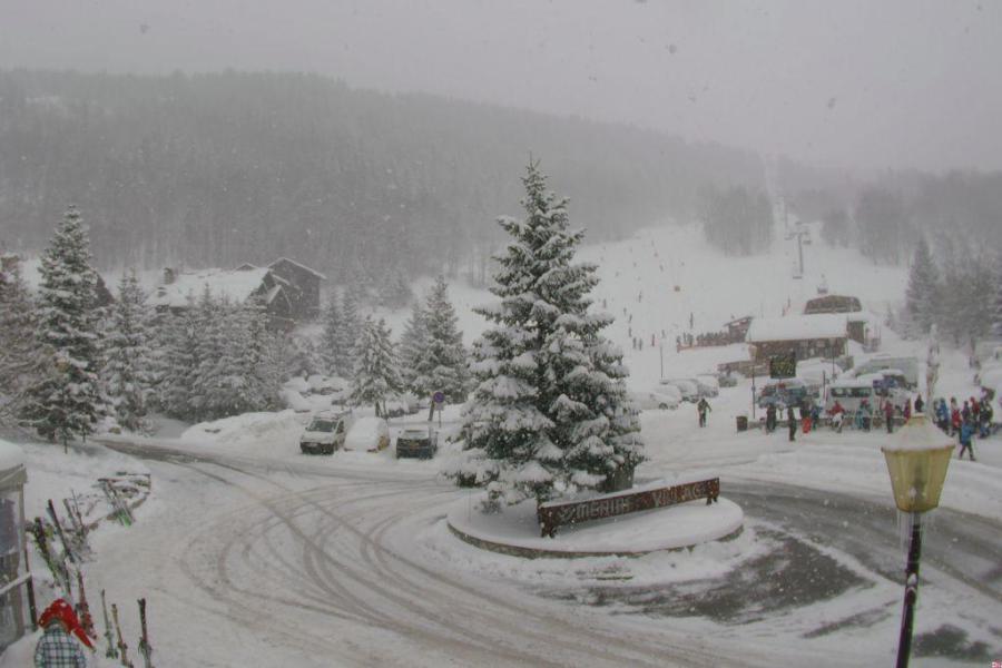
 Fresh snow and blue skies in Méribel today – 14 February 2020 – Photo: merinet.com
Today some flurries (700-1000m) remain across the north-eastern Alps, chiefly in Austria, the remnants of a storm that brought some 15-40cm of fresh snow at altitude yesterday and overnight across the north-western Alps – i.e. the northern French Alps (roughly north of Grenoble), much of Switzerland (with the exception of some parts of the far south), and the far west of Austria, especially the Arlberg area.
Note that while these areas have seen some useful new snow, any precipitation fell mostly as rain below about 1200m, meaning that resorts such as Morzine and Megève remain rather green at village level.
Temperatures will become very mild over the weekend, and even exceptionally mild on Sunday, when freezing levels will be well above 3000m in places. It will stay dry though, with plenty of sunshine and just some high cloud at times in the north.
Next week the weather will turn more unsettled again, although there will be some dry interludes, and even some sunny spells at times, especially in the southern Alps. However, weather fronts will arrive from the north-west from time to time, bringing some snow (but also some low level rain), especially across the northern half of the Alps.
Updated: 10am Thursday 13 February 2020 - New storm arriving in the Alps from the west…
Another Atlantic storm will bring further snow (and some rain) to western parts of the Alps today, before it moves further east overnight.
 A bright start to the day across western Austria. This is Mellau – 13 February 2020 – Photo: mellau.at
The heaviest snow will again fall across the north-western Alps, where resorts such as Avoriaz and Verbier could see between 20cm and 30cm above 1800m by tomorrow morning. The further south and east you are, the lighter and patchier any precipitation will become, with many south-eastern areas (e.g. Dolomites) staying largely dry. The rain/snow limit will start between 1500m and 1800m today but will fall towards 1000m tonight.
On Friday, some showers/flurries will linger across the eastern Alps (notably Austria) but most other areas will be dry with some sunshine. Saturday and Sunday will be mostly fine and very mild across the Alps, although cloud amounts will increase across the far north.
Early next week, the weather will then turn more unsettled from the north-west again, bringing further snow and some low-level rain in places, mostly in the north-western Alps. The second half of the busy half term week should see fine weather across the board.
Snow conditions in the Alps remain generally good at altitude, but a bit more mixed lower down, especially in the north-western Alps where there is very little natural snow below about 1200-1400m (e.g. Morzine, Megève, Gstaad).
Updated: 9.30am Wednesday 12 February 2020 - Relative reprieve in the Alpine weather…
Today we have a better overall weather day in the Alps, with some good spells of sunshine possible in places, especially in the southern and western Alps. However, the wind remains quite strong at altitude, and there is still some cloud around giving rise to some flurries across the north-eastern Alps (especially in Austria).
 A wintry looking scene this morning in the north-eastern Swiss Alps. This is Appenzell – 12 February 2020 – Photo: appenzell.ch
Tomorrow will also begin fine in many places, though the next storm will quickly reach the western Alps, bringing rain or snow again. This will spread to the French and Swiss Alps as the day progresses, before it heads into Austria overnight. Apart from some border areas in the far north-west, the Italian resorts will generally miss the heaviest of any precipitation.
The rain/snow limit in this new storm will start at around 1600m but will fall to 1000m or so later during both Thursday and Thursday night. Snowfall totals are likely to be in the region of 15-30cm above 1500m in the north-western Alps (e.g. 3 Valleys, Portes du Soleil, Verbier, Jungfrau region, Lech), with a bit more in some favoured areas.
Flurries will linger for a while across the eastern Alps on Friday, while most other parts of the Alps will enjoy fine weather with plenty of sunshine. Saturday will be an excellent weather day across most regions, with lots more sunshine and some very mild temperatures.
The next storm will then approach the north-western Alps on Sunday, heralding an unsettled start to the busy half term week, with new snow (and some low-level rain) likely, particularly across the northern and western Alps.
Snow conditions in the Alps are generally good right now, with plenty of snow (albeit often very windblown) at altitude. However, there is quite a bit discrepancy between high and low altitude areas, with the lack of natural snow below about 1300m in certain areas remaining a concern, especially in the north-western parts of the Alps (e.g. Morzine, Gstaad).
Updated: 9am Tuesday 11 February 2020 - Fresh snow for some northern and western parts of the Alps…
It’s another unsettled day across the Alps, with further snow (or rain) at times in the north and west. The wind also remains a factor, with lots of lift closures, especially at altitude.
 It’s snowing this morning in Méribel but the wind remains problematic at altitude – 11 February 2020 – Photo: merinet.com
Yesterday was especially wild, with wind gusts reaching well in excess of 100mph across many exposed parts of the Alps. The day started very mild, with rain to 2200m in the north-western Alps before colder air brought the snowline down to 1000-1400m last night.
Showers will continue today across the northern half of the Alps, with a rain/snow level generally between 700m and 1200m in the northern French and Swiss Alps, but 400m to 900m in the Austrian Alps.
Wednesday will see some residual showers or flurries across the eastern Austrian Alps, otherwise most other regions will be drier with some sunshine here and there. Thursday will then see the next storm approach the Alps from the north-west, bringing further snow but also some low level rain for the northern French, Swiss and western Austrian Alps later in the day.
As for snow conditions in the Alps, they generally remain good at altitude, where the wind has not made skiing impossible in places over the last day or two.
However, thanks to the relentlessly mild weather, the situation has become more complicated lower down. This is particularly true below about 1200m in the north-western Alps (e.g. Morzine) where there is little natural snow right now, which is unusual for the middle of February.
Updated: 11.20am Monday 10 February 2020 – Stormy conditions in the Alps!
The wind is the dominating factor in the weather in the Alps today, blowing at hurricane force across some northern parts, leading to multiple lift closures, and in some places even whole ski area closures.
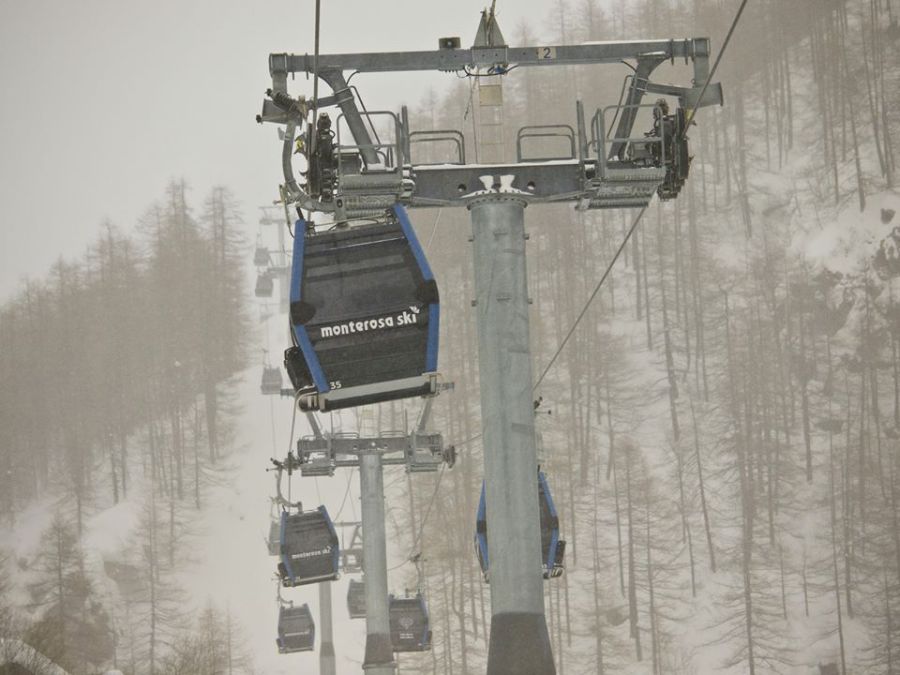 Wind is causing lots of problems in the Alps today. This is the Monte Rosa region - 10 February 2020 - Photo: facebook.com/MonteRosa
There are also plenty of showers around, mostly across the northern half of the Alps where snow is only falling above 1800-2200m but will lower somewhat later. Areas affected roughly include the French Alps north of Grenoble, much of the Swiss Alps (except the far south, including Ticino) and parts of the Austrian Alps (except Carinthia and Osttirol). The southern Alps are drier and brighter, but the wind is also a factor here today, especially at altitude.
Overnight and tomorrow, rain/snow will continue at times across the northern Alps but, as colder air digs in the rain/snow limit will descend towards 1000m or so, and a bit lower in places.
A ridge of high pressure will briefly bring better weather to most of the Alps on Wednesday, before a new storm arrives from the north-west late on Thursday, bringing further snow in places, heaviest in the north and west. This time the rain/snow limit will start at around 1200-1500m but will fall to under 1000m everywhere later.
Updated: 12pm Friday 7 February 2020 - A fabulous day to be skiing in the Alps…
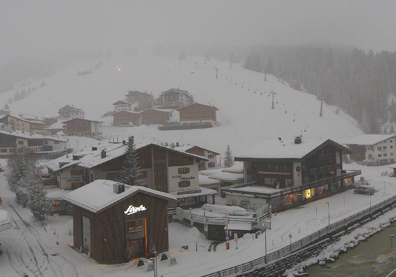
It’s gorgeous day across the Alps, with virtually wall-to-wall sunshine and mild, though not excessively warm, temperatures.
 Near perfect snow conditions right now in Ischgl – 7 February 2020 – Photo: ischgl.com
Snow conditions across the Alps are also generally excellent today, especially at altitude and in the northern half of the Alps (e.g. Avoriaz, Mürren, Klosters, Ischgl) where most of the fresh snow fell earlier in the week.
After a mostly fine start to the weekend, skies will become cloudier in the western Alps later on Saturday, and more so on Sunday, heralding the start of a new and active storm cycle next week.
Most of next week’s snow is likely to fall in the north-western Alps, especially in the northern French Alps (e.g. 3 Valleys, Paradiski) where some big accumulations are possible at altitude. It won’t be cold though, so there will be a risk of rain at times lower down.
Updated: 9.30am Wednesday 5 February 2020 - Still some snow for the eastern Alps today…
There are still some snow showers to very low levels across the eastern Alps this morning, notably to the east of Innsbruck in Austria, where they may see a further 10-20cm. Most other areas are dry, with the best of any sunshine the further south and west you are. Note that the wind remains a problem, even if it is not quite as strong as it was yesterday!
 New snow in the Austrian Salzburgland. This is the Gastein valley – 5 February 2020 – Photo: gastein.com
Over the past 24 hours, around 20-60cm of new snow has fallen above 1500m in the northern half of the Alps. The heaviest of the snow fell in the Austrian and eastern Swiss Alps, with 50cm or so in Lech and close to Klosters, for example.
However, yesterday was also exceptionally windy, leading to lots of lift closures, which continue to be in place at altitude today. Note that the risk of avalanche is very high in the northern Alps today, with off-piste excursions not recommended until things have settled down.
It has also been very windy in the southern Alps, although they have missed most of the snow this time around, having been protected by the “North Foehn.
The last of the snow flurries will move away from the Austrian Alps later today, after which all areas will enjoy several days of sunshine. The temperatures will also begin to rise but, thanks to low humidity, snow quality will generally remain excellent.
Next week we are expecting the weather in the Alps to turn stormy again, especially in the north and west, with heavy snow and high winds for many regions, and possibly some low altitude rain. Stay tuned…
Updated: 9.30am Tuesday 4 February 2020 - Winter is back, albeit temporarily…
The weather in the Alps is evolving at a furious pace. Yesterday there was still a lot of rain across the eastern Swiss and Austrian Alps with snow only above 2000-2400m, but today it is much colder with snow showers falling to increasingly low levels across the northern half of the Alps.
 Heavy snow in the Austrian Vorarlberg this morning. This is Lech – 4 February 2020 – Photo: lech.com
Areas affected in the north are the French Alps (roughly north of Grenoble), much of the Swiss Alps (with the exception of some parts of the south, like Ticino), much of the Austrian Alps (but with the exception of Carinthia and Osttirol). These areas will see plenty of snow showers today, heaviest in Switzerland and Austria where they will continue through the night and into tomorrow.
The rain/snow limit is this morning situated somewhere between 600m and 1000m but will drop towards 400-600 later today. By Wednesday morning we will see an additional 20-60cm above 1500m across a wide swathe of the northern Alps, with a bit more in some favoured parts of eastern Switzerland and western Austria.
Another key feature of today’s weather is the wind, blowing at storm force (or more) across many central and northern parts of the Alps, resulting in numerous lift closures. Overall the weather in the southern Alps will be better, with some glimpses of the sun possible here and there.
Updated: 9.30am Monday 3 February 2020 - Exceptionally mild but colder again tomorrow…
It has been a complicated weekend of weather across the Alps, with lots of rain in the north-west, lots of snow at high altitude (also mostly in the north-west) and unusually mild temperatures across the board.
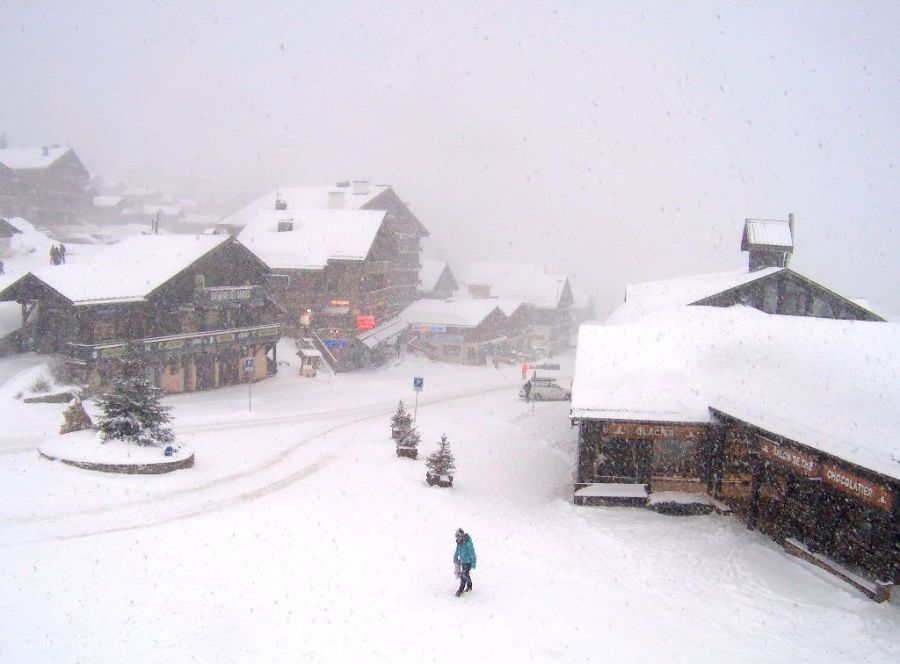
 The worst of the rain has now left the French Alps, with snow expected tomorrow. This is Méribel – 3 February 2020 – Photo: merinet.com
Areas in the north-west, where the heaviest precipitation was to be found on Sunday, were the French Alps, roughly north of Grenoble (e.g. 3 Valleys, Grand Massif, Mt Blanc area), the northern and western Swiss Alps (e.g. Verbier, Villars, Wengen) and the far north-western Italian Alps (e.g. Courmayeur, La Thuile).
The rain/snow limit here crept up to between 2200m and 2500m in most places, and even as high as 2700m in some areas close the foothills of the western French Alps.
Today the heaviest of the precipitation has shifted towards the north-eastern Alps (i.e. Austria), with a rain/snow limit somewhere between 2000m and 2300m.
Tomorrow a cold front will bring much colder Arctic air down from the north, producing snow showers to increasingly low levels (mostly in the northern Alps) as the day goes on.
Updated: 11.30am Sunday 2 February 2020 - “Rain, rain, go away!”
No two ways about it, it’s a shocking weather day across the north-western Alps! The big problem is the rain falling to increasingly high altitudes, notably across the northern French Alps, and northern and western Swiss Alps. It is also very windy, making skiing extremely unpleasant in these areas.
 Raining to all levels in the Portes du Soleil this afternoon – 2 February 2020 – Photo: châtel.com
The further south and east you are in the Alps today, the better the weather. The south-eastern Alps (e.g. Dolomites) will stay largely fine, with the possibility of some sunshine.
Today’s rain has been generated by an active warm front which is dragging in tropical air all the way from the Caribbean. Heavy rain is expected across the north-western Alps all day and all night, with a rain/snow limit rising to between 2200m and 2700m! This is set to affect the northern French Alps (3 Valleys, Chamonix, Portes du Soleil), and the northern and western Swiss Alps (e.g. Verbier, Gstaad, Wengen). There will be heavy snow at high altitudes, but there will also be very strong winds.
Some precipitation will also get through to the Austrian Alps, especially the west (e.g. St Anton), and into parts of Italy, especially the north-west (e.g. Courmayeur, Cervinia). The rain/snow limit will be a bit lower away from the north-western Alps but will still be in the region of 1700m to 2300m.