


ARCHIVE
Today in the Alps - December 2019
Read about current weather and snow conditions in the Alps
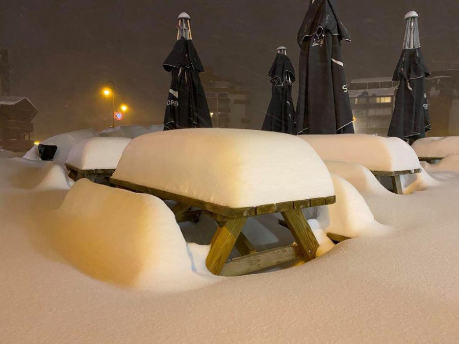
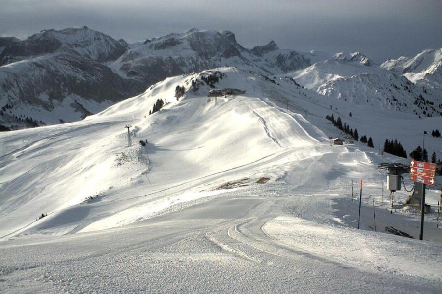
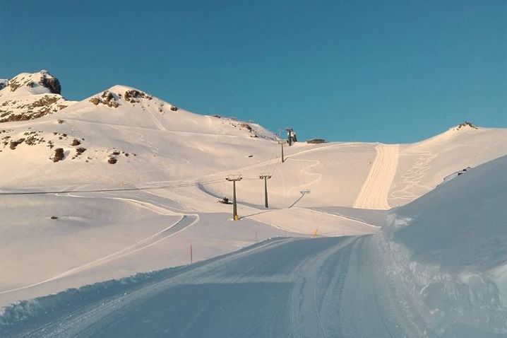
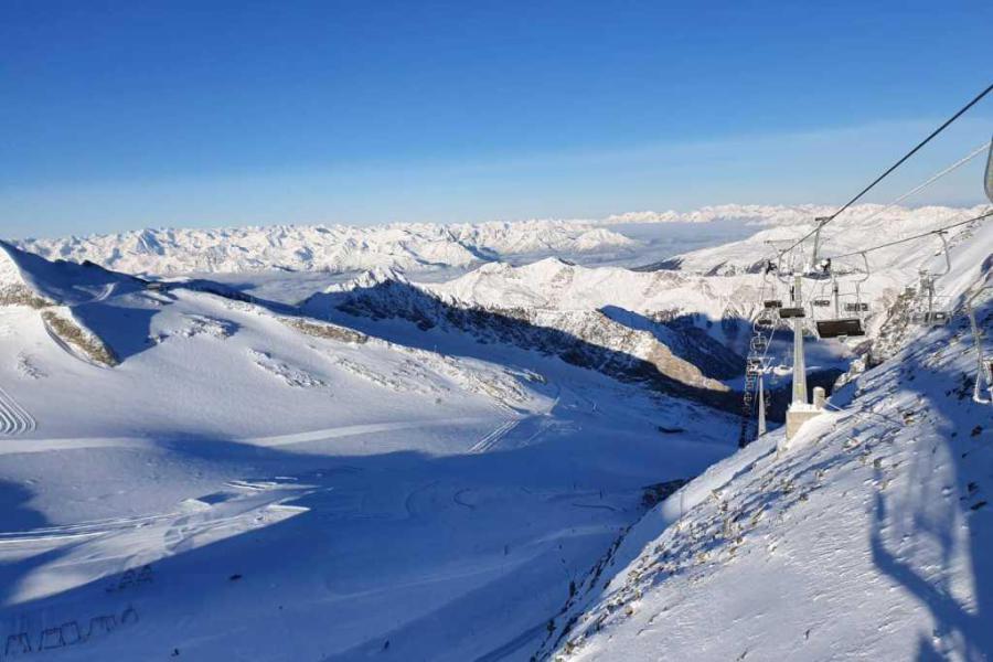
Updated: 12pm Sunday 29 December 2019 - Another glorious day in the Alps…
It’s another glorious day across the Alps with almost wall-to-wall sunshine and only a few patches of fog/low cloud, mostly close to the northern and western foothills.
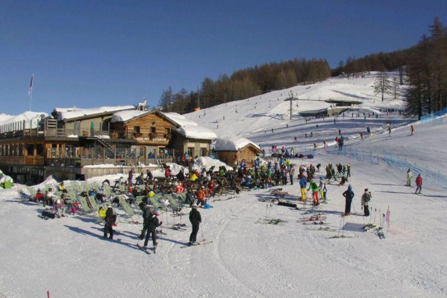 Another glorious day in the Alps. This is Bardonecchia – 29 December 2019 – Photo: bardonecchiaski.com
Temperatures will be relatively cold in the eastern Alps (i.e. Austria) and warmer in the western Alps (e.g. France) where afternoon freezing levels will reach 3000m. The weather will remain mostly fine across the Alps over the next few days, with cold nights and pleasantly mild afternoons, especially at altitude.
Snow conditions in the Alps remain excellent for late December in most areas. The only real weaknesses remain at very low altitude in the northern and north-western Alps (e.g. Morzine, Adelboden) but even here there is plenty of good piste skiing higher up.
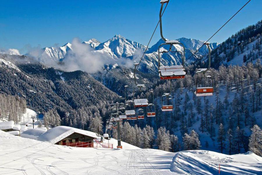
Updated: 2pm Saturday 28 December 2019 - Mostly sunny at altitude!
The eastern Austrian Alps have still had some cloud today, but otherwise there has been plenty of sunshine across most regions, at least at altitude. As is often the case at this time of year some valleys have unfortunately still been plagued by low cloud/fog.
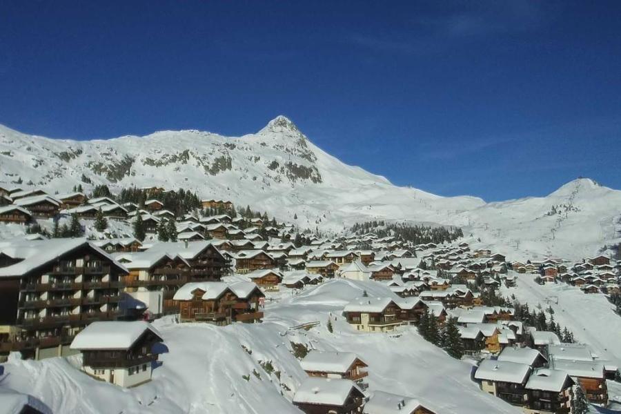 A lovely day in the Aletsch Arena. This is Bettmeralp – 28 December 2019 – Photo: bettmeralp.ch
The rest of December will see the weather in the Alps remaining settled, with more in the way of pleasant sunshine at altitude but also some nuisance value low cloud/fog in places.
As for snow conditions in the Alps, with one or two exceptions they are excellent for late December. The deepest snow is currently to be found in the western Alps where resorts such as Val Thorens and Flaine have around 2.5m of settled snow at altitude.
The only real weaknesses right now are at very low altitude close to the northern fringes of the Alps, where resorts such as Morzine and Adelboden, together with a few of the smaller resorts close to the German/Austrian border, have still got thin and/or patchy snow cover below 1200m or so.
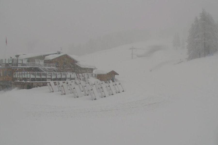
Updated: 11.30am Friday 27 December 2019 - More snow today then settling down…
More snow is falling across the Alps today, again mostly in the northern Alps – i.e. the French Alps roughly north of Grenoble, most of the Swiss Alps away from the far south and many parts of Austria, again away from the far south. By contrast, many parts of the Italian Alps close to the border areas are either dry or only seeing light and patchy snow.
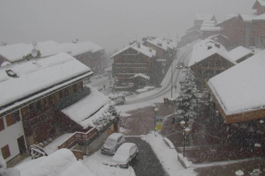 Snowing again in Méribel today but the sun should be back to tomorrow – 27 December 2019 – Photo: merinet.com
The last of the flurries will move away from the central/eastern Austrian Alps tomorrow. For the first time in quite a while, the Alps can then look forward to an extended period of fine and settled weather. At this time of year this means a lot of low cloud/fog in some of the valleys but lots of sunshine at altitude where it will feel quite mild.
Snow conditions in the Alps are generally very good for late December. While there hasn’t been a huge amount of snow in recent weeks in the south, resorts here already had an excellent base due to the big storms in November and earlier this month.
Snow depths are now very impressive at high altitude in the northern Alps, especially in the north-west where Val Thorens, for example, has 265cm. It is only the very low altitude areas (roughly below 1300m) in the north which still do not have a huge amount of snow, such as Morzine, but overall the picture is still very positive.
Updated: 10am Tuesday 24 December 2019 - Lots of snow for Christmas, especially at altitude!
A lot of snow has fallen across the northern and western Alps in the last few days, with over 1m above 2000m in some parts of the northern French Alps (e.g. Val d’Isère, La Rosière, Chamonix, Flaine) which has caused widespread problems and even temporarily cut off some communities (e.g. Le Fornet near Val d’Isère).
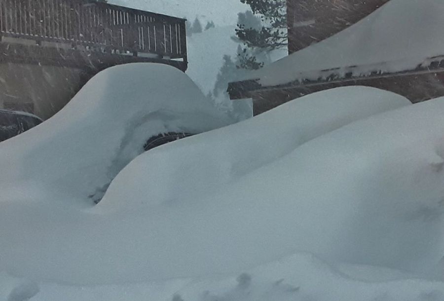 Huge snowfalls in Les Arcs. This was Arc 2000 yesterday, and there has been a lot more snow since! – 23 December 2019 - Photo: facebook.com/meteoalpes
There has also been significant snow in the last couple of days across many other parts of the Alps, including most of Switzerland and the west of Austria (e.g. St Anton). However, snowfall has recently been a bit more hit and miss across the southern Alps (i.e. Italy).
A warm front is delivering further heavy precipitation across the northern Alps today, with snow still falling to below 1000m in some enclosed valleys, though the rain/snow limit is already around 1500m across more exposed parts of the western Alps and could reach 1700-2000m later (e.g. Portes Du Soleil).
Christmas Day will be brighter in the western and southern Alps (i.e. French, western Swiss and most of the Italian Alps). However, snow showers will continue across the eastern Swiss and Austrian Alps, heavy at times with a rain/snow limit descending back towards or even below 1000m.
After a relatively fine day on Thursday, a new storm will bring snow to many parts of the Alps on Friday, especially in the north.
Updated: 2.40pm Monday 23 December 2019 - Huge snowfalls across the north-western Alps…
It’s been a very snowy couple of days in the north-western Alps, where between 40cm and 80cm of new snow has already fallen in the likes of Tignes, Val Thorens, Les Arcs, Flaine, Avoriaz and Verbier with plenty more still to come.
 Val Thorens early this morning – 23 December 2019 – Photo: facebook.com/ValThorens.resort
A combination of this new snow and strong winds has led to a lot of lift closures, as well as some disruption (due to avalanche risk) to road and rail routes in the northern French and western Swiss Alps in particular.
Many other parts of the Alps have also seen snow though it has generally been a bit lighter the further east you are. The rain/snow limit has fluctuated but is between 800 and 1200m in most places today.
It will stay very unsettled over the next couple of days with further showers, mostly across the northern half of the Alps with the heaviest precipitation gradually transferring further east into the eastern Swiss and Austrian Alps. The rain/snow limit will temporarily rise on Tuesday to between 1500m and 2000m before falling back towards 1000m on Wednesday.
The second half of the week will see the weather improve in the western Alps, though some snow showers will remain to relatively low levels in the north-eastern Alps (i.e. Austria).
Updated: 10.30am Friday 20 December 2019 - New storm hits the Alps!
A new active storm has hit the Alps today bringing heavy rain, heavy snow and strong winds to may areas, especially the south-western Alps.
 Heavy snow in the western Italian Alps this morning. This is Bardonecchia – 20 December 2019 – Photo: bardonecchiaski.com
Areas in the south-west particularly impacted include the southern French Alps roughly south of Grenoble (e.g. Serre Chevalier, Isola 2000), the central and western Italian Alps (e.g. Monte Rosa, Cervinia, Sestriere) and some parts of southern Switzerland (e.g. Saas-Fee, St Moritz).
These areas could see 30-50cm of new snow above 2000m by the early hours of Saturday morning, with a rain/snow limit initially between 1600m and 2000m, falling to between 1000m and 1300m later.
Elsewhere in the Alps, the northern French Alps (e.g. 3 Valleys, Grand Massif, Portes du Soleil), the rest of the Swiss Alps and the far west of Austria (Arlberg region) could see 5-20cm above 2000m by tomorrow morning but, on the whole, the further north-east you are the patchier and lighter any precipitation will be.
The wind will also be a factor today in many areas, with the Foehn still blowing strongly across the northern and especially north-eastern Alps ahead of the main cold front, which is crossing the region from west to east. Expect multiple lift closures in all regions, and not just Foehn-affected areas.
After something of a lull in the weather on Saturday, a new and very potent storm will affect the Alps on Sunday with the heaviest snow this time due in the northern French Alps (e.g. L’Espace Killy, 3 Valleys, Chamonix, Grand Massif, Portes du Soleil).
Updated: 12pm Thursday 19 December 2019 - New Foehn storm!
Today the Foehn is back, after a temporary lull, and steadily increasing in strength to become quite violent and potentially disruptive tonight.
 Foehny looking skies above Méribel this morning – 19 December 2019 – Photo: merinet.com
The Foehn means that the weather is mostly dry, very mild and increasingly windy across the northern half of the Alps, with some particularly violent gusts (in excess of 150km in places) due tonight. As has been the case for much of the week, the southern Alps will be cloudier with some precipitation in places, heaviest close to the Italian/Swiss border and between Cervinia and the Italian lakes, with a rain/snow limit between 1600m and 2100m.
Tomorrow an active cold front will move from west to east across the Alps. Ahead of this cold front, the Foehn will continue to affect the northern Alps, especially in Switzerland and Austria. On the southern side of the Alps (e.g. Serre Chevalier, Monte Rosa, Passo Tonale), precipitation will intensify with snow significant snowfall (30-50cm) at altitude. Precipitation will also become more widespread across the north-western Alps but not quite as heavy as further south, with about 10-20cm expected across the likes of Val d’Isère, Avoriaz and Verbier.
The north-eastern Alps (e.g. Austria) may stay mostly dry before the cold front arrives on Friday night, depositing a few centimetres of snow here and there. The rain/snow limit on Friday will start between 1600m and 2200m (highest in the north) but will lower towards 1000m everywhere later in the day.
Looking a bit further ahead, the next big storm is due to hit the Alps on Sunday with the heaviest snow due in the northern French and western Swiss Alps this time around. More on this storm in our detailed forecast tomorrow…
Updated: 11.30am Tuesday 17 December 2019 - Foehn storm in the northern Alps!
The weather in the Alps continues to be dominated by a mild southerly airflow, bringing cloud and some precipitation to the southern side of the Alps (especially in the western Italian Alps), but brighter, “Foehny” conditions (warm gusty wind) in the north, which is melting a lot of their lower-lying snow.
 “Foehny” skies above Engelberg this morning – 17 December 2019 – Photo: titlis.ch
Indeed, the Foehn has produced some astonishing weather across the northern Alps in the last 24 hours, with winds gusting to over 200km/hr in the Swiss canton of Schwyz, and temperatures in some of the Foehn affected valleys surpassing 20°C!
The next two to three days will see relatively little change in the weather pattern, with the Foehn continuing to blow across the northern half of the Alps and further precipitation falling across some southern parts.
This precipitation (snow 1500-1900m) will be concentrated to the east of Zermatt/Saas-Fee and towards Ticino and the Italian Lakes, in an area with few major ski resorts. However, some smaller resorts including Alagna, Madesimo and Bosco Gurin will see some significant snow.
Later in the week the snow will become heavier and more widespread, especially in the southern and western Alps, although it still won’t be especially cold.
Updated: 11am Monday 16 December 2019 - Foehn in the north, chance of showers in the south, especially in the south-west…
A southerly flow is currently dominating the weather in the Alps and will continue to do so until the end of the week. This means lots of cloud with some rain or snow in the southern Alps, especially in the central-southern and south-western Alps (e.g. Monte Rosa, Cervinia) with drier and brighter but Foehny (gusty warm wind) conditions in the northern Alps (e.g. Jungfrau region, Arlberg, Salzburgland).
 Decent snow cover at altitude in Adelboden right now, but the Foehn will melt a lot of the lower lying snow this week – 16 December 2019 – Photo: lenkbegebahnen.ch
Today there is a lot of cloud around, with a few showers (snow 1600-1900) in the southern French and western Italian Alps but generally not amounting to much. The best of any sunshine today will be in the north-east (e.g. Austria, especially the north) where it is also exceptionally mild, around 17°C in some of the lower valleys.
Over the next couple of days, the weather will stay mostly dry and very mild, but with gusty Foehn winds across most of Austria, much of Switzerland (away from the far south) and in the northern French Alps (e.g. Chamonix).
The central and western Italian Alps (e.g. Madesimo, Alagna, Prato Nevoso) may, however, see further showers from time to time with snow above 1600-1900m. These showers will also spill over into the south of Switzerland at times (especially just to the east of Zermatt/Saas-Fee), as well as into France (e.g. Isola 2000, Queyras and even as far north as Bonneval-sur-Arc).
At the end of the week, it looks likely that a cold front will bring colder weather with more generalised snow to the north-western Alps.
Snow conditions generally remain very good for mid-December, however, there will be a steady deterioration in the lower resorts of the northern Alps this week thanks to the Foehn. Stay tuned…
Updated: 10am Friday 13 December 2019 - Lots of snow in the western Alps today…
It has been snowing hard in the western Alps overnight, as expected, and will continue to do so for much of today with a rain/snow limit somewhere in the region of 600-1000m. Note that it is also very windy and that the risk of avalanche is high.
 Snowy day for Val d’Isère – 13 December 2019 – Photo: @Valdisere
The storm will hit the northern French Alps hardest, with 30cm of fresh snow having already fallen at resort level in Val d’Isère by 8am this morning, and snowfall totals at altitude of 80cm+ possible by tomorrow morning.
Other areas that will see a lot of snow from this storm include the 3 Valleys, Paradiski, Chamonix, Grand Massif and the Portes du Soleil, especially at altitude. In Switzerland, the likes of Verbier, Villars and the Val d’Anniviers will also see significant snow. In Italy, La Thuile and Courmayeur will also do well.
Generally, the further east you go in the Alps, the less intense the precipitation with be though, with only very modest snowfalls likely in the Dolomites, for example.
After a temporary dip in the rain/snow limit this evening, milder air will begin to arrive in the western Alps tonight/tomorrow which will turn the snow to rain at lower levels in places. Tomorrow’s rain/snow limit will again be difficult to forecast but could reach 1500-1800m in some western Alpine resorts later, staying lower in the more enclosed central Alpine valleys (e.g. in the Swiss Valais).
Updated: 10am Thursday 12 December 2019 - Still unsettled, more snow, especially in the west…
Over the last 24 hours another 5-20cm of new snow has fallen in some parts of the Alps, including the northern French Alps (e.g. Avoriaz, Flaine) and the western Swiss Alps (e.g. Les Diablerets, Mürren). The storm is still producing some snow showers (400-600m) this morning across the central and eastern Alps, while further west and south it is mostly dry, with some sunny spells starting to develop.
 New snow in Les Saisies with lots more expected tomorrow – 12 December 2019 – Photo: lesaisies.com
The next, more active storm will arrive from the west tonight and is set to influence the weather in the Alps until Saturday. The heaviest precipitation will fall on Friday and in the northern French Alps (e.g. Flaine, Chamonix, Paradiski, 3 Valleys, Espace Killy). Between Thursday night and Saturday afternoon these regions should see between 40cm and 80cm of new snow above 1800m, with a bit more in places.
Many parts of Switzerland, some western Italian resorts (e.g. La Thuile, Courmayeur) and some western Austrian resorts (e.g. St Anton, Lech) will also see significant snow from this next storm but, generally, the further south-east you are, the less active it will be.
As mentioned yesterday, the rain/snow limit of the next storm is tricky to forecast, due to a warm front gliding over colder air trapped in the Alpine valleys. We are expecting it to broadly remain quite low, with snow down to valley bottoms in many internal parts of the Alps. However, it may rise to 1000m or more at times in more exposed parts of the western Alps, especially on Saturday when rain is possible as high as 1600m in places.
Updated: 11am Wednesday 11 December 2019 – The weather remains unsettled, with further significant snow in the western Alps…
Another storm is currently approaching the Alps from the west. Most places will start dry today but showers or longer periods of rain/snow will reach the northern French Alps this afternoon, spreading further east later.
 A lovely day in prospect for the Alta Badia region in the Dolomites – 11 December 2019 – Photo: twitter.com/altabadia.org
Although this storm won’t be very potent, it should still deliver 5-15cm of new snow to the northern French and western Swiss Alps (e.g. Avoriaz, Verbier) by tomorrow morning.
There will also be a few centimetres in many other parts of Switzerland away from the far south, the west of Austria (e.g Lech ) and the western Italian Alps (e.g. La Thuile) but, generally speaking, the further east and south you are the less precipitation there will be.
The rain/snow limit today/tonight will be in the region 700-1200m, but a bit lower in some enclosed valleys.
After a relative lull in the weather on Thursday, the next, more active, storm will arrive on Thursday evening and continue to influence the weather in the Alps on Friday and for a time on Saturday.
This storm will deliver very large quantities of snow (and a lot of wind) to the western Alps, with an additional 50-80cm of snow possible above 1800m in the northern French Alps between Thursday night and Saturday.
Resorts that should do particularly well include Val d’Isère, Val Thorens, Les Arcs, La Plagne, Flaine, Chamonix and Avoriaz. Much of Switzerland, the western Italian Alps (e.g. La Thuile) and the western Austrian Alps (e.g. St Anton) should also see significant new snow, but the south-east (e.g. Dolomites) will again miss the heaviest precipitation.
The rain/snow limit in this storm is difficult to forecast, but should be in the vicinity of 500-1000m on Friday, perhaps a bit higher in places on Saturday.
Updated: 9.35am Tuesday 10 December 2019 - Weather window today in an otherwise stormy week…
In the last 24 hours there has been significant snow across many north-western parts of the Alps. Today, the last of the snow showers will move away from Austria leaving many southern and western parts of the Alps with lots of sunshine.
 Sunny skies in Avoriaz today after 30cm of new snow. The resort opens properly for the season on Saturday – 10 December 2019 – Photo: avoriaz.com
Snowfall totals have been in the range of 20cm to 50cm above 1500m in the last 24hrs across the north-western Alps, including the northern French Alps (e.g. 3 Valleys, Flaine, Chamonix, Avoriaz), much of the Swiss Alps way from the far south (e.g. Villars, Verbier, Mürren, Laax, Engelberg, Klosters) and the far western Austrian Alps (e.g. Lech, St Anton).
Other parts of the Alps have also seen some snow but generally the further south-east you are, the less the effects of this latest storm. The Dolomites, for example, have largely missed out this time around.
So, there are currently fantastic snow conditions across much of the Alps, especially in the north-west where the most recent snow has fallen. However, the usual caution applies for anyone wanting to go off-piste: always take a guide unless you are absolutely 100% sure that you know what you are doing.
After today’s relative calm, a new storm will arrive from the west tomorrow and linger into Thursday, with the heaviest snow again due in the west, especially in France.
However, the storm that we are keeping a particularly close eye on is the one expected to arrive on Friday. This will be the most potent one of the week with some potentially disruptive snowfall and high winds in the western Alps. Access to the higher resort in France such as Val Thorens, Tignes and Val d’Isère could be affected. Stay tuned…
Updated: 1pm Monday 9 December 2019 - A lot of snow for the western Alps this week…
The weather in the Alps is very unsettled, with several storms expected from the west over the course of the week.
 Very welcomed snow to increasingly low altitudes in the Portes du Soleil. This is Châtel – 9 December 2019 – Photo: chatel.com
Today’s heaviest snow will fall across the northern French Alps (e.g. Chamonix, Flaine, Avoriaz), though significant snow is also expected across parts of Switzerland (e.g. Mürren, Engelberg) and western Austria (e.g. Lech) later, especially tonight.
By Tuesday morning snowfall totals here are likely to be in the region of 20-40cm (above 1500m) with a rain/snow limit gradually falling to between 600m and 800m.
Tuesday will see something of a lull in the weather, with some great skiing conditions expected, especially where there is significant fresh snow, although care should be taken off-piste. The weather will then remain unsettled for the rest of the week as further storms arrive from the west.
A very active storm is expected on Friday which could bring a potentially disruptive amount of snow (and wind) to many parts of the Alps, especially in the west. This could make driving in the Alps on Friday and Saturday very hazardous, particularly on higher routes. Stay tuned…
Updated: 7.30am Friday 6 December 2019 - The weather in the Alps is beginning to change…
After what has been a largely fine week in the Alps with plenty of sunshine (at altitude at least), the weather is beginning to change. However, it won’t be until later on Sunday/Monday that we see any significant snow.
 Another fine day in the Monte Rosa region today – 6 December 2019 – Photo: facebook.com/VisitMonteRosa
Today will again be mostly fine, but tomorrow will see much more in the way of cloud across the northern Alps. There will be a little rain or snow (1800-2000m) here and there, but it will generally not amount to much.
A more active storm will reach the Alps on Sunday night and Monday, bringing heavy snow to increasingly low altitudes, particularly across the north-western Alps – i.e. the northern French Alps roughly north of Grenoble (e.g. 3 Valleys, Chamonix, Grand Massif, Portes du Soleil), most of the Swiss Alps away from the far south (e.g. Verbier, Crans Montana, Jungfrau region, Engelberg) and the far west of Austria (e.g. Lech, St Anton).
These areas could see 30-60cm of new snow between Sunday night and Monday night, with a rain/snow limit starting at around 1800m but falling steadily to between 700m and 900m late on Monday.
The further south and east you are in the Alps the less snow you will see from this storm, with some areas such as the Dolomites staying mostly dry.
For more details check out our latest weather & snow forecast. For more on snow conditions in the Alps see our latest snow report.
Updated: 9am Thursday 5 December 2019 - Still fine in the Alps, but turning more unsettled over the weekend…
There’s another glorious day in store for the Alps, with plenty of sunshine above any low-level cloud/fog. After another mostly fine day tomorrow, the weather will start to turn a little more unsettled from the north-west over the weekend, but we won’t see any significant snow before Monday.
 Fabulous snow conditions in the southern French resort of Auron – 5 December 2019 – Photo: auron.com
Next week will generally be very unsettled in the Alps. There will be some calmer interludes at times, but a succession of Atlantic storms will deliver significant new snow to many areas, at this stage looking set to particularly benefit the west.
For more on snow conditions in the Alps see our latest snow report.
Updated: 10am Wednesday 4 December 2019 - Fabulous weather and snow conditions across most of the Alps…
If you are skiing in the Alps this week, count yourself extremely fortunate! Not only is the weather fabulous, but the snow is generally great too. Indeed, the southern half of the Alps are looking at one of their best overall starts to the season in recent memory.
 Perfect weather on the Hintertux glacier today – 4 December 2019 – Photo: facebook.com/Hintertux.Gletscher
By the southern Alps, we are referring to the Italian Alps, the southern French Alps roughly south of Grenoble (e.g. Serre Chevalier, Risoul, Isola 2000) and some adjacent areas in the far south of Switzerland (e.g Saas-Fee, St Moritz), and far south of Austria (e.g. Obergurgl, Nassfeld).
Some northern Alpine resorts are also in great shape, notably Val d’Isère/Tignes, but snow cover across the northern Alps is generally average for early December, and even a bit patchy in places lower down.
After a mostly sunny week, the weather will start to turn more unsettled from the north-west this weekend, with some significant widespread snow expected in the Alps next week. Watch this space…
Updated: 9am Tuesday 3 December 2019 - A relatively calm week in the Alps…
The weather in the Alps has now calmed down and will remain settled for most of the week. However, by the weekend new storms will be starting to push in from the Atlantic and next week promises to be very unsettled with significant widespread snow likely across the Alps.
 Lots of sunshine at altitude in the Alps this week. This is Monterosa Ski – 3 December 2019 – Photo: facebook.com/VisitMonteRosa
So, anyone lucky enough to be skiing in the Alps this week will enjoy plenty of fine weather. Watch out for some fog/low cloud in some of the lower valleys but, at altitude at least, there will be lots of sunshine.
Snow conditions in the Alps are generally excellent for the time of year, especially in the south - including the southern French Alps roughly south of Grenoble, most of the Italian Alps, some southern parts of Switzerland (e.g Zermatt, Saas-Fee, Andermatt, St Moritz) and the south of Austria (e.g. Obergurgl, Nassfeld).
Many northern parts of the Alps are also doing well (e.g. Val d’Isère, Val Thorens) but there are still some weaknesses here and there, especially in the far north and at lower altitude (e.g. Morzine, Adelboden), and in Austria (e.g. Lech, Kitzbühel) where there is still some snow but more would be welcome.
Updated: 9am Monday 2 December 2019 - Amazing early snow conditions for many (but not all) parts of the Alps…
Yesterday saw a new storm hit the Alps with the heaviest snow falling across the south-west. Today any residual snow flurries will die away from the northern and eastern Alps, allowing the Alps to enjoy a more settled spell with plenty of sunshine, at least at altitude.
 Heavy snow yesterday in many French resorts. This is Val Thorens – 2 December 2019 – Photo: facebook.com/ValThorens.resort
The area that did the best from the latest storm was the south-western Alps, including the southern French Alps (e.g Serre Chevalier, Les 2 Alpes, Risoul, Isola 2000) and the south-western Italian Alps (e.g. Prato Nevoso, Sestriere, Bardonnechia), these areas having seen 30-70cm of new snow above 1800m in the last 36 hours. Many other parts of the Alps have also seen some new snow, but snowfall totals are generally lower the further east in the Alps you go.
Snow conditions in the Alps are currently excellent across just about all of the Italian Alps, most of the French Alps (with the exception of some of the lowest parts of the northern French Alps), the central and southern Swiss Alps (e.g. Zermatt, Saas-Fee, Andermatt, St Moritz), and the central and southern Austrian Alps (e.g. Obergurgl, Sölden, Hintertux, Nassfeld).
Areas that could still do with some more snow include the lower parts of the northern French Alps (e.g. Morzine, Megève), some lower parts of the northern Swiss Alps (e.g Villars, Adelboden) and some parts of the northern Austrian Alps (e.g. Lech, Kitzbühel, Zell-am-See). These resorts all have some snow, particularly at altitude, but more would be welcome.
The forecast for the Alps this week (after any residual flurries die away today) is for lots of dry weather and just a few bits and pieces of snow towards the weekend. Next week, by contrast, looks like becoming very unsettled again with active storms set to move in from the north-west. Watch this space…