Latest snow report
Updated: 4.20pm Saturday 31 December 2022
Snow conditions in the Alps are generally poor for late December but, as always, it is still possible to find some good skiing here and there.
The most consistent snow conditions right now are in the southern Alps, in areas that avoided most, if not all, of the recent rain, which plagued the north-western Alps. Although the Dolomites (which we have mentioned a lot of late) may not have a huge amount of natural snow, they were best placed to avoid the mild and rainy weather, which combined with excellent snowmaking has allowed some very good piste skiing since the beginning of the season.
Most other Italian resorts have also been able to offer some good piste skiing in recent days and weeks, as have resorts in the southern French Alps including Serre Chevalier, Montgenèvre and Isola 2000.
As a general rule, the further north and west you are in the Alps, the higher you have to be to find reasonable snow conditions. Height for height, the most problematic areas of the Alps are currently the northern French and western Swiss Alps, where natural snow cover is very patchy below 1600m or so in areas such as the Portes du Soleil, the Aravis, Megève, Villars, Gstaad and the Jungfrau region.
To be fair, most of these resorts have done magnificently in allowing a good number of pistes to remain open, until recently at least. At the time of writing, some of the areas mentioned above are now hanging on by the skin of their teeth. In the north-western Alps, it is only resorts with lots of slopes above 2300m or so (e.g. Val Thorens, Val d’Isère) that can offer extensive areas of decent skiing.
Across the pond, it’s a completely different story with ample snow in most western US and Canadian resorts…
Austria
Snow conditions are highly variable across the Austrian Alps right now. In the classic lower resorts of the northern Austrian Alps such as Saalbach (30/40cm) or Söll (20/60cm), natural snow cover is very patchy lower down but good piste management means that there are still plenty of runs open, even if conditions are less than ideal.
Higher altitude Obergurgl (40/60cm) and Sölden (10/165cm) are offering more consistent snow quality but could also benefit from some more snow, with off-piste opportunities remaining extremely limited. Another good bet is the more eastern resort of Obertauern (40/90cm) whose high altitude and more continental climate is also enabling more consistent on-piste conditions.
France
Snow conditions in the northern French Alps are extremely disappointing for late December, especially at low altitude where exceptionally mild temperatures and rain have left natural snow cover extremely patchy below 1600m or so.
This is bad news for resorts whose terrain is mostly below 2000m, such as the Portes du Soleil and Megève (5/35cm). Despite this, resort authorities have done an amazing job in keeping a fair number of runs open, but this cannot disguise the fact that serious snow is urgently needed and is not due until the second week in January at the earliest.
Snow conditions in the northern French Alps are better at high altitude, with some fresh snow and more wintry snow quality above 2300-2500m in resorts such as Tignes (55/170cm) and Val Thorens (60/110cm). However, even here, snow depths are below par and off-piste opportunities are very limited.
Tthe southern French Alps are in better shape with better coverage even at lower altitudes in the likes of Montgenèvre (20/90cm) and Serre Chevalier (40/170cm), although the very mild temperatures have left snow quality less than perfect.
Italy
All things considered, Italian resorts are probably offering the most consistent snow quality in the Alps right now, with good on-piste skiing available in many resorts, even if snow depths are still modest.
In the south-east, Dolomite resorts such as Arabba (20/80cm) and Kronplatz (40/100cm) have avoided the recent rain and have most of their areas open. In the far south-west, Bardonecchia (80/110cm) and Sestriere (20/90cm) also have reasonable coverage, though more snow would be welcome, especially lower down.
No significant fresh snow is expected in Italian resorts until the second week in January at the earliest.
Switzerland
Snow cover in the Swiss Alps is below par across the board. What’s more, very mild temperatures and recent rain have meant that there is very little natural snow at lower altitudes in the north and west. New snow is desperately needed in resorts such as Villars (5/30cm) and Grindelwald (1/25cm), though they are still managing to operate a fair number of runs.
For more consistent snow cover, you need to be much higher and/or further south and east. Zermatt (10/110cm) and Saas-Fee (30/190cm) are two of the better options in this respect, as is St Moritz (30/50cm) in the far south-east.
No significant or widespread fresh snow is forecast for the Swiss Alps until the second week of January at the earliest.
Rest of Europe
The Pyrenees have also been suffering in the recent warm weather, with generally patchy snow cover lower down. Good piste maintenance means that most of the runs are still open in Andorra’s Soldeu (10/40cm), but the best overall conditions are probably in Spain’s Baqueira Beret (30/45cm) though, even here, snow depths are substantially below par.
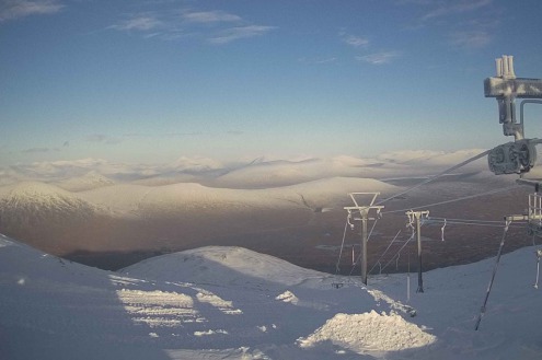
Scottish ski areas do have a bit of snow, though the status of individual resorts should be checked daily at www.winterhighland.gov.uk, as conditions can change very quickly. Three lifts were open in Glencoe today on a base of 5/20cm depending on altitude.
Snow conditions in Scandinavia are generally good with plenty of fresh snow in Norway’s Voss where on-mountain depths are now well over 100cm. Snow depths are more modest in Sweden’s Åre (23/29cm), though it does also have plenty of good skiing, on-piste at least, thanks to artificial back-up.
USA
It’s been snowing again in Utah, where Snowbird has a mid-mountain base of 203cm with another big storm cycle just getting underway which could deliver over 1m of snow over the next few days.
Further west, Colorado’s Breckenridge (105cm mid-mountain) is also in good shape with around 40cm of new snow in the last week and more in the forecast, albeit not in quite the same quantities as in Utah!
Canada
Whistler has seen 87cm of new snow over the last week, and now has a settled base of 155cm mid-mountain. The weather is set to remain relatively cold with more flurries due later next week, meaning that good conditions will continue into the first part of January.
Further inland, there is also plenty of good skiing to be found in the Banff-Lake Louise area (70/95cm) despite it having seen less fresh snow in recent days than areas nearer the coast.
Our next full snow report will be on
Friday 6 January 2023
If you enjoy reading our updates - please feel free to support us:


