


Updated: 9am Wednesday 30 October 2019 - Turning very unsettled, with significant snow at altitude in the western Alps this weekend…
The weather in the Alps is about to turn very unsettled as a succession of increasingly potent storms arrives from the west over the coming days. Although it won’t turn particularly cold, there is expected to be some significant snow at the weekend, at high altitude at least.
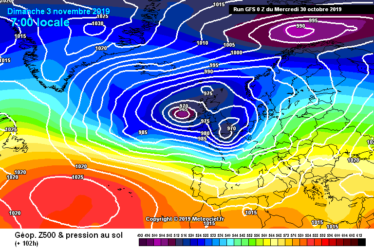 GFS pressure chart for Sunday 3 November 2019 showing a vigorous westerly airflow across the Alps – Image: meteociel.com
The first major storm in this cycle will arrive later on Friday heralding a very unsettled weekend for the Alps, with high winds, heavy rain and some heavy snow at altitude.
The heaviest snow will fall in the western Alps where the glaciers at both Tignes and Les Alpes, for example, could see 30-40cm of new snow by the end of Sunday. The rain/snow limit will generally be between 2200m and 2600m, and perhaps a bit lower in places later in the weekend and during the first part of next week.
Next week, the weather in the Alps will remain unsettled but it is still uncertain as to where and to what levels the heaviest snow might fall. Initial thoughts are that it will again be the western Alps that are most favoured but the situation is evolving and likely to change. Stay tuned…
Updated: 10.30am Tuesday 15 October 2019 - New storm hits the Alps…
After a mostly fine and very warm spell of weather over the past few days, a new storm is now affecting the western Alps today with lots of rain, high altitude snow and even some thunderstorms.
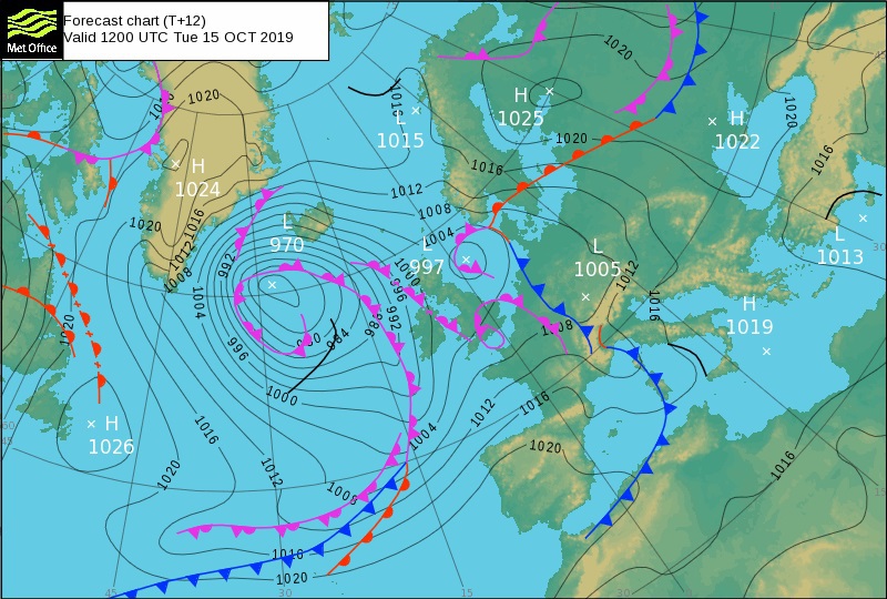 Met Office pressure chart for 12pm on 15 October 2019, showing weather fronts draped across the western Alps – Image: metoffice.co.uk
The general rain/snow limit today will start high (2600-2900m) but will lower steadily, reaching 1700-2000m in places by the end of the day. The high border areas between Italy/France and Italy/Switzerland (e.g. Zermatt, Saas-Fee) will see the most of today’s snow, with 30-40cm possible at 3000m. The Grande Motte glacier above Tignes (not yet open) will also see a decent top-up, with around 15-20cm.
The further north and east in the Alps you go the less potent this storm will be. The Austrian glaciers, for example, will see a little snow later today and tonight but not as much as further west.
Wednesday and Thursday will be drier, then further weather fronts will arrive later in the week and over the weekend, with more (high altitude) snow in many places.
Weather-permitting, glacier skiing is currently possible in the following resorts:
- Austria – Hintertux, Sölden, Stubai, Kaprun, Mölltal, Kaunertal and Pitztal
- Switzerland – Zermatt, Saas-Fee and Engelberg
- Italy – Passo Stelvio and Val Senales
Updated: 12pm Wednesday 9 October 2019 - More snow for the glaciers…
It’s snowing higher up in the Alps again today, which is great news for the glaciers, most of which are already in pretty good shape for early October.
 New snow is expected across the Alps today – 9 October 2019 – Image: bergfex.com
The heaviest of the precipitation this afternoon will fall in the northern French and Swiss Alps (e.g. Tignes, Zermatt), and then in the Austrian Alps tonight (e.g. Sölden, Stubai). The rain/snow limit will initially be between around 2500m and 2800m but will fall to around 2000m later.
By tomorrow we can expect between 5cm and 20cm of new snow at 3000m, with a dusting to 2000m here and there. Later in the week it will turn warmer again, meaning that any of the new snow will quickly disappear below glacier level.
Updated: 9.20am Monday 7 October 2019 - Snow in the Alps!
Many higher parts of the Alps are waking up to a new covering of snow this morning thanks to the cold front that moved across the region yesterday.
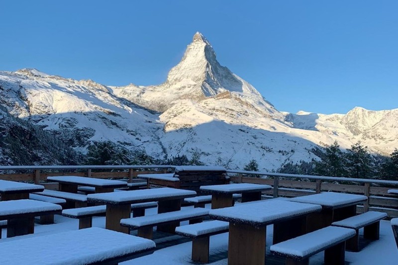 Fresh snow in Zermatt this morning – 7 October 2019 – Photo: facebook.com/Alphitta
It is still far too early for this snow to have any bearing on how the main ski season might pan out –as most of it will melt in the next few days – but it is very welcome news for the glaciers, some of which are already in operation while others are looking to open just as soon as conditions permit.
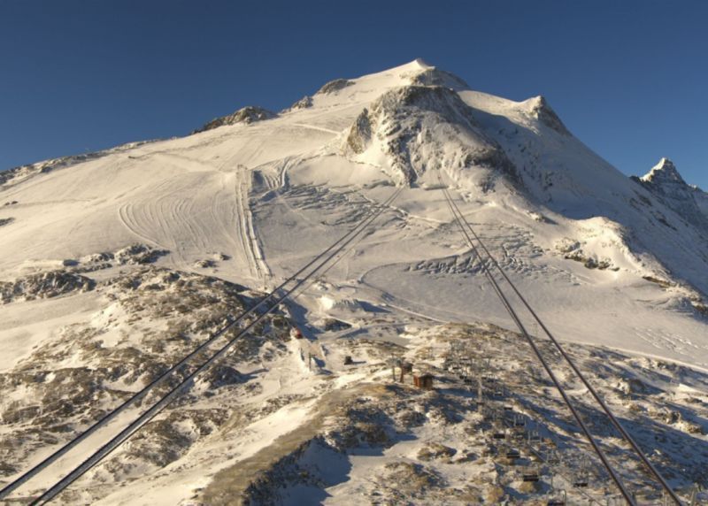
One such glacier is the Grande Motte above Tignes which had to postpone its scheduled 28 September opening due to a lack of snow, but now looks in much better shape thanks to 10-15cm of new snow yesterday alone.
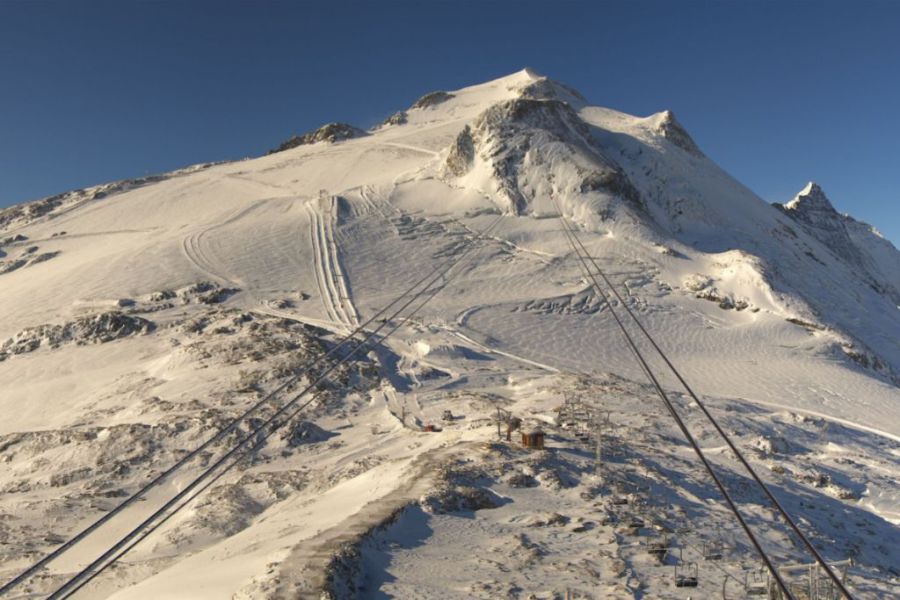 Looking much better on the Grande Motte glacier above Tignes this morning, but its opening date is yet to be confirmed – 7 October 2019 – Photo: tignes.net
On the whole, Austria is still the best bet when it comes to skiing options early this October with skiing possible in Hintertux (by far the best option right now), Sölden, Stubai, Pitztal, Kaunertal and (from next weekend) Kaprun.
In Switzerland you can currently ski in Saas-Fee and Zermatt, with more openings coming soon, including Engelberg this weekend. In Italy you can ski in Passo Stelvio and Val Senales.
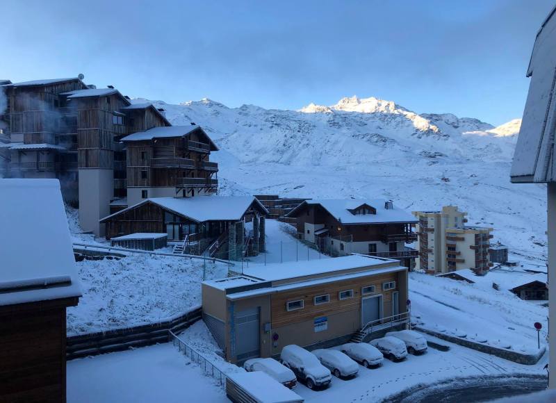 Looking wintry this morning in Val Thorens – 7 October 2019 – Photo: facebook.com/ValThorens
France currently has no lift-served skiing open, although Tignes may make an announcement soon. Watch this space!
As for the weather forecast in the Alps, there will be a bit more high altitude snow on Wednesday before it turns warmer and sunnier everywhere later in the week.
Updated: 1pm Friday 4 October 2019 – Snow conditions on the glaciers are gradually improving
Last month’s weather was relatively ‘normal’ in the Alps, with spells of warm sunshine interspersed with cooler, more unsettled interludes which brought a little high-altitude snow here and there. The most significant snow fell in the eastern Alps (i.e. Austria) where the glaciers are now in reasonable shape. Further west, snowfall may have been lighter and more sporadic so far this Autumn but the situation here is also steadily improving…
 Snow cover has been improving on the Grande Motte glacier above Tignes in recent days but there is still no word on its postponed opening – Photo: tignes.net, 3 October 2019
Here is a rundown of snow conditions in the Alps right now…
AUSTRIA
As in most years, Austria is the best bet for skiing in the Alps in early October, with 4 glaciers already open and more to follow soon.
Hintertux currently offers the best snow conditions and greatest extent of skiing in the Alps with 20km of pistes and 45cm of settled snow on the glacier.
Sölden has 4km of pistes currently in operation with more planned this weekend. Snow depths on the glacier currently stand at 63cm.
The Stubai glacier has 2 runs open today and is reporting a snow base of 25cm.
The Pitztal glacier also has 2 runs open today with a snow base of 30cm.
The Kaunertal glacier has 4 runs open today and is reporting a snow base of 20cm.
The Kitzsteinhorn glacier above Kaprun plans to open on 12 October 2019.
 New snow on the Hintertux glacier earlier this week – Photo: facebook.com/hintertux.gletscher
FRANCE
The French Alps currently have no lift-served skiing available, as the planned opening of the Grande Motte glacier above Tignes (on 28 September 2019) had to be postponed due to a lack of snow. Light snowfalls have improved the situation in recent days but at the time of writing there is still no word on when the glacier will re-open.
Les 2 Alpes hopes to open its glacier from 26 October to 3 November 2019 for half-term but has been unable to do so in the last two seasons due to a lack of snow. Watch this space! Otherwise no other French ski resort has any plans to open until the “main” season which, snow permitting, will kick off with the opening of Val Thorens on 23 November 2019.
ITALY
Italy currently has two glacier options open.
Passo Stelvio near Bormio has the deepest snow base in the Alps (190cm) and can offer 6km of pistes, while Val Senales has 2km on a much more modest 15cm!
SWITZERLAND
Switzerland has two good glacier options right now, with more openings coming soon. Saas-Fee and Zermatt can both offer around 18km of runs (weather permitting) with upper bases of around 50cm.
Engelberg plans to start operations on its Titlis glacier on 12 October 2019, but this has yet to be 100% confirmed.