


ARCHIVE
Today in the Alps - February 2023
Read about current weather and snow conditions in the Alps
Updated: 10.30am Tuesday 28 February 2023 – Powder-day for a lucky few!
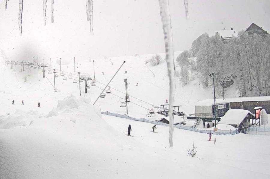
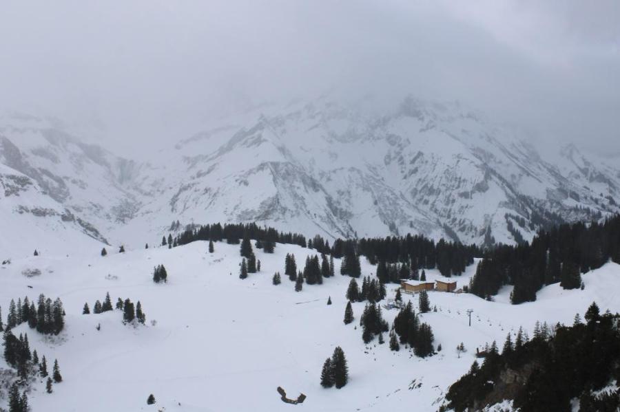
It’s a mostly fine but cold day across much of the Alps. The main exception being the far south-west, as has been the case for several days now, where some flurries are still affecting resorts in the southern Piedmont (e.g. Prato Nevoso) and across the border in France (Isola 2000). These areas have already seen a LOT of snow this week.
 Powder day in the southern Piedmont, but this is the exception rather than the rule. This Prato Nevoso – 28 February 2023 – Photo: pratonevoso.com
More snow is expected in these same regions over the next couple of days, heaviest the further south you are (e.g. Prato Nevoso, Limone Piedmonte) but also extending up into the Milky Way, the far eastern Maurienne (e.g. Bonneval, Val Cenis) and perhaps, to a lesser extent, towards Val d’Isère. Elsewhere in the Alps it will remain mostly fine but cold.
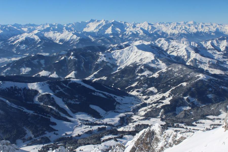
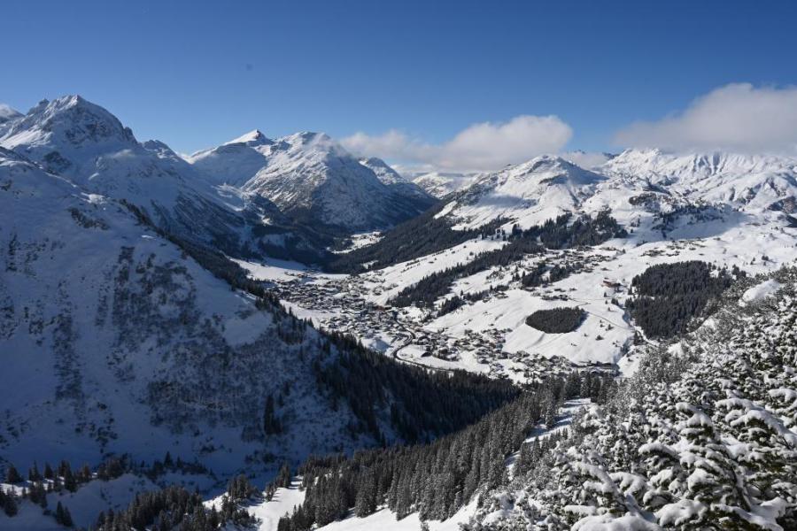
The snow situation in the Alps is an unusual one right now. Snow depths are way below where they should be for late February across most of the Alps, with very patchy or non-existent natural snow cover at lower altitudes in many central and western regions. Most major resorts can still offer plenty of reasonable piste-skiing, and the recent cold has at least now put the brakes on the thaw. However, the pistes are often hard-packed or icy and more snow is urgently needed to both improve the snow quality and to prospects for the rest of the season.
The good news is that it is going to stay cold, with an increasing chance of some more widespread snow later next week. However, the weather models remain very volatile and this a still a long way off being a done deal.
It should be said that not all resorts need fresh snow as badly as others. Plenty has already fallen in the far south-western Alps over the past few days, especially in the southern Italian Piedmont where resorts such as Prato Nevoso and Limone Piedmonte have seen 80cm, with even more in the forecast this week. The Milky Way (e.g. Sestriere), the Queyras and Isola 2000 have also seen significant snowfall, albeit not in quite the same extreme quantities.
Austria is also faring better than the Alpine norm right now. Although snow depths here are less than impressive and resorts haven’t seen much snow in recent days, they are still benefiting from having had the most consistent snowfalls in recent weeks, as well as the coldest temperatures.
This means that, in most cases, it still looks like mid-winter with decent piste-skiing at lower altitudes than is generally possible elsewhere in the Alps.
Updated: 8.30am Friday 24 February 2023 – Snow for some northern parts of the Alps tonight…
It’s a mostly dry morning across the Alps, with variable cloud cover but some sunshine in places, the best of which is in the northern French and western Swiss Alps. Later today and overnight, a few centimetres of snow are expected across many northern parts of the Alps, heaviest in Austria.
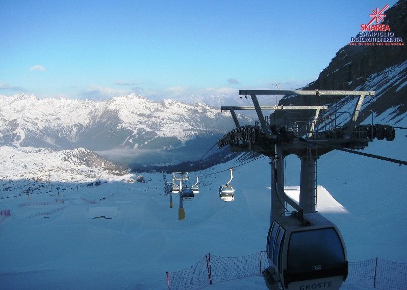 Sunny this morning in Madonna di Campiglio but this is not the case everywhere in the Alps – 24 February 2023 – Photo: funiviecampiglio.it
This weather front will linger across the northern and north-eastern Alps tomorrow, by which point the northern Austrian Alps should have seen 10-20cm of fresh snow, the upper end of this scale most likely in the Arlberg (e.g. Lech, St Anton). The northern Swiss Alps (e.g. Mürren, Engelberg, Klosters) will also see some snow tonight but in lesser quantities – probably closer to 5-10cm. The northern French Alps will also catch some light snow but generally less than 5cm, and probably only in the far north (e.g. Portes du Soleil).
On Sunday, a developing storm in the Gulf of Genoa may bring heavier snow to the south-western Alps by way of a ‘Retour d’Est’. Likely quantities remain uncertain though most of the snow is likely to fall close to the southern French/Italian border (e.g. Sestriere).
As for snow conditions, they are generally substandard across the Alps for late February. While it is still possible to find plenty of good skiing, particularly at altitude and/or in the Austrian Alps, snow depths are below average everywhere, and dramatically so in places.
We will bring you more on this in our detailed snow report out later today…
Updated: 9.25am Tuesday 21 February 2023 - Still mostly sunny in the Alps…
It’s another glorious start to the day in the Alps with almost wall-to-wall sunshine. Most regions will stay sunny although some cloud will spread into the western and south-western Alps later in the day.
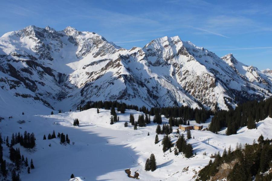 Another fine day in the Austrian Vorarlberg. This is Köbersee above Warth-Schröcken – 21 February 2023 – Photo: foto-webcam.eu
Wednesday will again be mostly dry with plenty of sunshine, especially in the central and eastern Alps. Further west, there will be more in the way of cloud with a few showers later in the day (snow 1700m), though these will not amount to much. Thursday may see the odd light shower or flurry (1500-1700m), but again not amounting to much.
Some more significant snowfalls are likely in some northern parts of the Alps on Friday and Saturday, however, with areas that might see some useful snowfalls including the central northern and north-western Swiss Alps (e.g. Engelberg, Klosters) and the northern Austrian Alps (e.g. Lech, Seefeld, Kaprun, Schladming). It remains uncertain how much snow will fall though, with different weather models predicting anything between 10cm and 40cm in these regions between Thursday night and Saturday morning.
In the meantime, snow conditions across the Alps remain mixed with snow depths generally well below average for late February. With most regions not having seen any significant snow for some time – nearly a month for some north-western parts of the Alps – most of the action is on-piste.
Thanks to heavy skier traffic, the snow is often quite hard or icy, especially in shadier areas. However, with the strengthening sun and recent mild temperatures, the snow has been softening up in places as the day goes on, especially lower down and/or on south-facing slopes.
There is still plenty of good on-piste skiing to be found in the Alps, but exactly where this is does vary depending on altitude, aspect, time of day and skier traffic. All things considered, Austria probably has the best snow conditions of the four main Alpine countries right now.
Updated: 9.30am Sunday 19 February 2023 – Still mostly fine in the Alps…
A weak weather front is bringing a lot of cloud to the north-eastern Alps today where a few showers or flurries (1300m) are likely, especially in the northern and eastern Austrian Alps (e.g. Obertauern). Elsewhere in the Alps, except for some cloud close to the northern foothills of the French and Swiss Alps, there will be plenty of sunshine.
 Some clouds in Lech today but it should stay mostly dry – Photo: lech-zuers.at
Looking a bit further ahead, the first half of next week looks mostly sunny and quite mild. The second half of the week is set to turn a little more unsettled with the chance of some showers or flurries in places, but the weather models are volatile so detail remains uncertain. One thing that is certain is that there is still no sign of any really widespread heavy snow in the forecast any time soon.
Snow conditions remain rather mixed across the Alps. On the whole, snow depths are below average, particularly in the central, southern and south-eastern Swiss Alps (e.g Andermatt, St Moritz). There is still some good piste skiing in most parts of the Alps but snow quality is variable due to a mix of heavy skier traffic (being peak holiday time) and the effect of mild temperatures and a strengthening sun, which has been increasing the freeze-thaw process on south-facing slopes.
Updated: 10.30am Friday 17 February 2023 – Still mostly sunny in the Alps, except for the north-east…
Following a largely sunny week in the Alps, it has turned cloudier in the north-east today with the odd shower or flurry (1800m) in the northern Salzburgland, northern Styria and Upper and Lower Austria. For the vast majority of the Alps, however, it will remain dry with long sunny spells and just some medium or high-level clouds close to the northern fringes of the Alps (e.g. Jungfrau region).
 Cloudier in the Austrian Vorarlberg today but with very little precipitation. This is the Warth-Schröcken area – 17 February 2023 – Photo: foto-webcam.eu
Most of the Alps will remain dry over the next few days, though the north-east may see some showers or flurries, with a few centimetres of snow possible in resorts such as Obertauern on Sunday.
Later next week there is the possibility of colder, more unstable air and more widespread snow across the Alps, but there is still quite a bit of uncertainty over this, so stay tuned!
As for snow conditions, they are a bit mixed right now. Most regions haven’t seen any new snow for quite some time meaning that pistes may be hard or icy, especially in areas that have heavy skiing traffic.
That said, as the days go on the mild temperatures and strengthening mid-February sun are softening up the snow in places, mostly on south-facing slopes where some freeze-thaw action is now underway, but also in a more limited fashion on some lower north-facing slopes. On the whole though, most north-facing slopes are remaining firm all day.
Updated: 1pm Wednesday 15 February 2023 - Still sunny in the Alps!
It’s another magnificent day across the Alps, with wall-to-wall sunshine at altitude, and just the odd bit of low cloud close to some of the northern foothills.
 It’s another glorious day across the Alps. This is St Johann in Tirol – 15 February 2023 – Photo: foto-webcam.eu
It will feel warm in the sun, with freezing levels typically around 2800m, though the dry air does mean that snow-melt will not be excessive, and many north-facing slopes will stay firm all day long. However, the sun is now strong enough to subject all but the highest south-facing slopes to at least some freeze-thaw action, most prominent lower down.
The weather will stay mostly fine but turn a bit cooler again on Thursday, with some clouds likely to appear in the northern and eastern Austrian Alps (e.g. Salzburgland). These will become more numerous across the northern Austrian and north-eastern Swiss Alps on Friday, with the odd shower or flurry (1800m) possible here and there, most likely close to the northern fringes of the Austrian Alps. Most of the Alps will stay dry with plenty of sunshine, however.
Updated: 1.20pm Monday 13 February 2023 – Sun, sun, sun!
It’s another mostly sunny day across the Alps today, with freezing levels typically between 2500m and 3000m, east to west. It will remain mostly dry and sunny all week, though weather fronts may affect some northern, and especially north-eastern, parts of the Alps on Friday, with the chance of some snow at altitude.
 Perfectly sunny skies today in St Anton, where lower south-facing slopes will soften up this afternoon – 13 February 2023 – Photo: foto-webcam.eu
All this fine weather is good news for most half-term skiers, the majority of which are families and happy to stay on-piste. It’s also early enough in the season for afternoon slush not to be too much of an issue, aside from on some lower south-facing slopes.
Hard-packed or icy pistes may be more of a problem in some resorts, especially in areas with lots of skier traffic, though this is certainly not the case everywhere, and most resorts will experience a variety of snow consistencies each day, depending on the time of day and altitude.
Updated: 10.30am Friday 10 February 2023 - Cool and sunny today in the Alps…
It’s a mostly sunny day across the Alps today, but still relatively cold with freezing levels generally below 1000m in the east (Austria) and a bit above in the west.
 Perfectly sunny across most of the Alps today. This is Saalfelden near Saalbach – 10 February 2023 – Photo: foto-webcam.eu
Except for the odd flurry in the north-eastern Austrian Alps on Sunday it will remain mostly fine over the next few days, and probably all next week too. It will also turn milder with freezing levels rising to between 2500m and 3000m later in the weekend and remaining at similar levels next week.
For more on snow conditions across the Alps, please see our detailed snow report.
Updated: 9am Thursday 9 February 2023 – Sun, sun, sun!
With high pressure currently dominating the weather, it will be mostly sunny in the Alps for the foreseeable future, including next week – the busiest week of the season.
 Anyone skiing in the Alps over the next few days will be seeing plenty of skies like these! This is St Johann in Tirol – 9 February 2023 – Photo: foto-webcam.eu
After a dusting of snow last night in the far south-western Alps close to the close to the southern French-Italian border (e.g. Bardonecchia), a few clouds are lingering here this morning but will soon break up allowing most regions to enjoy a fine but still relatively cold day, with freezing levels mostly below 1000m.
Over the next few days, it will remain mostly fine with just the chance of the odd flurry in the eastern Austrian Alps later in the weekend. Temperatures will increase, with freezing levels set to rise to 3000m next week in the western Alps, a bit lower further east.
In many ways this is good news for half-term skiers, many being families who would rather see wall-to-wall sunshine than stormy weather. Although many regions have not seen any significant snow for some time now, cover is still fine even at low levels, at least on-piste.
As for the quality of the snow, you should expect many of the pistes to be hard-packed next week, especially in lower shadier areas and/or in areas with lots of skier traffic where there will also be some icy patches.
The pistes should soften a little later in the day, especially lower down and in areas exposed to the sun. However, it is still too early in the season for there to be any major freeze-thaw cycles except on some south-facing terrain. The best snow quality will be found at higher altitudes and/or on gentler gradients, especially where skier traffic is lower.
Overall though, there should be lots of enjoyable skiing to be had next week, particularly given the magnificent weather.
Updated: 9.20am Tuesday 7 February 2023 – A mostly sunny week ahead in the Alps…
As expected, some south-western parts of the Alps are waking up to a dusting of fresh snow this morning, mostly close to the southern French/Italian border including resorts such as Sestriere and Isola 2000.
 Great conditions in much of Austria right now. This is Hochkönig – 7 February 2023 – Photo: foto-webcam.eu
Today will be almost entirely sunny across the Alps though, and it will remain sunny for most for the rest of the week and into next week too. After a chilly start today, it will gradually warm up as the week progresses with freezing levels generally starting at close to or below 1000m this morning and reaching 1500-2500m (east to west) by the weekend.
Snow conditions do remain a bit mixed across the Alps although, on the whole, most regions can still offer plenty of good skiing. Best of all right now are the resorts of the eastern Austrian Alps (e.g. Obertauern) where over 1m of snow fell last week.
By contrast, many western areas (e.g. 3 Valleys, Grand Massif, Portes du Soleil, Verbier, Zermatt) haven’t seen any significant snow for some time. They do still have plenty of good skiing on offer, especially on-piste, but snow quality does vary - sometimes hard-packed, sometimes a bit icy, sometimes good.
With the strengthening sun and temperatures rising later in the week, you might notice the snow starting to soften up later in the day, especially on the lower south-facing slopes. However, it is still too early in the season to be talking about proper freeze-thaw cycles and the majority of pistes will stay firm for now.
Updated: 12pm Monday 6 February 2023 - Increasingly sunny in the Alps…
Following a dusting of snow in some parts of the Alps last night (e.g. Portes du Soleil) it’s a mostly dry day today though there are some areas of cloud drifting around, notably in Austria. The best of the sunshine is in the western Alps.
 Great skiing right now in Lech, with mostly sunny skies forecast for the rest this week – 6 February 2023 – Photo: foto-webcam.eu
Apart from a few flurries close to the southern French/Italian border tonight (with 2-4cm possible in Sestriere, for example), it is set to stay mostly dry across the Alps all week. There will be low cloud in some of the valleys but it will be mostly sunny and increasingly mild at altitude.
Snow conditions remain a bit mixed across the Alps right now. Austria generally has the best conditions, thanks to significant fresh snow last week, with close to 1m in parts of the Tirol, the Salzburgland and Styria. Be very careful off piste here though as there was also a lot of wind during this storm and the risk of avalanche remains high.
Some eastern Swiss resorts (e.g. Klosters) also saw significant snow late last week but most of the Alps haven’t had a good dump for quite some time now. The few centimetres of snow that fell in some French and western Swiss resorts (e.g Portes du Soleil) last night which will have temporarily freshened things up but, on the whole, pistes in the western and southern Alps remain quite hard-packed with some icy patches.
Updated: 9.50am Friday 3 February 2023 – Huge snowfalls across parts of Austria…
It’s a mostly dry day with plenty of sunshine across the Alps today, the main exception again being the north-eastern quarter (i.e. Austria), where there is more cloud and a few flurries (700-800m).
 Big snowfalls in the north-eastern Alps. This is Mariazell in Styria, Austria – 3 February 2023 – Photo: snoweye.com
That said, today is quieter in Austria than the past couple of days, which saw some very big snowfalls in some areas, with 60-90cm of new snow across some parts of the Tirol, northern Styria and the Salzburgland (e.g. Obertauern area).
More generally, Austrian resorts have seen between 30cm and 50cm of new snow this week, except in the south (Osttriol, Carinthia) where little, if any, snow has fallen. Needless to say, the risk of avalanche is very high, especially in the northern and eastern Austrian Alps where fresh snowfall totals are greatest.
The eastern Swiss Alps (e.g. Klosters) have also seen some snow over the last couple of days, though not as much as in Austria. Most other parts of the Alps have seen little if any snow for some time now.
The snow will intensify over the north-eastern Alps again tonight, lasting on and off over the weekend, with a further 20-50cm possible across some parts of Austria (away from the south) and the eastern Swiss Alps. It won’t be especially cold though, with a rain/snow limit between 900m and 1200m, meaning that it may rain rather than snow at times close to resort level in some of the lower Austrian resorts such as Söll and Kitzbühel.
Updated: 11am Thursday 2 February 2023 – Big snow for Austria!
It’s a cloudy day in most Austrian ski resorts, with snow at times (800m), heaviest in the east (e.g. Obertauern), and patchier in the south where some places will stay dry (Carinthia).
 Heavy snow in Obertauern today, which will continue on and off for several days – Photo: foto-webcam.eu, 2 February 2023
Apart from a few flurries in the eastern Swiss Alps (e.g. Klosters) and the northern Dolomites, most of the rest of the Alps will be dry with sunny spells. The best of the sunshine will be found the further south-west you are.
After a brief lull tomorrow morning, heavy snow will return to many Austrian resorts tomorrow and continue into the weekend, especially in the north and east (e.g. Kaprun, Obertauern). Indeed, some high eastern Austrian resorts like Obertauern could see storm totals of over 1m by Sunday. Most other Alpine regions will escape this storm, aside from the northern and eastern Swiss Alps (e.g. Braunwald, Klosters) where there will be a bit of snow from time to time, especially late on Saturday and on Sunday.
Some snow might also fall in the north-western Swiss Alps (e.g Jungfrau region) later on Saturday/Sunday, and possibly even in the far northern French Alps (e.g. Portes du Soleil).
Over the next few days the rain/snow limit will generally sit between 700m and 1200m, but possibly a bit higher for a time over the weekend.
Updated: 12.45pm Wednesday 1 February 2023 – Lots of snow for some Austrian resorts over the next few days…
It’s a dry and bright day across much of the Alps, but with more cloud in the eastern Swiss Alps and across the Austrian Alps, with a few flurries (600m) here and there.
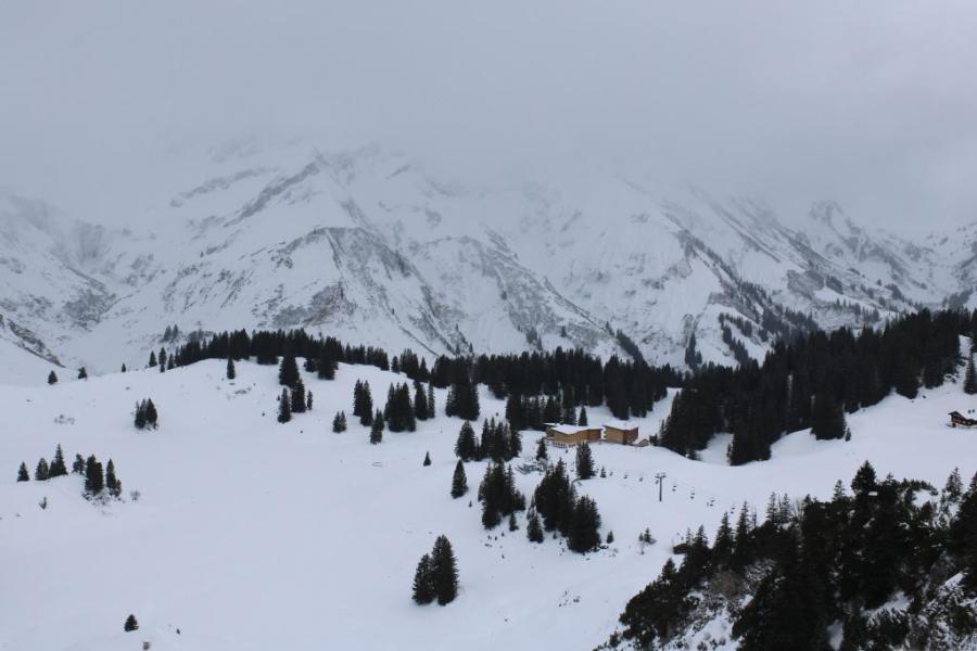 Cloudy in the Austrian Vorarlberg today, with light snow setting in. This is Köbersee above Warth-Schröcken – 1 February 2023 – Photo: foto-webcam.eu
These flurries will become heavier and more persistent later today and tonight but will remain confined to Austria (away from the far south) and some eastern parts of Switzerland. This pattern will continue for the next few days, with further snow at times for many Austrian resorts (again away from the far south) as well as some parts of the northern and eastern Swiss Alps (e.g. Klosters).
Between now and Sunday, there could be significant accumulations of snow across much of Austria, with 40-80cm possible in places (e.g. Lech, Kaprun, Schladming, Obertauern). A few centimetres are also likely in the north-eastern Swiss Alps (e.g. Flumserberg, Klosters), most of which will fall tonight and again at the weekend. The rain/snow limit will be between 600m and 1300m, generally lowest the further east you are.
The rest of the Alps are not expecting to see much if any snow over the next few days. The best of the sunshine will be found the further south-west you are.