

Latest snow report
Updated: 12.30pm Friday 28 January 2022
Snow conditions across the Alps are very variable right now, with an increasing disparity between the north-eastern Alps (which have the best snow conditions) and the south-western Alps (where there hasn’t been any significant snow for weeks).
In the north-east, the areas that saw the most snow from last week’s storms were the eastern Tirol (e.g. Kitzbühel), the north of Styria (e.g. Schladming), the Salzburgland (e.g. Kaprun, Obertauern) and Upper Austria (e.g. Gosau, Hinterstoder). These areas will also see the most snow from a new storm cycle that has just begun today.
Snow depths are seriously below average for the time of year in the south-western Alpes, including the southern French Alps (e.g. Isola 2000, Risoul) and the south-western Italian Alps (e.g. Prato Nevoso, Bardoneccchia, Sauze d’Oulx). While there is still some good piste skiing on offer in these areas for now, there could be major problems later in the season if there aren’t any big dumps in the next few weeks.
Elsewhere in the Alps, the rest of the southern Alps (e.g. Cervinia, Monte Rosa, Livigno, Dolomites) also have below average snow depths, but not as much below as in the far south-west. The north-western Alps (e.g. L’Espace Killy, 3 Valleys, Grand Massif, Portes du Soleil, Verbier, Villars, Mürren, Engelberg, Lech/St Anton) have better snow cover relative to altitude but, even here, snow depths are generally now a little below average.
Across the pond, the Banff/Lake Louise area continues to offer the best conditions in the western US…
Austria
Snow conditions remain excellent across most of the Austrian Alps, with further snow due today in the north, particularly in the north-east (e.g. Salzburgland, Upper Austria). Right now, snow depths are 80/180cm in Lech, with a dusting expected today and heavy snow early next week.
Further east, Saalbach has 40/100cm depending on altitude, with snow forecast on and off for the next few days, heaviest early next week.
The far southern Austrian Alps will miss most of the action from this latest storm cycle, although Carinthia’s Nassfeld is still skiing very well on-piste, with base depths of 60/130cm.
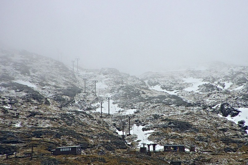
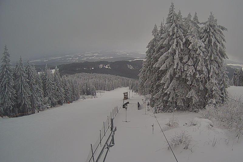 Snowing today in the north-eastern Alps. This is Bad Leonfelden – 28 January 2022 – Photo: snoweye.com
France
On-piste snow conditions are still generally quite good in the French Alps, despite a lack of significant snow in recent weeks. The best skiing is currently to be found in the northern half of the French Alps, where most of the snow fell earlier in the season. Val Thorens has base depths of 110/160cm while Avoriaz has 40/140cm.
Snow depths in the southern French Alps are very modest by comparison, with just 20/40cm in Montgenèvre and 30/50cm in Pra Loup.
Some snow is expected early next week, most of which will fall in the northern half of the French Alps (roughly north of Grenoble).
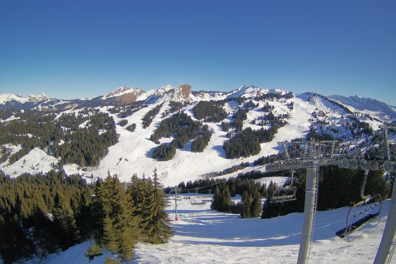 Good snow cover still across the Portes du Soleil. This is Les Gets – 28 January 2022 – Photo: lesgets.com
Italy
Italian resorts haven’t seen much snow in recent weeks, with snow depths uniformly below average for the time of year.
The snowpack is particularly thin in the south-west right now, with 20/40cm in both Pila and Sestriere, for example. However, on-piste at least, some reasonable skiing is still possible here for now.
Further east, the situation is better in Passo Tonale (40/170cm) and Arabba (40/160cm), though more snow would be welcome here as well. Unfortunately, there is no sign of any heavy snow in the forecast any time soon.
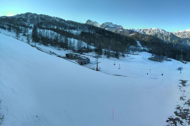 Modest snow depths in the Italian Piedmont. This is Bardonecchia – 28 January 2022 – Photo: bardonecchia.it
Switzerland
Snow conditions are still generally quite good across the Swiss Alps even if snow depths are now mostly below average for the time of year.
In the northern Swiss Alps, Mürren (50/115cm) and Laax (40/225cm) are skiing as well as anywhere right now. However, further south, Saas-Fee (40/200cm) has perhaps the most impressive snowpack.
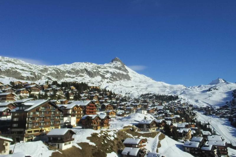 Sunny skies again today across the Aletsch Arena. This is Bettmeralp – 28 January 2022 – Photo: bettmeralp.ch
Rest of Europe
There hasn’t been any significant snow for some time in the Pyrenees but, on-piste at least, conditions remain very good in most resorts including Andorra’s Soldeu (100/150cm) and Spain’s Baqueira Beret (170/275cm).
Snow depths are more modest across most of Norway, where resorts such as Hemsedal (30/40cm) are skiing on a mix of natural and man-made snow. Closer to the western Norwegian coast, Voss has healthier natural snow depths, with 100cm mid-mountain.
Snow conditions in Scotland remain very poor, with just a few patches of snow here and there, and skiing confined to a small beginner’s area in the more eastern resorts of Glenshee, Cairngorm and the Lecht (open at weekends only).
 Not enough snow for skiing right now in Glencoe – 28 January 2022 – Photo: winterhighland.info
USA
Most western US resorts continue to offer good skiing, following further light snowfalls this week in the Colorado resorts of Vail (45/120cm) and Aspen (60/105cm), where conditions are good both on and off-piste.
Further west, Mammoth (180/390cm) may not have seen any snow for some time but is still skiing very well, on-piste at least, with more sunshine forecast over the next few days.
Canada
Whistler (220cm upper base) hasn’t seen any new snow since we last reported a week ago but, on-piste at least, there is still plenty of good skiing to be had, especially at altitude.
Further inland, there has been very little fresh snow recently in the Banff/Lake Louise (140/200cm) area either, though snow conditions here remain excellent thanks to an exceptionally snowy start to the season.
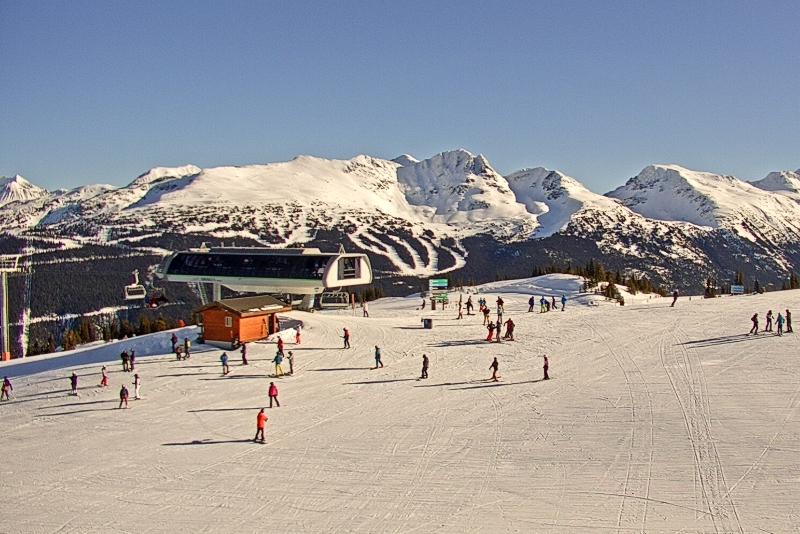 Calm, sunny conditions in Whistler – 28 January 2022 – Photo: whistlerblackcomb.com
Our next full snow report will be on
Thursday 3 February 2022
If you enjoy reading our updates - please feel free to support us: