Latest snow report
Updated: 9pm Friday 29 March 2024
Snow conditions are extremely mixed across the Alps right now. For quite some time, the weather pattern has been stuck in a largely southerly or south-westerly flow, meaning that the bulk of any fresh snow has fallen across the southern Alps, particularly in the south-west.
Resorts that have done particularly well from this pattern include those in the Monterosa region, alongside Isola 2000, Montgenèvre and Sestriere. The snow has also spilled further north at times, with Val Cenis, Val d’Isère, Tignes, Zermatt and Saas-Fee also seeing significant totals in the last week or two, especially at altitude.
Elsewhere in the Alps, there has been some new snow at times in recent days but, as it has never been that cold, the spring thaw has outweighed any new accumulations at lower altitudes. The Foehn has also been a nuisance and will blow strongly again this weekend.
Across the pond, Utah continues to offer some of the best snow conditions in North America…
Austria
Mild weather has led to a rapid loss of snow at lower altitudes in Austria in recent days. You can still find a number of pistes open at altitude in the likes of Zell am See (0/125cm) and Söll (0/55cm) but conditions are very spring-like.
For better snow conditions you need to be in a resort with plenty of skiing above 2200m, such as Obergurgl (95/195cm) or Ischgl (20/160cm).
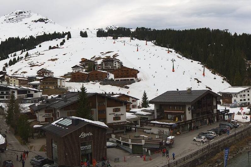 Signs of the mild weather in the northern Alps are showing lower down in Lech, but the ski area still has plenty of snow generally – Photo: lech-zuers.com, 29 March 2024
France
Snow conditions are all over the place in the French Alps, as is often the case in spring!
The heaviest of the recent snow has fallen in resorts close to the southern border with Italy, such as Isola 2000 (250/310cm) and Montgenèvre (180/310cm), both of which have very impressive cover right now. However, temperatures have turned mild again today meaning that snow quality is not necessarily that good.
For the best snow conditions, you still need to be in a resort with lots of skiing above 2400m, such as Tignes (140/400cm) or Val Thorens (150/200cm).
Lower down, conditions remain less than ideal with very little natural snow below 1600m or so (especially in the north) and only a handful of runs still open in the likes of Morzine (0/80cm) and Megève (0/205cm).
 Masses of snow in the far southern French resort of Isola 2000 – Photo: isola2000.com, 29 March 2024
Italy
Italian resorts have seen most of this week’s snow in the Alps, as they have generally in recent weeks.
Areas that have done particularly are the Piedmont region, including the likes of Prato Nevoso (70/170cm) and Alagna (40/150cm), and the eastern Aosta, including Cervinia (120/250cm). All these areas are offering excellent skiing right now, especially at altitude.
Lower down, there is still plenty of piste-skiing on offer in the Dolomites, though conditions are generally far more spring-like in resorts like Selva (30/100cm).
 The Monte Rosa region has seen some of the heaviest snowfall in the Alps this March – Photo: regione.vda.it, 29 March 2024
Switzerland
Snow conditions are hugely variable across the Swiss Alps, largely dependent on altitude. The best snow conditions are currently in the high resorts of the south where the bulk of the recent snow has fallen, like Zermatt (5/200cm), Saas Fee (85/445cm) and St Moritz (50/240cm).
By contrast, there is now very little natural snow lower down, especially in the northern Swiss Alps. There are still plenty of pistes open in Adelboden (0/145cm), for example, but the valley bottoms are largely snow-free and the thaw will continue at pace with the Foehn blowing this weekend.
 Impressive snow cover still in high altitude Bettmeralp in southern Switzerland – Photo: bettmeralp.ch, 29 March 2024
Rest of Europe
Thanks to significant new snow in the last few weeks, there is some decent spring skiing on offer in the higher resorts of the Pyrenees, such as Andorra’s Granvalira (50/180cm), but lower down many smaller resorts have long since closed.
Scandinavia’s generally snowy and colder than average season means that cover remains good in most resorts. Norway’s Hemsedal now has settled depths of 45/110cm depending on altitude, while Sweden’s Sälen has 70/125cm.
Scotland also has some decent skiing on offer right now, not something we have been able to say too many times this season. Glencoe is skiable above the mid-station with an upper base of 65cm.
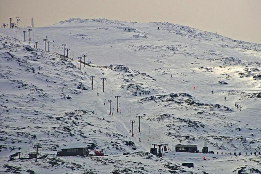 A bit late in the day but finally some reasonable skiing in Scotland! This is Glencoe – Photo: winterhighland.org, 29 March 2024
USA
Utah is still the place to be in the western US, with 20cm+ of new snow in the last 48-hours in Snowbird (350cm mid-mountain base) and more in the forecast this weekend.
Most Colorado resorts have also seen significant snow in the last week, with around 35cm in Breckenridge (175cm upper base), and more flurries expected over the next few days.
Canada
Whistler (231cm mid-mountain base) now has plenty of snow thanks to big falls earlier in the month and further top-ups this week. This has brought snow depths back to average after a very meagre early season. Next week will start mild, but further snow and cooling temperatures are expected from mid-week on.
Further inland, Lake Louise/Banff (165cm upper mountain) are also skiing well, with 20cm of snow having fallen last night, and further flurries today. It will be largely fine here from Sunday onwards before snow returns again mid-week.
 Fresh snow has fallen overnight in the Banff-Lake Louise area – Photo: snoweye.com, 29 March 2024
Our next full snow report will be on
Saturday 6 April 2024
If you enjoy reading our updates - please feel free to support us: