Latest snow report
Updated: 8.45pm Friday 7 March 2025
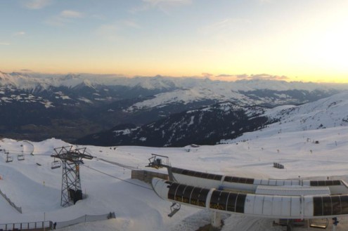
Snow conditions in the Alps haven’t changed a huge amount since our last detailed report, despite further snow loss at lower altitudes. The weather has been largely fine this past week, and for the most part not excessively warm, although some northern valleys will hit 20°C this weekend due to the Foehn.
This means that there is still some enjoyable skiing on offer in the Alps, despite mostly below par snow depths. Most of it is on-piste, with the most consistent snow quality on higher north-facing slopes. At lower altitudes, conditions are more typically spring-like, with often very patchy natural snow cover. However, as always, resort authorities have been doing an excellent job in keeping pistes open down to the valleys, even if the adjacent slopes are now green.
Some snow is expected in the Alps over the next few days, mostly in the southern French Alps (e.g. Isola 2000), the Italian Piedmonte region (e.g. Prato Nevoso, Alagna) and perhaps over the border into the far south-west of Switzerland (e.g Zermatt, Saas-Fee).
Across the pond, Whistler is at the start of a major storm cycle that will dump huge amounts of snow over the next few days…
Austria
Snow conditions in the Austrian alps this week have been spring-like lower down, and will remain so over the weekend, especially in the north thanks to the Foehn.
Zell am See (0/80cm) can still offer some reasonable piste -skiing up top but is looking decidedly patchy lower down. For more consistent snow conditions, you need to be skiing in a resort that has plenty of terrain over 2000m, such as Ischgl (60/90cm) or Hintertux (25/185cm).
A little snow is forecast for most Austrian resorts early to mid-week next week, when it should also start to turn colder.
France
Like most other parts of the Alps snow quality is variable in the French Alps, especially lower down where natural cover is patchy in the likes of Les Gets (15/120cm) and La Clusaz (5/190cm) and spring conditions rule.
For more consistency you need to be higher up, in the likes of La Plagne (130/185cm) or Tignes (130/205cm) but, even here, some icy patches are inevitable.
Some snow is forecast later this weekend and early next week, but mostly in the southern Alps (e.g. Isola 2000, Risoul).
Italy
Like most other parts of the Alps, snow depths are below par in most Italian resorts, with the exception perhaps of the far north-west where La Thuile (60/220cm) continues to be as good as anywhere.
Further east, some of the best conditions are in Livigno (60/70cm), though most of any fresh snow that falls later in the weekend and early next week will be in the Piedmonte (e.g. Prato Nevoso).
Switzerland
Snow conditions remain highly variable across the Swiss Alps, with patchy natural snow cover and spring conditions lower down in resorts like Gstaad (15/70cm) and Grindelwald (5/105cm) where more snow would be welcome.
For more consistent on-piste snow quality, you need to aim for resorts with plenty of terrain above 2300m such as Zermatt (20/250cm) or Saas-Fee (60/230cm). Even here though, you will still find some icier and/or slushy conditions lower down depending on the time of day.
Some fresh snow is expected early next week, but mostly in the far south-west (e.g. on the border around Zermatt and Saas-Fee).
Rest of Europe
There has been some good piste-skiing in the higher resorts of the Pyrenees this week although poor weather conditions will make things tricker over the next few days. In Andorra, Soldeu (125cm upper base), for example, is expecting plenty of new snow up top but also some rain at times closer to resort level.
After a mild spell of weather in Scandinavia it will turn much colder next week with maximum temperatures struggling to reach -10°C in Norway’s Hemsedal (30/35cm) by Wednesday. Most Scandinavian resorts will see some fresh snow over the next few days though, which will help to freshen up the pistes.
It’s bad news still for Scotland though, where there is only very patchy snow and no proper lift-served skiing available in any of its resorts.
USA
In the US, there is plenty of good skiing available in Colorado, with around 40cm of new snow this week in Vail, which has a 196cm mid-mountain base. It will be mostly sunny and quite warm here next week though, so expect a few days of increasingly spring-like conditions.
It’s a similar story up in Wyoming’s Jackson Hole (208cm mid-mountain base) where there has been some useful snowfalls in recent days, but where sunnier and milder weather will prevail next week.
Canada
In Canada, Whistler (193cm mid-mountain base) hasn’t seen that much snow in the last week but is at the start of a big storm cycle that should deliver well over 1m of new snow at altitude over the next few days. Needless to say, conditions will be excellent here once the weather calms down, both on and off-piste.
Further inland, snow is also forecast later in the weekend and early next week in Lake Louise (140cm upper base), although in more moderate quantities.
Our next full snow report will be on
Friday 14 March 2025


