


ARCHIVE
Today in the Alps - December 2024
Read about current weather and snow conditions in the Alps
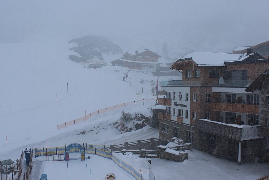
Updated: 1pm Tuesday 31 December 2024 – Change of weather in the Alps on Thursday…
It’s been a splendid few days of weather in the Alps, with almost wall-to-wall sunshine and just the usual bits and pieces of low cloud/fog trapped in some valleys, mostly close to the foothills. After plenty more sun today and tomorrow (New Year’s Day), the weather will change on Thursday with the arrival of weather fronts from the north.
 Perfect weather again today in Schröcken in the Austrian Vorarlberg – 31 December 2024 – Photo: warth-schroecken.at
These weather fronts will bring some snow to the Alps late on Thursday and overnight, mostly to the north (e.g. Val d’Isère, Avoriaz, Verbier, Laax, St Anton, Kaprun) with snowfall totals of around 5-20cm, with the greatest accumulations further west. The southern Alps (e.g. Sestriere, Pila, Madesimo, Dolomites) will miss most of the snow.
The weather will brighten up on Friday but then turn unsettled again over the weekend, although it will be milder with the possibility of some rain at lower altitudes in the western Alps. Looking longer term, there is a chance that some severe cold weather will engulf the Alps during the second week of January. At this stage, this is far from certain but just something we are keeping an eye on…
Updated: 1pm Friday 27 December 2024 – Excellent snow conditions for most of the Alps…
A vast area of high pressure is dominating the weather in the Alps and will continue to do so for some days to come, meaning that there will be lots of sunshine until the middle of next week, at least at any degree of altitude, with just a bit of nuisance-value low cloud close to some of the foothills.
 Perfect weather across the Alps today. This is St Johann in Tirol – 27 December 2024 – Photo: foto-webcam.eu
Freezing levels are quite high today, at around or over 3000m in the western Alps, and a little lower further east. However, the sun angle is very low at this time of year and this, combined with low humidity, means that any snowmelt will be very limited.
Indeed, snow conditions are generally excellent across the northern Alps, especially in the north-west which saw so much snowfall just before Christmas.
On the whole, snow depths are much more modest across the southern Alps, especially in the far south-west (e.g. Isola 2000), though even here there is some decent piste-skiing on offer thanks to a mix of natural and artificial snow.
Updated: 11am Tuesday 24 December 2024 – Fabulous snow conditions for much of the Alps…
Flurries will linger across parts of the northern Austrian Alps today, though these will generally become light. For most of the rest of the Alps it will become sunny, where it isn’t already, but it will still be cold and windy in exposed areas. It will remain mostly fine over the next few days but will turn much milder, especially in the western Alps.
 It doesn’t get much better than this! Perfect snow conditions in Les Gets this morning – Photo: lesgets.com, 24 December 2024
Snow conditions are fantastic across most of the northern and western Alps, with significant new snowfall, cold temperatures, and increasingly sunny skies. Since last Thursday, many ski areas in the north-western Alps, including Val d’Isère, Chamonix, Flaine, Avoriaz, Mürren and Engelberg have seen 1m or more new snow at altitude. There has also been significant snow lower down, meaning that resorts like Megève, Morzine, Villars and Adelboden are looking at one of their best Christmas periods for many years.
Other northern parts of the Alps have also done very well (e.g. Arlberg), although Austria has generally seen slightly less impressive quantities of snow. Aside for some areas close to the border (especially La Thuile, Courmayeur, Cervinia), the Italian Alps and far southern French Alps have seen much more modest quantities of snow in recent days, though they still have some excellent piste skiing on offer.
The fine weather in the Alps is expected to last for several days. Needless to say, the off-piste will be hazardous in many places, especially in the north-western Alps, so a good guide is always recommended.
Updated: 11am Monday 23 December 2024 – Huge snowfalls for many north-western parts of the Alps!
This morning it’s a very snowy scene across the north-western Alps where it will continue to snow to very low levels for most of the day. Aside from close to some border areas, the southern Alps are drier with variable cloud clover. Christmas Eve will see snow flurries linger for a time across the north-eastern Alps (i.e. parts of Austria) while most other parts of the Alps will enjoy a brighter day.
 50cm of new snow has fallen at resort level in Val d’Isère in the last 24 hours, and it is still going strong this morning! – 23 December 2024 – Photo: valdisere.com
The distribution of snowfall from this latest storm has been somewhat different than forecast a few days ago. The north-western Alps (e.g. La Rosière, Flaine, Avoriaz, Mürren, Engelberg) have seen as much snow as forecast, with well over 1m at altitude since Thursday and more to come this afternoon.
This snow has been especially welcome for the lower resorts of the north-western Alps like Morzine, Megève and Villars, which have struggled in recent seasons but now have more snow on the ground (lower down) than at any point last winter.
In western Austria, however, snowfall has not been quite as heavy as originally expected. There have still been some big falls in places, especially in the Arlberg (e.g. Lech/St Anton), with more to come later today/tonight, but it is the northern French Alps and northern Swiss Alps that have seen the biggest snowfall totals from this storm, with perhaps 1.5m or more since last Thursday in some favoured spots.
Snow conditions over the Christmas period will be exceptional across the northern half of the Alps, especially in the north-west, which has seen the heaviest snow in recent days. Needless to say, the off-piste will remain very dangerous for a while, so do not venture off the beaten track without an experienced local guide!
In the parts of the southern Alps that have seen less snow (e.g. Dolomites) there is still plenty of good piste-skiing on offer on a mix of natural and man-made snow.
Updated: 10am Saturday 21 December 2024 – New storm incoming for the Alps…
It’s a sunny morning across much of the Alps although cloud cover is already thickening in the far west, heralding the arrival of the next storm tonight. This storm will be more potent than the last and will influence the weather in the Alps until Tuesday at least.
 View from the Super-Morzine area this morning, with the first clouds of the new storm starting to move in from the north-west – 21 December 2024 – Photo: morzine-avoriaz.com
Over the next three or four days well over 1m of new snow is forecast across much of the northern Alps, however, the southern Alps will see much more modest quantities. Check out our latest country-by-country weather and snow forecast later today for more details.
Snow conditions in the northern Alps will be greatly improved in the run-up to Christmas (see our detailed snow report published yesterday), however, all the new snow will be accompanied by high winds meaning that off-piste conditions will be dangerous and take some time to settle down.
Snow conditions in the southern Alps will only see limited improvements, though they are still able to offer lots of good piste-skiing.
Updated: 11am Friday 20 December 2024 – Fresh snow for most of the Alps!
It’s a cloudy morning across many northern and north-eastern parts of the Alps, with some residual flurries, especially in Austria. Elsewhere, it is a brighter picture, with the best of the sunshine the further south and west you are. It is much colder everywhere today, though, with a strong northerly wind in exposed areas.
 Fresh snow this morning in Les Gets – 20 December 2024 – Photo: lesgets.com
After a generally dry tomorrow, with the best sunshine the further south-east you are, the next storm will reach the north-western Alps late on Saturday evening, moving further east to reach much of Austria by Sunday morning. This storm will influence the weather in the Alps until Tuesday and deliver very large quantities of snow to much of the northern Alps. The rain/snow limit will rise to 1500m for a time in some exposed western regions but will remain lower further east and in the more internal valleys.
Between yesterday and Tuesday, storm totals above 1800m are likely to be in the 70-120cm range in many northern/north-western Alpine ski resorts, including Flaine, Avoriaz, Verbier, Mürren, Engelberg, and possibly more resorts in the Arlberg region (Lech, St Anton, Warth).
Storm totals during this same period in the southern half of the Alps (e.g. Sestriere, Alta Badia) will be more in the 10-30cm range.
Needless to say, snow conditions (which had already improved thanks to yesterday’s snowfalls) will be further improved in the run-up to Christmas. This will come as a relief for many as, although there has been plenty of good skiing available in the Alps over the last week or so, milder temperatures were allowing some cracks to show, especially lower down, and more snow was needed.
Updated: 11am Thursday 19 December 2024 – New storm hits the Alps…
A new storm has hit the Alps, with rain and snow falling across many western parts of the Alps this morning, which will spread further east as the day progresses, reaching Austria and the eastern Italian Alps (i.e. Dolomites) tonight.
 Stormy-looking skies over Lech, where over 1m of snow is expected between tonight and Tuesday morning – Photo: lechzuers.com, 19 December 2024
The rain/snow limit will start at around 2200m and decrease steadily to reach 500-1000m by the night’s end, with the mildest air holding on for the longest in the south-east. Friday will be much colder with some flurries lingering across the northern and eastern Alps for a time, but generally much brighter in the southern Alps. This first storm will typically deliver between 10cm and 30cm of new snow above 2000m, with 40cm+ in a few favoured parts of the north-western Alps (e.g. Avoriaz).
A second, more potent storm will arrive from the north-west on Saturday night and influence the weather in the Alps until Tuesday. This storm will mostly affect the northern half of the Alps, delivering another 40-70cm (and more in places) between Saturday night and Tuesday morning to regions including the northern French Alps, much of Switzerland and Austria (away from the south).
Storm totals over the next five days could exceed 1m in many northern and north-western parts of the Alps, with as much as 1.2m to 1.5m possible in a few favoured spots like the Austrian Arlberg.
Updated: 1pm Wednesday 18 December 2024 – Mostly dry today in the Alps, but two significant storms are on their way…
It’s another mostly dry and very mild day across the Alps today, but with more in the way of cloud, especially in the northern half of the chain. The best of any sunshine will be further south, especially in the far south-west (e.g. Isola 2000).
 The best of today’s sunshine is in the south-western Alps, including here in Bardonecchia – 18 December 2024 – Photo: bardonecchia.com
Tomorrow, a new storm will cross the Alps from west to east. Most regions will benefit from at least some new snow though the heaviest falls will again be in the north-west, with resorts like Avoriaz potentially seeing as much as 40-50cm above 1800m by Friday morning. The rain/snow limit will start at around 2000m on Thursday but will fall steadily throughout the day and on Thursday night to reach 400-700m by Friday morning.
Flurries will linger for a while to low levels across the northern Alps on Friday before another storm reaches the Alps on Saturday, which will continue to influence the weather until Monday. This second storm will bring further, significant quantities of snow to much of the Alps but with the heaviest falls in the north-west.
Between now and Monday, between 80-120cm of new snow can be expected above 1800m across many north-western parts of the Alps, including Tignes, Flaine, Avoriaz, Verbier, Mürren, Engelberg and St Anton, to name just a few.
Updated: 9.45am Monday 16 December 2024 – A mostly fine and very mild start to the week in the Alps…
A few, very light, snow showers or flurries (1500m) will linger this morning across the eastern Austrian Alps. Otherwise, it will be a mostly fine and increasingly mild day, with freezing levels exceeding 3000m in the west!
 Fine weather with plenty of snow in Les Saisies, France – 16 December 2024 – Photo: lesaisies.com
Over the next few days, the weather will remain mostly fine and very mild, especially noticeable at altitude, before a storm rolls in from the west on Thursday bringing significant snow to many parts of the Alps. Stay tuned!
Right now, snow conditions remain pretty good across most of the Alps, with sunshine and very mild temperatures in the first half of this week making for some particularly pleasant skiing, at least on-piste. Note that natural snow levels are still generally very modest lower down though.
Updated: 11am Sunday 15 December 2024 – Excellent skiing conditions across many parts of the Alps…
It’s a mostly cloudy morning across the north-eastern Alps (i.e. much of Austria away from the south) with light flurries to relatively low altitudes. Elsewhere in the Alps, it is brighter, with the best of the sunshine the further south and west you are.
 Good snow and weather today in Avoriaz – 15 December 2024 – Photo: avoriaz.com
Next week will see a few days of mostly fine and much milder weather before a new storm arrives from the north-west on Thursday.
Snow conditions in the Alps are mostly very good today, especially in the areas that have seen a top-up this weekend, including the St Anton/Lech area, which has seen around 10cm of new snow. Early yesterday, there were flurries in the western/south-western Alps (e.g. Alpe d’Huez), which then spread further north and east later in the day reaching Austria, where they continue to linger for a while today.
On the whole, the south-eastern Alps (e.g. Dolomites) have missed most of the snow in recent days but their excellent snow-making means that there is still lots of good piste-skiing available.
Updated: 3pm Friday 13 December 2024 – A bit more snow on its way for some parts of the Alps…
It has been another fine day across most of the Alps, with the best of the sunshine in the east. Cloud has been thickening up this afternoon in the far western Alps though, heralding the arrival of a weather front that will bring a few centimetres of snow to some south-western parts of the Alps tonight.
 Lovely day in Lech but snow is forecast for tomorrow – Photo: foto-webcam.eu, 13 December 2024
This snow will be mostly light, but a little heavier for a time on the western side of the southern French Alps (from about Alpe d’Huez southwards) including resorts such as Super Dévoluy and Orcières-Merlette where 5-10cm of new snow is possible.
On Saturday, flurries will transfer to the northern side of the Alps, all the way from the northern French Alps (e.g. Avoriaz), across much of Switzerland (e.g. Wengen, Engelberg) and into Austria (e.g. Arlberg). Again, we are not expecting a huge amount of snow, generally around 2-10cm, with a few flurries lingering into Sunday.
Updated: 11am Thursday 12 December 2024 – Another glorious day for most of the Alps…
It’s another beautiful day across most of the Alps, with just a few areas of nuisance-value low cloud trapped in the lowlands and some of the valleys, especially close to the northern and western foothills.
 Glorious weather across most of the Alps today including here in Schröcken in the Austrian Vorarlberg – 12 December 2024 – Photo: warth-shroecken.com
It will remain mostly fine on Friday though, with thickening cloud in the far west later in the day heralding the arrival of some light flurries in the south-western Alps (Alpe d’Huez, Risoul, Isola 2000) on Saturday. Later in the weekend, snow flurries will transfer to the northern Alps, remaining mostly light but with the potential for 5-10cm in some Austrian resorts, notably in the Arlberg.
Snow conditions in the Alps remain largely good for the time of year, at least on-piste, even if snow depths are generally still modest. For a full country-by-country update, check out our latest detailed snow report, which will be out later today…
Updated: 10am Wednesday 11 December 2024 – Mostly dry and still on the cool side today in the Alps…
Another mostly dry day is expected in the Alps today, with plenty of sunshine, especially at altitude and/or in the more internal Alpine regions. That said, there will be some areas of cloud floating around and some valleys, especially close to the northern and western foothills which continue to be plagued by low cloud. Temperatures will remain on the cool side with very little (if any) melting of any of the recent snowfall.
 Cold and snowy this morning in Châtel – 11 December 2024 – Photo: chatel.com
The next snow is forecast for this weekend, initially in the western Alps (e.g. Alpe d’Huez) then in the northern Alps (e.g. Engelberg, Lech) but in very modest quantities in both cases.
Snow conditions in the Alps are generally good for the time of year even if snow depths are unremarkable. The southern Austrian Alps (Carinthia) and the northern and eastern Dolomites (e.g. Kronplatz) have the least natural snow, but still have some excellent piste-skiing on offer thanks to world-class snow-making.
The area with the most natural snow is at altitude in the western Alps with, for example, a claimed 115cm of settled snow up top in Val Thorens. Many lower resorts also look wintry right now albeit with modest snow depths, so ideally need further significant snow to be secure for the early season.
Snow conditions in the Pyrenees have been transformed in recent days, at least in the northern half of the chain (which includes Baqueira Beret) thanks to huge snowfalls of over 1m at resort level in places, and closer to 2m at high altitude.
Updated: 11am Tuesday 10 December 2024 – Wintry scenes across much of the Alps!
The Alps are under the influence of a cool north-easterly airflow, with most Alpine regions dry today with variable cloud but also plenty of sunshine, especially at altitude. In the far south-western Alps (e.g Prato Nevoso) there will be a few snow flurries with accumulations of 1-3cm possible in places.
 Very wintry looking scenes at Hochries in Bavaria on the German-Austrian border – 10 December 2024 – Photo: foto-webcam.eu
Over the next few days it will stay mostly dry in the Alps, with plenty of sunshine but also some nuisance-value low cloud, especially close to the northern foothills. By the end of the week and over the weekend, some further light snow flurries are possible, first in the south-western Alps (e.g. Isola 2000) then in the northern Alps (e.g. Jungfrau region, Engelberg, Kaprun) but not amounting to much. It will remain on the cool side.
Snow conditions in the Alps are mostly very good right now, especially on-piste. Some good off-piste is also possible in places, especially in the French and western Swiss Alps but a good guide is strongly recommended: not only are snow depths very modest in places lower down, but there has also been a lot of wind during these recent storms that has distributed the snow very unevenly.
The Pyrenees deserve a special mention again, having seen a huge amount of snow in the last few days, especially in the northern half of the chain (which includes Baqueira Beret), with many resorts (e.g. La Mongie, Gourette) reporting from 1m to 1.5m of new snow at resort level!
Updated: 10am Monday 9 December 2024 – Snow conditions are much improved across most of the Alps…
With low pressure in the Mediterranean and high pressure over north-west, the Alps are currently under the influence of a cool north-easterly airstream. This will bring a lot of cloud but generally very little new snow, with probably only the extreme south-western Alps (e.g. Prato Nevoso) and the extreme eastern Austrian Alps (Semmering) likely to see any additional measurable accumulations (1-3cm).
 Wintry scenes this morning in Les Gets – 9 December 2024 – Photo: lesgets.com
It will stay mostly dry over the next few days, with more in the way of sunshine, especially at altitude. Temperatures will remain on the cool side.
Snow conditions are much improved across most of the Alps following significant snow over the weekend. The heaviest of this fell in the western Alps, with around 20-40cm above 1800m in many French resorts (and 60cm+ in some western foothills near Grenoble).
On the whole, the further east you were the less snow fell, with typically only around 5-20cm and a bit more in some parts of the western Dolomites and eastern Lombardy. The least snow fell in the southern Austrian province of Carinthia, however, it looks like winter now just about everywhere in the Alps. With cool temperatures forecast to continue, snow-making can also continue apace.
Updated: 10.30am Sunday 8 December 2024 – It’s beginning to look a lot like winter…
Just about all parts of the Alps have fresh snow this morning, though the amounts vary hugely from region to region.
 Lots of new snow in Chamrousse near Grenoble, with more to come today – 8 December 2024 – Photo: chamrousse.com
As expected, some of the heaviest falls have been in the western French foothills close to Grenoble (e.g. Chamrousse, Villards de Lans) where 40-50cm has fallen at altitude with plenty more to come today. More generally in the western Alps there have been falls of 20-40cm above 1800m (with less in the far south-west), and 5-20cm typically across the eastern Alps, with a bit more in the western Dolomites and eastern Lombardy.
Today most of the Alps will only see occasional very light flurries. However, there will still be some more consequential snow in places, again including the western French foothills near to Grenoble, and also in the western Dolomites (e.g Madonna di Campiglio) and eastern Lombardy.
The areas having seen the least snow from this latest storm are the southern Austrian province of Carinthia, and some central and eastern parts of the Dolomites (e.g. Cortina).
Looking into next week, although we are not expecting any significant new snow, it will remain relatively cold which will help consolidate the snow that has fallen, and allow snowmaking to continue apace.
Away from the Alps, the Pyrenees also deserve a mention, where they have a huge amount of new snow, with well over 1m expected at altitude in many resorts (e.g. Baqueira Beret) by tomorrow.
Updated: 11am Saturday 7 December – Snow on its way for many parts of the Alps…
A new storm is approaching the Alps from the west this morning, which will continue to influence the weather throughout the weekend.
 Most Alpine regions will see fresh snow falls this weekend, with the greatest accumulations in the west (shown in darker blues) – Image: bergfex.com, 7 December 2024
The rain/snow will reach the French, western Swiss and western Italian Alps by early to mid-afternoon, before continuing east to reach the more eastern parts of the Alps later today and overnight, albeit tending to reduce in intensity. The rain/snow limit will start at around 1700-2000m but will quickly fall towards 1000m later today then to very low levels in the west overnight.
Between Saturday lunchtime and Sunday morning, between 15cm to 30cm of new snow can be expected above 1800m across much of the French and far western Swiss Alps, with a bit more in places, especially in the Vercors and Chartreuse regions (west of Grenoble). Most of the rest of the Alps will see between 5cm and 15cm, again with a little more in places (e.g. western Dolomites). Generally, Austria will see the least snow, especially the central and eastern Austrian Alps (e.g. Obertauern).
Sunday will be cold with further light flurries to low levels here and there. These won’t generally amount to much but could produce a few more centimetres in places, notably in the western French foothills (e.g. Vercors, Chartreuse).
Updated: 11am Friday 6 December – Turning more wintry in the Alps this weekend…
A weather front crossed the Alps last night which continues to influence the weather this morning, with showers or longer spells of rain/snow across many northern parts of the Alps.
 Snowing in Obertauern this morning – 6 December 2024 – Photo: foto-webcam.eu
Any precipitation will die out across the north-western Alps this morning but will continue for a time further east, notably in Austria. The rain snow/limit (that did reach over 2000m in the west last night) will fall to between 900m and 1400m as the day progresses, lowest furthest east.
Snowfall totals from this latest front will be in the 5-15cm range above 2000m across the northern Alps (e.g. Chamonix, Engelberg, St Anton, Kaprun).
On Saturday another storm will approach the Alps introducing much colder air from the north-west. This storm won’t bring as much snow as hoped a few days ago, but many parts of the Alps will still see some useful falls to low altitudes and it will mark of several days of cold weather.
Updated: 11am Thursday 5 December 2024 - All eyes are on this weekend in the Alps!
High pressure is currently in charge of the weather in the Alps, meaning that most areas will have plenty of sunshine today. That said, cloud will thicken in the north-western Alps later today, heralding the arrival of a warm front that will bring some rain and snow to the northern Alps, first in France and western Switzerland, before reaching eastern Switzerland and western Austria later tonight. The rain/snow limit will be around 2000m in the west and 1500m further east.
 Beautiful weather this morning in Val d’Isère but some rain and snow is expected tonight, with heavier snow forecast over the weekend – Photo: valdisere.com, 5 December 2024
Tomorrow, early rain/snow (1700-2000m) will die away from the north-western Alps but linger a little longer further east (Austria). On Thursday evening and Friday afternoon around 5-15cm of new (windblown) snow is expected to fall across many northern parts of the Alps (e.g. Val d’Isère, Verbier, Engelberg, St Anton, Kaprun). Throughout this period the southern Alps (e.g Isola 2000, Sestriere, Alagna, Passo Tonale, Dolomites) will remain mostly dry.
On Saturday, another more active storm will arrive from the west, that will continue to influence the weather in the Alps on Sunday. This storm will bring more widespread snow and rapidly falling temperatures on Saturday night, with snow likely to fall to very low levels by Sunday. We will bring you more details on this storm tomorrow…
For our most recent country by country round-up on snow conditions in the Alps, see our latest snow report.
Updated: 9am Tuesday 3 Dec 2024 – Last night saw a top-up of snow for some northern parts of the Alps…
As forecast, a weather front crossed the Alps last night bringing a few centimetres of snow to some northern regions, with a rain/snow limit that descended from around 2000m to closer to 1000m this morning. Snowfall totals above 2000m were typically around 5-10cm from the northern French Alps through many parts of Switzerland (away from the south) and into the west of Austria.
 A break in the clouds this morning high above Laax, where a few centimetres of new snow fell overnight – Photo: live.laax.com, 3 December 2024
Flurries (800-1000m) will continue today across some northern parts of the Swiss Alps, and more generally in the Austrian Alps, but will not amount to much. Many other Alpine regions will be dry today but with plenty of cloud around, and the best of any sunshine in the south-western Alps.
All eyes are now on the weekend when we are expecting a more notable wintry blast from the north-west (see our latest weather & snow forecast, published yesterday). Before this, though, the Alps must get through a milder spell of weather on Thursday night/Friday with some rain to 2000m or so for a time.
For our most recent country by country round-up on snow conditions in the Alps, see our latest snow report.
Updated: 9.30am Monday 2 December 2024 – New weather fronts are arriving in the Alps from the north-west…
It’s a bright start to the day in many southern and eastern parts of the Alps, but cloudier in the north-west, heralding the arrival of new, relatively weak, weather fronts that will deliver some light to moderate snow to many north-western regions over the next 24 hours or so.
 Cloud thickening in St Anton this morning heralding the arrival of some mostly light rain turning to snow later today – 2 December 2024 – Photo: foto-webcam.eu
Most of the snow will fall tonight and tomorrow morning, with the heaviest falls likely in the northern Swiss Alps (e.g., Mürren, Engelberg) where 10-15cm is possible above 2000m. The northern French Alps (e.g. Avoriaz, Flaine, Tignes) should see around 5-10cm by tomorrow morning, as should the far west of Austria (Lech, St Anton). The north-eastern Alps (e.g. Kaprun, Schladming) will see less snow, likely in the region of 1-3cm, though very light flurries may continue here for longer tomorrow.
The rain/snow limit in this storm will start at around 2000m but will drop to around 1000m by tomorrow morning.
For the remainder of this week the weather in the Alps will remain relatively unsettled, with further (mostly weak) weather fronts affecting the northern Alps from time to time. These will likely become more active on Friday, but with the rain/snow limit rising to 2000m for a time. By Sunday it is likely to become much more wintry, with the prospect of some much more significant snow for many Alpine regions. Watch this space!
As for snow conditions in the Alps right now, check out our latest detailed snow report published yesterday…