Updated: 9am Wednesday 30 March 2016 - Weather and snow conditions in the Alps remain variable
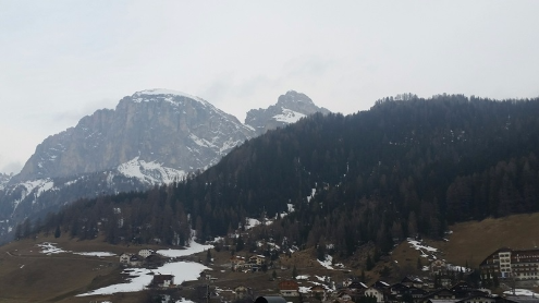
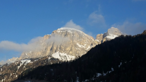
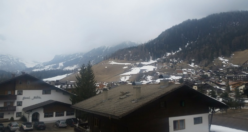
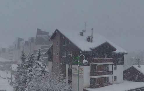
Weathertoski is in Corvara in the Dolomites, where it is cloudy this morning with a temperature of about 4°C. Elsewhere in the Alps there is also a lot of cloud first thing, but except for a few isolated showers here and there (snow 1800-2000m), it is mostly dry.
Snow conditions here in Corvara were pretty good yesterday, thanks to the refreeze the night before, only becoming really slushy on south and west-facing slopes later in the day.
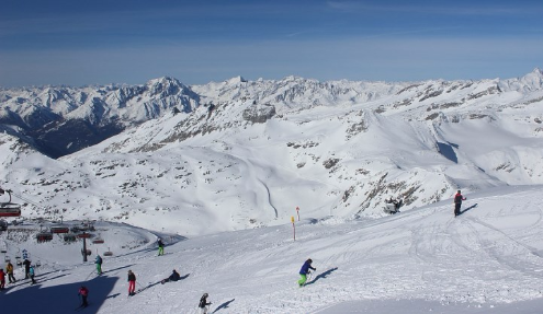
Today, after a largely cloudy night, the snow is likely to be more sugary from the outset. Generally, snow quality in the Alps today will depend on altitude and whether there was a decent re-freeze last night. As most places didn’t get a decent re-freeze, you will have to stay high today to find “wintry” snow.
The forecast for today is quite mixed with plenty of cloud, but also some good sunny breaks, these mostly likely on the northern side of the Alps. There will also be a scattering of showers here and there, most likely along the main Alpine ridge.
For the rest of the week the weather in the Alps will remain variable, but with rapidly increasing temperatures, snow conditions will generally become less favourable, especially at lower altitudes where the thaw will accelerate.
Updated: 8am Tuesday 29 March 2016 - Scattered snow showers in the northern Alps, sunnier further south
Weathertoski is in Corvara in the Dolomites, where it is mostly sunny first thing this morning with a temperature of about 0°C. Snow conditions should be better this morning due to an overnight refreeze, which was absent yesterday under the cloud cover.
Elsewhere in the Alps the weather is still quite variable, with scattered showers (snow 1300-1700m) moving west to east across the northern Alps, but generally not amounting to a great deal. The best of the sunshine will be on the southern side of the Alps today, but even here there will be areas of cloud, especially later.
The rest of the week will remain changeable with variable cloud and some sunny spells, with occasional showers, heaviest in the west on Thursday. It will also turn warmer, especially on the northern side of the Alps where a strong Foehn will develop.
Updated: 9.45am Monday 28 March 2016 - Very mixed weather and snow conditions across the Alps
Weathertoski is in Corvara in the Dolomites, where it is cloudy but dry this morning with a temperature of about 4°C.
Generally speaking there is a lot of cloud across the Alps today, with a few light showers (snow 1500-1900m) here and there, and some more persistent precipitation in the west. By contrast, aided by a slight Foehn effect, the north-eastern Alps (including much of Austria) are quite sunny.
Snow conditions are quite mixed in the Alps, and typical of the time of year. Some regions have seen a little fresh snow in the last 24 hours, mostly in the western Alps, but not really enough to make a huge difference.
As a rule you will have to stay quite high today if you want firm “wintry” snow, especially where cloud cover has prevented a proper overnight re-freeze. The most pleasant skiing conditions, at least if it is sunshine you are after, will be north of the main Alpine ridge in Austria. Later today, the band of rain/snow in the western Alps will edge further eastwards, but will become more showery in nature as it does so.
The weather for the rest of the week will remain mixed, with the most cloud in the south and west, and the best of any sunshine still in the north-east. It will, however, become steadily warmer.
Updated: 8.50am Sunday 27 March 2016 - Variable weather in the Alps today
After a glorious Saturday for most on Saturday, the weather is more mixed today, with frontal systems moving from west to east across the Alps.
These weather fronts will deliver bits and pieces of snow (1600-1800m), heaviest in the western Alps (France), but still generally not amounting to very much. The eastern Alps will start sunny, but cloud will also thicken up here with a few showers later, especially tonight.
Further bits and pieces of snow will cross the Alps (1500-1800m) tomorrow, but never in any great quantity again, with some places staying dry.
It will remain rather changeable for the rest of the week with showers in places, these being most frequent in the west and south-west. The northern, and especially north-eastern Alps, will see the best of any drier brighter weather. It will turn milder, particularly later in the week when it will feel positively spring-like in places.
After a generally excellent March, snow conditions are slowly becoming more variable, with increasingly spring-like conditions at lower altitude. This will become more and more evident as we move through this week. However, you will still be able find some decent wintry snow if you are lucky enough to be skiing in a high altitude resort with plenty of north-facing slopes above 2000m, and preferably above 2500m later in the week.
Updated: 9.05am Thursday 24 March 2016 - Fresh snow for some eastern parts of the Alps
Some eastern parts of the Alps are waking up to a little fresh snow this morning. In the northern and eastern Swiss Alps (e.g. Engelberg), as well as the far western Austrian Alps (e.g. Lech), there was only a dusting. However in the northern and eastern Tirol, the Salzburgland, and parts of Styria and Upper Austria, there is 5-20cm of new snow, locally a bit more.
Today, a few flurries (700-1000m) will continue across the northern Austrian Alps at first before gradually dying out later. Much of the rest of the Alps will be dry with plenty of sunshine, though high cloud will spread back into the west later in the day. Temperatures will remain on the cool side with freezing levels between 1100m in the far east and 2000m in the west.
Snow conditions remain pretty good across most parts of the Alps for late March, even with some powder to enjoy in some parts of Austria today. Generally speaking, however, most regions have not seen any significant snowfall for some time now which means searching for spring (corn) snow if you are heading off-piste.
The forecast over the next few days is mixed, with bits and pieces of snow here and there, and perhaps some more significant snow in the west early next week, though there is still a lot of uncertainty right now over detail and timing.
Updated: 10am Wednesday 23 March 2016 - Some snow for the north-eastern Alps today
The Alps are under the influence of a cold north-easterly airflow which is feeding snow showers into parts of Austria and Switzerland today.
Most of the snow showers will be in the northern half of the Austrian and Swiss Alps. These will be heaviest later in the day with a rain/snow limit between 700m and 1000m, but lower in the east. Snowfall totals will generally be quite modest, but 20-30cm is possible in some favoured locations.
The southern and western Alps, including France and Italy, will stay mostly dry with variable cloud and sunny spells. It will feel cool though with a raw north-easterly breeze in exposed areas.
Snow conditions remain pretty good in the Alps for late March, even if most of the obvious powder has long disappeared or been tracked out. As we have already mentioned, some north eastern parts will see some fresh snow today but, with one or two exceptions, quantities will be relatively modest.
The weather will remain rather changeable over the next few days with plenty of dry weather but also some bits and pieces of (mostly light) snow here and there. There will probably be a more significant fall in the west on Sunday.
Updated: 10.20am Tuesday 22 March 2016 - Best of the sun in the south and west
The weather in the Alps is highly variable this morning. In the Austrian Alps north of the main Alpine ridge, as well as in the northern and eastern Swiss Alps, there is a lot of low and medium level cloud with an upper limit of around 1700-2000m. The eastern Austrian Alps are more generally cloudy with a few light showers (snow 1200-1500m).
The further south and west you are the better the weather, with plenty of sunshine across the Italian, French, and western and southern Swiss Alps.
Tomorrow and especially on Thursday, snow flurries will become more widespread across the eastern Alps, with some light to moderate accumulations (5-30cm) possible in parts of Austria and eastern Switzerland. The best of the weather will again be further west.
Snow conditions remain pretty good for late March, with the most pleasant skiing in the sunnier western Alps over the next couple of days. It will be chilly for the time of year, especially in the more exposed parts of the northern Alps where there will be a noticeable north-easterly wind.
For more detailed weather information on the Alps, check out our full forecast later today…
Updated: 11.15am Monday 21 March 2016 - Still mostly fine
After a fabulous weekend of weather in the Alps, it’s another fine start to the day for most, with plenty of sunshine at altitude. However, with some slightly more humid air feeding in from the east, the northern and north-eastern Alps have a lot of cloud in their lower valleys. Some cloud may also bubble up almost anywhere later.
This extra humidity means that snow conditions are not quite as good as they were couple of days ago, with an accelerated thaw at low altitude. However, it’s all relative, and generally speaking the Alps are still in good shape for late March. Indeed, freezing levels are still quite low for the time of year (close to or below 2000m today), and will drop again mid-week with a few snow showers in places, notably in the eastern Alps.
All in all it’s looking pretty good in the run up to the busy Easter period, though the very best snow will inevitably be in resorts with plenty of high altitude north-facing terrain.
Updated: 11.40am Saturday 19 March 2016 - Fabulous weekend of weather in the Alps
It’s a beautiful day in the Alps, with virtually wall to wall sunshine and freezing levels close to or a fraction above 2000m.
Snow conditions remain pretty good for mid to late March. There will inevitably be some afternoon slush on slopes that are low and/or exposed to the sun, but temperatures are not excessively high and, with very low humidity, the quality of the snow remains good at altitude, and on north-facing slopes generally.
The weather in the Alps will remain mostly fine over the next couple of days at least, before it turns a little more unsettled mid-week. A few snow showers are therefore expected on Tuesday and Wednesday, these most likely in Austria, but widespread significant snow is not on the cards at this stage.
Updated: 9.15am Friday 18 March 2016 - Sun, sun, sun
The weather in the Alps will be glorious today, with lots of sunshine and afternoon freezing levels hovering around 2000m.
With light winds, it will feel warm out there in the strong March sun. However, temperatures are not excessive for the time of year, and with low humidity, snow conditions should hold up relatively well. Yes, there will an inevitable freeze-thaw cycle, most noticeable on low south-facing slopes, but afternoon slush won’t be as bad as it can be at this time of year and it should be quite easy to find more “wintry” snow on shady north-facing slopes, especially at altitude.
This fine spring weather will continue through the weekend and well into next week, with lots of sunshine and cold nights, but pleasantly warm afternoons.
Towards the middle of next week, it may turn a little more unsettled, with the chance of some snow showers, on both the southern and northern flank of the Alps. However, detail is still sketchy at this stage, so stay tuned. Once thing is for sure, temperatures will drop again - no bad thing in the run up to Easter.
Updated: 9.25am Thursday 17 March 2016 - Mostly sunny, fresh snow in the Italian Piedmont
The last flurries from yesterday’s big storm are dying away from the southern Italian Piedmont this morning, leaving much of the Alps with a fine and sunny day to look forward to.
Yesterday’s storm left 20-50cm of new snow across the Italian Piedmont (e.g. Alagna, Sestriere), with close to 1m locally in the Ligurian Alps (e.g. Prato Nevoso). The snow spilled over the border into parts of France (e.g. Isola 2000, Abriès) and Switzerland (Simplon region), but gave no more than a dusting in Val d’Isère, Zermatt and Saas-Fee, that might have expected more in this kind of situation.
Snow conditions in the Alps remain excellent for mid-March, with plenty of sunshine to look forward to over the next few days, including at the weekend. At this time of year we will inevitably see a freeze-thaw cycle, which will be strongest on lower south-facing slopes, but more limited the higher and more north facing you are.
Generally speaking, however, the melting process won’t be too extreme, thanks to relatively low ambient temperatures and humidity.
Looking a bit further ahead and there should be lots of fine weather around next week, especially in the northern Alps. In the southern Alps there is the chance of some further snowfall, but there is still lots of uncertainty over this, so stay tuned.
Updated: 9.25am Wednesday 16 March 2016 - Heavy snow for the Italian Piedmont
The weather in the Alps is highly variable this morning. There is heavy snow in the Italian Piedmont (e.g. Alagna, Sestriere, Prato Nevoso), while in the central and north-eastern Alps (e.g. Zell-am-See), there are some good sunny breaks.
Looking back at yesterday and an area of (mostly light) snow moved south-westwards out of Austria, across parts of Switzerland and into France. Snowfall totals were not very significant, generally just 1-10cm, and many central Alpine valleys stayed dry.
Some parts of Italy also saw some snow (10cm in the Sella Ronda, for example), but it was very hit and miss here until later in the night when some more significant snow arrived in the Piedmont area, where it will snow heavily for most of today.
Indeed we could see 25-50cm quite widely across the Piedmont by tomorrow morning (e.g. Alagna, Sestriere), and possibly as much as 100cm locally in the far south-west (e.g. Prato Nevoso). Heavy snow may also spill over the Italian border into some southern French resorts (e.g. Queyras region), as well as the far south of Switzerland (e.g. Zermatt, Saas-Fee). However, most of the rest of the Alps will be dry with variable cloud, and just the odd flurry here and there.
Generally speaking, it will be cold with snow falling to low levels - typically 400-600m in the Piedmont. However, it may feel quite warm locally in some of the brighter, Foehn-affected spots of the central and north-eastern Alps.
Towards the end of the week the weather will settle down again, with lots of sunshine expected across the board this weekend.
Snow conditions remain very good for mid-March, with some serious powder opportunities in the Italian Piedmont over the next 48 hours. As ever, however, make sure you know what you are doing if you head off-piste!
Updated: 9.40am Tuesday 15 March 2016 - Snow for the north-east
The weather in the Alps is still coming in from the east, as it has done for several days now. Today the western Alps are expected to be mostly fine, though cloud amounts will increase later. By contrast, it is snowing in the north-eastern Alps (especially in Upper Austria and the northern Salzburgland).
These snow flurries will become a little more widespread across Austria (away from the far south) as the day progresses, moving further west to affect some northern and eastern parts of Switzerland later. However, snowfall totals will be modest - generally just a few cm here and there, perhaps a bit more substantial close to the German/Austrian border. The French Alps should hold on to the sunshine for the longest.
Tomorrow and Thursday, the disturbance will move further west, with the focus of the snow on the western Italian Alps, especially the Piedmont (e.g. Sestriere, Prato Nevoso) where some big snowfall totals are likely (50cm+). It will also remain on the cold side, with any snow falling to low altitudes over the next few days.
High pressure will reassert itself by the weekend, which means lots of fine, sunny weather everywhere with a small, but certainly not excessive, rise in temperature.
Snow conditions in the Alps remain very good for mid-March thanks to the relatively cool ambient temperature, which has limited the effect of any freeze-thaw cycles in the strengthening spring sun. Weathertoski has been in Flaine over the last couple of days, where the snow has remained “wintry” on north-facing slopes right down to resort level (1600m) all day long.
If it’s powder you are after, keep on an eye on the western Italian Alps (especially the Piedmont) over the next two days, where some serious dumps are likely. Elsewhere it’s more a case of bits and pieces, but temperatures will remain on the low side, at least until the weekend.
Updated: 9.15am Monday 14 March 2016 - More in the way of sunshine than yesterday
Weathertoski is still in Flaine, where it is cold and clear this morning and should remain sunny for much of the day.
There is still quite a lot of low cloud around the Alps today but less so than we saw yesterday. It will also break up more easily, which means that we will see more in the way of sunshine. The main exception will be parts of the western Italian Alps, particularly the southern Piedmont (e.g. Sestriere), where it will be more generally cloudy with some snow flurries. Some parts of Austria will also see larger areas of cloud early today, but will also see more in the way of sunshine, overall.
Yesterday, snow conditions in Flaine were again excellent. Yes, there was a little slush on south-facing slopes later in the day but, with the continuing low ambient temperature, north-facing pistes remained firm and grippy at virtually all levels all day.
The weather will turn more unsettled mid-week, especially on Wednesday and Thursday, with snow showers becoming a little more widespread for a time, heaviest again in the southern Italian Piedmont (e.g. Sestriere).
Updated: 8.30am Sunday 13 March 2016 - Variable cloud cover
Weathertoski is in Flaine, where it is cloudy at 1600m this morning but sunny on the higher slopes above 2200m or so.
With the weather coming in from the east there is a lot of low and medium altitude cloud across the Alps today. At high altitude there is also a lot of sunshine, but the height at which you break through this cloud is highly variable from one region to another. The eastern Austrian Alps are more generally cloudy with a snow showers. A few flurries are also possible in the western Italian Alps close to the Italian border, but in both cases significant snow is not expected and the majority of the Alps will stay dry.
Snow conditions were superb in Flaine yesterday afternoon, though most of the obvious powder has long been tracked out. It felt warm at times in the sun, but the ambient temperature is still quite low for mid-March which meant that the snow remained “wintry” on north-facing slopes above 1600m all day.
Over the next few days cloud cover in the Alps will remain variable, with the best of any sunshine at altitude and in the west. The eastern Alps, notably Austria, will continue to see some scattered snow showers, which will become more widespread mid-week. Some heavier snow is also possible in the western Italian Alps on Wednesday/Thursday.
Updated: 9.20am Friday 11 March 2016 - Cloudy in some eastern areas, otherwise mostly fine
The Alps are subject to a relatively cool easterly airflow which is bringing a lot of cloud into the far east, particularly Austria. However, for most regions there is still plenty of sunshine, even if fog is plaguing some of the lower valleys, especially close to the northern foothills.
Snow conditions remain excellent across the Alps, with the relatively low temperatures (for mid-March) helping to limit the impact of any freeze-thaw cycles, which are inevitable during fine weather at this time of year. There is also still plenty of powder available, particularly in the north-western Alps (e.g. Avoriaz) and the far south-eastern Alps (e.g. Cortina), though you might need good local knowledge or a guide to find it.
The weather for the weekend is broadly similar; remaining relatively cool with the best of any sunshine in the west. Further east there will be more in the way of cloud, especially in Austria where some flurries are likely here and there, especially in the far east. There could also be a few flurries in the western Italian Alps close to the border with France, but most areas should remain dry.
Updated: 10.15am Thursday 10 March 2016 - Fabulous snow conditions continue in the Alps
Except for a little patchy cloud in the far eastern Alps it’s another glorious day, with lots of sunshine and relatively cool temperatures, for mid-March.
The sun is now quite high in the sky, which means that there is something of a freeze-thaw cycle in progress, at least lower down and on slopes more exposed to the sun. However, given that freezing levels are quite low (generally between 1200m and 1700m), any afternoon slush is still relatively limited and easy to avoid.
Indeed snow quality is generally excellent, and there is still plenty of powder to be found (though note that avalanche risk remains high in many areas).
Looking a little further ahead and there will be plenty more fine weather over the next few days. That said, there could be more in the way of cloud and a few flurries feeding into the eastern Alps at times, notably in Austria this weekend.
With the air coming in from the east, it will also remain relatively cool with excellent snow quality at altitude, and only a slow thaw lower down. All in all, snow conditions in the Alps are excellent for mid-March.
Updated: 8.30am Wednesday 9 March 2016 - Excellent snow conditions continue in the Alps
The sun is out today across most of the Alps, and snow conditions are excellent just about everywhere.
That said there are still a few areas of cloud around, these mostly affecting the far eastern and south-eastern Alps. Some cloud will also move back into the far western Alps this afternoon, but for the vast majority of regions there’s a fine day in store.
Despite the very cold start (-21°C in Bessans in the Maurienne first thing this morning), temperatures will recover this afternoon, with freezing levels somewhere between 1300m and 1700m.
As previously mentioned, snow conditions are superb in the Alps right now - the best (generally speaking) that they have been all season. The best of the fresh is in the northern Swiss Alps (e.g. Engelberg) and the south-eastern Alps (e.g. Arabba), where between 25cm and 50cm has fallen in the last 48 hours or so (locally a bit more).
There won’t be much in the way of new snow over the next few days, just the odd flurry here and there, most notably in the eastern Austrian Alps this weekend. There will, however, be plenty of fine weather.
With the wind coming in from the east it will also stay relatively cool for mid-March, which means that any afternoon slush (inevitable in fine weather at this time of year) should be easily avoidable on higher and/or shady slopes.
Updated: 9.30am Tuesday 8 March 2016 - Fabulous snow conditions continue in the Alps
Some parts of the Alps are waking up to fresh snow again this morning, particularly in the north-western, and the eastern/south-eastern Alps.
In the north-western Alps, the French Haute-Savoie (e.g. Avoriaz, Flaine) and the northern and north-western Swiss Alps (e.g. Mürren, Engelberg) have 10-25cm of new snow, locally even more (33cm in Hasliberg, for example).
There has also been snow for much of Austria, especially in the south and east (e.g. Nassfeld, Obertauern), as well as the Dolomites (e.g. Arabba). These areas have seen 20-40cm of new snow, and very locally even 50cm+. Elsewhere, especially in the central and south-western Alps there has been little or no new snow in the last 24 hours.
Today, the snow showers across the northern Swiss Alps should slowly ease as the day goes on. However, flurries will continue to low levels further east in Austria (especially in the south and east) and the eastern Italian Alps (e.g. Dolomites), where they could still be moderate at times. The best of the sun will be in the south-western half of the Alps, but it will remain cold everywhere.
As we have mentioned several times recently, snow conditions in the Alps are, generally speaking, the best they have been all season, with few if any weak spots, plenty of fresh snow and cold temperatures.
Today, the very best snow conditions are perhaps in the central northern Swiss Alps, where there is around 20cm of light, dry powder in resorts such as Engelberg, Stoos, and Braunwald. Powder aficionados should also have their eyes on the south-east (e.g. Cortina, Arabba, Nassfeld), where the new snow is deeper still - though fractionally more humid. Needless to say, make sure you know what you are doing if you venture off-piste as avalanche danger remains high.
Tomorrow will see fewer snow flurries and more in the way of sunshine across the board.
Updated: 10.05am Monday 7 March 2016 - Excellent snow conditions, mixed weather
It’s a sunny start to the day in the western and north-western Alps, but rather cloudier in the east and south-east with a scattering of flurries.
These flurries will tend to become heavier later in the day, especially in the eastern Austrian Alps (e.g. Obertauern) and the eastern Dolomites (e.g. Arabba). At the same time, it will cloud over in the north-western Alps, with some snow showers here as well later in the day (e.g. Avoriaz) and especially tonight.
Any snow will fall to low levels today - 400m or less in the north-west, 800m in the south-east. Overall, the best of the sunshine will be in the south-western Alps (e.g. Sestriere).
Snow conditions in the Alps are generally excellent right now, as good as they have been all season. A lot of the more obvious powder may have been tracked out, but (with good local knowledge and/or a good guide) there is still plenty to be found in many parts of the Alps. Note the avalanche danger remains high though.
The weather forecast for the week ahead remains rather complicated. It will begin quite cold with a mixture of sunny periods and occasional light to moderate snow in places.
Towards next weekend it may start to settle down, with warmer temperatures and more extended periods of sunshine. However, there is still a lot of uncertainty over this, so stay tuned!
Updated: 10.40am Sunday 6 March 2016 - Fabulous snow conditions across most of the Alps
There has been lots of snow in the southern Alps in the last 24 hours, heaviest in the south-eastern Swiss Alps (e.g. St Moritz), the southern Austrian Alps (e.g. Nassfeld), and the central and eastern Italian Alps (e.g. Passo Tonale, Cortina).
The above regions have had between 40cm and 80cm of new snow, locally even more. Most other Alpine regions have also seen significant new snow (15-40cm, generally speaking), with the exception of some northern and north-eastern parts of the Austrian Alps.
All in all then, snow conditions in the Alps are superb right now but lots of care is needed off-piste as avalanche danger is high, very high in places. Today, snow flurries will continue at times across the northern and eastern Alps, with a rain/snow limit at around 400m in the west, and 1000m or more in eastern Austria. The southern side of the Alps will see the best of the sun, especially the south-west.
Next week the weather remains rather mixed with further flurries at times, but also some good spells of sunshine. Later in the week and towards the weekend, more extended periods of fine weather are likely, especially in the west.
Updated: 2.15pm Saturday 5 March 2016 - Snow, snow, snow
Heavy snow is once again falling across many parts of the Alps, heaviest in south-eastern Switzerland (e.g. St Moritz) and the central Italian Alps (e.g. Passo Tonale), where over 50cm+ is likely today alone.
Many other parts of the Alps also have fresh snow today, heaviest in the south and west, with only parts of Austria (notably the north and east, e.g. Kitzbühel, Schladming) missing out for the time being.
It will remain cold and unsettled on Sunday, with further snow showers in many places, heaviest in the Dolomites (e.g. Arabba).
As we have been saying over the last few days, snow conditions in the Alps are (generally speaking) the best they have been all season, though watch out for a high risk of avalanche off-piste, especially in the west and south.
It will stay cold for the first part of next week, with some brighter interludes, but also further flurries in places.
Updated: 10am Friday 4 March 2016 - Fabulous snow conditions and more on its way!
Looking at the Alps as a whole, snow conditions are the best they have been all season, with just about everywhere having seen significant snow at some stage this week. What’s more, another storm is on its way, this time favouring the south and west.
Looking back at yesterday, and early snow in the southern Alps quickly died away giving way to a largely bright day. In the north, however, there were frequent, heavy snow showers with accumulations of 15-40cm quite widely, and up to 50cm very locally in parts of the northern Swiss Alps. It also snowed to low altitude, which was great news for the likes of Morzine, which has endured a frustrating season to-date.
This morning, many central and eastern parts of the Alps are enjoying some sunshine (except for the far east where there are still a few flurries). However, it is already clouding over again in the west (e.g. Portes du Soleil), with some showers likely here later. It will turn temporarily milder, with the rain/snow limit rising to 1200-1400m (lower in western Italy).
Tonight the precipitation will intensify in the west and south, lingering well into tomorrow. With colder air returning, the rain/snow limit will drop to between 500m and 1000m, with the heaviest snow likely in the French, southern Swiss and Italian Alps, where 30-40cm (locally more) is possible in places.
Protected by a weak Foehn, the north-eastern Alps (e.g. Kitzbühel) may stay mostly dry until late tomorrow. We will have further details in our full Friday weather report later this afternoon…
Updated: 9.45am Thursday 3 March 2016 - New snow for many parts of the Alps
Many parts of the Alps have woken up to fresh snow this morning, the heaviest of which has been in the north-western Alps (e.g. Avoriaz) and the south-eastern Alps (e.g. Dolomites), where we have seen 15-30cm quite widely and 40cm+ in one two favoured locations.
This latest wintry outbreak comes courtesy of an active cold front that hit the north-western Alps yesterday afternoon, before sweeping eastwards to affect many other parts of the Alps, to a greater or lesser extent. The cold front brought about a dramatic drop in temperature that saw the rain/snow limit drop from around 1500m to 700m in some north-western parts of the Alps in just a few hours.
As we have already mentioned, some southern parts of the Alps have also seen significant snow, aided by the formation of a secondary low pressure area over northern Italy.
This morning, the heaviest snowfall is still in the north-west and the south-east, where it is snowing to very low altitudes. As the day progresses there will be a tendency for any snow in the south and south-east to gradually die away. Snow showers will, however, continue (to low altitudes) across many other parts of the Alps, especially in the north.
Tomorrow many eastern parts of the Alps will see something of a reprieve, though the west will see the next Atlantic storm sweep in, bringing further snow and a temporary (but not serious) rise in temperature.
The recent snow is significant in the context of the season, in that it has plugged some of the last remaining weaknesses in snow cover across the Alps. The southern Alps are now in very good shape, despite their very slow start to the season.
Further north the situation is also improving in low altitude resorts such as Morzine, which has (thanks to mild temperatures and too much rain) endured a very frustrating season to-date. It’s certainly not perfect but, looking at the Alps as a whole, this this is probably the best that snow conditions have been all season.
Updated: 9.30am Wednesday 2 March 2016 - Active cold front moving in from the north-west this afternoon
The weather in the Alps is highly changeable right now, with successive fronts piling in off the Atlantic. This unsettled weather will continue for several days, with significant snowfall totals for many parts of the Alps, greatest in the north-west.
This morning a weak warm front is crossing the northern Alps, bringing a little showery rain/snow, but also a temporary rise in temperature with a rain/snow limit between 1100m and 1700m. These scattered, mostly light showers will give way to heavier precipitation in the west this afternoon with the arrival of an active cold front.
The cold front will hit the French Alps early this afternoon (especially the north) before sweeping east to reach most of Switzerland and the far west of Austria by evening. It will snow heavily in the mountains with a rain/snow limit dropping quickly to 700m by the end of the day in the west.
Tonight the front will continue its progress eastwards, bringing snow to most of the Austrian Alps too. Behind this front, showers will continue to pack into the northern half of the Alps and, with the arrival of the colder air, they will fall as snow to 400-600m.
Throughout this period any precipitation will be patchier in the southern Alps, with the exception of two areas - the far north-western Italian Alps (e.g. Courmayeur, La Thuile), which are likely to see some heavy snow this evening, and the south-eastern Alps (e.g. the Dolomites), which may see some heavier snow thrown back by the formation of a secondary low over northern Italy. By contrast, the far southern French Alps (e.g. Isola 2000) and south-western Italian Alps (e.g. Prato Nevoso) may stay completely dry.
Tomorrow will be cold with showers or longer spells of snow in many places. Then, on Friday, the eastern Alps will see something of a reprieve before the next (warm) front brings further heavy snow into the west, with a temporary (but not serious) rise in temperature. It will then turn colder again over the weekend with further snow for many.
As for snow conditions in the Alps right now, they are (in theory at least) very good across many parts of the Alps. In practice, however, there is a lot of bad weather coming up, especially but by no means exclusively across the north-western half of the Alps.
Alongside the prospect of bad visibility and high winds (which may shut some lifts), the risk of avalanche off-piste remains high, even very high in places.
Updated: 9.15am Tuesday 1 March 2016 - Looking to the north-west again!
The big southern storm is over. Now it’s all eyes on the north again, especially the north-western Alps, where some serious snow is expected from Wednesday onwards. Freezing levels will again be up and down, but plenty of snow will get through to lower levels, especially later in the week.
Looking at figures from the storm just passed, anyone following our updates yesterday will be aware that it was the Italian Piedmont that came out on top with an incredible 150cm+ of new snow in Prato Nevoso, situated about half way between Sestriere and the Mediterranean.
This was very much the exception rather than the norm, though several other areas did also exceed 1m of new snow in 48 hours, including the upper slopes of Saas-Fee, the eastern Monte Rosa region, the French Queyras and the upper Maurienne (e.g. Bonneval-sur-Arc).
Generally speaking, the rest of the southern Alps saw more in the region of 15-60cm of snow. While, under the influence of the Foehn, the northern Alps saw little or nothing until yesterday when the snow shifted further north.
So this morning many northern parts of the Alps have also woken up to some fresh snow - no more than a dusting in the north-west, but 15-25cm in parts of the northern Swiss and Austrian Alps (e.g. Mürren and Lech).
This snow will continue for a time in the north-eastern Alps (notably in Austria), but will die away further west, only to be replaced by another weather system in the far north-western Alps later.
In between, and in the southern Alps more generally (e.g. Zermatt, Saas-Fee, Monte Rosa, Milky Way), there will be some brighter or even sunny weather around today, which will allow for some truly fabulous skiing - though note that the risk of avalanche off-piste will be sky high.
As we intimated earlier, the northern Alps will for the rest of the week be subjected to a series of potent storms, with some serious snowfall totals likely in places. The most snow will fall in the western Swiss and northern French Alps, with over 1m of new snow possible by the weekend (at least at altitude) in the likes of Flaine, Avoriaz and Verbier.


