


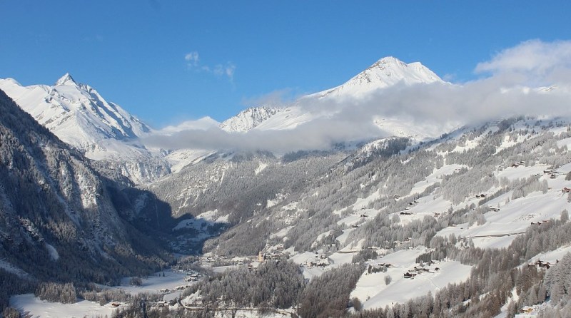
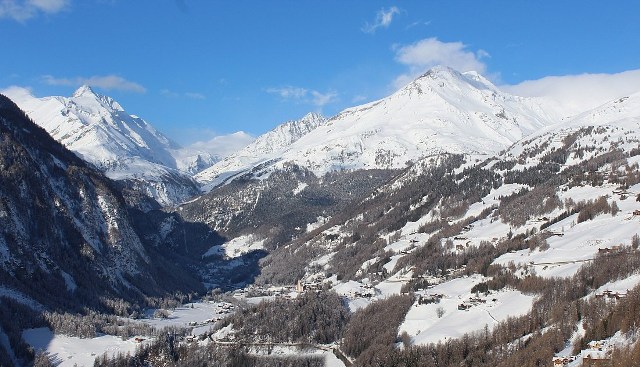
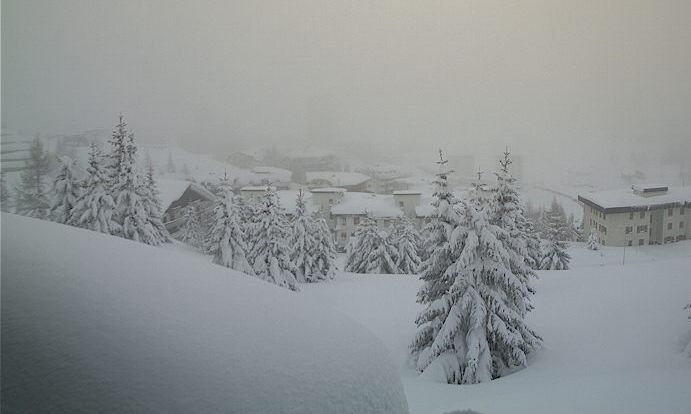
Updated: 10.50am Wednesday 31 January 2018 - Last fine day before fronts move in from the west tonight
The weather in the Alps will be mostly fine again today, with just a few areas of cloud here and there. Late in the day some more general cloud cover will invade the north-west, heralding a change to more unsettled conditions over the next few days.
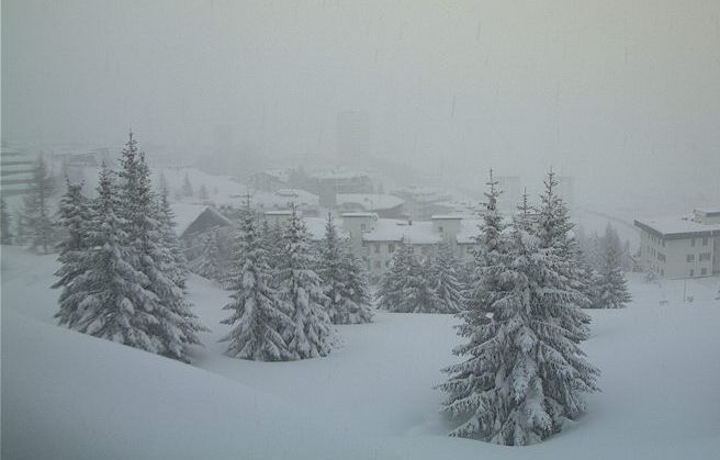
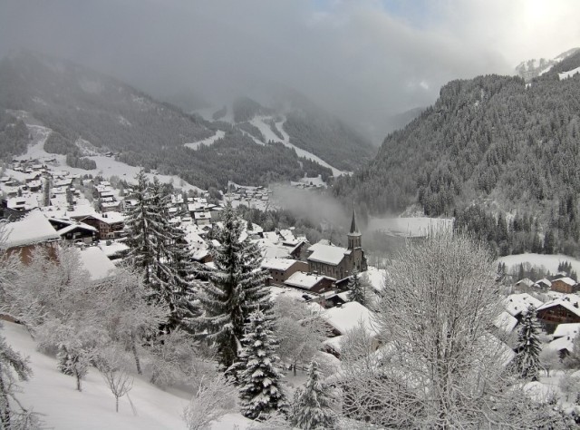
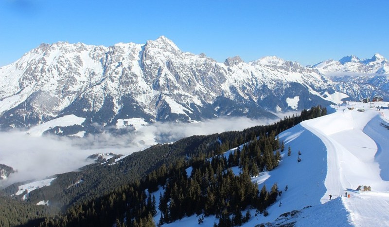 Beautiful morning in Leogang, Austria – 31 January 2018 – Photo: saafelden-leogang.com
Some snow (1200m) will reach the north-western Alps tonight, spreading further east and lowering to between 400m and 900m tomorrow. Initially most of the snow will be in the north-western Alps (e.g. Les Arcs, Avoriaz, Verbier, Engelberg), however, with a secondary area of low pressure forming over the Mediterranean, the heaviest snow will transfer to the south-eastern Alps later in the day and into Thursday night.
Indeed the Dolomites (e.g. Cortina) could see 50cm+ by Friday morning, and parts of Carinthia (e.g. Nassfeld) close to 100cm!
The weekend won’t be too bad weather-wise, with a few flurries here and there but also plenty of dry and bright weather. Generally speaking, however, the weather remains in a changeable mood with more snow expected for most next week.
Updated: 8.50am Tuesday 30 January 2018 - Mostly fine, snow later in the week
It is cloudy across the north-eastern Austrian Alps this morning, with a few showers (snow 1000-1400m). Just about everywhere else there is plenty of sunshine, at least above any low cloud/valley fog patches.
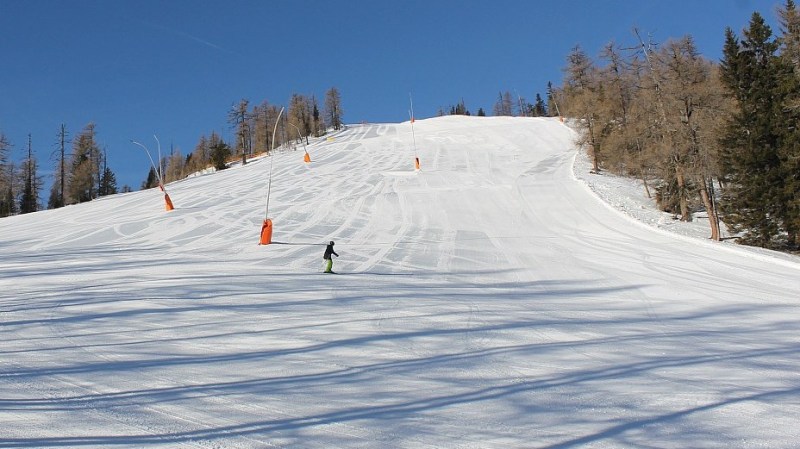 Nice weather and great piste skiing in the southern Austrian Alps today. This is Bad Kleinkirchheim – 30 January 2018 – Photo: badkleinkirchheim.com
It will remain mostly fine across many regions tomorrow, but cloud will increase in the west later in the day heralding a more significant change in the weather for the rest of the week.
During Wednesday night and on Thursday, weather fronts will bring some snow to many parts of the Alps, generally heaviest in the northern French and Swiss Alps (away from the far south) but with secondary “hot spots” in the far south-east (e.g. the eastern Dolomites and Carinthia). The rain/snow limit will start at around 1300-1500m on Wednesday night before falling to low levels during the course of Thursday. The southern Alps will generally only see light and patchy snow.
Friday will then be cold with snow showers, mostly across the northern Alps, and Saturday will see further flurries in the east, but it will brighten up for a time in the west.
Generally speaking, snow conditions remain excellent across the Alps though last week’s high winds and fluctuating temperatures have made the off-piste more variable.
Updated: 8am Monday 29 January 2018 – Fine until mid-week
It has been a glorious weekend across much of the Alps, with another sunny and mild day expected today.
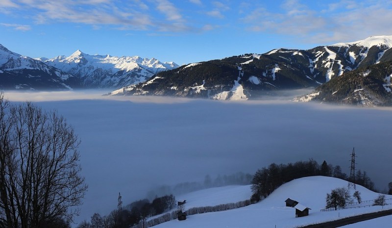 Sunny skies above the valley fog in Zell am See this morning – 29 January 2018 – Photo: zellamsee-kaprun.com
The fine weather will last until Wednesday when a new Atlantic storm will start to make its presence felt in the west. This will mark a major change in the Alpine weather with the second half of the week expected to be much more unsettled, with snow for most areas.
The rain/snow limit will fall to low levels on Thursday, then temporarily rise again in some western parts later on Friday (perhaps to 1500m), before falling again later on Saturday. Sunday and the early part of next week look like being very cold across all parts of the Alps, with further flurries in places.
At this stage it looks like the most snow from this storm will be seen in the north-western Alps - i.e. the northern French Alps roughly north of Grenoble, much of Switzerland (away from the far south), and the far west of Austria.
Updated: 10.30am Friday 26 January 2018 - Snow for some south-western parts of the Alps today
A new storm has reached the Alps but will be much less potent than those we have seen in recent weeks, having been continually downgraded over the last couple of days.
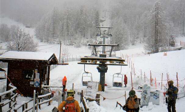
 Light snow in Bardonecchia today – 26 January 2018 – Photo: bardonecchiaski.com
Nevertheless we will see some snow today across the south-western Alps (1000-1300m), mostly in the Italian Piedmont (e.g. Prato Nevoso, Sestriere, Alagna) and the northern and eastern Aosta (e.g. Cervinia, Champoluc).
Snowfall totals will be much more modest than expected just a couple of days ago, generally in the region of 5-20cm, but with 30cm in a few favoured places. Parts of the southern French Alps (e.g. Isola 2000) and the southern Swiss Alps (e.g. Zermatt) will also see a little snow.
A tiny bit of snow may also spill over the Italian border into resorts like Val d’Isère and Val Cenis but, generally speaking, the northern French Alps will miss out. Most of Switzerland (away from the far south), all of Austria and the eastern Italian Alps will also stay mostly dry, if rather cloudy, at times.
Over the weekend, we are expecting the sun to return to most places, though it may take a while to break through in some central and southern parts of the Alps. It will then remain dry until the middle of next week at which point a new storm is expected to arrive from the north-west.
Updated: 10.30am Thursday 25 January 2018 - Very mild today, snow for some tomorrow
The Alps are experiencing a very mild period of weather. Most places will again be dry and sunny today but it will turn increasingly cloudy in the south-western Alps, heralding the arrival of the next set of weather fronts.
 Very mild in the Portes du Soleil today but there is good piste skiing here in Morgins – 25 January 2018 – Photo: telemorgins.ch
The next storm won’t be nearly as potent as recent ones, and has already been downgraded somewhat over the last 24 hours. Nonetheless it will bring a moderate fall of snow to some southern and western parts of the Alps tomorrow before dying out early on Saturday.
The areas set to see the most snow from this storm are the southern French Alps, especially the far south-east (e.g. Isola 2000), the far south-western Italian Alps (e.g. Limone, Prato Nevoso) and perhaps areas around and just to the east of the Monte Rosa region and adjacent areas across the Swiss border (e.g. Zermatt).
Some other parts of the French, southern Swiss and Italian Alps may also see a little snow but generally nothing too significant. The northern and eastern Alps will stay mostly dry. During this period, the rain/snow limit will generally be between 1000 and 1300m.
Saturday will see any of the last remaining showers/flurries die away, after which most places will become fine and very mild again.
Updated: 9.30am Wednesday 24 January 2018 - The Alps are slowly returning to normal
It’s going to be a lovely day for most of the Alps, with freezing levels close to 3000m in some western areas, but a bit lower further south and east.
 Blue skies in La Plagne today – 24 January 2018 – Photo: facebook.com/LaPlagne
The next storm will start to make itself felt on Thursday when, after a mostly fine start, the southern and western Alps will see a few showers (snow 1200-1400m) here and there later in the day.
Friday will see more widespread snow across the Alps, heaviest in the south and west (i.e. the Italian and French Alps). Saturday will be a day of transition before the sun returns to all regions by Sunday.
 Fabulous skiing conditions in Sölden – 24 January 2018 – Photo: facebook.com/Solden
Snow depths at altitude are above average across all parts of the Alps right now, and close to or at record breaking levels in places, especially in the north and west (e.g. Engelberg, Zermatt, Cervinia, Flaine, Tignes). However, as it hasn’t been cold recently, snow cover is much more “normal” at lower altitudes, roughly below 1300m.
 Huge amounts of snow on the Stubai glacier – 24 January 2018 – Photo: facebook.com/Skifahren.Stubaiergletscher
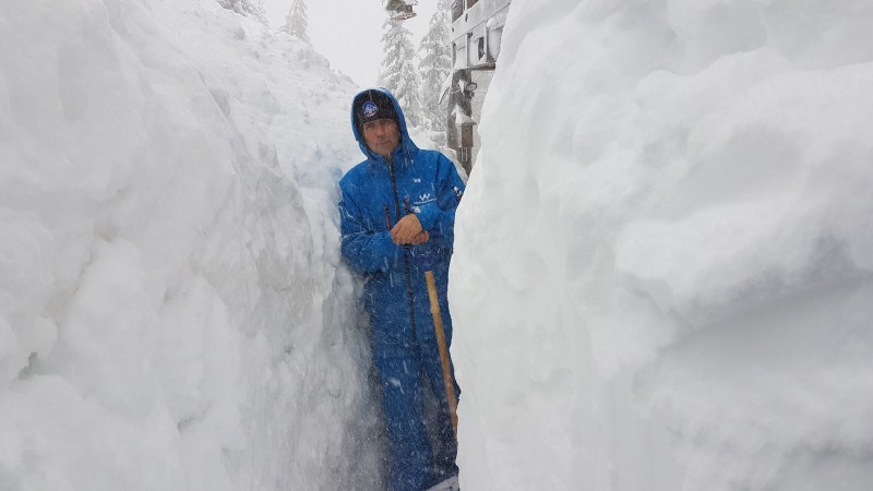
Although resorts are starting to get back to normal today after the huge snowfalls of recent days, some problems still remain.
At the time of writing Zermatt is still cut off, for example, though the access road and railway should reopen later today. Another issue is the number of high lifts that are still buried in snow and need to be dug out! Meanwhile, the off-piste is slowly stabilising but is not advised without a qualified local guide.
Updated: 9.30am Tuesday 23 January 2018 - And breathe!
The last of the showers are dying away from the northern and eastern Austrian Alps this morning, marking the end of the latest disruptive storm cycle.
 Blue skies at last in Tignes this morning – 23 January 2018 – Photo: tignes.net
Most of the Alps will see some sun today but the risk of avalanche is still critical, particularly in the northern and western Alps, and some resorts such as Zermatt and Saas-Fee remain cut-off.
Between 100cm and 200cm of new snow has fallen above 2000m since Saturday across a wide swathe of the northern and western Alps, including resorts as far apart as Chamonix, Zermatt, Crans Montana, Davos and St Anton, to name just a few.
Combined with the other major storm cycles that we have seen in the last three weeks, this has left many resorts with record-breaking snow depths for January. Indeed you would have to go back to the big avalanche year of 1999 to find anything comparable over such a wide area – and that was in February, not as early as January.
 Better weather in Saas-Fee today – 23 January 2018 – Photo: saas-fee.ch
Although there has been a huge amount of snow high up, it hasn’t been cold and rain has also been falling at times lower down, especially yesterday. This means that snow depths below 1400m or so are generally much more “normal”, even in the northern and western Alps. Some areas like the Dolomites have missed the extreme precipitation altogether, and have therefore offered by far the best skiing conditions in recent days, having not been disrupted by the weather!
The Alps can now look forward to two or three days of mostly fine and quite mild weather before the next storm arrives from the west later on Thursday and on Friday. This time it will be the southern and western Alps that will see the heaviest snow, at least in the first instance, possibly reaching Austria over the weekend. Watch this space…
Updated: 9.40am Monday 22 January 2018 - Further chaos for some northern and western parts of the Alps
The north-western Alps have one more day of seriously bad weather today before things settle down again tomorrow.
 Incredible snow depths in Val Thorens – 22 January 2018 – Photo: facebook.com/ValThorens.resort
It will continue to rain or snow today across the northern French Alps, much of Switzerland and western Austria. The rain/snow limit is still quite low in the internal valleys of the central and eastern Alps and may remain so for a good part of the day.
However, with milder air increasingly in the mix, it will rise towards 1800m in the western Alps, and up to 2000m or higher in some exposed areas of the far north-west (e.g. Portes du Soleil) later.
 Val d’Isère this morning – 22 January 2018 – Photo: facebook.com/Val-disere-Location
 Staggering snowfalls across many Swiss resorts. This is Rosswald – 22 January 2018 – Photo: alpenweerman.nl
Another 30-50cm is possible above 2200m today alone in resorts such as Chamonix, Flaine, Mürren, Engelberg and St Anton, to name a few. Needless to say, the avalanche risk in the northern and western Alps remains sky high at 5/5 in many places.
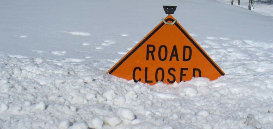
Expect widespread lift closures and disruption to infrastructure, not just from the risk of avalanche but also from landslides and flooding lower down. Be vigilant and take heed of all advice from local authorities.
 5/5 avalanche risk today across a large swathe of the Swiss Alps – 22 January 2018 – Photo: slf.ch
It should be noted that weather conditions in recent days have been far from extreme across a good portion of the southern Alps (including most of Italy away from the far north-western border regions), and that all areas will enjoy a couple of calmer days of weather from tomorrow.
However, further snow is forecast towards the end of the week in the southern and western Alps. Watch this space…
Updated: 9am Sunday 21 January 2018 - More extreme weather for the northern Alps
The northern Alps are about to experience yet another period of disruptive weather, with blizzards and torrential rain expected over the next 36 hours.
 Huge snow depths in Méribel – 21 January 2018 – Photo: facebook.com/Meribel3Vallees
The really bad weather will, roughly speaking, affect the French Alps north of Grenoble, most of the Swiss Alps except for the far south (Ticino) and much of Austria also away from the far south (away from Carinthia). Apart from some border areas in the far north-west (e.g. La Thuile, Courmayeur, Cervinia), Italy will escape the heaviest precipitation.
This latest storm began yesterday and will continue until Monday night, with huge variations in the rain/snow limit. This morning it is snowing to relatively low levels – 500m or so in Austria, closer to 1000m in France – but later today and tonight it will rise towards 1800m in the west, and even as high as 2100m in some places. It should remain a bit lower further east, especially in the more enclosed valleys.
The very heaviest rain/snow will be in the northern French and Swiss Alps where three day snowfall totals will be in the range of 1.2-2m above 2200m by the end of Monday. Once again the avalanche risk will become extreme, reaching 5/5 in places. Ski areas will close and some resorts will be cut off. Lower down, flooding and landslides will also be an issue and our advice is to avoid driving in the northern Alps over the next couple of days at least, if at all possible.
The 2017-18 season is turning into a truly historic one, with snow depths in the north-western Alps at record levels in many places, at least at altitude. We will compile a more detailed report once the weather settles down next week but we can already tell you that in the French Savoies, for example, the snow is now over 4m deep at 2500m, and even as deep as 6m in places - unprecedented for January.
Updated: 10am Friday 19 January 2018 - Another metre or more of snow for some northern and western parts of the Alps by Monday
It’s still snowing across some northern parts of the Alps this morning, especially in Switzerland and Austria, with a rain/snow limit between 600m and 900m. It is generally drier across the southern Alps, with some sunny spells in places.
 Serious snow in Les Arcs! – 19 January 2018 – Photo: facebook.com/PDSArcs
Yesterday we saw further significant snow across the northern Alps, though it did turn to rain below 1400m for a time in some exposed areas (lower in enclosed valleys) before it turned colder again everywhere overnight.
The forecast for the weekend is again complicated, with an active warm front set to arrive from the west later on Saturday. This will bring a lot of precipitation to the western Alps on Saturday evening and Sunday, then to the eastern Alps later in the weekend and into the first part of next week.
The rain/snow limit will start low, and remain low for a time in some of the more internal valleys where the colder air hangs on for longest. However, it will rise to 1800m or more in some exposed parts of the western Alps later on Sunday.
Between now and Monday we could see another metre or more of snow above 2000m in some northern and western parts of the Alps, such as Tignes, Chamonix, Flaine, Verbier, Mürren and Zermatt.
This will again cause some disruption, not only due to the snow but also the possibility of flooding lower down. Be vigilant and stay tuned!
Updated: 9.15am Thursday 18 January 2018 – Yet more snow for the northern half of the Alps
The very strongest of the winds may have eased in the west but the weather in the Alps remains very unsettled, with further Atlantic storms set to roll in over the next few days.
 Huge snow depths in Les Menuires – 18 January 2018 – Photo: facebook.com/Les.Menuires
The latest storm will bring plenty more snow across the northern Alps today, heaviest in the northern French Alps (e.g. Chamonix) and north-western Swiss Alps (e.g. Mürren). However, with milder air filtering in, the rain/snow limit will rise from relatively low levels to between 1200m and 1500m later in the day (still lower in some enclosed valleys). Once again the southern Alps (e.g. most of Italy) will avoid the heaviest precipitation, with some places remaining dry and bright.
Over the next few days, there will be further rain/snow, again mostly across the northern Alps. Temperatures will fluctuate considerably, but will tend to rise later in the weekend and into next week, which means that rain will become more of an issue lower down.
With so much wind, snow and rain in the mix, not to mention fluctuating temperatures, conditions in the Alps are highly variable right now. While snow depths may be exceptional at altitude, especially in the west, for your average skier the conditions are not ideal, at least in the northern Alps where it may be the middle of next week before the weather settles down again.
Updated: 9.25am Wednesday 17 January 2018 - More wild weather in the Alps!
It has been a very stormy night in the Alps with wind gusts exceeding 200kph in places, such as on the glacier at Saas-Fee. It remains very windy this morning with lift operations severely hampered in many parts of the Alps, especially in the west where some resorts are entirely closed.
 Blizzards this morning in Méribel, where few (if any) lifts are expected to open today – 17 January 2018 – Photo: facebook.com/Meribel3Vallees
It has also been snowing, though snowfall totals are almost impossible to confirm given the strength of the wind. The rain/snow limit was initially around 1200-1400m in the western Alps last night but has come down to well below 1000m in all regions today.
The heaviest snow showers will continue to be across the northern half of the Alps - i.e. the French Alps roughly north of Grenoble, the Swiss Alps (except for the far south), much of Austria away from the far south, and the far north-west of Italy. The most likely spot to catch some sun will again be the Dolomites.
Tomorrow will see further bad weather, with the heaviest precipitation again in the north and west. However, with warmer air the mix, the rain/snow limit will again rise to around 1300m, at least in the more exposed ranges. It should stay lower in the more enclosed central valleys.
There will be yet more snow on Friday (once again most of it in the north and west) though it will turn colder once more.
Overall it’s a very messy picture over the next few days with difficult skiing conditions at times, especially at altitude where there will continue to be lots of wind-related disruption. The best conditions, in the short term at least, are going to be in resorts with plenty of trees, especially in the central and south-eastern Alps where things are not quite so wild.
Needless to say, the avalanche danger has become critical again in many areas and off-piste is strongly discouraged until the weather settles down.
Updated: 9.45am Tuesday 16 January 2018 - The storms return!
Here we go again! After the calm of recent days, the stormy weather is back and will remain so for the rest of the week. Expect a lot of snow in the north-western Alps over the coming days, some rain at low altitudes and a lot of wind everywhere.
 Here we go again! The storms are back in Méribel this morning – 16 January 2018 – Photo: facebook.com/Meribel3valleys
Overnight, we have already seen some snow across the northern French Alps, much of Switzerland and western Austria. The rain/snow limit started quite low but has now risen to around 1300m in some of the more exposed parts of the western Alps. In the more sheltered inner-alpine valleys it is lower and will remain close to or below 1000m all day.
So you should expect precipitation to continue on and off all day and for the next few days, always heaviest in the north-west, from the northern French Alps (e.g. Avoriaz, Flaine) through much of Switzerland (e.g. Verbier, Mürren, Engelberg) and into western Austrian (e.g. Lech). However, freezing levels will be yo-yoing quite markedly with snow falling to low levels again tonight and tomorrow. The rain/snow limit will rise on Thursday with the arrival of another warm front and then fall again on Friday and into the weekend.
Over the next five days we will see as much as 120-180cm of new snow above 1800m in some north-western parts of the Alps (e.g. Flaine, Avoriaz, Chamonix), but more generally 50-90cm in the northern half of the Alps. Any precipitation will generally be lighter and patchier in the southern Alps, though there will be one or two exceptions including close to the border areas in the Aosta valley (e.g. Courmayeur, Cervinia). The driest and brightest weather this week will be in the Dolomites.
One factor we need to highlight in all areas is the wind, which will be very strong at times this week and will inevitably lead to some disruption to lift operations. Skiing in an area with lots of trees will be a distinct advantage until the weekend at least.
Updated: 9am Monday 15 January 2018 - More heavy snow and high winds on the way
The weather in the Alps is on the change again with a succession of Atlantic storms set to cross the Alps over the next few days.
 A fine morning in Austria today. This is the Grossglockner, Austria’s highest mountain (on the left) – 15 January 2018 – Photo: foto-webcam.eu
It is still mostly fine this morning, but the first of the weather fronts will make itself known in the western Alps later today before moving further east overnight. The heaviest precipitation will be in the northern French, Swiss and western Austrian Alps. The rain/snow limit will initially be quite low today but will rise to between 1000m and 1300m tomorrow.
Over the coming week it will continue to be very unsettled with lots more snow (and wind) in the northern French, Swiss and western Austrian Alps, and a rain/snow limit fluctuating between about 500m and 1500m. Generally speaking any precipitation in the southern Alps will be lighter and patchier, with the possible exception of the far north-west of Italy (e.g. parts of the Aosta valley) which may also see some significant falls of snow.
Updated: 11.10am Sunday 14 January 2018 - Still relatively calm, but turning very unsettled next week
There is quite a lot of cloud around the Alps today with a few snow showers, especially in the far south-eastern Alps (e.g. Cortina) and far south-western Alps (e.g. Isola 2000). However, most places will be dry with the best of any sunshine at altitude across the north-eastern Alps.
 Beautiful day at altitude in the Vorarlberg. This is Warth-Schröcken – 14 January 2018 – Photo: koerbersee.at
After another relatively calm day tomorrow, the first effects of a new storm cycle will start to be felt in the western Alps on Monday night with some snow (800-1200m) in places. The rest of the week then looks very unsettled with some significant snow across the western and northern Alps, although the really big disruptive snowfall totals that had been predicted by some models have now been toned down a little.
The areas that will see the most snow next week are the northern French, Swiss and western Austrian Alps. Italy will generally see the least, except perhaps in the far north-west. The rain/snow limit will fluctuate between 700m and 1500m, but will then lower everywhere towards the weekend.
Updated: 10.50am Friday 12 January 2018 - Plenty of sunshine at altitude
It’s a magnificent day at altitude across many parts of the Alps, though quite a lot of fog/low cloud is trapped in the valleys, especially in the northern Alps.
 Lovely morning in Heiligenblut, Austria – 12 January 2018 – Photo: foto-webcam.eu
The weather will remain fairly quiet over the weekend with plenty more sunshine at altitude but also stubborn low cloud in some of the valleys. However, change is afoot next week with a succession of Atlantic storms due to hit the Alps starting on Monday night, set to last until the weekend at least.
Next week’s storms will bring further very significant quantities of snow to parts of the Alps, notably the north and west, including areas such as l’Espace Killy, 3 Valleys, Portes du Soleil, Verbier, Bernese Oberland and Engelberg, to name just a few. The rain/snow limit will fluctuate between 500m and 1500m but will drop to very low levels by the end of the week.
Updated: 9.15am Thursday 11 January 2018 – Calm for now but further heavy snow likely next week!
There is a lot of cloud around in the Alps today but only the odd light flurry here and there. The best of any sunny spells are likely to be in the southern Alps.
 Blue skies this morning in the Alta Badia – 11 January 2018 – Photo: dolomitisuperski.com
This relatively calm period of weather will last through most of the weekend, until things start to change again later on Sunday and on Monday, first with some light snow for the southern Alps then with some heavier more widespread snow by mid-week. This is something we will be keeping a close eye on as some models are predicting further extreme snowfalls for the western Alps. Stay tuned…
In the meantime, the clear up operation in the areas affected by the last big storm continues and the skiing (on-piste at least) is slowly getting back to normal. Needless to say the off-piste remains very dangerous and should not be attempted without an experienced and properly qualified mountain guide.
Snow depths are truly extraordinary in the higher resorts of the western Alps with 210/350cm of settled snow in Tignes and 230/310cm in Cervinia, both very close to their all-time record figures for early January. In Engelberg, which didn’t even see that much from the last storm, the snow is now over 5m deep on the Titlis glacier!
However, while snow depths are above average across most of the Alps, it has been mild of late and snow cover is a bit on the thin side in some low northern resorts such as Morzine and Adelboden, at least close to resort level.
We should stress that these resorts are not by any means in trouble, there is still lots of snow at altitude and plenty of great skiing on offer. It’s just that in comparison to the record snow figures in some higher resorts, the depths here are relatively modest.
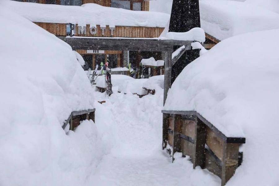
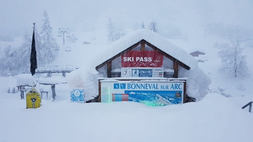
Updated: 10.15am Wednesday 10 January 2018 - The clear up continues
The weather in the Alps has calmed down but there are still problems in those resorts affected by the massive (and in some cases unprecedented) snowfalls earlier in the week.
 Cutting a path to Bonneval sur Arc – 10 January 2018 – Photo: facebook.com/Meteoalpes
In Switzerland, Zermatt has been cut off for a couple of days but is set to reopen its railway line this morning. While Zermatt has been grabbing all the headlines thanks to its status as a major international resort, little Bonneval sur Arc in France’s Haute-Maurienne valley has also been cut off by a massive avalanche that hit its main access road. Bonneval saw 150cm of snow in just 24 hours and around 2m at altitude overall from this single storm alone.
 Record breaking snow depths in Tignes right now – 10 January 2018 – Photo: alpenweerman.nl
Meanwhile, Tignes is claiming that snow depths in resort (around 2.5m of settled snow) are the highest on record for January and close to the highest on record at any stage of winter!
In Engelberg, snow depths on the Titlis glacier have now surpassed 5m, the first resort (to the best of our knowledge) to claim this anywhere in the world this season.
 Crazy snow depths in Cervinia – 10 January 2018 – Photo: Marco Kaschuba, wetteronline.de
The resorts most affected by the recent storm are Zermatt, Saas-Fee, Cervinia, the Monte Rosa region, Tignes, Val d’Isère, Bonneval sur Arc, Sestriere and Prali.
However, it should be stressed that not everywhere in the Alps has huge amounts of snow. In fact, it has been quite mild in recent days, particularly on the northern side of the Alps where resorts as far apart as Morzine, Adelboden and Kitbühel are all losing snow on their non-pisted low south-facing slopes.
That’s not to say their pistes are in trouble, far from it, but snow depths at valley level are undeniably modest and more snow would be welcome.
 Snowy scenes in the Monte Rosa region yesterday – 10 January 2018 – Photo: facebook.com/VisitMonteRosa
Longer term the weather forecast for the Alps is interesting. After a relatively benign few days of weather, it looks like it will become very unsettled again from the middle part of next week with further heavy snow for many. Watch this space…
We will have a full round-up of snow conditions right across the Alps tomorrow.
Updated: 9.50am Tuesday 9 January 2018 - Chaos in the Alps, again!
It has continued to snow heavily all night in many western and south-western parts of the Alps, with some areas virtually in lockdown following 1.5m to 2m of snow in the last 48 hours alone.
 Monster dumps in Tignes – 9 January 2018 – Photo: facebook.com/Tignes
In Italy, the heavy snow has been in the west affecting the likes of Alagna, Gressoney, Champoluc, Cervinia, Pila, Prali and Sestriere, to name just a few. In France, the worst affected areas are in the Queyras, the Haute Maurienne (e.g. Val Cenis and Bonneval sur Arc) and the Haute Tarentaise (e.g. Val d’Isère and Tignes). In Switzerland there is disruptive snow in the south of the Valais (e.g. Zermatt and Saas-Fee).
All the above areas are on the maximum avalanche alert and have problems this morning with road closures, some pre-emptive but some due to actual slides in populated areas. In some cases, especially in the Monte Rosa region and the Swiss Valais, people have also had to be evacuated from their homes.
 Sestriere this morning – 9 January 2018 – Photo: vialattea.it
Overnight the heavy snow moved a little further north than expected, with the likes of La Plagne, Les Arcs and the 3 Valleys also seeing a good dump.
Generally speaking, however, the heaviest snow fell close to the border areas between France, Italy and south-west Switzerland. The further north and east you went from the above mentioned areas, the lighter any precipitation became.
 A typical scene in the Monte Rosa region last night where many roads were closed – 9 January 2018 – Photo: facebook.com/VisitMonteRosa
Today it will continue snowing for a while (1200-1500m) in parts of the Italian, southern Swiss and southern Austrian Alps while the northern half of the Alps stay mostly dry.
The rest of the week will then be rather unsettled, with some dry weather but also bits and pieces of snow, though certainly nothing as heavy as we have seen in recent days.
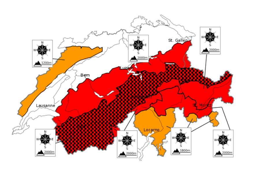
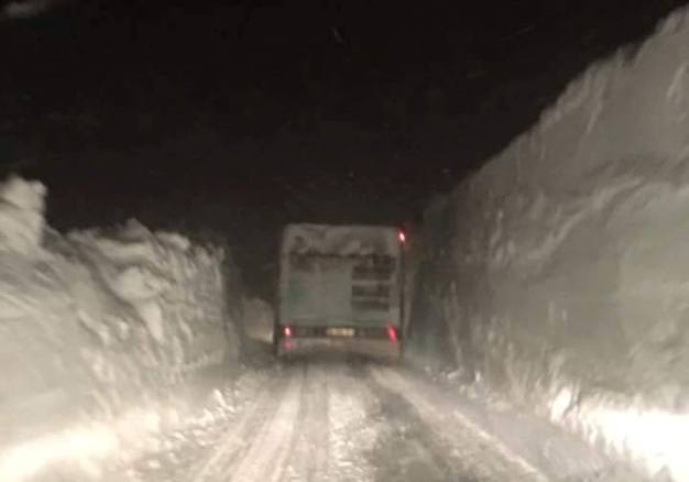
Updated: 7pm Monday 8 January 2018 – Code Red avalanche warning for the Savoie region in France
Météo France has released a “Code Red” avalanche warning for the Savoie region, the highest level of warning they can issue.
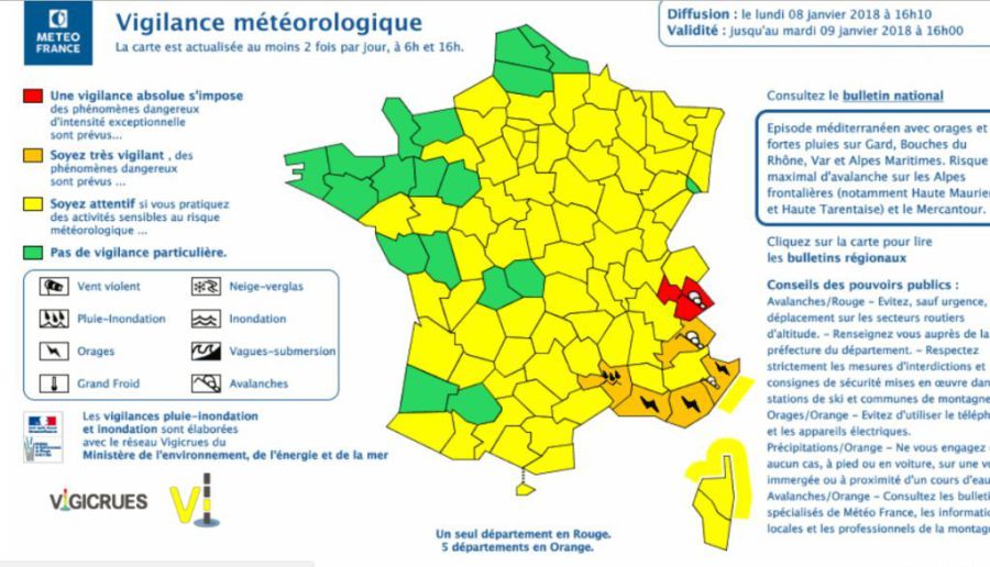 Météo France has issued a Code Red warning for the Savoie department – 8 January 2018 – Image: meteofrance.fr
This warning is extremely serious, though we should note that it does not apply to the entire region, and affects some resorts in the south-east of the department, which include Val d’Isère, Tignes and Bonneval sur Arc. The warning follows some 70-120cm of new snow in this region in the last 18 hours, with up to another metre possible overnight.
Météo France’s warning implies that the risk of large avalanches now extends to some roads and built up areas. Anyone staying in affected resorts is therefore being urged to stay indoors and/or listen carefully to official advice. The situation in affected resorts is stated to be a “1 in 30 year” event.
 Huge snowfalls in Bonneval sur Arc – 8 January 2018
Exceptionally heavy and potentially disruptive snow is also currently affecting many western Italian resorts including Sestriere, Cervinia and the Monte Rosa region, where we hear that some residents have been evacuated from parts of Champoluc this evening due to the risk of avalanche.
Huge snowfalls are also affecting the far south of Switzerland, in particular those areas closest to the Italian border between Zermatt and the Simplon Pass.
We will have full update on the situation in the morning…
Updated: 9.40am Monday 8 January 2018 - Huge snowfalls for some south-western parts of the Alps
The famous ‘Retour d’Est’ is in full swing, delivering copious quantities of snow to parts of the western Italian Alps as well as some adjacent border areas of France and Switzerland.
 The snow is deep in Sestriere with plenty more to come today – 8 January 2018 – Photo: vialattea.it
The Retour d’Est (French for “return from the east”) is a phenomena that occurs when a storm is centred over the Mediterranean and moisture-laden east or south-easterly winds are thrown back up towards the western Italian Alps. The first mountains they reach are the southern Piedmont, which rise abruptly from the flat Po valley forcing the air to rise and condense into precipitating clouds.
Not only do parts of the western Italian Alps see a lot of precipitation in these situations, but parts of France are also affected as the bad weather often spills over across certain “weak spots” on the border. For example, Val d’Isère has already reported 50-60cm of new snow this morning in the Le Fornet sector near the border.
Other resorts seeing snow from the Retour d’Est include Sestriere, Val Cenis and Bonneval sur Arc, where 48 hour storm totals are likely to be between 1m and 2m above 2000m by tomorrow morning with a rain/snow limit generally between 1200m and 1600m, but a little lower in places.
In Switzerland, Zermatt has also seen a lot of snow overnight, though this isn’t necessarily apparent from the village as most of it fell at altitude close to the Italian border. Cervinia and the Monte Rosa region are also likely to get 1-2m of snow at altitude by tomorrow morning.
Elsewhere in the Alps there is lots of dry mild weather with some good breaks in the cloud, particularly in the far north and north-eastern Alps.
Updated: 11.05am Sunday 7 January 2018 - Heavy snow for some south-western parts of the Alps
A new storm has hit the Alps, this time with the heaviest snow focussed on the western Italian Alps and some adjacent border regions of both France and Switzerland.
 Heavy snow for Prali today – 7 January 2018 – Photo: nuova13laghi.com
Over the next couple of days this storm will deliver very large snowfall totals to areas such as the Monte Rosa region (Alagna, Gressoney, Champoluc), Saas-Fee, Zermatt, Cervinia, Sestriere, and Prali. Above 2000m these areas are likely to see between 1m and 2m of new snow by the end of Monday, locally even more. Two other resorts that are likely to do well are Val d’Isère and Val Cenis, though perhaps not with quite the extreme figures quoted above. The rain/snow limit will be around 1200-1600m.
During this period, the northern Alps will be mostly dry and mild though often quite cloudy. The best of any sunshine will be in the far north of Austria.
Updated: 9.45am Friday 5 January 2018 - And breathe!
The big storm is now over, but another is already waiting in the wings! The next storm will hit the Alps later this weekend, with the heaviest precipitation focused on the western Italian Alps and some adjacent border regions.
 Better weather across most of the Alps today. This is the Kitzsteinhorn glacier in Austria – 5 January 2018 – Photo: facebook.com/kitzsteinhorn
As to the last storm, by yesterday afternoon the rain/snow limit had risen to 2300m across some western parts of the Alps (notably in France) though remained considerably lower in some central and eastern parts of the Alps. As expected, both the huge snowfalls at altitude and rain lower down caused a lot of problems, with multiple reports of avalanches, landslides, and flooding, especially in Switzerland and France.
Today the weather is much calmer across the Alps which will allow the clear-up operation to begin. The north still has one or two residual showers but most places will be dry (and mild) with some good sunny spells developing, especially away from the northern foothills.
Don’t be surprised if it takes some time to get some of the higher ski areas anything like close to fully operational though. Please also note that the risk of avalanche remains extremely high and that off-piste is strongly discouraged virtually everywhere in the Alps right now.
Over the weekend and into the first part of next week a new storm will approach from the west. However, with the flow coming from the south-east, the heaviest precipitation will be in the western Italian Alps as well as some adjacent border regions of the French and southern Swiss Alps.
The area currently projected to see the most snow from this new storm is Italy’s Monte Rosa region (Champoluc, Gressoney, Alagna) where over 1.5m is possible on Sunday and Monday. Other areas that should do very well are Zermatt, Cervinia, the Milky Way (Sestriere, Sauze d’Oulx, Montgenèvre) Val Cenis, Val d’Isère and Tignes.
By contrast, the northern half of the Alps will be under the influence of the Foehn which means lots of dry and very mild weather.
Updated: 9am Thursday 4 January 2018 - Chaos in the Alps!
The weather situation in the western Alps has become critical following further heavy snow, torrential rain and hurricane-force winds – and will get even worse today!
 Massive snowfalls in Val Thorens where little if any skiing is expected to be possible today – 4 January 2018 – Photo: facebook.com/ValThorens.Resort
Yesterday the main problem was the wind, which gusted to over 150kph in places with many ski areas (e.g. Avoriaz) forced to remain closed all day. It was quite mild in the morning, with the rain/snow limit in the western Alps reaching 2100m in places, but it turned colder by the afternoon with snow down to 1000-1300m again later in the day.
It continued to snow all last night across much of the French Alps (away from the far south), most of Switzerland, parts of Austria (especially the west) and parts of Italy (mostly in the border regions of the north-west).
The cumulative effect of all this bad weather is already causing a lot of problems in the Alps, especially in the west, with the situation set to deteriorate further today. Tignes, for example, is already cut off from Val d’Isère, which is itself cut off from Bourg St Maurice, while Val Thorens is cut off from Les Menuires. In these high resorts the main issue is the risk of avalanches reaching the roads. Indeed, in Tignes, you are no longer allowed to walk or drive anywhere in the resort!
 The road between Val d’Isère and Fornet yesterday evening – 3 January 2018 – Photo: radiovaldisere.com
By the end of today, 48 hour snowfall totals above 2300m are likely to be in the region of 1.5-2m in places, though the snow is so windblown it is difficult to evaluate accurately.
Lower down, flooding and landslides are now a major concern as it is about to turn much warmer, with the rain/snow limit set to rise to between 2200m and 2500m across the western Alps this morning.
Above 2300m or so we can expect another 50-100cm of new snow today, but lower down it will be a complete washout. If you are driving in the Alps, do not assume that you are safe just because you are below the snow-line. Multiple landslides and flooding rivers will also be a threat, not just to roads in isolated areas but in built up areas too.
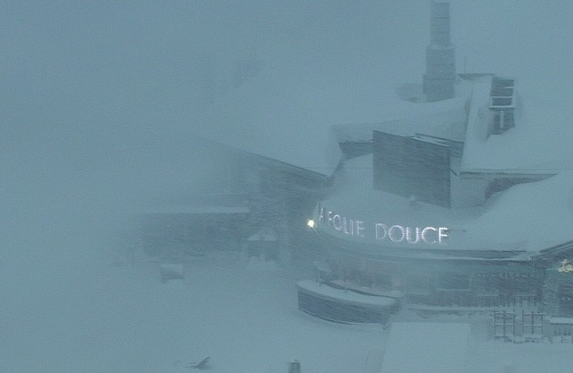 No dancing at Val d’Isère’s Folie Douce today! – 4 January 2018 – Photo: valdinet.com
The very worst of today’s weather will be in the Haute-Savoie, Savoie and Isère departments in the northern French Alps. However, the situation is also serious across larger parts of Switzerland (especially the western Valais), parts of western Austria and the far north-west of Italy. Our advice is simply not to drive or venture out in any of these areas today unless you absolutely have to.
Looking a bit further ahead, the weather will calm down a bit tomorrow before the snow returns again over the weekend. This time it will mostly affect the southern Alps, but with Val d’Isère and Tignes likely to also be in the firing line again due to the ‘Retour d’Est’, with bad weather spilling over the border from Italy.
We will file updates later in the day as the situation in the Alps develops…
Updated: 9.50am Wednesday 3 January 2018 - Stormy!
We are in for a very stormy couple of days across the Alps, especially in the west, with a mixture of heavy snow, heavy rain and high winds.
 Challenging conditions in the northern French Alps this morning with rain below 2000m. This is La Clusaz – 3 January 2018 – Photo: laclusaz.com
There were outbreaks of snow across the western Alps overnight, initially to quite low levels especially in the enclosed valleys of the Swiss Valais. However, in areas more exposed to the mild Atlantic air, especially in the French Alps, this snow had turned to rain below 2000m by early this morning.
The weather picture in the Alps is a very messy one today. Most regions will see showers or longer spells of precipitation, heaviest in the west (e.g. northern French and western Swiss Alps). The rain/snow limit will be all over the place though – initially around 2000m in the northern and western Alps this morning (though still much lower in some enclosed valleys), then dropping more generally to between 1000m and 1400m again later this afternoon. Some southern parts, especially the far southern French Alps (e.g. Isola 2000), the far south-western Italian Alps (e.g. Prato) will see little or no precipitation.
The bad weather will continue overnight and into Thursday with an even greater intensity of precipitation in the west. It will then become very mild again with the rain/snow limit rising to above 2000m across most of France and western Switzerland but a little lower further east. Once again many southern parts of the Alps will miss the heaviest of any rain or snow but it will be very windy everywhere which will seriously hamper lift operations in most high (and some low) resorts.
Over the next 48 hours we are likely to see up to 1.5m of new snow above 2300m in some western resorts, such as Val d’Isère, La Rosière, Chamonix and Zermatt, but there will be problems with rain at lower altitudes, especially tomorrow when it could rain all day.
All in all it is going to be a difficult couple of days for skiing and driving in the Alps, especially in the west. Watch out for road closures due to flooding, and potentially landslides, especially on Thursday. Skiers are also seriously discouraged from venturing off-piste for the time being.
Over the weekend the focus for snowfall will shift to the southern Alps while the northern Alps become mostly dry.
Updated: 9am Tuesday 2 January 2018 - More extreme weather on its way for the Alps
Many western and north-western parts of the Alps are waking up to yet another significant dump of snow, with as much as 30-40cm since yesterday afternoon in the likes of Les Arcs and Val d’Isère.
 More overnight snow for Méribel – 2 January 2018 – Photo: merinet.com
Although many southern and eastern parts of the Alps missed the heaviest of the snow, the far south-east (e.g Dolomites) did also get in on the action with 15-30cm falling quite widely over the last 24 hours.
This morning there are still some snow showers across the central and eastern Alps. The western Alps will see a relative reprieve in the weather before the next set of fronts arrive this afternoon. On Wednesday and Thursday we are then looking at another extreme weather event for the western Alps with as much as 1-1.5m of snow above 2000m, but also a lot of rain lower down. The areas most in the firing line will again be the French Alps, roughly north of Les 2 Alpes, and the west/south-west of Switzerland (e.g. Zermatt).
Anyone travelling in the western Alps tomorrow or Thursday should be prepared for more disruption with the risk of road closures from both snow/avalanche danger higher up and flooding/landslides lower down. The roads to the higher resorts of the Tarentaise will again be particularly vulnerable e.g. Val d’Isère, Tignes, Les Arcs, Val Thorens.
Updated: 11.15am Monday 1 January 2018 - It continues to be very unsettled as we start 2018!
After what has been the snowiest start to an Alpine winter for at least 20 years, there is still plenty more snow in the forecast as we begin 2018.
 A snowy scene this morning in Châtel, where there will be a mix of further snow but also some rain at times this week – 1 January 2018 – Photo: chatel.com
Many northern and western of the Alps have again seen some snow overnight, generally in quite modest quantities but with as much as 15-20cm in a few favoured spots, such as Flaine in the northern French Alps. The far south-eastern Alps (e.g. Dolomites) have also caught some significant fresh snow.
This morning there are still some snow showers across the eastern Alps while western areas experience something of a reprieve. It won’t last too long though, as the next active storm will move in from the Atlantic later this afternoon.
This new storm will bring high winds and further significant snow to the western Alps this evening and overnight, with another 15-40cm quite likely in resorts such as Val d’Isère, Val Thorens, La Rosière, Flaine, Chamonix, Avoriaz and Verbier. The rain/snow limit will be around 700-900m, perhaps a bit lower in some enclosed valleys.
Watch out for further disruptive weather mid-week as another really big storm hits the western Alps. Much like what happened on Saturday, this storm will bring huge quantities of snow to the French and western Swiss Alps (on Wednesday and Thursday), but also some rain lower down. Travel may be affected and the risk of avalanche will become critical in places.