


Latest snow forecast
Updated: 6pm Sunday 29 January 2023
After a recent period of quiet weather in the Alps, with plenty of sunshine (at altitude at least), a series of weather fronts is now forecast to arrive from the north over the next few days.
The first cold front will arrive tomorrow and be a relatively weak affair, delivering 5-15cm across the northern half of the Austrian Alps (e.g. Lech, Kaprun) and a centimetre or two in the north-eastern Swiss Alps (e.g. Flumserberg). The north-western Alps (e.g. Portes du Soleil, Jungfrau region) will probably stay dry though.
The second cold front will arrive mid-week and will be more potent but again still mostly affecting the north-eastern Alps. This front can be expected to deliver 20-40cm in the northern and eastern Austrian Alps (e.g. Kaprun, Obertauern) between Wednesday afternoon and Thursday night, with perhaps 5-15cm in the eastern Swiss Alps (e.g. Klosters) and a dusting in the north-eastern Swiss and far northern French Alps (e.g. Avoriaz).
The southern half of the Alps (e.g. Risoul, Sestriere, Livigno, Cortina) will stay dry and bright but chilly throughout the week…
Detailed weather & snow forecast:
Austria
Monday will start dry and bright for most of the Austrian Alps, and will remain mostly sunny in the south (e.g. Carinthia). Cloud will increase further north (e.g. Seefeld, Kaprun, Schladming), with some flurries later in the day and lasting into the night, heaviest in the north-east (Upper/Lower Austria). The rain/snow limit will start at around 700m but fall to very low levels later. Between Monday afternoon and Tuesday morning, the northern half of the Austrian Alps can expect somewhere in the range of 5cm to 15cm of snow (the lower end being in the west, the higher in the east).
Tuesday will be cool but mostly dry, with variable cloud in the north and the best of the sunshine in the south.
On Wednesday it will start snowing in the north again, the snow becoming a bit more widespread across the Austrian Alps on Wednesday and lasting into Thursday, by which time some areas (e.g Obertauern) might have seen an additional 20-40cm. The rain/snow limit will start at around 600m on Wednesday but will fall to all levels later in the day. The southern Austrian Alps will see little if any snow.
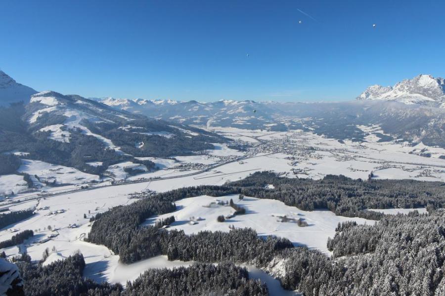 Suuny skies today in St Johann in Tirol, but snow is expected at times this week, especially from late Wednesday onwards – 29 January 2023 – Photo: foto-webcam.eu
France
Monday will be mostly dry in the French Alps, with plenty of sunshine across the board, although cloud may increase in the far north later. It will remain on the cool side with freezing levels typically around 1500m.
Tuesday and Wednesday will also remain mostly dry with plenty of sunshine. However, cloud cover is likely to increase more substantially late on Wednesday, with light flurries possible in the Haute-Savoie early on Thursday morning.
Italy
Monday and Tuesday will be dry, cool and mostly sunny, with freezing levels around 1500m.
It will remain mostly fine on Wednesday, but cloud will increase in the far eastern Italian Alps (e.g. Dolomites) later, with a few flurries possible on Wednesday night.
Thursday will see further flurries in the east with some accumulations possible close to the border with Austria’s Carinthia region. For most of the Italian Alps it will stay dry and mostly sunny though.
Switzerland
Monday will be mostly dry in the Swiss Alps, with plenty of sunshine although cloud will increase in the north and north-east later in the day, with a few flurries possible (600m) in resorts to the east of Zurich.
Tuesday may start cloudy in the north, but most areas should see some good sunny spells. It will remain on the cool side with freezing levels typically around 1300-1500m.
Wednesday will start dry and bright and remain so in the south. Further north, cloud will thicken with snow flurries expected later in the day, heaviest in the north-east.
This snow will continue across the northern and especially north-eastern Swiss Alps (e.g. Klosters) overnight and throughout Thursday, but amounts in the north-west (e.g. Gstaad, Wengen) are likely to be modest and the southern Swiss Alps (e.g. Zermatt, St Moritz) will see little, if any, snow.
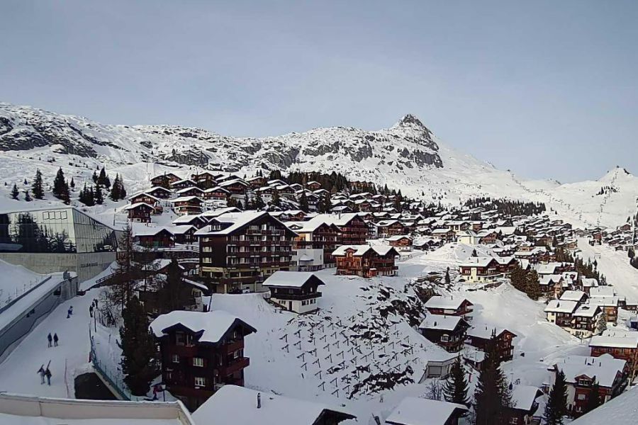 Clear skies this evening in Bettmeralp in the Aletsch Arena, where the next fresh snow is expected on Wednesday night - Photo: aletscharena.ch, 29 January 2023
Outlook:
Friday is likely to see further flurries to low altitude in the eastern Alps, especially in Austria, with it remaining mostly dry but rather cold elsewhere. The best of the sunshine will be found the further west you are.
Our next detailed weather & snow forecast will be on
Friday 3 February 2023
If you enjoy reading our updates - please feel free to support us: