


Latest snow report
Updated: 7.30pm Friday 27 December 2024
Snow conditions have generally been good across the Alps this Christmas, thanks to the timely storms that hit the northern and especially north-western Alps last week.
Earlier in December there had been some enjoyable piste-skiing on offer, however, base depths remained modest and cracks were beginning to show. But, just in time for the Christmas rush, a major storm cycle dumped 1-1.5m of snow over a five-day period across much of the north-western Alps (e.g. Val d’Isère, Flaine, Mürren, Engelberg, Lech), with significant snow falling to low altitudes too (e.g. Morzine), something we haven’t seen that often in recent early seasons .
Most of the rest of the Alps also saw some new snow, though quantities were generally much more modest across the southern Alps (e.g. Dolomites), which have been more reliant on their world-class snow-making to ensure the extensive, high-quality piste-skiing that we have become accustomed to in this part of the world.
Note that most of the early storms that have hit the Alps this winter have been accompanied by a lot of wind, leaving some exposed areas looking quite bare, and rendering the off-piste situation somewhat complicated. While there is a lot of good skiing on offer off the beaten track, a good local guide is highly recommended.
The weather in the Alps is likely to remain fine until at least the middle of next week, at which point new storms may start to move in from the Atlantic. Watch this space!
Meanwhile, across the pond, the Pacific north-west continues to offer the best snow conditions…
Austria
Most Austrian ski resorts are in good shape for the time of year even on lower slopes in areas like the Ski Welt (25/105cm), where there is solid top-to-bottom snow cover and most runs are open.
Higher up and further west, it won’t come as much of a surprise to learn that St Anton (40/140cm) and Sölden (15/170cm) are also offering some excellent snow conditions, although the high winds that accompanied the storms have led to the snow being very unevenly distributed, at altitude at least.
 Snow to low levels and some great piste-skiing on offer in St Johann in Tirol – 27 December 2024 – Photo: foto-webcam.eu
France
Most French ski resorts are in good shape for the time of year, even the low ones like Morzine (20/100cm), which is enjoying its best Christmas period for many years. Another resort also considered somewhat risky this early in the season, Megève (70/125cm), is also offering fabulous skiing right now.
Only the far southern French Alps missed out on the recent storms, with Isola 2000 (30/40cm) still heavily reliant on artificial snow.
 Lots of good skiing on offer in Val d’Isère despite evidence of high winds during recent storms – 27 December 2024 – Photo: valdisere.com
Italy
The north-western Italian Alps did best from the recent storms with impressive conditions for December in La Thuile (20/150cm) and high-altitude Cervinia (50/150cm) despite there being some very windblown snow at altitude.
Further east, you will also find some great piste-skiing in the Dolomites despite the more modest natural snow depths. The Alta Badia has 40/50cm of settled snow depending on altitude, while Madonna di Campiglio has 45/90cm.
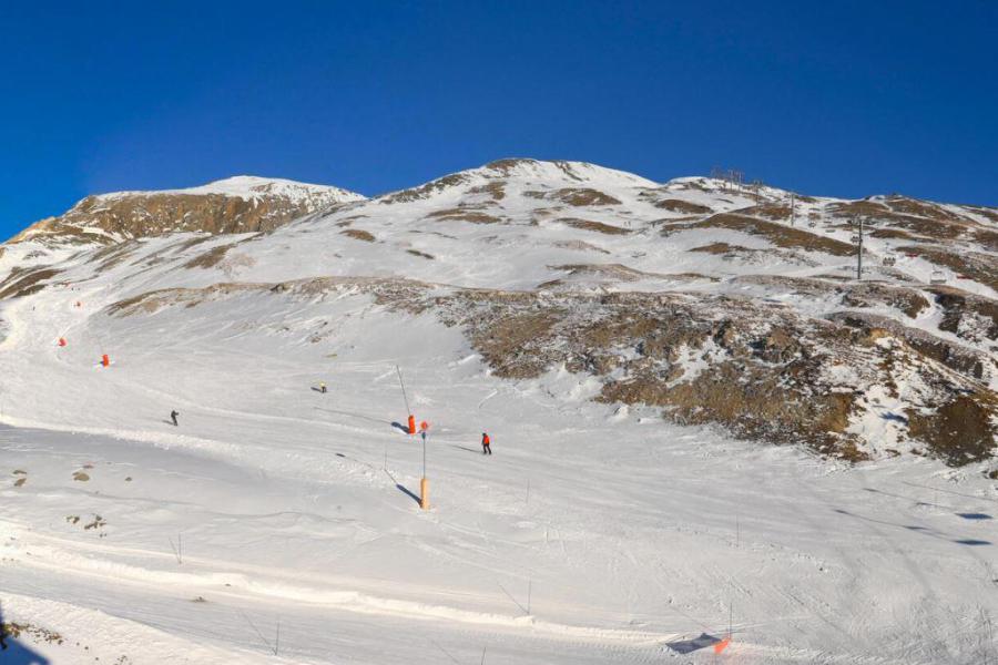
 Relatively modest snow cover in Bardonecchia but still some good piste skiing on offer – 27 December 2024 – Photo: bardonecchia.it
Switzerland
Most Swiss ski resorts are in great shape for the time of year, with 45/100cm in Wengen and 30/108cm in Villars, neither of which are particularly high.
Further east, Engelberg (40/135cm) did particularly well from last week’s storms, although the snow is very unevenly distributed at high altitude.
Only in the far south of Switzerland do snow depths remain modest, although St Moritz (25/50cm) still looks wintry and is offering some great piste-skiing right now.
 Blue skies and good snow cover at all levels in Château d’Oex – 27 December 2024 – Photo: alpesvaudoises.ch
Rest of Europe
The Pyrenees are enjoying a pretty good start to the season, even if snow depths are far from exceptional, with 60/90cm in Andorra’s Soldeu and 45/75cm in Spain’s Baqueira Beret.
Snow depths are generally below par across Scandinavia, where few resorts are close to being fully open. That said, new snow is improving conditions in many resorts, including Norway’s Trysil (35/45cm), where it is expected to remain cold but mostly dry over the next few days.
Scotland’s stuttering start to the season continues with none of its five main areas currently able to offer any proper lift-served skiing.
 Good early snow conditions in Baqueira Beret – 27 December 2024 – Photo: baqueira.es
USA
Snow conditions are a bit mixed across the western US right now. Utah has been struggling somewhat, with considerably below-par snow depths permitting only limited partial openings over Christmas in some resorts, including Park City (65cm mid-mountain base).
Snow is falling now, though, which will improve conditions considerably over the next few days. Some snow is also forecast on and off over the next few days in Vail where the 95cm mid-mountain base is now a little below average for the time of year.
The best snow conditions in the US are currently to be found in the Pacific north-west, where Mount Baker (275cm upper base) has seen lots of snow in recent days and has yet more in the forecast over the weekend.
Canada
Whistler (175cm mid-mountain base) continues its excellent start to the season with another 75cm or so falling at altitude in the last week, with more snow in the forecast, both this weekend and towards the middle of next week.
Most interior ski resorts also have above par snow depths and are skiing well, with settled snow depths of 184cm mid-mountain in Revelstoke, for example.
 Dawn in the Banff ski area, where snow conditions are pretty good right now – 27 December 2024 – Photo: snoweye.com
Our next full snow report will be on
Friday 3 January 2025
