


ARCHIVE
Today in the Alps - February 2022
Read about current weather and snow conditions in the Alps
Updated: 2.15pm Monday 28 February 2022 – Mostly fine but fresh…
High pressure continues to dominate the weather in the Alps, meaning there will be plenty of sunshine for most areas today. It is on the fresh side though, with freezing levels typically between 1000m and 1800m.
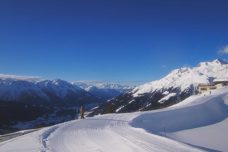
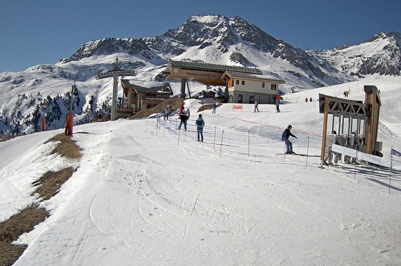 Beautiful day in the Maurienne valley. This is Aussois – 28 February 2022 – Photo: haute-maurienne-vanoise.com
Over the next few days, it will remain mostly sunny, with temperatures only rising very slowly. This is good news for skiers as, although the sun is now quite strong, the relatively cool weather combined with low humidity means that any thaw will be gradual.
That said, snow cover is very thin across some southern parts of the Alps, notably in the southern French Alps (e.g. Auron, Risoul) and south-western Italian Alps (e.g. Sauze d’Oulx, Bardonecchia), where it looks more like mid-April than late February.
The situation is better elsewhere though, with generally near normal snow cover across the northern half of the Alps.
Updated: 12pm Friday 25 February 2022 – Mostly fine after a little overnight snow in the northern Alps…
It’s a mostly fine day in the Alps today though there are some areas of cloud around, chiefly in the northern and eastern Alps where the odd isolated snow flurry is possible. The best of today’s sunshine will be in the southern and western Alps.
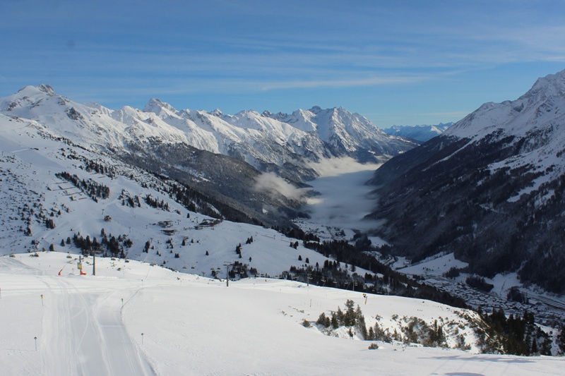
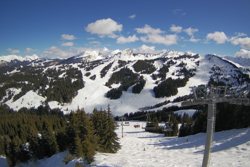 Fine in Les Gets today after a dusting of snow last night –25 February 2022 – Photo: lesgets.com
Today’s (mostly) fine weather follows the passage of a cold front last night which brough a few centimetres of snow to the northern Alps, chiefly in a line between the Portes du Soleil and the Austrian Arlberg, with 5-10cm of fresh snow in resorts such as Avoriaz, Villars, Mürren and Lech.
Another weak cold front will bring a few more centimetres of snow to low levels across the northern Alps on Friday night and into Saturday morning, chiefly to the northern Swiss Alps (e.g. Engelberg) and the northern Austrian Alps (e.g. Lech, Kaprun).
As has been the case for much of the season there is now a big divide between snow depths on the northern and southern side of the Alps. Snow depths are generally not far off normal for late February in the northern Alps (i.e. the French Alps north of and including Les 2 Alpes/Alpe d’Huez, most of the Swiss Alps excluding Ticino and the far south of Engadin, and most of Austria excluding Osttirol and Carinthia), and a bit above average in some cases, especially in the far west of Austria (e.g. Lech).
By contrast, snow depths are uniformly below average across the southern Alps (i.e. the French Alps south of Les 2 Alpes/Alpe d’Huez, the Italian Alps, the far south of Switzerland and the far south of Austria). The areas with the least snow are in the far south-west (e.g. Sauze d’Oulx, Prato Nevoso, Auron), where there is still some reasonable piste skiing on offer but natural snow cover is very patchy lower down.
Updated: 12.40pm Thursday 24 February 2022 – More snow for some northern parts of the Alps tonight…
It’s a fine day across many parts of the Alps today although cloud is already thickening in the north, heralding the arrival of a cold front tonight. The best of any sunshine will be in the southern Alps.
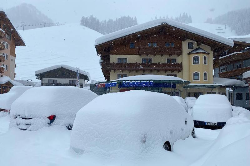
 Lots of snow in Lech right now, with another 10-15cm due in the next 24 hours – 24 February 2022 –Photo: facebook.com/LechZuers
The cold front will cross the Alps tonight and early tomorrow bringing with it a drop in temperature and some light to moderate snow for some northern parts of the Alps. The heaviest snow will fall in the central-northern Swiss Alps (e.g. Engelberg) eastwards into Austria (e.g. Lech, Saalbach) where 10-15cm of fresh snow is possible by tomorrow lunchtime.
The north-western Alps will see less snow, with just 5-10cm likely in Avoriaz and Flaine, and 1-3cm in Val d’Isère and Les Arcs. The rain/snow limit will start at around 1300m before falling to 500m/700m later tonight.
As has been the case for much of the season there is now a big divide between snow depths on the northern and southern side of the Alps. Snow depths are generally not far off normal for late February in the northern Alps (i.e. the French Alps north of and including Les 2 Alpes/Alpe d’Huez, most of the Swiss Alps excluding Ticino and the far south of Engadin, and most of Austria excluding Osttirol and Carinthia), and a bit above average in some cases, especially in the far west of Austria (e.g. Lech).
By contrast, snow depths are uniformly below average across the southern Alps (i.e. the French Alps south of Les 2 Alpes/Alpe d’Huez, the Italian Alps, the far south of Switzerland and the far south of Austria).
The areas with the least snow are in the far south-west (e.g. Sauze d’Oulx, Prato Nevoso, Auron), where there is still some reasonable piste skiing on offer but natural snow cover is very patchy lower down.
Updated: 1.30pm Wednesday 23 February 2022 - Sunny for most of the Alps!
It’s a lovely day across most of the Alps today, with just a few scattered clouds here and there, most of which are in the east. Freezing levels range from about 3000m in the west (e.g. Alpe d’Huez) to 1500m in the east (e.g. Obertauern).
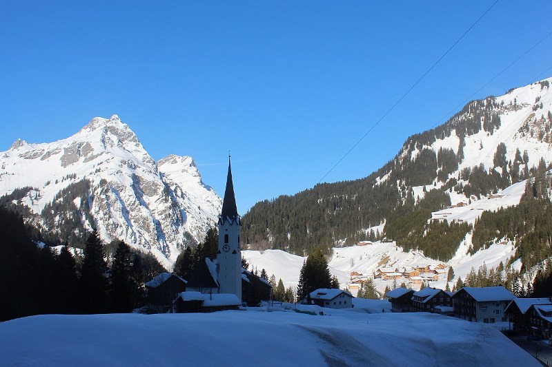
 Sun and snow in Warth-Schröcken today – 23 February 2022 – Photo: warth-schroecken.at
Tomorrow will be another mostly fine day, until a cold front approaches the northern Alps late in the day bringing some snow to the northern Alps overnight and into Friday. The snow will be light and patchy in the north-western Alps (e.g. 3 Valleys, Grand Massif, Portes du Soleil, Verbier, Villars) but a little more substantial in the central-northern Swiss Alps (e.g. Engelberg) and eastwards into Austria (e.g. St Anton, Lech, Saalbach, Kaprun), where 10-15cm is possible.
As has been the case for much of the season, there is now a big divide between snow depths on the northern and southern side of the Alps.
Snow depths are generally not far off normal for late February in the northern Alps – i.e. the French Alps north of and including Les 2 Alpes/Alpe d’Huez, most of the Swiss Alps (excluding Ticino and the far south of Engadin), and most of Austria (excluding Osttirol and Carinthia) – and even a little above average in some areas, especially in the far west of Austria (e.g. Lech).
By contrast, snow depths are uniformly below average across the southern Alps (i.e. the French Alps south of Les 2 Alpes/Alpe d’Huez, the Italian Alps, the far south of Switzerland and the far south of Austria). The areas with the least snow are in the far south-west (e.g. Sauze d’Oulx, Prato Nevoso, Auron). While these areas do still have some reasonable piste skiing on offer, natural snow cover is very patchy lower down.
Updated: 9.30am Tuesday 22 February 2022 – Lots of new snow for north-western Alps…
As expected, a lot of snow has fallen across the north-western Alps in the last 24 hours or so. There has also been a lot of wind (with speeds of 198kmph on the Pisaillas glacier above Val d’Isère) which has heightened the already high avalanche risk and means that certain areas may be slow in opening today.
 Fresh snow and sunny skies in the northern French Alps this morning. This is Les Saisies – 22 February 2022 – Photo: lessaisies.com
Snowfall totals from this latest storm are roughly in the 30-50cm range above 1500m across the north-western Alps in resorts such as Val Thorens, La Plagne, Flaine, Verbier, Mürren, Engelberg and Lech, though the very high winds have made it very difficult to measure!
There has been less snow from this storm further east and south, with 10-15cm in Saalbach and Kitzbühel, for example, and 18cm in Livigno. The far south-west (e.g. Isola 2000, Prato Nevoso) stayed completely dry.
Snow flurries will continue for a while today in the eastern Swiss Alps and Austria (away from the south) before dying away later. Elsewhere in the Alps it should be become mostly sunny, though it will be cold and remain very windy at altitude.
Once the “dust” from this latest storm has settled, snow conditions will look very positive across the northern half of the Alps as we enter the second half of the season.
Snow depths remain modest further south, however, and very modest in the far south-west where resorts such as Sauze d’Oulx, Bardonecchia and Auron will struggle to last through March (at lower altitudes, at least) unless they see some serious snow soon.
Updated: 10am Monday 21 February 2022 – Major storm for the north-western Alps…
An active cold front is crossing the Alps today bringing significant snow to north-western regions but rather less the further south and east you are.
 Heavy snow in Lech this morning where around 40cm is expected by tomorrow morning – 21 February 2022 – Photo: lech-zuers.at
Between 30cm and 50cm of snow is forecast above 1300m by the end of tonight in the north-west of the Alps, including the northern French Alps roughly north of les 2 Alpes (e.g. 3 Valleys, Paradiski, Grand Massif, Portes du Soleil), the northern and western Swiss Alps (e.g. Verbier, Villars, Mürren, Engelberg) and the far west of Austria (e.g. St Anton, Lech).
Snowfall in the southern and eastern Alps will be patchier, with some parts of the far south-western Alps (e.g. Isola 2000) staying completely dry.
Today the rain/snow limit will generally start around 1000m but will lower to 500-800m later, with the following snowfall totals forecast above 1500m by tomorrow morning:
- 40cm: Engelberg, Mürren, Lech
- 30-35cm: Alpe d’Huez, Les Arcs, Flaine, Avoriaz, Verbier
- 25-30cm: Courmayeur, Zermatt, Laax, Klosters, Ischgl
- 15-20cm: Saalbach, Kitzbühel, Kaprun, Obertauern, Cervinia
- 7-12cm: Serre Chevalier, Monte Rosa, Milky Way, Livigno, Obergurgl
- 1-5cm: Dolomites
This new snow will obviously improve conditions across many parts of the Alps (which had been very mixed in recent days), especially in the north-west which will see the lion’s share of the snow. There will be a lot of wind again though which will only add to the rising avalanche risk.
Snow depths in the southern Alps remain very modest, however, with no significant snow in the forecast any time soon.
Updated: 9.10am Thursday 17 February 2022 - Still mild and damp in the north-western Alps…
Weathertoski is currently in Les Arcs where it is cloudy with rain showers this morning, with a rain/snow limit of about 2000m. The snowline will lower slightly as the day progresses, though any precipitation should die about by the middle of the afternoon.
 Some sunny breaks in Zell-am-See this morning – 17 February 2022 – Photo: foto-webcam.eu
Today’s forecast is similar across the north-western Alps, including the northern French Alps (e.g. 3 Valleys, Grand Massif, Portes du Soleil), the northern and western Swiss Alps (e.g. Villars, Wengen, Engelberg) and some western parts of Austria (e.g. Lech). The further south and east you are the better your chances are of seeing some drier and brighter weather. The Dolomites, for example are expected to see plenty of sunshine.
As for snow conditions, the snowpack is now very humid at lower levels in the resorts of the north-western Alps thanks to the rain that has fallen here over the last couple of days. The best snow conditions are currently to be found further south and east, especially in resorts with decent altitude such as Obertauern and Obergurgl.
Friday will be a better weather day all-round, although it will be very mild. New weather fronts will reach the French and western Swiss Alps by evening though, with snow (and some low altitude rain at first) spreading across the north-western half of the Alps overnight.
Updated: 9.40am Wednesday 16 February 2022 – Snow (and rain) for the north-western Alps…
Weathertoski is currently in Les Arcs where it is snowing again this morning. The snow is expected to continue for most of the day, though the rain/snow limit will gradually rise from 1000-1200m to 1800-2000m later today!
 Snowing again in Les Arcs this morning but it may turn to rain later! – 16 February 2022 – Photo: weathertoski.co.uk
This increase in temperature is being caused by a warm front that is dragging moist subtropical air across the northern Alps. The heaviest of today’s precipitation will fall in the northern French Alps (e.g. 3 Valleys, Chamonix, Portes du Soleil) and the northern and western Swiss Alps (e.g. Verbier, Jungfrau region). These regions can expect between 10cm and 20cm of new snow above 1800m today, though the rain/snow limit will rise during the day, reaching 1800-2000m by the end of the afternoon.
Today’s rain/snow will also affect other parts of Switzerland (e.g. Flims, Klosters), the west of Austria (e.g. St Anton) and the north-western Italian Alps (e.g. Courmayeur) though it will generally be patchier the further east and south you are. Indeed, many southern parts of the Alps (e.g. Isola 2000, Dolomites) will remain dry with good sunny spells.
Tomorrow will again be mild with further rain or snow across the north-western Alps, especially in the morning. The weather will again be drier and sunnier the further south-east you are (e.g. Dolomites). Friday will then be sunnier (and very mild) for a time before new weather fronts approach from the west later in the day.
Updated: 8.50am Tuesday 15 February - Fresh snow across the Alps!
Weathertoski.co.uk is currently in Les Arcs, where it is cloudy with light snow flurries this morning. Snow from this new storm fell here yesterday afternoon and has continued on and off all night, with at least 15cm of fresh snow at 1800m this morning.
 15cm of fresh snow in Les Arcs this morning – 15 February 2022 – Photo: weathertoski.co.uk
Flurries are expected to continue today here in the northern French Alps for most of the day before dying out later. There will also be flurries in many other parts of the Alps, heaviest in the far south-east (e.g. Cortina), though will be drier in south-western Alps (e.g. Sauze d’Oulx, Isola 2000) where some sunshine is expected.
A new storm will arrive from the west tomorrow, with further snow expected across the northern French Alps (e.g. Grand Massif, Portes du Soleil) and the northern and western Swiss Alps (e.g. Jungfrau region). However, with warmer air in the mix, the rain/snow level will rise from about 800m to between 1600m and 2000m later in the day. The weather will be better the further south and east you are.
It will be a similar story on Thursday, with the risk of rain lower down in the north-west and the best of the weather in the south-east.
Just about all the Alps have benefited from fresh snow over the last 24 hours or so, with the heaviest falls this time being in the southern French Alps (e.g. Puy St Vincent, Les Orres, Auron), where snowfall totals are more in the 25-50cm range.
This should improve snow conditions in most areas in what is one of the busiest weeks of the season. Here in Les Arcs there was already plenty of snow before this latest storm, though some lower slopes were getting quite icy, mostly due to the volume of traffic.
Updated: 8.20am Monday 14 February 2022 - New storm!
Weathertoski is currently in Les Arcs where it is partly cloudy this morning, with a new storm approaching from the west. This time it will be the western and southern Alps that will see the most snow, while the north-eastern Alps will mostly miss out.
 Still quite bright in Les Arcs this morning thanks to a light Foehn. Snow is expected this afternoon though – 14 February 2022 – Photo: weathertoski.co.uk
This morning it is already snowing across most of the southern French Alps, benefiting resorts such as Superdévoluy, Les Orres and Auron, which have so far not seen much snow at all this season.
The snow (700-1200m) will move slowly east during the day but will take time to penetrate ‘Foehn-protected’ areas, such as the interior of the northern French Alps (e.g. Val d’Isère) and the Swiss Valais (e.g. Val d’Anniviers). The eastern Alps (i.e. Austria and the Dolomites) will stay mostly dry with the best of any sunshine today in the northern and eastern Austrian Alps (e.g. Salzburgland).
 Snow at last for the southern French Alps. This is Auron –14 February 2022 – Photo: auron.com
In the next 18-24 hours, between 5cm and 25cm of snow will fall across the western half of the Alps, with as much as 40cm in some parts of the southern French Alps. There will generally be less snow in the eastern half of the Alps, with some places staying dry.
On Tuesday, some flurries will linger across the western side of the Alps with the best of any sunny spells the further south you are. The more persistent snow will fall on the eastern side of the Alps (i.e. in Austria and the Dolomites).
Updated: 10am Friday 11 February 2022 - Snow for some northern parts of the Alps…
This morning a band of light to moderate snow is sitting across the northern Alps. It will die away from the north-western Alps (e.g. northern French Alps) later this morning but will linger across the north-eastern Alps (Austria) for much of the day. The southern Alps will again be dry with some sunny spells.
 It's snowing in the Portes du Soleil this morning. This is Les Gets – 11 February 2022 – Photo: lesgets.com
The rain/snow limit will be around 500-800m today with between 5cm and 15cm of new snow in areas such as the Portes du Soleil, Jungfrau region and the Arlberg.
After a couple of mostly fine days on Saturday and Sunday, a storm will reach the western Alps on Monday, this time with the heaviest snow falling in the southern French Alps!
It will then turn much milder from mid-week onwards with lots of sunshine for most, but the risk of some rain in the north-west. Stay tuned for updates!
Updated: 9.40am Thursday 10 February 2022 – More sun, and snow for some tonight…
It’s another glorious day across most of the Alps today. It will be cooler than yesterday though, with freezing levels this morning typically between 2500m and 3000m (west to east) but tending to fall as the day goes on.
 Another lovely day in the Austrian Vorarlberg today, though light snow is expected tomorrow morning. This is Schröcken – 10 February 2022 – Photo: warth-schroecken.at
Tonight, some light snow will reach the north-western half of the Alps (e.g. Portes du Soleil, Jungfrau region), pushing further east into eastern Switzerland and parts of Austria later in the night. The rain/snow limit will start at around 1300m before dropping to 800m by tomorrow morning.
Snow will die away from the north-western Alps on Friday, though it will continue for longer across the eastern Swiss Alps and parts of Austria (e.g. Engelberg, Lech), albeit tending to die away as it reaches the north-eastern Austrian Alps (e.g. Schladming).
Over the next 24 hours, around 5-15cm of fresh snow can be expected across the north-western Alps (e.g. Avoriaz, Mürren, Engelberg, Lech), however, the southern Alps will again stay mostly dry.
Saturday and Sunday will also be mostly dry with sunny spells, but a new storm will reach the Alps on Sunday night, with snow forecast on Sunday night and Monday for both the western and southern Alps, including the previously snow-starved southern French and south-western Italian Alps (e.g. Isola 2000, Bardonecchia)!
Updated: 9.15am Wednesday 9 February 2022 – Mostly sunny…
It’s a beautiful sunny day across most of the Alps, with just a few patches of fog in some of the lower valleys this morning. These should clear, and it will feel warm in the sunshine this afternoon with freezing levels above 3000m.
 Lots of sunshine across the Alps today. This is St Johann in Tirol – 9 February 2022 – Photo: foto-webcam.eu
Thursday will again be sunny but cooler. On Friday a cold front will then bring a few centimetres of snow to the northern Alps, but the southern Alps will again miss out.
After a fine start to the weekend, further weather fronts will reach the Alps later on Sunday heralding an unsettled start to the week with further snow for some, this time probably heaviest in the west and maybe even the south-west at last! Watch this space…
For those heading out to the Alps for the half term week, we will be publishing a half-term special season progress report later today…
Updated: 9.30am Tuesday 8 February 2022 – Calmer weather in the Alps!
The weather in the Alps has settled down, meaning that there is plenty of sunshine in store for most of the Alps today with just a few areas of cloud across the east, thickest in the eastern Austrian Alps.
 Still some cloud across the eastern Alps this morning, though this should break up later. This is Mellau – 8 February 2022 – Photo: mellau.at
It will be very mild in the western Alps with freezing levels as high as 3700m in the far south-west (e.g. Isola 2000) but closer to 1200m in the eastern Austrian Alps (e.g. Obertauern).
Wednesday will then be mostly sunny and very mild across the board. It will remain fine on Thursday, though it will start to turn cooler again. Friday will then be chilly with some light snow returning to the northern Alps later.
For those heading to the Alps next week, we will be publishing a special half-term season progress report tomorrow…
Updated: 10.20am Monday 7 February 2022 – Lots of new snow across the northern half of the Alps…
It’s mostly cloudy this morning across the northern and eastern Alps, with heavy snow still falling in the eastern Swiss Alps (e.g. Klosters), and Austrian Alps (e.g. Lech, Saalbach) away from the far south. There are some residual snow flurries in the north-western Alps (e.g. Verbier, Avoriaz, Val d’Isère) today, but the main thrust of the storm has now passed and skies will gradually brighten. The best of any sunshine will be in the south-western Alps (e.g. Milky Way)...
 Heavy overnight snow in Lech with more to come this morning – 7 February 2022 – Photo: lech.com
Overnight, 15-40cm of snow fell across a wide swathe of the northern Alps with Val d’Isère reporting 25cm of new snow and St Anton 30cm, for example. With further heavy snow across many eastern parts of the Alps this morning, some parts of eastern Switzerland and Austria (e.g. the Arlberg region) will see storm totals of well over 50cm by the end of today.
As has been the case with several recent storms, bits and pieces of snow have got through to the southern Alps, but many places have stayed dry, particularly in the far south-west where the likes of Sauze d’Oulx and Isola 2000 have seen little if any new snow since early December!
It is currently very windy across the Alps as a whole right now, which combined with all the recent snow in the northern Alps is sending the risk of avalanche (off-piste) here sky high.
Tuesday and Wednesday will see much calmer and generally sunny weather right across the Alps.
Updated: 10.15am Friday 4 February 2022 - A mostly sunny and mild day in the Alps…
It will be dry for much of the day today, with good sunny spells and mild temperatures. Cloud will thicken up from the north later in the day though, with a few centimetres of snow (800-1200m) due to fall across the northern Alps (e.g. Engelberg, Lech) overnight.
 Blues skies in today in the Swiss Valais. This is Bellwald-Fleschen – 4 February 2022 – Photo: snoweye.com
After a fairly settled and mostly sunny day again tomorrow, a new storm will bring snow back to the northern Alps late on Sunday, heaviest (again) in the Swiss and Austrian Alps. More on this in our latest detailed forecast out later today….
Updated: 9.45am Thursday 3 February 2022 – The big storm finally comes to an end, but what’s next for the Alps?
The last few remaining flurries are dying out from the eastern Austrian Alps this morning, as the big storm finally comes to an end. Elsewhere in the Alps, there is plenty of sunshine (albeit very hazy in places) and it is quite warm, with freezing levels between 1600m in the far eastern Alps, and over 3000m in the western Alps.
 The sun is back in St Anton with at least 1m of fresh snow at altitude across the Arlberg area – 3 February 2022 – Photo: stantonamarlberg.com
The high cloud that is currently circulating across some northern parts of the Alps will tend to thicken up as the day goes on, leading to flat light in places later today. It will stay dry though. Friday will again be mostly dry, bright and mild, although cloud will thicken up in the northern Alps later in the day, possibly bringing a few centimetres of snow to areas close to the northern foothills (e.g. Engelberg, Lech) on Friday night.
Over the last few days, between 50cm and 80cm of snow has fallen quite widely across the northern half of the Alps (roughly from the Jungfrau region eastwards), with well over 1 metre in a few favoured spots such as in the Glarus Alps of eastern Switzerland and the Vorarlberg region of western Austria.
However, the fresh snow may be a bit stickier than some might have expected (thanks to temperatures being warmer towards the end of this storm cycle), especially lower down. Whatever the case, you should not be venturing off-piste in these regions today, as the risk of avalanche is very high, not helped by the high winds that accompanied the storm.
Over the last few days, the far western Swiss Alps (e.g. Villars) and the northern French Alps (e.g. Chamonix, Flaine, Courchevel) have also seen some snow but in far more modest quantities (typically 10-30cm) than further north. With one or two exceptions (e.g Cervinia, Livigno), the southern Alps have seen very little if any snow.
Looking at the snow situation more generally in the run up to the busy February school holidays, snow depths are now above average across the northern half of the Alps (from about central Switzerland eastwards and including most of Austria but away from the southern provinces of Carinthia and Osttirol).
Snow depths are reasonable, but still generally below average, across the west of Switzerland and the northern French Alps (e.g. Wengen, Verbier, Chamonix, 3 Valleys), but below average across the entire southern Alps, with an extremely thin snowpack in the south-west (e.g. Milky Way, Pila, Risoul, Isola 2000).
Updated: 10.30am Wednesday 2 February 2022 – More wind and snow for the northern and north-eastern Alps, but milder…
The weather in the Alps remains very unsettled, with further snow (and some rain) today across the northern and especially north-eastern Alps. Further south it will again be drier with some sunny spells, but the wind will continue to be factor just about everywhere, with some lift operations again affected, especially at altitude.
 Serious snow in many parts of Austria. This is Zauchensee – 2 February 2022 – Photo: facebook.com/powderchasers
Once again, the heaviest snow today will be in the northern half of the Alps from about central Switzerland (e.g. Andermatt) eastwards into the Austrian Vorarlberg, parts of the Tirol and the Salzburgland. These areas could see another 20-40cm of snow today, with resorts such as Galtür, St Anton, Lech and Warth-Schröcken likely to be recording some of the highest figures.
These resorts, among others, have already seen well over 1m of new snow this week, meaning that totals from this latest storm could reach as much as 150cm in places by tonight. Temperatures will be milder than yesterday, with the rain/snow limit rising to between 1000m and 1400m in the north-western Alps, and from 800m to 1200m in the north-eastern Alps.
The north-western Alps (e.g. Les Arcs, Chamonix, Verbier, Villars) will see patchier precipitation today, though this will quickly die out this morning, and the best of any sunshine will be in the south-western Alps (e.g. Bardonecchia, Isola 2000).
Thursday will be a much calmer day, with sunny spells but also some areas of cloud drifting around. It will be very mild in the western Alps tomorrow with freezing levels close to or even above 3000m in France, western Italy and western Switzerland. It will remain cooler in the eastern Alps, with freezing levels between 1000m in the east (e.g. Obertauern) and 2400m in the west (e.g. Lech).
If you are planning to ski in any of the areas that have seen a lot of snow over the last few days, do be warned that the risk of avalanche off-piste will be sky high for a while.
As for snow conditions in the run up to the busy February school holidays, snow depths are now above average across the northern half of the Alps, from about central Switzerland eastwards and including most of Austria but away from the southern provinces of Carinthia and Osttirol.
Snow depths are reasonable, but still generally below average, across the west of Switzerland and the northern French Alps (e.g. Wengen, Verbier, Chamonix, 3 Valleys), but below average across the entire southern Alps, with an extremely thin snowpack in the south-west (e.g. Milky Way, Pila, Risoul, Isola 2000).
After today, we are not expecting any more significant widespread snow in the Alps before the beginning of the main UK half term week starting on 12 February.
Updated: 9.30am Tuesday 1 February 2022 - Massive snowfalls for some northern parts of the Alps…
It’s snowing again today across the northern and north-eastern Alps, roughly from the central Swiss Alps eastwards (e.g. Engelberg, Davos, St Anton, Ischgl, Kitzbühel). It is drier with some sunny spells., for now at least, in the far western Swiss Alps and the northern French Alps (e.g. Portes du Soleil, 3 Valleys). Many southern parts of the Alps are also dry, with the best of any sunshine in the far south-west.
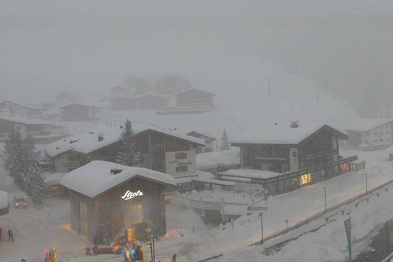 Blizzards in progress in the Austrian Arlberg. This is Lech, where storm totals are expected to exceed 1 metre by Thursday morning – 1 February 2022 - Photo: lech-zuers.at
Later today some flurries will also develop across the north-western Alps (e.g. Portes du Soleil, Grand Massif, 3 Valleys, Verbier) but snowfall will remain heaviest and most persistent across the central and eastern side of the northern Alps (e.g. Engelberg, Laax, Klosters, Lech, Seefeld, Saalbach, Kaprun). Indeed, it will continue to snow heavily all night and for much of tomorrow in these central northern and north-eastern parts of the Alps, starting with a very low rain/snow limit today but rising to between 800m and 1200m (east to west) later tomorrow, meaning that some rain is possible in the lowest valleys.
All the snow forecast for the next 36 hours comes in addition to the considerable amount of snow that has already fallen across the northern and north-western Alps over the last 24 hours.
By Thursday morning, 72-hour snowfall totals will range from 60cm to 120cm across a wide swathe of the northern Alps, roughly from the Jungfrau region eastwards, including resorts such as Mürren, Engelberg, Laax, Klosters, Ischgl, Lech, St Anton and Kaprun. Some of the very highest snowfall totals are likely to be in the Austrian Arlberg area, which includes the resorts of St Anton, Lech, Zürs, Warth-Schröcken.
These areas will not only see huge amounts of snow, but there will also be a lot of wind, meaning that the risk of avalanche will become critical.
Over the next couple of days, the further south and west you are in the Alps the less snow there will generally be. The northern French Alps (e.g. 3 Valleys, L’Espace Killy, Chamonix) will only see another 10cm or so from this storm cycle, most of which will fall tonight, and with some exceptions (e.g. Livigno), the southern Alps will miss most of the action with some places staying completely dry.
By Thursday, the weather should have settled down across the board, but it is important to remember that the risk of avalanche danger will remain sky high in many northern and north-eastern parts of the Alps.