Latest snow report
Updated: 12.20pm Saturday 3 February 2024
It has been a mild week in the Alps, particularly between Monday and Wednesday when freezing levels exceeded 3000m at times, with temperatures as high as 15-17°C in some of the lower Alpine valleys, particularly in the west.
Thursday saw a little bit of snow in some northern regions, mostly in eastern Switzerland and Austria, but nothing particularly significant, and most southern and western parts of the Alps remained dry.
This weekend and into next week it will remain mild with plenty of sunshine. Then, later next week there are signs that the weather will turn more unsettled with the chance of some more widespread and significant snow towards the weekend. This is a long way off though, and there is still lots to play for.
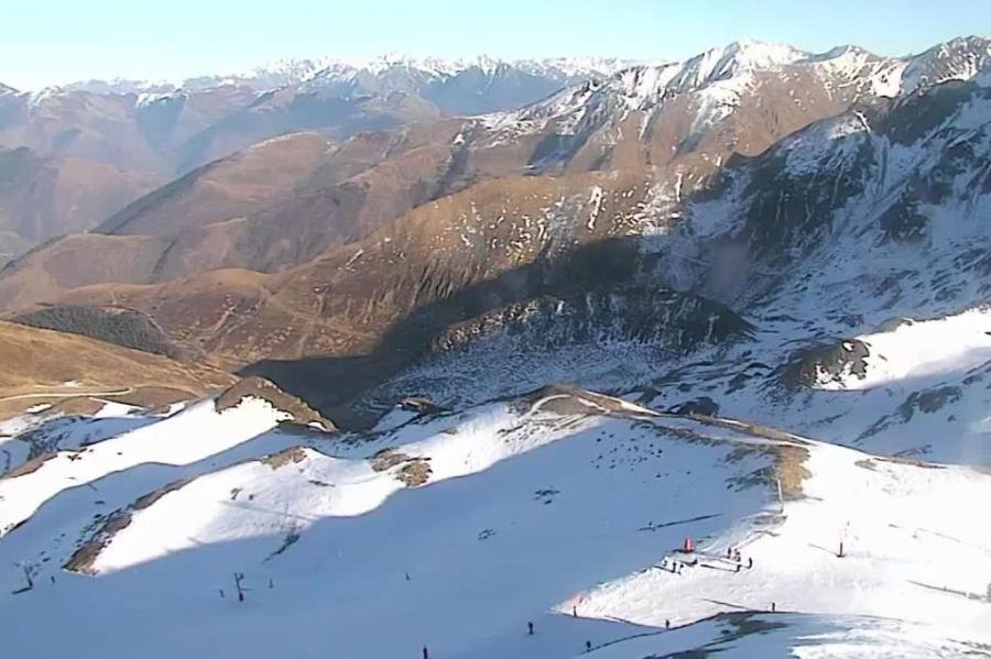
In the meantime, snow conditions in the Alps remain very mixed. In the northern Alps, there is a decent amount of snow at high altitude, as has been the case for most of the season, but you need to be well above 2000m (and in some cases 2500m) to find anything like consistently ‘wintry’ snow. At mid and lower altitudes, the pistes have been going through various degrees of freeze-thaw, making them icy at times, and slushy at others, especially on lower slopes exposed to the sun. Natural snow is also often patchy at low altitudes, and virtually non-existent below about 1300m in some north-western areas, even on north-facing mountains.
In the southern Alps, snow depths are mostly well below par too, though on-piste conditions are slightly more consistent as they have avoided most of the rain that has afflicted areas further north (and particularly further north-west) at times this season.
Whatever the case, there are very few good off-piste opportunities in the Alps right now.
Across the pond, significant snow is falling across many western US resorts right now, especially in California…
Austria
Austria still has the most snow relative to altitude, with impressive upper depths in the likes of St Anton (65/355cm) and Sölden (30/301cm). The recent warm weather has led to spring-like snow quality lower down though, so you need to stay well above 2200m if you want consistently ‘wintry’ conditions.
The warm weather has been more problematic for the lower resorts, like Zell am See (0/160cm) and Söll (0/100cm). Most of the pistes are still open but there is very little natural snow close to resort level, and you need to contend with much more variable snow quality, even higher up.
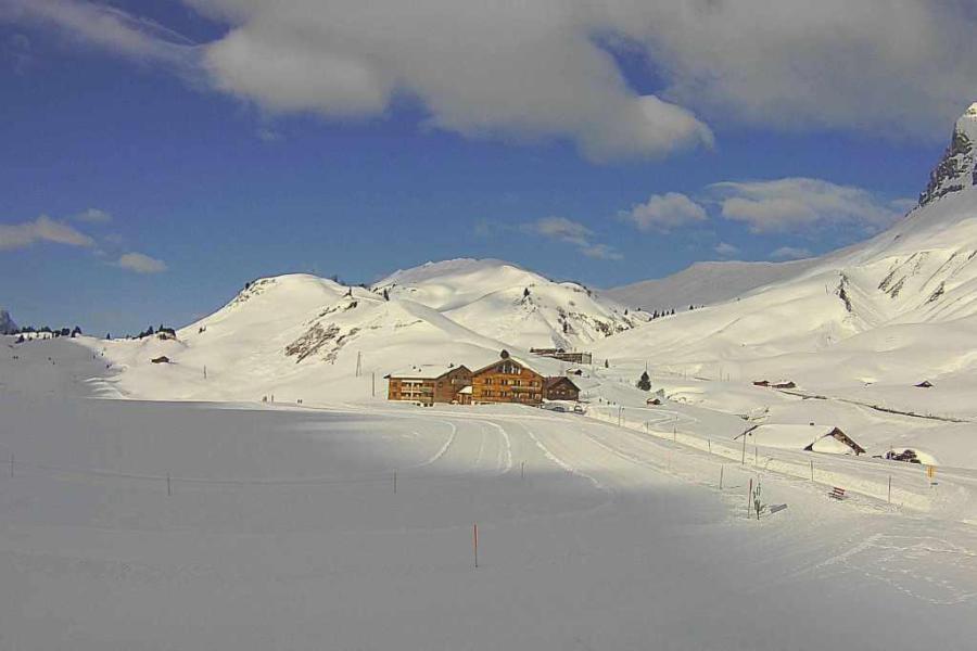 Plenty of snow in the Austrian Vorarlberg, even at relatively low altitudes. This is Warth – 3 February 2024 – Photo: warth-schroecken.at
France
To find consistently good snow conditions in the French Alps, you need to aim high right now, to the likes of Val d’Isère (105/195cm). However, even here, only the upper half of the area is skiing well, despite the decent base depths, and good off-piste opportunities are hard to find.
Lower down, resorts like Megève (0/130cm) are still operating a reasonable number of pistes, though natural snow cover is very patchy lower down and conditions are more akin to spring.
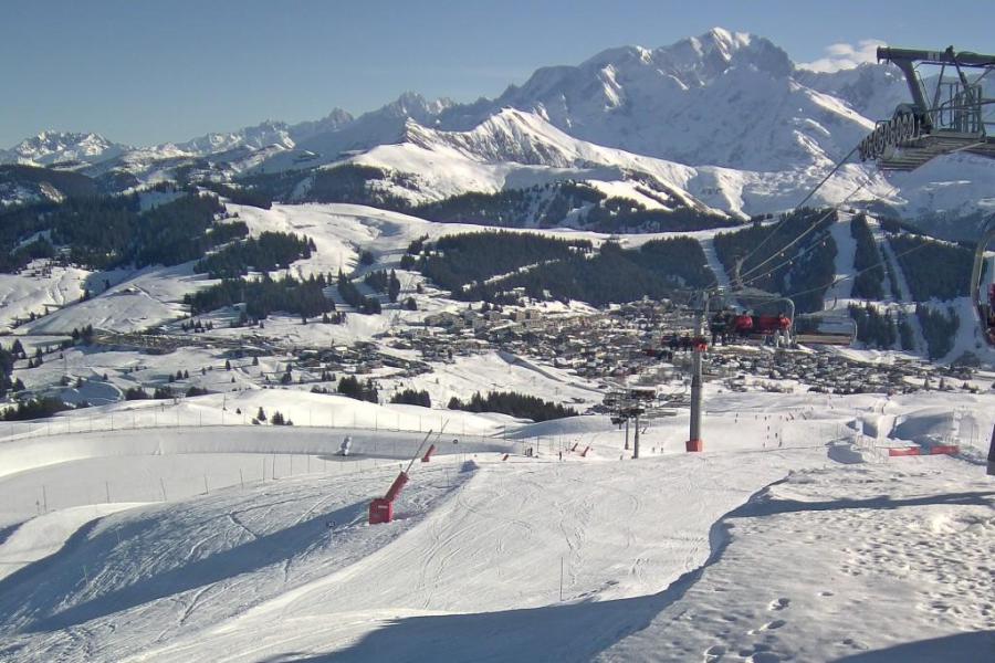 Les Saisies is just high enough to have good snow cover down to resort – 3 February 2024 – Photo: lessaisies.com
Italy
Snow depths are universally below average in the Italian Alps, with the best skiing at high altitude in resorts such as Cervinia (80/145cm) and Livigno (60/105cm) where there is some good piste-skiing on offer.
Lower down, natural snow cover is quite patchy, particularly in the Piedmont where Bardonecchia (5/70cm), for instance, is unusually green at resort level for early February.
On the other side of the Italian Alps, the Dolomites are faring better, in part due to their world-class snowmaking, but it has also felt positively spring-like at times this week, including in Selva (30/60cm).
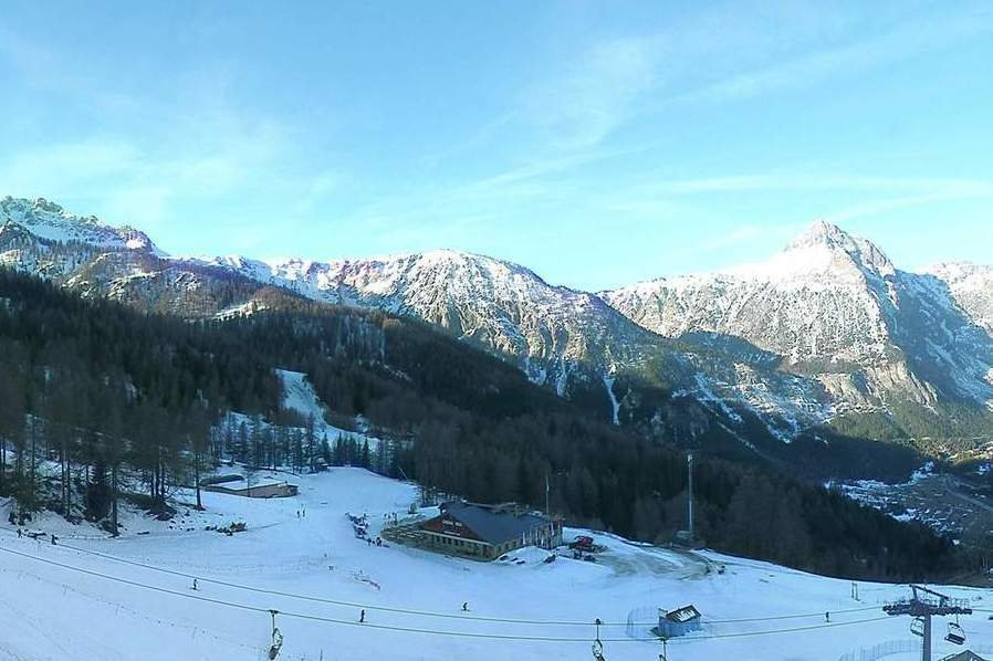 Patchy natural snow cover lower down in Bardonecchia – 3 February 2024 – Photo: bardonecchia.it
Switzerland
This week’s spring-like weather has taken its toll at lower altitudes in the Swiss Alps, with very little natural snow lower down in the likes of Adelboden (0/110cm) and Leysin (20/110cm). Both resorts still have a good number of pistes open, albeit with highly variable snow quality.
For more wintry snow conditions you need to find resorts with plenty of skiing above 2300m, such as Zermatt (15/105cm) though, even here, snow depths are way below par and the off-piste is limited.
Height for height, the best snow cover is currently to be found in the eastern Swiss Alps, in resorts like Laax (20/365cm) and Davos (70/190cm), though the snow quality is still very mixed lower down here too.
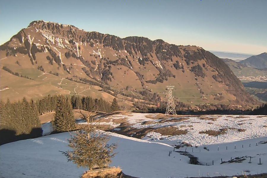 Good illustration of how little snow there is at low altitude in the northern Swiss Alps. This is Engelberg (where there is plenty higher up) – 3 February 2024 – Photo: titlis.ch
Rest of Europe
It has been very warm in the Pyrenees this week which has made things difficult for lower resorts, some of which are no longer able to operate. Higher up there are still plenty of pistes open in Andorra’s Granvalira (25/70cm) and Spain’s Baqueira Beret (75/105cm), but the conditions are very much spring-like.
Scandinavia has had a stormy week, with hurricane force winds temporarily closing some resorts. However, these storms have also brought a lot of snow to the resorts of western Norway, where Voss is reporting a base of 125/150cm and should offer some fabulous skiing once resort authorities have “cleaned up”!
The situation in Scotland is not good right now, with stormy but very mild weather leading to further loss of the already modest snow cover. At the time of writing, it is doubtful that there will be any serious lift-served skiing possible in Scotland this weekend.
 Meagre snow cover in the Pyrenees. This is Peyragudes – 3 February 2024 – Photo: snoweye.com
USA
It’s snowing this weekend across many western US resorts, with Wyoming’s Jackson Hole expecting around 20cm by the end of today, and Colorado’s Vail (130cm mid-mountain base) perhaps as much as 30cm. This will obviously improve snow conditions in both resorts, although snow depths remain considerably below the long-term average.
The biggest snowfalls are expected in California, with conditions set to be transformed in Mammoth (190cm mid-mountain base) where another metre is possible over the next few days.
Canada
Although there hasn’t been much snow in Whistler (135cm mid-mountain base) recently, it has at least cooled down after a very mild spell earlier in the week. This means that on-piste conditions are firmer even if snow depths remain considerably below par.
Further inland, it was also very mild earlier in the week with rain to over 2000m in Fernie (156cm mid-mountain base) where snow conditions were very wet for a time. The weather has now turned cooler again though, and there is a little new snow forecast today.
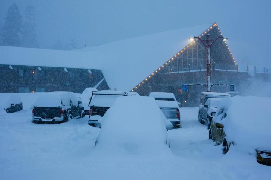 Yesterday saw heavy snow falling in Mammoth, which is set to continue on and off for the next few days – Photo: facebook.com/mammothmountain, 2 February 2024
Our next full snow report will be on
Friday 23 February 2024
If you enjoy reading our updates - please feel free to support us: