


ARCHIVE
Today in the Alps - November 2018
Read about current weather and snow conditions in the Alps
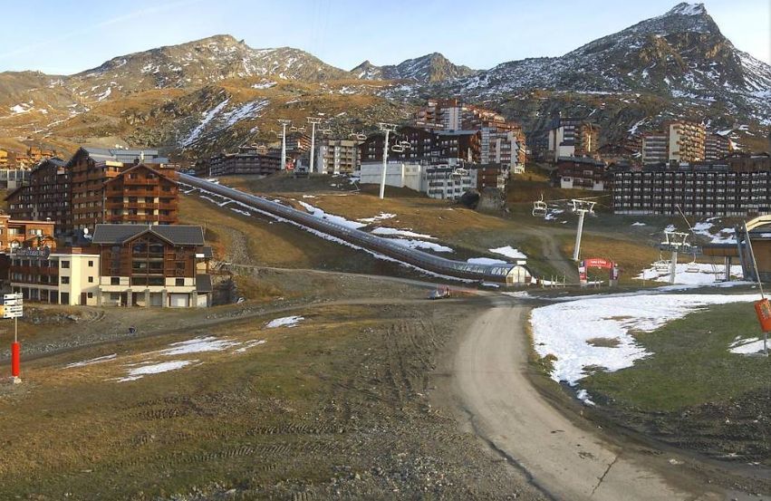
Updated: 9.45am Friday 30 November 2018 - Unsettled but turning very mild on Sunday and Monday…
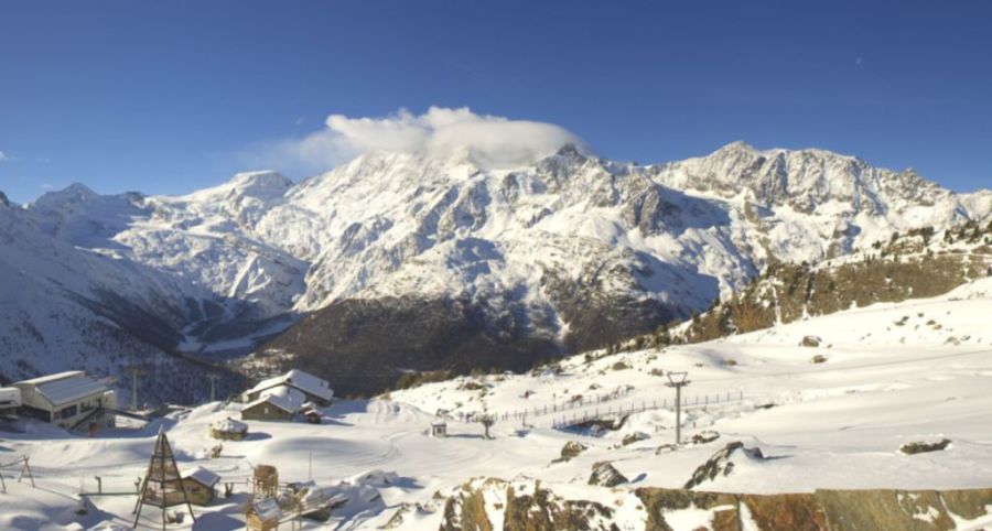
As expected, we have a new storm approaching the Alps from the west this morning. This storm will weaken today as it moves east across the Alps, with the heaviest precipitation expected in the southern and western French Alps (e.g. Les 2 Alpes) where 10cm or so is possible.
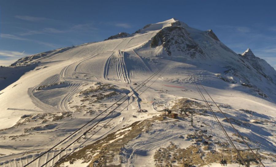
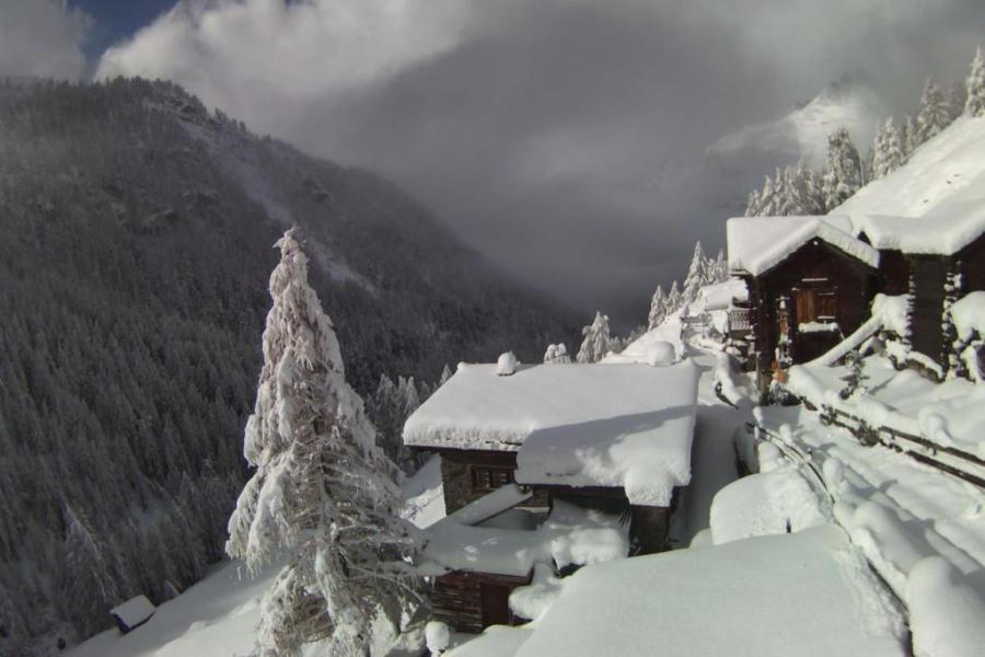
 A few centimetres of new snow are expected in Les 2 Alpes today – 30 November 2018 – Photo: les2alpes.com
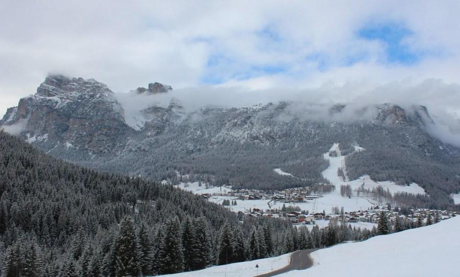
Many other parts of the Alps will see a little snow over the next 24 hours, but not generally enough to get excited about, and some south-eastern parts (such as the Dolomites) will miss out completely. The rain/snow limit will typically be around 1200-1500m, but perhaps a bit lower tonight across the northern Alps.
Saturday will be a fairly benign weather day with plenty of early sunshine for most parts of the Alps, after any early flurries/showers clear in the east. Later in the day, however, cloud will stream back into the western Alps, heralding the arrival of a more active storm for Sunday.
Sunday itself will be very unsettled, especially across the northern and western Alps, thanks to an active warm front which is bringing some very mild Atlantic air that will send the rain/snow limit to between 2000m and 2400m.
This mild and unsettled theme will continue into Monday, with the heaviest precipitation in the north-western Alps – i.e. the northern French Alps roughly north of Les 2 Alpes (including the likes of the 3 Valleys, Chamonix and the Portes du Soleil), the Swiss Alps, away from the far south (including the likes of Verbier, the Jungfrau region and Laax), and the western Austrian Alps (including the likes of Lech and St Anton).
While Sunday and Monday's rain may wash away much of the low-lying snow across these northern and western parts of the Alps, some moderate accumulations of new snow can be expected above 2300m.
The far southern French Alps, the far southern Swiss Alps, the southern Austrian Alps and much of Italy will see lighter and patchier precipitation.
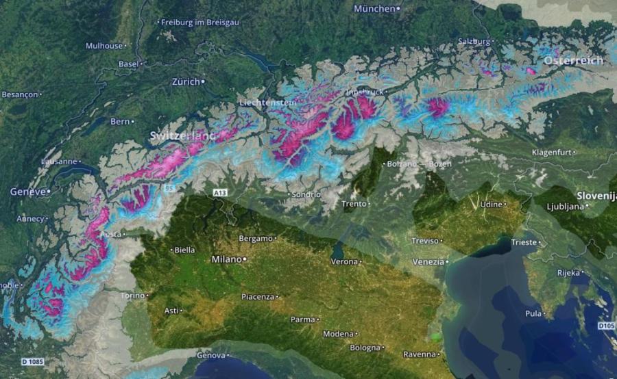 Accumulated snowfall forecast for the Alps over the next days, clearly favouring the north and west – Image: meteoexploration.com, 29 November 2018
A return to more widespread snow to lower levels is possible by the end of next week, but this is still too far off to be certain.
In the meantime, if you are planning to go skiing in the Alps this weekend, Saturday will be the best weather day in virtually all areas. There are also a lot of new openings scheduled for tomorrow, including Les 2 Alpes and Alpe d’Huez in France, both of which have reasonable early snow cover with the added bonus of a few centimetres of fresh snow falling today.
Other good bets for tomorrow include Montgenèvre, Isola 2000, Val d’Isère/Tignes, Cervinia, Zermatt and Saas-Fee, to name just a few. All of these ski resorts should also have reasonable weather and a few centimetres of new snow. But do remember that the weather will be far less clement on Sunday, and lift closures are likely.
For a more detail on snow conditions in the Alps in general, see our latest detailed country by country snow report.
Updated: 10.20am Thursday 29 November 2018 - Unsettled but generally quite mild over the coming days…
Anyone lucky enough to be skiing in the Alps today can look forward to some decent weather, at least above any lowland cloud. It has turned milder though, and this will be particularly apparent across the northern Alps where the Foehn wind is blowing.
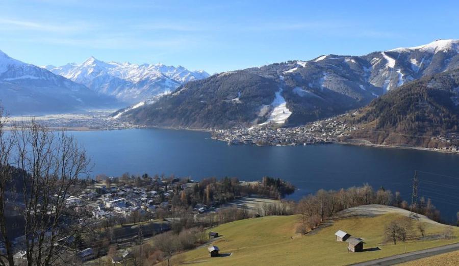 Any low-lying snow on the northern side of the Alps is melting rapidly. This is Zell-am-See – 29 November 2018 – Photo: zellamsee-kaprun.at
On Friday a weather front will cross the Alps from west to east, clearing the eastern Alps on Saturday. It will bring a few centimetres here and there but nothing really significant, with a rain/snow limit typically between 1200m and 1500m.
After something of a reprieve on Saturday afternoon, new weather fronts will reach the Alps on Sunday and influence the weather into the early part of next week. This time there will be much milder air in the mix though, and the rain/snow limit is likely to rise to well above 2000m.
Towards the weekend after next, that’s to say 8/9 December, there is some hope of a return to winter with more widespread snow to lower levels. However, this is a long way off so not something to get too excited about just yet.
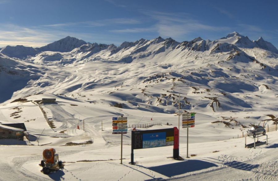
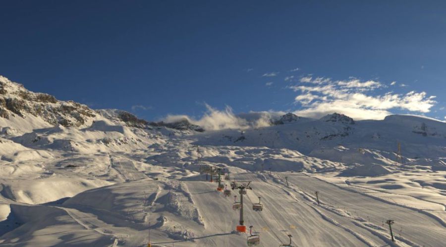
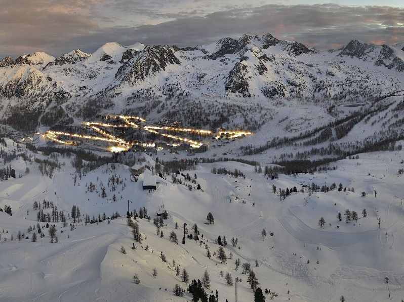 Lots of snow in the southern French Alps. This is Isola 2000, which is due to open this weekend – 29 November 2018 – Photo: Isola 2000.com
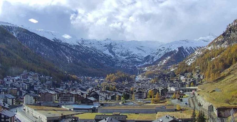
In the meantime, expect much of the low-lying snow that fell across the northern Alps earlier this week to melt over the next few days, even if there is another temporary dusting tomorrow and Saturday.
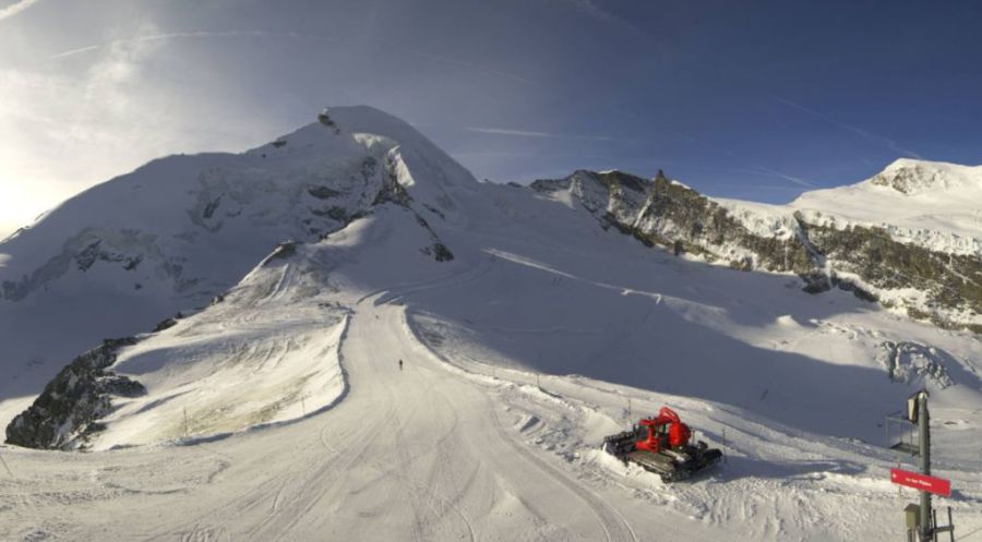
As we have said before, with the odd exception it is the higher resorts of the southern Alps that offer the most reliable snow conditions right now including the likes of Zermatt, Saas-Fee, Cervinia and Passo Tonale. One notable exception on the northern side of the Alps is Val d’Isère/ Tignes where there is also good natural snow cover, at least above 2300-2400m or so.
For more detail on snow conditions in the Alps and beyond, check out our latest snow report out later today….
Updated: 10am Wednesday 28 November 2018 - Looking wintry but turning milder again…
Following two days of snow showers, it’s looking a lot more wintry across the northern Alps today. However, with temperatures on the rise again, much of this new snow will melt over the next couple of days, at least at low levels. For serious lasting snow, you generally still need to be looking at the higher resorts of the central and southern Alps.
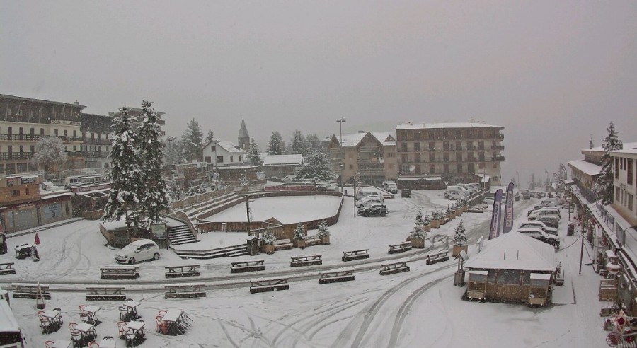
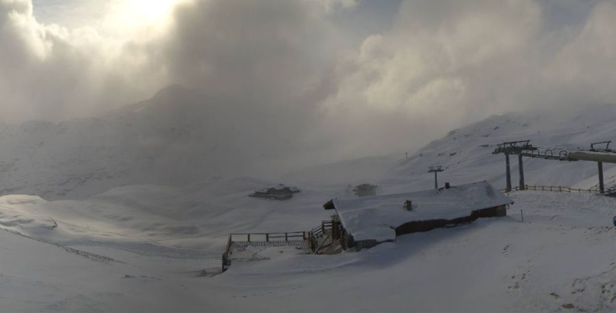
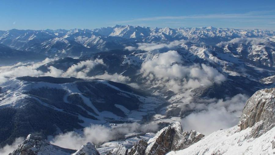 Looking more wintry across the lower Austrian resorts, but more snow is still needed. This is Hochkönig – 28 November 2018 – Photo: hochkoenig.at
The weather forecast for the Alps this week is for temperatures to increase until Friday. Most places will be dry today and tomorrow with plenty of sunshine, at least above any low level cloud/fog. It will become milder though, especially on the northern side of the Alps where the Foehn will be blowing.
On Friday a new storm will move in from the west and it will remain rather unsettled over the weekend. We are also expecting some new snow in places, but not in huge quantities. Stay tuned for details…
In the meantime, here are some suggestions for the best places to ski in the Alps right now.
In France, Val d’Isère and Tignes lead the way with 41 open pistes, plenty of natural snow above 2300m or so and artificial snow low down. The only other option right now is Val Thorens, where 17 pistes are open, which also has a little natural snow but is more dependent on snow-making.
A number of new openings are expected this weekend, most of them further south where the snow is best. These include Les 2 Alpes, Alpe d’Huez, Serre Chevalier, Montgenèvre and Isola 2000, to name just a few.
In Switzerland, the best snow conditions remain in Zermatt and Saas-Fee but there are plenty of other more limited options including St Moritz, Andermatt, Davos/Klosters and Engelberg. As a rule, the closer you are to the Italian border, the better the snow base.
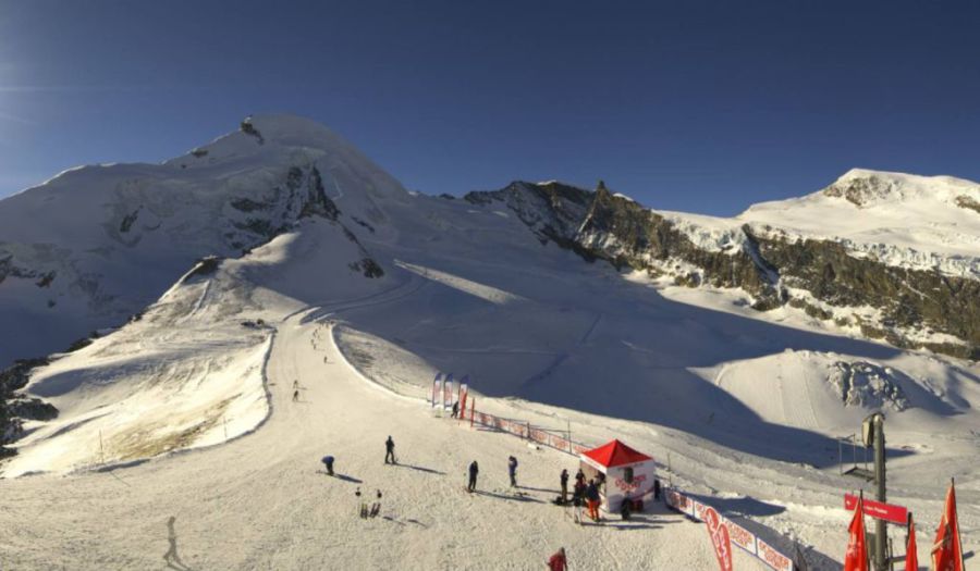
 The best snow conditions remain in the high resorts of the central and southern Alps. This is the view of Saas-Fee from the slopes of Saas-Grund – 28 November 2018 – Photo: saas-fee.ch
In Austria, glaciers aside, Obergurgl is a good bet with a significant proportion of its pistes (70km) open on a mixture of real and man-made snow. Ischgl is another with 69km of runs open, again on a mixture of natural and artificial snow. Further east, Obertauern is also offering a handful of pistes. However, more snow is needed generally across Austrian ski resorts.
Italian ski resorts offer the best snow conditions at the moment, all things considered, even if not that many are open yet. As we have been saying for some time, Cervinia is as good as it gets right now with most of its area open and skiable down to resort. A handful of smaller areas are also offering skiing this week including Val Senales, Prali and Passo Tonale, with more resorts expected to open this weekend.
Updated: 9.30am Tuesday 27 November 2018 - Some snow for the northern Alps, but the best bets remain further south
Most of the snow has fallen in the southern Alps so far this autumn, but over the last 24 hours it has at last been snowing across the northern Alps, especially in Austria. In most cases accumulations have remained light to moderate though, and temperatures will rise again after today.
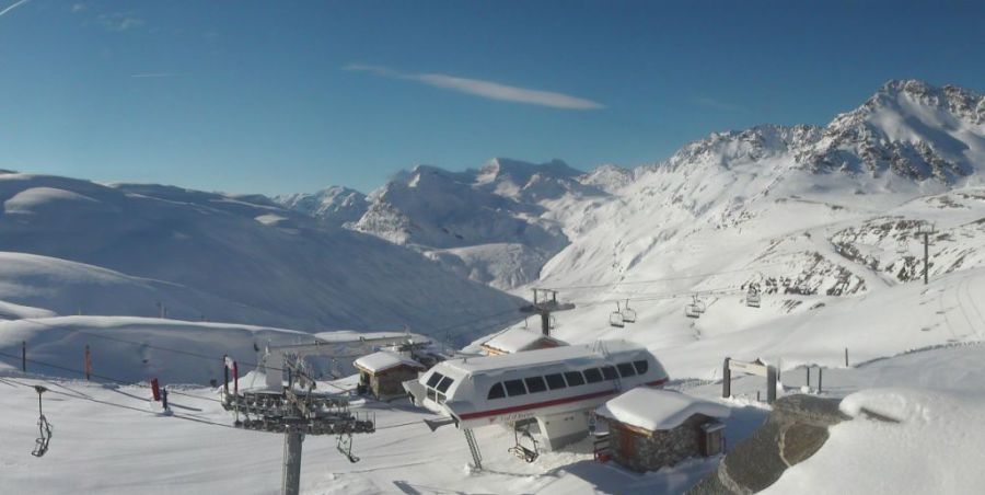
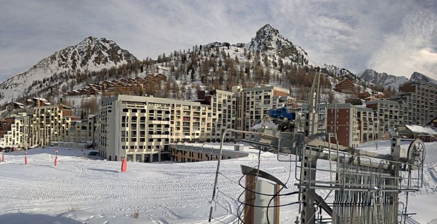 The southern French resort of Isola 2000 is in excellent shape ahead of its scheduled opening on Saturday – Photo: isola2000.com, 27 November 2018
So it is temporarily white again across many parts of the “snow starved” northern Alps, including the Portes du Soleil, Villars, Wengen/Mürren, Engelberg, Lech/St Anton, and the low resorts of the Tirol, Salzburgland, Upper Austria and Styria.
But useful as this snow is, it is still not the “killer dump” needed to really ignite the season across many of the lower (and some higher) resorts of the northern Alps. As of tomorrow, the snow-line will move up the mountain again, especially on slopes exposed to the sun.
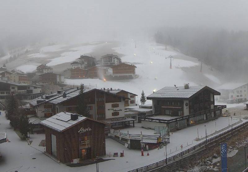
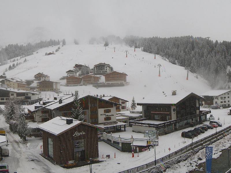 New snow for the northern Alps, but more would be welcome. This is Lech – 27 November 2018 –Photo: lech.com
With one or two exceptions, for the time being the safest bets for a snow-sure early season ski holiday remain the higher resorts of the central and southern Alps, including the likes of Zermatt, Saas-Fee, Cervinia and the Monte Rosa region.
If you are thinking of going skiing in early to mid-December you might also want to consider Val d’Isère/Tignes, Alpe d’Huez, Les 2 Alpes, Isola 2000, Sestriere, Livigno, Passo Tonale, St Moritz, Andermatt, Kaprun and Obertauern, to name a few.
The next snow in the Alps is due on Friday and Saturday, and will probably most favour the southern French Alps. It won’t signal a proper return to winter though, and the first part of next week looks like it will be dominated by a “warm high”, meaning plenty of dry, sunny and mild weather for the Alps.
Updated: 9.25am Monday 26 November 2018 – North-south divide in the Alps…
Over the weekend there was further snowfall across the southern and western Alps, with the southern French Alps (e.g. Isola 2000, Serre Chevalier, Les 2 Alpes) hitting the jackpot with 40-60cm at altitude.
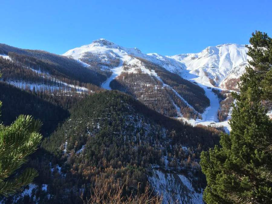 Lost of snow in the southern French Alps. This is Auron near Isola 2000, both of which open this coming weekend – 26 November 2018 – Photo: Pascal Lequenne
Thanks to multiple snowfalls in recent weeks, most resorts on the southern side of the Alps now have an excellent early base, even if they are not yet open. Areas that have lots of snow, at least at altitude (but in some cases quite low down too) include Isola 2000, Serre Chevalier, Sestriere, Cervinia, Monte Rosa, Passo Tonale, Zermat, Saas-Fee and Andermatt.
Some northern parts of the Alps also saw snow over the weekend, especially in France (e.g 3 Valleys, Portes du Soleil) although it fell in more modest quantities. So, with one or two exceptions (e.g. Val d’Isere), there is still very little meaningful snow across the northern half of the Alps (e.g. Morzine, Villars, Wengen, St Anton, Saalbach).
 Still little natural snow in many northern parts of the Alps, including here in Lech – 26 November 2018 – Photo: lech.com
The weather in the Alps has now temporarily turned colder, and there is also some snow forecast today, this time mostly for the north-eastern Alps (i.e. much of Austria away from the far south, parts of the central and northern Swiss Alps, and the northern French Alps). On the whole, snowfall will be modest (2-10cm), but 20-40cm is possible over the next 24 hours in parts of Austria (e.g. Salzburgland), and it will fall to low levels. For once, it is the southern side of the Alps that will see little or no snow from the current storm.
Looking further ahead, the extended weather forecast for the Alps does not make great reading. The last of the snow showers in the eastern Alps will die away later on Tuesday, and it will then be mostly fine and increasingly mild until the end of the week. On Friday a new storm is likely to deliver a bit of snow (at altitude) to some southern French and western Italian resorts, though it won’t be cold and the weather is likely to stay on the mild side next weekend and beyond.
Updated: 10.15am Friday 23 November 2018 - New storm incoming!
A new storm is approaching the Alps from the south which will deliver significant snow over the next 24 hours to some south-western parts of the Alps, with the southern French Alps (e.g. Les 2 Alpes, Serre Chevalier, Isola 2000) likely to do particularly well.
 Heavy snow this morning in the southern French Alps. This is Auron – 23 November 2018 – Photo: auron.com
This morning it is already raining or snowing across most of the southern French Alps and the western Italian Alps. A few showers have also broken out across the northern French and southern Swiss Alps but, for the moment, many other parts of the Alps are dry.
During the course of the day, and especially this evening, the precipitation will move a bit further north into the northern French Alps (e.g. 3 Valleys, Portes du Soleil) and the central/southern Swiss Alps (e.g. Zermatt, Andermatt). Some precipitation will also reach the eastern Italian Alps (e.g. Dolomites) and the far south of Austria.
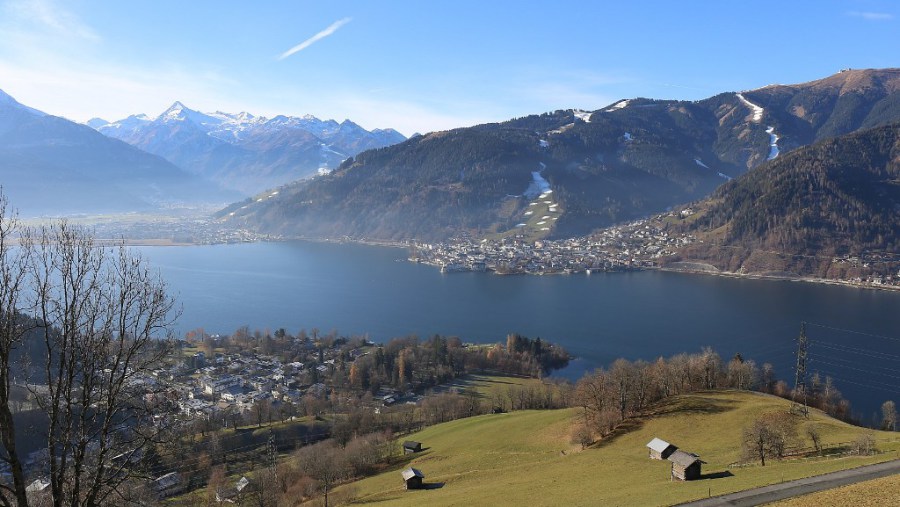 Still very little natural snow on the northern side of the Alps. This is Zell-am-See – 23 November 2018 – Photo: zellamsee-kaprun.com
However, the heaviest snow will always be in the southern French and western/central Italian Alps, as well as some of the border areas between Italy and Switzerland. These areas (e.g. Les 2 Alpes, Isola 2000, Cervinia, Monte Rosa, Zermatt, Saas-Fee and Passo Tonale) could see between 20cm and 40cm of new snow in the next 24 hours, with 50cm very locally. The rain/snow limit will generally sit between 800m and 1400m in the southern Alps (locally a bit lower), but between 1200m and 1800m in the north-western Alps (e.g. the French Savoie regions).
Meanwhile, under the influence of the Foehn, the northern Swiss Alps (e.g. Bernese Oberland) and much of Austria (away from the far south) will miss most of the precipitation and remain mild and windy.
After another mostly fine day on Sunday, further snow will reach many parts of the Alps early next week. It will probably remain light to moderate but will favour some northern and eastern parts of the Alps (e.g. Bernese Oberland and much of Austria) which have until now missed out. It will also turn colder again, so any snow will fall to relatively low levels.
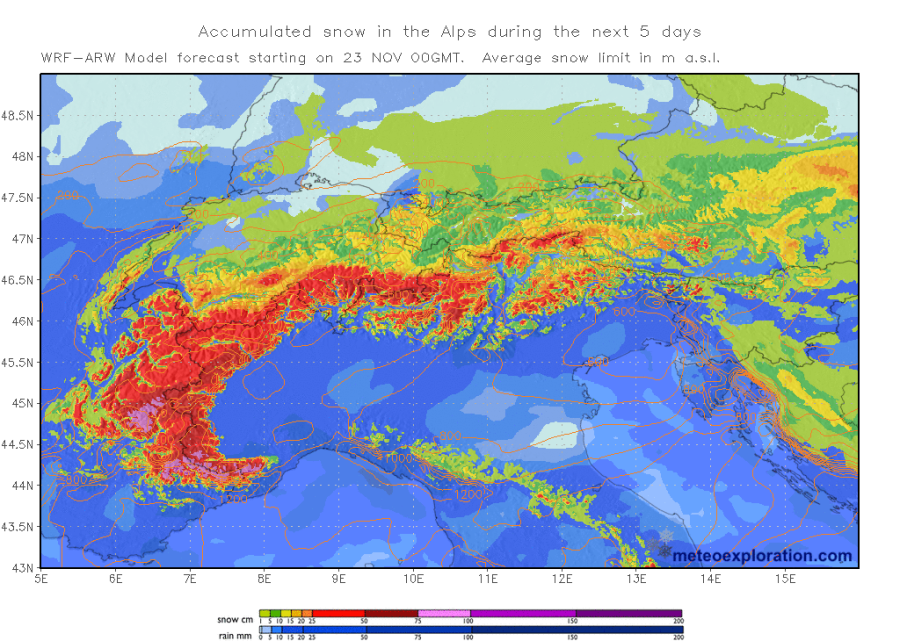 Predicted accumulated snowfall in the Alps over the next five days – 23 November 2018 – Image: meteoexploration.com
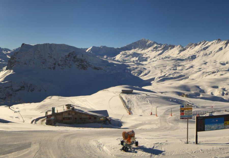
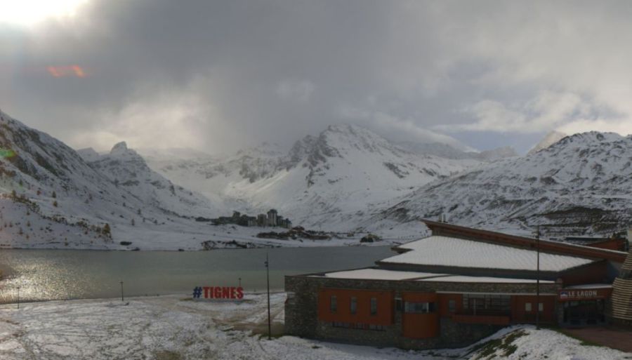
A number of big resort openings are scheduled for tomorrow, including L’Espace Killy (Val d’Isère/Tignes) which already has a good base above 2400m but can expect another 20cm or so later today and tonight. Val Thorens will also open, a week later than originally scheduled (due to lack of snow) - they have been working hard with the snow-cannons but can also expect 20cm or so tonight. Both these resorts should see some sunshine tomorrow.
Elsewhere in the Alps, yesterday’s opening of Ischgl in the Austrian Tirol is the big story – though they are completely reliant on artificial snow and will largely miss out on the latest storm.
If you are planning a last minute ski trip, in our opinion the two best areas in the Alps this weekend (considering both snow and extent) are Val d’Isère/Tignes and Zermatt/Cervinia.
Updated: 10am Thursday 22 November 2018 - Contrasting snow conditions across the Alps…
There is currently a huge contrast in snow conditions across the Alps, with significant snow at altitude both in the southern Alps and close to the main Alpine ridge (e.g. Val d’Isère, Cervinia, Zermatt, Saas-Fee, Monte Rosa, Andermatt and Passo Tonale). Glaciers aside, however, there is little meaningful snow across the northern half of the Alps (e.g. Portes du Soleil, Bernese Oberland, Arlberg, Salzburgland).
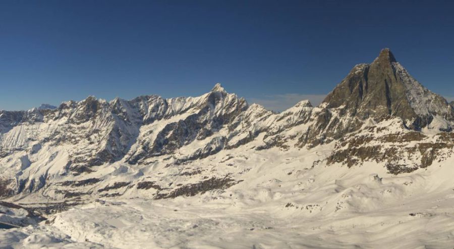
 Cervinia continues to offer the best skiing in the Alps right now – 22 November 2018 – Photo: cervinia.it
This weekend will see a number of big openings – biggest of all being L’Espace Killy (Val d’Isère-Tignes) where there is decent natural snow cover above about 2400m, though still very little lower down.
 Looking good for Saturday’s big opening up top in Val d’Isère – 22 November 2018 – Photo: valdisere.com
Val Thorens will also open this weekend, a week later than planned. There is less snow here than in L’Espace Killy, but they are working hard with artificial help to open as many runs as possible.
 Val Thorens opens this weekend on artificial snow – 22 November 2018 – Photo: valthorens.com
Another big opening today is Ischgl, which has 48km of pistes available, almost entirely on artificial snow.
 Ischgl is another big opening this weekend, on artificial snow – 22 November 2018 – Photo: ischgl.com
The weather in the Alps will remain rather mixed over the next few days. After a mostly fine day today, a new storm will approach the western Alps tomorrow, with a moderate fall of snow expected across the southern French Alps (e.g. Les Alpes, Serre Chevalier, Isola 2000), the far southern Swiss Alps (e.g. Zermatt and Saas-Fee) and the central and the western and central Italian Alps (e.g. Sestriere, Cervinia, Monte Rosa, Passo Tonale).
Above 2000m these regions could see between 15cm and 40cm of new snow by Saturday with a rain/snow limit between 1200m and 1700m. As has tended to be the theme so far this autumn, the northern half of the Alps (especially the north-east) will again see less snow.
 Very little if any snow in the northern Austrian Alps. This is Grossarl – 22 November 2018 – Photo: skiamade.com
If you are lucky enough to be in the Alps this weekend or next week, our pick (weather permitting) would again be Cervinia where snow conditions are the best in the Alps right now. Other good bets include Val d’Isère/Tignes, Zermatt and Saas-Fee. The “weather permitting” caveat is important, as it is likely to remain changeable in all these resorts over the weekend and into the first part of next week. Given the altitudes of these ski areas, bad weather can easily lead to closures, especially if it is windy.
Updated: 12.40pm Tuesday 20 November 2018 - Fresh snow for some…
Fresh snow has fallen across some parts of the Alps over the last day or two, most of it again being in the southern Alps and/or close to the border areas between Switzerland and Italy.
 Fresh snow in the Dolomites where the snow-cannons are already working overtime! – 20 November 2018 – Photo: altabadia.org
Cervinia, which already offers the best snow conditions in the Alps, saw another 20-30cm of new snow yesterday and is now nicely set for the season. Other areas that have also seen moderate snowfall include Madesimo, Santa Caterina, Livigno, Passo Tonale and parts of the Dolomites. The northern Alps again mostly missed out, though there were a few centimetres in the French Haute-Savoie (e.g. Avoriaz).
Whatever the case, the weather in the Alps is cold, meaning that the snow-cannons are continuing to operate at full speed.
As for the forecast, a few light flurries are still possible across some southern (especially south-western) parts of the Alps over the next couple of days. It will also turn a little milder for a time, but not seriously so.
Then, after a mostly dry day on Thursday, further more active storms are likely to bring more snow to the southern Alps on Friday and Saturday. At this stage, it seems like the southern French Alps (e.g. Les 2 Alpes) and central/ western Italian Alps (e.g. Passo Tonale, Alagna) will see the heaviest snow at the end of the week.
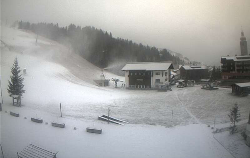
 Snow-making in the northern Austrian Alps. This is Saalbach – 20 November 2018 – Photo: saalbach.com
Here is a complete run down of which ski resorts are now open in the Alps:
France:
Tignes (Grande Motte glacier).
Italy:
Cervinia, Monte Rosa (weekends only for now), Passo Tonale, Sulden am Ortler, Val Senales and Livigno (just one run for now). Of these, Cervinia remains by far the best bet in terms of the extent of skiing available.
Switzerland:
Zermatt, Saas-Fee, Diavolezza, Glacier 3000, Andermatt (weekends only), Engelberg and Verbier (still at weekends only). Of these, the best options remain Zermatt and Saas-Fee.
Austria:
You can ski on all eight glaciers at Hintertux, Stubai, Sölden, Kaprun, Mölltal, Pitztal, Kaunertal and Dachstein. You can also ski in non-glacial Obergurgl and, on a very limited basis, in Kitzbühel. The best options right now are probably Obergurgl, Kaprun, Hintertux, Stubai and Sölden.
Updated: 10.15am Monday 19 November 2018 - Looking more wintry in the Alps…
The weather in the Alps has turned much more wintry. Although not everywhere will see much in the way of new snow, the drop in temperature means that most areas can at least now start laying an artificial base. Later in the week the weather will turn a little milder, though nothing serious, and the cold may well return next weekend or early next week.
 Fresh snow in the central Italian Alps. This is Santa Caterina – 19 November 2018 – Photo: santacaterina.it
Back to today, many eastern and southern parts of the Alps have already seen a little new snow including Cervinia, Livigno and St Moritz, to name a few. During the day, almost anywhere may see a few flurries to low altitudes but most of the snow will again fall in the southern Alps and/or close to the Italian border areas, especially those near the Swiss-Italian border.
By this time tomorrow there may be 10-20cm of new snow on the slopes of resorts such as Zermatt, Saas-Fee, Cervinia, Monte Rosa, Livigno, Madesimo. St Moritz and Passo Tonale. The areas least likely to see any snow are the northern Austrian Alps (e.g. the Salzburg area).
Over the next couple of days it will stay on the cold side for most, though a slight Foehn effect will raise temperatures on the northern side of the Alps, especially in Austria. There will be a few snow flurries here and there, but most places will be dry with some sunny spells.
 Snow-making underway in Lech – 19 November 2018 – Photo: lech.com
Last weekend saw a number of new openings across the Alps, including Andermatt (open at weekends only) which saw a lot of snow from the storms a few weeks back. The upper parts of the Monte Rosa region were also able to open a number of runs, but will continue to only open at weekends for now.
Here is a complete run down of which ski resorts are now open in the Alps:
France:
Tignes (Grande Motte glacier).
Italy:
Cervinia, Monte Rosa (weekends only for now), Passo Tonale, Sulden am Ortler, Val Senales and Livigno (just one run for now). Of these, Cervinia remains by far the best bet in terms of the extent of skiing available.
Switzerland:
Zermatt, Saas-Fee, Diavolezza, Glacier 3000, Andermatt (weekends only), Engelberg and Verbier (still at weekends only). Of these, the best options remain Zermatt and Saas-Fee.
Austria:
You can ski on all eight glaciers at Hintertux, Stubai, Sölden, Kaprun, Mölltal, Pitztal, Kaunertal and Dachstein. You can also ski in non-glacial Obergurgl and, on a very limited basis, in Kitzbühel. The best options right now are probably Obergurgl, Kaprun, Hintertux, Stubai and Sölden.
Updated: 12.15pm Saturday 17 November 2018 - Cold incoming!
The weather in the Alps is turning colder. This will peak on Tuesday or Wednesday before temperatures slowly rise again. However, the colder air will never be far away and a cold end of the month is still very much possible.
 Snow-making in the Alps is underway. This is Madonna di Campiglio – 17 November 2018 – Photo: funiviecampiglio.it
While this colder weather will allow snow-making to get underway on an industrial scale, the question everyone really wants answered is: will it snow? The short answer is yes, but widespread heavy snow is not on the cards for the time being.
Today there will be a few light snow showers across some parts of the southern French and western Italian Alps (e.g. Milky Way), though it won’t amount to anything. However, most of the Alps will stay dry with plenty of sunshine at altitude.
After a mostly fine but chilly day on Sunday, further snow showers are likely on both Monday and Tuesday. These could fall almost anywhere, but are most likely in the southern and eastern Alps with a few centimetres here and there. The Dolomites, in particular, could do quite well next week, and with the cold air firmly in place, any snow will fall to very low levels.
There is quite a lot of uncertainty as to what will happen later next week but it does seem likely that temperatures will start to rise again, albeit not dramatically. There are also likely to be further showers, these being most likely in the southern Alps. Watch this space…
Updated: 10.40am Friday 16 November 2018 - Last really mild day in the Alps…
It has been another very mild week in the Alps, however the weather is on the change with much colder air expected to arrive from the east over the next few days. There probably won’t be a huge amount of snow, but the drop in temperature will at least allow resorts to start their own snow-making operations.
 Snow making is just beginning in the Dolomites and will be cranked up on an industrial scale next week – 16 November 2018 – Photo: kronplatz.com
The colder weather will begin to make itself felt this weekend. Most places will remain dry, with the best of any sunshine across the northern half of the Alps (at least above any valley fog), although there will be a few light showers in the southern French and western Italian Alps (e.g. Sestriere) on Saturday.
Next week will see the weather turn colder still with a scattering of light flurries here and there but certainly no widespread heavy snow just yet. The detail should become clearer over the next few days but if there is any significant snow to be had it is more likely to fall across the southern and eastern Alps – i.e. the Italian and Austrian Alps.
One thing is certain though: snow-making will soon be starting up on an industrial scale. This is good news for everyone, but especially for the Dolomites and many of the lower Austrian resorts where it is used so effectively. These eastern Alpine resorts are also where we will see the lowest temperatures, so by the end of next week they should be well on their way to laying a good on-piste base, regardless of how much natural snow ends up falling.
 Excellent snow conditions on the glacier at Saas-Fee – 16 November 2018 – Photo: saas-fee.ch
In the meantime, there is some excellent glacier skiing to be had across the Alps this week helped by the good weather. Some of the best options include Tignes, Zermatt, Saas-Fee, Hintertux, Sölden, Stubai and Kaprun. Best of all, however, remains Cervinia (linked to Zermatt) where 16 runs are open on the Italian side alone and you can comfortably ski down to the mid-station at Plan Maison.
One notable opening yesterday was that of entirely non-glacial Obergurgl. There isn’t much snow at resort level but on the upper half of the mountain there is enough to allow for 37km of pistes to be open with an impressive top snow depth of 110cm.
Updated: 10am Thursday 15 November 2018 - Colder weather still on its way…
High pressure is still dominating the weather in the Alps, however it will continue to pull away north-eastwards over the next few days allowing increasingly cold air to move in from Russia.
 Excellent snow conditions on the Grande Motte glacier above Tignes right now – 15 November 2018 – Photo: tignes.net
Today it is still sunny and mild in the Alps, at least above any of the low level cloud that is often a nuisance at this time of year. Tomorrow will be broadly similar with plenty of sunshine at altitude. However, there will be some subtle changes in the weather with an increasing breeze bringing a bit more in the way of cloud to the southern Alps, and perhaps even a few light showers in the western Italian Alps later in the day (with a few flakes above 2200m, then lower overnight).
On Saturday the colder air will start gaining ground from the east. Most places will be sunny but there will again be some showers in the western Italian Alps with the rain/snow limit falling to 1200m. A few light showers may also fall in the southern French Alps but freezing levels here will be a little higher.
It will turn colder still on Sunday and into the early part of next week. Sunday should be mostly dry but Monday and Tuesday could well see some more widespread snow flurries to low levels across the southern and eastern Alps in particular. Watch this space…
In the meantime, there is some excellent glacier skiing to be had across the Alps this week, helped by the good weather. Some of the best options include Tignes, Zermatt, Saas-Fee, Hintertux, Sölden, Stubai and Kaprun. Best of all, however, remains Cervinia (linked to Zermatt) where on the Italian side alone 16 runs are open and you can comfortably ski down to the mid-station at Plan Maison.
One notable opening today is that of entirely non-glacial Obergurgl. There may not be much snow at resort level but on the upper half of the mountain there is enough to allow for 37km of pistes to be open with an impressive top snow depth of 110cm.
 Skiing gets underway in entirely non-glacial Obergurgl today – 15 November 2018 – Photo: obergurgl.at
Updated: 11.45am Wednesday 14 November 2018 - Colder weather incoming, but will it snow?
A huge area of high pressure is currently dominating the weather in the Alps - meaning lots of sunshine for most today but also some nuisance value low level cloud and fog.
 Masses of snow at altitude in Cervinia – 14 November 2018 – Photo: cervinia.it
Over the next few days the area of high pressure will gradually move away eastwards allowing a increasingly chilly easterly airflow to develop. The drop in temperature will be fairly gradual at first but it is likely to become much colder by the middle of next week.
Encouraging as this is, the big question is will it snow? The short answer is yes, but not everywhere. The best direction for the weather to be coming in from for widespread snow across the Alps is the north-west, especially if a secondary storm then forms over the Mediterranean which sends snow back north across the southern Alps.
An easterly flow, like the one expected across the Alps next week, does not favour widespread heavy snow. However, depending on the exact wind direction, some significant falls are possible, especially in the southern Piedmont (e.g. Sestriere, Prato Nevoso).
Other parts of the Alps may also see some snow but it will be a bit more hit and miss. Whatever the case, it will turn much colder next week which will allow snow-making to begin on an industrial scale, especially later in the week. Stay tuned for further updates…
In the meantime, snow conditions on the Alpine glaciers are generally pretty good right now.
In France you can only ski on the Grande Motte glacier above Tignes. However, there is probably now enough snow in the Val d’Isère/Tignes area (generally) above 2400m or so for it to offer a selection of non-glacial runs come the official opening of L’Espace Killy on 24 November. The same can’t be said for most other French resorts. Val Thorens, for example, has had to postpone its planned opening (originally scheduled to be this weekend) by at least a week.
 Val d’Isère should now have enough snow at altitude to get some non-glacial runs open on 24 November 2018 – Photo: valdisere.com, 14 November 2018
In Switzerland the best skiing remains on the glaciers above Zermatt and Saas-Fee, though it is also possible to ski on a more limited basis in a handful of other areas, including Glacier 3000 and Diavolezza.
In Italy, Cervinia currently offers the best snow conditions in the Alps with 16 open runs and skiing down to Plan Maison at 2500m. Elsewhere in the Italian Alps you can ski on a more limited basis in Val Senales, Passo Tonale and non-glacial Sulden-am-Ortler.
In Austria all eight glaciers are open, the best of which are at Kaprun, Hintertux, Sölden and Stubai.
Updated: 9am Tuesday 13 November 2018 - Major cool down likely next week…
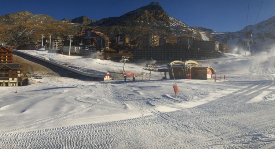
The weather in the Alps remains very mild. Indeed Val Thorens has just announced that it has had to postpone its planned 17 November opening by a week due to a lack of snow - the persistently high temperatures have meant that they haven’t even been able to get the snow cannons going.
 Very little snow in Val Thorens, which has postponed its opening to 24 November 2018 - Photo: valthorens.com, 13 November 2018
There is some good news though: we are increasingly confident that the temperature will plummet next week as cold air is drawn in from the east. How much snow there might be is still uncertain - widespread heavy snow still seems unlikely at this stage. However, at the very least, it seems likely that many resorts will be able to operate their snow cannons at long last.
The only skiing in France right now is on the Grande Motte glacier above Tignes. Most of the snow at resort level has now melted but L’Espace Killy (Val d’Isère/Tignes) did see a fair amount of snow over the last two weeks from the “southerly” storms and should now have something of a base above 2400m or so. However, the vast majority of French resorts do not have any meaningful snow as yet.
Cervinia is the stand out resort in Italy – perhaps even in the Alps – with skiing now possible to Plan Maison at 2500m where settled snow depths are an impressive 120cm. There is even some snow in resort, but not enough to warrant opening anything all the way down as yet.
 Cervinia is probably the best bet in the Alps right now – 13 November 2018 – Photo: cervinia.it
Elsewhere in Italy you can ski on the glaciers in Val Senales and Passo Tonale, and on a handful of runs at non-glacial Sulden-am-Ortler. While the Italian Alps have generally seen the most snow so far this autumn, it has only fallen at high altitude, so has been meaningless for resorts where most or all of the terrain is below 2300m or so.
In Switzerland, Zermatt and Saas-Fee are the stand-out resorts, having received huge amounts of snow from the ‘southerly storms’ early last week, with snow piling in over the Italian border. Zermatt is already claiming 300cm of settled snow up top and has 11 pistes open.
The only other options in Switzerland right now are at Glacier 3000 near Les Diablerets and the Diavolezza glacier near St Moritz, the latter of which has the best snow. So far this autumn, it has been the resorts closest to the Italian border that have done best from any snowfall, however, (as with Italy) it is only those with plenty of skiing above 2300m or so have truly benefited. The northern Swiss Alps (e.g. Villars, Grindelwald) currently have very little snow.
 Lots of snow up top in Saas-Fee – 13 November 2018 – Photo: saas-fee.ch
In Austria all eight glaciers are open but the most extensive terrain can be found in Hintertux, Stubai, Sölden and Kaprun. Glaciers aside, Austria is the most snowless of the four main Alpine countries right now. Indeed there is virtually no snow below 2500m on the northern side of the Alps (e.g. St Anton).
Back to the weather forecast and the Alps will have to endure another mild week, although there will be plenty of sunshine, at least above any low level valley fog. Towards the weekend we will start to see the first signs of a significant cool down from the east. Then next week it seems likely that a much colder easterly airflow will engulf the Alps.
This could bring some snow for some, especially to Austria and the Dolomites, but the detail is still a bit sketchy. At the very least it will allow resorts to switch on their snow cannons which is a positive step forward.
Stay tuned for further details…
Updated: 9.30am Monday 12 November 2018 - Still mild but hints of a cool down next week…
The weather in the Alps remains very mild, however, unlike last week when there were further showers (and some high altitude snow) across many southern and some western parts of the Alps, this week will be mostly dry with plenty of sunshine.
 Plenty of snow in Cervinia, but this is one of the exceptions in the Alps and not the rule – 12 November 2018 – Photo: cervinia.it
So where does this leave us in terms of current snow conditions in the Alps?
Well, anyone following our updates over the last couple of weeks will know that a huge amount of snow has fallen at high altitude across some central and southern parts of the Alps, especially close to the Swiss-Italian border. Resorts that have benefited most from these storms include Cervinia (185cm upper base depth), Zermatt (300cm upper base depth) and Saas-Fee (250cm upper base depth, all of which have now got a secure base on the upper half of their mountains.
As to the rest of the Alps, skiing generally remains confined to the glaciers.
In Italy, apart from Cervinia, skiing is available on the glaciers of Val Senales and Passo Tonale, although non-glacial Sulden-am-Ortler is also operating a handful of runs. While the Italian Alps have seen the most snow so far this autumn, it has only fallen at high altitude so has been meaningless for resorts where most or all of the terrain is below 2300m or so.
In Switzerland, aside from Zermatt and Saas-Fee the only other option right now is the Diavolezza glacier near St Moritz. So far this autumn, is has been the resorts closest to the Italian border that have done best from any snowfall, however, only those with plenty of skiing above 2300m or so have truly benefited. The northern Swiss Alps (e.g. Villars, Grindelwald) currently have very little snow.
In Austria all eight glaciers are open but the most extensive terrain can be found in Hintertux, Stubai, Sölden and Kaprun. Glaciers aside, Austria is the most snowless of the four main Alpine countries right now. Indeed, there is virtually no snow below 2500m on the northern side of the Alps (e.g. St Anton).
 Still very green on the northern side of the Alps. This is Zell-am-See with the Kitzsteinhorn glacier above Kaprun in the background – 12 November 2018 – Photo: zellamsee-kaprun.at
In France skiing is still confined to the Grande Motte glacier above Tignes. Although most of the snow at resort level has now melted, L’Espace Killy (Val d’Isère/Tignes) did see a fair amount of snow from the “southerly” storms over the last two weeks and should now have something of a base above 2400m or so. However, the vast majority of French resorts do not have any meaningful snow as yet
 Good snow cover at altitude in Val d’Isère but there is still very little lower down – 12 November 2018 – Photo: valdisere.com
Back to the weather forecast and it is going to be another mild week. However, this time around all regions should also see plenty of sunshine. There is a hint of some colder air trying to move in from the north or east next week but no sign (as yet) of any significant new snow.
However, as some clear nights are coming up, the ground will start to cool down meaning that resorts can start to think about their snow-making operations, although these are unlikely to kick off on any sort of scale until next week at the earliest.
Updated: 10am Friday 9 November 2018 – Continuing very mild in the Alps
The weather in the Alps remains stuck in a rut with a mild southerly airstream that will continue to influence proceedings over the weekend and into next week.
 Some snow at altitude in the central Austrian Alps but lower down the thaw continues. This is Heiligenblut – 9 November 2018 – Photo: foto-webcam.eu
This southerly airflow has brought a lot of snow at high altitude to both the southern side of the Alps and areas close to the main Alpine ridge (e.g. Zermatt, Saas-Fee, Cervinia, Monte Rosa, St Moritz, Passo Tonale). In Saas-Fee, for example, well over 3m of new snow has fallen on the glacier in the last 10 days or so.
However, while the rain/snow level was relatively low for a time early last week, it has generally been closer to 2300-2500m in recent days meaning that any new snow has been increasingly confined to the tops of the affected ski areas. Furthermore, the northern half of the Alps has been affected by the warm Foehn wind which has sent temperatures soaring into the low 20°C’s in the valleys and eaten all but the highest level snow.
Not a huge amount will change over the weekend. Weather fronts will try and move in from the west with some precipitation for the western and especially south-western Alps. However, it will remain very mild with any new snow mostly above 2200-2500m. The northern and eastern Alps will remain dry with sunny spells.
Looking further ahead, it will remain on the warm side all next week and possibly beyond that too. It is also likely to brighten up in those areas close to the main Alpine ridge and on the southern side of the Alps (e.g. Cervinia, Saas-Fee) which have been plagued by cloud, rain and snow in recent days.
Updated: 11.20am Monday 5 November 2018 - A mild week for the Alps…
The Alps are under the influence of a very mild southerly airflow that will remain in place for the rest of the week. This means further precipitation for the southern side of the Alps but generally not as intense as we saw last week, and with a relatively high rain/snow limit.
 Still lots of snow at altitude in Zermatt, but it’s green again in the village – 5 November 2018 – Photo: zermatt.ch
A lot has been made of the recent snowfall in the press over the last few days but the real picture in the Alps is not quite as rosy right now as some have painted.
While there is a lot of snow at high altitude in some central, southern and western parts of the Alps (e.g. Zermatt, Saas-Fee, Cervinia), the weather has been mild – very mild across the northern half of the Alps where the Foehn has also been blowing – and the percentage of Alpine ski resorts that have a meaningful base is still very small indeed.
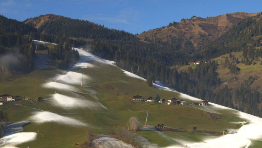
 No snow at all below 2000m for most of the northern Alps including here in Damüls in the Austrian Vorarlberg – 5 November 2018 – Photo: damuels.at
As previously mentioned, it is also set to stay very mild this week. There will be further snow for some high parts of the southern and south-western Alps, especially close to the Franco-Swiss and Franco-Italian borders, but only above 2300m or so, and most of the Alps will stay dry.
So where are the best places to ski this week?
In Austria all of the glaciers are open (with the exception of Dachstein) and in good condition, though the weather is still a bit mixed, although they are not expecting much snow. There will be quite a lot of cloud, especially in the south (e.g. Mölltal) with the best of any sun in the north (e.g. Kitzsteinhorn). The most extensive options right now are Hintertux, Stubai, Kitzsteinhorn and Sölden.
In Switzerland the best options are, in theory at least, the glaciers above Zermatt and Saas-Fee where there is tons of snow. However, it is likely to be cloudy for most of the week with further wind and snow, so these areas may be closed for long periods of time.
Italy has the same problem, with loads of snow above Cervinia but lots of bad weather on the cards this week which will severely limit the action. You may have more luck further east in Val Senales but the weather is also going to be less than perfect with lots of cloud and a few snow showers.
In France the only skiing option right now remains Tignes, but once again bad weather will be a factor. If there is a break in the weather there is now plenty of snow up on the glacier to take advantage of, even if most of it is now melted at resort level.
 Plenty of snow up top in Tignes but it is melting rapidly at resort level – 5 November 2018 – Photo: tignes.net
Updated: 10am Thursday 1 November 2018 - More snow for the south but don’t get too excited yet…
As forecast, a second storm has brought more heavy snow to some southern parts of the Alps, with the heaviest falls once again close to the Swiss-Italian border.
 Huge snowfalls on the Corvatsch above St Moritz – 1 November 2018 – Photo: corvatsch.ch
Above 2600m, some parts of the southern Swiss and northern Italian Alps (roughly in the triangle between Saas-Fee, Obergoms and Locarno) have seen over 3m of new snow since Saturday. This area is renowned for getting pasted when storms move up from the south, but has very few ski resorts.
However, areas that are close by and will still benefit include Zermatt, Saas-Fee, Cervinia and the Monte Rosa region. All of these have a huge amount of snow at high altitude and will probably now have a lasting base above 2500m or so.
 Big snowfalls in the Zermatt area – 1 November 2018 – Photo: zermatt.ch
These areas are of course not the only ones to have seen snow this week. Many other parts of the Alps have also seen at least some temporary snow cover.
In the northern Alps, however, the warm Foehn wind has been blowing, sending the snowline scurrying back up the mountain in areas such as the Bernese Oberland (Wengen, Mürren) and the Arlberg (Lech, St Anton). Indeed the northern Austrian Alps now have almost no meaningful snow left below about 2300m.
 Warm Foehn winds have eaten most of the snow in the northern Alps. This is Lech – 1 November 2018 – Photo: lech.com
The snow has generally been heavier and will stick around a bit longer in the more central and southern Alpine resorts, especially the higher ones such as Andermatt, St Moritz, Livigno and Passo Tonale. However, even here you the lower half of the ski area will turn green this weekend or at some point next week as the weather is set to turn drier and warmer again. Also, once this “southerly storm” dies away over the next couple of days it is unlikely there will be a significant return to winter for some time to come.
So, in conclusion, don’t get too excited yet! Although some high resorts (especially those in the central and southern Alps with skiing above 2500m) now have a lasting base, and glacier areas are also in great shape, for the majority of areas it is still all to play for.
But as we often stress, this is not something to be overly concerned about at this time of year. Many a great season has not got going until well into December...