


ARCHIVE
Today in the Alps - December 2023
Read about current weather and snow conditions in the Alps
Updated: 3.30pm Saturday 30 December 2023 – Good weather day in the Alps!
Today has been a mostly sunny day in the Alps, with freezing levels typically around 1500-2000m. However, tomorrow a new weather front will arrive in the Alps, reaching the eastern Alps later in the day or overnight.
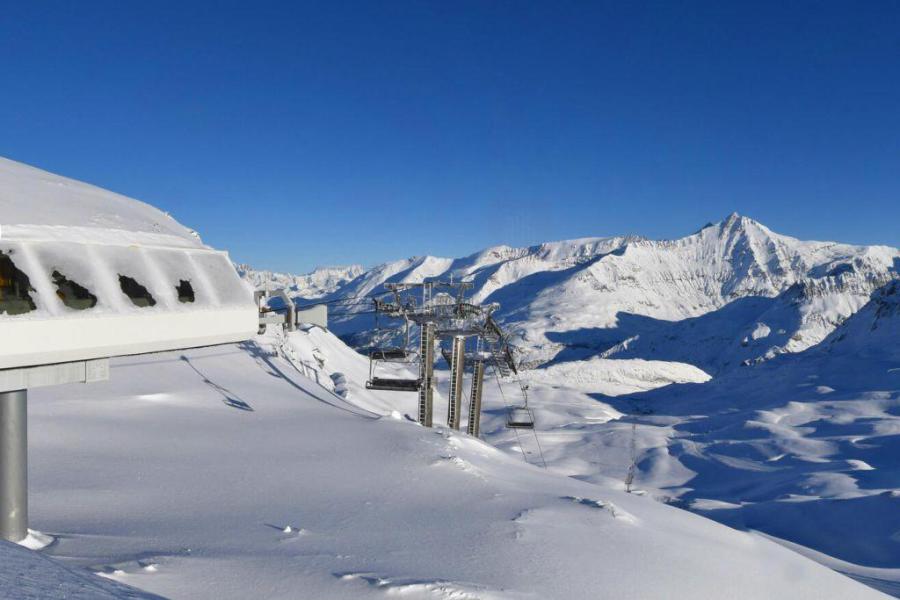
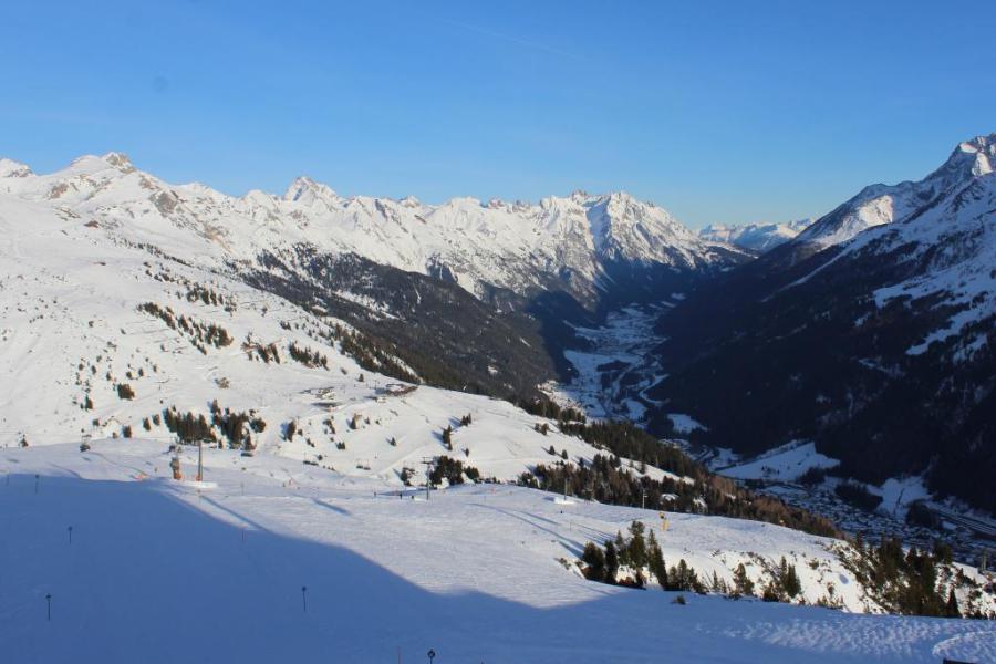 Lovely weather and good snow conditions in St Anton today – 30 December 2023 – Photo: foto-webcam.eu
By the end of Sunday night this front will deliver between 5-10cm of snow above 1500m to a good portion of the Alps, with perhaps a little more in some western parts of the Dolomites (e.g. Madonna di Campiglio). The far south-west (e.g. Isola 2000) may again miss out though.
After a mostly dry day on Monday, further, more active weather fronts will reach the Alps on Tuesday and Wednesday. These will be most active in the western Alps but, with some milder air in the mix, it may rain to 2000m in places for a short time late on Tuesday.
As to snow conditions in the Alps, they remain excellent at altitude across the northern Alps, but more mixed lower down and across the southern Alps where depths are much more modest.
We will bring you a more detailed snow report later today…
Updated: 11am Friday 29 December 2023 - Mixed fortunes for the Alps…
Another mostly dry day is expected in the Alps today, with some sunny spells but also some areas of cloud floating around, especially in the north.
 Patchy natural snow cover at lower altitudes in St Johann in Tirol - typical of lower resorts right across the Alps right now – 29 December 2023 – Photo: foto-webcam.eu
After a largely sunny day on Saturday, a new weather front will deliver a few centimetres of snow to much of the Alps on Sunday with a rain/snow limit somewhere in the range of 1000-1600m. Next week then looks very unsettled, with further weather fronts piling in off the Atlantic. A lot of snow is expected at altitude in the western Alps, however, with milder air again in the mix, there could also be a lot of rain lower down.
As for snow conditions in the Alps right now, there is generally still lots of snow at altitude in the northern Alps, but precious little natural snow lower down, with eastern Switzerland and parts of Austria faring slightly better than western Switzerland and France. Tignes, Val Thorens, Davos, St Anton and Ischgl, for example, are all in great shape. Whereas Megève, Gstaad, and the Ski Welt are struggling, with little if any natural snow on their lower slopes, although they do still have a good number of pistes open.
The southern Alps, including the Milky Way, the Monte Rosa region and the Dolomites, have universally below par snow depths for the time of year. Again, you will still find plenty of pistes open (especially in the Dolomites) thanks largely to artificial help, but natural snow cover is very modest.
Updated: 4pm Wednesday 27 December 2023 – Mostly dry and mild in the Alps…
The Alps remain under the influence of a mild south-westerly airflow but, with high pressure very close by to the south, it will remain mostly dry for the next couple of days at least.
 View from La Plagne at the close of play today, looking towards Courchevel in the background – 27 December 2023 – Photo: laplagne.com
Over the weekend, and more especially early next week, Atlantic weather fronts are likely to make some inroads into the north-western Alps. It is expected to remain mild though, meaning that rain is again a possibility at lower altitude.
For now, snow conditions remain excellent at altitude across the northern half of the Alps (e.g. Val d’Isère, Val Thorens, Engelberg, Davos, Lech, Ischgl, Obertauern). Lower down though, some resorts are suffering a bit (e.g. Morzine, Villars) and more snow would be welcome.
Snow depths are also very modest across most of the southern Alps (e.g. Dolomites, Monte Rosa region). Here though, the drier climate makes for better snowmaking and snow preservation than in the north-western Alps, meaning that there is still some decent piste-skiing on offer.
Updated: 2.30pm Sunday 24 December 2023 – Very mild weather in the Alps…
The Alps are under the influence of a very mild south-westerly airflow that will remain in place for several days.
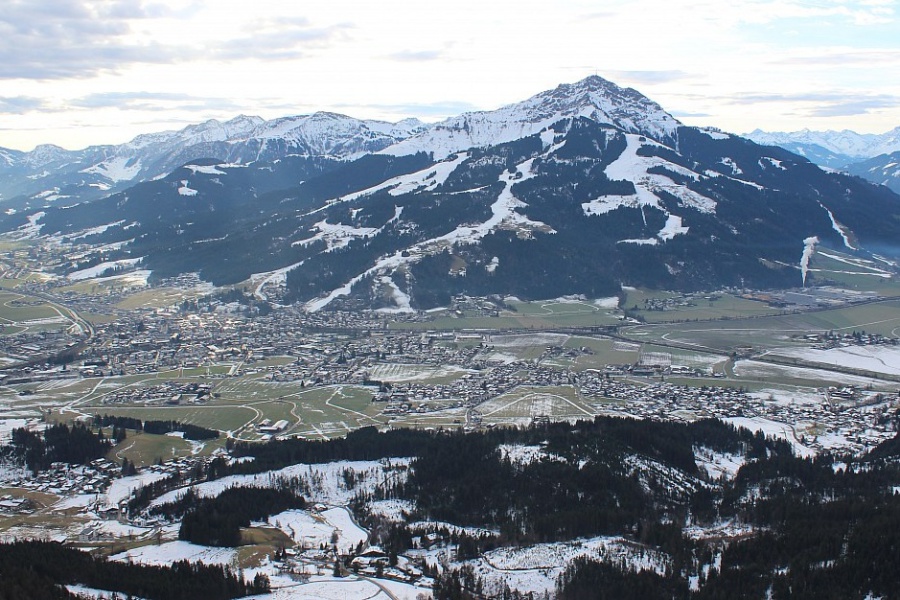
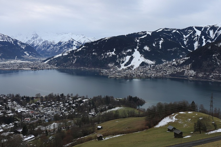 Mild temperatures are leading to a deterioration in snow conditions lower down in many resorts. This is Zell am See – Photo: foto-webcam.eu, 24 December 2023
Some showers are still grazing the northern foothills of the Alps today, with a little snow falling above 2000-2500m. For most of the Alps though it will be a dry day, with the best of any sunshine the further south you are. Christmas Day and Boxing Day should be dry with plenty of sunshine, and again very mild.
There remains a lot of snow at altitude across the northern Alps, but lower down conditions are deteriorating again due to the exceptionally mild weather.
We will bring you further details in our more detailed snow report later today…
Updated: 9.30am Friday 22 December 2023 – High winds in the Alps, with snow for the north…
The latest storm cycle is reaching its peak today, with high winds closing numerous lifts and some resorts entirely unable to open.
 Near whiteout conditions at times in Obertauern today where most of the area is closed due to wind – 22 December 2023 – Photo: obertauern.com
A lot of snow is also falling across the northern Alps, heaviest in the Austrian and eastern Swiss Alps with a rain/snow limit somewhere between 1000m and 1400m. The storm will start to ease tomorrow, by which time up to 1m or more of snow will have fallen at altitude across some parts of eastern Switzerland and Austria.
More generally, there will be falls of 30-50cm of very windblown snow across the northern Alps, a bit less in the northern French Alps. Needless to say, the risk of avalanche is already very high and could become higher still later today and early tomorrow.
For the southern half of the Alps this storm has been less significant, at least in terms of snow as winds have still been an issue in places, though some snow has got through here and there (e.g Livigno).
Disruptive weather aside, the snow situation in the Alps remains broadly the same as it has been for some time now, namely that there is a lot of snow in the northern half of the Alps, especially at altitude, although there are still some weaknesses at very low altitudes due to the relatively mild temperatures.
On the whole, the southern Alps have less snow than in the north, but they have also seen less volatility in the weather, meaning that most areas are offering some perfectly reasonable piste-skiing.
The area with the least natural snow is currently the far south-west (e.g. Bardonecchia, Isola 2000), where resorts are still quite heavily reliant on artificial help.
Updated: 12.15pm Thursday 21 December 2023 – Becoming very stormy across the northern Alps…
A new storm cycle is underway which will deliver very significant quantities of snow and a lot of wind to many northern parts of the Alps.
 Snow (and wind) setting in around Warth-am-Arlberg where over 1m of new snow is likely by Saturday – Photo: warth-schroecken.at, 21 December 2023
At midday today it is already raining or snowing across a good portion of the northern Alps from the French Haute-Savoie (e.g. Flaine), through much of Switzerland (away from the far south) and into the west of Austria, with a rain/snow limit between 1000 and 1400m.
Tonight, the precipitation will intensify across the northern Alps, lasting all day tomorrow and into Saturday, heaviest in the central/eastern Swiss and Austria Alps. The rain/snow limit will change a little, generally sitting between 1000m and 1500m, perhaps a touch lower in places at times.
Between now and Saturday, between 30-60cm of new snow is expected above 1500m across a broad swathe of the northern Alps, with over 1m in parts of Switzerland and, especially, Austria (e.g. Lech, St Anton, Ischgl, Kaprun).
Throughout this period the southern half of the Alps will see much less snow (probably just a brief spell on Thursday night) and will often be dry with variable cloud cover.
It will be very windy everywhere though, especially at altitude which will lead to extensive lift closures, especially on Friday, as well as an increasingly high risk of avalanche in the northern Alps.
Updated: Wednesday 20 December 2023 – New storm cycle in the Alps…
The weather in the Alps has changed again, with a new storm cycle underway, mostly affecting the northern half of the Alps.
 Cloudier today in St Johann in Tirol with the odd light flurry (above 800-1000m) – 20 December 2023 – Photo: foto-webcam.eu
Today will be mostly cloudy across the northern Alps with some light rain or snow here and there, and a rain/snow limit close to 1000m. The best of any brightness will be in the southern Alps, though it will also be mostly cloudier than of late.
Between Thursday and Saturday, any precipitation will tend to become heavier and more prolonged across the northern Alps, especially in the northern Swiss and Austrian Alps (e.g. Engelberg, St Anton, Kaprun) with a rain snow limit typically between 1000m and 1500m. It will also become very windy, especially at altitude.
Between now and the end of Saturday, we are expecting some very significant snowfall totals above 1500m across some regions, especially the central/north-eastern Swiss and northern Austrian Alps (e.g. Arlberg/Vorarlberg) where over 1m is possible.
By Sunday, it will have turned milder with the rain/snow limit rising to above 2000m in places, although the precipitation will be lighter.
Updated: 11am Tuesday 19 December 2023 – Another beautiful day in the Alps, but the weather will change again tomorrow…
It’s another beautiful day in the Alps, with virtually unbroken sunshine and freezing levels above 3000m!
 Another beautiful day in the Aletsch Arena but it will be cloudier tomorrow – Photo: bettmeralp.ch, 19 December 2023
Tomorrow it will be cloudier across the northern Alps, with some flurries above 1000-1300m, mostly light but with a few centimetres possible in places. The southern Alps will be drier and brighter.
Thursday and Friday will see increasingly heavy and persistent showers or longer spells of rain/snow across the northern Alps, heaviest in Switzerland and Austria. The rain/snow limit will be around 1000-1400m. The southern Alps will see fewer showers with many areas remaining dry, and even bright. However, it will become very windy everywhere, especially at altitude.
Between Wednesday and Saturday, significant quantities of snow are expected to fall above 1500m across many northern parts of the Alps, especially in Switzerland and Austria, where totals of 50-80cm, and maybe even over 1m are possible. We will have more details on this new storm cycle in our update tomorrow.
In the meantime, there is some fabulous skiing on offer at altitude in the Alps, even if temperatures are unusually high right now - Val d’Isère hit 10°C yesterday, for example. Luckily, the fact that the sun angle is so low at this time of year, combined with the calm, stable and relatively dry (low humidity) atmosphere, means that any snow melt at altitude will be minimal.
Updated: 10am Monday 18 December 2023 – Generally excellent snow conditions in the Alps…
With high pressure in control of the weather in the Alps, there is a lot of sunshine today and just a little nuisance-value stratus cloud trapped in some of the lower valleys.
 Deep snow and sunny skies in Lech right now – 18 December 2023 – Photo: facebook.com/LechZuers
It will feel quite warm at altitude, especially on south-facing slopes, with freezing levels surpassing 3000m in many areas. This very mild and mostly sunny weather will continue for the next couple of days before the weather starts to break down again from mid-week onwards, at least in the northern Alps.
Snow conditions are mostly excellent right now in the Alps, especially at altitude and in the north. Today, it may feel quite spring-like in the sunshine but, with the low sun angle and relatively dry air, the snow should for the most part stay quite firm, only turning a bit slushy on the lower slopes with direct and prolonged exposure to the sun.
In terms of snow cover/depths, there are still a few weaknesses at lower altitudes in the Alps, most notable in the north-west where last week’s rainfall has led to natural snow cover still being patchy below 1400m or so. That said, the situation quickly improves with an increase in altitude. The most obvious example of this is the difference between Morzine (1000m) and neighbouring, linked Avoriaz (1800m) where the former has next to no snow right now at resort level while the latter has close to 1m.
Indeed, the higher resorts of the northern French Alps (e.g. La Rosière) have settled snow depths of over 3m at altitude, close to record depths for the time of year.
On the whole, the southern Alps have less snow than in the north. However, having largely avoided last week’s rain and with excellent snow-making facilities (especially in the Dolomites) there is plenty of good piste-skiing to be had, despite generally modest snow depths.
Updated: 11am Friday 15 December 2023 - Mostly sunny across the Alps…
For the vast majority of the Alps, it will be a sunny and relatively cold day today, although some clouds and a few flurries will linger across parts of northern Austria this afternoon.
 Sunny skies in the southern Austrian Alps today. This is Bad Kleinkirchheim – 15 December 2023 – Photo: foto-webcam.eu
Over the next few days, it will remain mostly sunny, at least above any of the low-lying cloud/fog that will plague some of the valley bottoms. It will also turn much milder, most noticeably at altitude with freezing levels set to exceed 3000m in many regions later in the weekend.
After what has been a chaotic week of weather (at least in the northern and western Alps) with lots of rain, snow and wind, snow conditions across the Alps remain generally excellent at altitude, but a little more mixed lower down. Find out more in in our detailed snow report later today…
Updated: 10am Thursday 14 December 2023 – Snow conditions are generally excellent in the Alps, with some exceptions…
The Alps are currently covered by a cool and still slightly unstable northerly airstream, which will bring further snow flurries to relatively low levels across some northern parts of the Alps today. These will be heaviest in the north-eastern Swiss and western Austrian Alps (e.g. Arlberg). The southern half of the Alps will remain dry and generally sunny.
 Looking very snowy this morning in Châtel, though the fresh snow is only masking the rain-damaged (and in some places now absent) base at lower altitude – 14 December 2023 – Photo: chatel.com
Flurries will continue across some of the northern Alps tomorrow, but they will become increasingly confined to the north-east (i.e. northern Austria). Elsewhere it will be mostly sunny.
Over the weekend a huge area of high pressure will then start to dominate, bringing generally fine weather across the Alps although there will be some areas of low cloud/fog stuck in some of the lower valleys. Temperatures will become increasingly mild, most noticeably on sunnier slopes at altitude.
With so much weather going on this week, snow conditions in the Alps are now very mixed. At altitude and in the northern half of the Alps, conditions are excellent with exceptionally deep snow bases for the time of year above 2500m, in regions all the way from the Tarentaise (e.g. Tignes, Val Thorens), through the northern Swiss Alps (e.g. Engelberg, Laax) and into Austria (e.g. St Anton, Kaprun).
Lower down in the northern half of the Alps, the situation is more complicated thanks to the recent rain. In the Portes du Soleil, for example, Morzine has had to push back this weekend’s planned opening due to a serious loss of snow on its lower slopes. The rain did turn back to snow at increasingly low altitudes yesterday, but it remains to be seen how things will pan out once resort authorities assess conditions across the area.
The lower resorts of the north-eastern Alps also saw a bit of rain this week, albeit not in the same quantities and, in any case, had more snow to start with. In short, this means that most of Austria and the north-eastern Swiss Alps remain in excellent condition.
As is normally the case, the southern Alps have had fewer issues with rain and are offering stable snow conditions, even if they have less snow at altitude. The resorts of the Dolomites, for example, have generally modest bases but have been offering decent piste-skiing this week on a mix of natural and natural snow, with quite a nice top-up of natural snow in places yesterday.
Updated: 9.30am Wednesday 13 December 2023 – Temperatures in the Alps are getting colder!
There is both good news and bad news for the Alps this morning. The bad news is that the two days of rain across the north-western Alps (sometimes as high as 2500m) has caused a lot of damage to the snowpack at low altitudes. However, the good news is that it has turned colder overnight with the rain now turning to snow to between 1000m and 1500m in the areas that were most affected by the rain, meaning that conditions are already starting to improve again.
 The rain has turned to snow early this morning in Les Saisies – 13 December 2023 – Photo: lessaisies.com
Today it is cloudy across most of the Alps, with flurries or longer spells of snow with a rain/snow limit generally between 1000m and 1500m, but a little higher for a time across some of the southern Alps. Nearly all of the Alps can expect at least some snow today, though the far south-west (e.g. Isola 2000) will largely miss out.
The heaviest snow will fall across the northern Alps, especially in the northern Swiss Alps and northern and western Austrian Alps later today. The Dolomites, which have recently been largely dry, will also see some snow today.
Tomorrow any snow will be confined to the northern half of the Alps, especially the northern Swiss and Austrian Alps, with the southern Alps remaining mostly dry with long sunny spells.
On Friday, some flurries will linger across the northern Austrian Alps, otherwise most regions will see fine weather. It should then remain fine everywhere this weekend, but with rising temperatures.
Updated: 9.20am Tuesday 12 December 2023 - Further rain for many northern and western parts of the Alps…
It’s another dismal day across the north-western Alps, with heavy snow at high altitude but lots of rain lower down. The worst of the weather will again be centred between the northern French Alps and the Austrian Arberg, including much of Switzerland away from the far south.
 More rain today in Les Gets. This is the Les Chavannes area (1500m) – Photo: lesgets.com, 12 December 2023
The rain/snow limit is still high today, typically between 2200m and 2500m, but will lower a little tonight. It will then turn colder tomorrow with snow falling to between 1000m and 1500m.
On Thursday, flurries will linger to increasingly low levels across the northern Alps (especially in Austria).
Snowfall totals from the beginning of this storm on Sunday night to Thursday are expected to be in the region of 1m to 1.5m above 2500m across a wide swathe of the north-western Alps, including the likes of Tignes, Chamonix, Verbier, Engelberg and St Anton. The southern Alps have been less affected by this storm, with some places staying completely dry.
Needless to say, snow conditions haven taken a battering at lower altitudes right across the western and northern Alps, particularly in the north-west (e.g. Megève, Portes du Soleil, Villars, Jungfrau region) where there has been a lot of snow-melt below 2000m or so.
However, the good news is that the damage will start to be repaired tomorrow when the rain/snow limit returns to more reasonable levels. The risk of avalanche is now extremely high at high altitudes in the north-western Alps, while lower down flooding has and will continue to be an issue in places.
Updated: 5pm Sunday 10 December 2023 – The calm before the new “warm storm”…
After a largely fine day today across the Alps, cloud is already thickening in the west, heralding the arrival of a significant new storm cycle that will bring a lot of snow to the north-western Alps at high altitude but also a lot of rain lower down.
 Lovely weather and excellent skiing earlier today in Les Saisies, France, though heavy rain is on the cards for Monday and Tuesday – Photo: lessaisies.com, 10 December 2023
Between this evening and Wednesday night, between 1m to 1.5m of new snow will fall above 2500m across some of the north-western Alps - from the northern French Alps, through Switzerland (away from the south) and into the west of Austria (Arlberg/Vorarlberg). The very heaviest precipitation is likely to fall in the northern French Alps (Savoie, Haute Savoie) and the far west of Switzerland, where the risk of avalanche will become extreme at high altitudes, as will the risk of flooding lower down.
By Wednesday night, snow depths above 2800m could approach record levels for the time of year in the higher parts of the Tarentaise (e.g. Tignes) and around the Massif du Mont Blanc.
Temperatures will also start to turn colder on Wednesday, with snow set to fall to more seasonal levels again in many areas, albeit in increasingly small quantities.
Over the next couple of days, broadly speaking, the further south-east you are in the Alps, the lighter and patchier any precipitation will be, though the rain/snow limit will be lower. We will bring you more on this potentially quite extreme weather scenario in our update tomorrow…
Updated: 9.20am Friday 8 December 2023 - More snow for the west today, but lots of rain is due in the northern and western Alps next week…
New weather fronts have reached the western Alps this morning, moving further east as the day progresses albeit losing their intensity.
 Snowy in the southern French resort of Auron today – 8 December 2023 – Photo: auron.com
We are expecting around 5-15cm of new snow above 1500m today in the western Alps – i.e. the French Alps, the western Swiss Alps (e.g. Verbier) and some parts of the western Italian Alps, especially in the far south-west (e.g. Prato Nevoso). Indeed, areas close to the Mediterranean like Prato Nevoso and Isola 2000 could see 20cm or more.
Generally, the further east you are in the Alps the lighter and patchier any precipitation will be, with next to nothing for much of Austria (except in the far west where the Arlberg/Vorarlberg area may see 5-10cm later today/tonight). The central and eastern Italian Alps will also see little or no new snow from this storm.
Today’s rain/snow limit will be around 1200-1500m in the more exposed mountains of the western Alps but will remain lower in the more internal valleys of the Alps, including the Swiss Valais.
On Saturday a new storm will arrive from the west but with the rain/snow limit rising towards 2000m late in the day. Later on Sunday, yet another storm will arrive from the west though this one will be dragging in even milder air, heralding a very wet spell of weather for the north-western Alps in particular early next week.
Between Sunday night and Wednesday we are expecting a lot of rain in the northern French and western Swiss Alps in particular, with the rain/snow limit rising to 2400-2700m. As is normally the case in these rainy warm front situations, the further south and east you are in the Alps, the less problematic any rain will be, with the Dolomites, for example, avoiding it completely.
Updated: 9.30am Thursday 7 December 2023 – Great snow conditions in the Alps, but…
It’s a mostly fine day in the Alps, though low cloud will plague some of the lower valleys, especially close to the foothills. Later in the day more general high cloud will spread into western areas heralding the arrival of a new storm tomorrow.
 Lovely weather and plenty of snow in Leogang today – 7 December 2023 – Photo: foto-webcam.eu
This new storm will deliver some snow tomorrow, mostly to the western Alps (i.e. the French, western Swiss and far western Italian Alps) and mostly in quite modest quantities (5-10cm), though a bit more will fall in the far southern French Alps (e.g. Isola 2000). The rain/snow limit will be between 800m and 1300m, but lower in some internal valleys such as in the Swiss Valais.
New weather fronts will then arrive from the west over the weekend and into next week, dragging in increasingly moist and mild Atlantic air. The rain/snow limit will then rise to well over 2000m in the western Alps on Sunday night and will remain high on Monday and Tuesday. This means lots of rain is set to fall at lower and mid-level altitudes in the north-western Alps in particular early next week.
Snow conditions in the Alps are generally excellent for now, though they will deteriorate in places lower down next week, especially in the northern French Alps, and northern and western Swiss Alps. Stay tuned…
Updated: 9.50am Wednesday 6 December 2023 – Great snow conditions for most of the Alps…
It’s a mostly cloudy start across the northern Alps with some light flurries to low levels, especially in the eastern Swiss and Austrian Alps.
 Fabulous snow conditions in Val d’Isère right now. This is the top of the Vorsat chairlift – 6 December 2023 – Photo: valdisere.com
It’s a mostly cloudy start across the northern Alps with some light flurries to low levels, especially in the eastern Swiss and Austrian Alps.
During the day, any light flurries will die out across the northern and eastern Swiss Alps but continue for much of the day across the northern Austrian Alps. Further west, it will quickly brighten up today, and the southern half of the Alps should be largely sunny all day long.
The next storm will reach the Alps on Friday, mostly affecting the far west and south-west (e.g. Isola 2000), bringing only modest quantities of snow. Over the weekend and into the first part of next week, the threat of rain will also return to some northern and western parts of the Alps.
In the meantime, snow conditions in the Alps are excellent for the time of year with above average snow depths at altitude in most areas. Lower down, some areas are also very snowy, especially in the far eastern Swiss Alps and the Austria Arlberg/Vorarlberg (e.g. Lech, Warth-Schröcken).
Even the far south-west (e.g. Auron, Isola 2000, and Sauze d’Oulx), which has missed much of the snow that has fallen so far this season, is now looking more wintry thanks to some snow having fallen here earlier this week, though snow depths here remain modest.
Updated: 11am Monday 4 December 2023 – New storm in western Alps!
After yesterday’s amazing weather, a new storm has arrived from the west with further snow falling in the western Alps today, mostly in France.
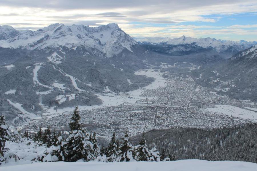 Looking very wintry today in Garmisch-Partenkirchen in southern Germany, close to the Austrian border – 4 December 2023 – Photo: foto-webcam.eu
This storm will affect the whole of the French Alps, both north and south this time, with 10-30cm expected in many areas by the end of tonight. The rain/snow limit will typically be between 800m and 1300m, perhaps bit lower in some of the more enclosed valleys.
This storm will also affect the western Swiss Alps (e.g. Mürren, Verbier) and the far western Italian Alps (e.g. Bardonecchia), but it will lose its potency as it moves eastwards tonight, with no more than a few light flurries for Austria and the Dolomites tomorrow.
Snow conditions in the Alps are now generally excellent for early December, especially at altitude. Lower down, however, depths are still modest in places, most notably in the south-western Alps (i.e. the southern French and south-western Italian Alps) but here, at least, there will be some snow today.
Updated: 9.25am Saturday 2 December 2023 - Colder again, with further snow, mostly in the east…
The weather in the Alps has turned colder again, with any snow now falling to very low levels.
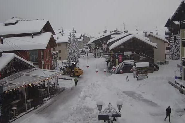 Livigno has seen heavy overnight snowfalls – Photo: livigno.eu, 2 December 2023
Today, the heaviest falls are in the eastern Alps (ie. Austria, Dolomites), with snow showers also falling across many northern parts of the Alps (e.g. Avoriaz, Engelberg) though these will tend to die out from the west as the day progresses. By contrast, the south-western Alps (e.g. Sestriere, Isola 2000) are dry with some sunny spells. However, with a strong north or north-easterly wind, it will feel bitterly cold everywhere.
As for snow conditions, the situation is quite complicated thanks to the recent mix of snow, rain and wind. There is generally a lot of snow at higher altitudes, except in some south-western regions (e.g Bardonecchia, Isola 2000). Lower down, there is also quite a lot of snow in places, notably in the Arlberg/Vorarlberg (e.g Lech).
Although snow is sticking to very low levels this morning, don’t get too excited. This snow is following a period of rain – to 2500m or higher in the French Alps for a time yesterday – which will have partially or fully melted some of the older lower-lying snow.
Whatever the case, we will have a better idea of how things are looking once the current storm has moved on, and resort authorities have prepared the slopes – though many low resorts still aren’t open yet of course…
In the meantime, do check out our more detailed snow report for an overview of snow conditions across the Alps and beyond.