


Updated: 10.30am Friday 29 March 2019 - Winter to return next week?
High pressure is still dominating the weather in the Alps and will continue to do so over the weekend. The cloud and showers that have been affecting the far east of the Alps over the last couple of days have now moved away and all areas will enjoy plenty of sunshine today.
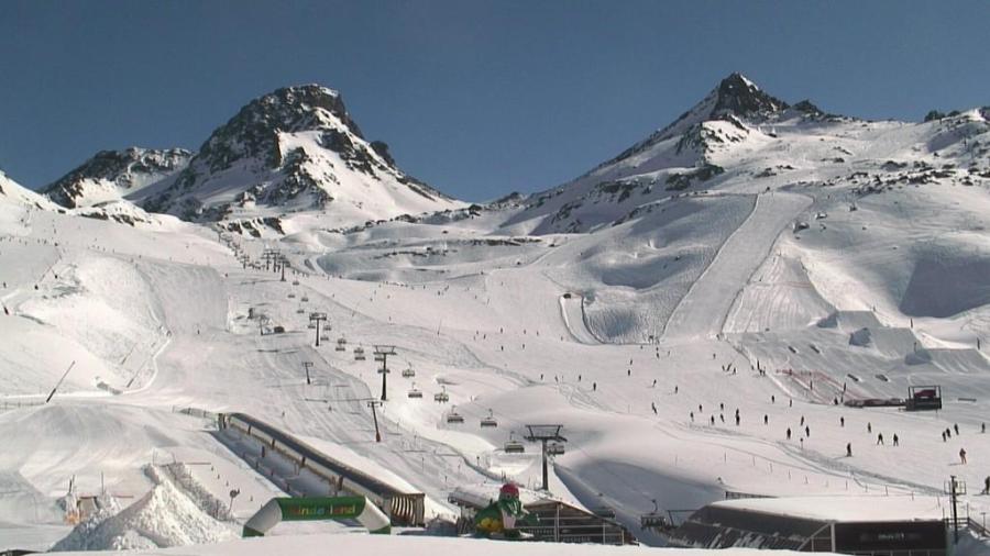
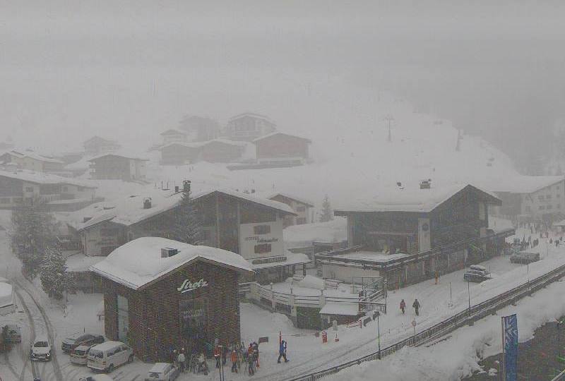
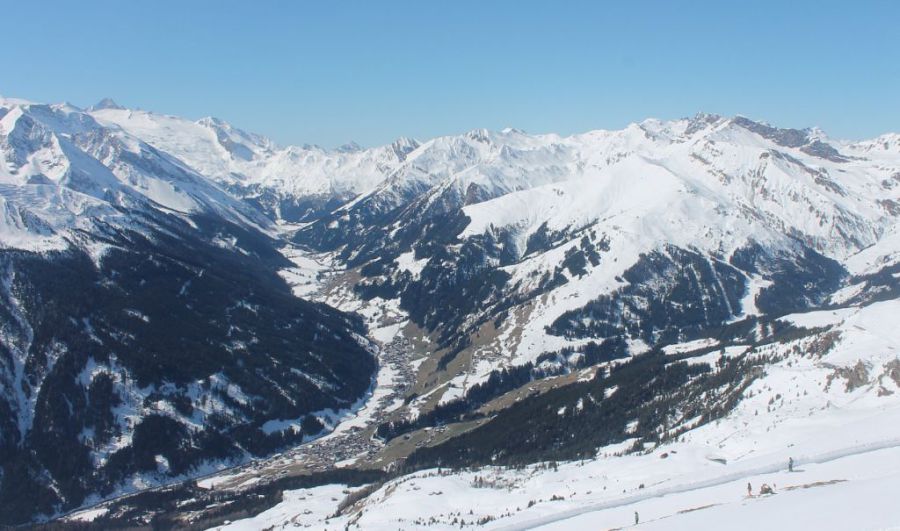 A lovely day in the Tuxertal – 29 March 2019 – Photo: tuxertal.at
Temperatures are also on the rise, with freezing levels expected to sit between 2200m and 2700m on Saturday and Sunday before they begin to fall again early next week. Current weather models suggest that it will then become much colder around the middle of next week with the chance of significant snow in places, especially in the western Alps. However, it is not possible to put any real detail on this at this stage. Watch this space…
As for snow conditions, these will be typically spring-like over the next few days, meaning generally hard/icy slopes early in the day followed by a steady softening of the snow as the day progresses. The speed and severity of this melting process is dependent on altitude and aspect, with the slopes most prone to afternoon slush being lower south- and west-facing, and the least being higher and north-facing.
If you want your snow to remain firm all day long you generally need to be skiing on north-facing slopes above about 2200m.
Updated: 8.45am Thursday 28 March 2019 - Still mostly fine, possible wintry spell next week…
High pressure is currently dominating the weather in the Alps. There is still some cloud in the eastern Austrian Alps this morning, but for most regions it will be sunny today with afternoon freezing levels somewhere between 1700m and 2400m.
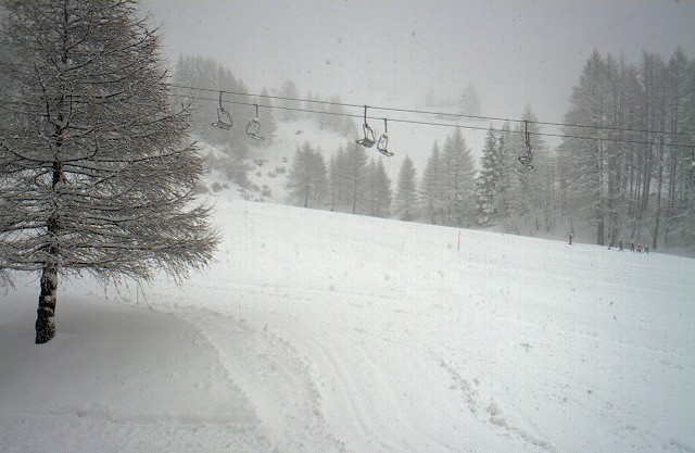
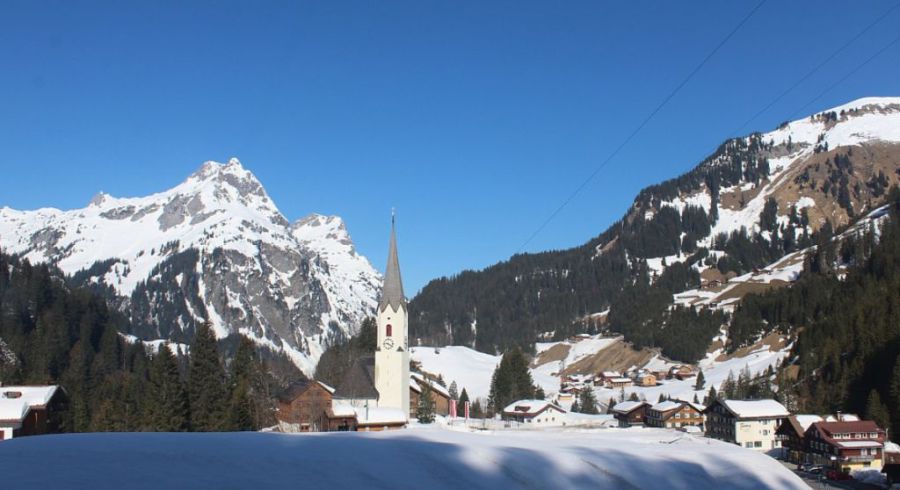 Another fine day for most of the Alps – 28 March 2019 – Photo: warth-schroecken.at
Over the next few days it will continue mostly fine, though there will be some cloud around at times, especially on Sunday when there could even be the odd shower/flurry here and there. Then next week things could become quite interesting, though there are still huge discrepancies between the various weather models.
Some charts are going for widespread snow around the middle of next week while others are suggesting a more modest wintry spell. Either way it will almost certainly turn colder from Tuesday onwards.
Snow conditions remain very good in the northern half of the Alps, especially at altitude. However, snow cover is generally patchier in the southern Alps, especially lower down.
Updated: 12pm Wednesday 27 March 2019 - Mostly fine, colder next week…
There are some areas of cloud across the eastern Alps today (mostly in Austria) but for the majority of regions it will be sunny. It will feel quite warm in the sun in the western Alps where freezing levels will be close to or even slightly above 2000m, but chillier in the east (i.e. Austria) where they will be closer to 1000-1500m.
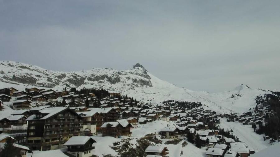
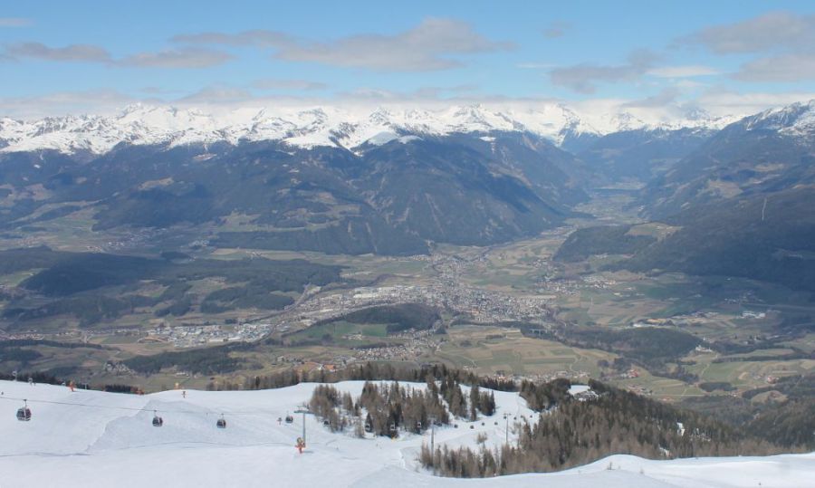 Good piste skiing still possible in Kronplatz – 27 March 2019 – Photo: kronplatz.com
The weather will continue to be mostly fine over the next few days, with temperatures peaking on Saturday before colder weather starts to return from the north or north-east early next week.
It is then likely to stay on the cold side for the time of year for the whole of next week. There will also be some snow showers in places, but we will probably not see the heavy widespread snow that had previously been showing on the charts for the middle part of next week. But watch this space…
Snow conditions remain very good in the northern half of the Alps, especially at altitude. However, snow cover is generally patchier in the southern Alps, especially low down.
Updated: 11.25am Tuesday 26 March 2019 - Mostly fine, slowly warming up again…
While there are still a few snow flurries across the north-eastern Alps today (mostly in Austria), most of the Alps will have a fine day, with the best of any sunshine the further south and west you are. It will still feel quite cold though, particularly in areas exposed to the brisk north-easterly wind.
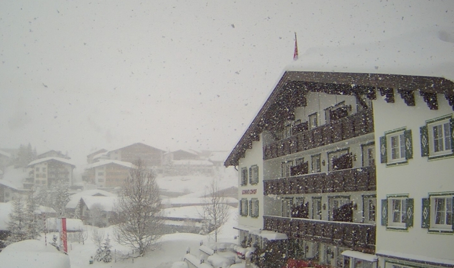
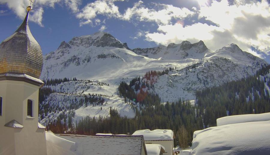
 Brightening up in Lech today following 20cm of new snow in the last 24 hours – 26 March 2019 – Photo: lech.com
Snow conditions are very good right now across the northern Alps thanks to the new snow that has fallen in the last 24 hours. The heaviest snow has fallen in the central-eastern Swiss Alps (e.g. Engelberg, Laax) and the northern and western Austrian Alps (e.g. Kaprun, St Anton) where at least 20cm has fallen at altitude.
The north-western Alps have seen less snow, while the northern French Alps have had next to nothing. The southern Alps have also missed out on this latest storm and snow cover is much more patchy here than in the north, especially at low altitude.
Over the next few days the weather in the Alps will be mostly sunny and increasingly warm again. However, some weather models are hinting that winter could return with a vengeance early next week. Watch this space…
Updated: 8.50am Monday 25 March 2019 - Some snow for the north and east, but mostly sunny in the south and west!
A large area of high pressure is currently located to the north-west of the Alps, but is sufficiently far away to allow a blast of cold and unstable polar air, with some snow showers, to reach the northern Alps today, especially in the north-east.
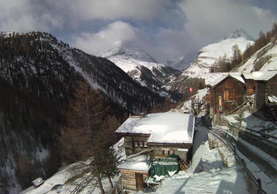
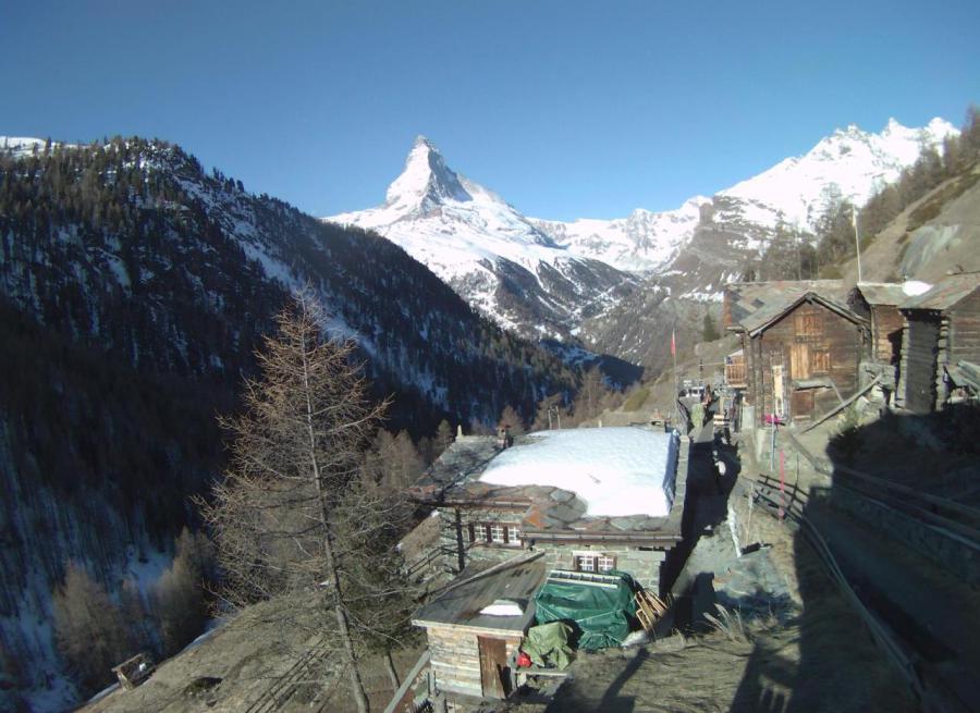 Sunny this morning in the far south of Switzerland. This is Zermatt – 25 March 2019 – Photo: zermatt.ch
Most of today’s snow will fall in the Austrian Alps (away from the south) and the eastern Swiss Alps. Accumulations will be relatively modest (general in the region of 5-15cm) with a rain/snow limit descending from 1000-1200m to 700m or lower later.
The western Swiss Alps (e.g. Verbier) and the far northern French Alps (e.g. Avoriaz) may also see a few light flurries later, but most of the French Alps, the far south of the Swiss Alps and practically the entire Italian Alps will be dry. The further south and west you are, the more likely it is to remain sunny.
Snow conditions remain pretty good for late March, although natural snow cover is now very patchy in some of the lower resorts of the southern Alps (e.g. Auron, Sauze d’Oulx, Selva). These resorts can still offer plenty of piste skiing but outside of the marked runs there is very little snow, at least lower down and/or on slopes exposed to the sun.
By contrast, snow depths are still very impressive at altitude on the northern side of the Alps. Engelberg and Andermatt, for example, both have more than 6m packed down up top, while St Anton and Kaprun have somewhere close to 4m.
Updated: 10.50am Thursday 21 March 2019 - Sunny and milder…
Thanks to high pressure currently dominating the weather in the Alps, plenty of sunshine can be expected in all areas today. It will also feel milder than in recent days, with freezing levels this afternoon typically around 2500m.
 Sunny and increasingly warm this week in Ischgl, but it will get colder again next week – 21 March 2019 – Photo: ischgl.com
This sunny and increasingly warm weather will continue over the next few days, with temperatures peaking on Saturday (freezing levels typically 3000m or more). A cold front will then introduce colder air from the north later on Sunday and into the first part of next week.
Monday and Tuesday will see some snow showers, most of which will be across the north-eastern Alps (i.e. Austria) but possibly across parts of Switzerland too. The further south and west you are, the less likely you are to see any flurries.
Snow conditions in the Alps are generally still pretty good for late March although natural snow cover is now very patchy in the lower resorts of the southern Alps (e.g. Sauze d’Oulx). It will feel increasingly spring-like over the next few days, with plenty of afternoon slush in prospect lower down and/or on slopes exposed to the sun. However, another sharp fall in temperature early next week will slow the freeze-thaw process down again. You may even find some powder in some north-eastern parts of the Alps, watch this space…
Updated: 10.40am Wednesday 20 March 2019 - Lots of sun, slowly rising temperatures…
High pressure is in now in charge of the weather in the Alps with lots of sunshine across the board today. After the last couple of chilly days, it will feel a fraction warmer today even if shade temperatures are still a bit below where you might expect them to be for the time of year.
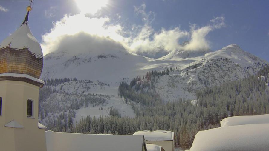
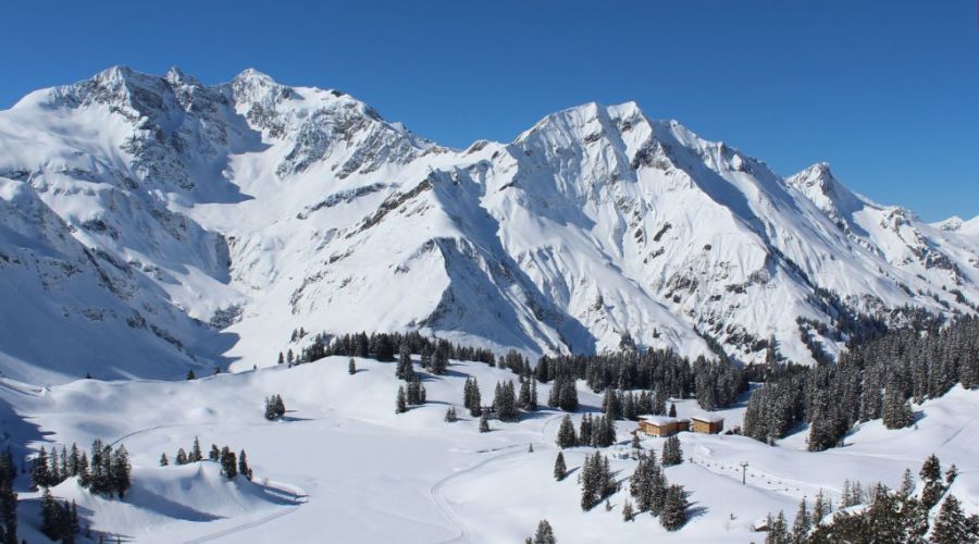 A wonderful day’s skiing in prospect in the Austrian Vorarlberg. This is Schröcken – 20 March 2019 – Photo: warth-schroecken.at
The weather will remain fine over the next few days with freezing levels rising steadily to reach 3000m or so in the western Alps by the weekend. Another pulse of cold polar air will then arrive from the north on Sunday, meaning that temperatures will dip again, especially in the northern and eastern Alps. There may also be some snow for the north-eastern Alps (mostly Austria), but probably not amounting to much.
All things considered, snow conditions remain pretty good for mid to late March. The cold air and low humidity of the last couple of days has meant that the usual freeze-thaw process has been much slower than you would expect at this time of year. It will accelerate as the week goes on but will slow down again early next week.
The deepest snowpack remains on the northern side of the Alps, while some low southern Alpine resorts are now looking a bit patchy. However, most resorts are still able to offer some good piste skiing at least.
Updated: 10am Tuesday 19 March 2019 – Sunny but still quite cold in the Alps…
It will be sunny today across the majority of the Alps, though there is still some cloud across the eastern Alps and even a few snow flurries in the eastern Austrian Alps (e.g. Salzburgland).
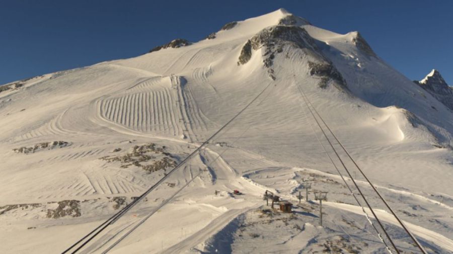 Sunny but cold today in Tignes – 19 March 2019 – Photo: tignes.net
It is cold though with freezing levels not expected to rise above 1000-1500m, meaning that any softening of the snow will be much slower and more limited today than you would expect for mid-March. There is also still some powder around, the best of this being in the central-eastern Swiss Alps (e.g. Engelberg, Laax) which saw 30-50cm of new snow from the most recent storm.
The weather will remain fine for the rest of the week but rising temperatures mean that snow conditions will steadily become more spring-like.
Updated: 8am Monday 18 March 2019 - Much colder in the Alps…
It is MUCH colder across the Alps today. While it is mostly sunny in the southern Alps, at least away from the border areas, there are still some snow showers in some northern and eastern parts of the Alps.
 Much colder but with brightening skies today in Zermatt – 18 March 2019 – Photo: zermatt.ch
The colder weather is the result of a cold front that moved across the Alps yesterday evening and overnight, which brought a few centimetres of snow to many areas, although the south-western Alps stayed mostly dry.
Snow showers will linger for a while today across some eastern parts of the Alps, notably the southern Austrian Alps and the Dolomites, but will generally die out further west where skies will steadily brighten.
Tuesday will be mostly sunny but still quite cold, especially in the morning. The rest of the week will then remain sunny with steadily rising temperatures.
Snow conditions in the Alps are generally pretty good for late March. The northern Alps may have the deepest snow pack, but there is still plenty of good piste skiing available in the south, and even some fresh snow in places today, especially in the Dolomites.
Updated: 12.05pm Sunday 17 March 2019 - One more storm then a long spell of settled weather…
It’s another glorious morning across most of the Alps, though cloud will thicken in the west this afternoon, heralding the arrival of the next (moderately active storm) this evening.
 Sunny in Bivio today in south-eastern Switzerland but snow is expected early tomorrow – 17 March 2019 – Photo: bivio.ch
The storm will move east across the Alps tonight, bringing a few centimetres of snow to many parts, first above 1600-1800m but to increasingly low levels later. Monday will be cooler with some snow showers lingering in the eastern Alps, but it will become increasingly sunny in the west.
The areas likely to miss out on the snow are the southern French Alps (e.g. Risoul, Isola 2000) and the south-western Italian Alps (e.g. Sestriere, Prato Nevoso). Most other parts of the Alps should see somewhere between a dusting and 30cm by the end of tomorrow, with the highest figures likely in the far south-east of Switzerland (e.g. St Moritz) and the eastern Italian Alps (e.g. Passo Tonale, Dolomites).
From Tuesday onwards we will see a return to much calmer sunnier weather right across the Alps, meaning that typically spring-like freeze-thaw conditions will also start developing.
Updated: 9.40am Friday 15 March 2019 - Lots of snow but sky-high avalanche danger across the northern Alps…
A LOT of snow has fallen across the northern Alps in the last 24 hours, with plenty more to come today. However, thanks to rising temperatures there is also some rain in the mix, especially in areas exposed to the west. Whatever the case, the avalanche danger is extremely high across the northern Alps today, with 5/5 in places (e.g. Avoriaz) and lots of closures.
 Huge snowfalls in the Austrian Vorarlberg. This is Lech – 15 March 2019 – Photo: lech.com
In the last 24 hours, 20-60cm of new snow has fallen quite widely across the northern and north-western Alps, with close to 1m in some favourable spots. The areas that have seen the most snow are the northern French Alps (roughly north of Grenoble), the Swiss Alps (with the exception of some central-southern parts such as southern Ticino), the Vorarlberg and the western Tirol. With some exceptions in areas close to the border (e.g. La Thuile, Cervninia), the southern Alps have seen less snow with some places even remaining completely dry.
Back to today and a warmer segment of air is causing complications as the snow turns to rain in places. In this type of warm front situation the rain/snow limit is extremely variable as it often continues to snow in the deep “enclosed” valleys such as the Swiss “Valais” while nearby areas, that are higher but more exposed to the incoming milder air, see the snow quickly turning to rain. Areas most at risk from rain today are the exposed areas of the northern French Alps (e.g. Portes du Soleil) and the western Swiss Alps (e.g. Villars, Gstaad), where the rain/snow limit could rise to 1500-1800m later.
The heaviest precipitation today will fall in the central/eastern Swiss Alps and, especially, the Austrian Vorarlberg/Arlberg area (e.g. Lech, St Anton) where well over 1m of new snow is likely from this storm (above 1800m).
Saturday will be a better weather day across the Alps but, while the spring sunshine will make the powder look particularly appealing, be warned that the risk of avalanche is EXTREMELY HIGH across many northern parts of the Alps, with a risk factor of 4/5 or 5/5 in places.
A new storm will reach the Alps later in the weekend and early next week (again mostly affecting the north and west) before things settle down again mid-week.
Updated: 1.30pm Wednesday 13 March 2019 - More fresh snow in places…
After a largely fine day yesterday in the Alps, the weather has turned more unsettled again today, with further snow showers in places, heaviest and most frequent in the north-west. It will also be quite chilly with any snow falling to relatively low levels (600-900m).
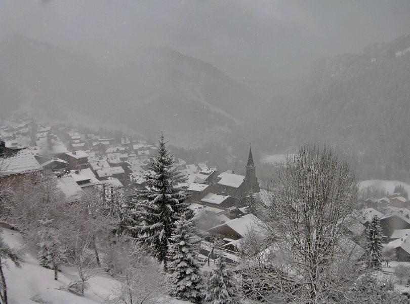 Snow showers today in the Portes du Soleil. This is Châtel – 13 March 2019 – Photo: chatel.com
Areas set to receive the heaviest showers are the northern French Alps (roughly north of Grenoble), the Swiss Alps (away from the far south) and the western Austrian Alps. The southern Alps will see fewer showers today, with many places staying dry and some even seeing quite a lot of sunshine.
Further storms will affect the Alps on Thursday and Friday with the heaviest precipitation again in the northern and western Alps. The rain/snow limit will be variable but will tend to rise on Friday with the threat of rain up to 1500m or even 2000m in places. The weather should improve on Saturday.
Snow conditions are still quite variable across the Alps. While conditions are generally good across the northern and especially north-western Alps where there is plenty of fresh snow (e.g. Avoriaz, Verbier, Mürren, Engelberg and Lech), they are rather more spring-like in some southern resorts where they haven’t seen much snow in recent days (e.g. Isola 2000, Sauze d’Oulx, Dolomites).
Updated: 12.30pm Tuesday 12 March 2019 - Better weather today, then stormy again for the rest of the week…
It’s a better weather day in the Alps today, after yesterday’s storm delivered strong winds and heavy snow showers to many northern parts of the Alps.
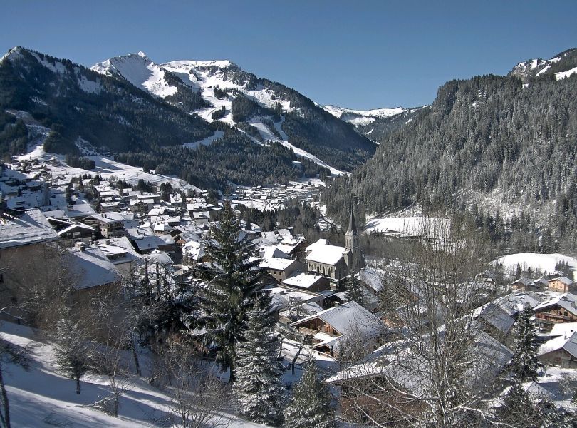 Lovely skiing conditions in the northern French Alps today. This is Châtel – 12 March 2019 – Photo: chatel.com
If you are out in the Alps skiing right now, make the most of any sunshine today. The next storm is already approaching from the west, with high cloud streaming back in towards the northern French and western Swiss Alps later in the day.
Between Wednesday and Friday we can expect significant snow at altitude across the western Alps (with less the further south and east you are) before the weather settles down again over the weekend.
By the end of the week we could see another 40-80cm of new snow (at altitude) across the northern French, Swiss and western Austrian Alps – though watch out for high winds and some rain lower down, especially on Thursday.
Some Italian resorts close to the border (e.g. La Thuile, Cervinia) will also see significant snow but the southern Alps will generally see less precipitation.
Updated: 10.50am Monday 11 March 2019 - Continuing very unsettled…
The weather in the Alps remains very unsettled. After a mild day yesterday, with lots of wind, rain and some high altitude snow across the northern Alps, it has now turned colder again. A strong north-westerly wind is also feeding in lots of snow showers mostly to the northern Alps, with a rain/snow limit as low as 500m. The best of any sunshine today will in the southern Alps, away from the high border areas.
 Heavy snow in Lech today – 11 March 2019 – Photo: lech.com
Tuesday will be a better weather day in the Alps with plenty of sunshine for most, though cloud will increase again in the western Alps later. The next storm will arrive from the north-west on Tuesday night and Wednesday, bringing some significant snow to many parts of the Alps, especially (again) the north-west.
Snow conditions in the Alps are clearly still highly variable. Yesterday’s rain led to a notable deterioration in the snow quality across many northern parts of the Alps, at least lower down. Today is colder though, with snow to lower levels meaning that the situations is markedly better again. The next storm will also see snow falling to relatively low levels, so the overall outlook is quite promising, especially if you are planning to ski anywhere at a half-reasonable altitude.
The southern Alps (e.g. Milky Way, Dolomites) have missed the heaviest of the precipitation in recent days but, while there may have been less fresh snow, rain has also been less of an issue and lower humidity has allowed many resorts to continue to offer some perfectly decent skiing.
Updated: 11.30am Thursday 7 March 2019 - Remaining very changeable…
The weather in the Alps remains very changeable, with a succession of Atlantic storms set to move from west to east over the coming days.
 Fresh snow today in Madesimo, Lombardy – 7 March 2019 – Photo: madesimo.biz
One such storm is moving east across the Alps today, bringing a light to moderate fall of snow to many parts. This will peak in intensity close to the Swiss-Italian border, from the Gotthard region, through the southern Engadin and towards the western Dolomites. The rain/snow limit has typically been between 1000m and 1500m. In the western Alps, by contrast, it was already starting to brighten up at the time of writing this morning.
Friday and Saturday will generally be better weather days, although some cloud and a few showers/flurries could still affect some northern fringes of the Alps. It will remain unsettled next week with further snow at times, perhaps becoming heavier and more widespread for a time mid-week.
Needless to say, snow conditions in the Alps are highly variable right now, but generally remain pretty good at altitude, especially where there has been fresh snow. Lower down, fluctuating temperatures (and in places some rain) have made for more variable snow quality at times.
Updated: 11am Wednesday 6 March 2019 - Windy!
The weather in the Alps remains in a mobile westerly pattern, with a succession of Atlantic storms set to hit the Alps over coming days.
 High cloud is spilling north across the southern border into the Aletsch Arena, but protection by the Foehn means it should stay mostly dry here today – 6 March 2019 – Photo: bettmeralp.ch
It will be very windy in the Alps today, especially in central and northern valleys exposed to the Foehn. With winds expected to reach 150km/hr in places, there will also be numerous lift closures, especially (but not exclusively) at altitude. Although most places will be dry, the Foehn will be accompanied by the “Sud Satu” (or “southern blocking”), meaning that cloud will be piling up on the southern side of the Alps, especially in the south-west where some snow (1000-1500m) is expected later. The high border areas between Switzerland and Italy are most likely to see significant snow later today.
Later tonight and early tomorrow, the Foehn will ease as a cold front moves west to east across the Alps. This will bring some more widespread snow, first above 1300-1600m but to increasingly low levels later. Friday may see some early flurries in the eastern Alps before brighter weather spreads across all regions later. It will then remain unsettled with the chance of some widespread heavy snow to lower levels around the middle of next week.
Not surprisingly, snow conditions in the Alps are highly variable right now. Expect spring-like snow at low altitude in the very short term, especially in the central and northern Alps where the warm Foehn wind will be blowing. However, fresh snow will improve conditions in many areas over the next few days, at least higher up.
Updated: 12pm Tuesday 5 March 2019 - A very unsettled few days ahead…
It’s a better day in the Alps today, after yesterday’s storm delivered 5-20cm of snow at altitude to many northern and north-western parts.
 There’s fine weather across most of the Alps today, including here in Lech – 5 March 2019 – Photo: lech.com
Tomorrow, will also be mostly dry but cloud will increase in the south-west (southern French and western Italian Alps) later with a few flurries (1500-1700m) possible later. The key feature though will be the Foehn, which will become strong across the northern half of the Alps, especially later in the day.
Thursday will then see a more active storm crossing the Alps with some significant snowfall in places, especially in the west. It won’t be particular cold though, with rain also possible at lower altitudes, especially early on. The southern and far eastern Alps will miss the heaviest of any precipitation with some places remaining dry.
Snow cover remains pretty good for March across most parts of the Alps, especially in the north. However, snow quality will be highly variable over the next few days due to the changeable weather and fluctuating temperatures.
Updated: Monday 4 March 2019 - Changeable but generally quite mild weather this week…
A mobile westerly airflow will dominate the weather in the Alps this week, with several Atlantic storms crossing the region. Temperatures will fluctuate considerably, so while there may be some significant snow at altitude (especially in the western Alps), there will also be some rain at times lower down. The driest weather this week will be in the eastern and especially north-eastern Austrian Alps.
 Heavy snow this morning at altitude in Megève – 4 March 2019 – Photo: hiver.combloux.com
Back to this morning, and it is snowing above about 1200-1400m in the northern French and western Swiss Alps. This band of precipitation will move further east as the day goes on, reaching Austria later this afternoon and overnight but weakening as it does so. The rain/snow limit will lower to 700-1000m in the western Alps by this evening. Above 1600m we can expect between 5cm and 20cm of snow in the northern French and western Swiss Alps (e.g. Flaine, Verbier) by tonight.
Tuesday will be a better weather day all round. Many places will also stay dry on Wednesday, but a strong Foehn wind will develop across the northern half of the Alps where it will accelerate the thaw and disrupt some lift operations.
The next storm will then move in from the west, bringing significant precipitation to the western Alps on Thursday. The rain/snow limit may again start quite high, especially on the northern side of the Alps, before falling back towards 1000m later in the day. The north-eastern Austrian Alps (e.g. Schladming) will again see the least precipitation.
Updated: 9am Friday 1 March 2019 - Some snow in places, especially in the north-western Alps…
It’s a much cloudier day today in the northern and western Alps, with some snow (1000-1300m) at times, heaviest in the north-west roughly in an arc from Mont Blanc through the central and northern Swiss Alps and into western Austria. These regions could see 10-25cm of new snow above 1500m by the end of the day.
 It’s snowing this morning in the northern Swiss resort of Engelberg – 1 March 2019 – Photo: titlis.ch
By contrast, the southern French Alps (roughly south of Les 2 Alpes), the Swiss canton of Ticino, the Austrian provinces of Osttirol and Carinthia and much of the Italian Alps will stay mostly dry.
After a relatively benign period of weather this weekend, further Atlantic storms will hit the Alps next week. These will be more potent in the west and will favour the northern French and Swiss Alps in terms of snow. That said, temperatures will be up and down, and some rain is likely at times lower down. With the exception of some areas near the border, the southern Alps will again miss the bulk of the precipitation.
So by the end of next week we could have a lot of new snow at altitude in areas such as Val d’Isère/Tignes, 3 Valleys, Chamonix, Flaine, Avoriaz, Verbier, Jungfrau region, Andermatt, Engelberg, Klosters, Laax and St Anton - but do note that it could be soggy at times lower down.