

Latest snow report
Updated: 10am Friday 6 January 2023
The snow situation in the Alps has received a lot of adverse media attention this week, much of it justified, some it not.
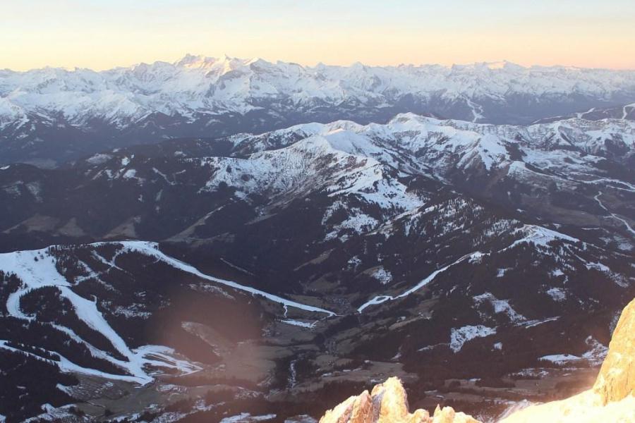
Looking at the facts first: snow depths are below average for early January right across the Alps, considerably so for most. But you don’t necessarily need a huge amount of snow for there to be some perfectly acceptable piste-skiing. The really serious problem area is in the north-western Alps below about 1600m, where natural snow cover is either very patchy or non-existent.
This region includes the northern French Alps roughly north of Grenoble, and the northern and western Swiss Alps. Resorts in these areas where the majority of skiing is below 2000m – such as Megève, La Clusaz, the Grand Massif, the Portes du Soleil, Villars, Leysin, Gstaad, Grindelwald and Wengen – can still offer some skiing albeit on a limited basis. In Morzine’s case, they are currently only offering two very short runs.
Higher resorts in the north-western Alps (such as Val d’Isère, Tignes, Les Arcs, La Plagne, Courchevel, Méribel, Val Thorens and Verbier) are in better shape, with plenty of open pistes. However, snow cover is still patchy lower down and there is no off-piste to speak of. Another issue is that holidaymakers from the nearby snow-starved lower areas are flocking to these higher resorts adding to the pressure, though some resorts have now limited or stopped anyone not staying in resort from buying day passes.
The main reason for the current snow shortage in the lower resorts of the north-western Alps is the unusually high rainfall in recent weeks, sometimes falling as high as 2500m due to the unseasonably warm temperatures. This rain has washed away a lot of the lower-lying snow.
Less rain fell further south and east, with some southern and notably south-eastern parts of the Alps having missed it completely. As is usually the case, resorts such as Isola 2000 and Auron in the extreme southern French Alps, Nassfeld in the far south of the Austrian Alps, and Livigno and Alta Badia in the central/eastern Italian Alps, have all missed the rain and been able to offer consistently decent snow quality, on-piste at least.
Elsewhere, the north-western Italian Alps (e.g. La Thuile), the central and eastern Swiss Alps (e.g. Andermatt, Davos) and the Austrian Alps (e.g. Saalbach, Kitzbühel) have all seen a bit of rain but not as much as the northern French and western Swiss Alps, so have more open at low altitudes.
As we have reported for some time now, significant snow is forecast in the Alps on Sunday/Monday though more than one big storm is needed to get things properly going again, especially in the worst-affected areas, and there is still lots of uncertainty as to what will happen later next week.
Across the pond, most western Canadian and US resorts are in much better shape, with Utah the stand-out area right now…
Austria
Natural snow cover is patchy in the classic lower resorts of the northern Austrian Alps such as Söll (20/50cm) and Saalbach (30/40cm). However, these areas didn’t see the intensity of rain that afflicted more western Alpine resorts in late December and, with the help of artificial snow, can still offer some reasonable piste skiing.
For the most consistent snow quality, you do need to aim higher though, with resorts such as Sölden (70/165cm) and Obergurgl (40/60cm) skiing as good as anywhere right now.
In the far south, Bad Kleinkirchheim (15/40cm) and Nassfeld (15/70cm) are also offering consistently reasonable piste-skiing, despite modest snow depths.
 Not much snow lower down but still plenty of skiing on offer in the Hochkönig area of Austria – 6 January 2023 – Photo: hochkoenig.at
France
Snow conditions are very mixed across the French Alps right now, generally better (relative to altitude) the further south you are. Weathertoski is currently in Serre Chevalier (35/170cm) where there is decent top to bottom cover and some enjoyable piste skiing on offer, even if it is rather hard-packed and a bit icy in places.
Other good bets in the French Alps right now include nearby Montgenèvre (20/90cm) and Puy St Vincent (50/185cm), as well as Isola 2000 (55/80cm) in the far south.
Further north, you need a lot of altitude to be sure of a decent amount of skiing. Val d’Isère/Tignes (56/172cm) and Val Thorens (60/110cm) are the best bets right now although, even here, most of the action remains on-piste. Lower down the situation is far trickier with only patchy snow cover in the Portes du Soleil, where Morzine (0/25cm) is down to two short runs. It’s not much better in the Grand Massif where the outlying resorts are now closed and the only skiing on offer is in Flaine (0/110cm).
Significant snow is forecast for most French resorts on Sunday/Monday, but it probably won’t be enough to get the worst-affected areas back up and running.
 Good on-piste skiing in the southern French resort of Serre Chevalier – Photo: weathertoski.co.uk, 5 January 2023
Italy
Of all the main Alpine countries, Italy is probably offering the most consistent quality of piste-skiing right now - not down to snow quantities but rather thanks to having avoided most of the rain that caused so much damage further north-west. The climate here is also less humid, which allows for better snow preservation. This coupled with excellent snow-making facilities, especially in the Dolomites, means that there is still lots of good piste skiing on offer, even at reasonably low altitudes.
In the Dolomites, Arabba (40/100cm) is skiing as well as anywhere in Italy right now while further west, high-altitude Cervinia (10/110cm) also has some decent piste skiing on offer, despite significantly below-par snow depths. Bardonecchia (85/110cm), further south-west in one of the driest corners of the Alps, is also doing ok with some worn patches lower down but reasonable cover and decent piste-skiing across most of the area.
Most Italian resorts are expecting a significant fall of snow on Sunday night.
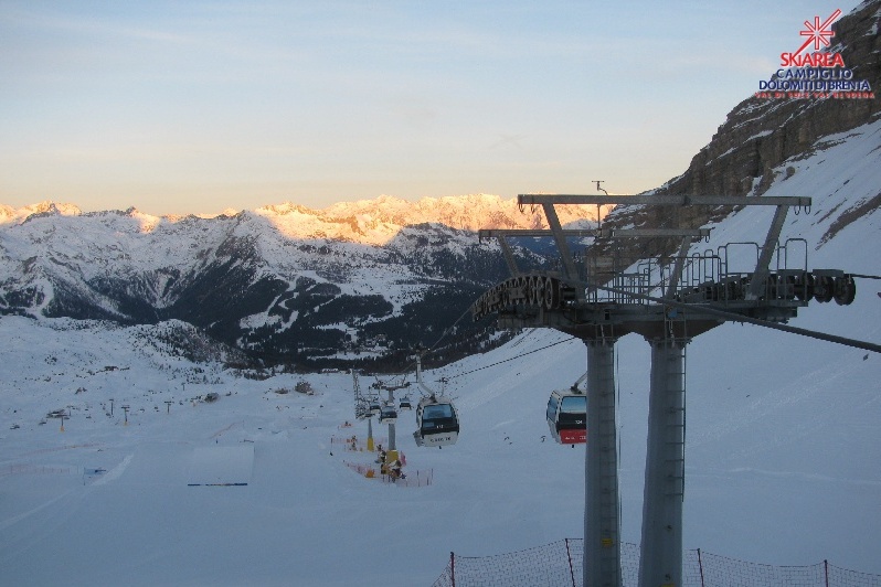 Plenty of good piste skiing still in the Dolomites. This is Madonna di Campiglio – 6 January 2023 – Photo: funiviecampiglio.it
Switzerland
Snow conditions in Switzerland are generally quite poor for early January, and very poor in some lower north-western parts of the Swiss Alps such as Villars (5/40cm) and Gstaad (10/35cm) where natural snow cover is virtually non-existent below 1600m or so. Even these resorts still have a handful of runs open, however.
The situation is better the higher or further east/south-east you go. In the far south-west, thanks to its unbeatable altitude, Zermatt (10/110cm) only has very thin snow cover lower down but plenty of good piste-skiing higher up.
Further east, Arosa (20/30cm) has very modest snow depths but was less affected by the recent rain than many resorts further west, so still has plenty of reasonable piste-skiing on offer.
That said, heavy snow is needed across all Swiss resorts and is forecast to arrive later on Sunday and on Monday.
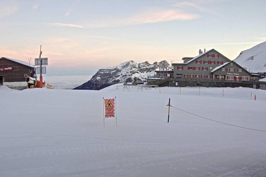 Reasonable snow cover at high altitude in Engelberg but it’s very patchy lower down – 6 January 2023 – Photo: titlis.ch
Rest of Europe
The Pyrenees are also struggling with very patchy natural snow cover lower down and only a handful of higher resorts able to offer a reasonable number of pistes. These include Andorra’s Soldeu (10/30cm) and Spain’s Baqueira Beret (15/35cm).
There are no such issues in Scandinavia, with plenty of good skiing on offer in Nowway’s Hemsedal (40/100cm), where more snow is also forecast. Sweden’s Sälen (35/65cm) is also offering lots of good skiing, on-piste at least, with snow in the forecast here too.
Scotland is typically a bit all over the place right now. Most of the ski centres have seen plenty of snow in recent days though some of the lower-lying snow has thawed thanks to milder temperatures. More snow in the forecast though, especially early next week, with over 50cm due to fall at altitude in Glencoe where the current upper mountain snow depths are around 40cm.
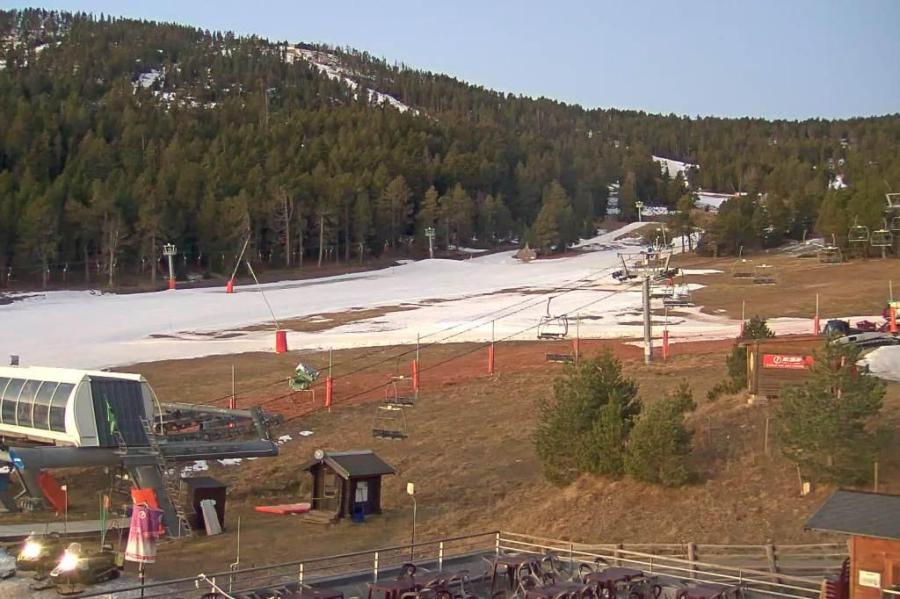 Serious lack of snow in the lower resorts of the Pyrenees. This is Formiguères in France – 6 January 2023 – Photo: snoweye.com
USA
There is plenty of snow across the resorts of the western US. Utah continues to offer some of the very best conditions with another major storm in progress and upper mountain snow depths now approaching 3m in Snowbird.
Further north, Wyoming’s Jackson Hole is also in good shape, with all lifts operating and an upper base of just over 2m.
Canada
It’s currently snowing in Whistler, meaning that conditions are excellent across the area, especially at altitude where base depths are around 160m.
Further inland, the Lake Louise/Banff area has a dusting of new snow and settled snow depths of 70/90cm depending on altitude.
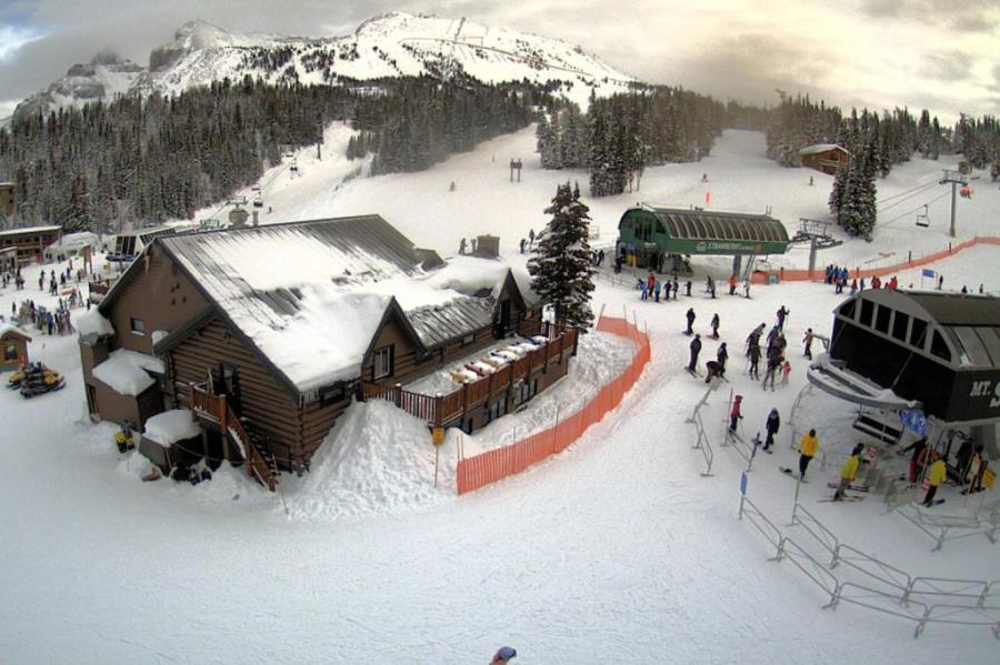 Decent rather than spectacular snow conditions in the Banff/Lake Louise ski area right now – 6 January 2023 – Photo: snoweye.com
Our next full snow report will be on
Thursday 12 January 2023
If you enjoy reading our updates - please feel free to support us: