

Latest snow report
Updated: 4.30pm Thursday 19 January 2023
Snow conditions have dramatically improved across much of the Alps this week, thanks to a storm cycle that begun on Sunday and is only just fizzling out now.
Areas that have benefited the most are the lower resorts of the north-western Alps, including Megève, Morzine, La Clusaz, Villars, Gstaad and Grindelwald, which have seen between 50cm and 100cm of new snow in four days. Not only that, but there has also been significant snow to low levels, with 60-70cm of new snow at resort level in Les Gets (1172m), for instance.
Most of the rest of the Alps have also seen a least some new snow this week, typically 20-40cm, but less (and not as much as hoped) in some of the north-eastern Alps, notably the Austrian Tirol (e.g. Kitzbühel). Whatever the case, it has now turned very cold across the board, allowing the snow cannons to operate again at full capacity. It will also remain on the cold side for the foreseeable future.
Across the pond, it is California’s snowfall depths that are catching the eye, following a number of huge headline-catching storms in recent weeks…
Austria
Some Austrian resorts have received significant snow this week though snowfall totals have generally been disappointing compared with further west.
The far south-east has done best, with significant fresh snow allowing for some excellent conditions in Carinthia’s Nassfeld (25/100cm). There have also been some useful top-ups in the Arlberg in the far west, where Lech (70/160cm) is skiing nicely right now.
In between, resorts in the Austrian Tirol such as Kitzbühel (40/60cm) and Söll (25/70cm) only saw bits and pieces of snow but can still offer some excellent piste-skiing, although depths remain modest.
Very cold temperatures are allowing for snowmaking at all levels though, and there may be some more snow over the next few days, heaviest the further east you are.
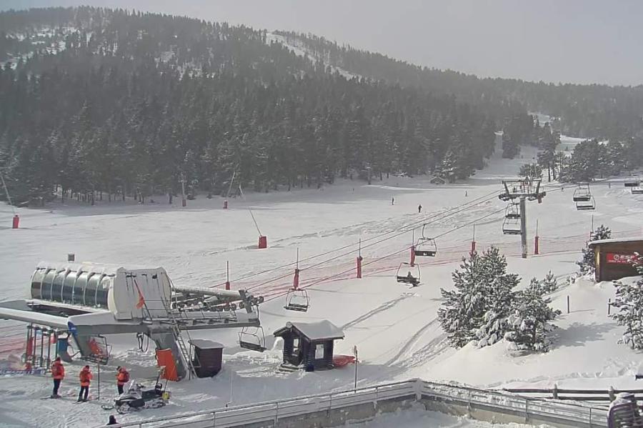
 Cloudy with a little light snow today in the eastern Austrian Alps. This is Hinterthal – 19 January 2023 – Photo: snow-eye.com
France
Snow conditions are superb across the French Alps right now thanks to fresh snow and cold temperatures. Best of all are the lower resorts of the northern French Alps, which have seen 60-90cm of new snow since Sunday, utterly transforming the fortunes of resorts such as Morzine (40/100cm) and La Clusaz (45/190cm).
Unsurprisingly, the higher resorts like Val d’Isère (120/230cm) and La Plagne (105/215cm) are also offering great skiing though the risk of avalanche off-piste is high, especially at altitude where it has been very windy.
The southern French Alps have generally not seen quite as much fresh snow, but the lower slopes here were in better condition than further north before the storm, so resorts like Serre Chevalier (60/225cm) can still also offer superb all-round conditions.
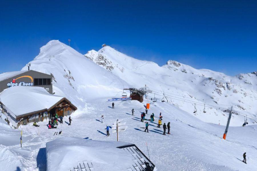 Fresh snow and sunny skies in Alpe d’Huez – 19 January 2023 – Photo: alpedhuez.net
Italy
All Italian resorts have seen new snow over the last few days, in varying quantities. The heaviest snow has fallen in the far north-west, where La Thuile (90/220cm) is in excellent shape right now.
Further south, the snow hasn’t been quite as heavy in Bardonecchia (50/90cm) but there’s still enough to allow for some fabulous conditions right now, even lower down.
Snow depths are generally quite modest further east but, on-piste at least, conditions are still excellent in both Livigno (45/65cm) and Alta Badia (20/65cm), helped by the cold temperatures and state-of-the-art snowmaking.
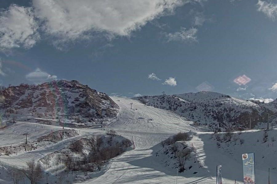 Excellent piste skiing in the southern Piedmont right now. This is Limone – 19 January 2023 – Photo: snoweye.com
Switzerland
Snow conditions are much improved across the Swiss Alps following fresh snow this week. The lower resorts of the north-western Swiss Alps have benefited most, with the likes of Gstaad (40/95cm) and Wengen (20/80cm) having seen 40-70cm of new snow since Sunday, and up to 1m in the Portes du Soleil.
Elsewhere in Switzerland, snowfalls have been more modest with typically 15-25cm over the last few days. However, thanks to the frigid temperatures, snow has fallen to very low levels and the snow cannons can operate at full capacity, where resorts choose to use them. This has allowed for some excellent skiing conditions (especially on-piste) further south in Zermatt (15/110cm), and in Davos (25/100cm) further east.
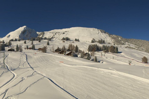 Much improved snow conditions in the lower resorts of the western Swiss Alps. This is Leysin – 19 January 2023 – Photo: alpesvaudoises.ch
Rest of Europe
Fresh snow has been improving snow conditions this week across the Pyrenees, with more falling today in both Spain’s Baqueira Beret (40/65cm) and Andorra’s Soldeu (25/55cm). Base depths remain modest but, on-piste at least, snow conditions should be excellent once the weather settles down.
There is plenty of snow in the Scottish ski resorts right now with cold temperatures and soft powdery snow across all five main areas! In the western highlands, Glencoe is reporting a very impressive 170cm up top.
Snow conditions are also excellent across most of Norway, especially in the south and west where Voss (near Bergen) has fresh snow and a healthy 150cm mid-mountain base.
 It’s been snowing in the Pyrenees too. This is Formiguères on the French side – 19 January 2023 – Photo: snoweye.com
USA
Snow conditions in the western US are generally very good right now, with some incredible snow depths in parts of California and Utah. Mammoth, for example, now has 452/655cm of settled snow depending on altitude, while Alta has 190/409cm.
Further east, snow depths are more “normal” in Colorado, with some excellent piste-skiing on offer in both Vail (50/147cm) and Aspen (70/100cm).
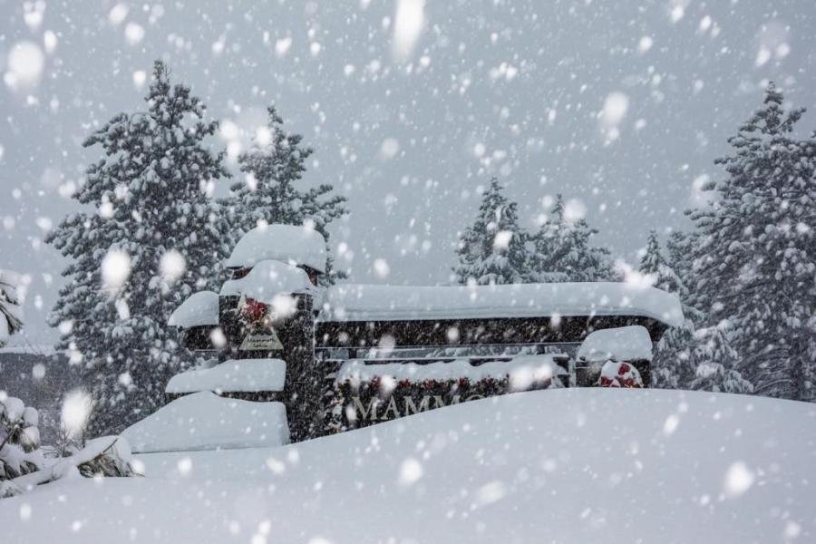 Huge snowfalls in Mammoth earlier this week – 19 January 2023 – Photo: facebook.com/MammothMountain
Canada
Whistler is in good shape right now with another 67cm of snow falling in the last week and a settled mid-mountain base of around 2m. More snow is forecast here on Saturday before the weather settles down again next week.
Further inland, Banff (105cm mid-mountain base) has less in the way of new snow but is also in good shape overall, especially on-piste.
Our next full snow report will be on
Thursday 26 January 2023
If you enjoy reading our updates - please feel free to support us: