

ARCHIVE
Today in the Alps - October 2015
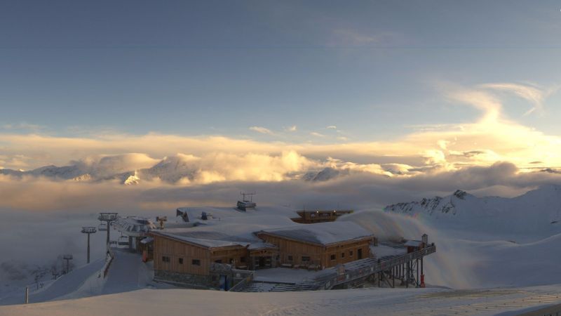
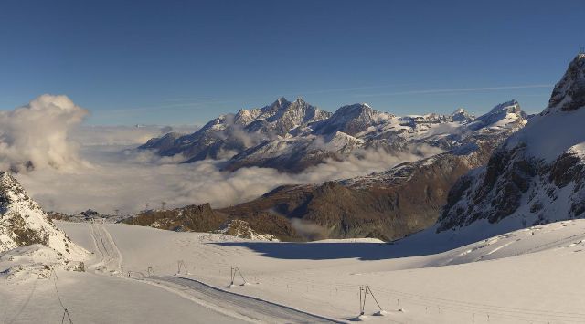
Updated: 9.50am Saturday 31 October 2015 - Glorious sunshine at altitude
A massive area of high pressure is anchored over eastern Europe, dragging very mild air across the Alps from the south. Due to temperature inversions, there is some nuisance value low cloud in some of the valleys, but at altitude we can expect wall to wall sunshine today with freezing levels between 3300 and 3600m!
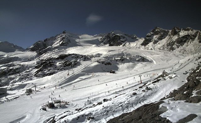
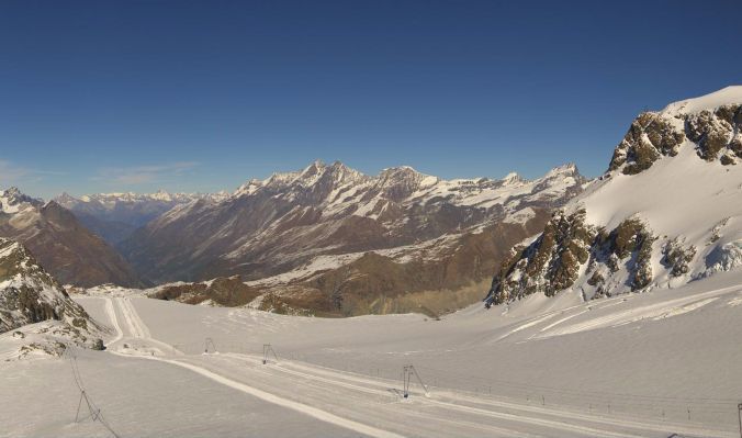
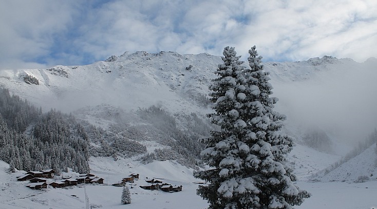
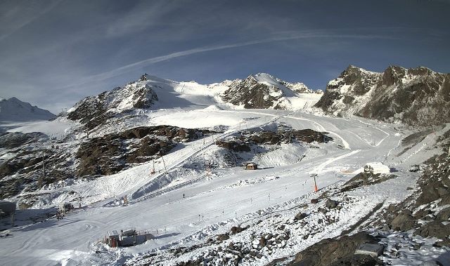
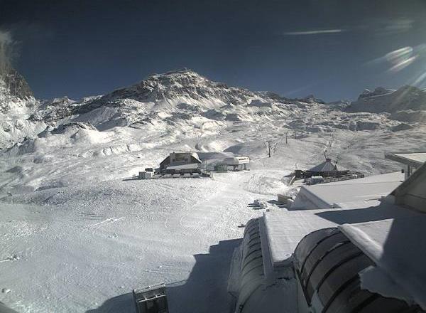
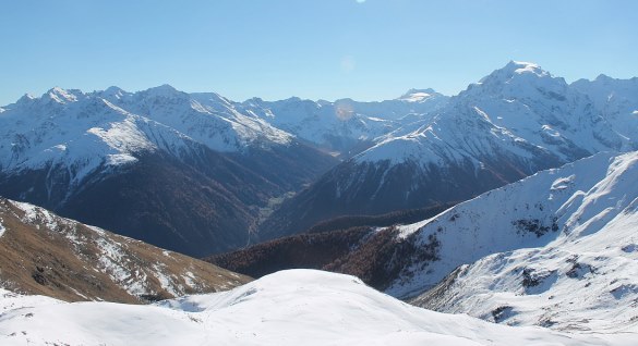 Lots of snow still in the Vinschgau region of the Sud-Tirol (where you will find the resort of Sulden) - Photo: foto-webcam.eu
Skiing conditions on the glaciers remain excellent but, with the “Indian Summer” expected to continue all week, we will see a steady thaw of any low-lying snow over the coming days, especially on slopes exposed to the sun.
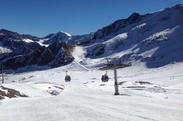
Two Swiss areas open for the first time today - Glacier 3000 (near Les Diablerets) and, further east, the Titlis glacier above Engelberg (weekends only). Elsewhere in Switzerland, you can ski on the Diavolezza glacier near St Moritz, but the most extensive terrain by far is in Saas-Fee and Zermatt.
In Italy, Cervinia (which has already had two weekend previews) will now open on a daily basis, with skiing below glacier level down to Cime Bianche Laghi. You can also ski at Passo Stelvio, Val Senales and Sulden, but note that Passo Stelvio, which is a “summer only” area, closes for the winter after tomorrow.
In France, you can ski on the glaciers above Tignes and Les 2 Alpes, but the latter also closes again after tomorrow, reopening in early December.
Austria offers the greatest number of options in the Alps, with Hintertux, Sölden, Stubai, Kaprun, Dachstein, Pitztal, Kaunertal and Mölltal. Surprisingly, Kitzbühel is also hanging on to one non-glacial slope after its early opening on 24 October, probably not for long though…
Updated: 10.50am Friday 30 October 2015 - Indian summer?
High pressure is now in charge of the Alps and will dominate the weather for the foreseeable future. What’s more, this high is centred to the east of the Alps, which means an increasingly warm airflow from the south.
 Great conditions on most of the glaciers for now. This is Hintertux - Photo: Helden Der Nacht via Facebook.com/hintertux.glacier
Over the next few days then, possibly even a week or more, we can expect lots of fine, sunny and exceptionally mild weather in the mountains. Freezing levels will be well above 3000m (close to 4000m at times) with maximum temperatures at 2000m in range of 10°-14°C!
Skiing conditions on the glaciers are currently excellent, especially in the western and southern Alps, where we have seen the heaviest of the recent snow.
However, there will now be a rapid loss of any low-lying snow over the next few days, especially on slopes exposed to the sun.
In short, enjoy all the snowy pictures circulating on social media, but don’t be fooled into thinking this means we are in for a bumper early season - much of the “good work” will soon be undone.
By our reckoning there are 16 ski areas open across the Alps right now. In France, this means Tignes and Les 2 Alpes (at half term only), in Switzerland, Zermatt, Saas-Fee and Diavolezza near St Moritz.
In Italy, you can ski at Val Senales, Passo Stelvio and Sulden, with Cervinia set to open full-time as of this weekend. In Austria, you can ski at Hintertux, Sölden, Stubai, Pitztal, Kaunertal, Mölltal, Dachstein and Kaprun. Kitzbühel is scheduled to reopen this weekend but a lot depends on the snow conditions.
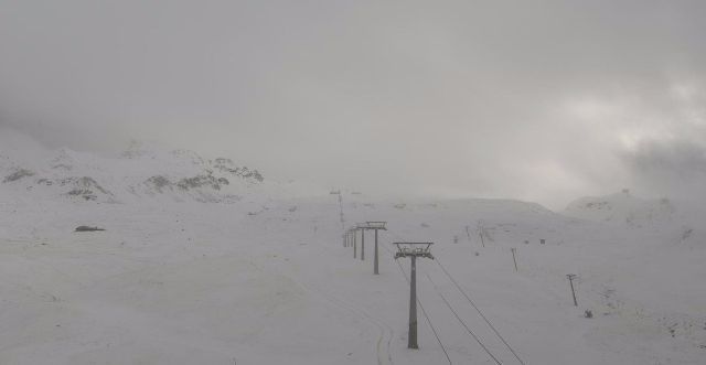
Updated: 7.50am Thursday 29 October 2015 - Fresh snow for some, but it’s only temporary
As forecast, we have seen plenty of snow at altitude in the last 24 hours across the western half of the Alps. This morning, there are still a few showers across the central Alps, but the storm has stalled and is now dying out, which means little if any action for eastern parts - including much of Austria.
 Decent snowfall up on the Grande Motte glacier in Tignes - Photo: tignes.net
The heaviest snowfalls have been close to the border between Italy and France, and Italy and Switzerland (e.g. Sestriere, Tignes, Zermatt), where above 2500m we have 10-30cm of fresh snow (locally a bit more). Many other central and western parts of the Alps have also seen at least a bit of snow, but the front (as expected) has failed to make much progress east, leaving the eastern Italian Alps and much of Austria (away from the far south-west) missing out this time around.
The rain/snow limit was lowest in the western Alps, with a dusting to 1500m in one or two places. As for today, there is still a lot of residual cloud around, but the sun will make an appearance here and there, especially at altitude and in the west later in the day.
The outlook is not good for fans of wintry weather, with high pressure now expected to dominate the Alpine weather for some time to come. Unfortunately, this high will be positioned to drag some very mild air in across Western Europe, which will once again send freezing levels soaring above 3000m.
By our reckoning there are 16 ski areas open across the Alps right now. In France, this means Tignes and Les 2 Alpes (at half term only), in Switzerland, Zermatt, Saas-Fee and Diavolezza near St Moritz.
In Italy, you can ski at Val Senales, Passo Stelvio and Sulden, with Cervinia set to open full-time as of this weekend. In Austria, you can ski at Hintertux, Sölden, Stubai, Pitztal, Kaunertal, Mölltal, Dachstein and Kaprun. Kitzbühel is scheduled to reopen this weekend but a lot depends on the snow conditions.
Updated: 9am Wednesday 28 October 2015 - Snow at altitude in the south-west
A cold front is approaching from the west, though it is slightly less potent than originally forecast. Ahead of this front, an unstable southerly airflow has already brought some overnight snow to some south-western parts of the Alps (e.g. Sestriere, Cervinia).
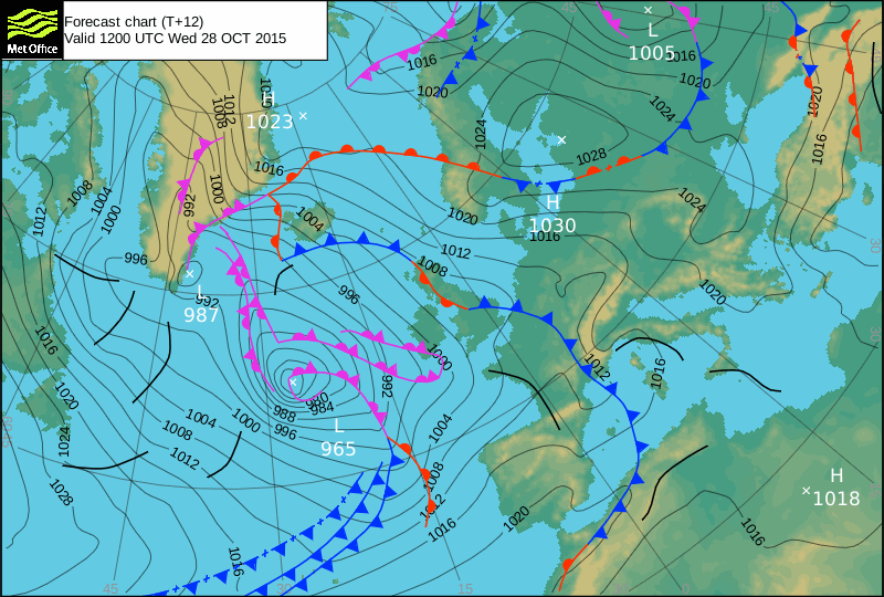 A cold front is approaching the Alps today, with snow expected at altitude in the south-west - Image: Met Office
Later today, the weather will deteriorate more generally across the western Alps, with the heaviest snow again likely in the high border areas between Italy and Switzerland, as well as Italy and France. The rain/snow level will begin at around 2200-2500m, but fall steadily to reach about 1700m in the west overnight.
By contrast, due to the Foehn effect, the central and eastern Alps will stay dry and warm for much of the day, with plenty of sunshine, especially in Austria. However, here too, cloud will encroach from the south-west late in the day, with some precipitation likely in eastern Switzerland and the extreme west of Austria overnight.
In terms of the ski resorts that are open, or about to open, Les 2 Alpes, Tignes, Zermatt, Saas-Fee and Cervinia will do the best from this storm. There has been a slight downgrade in snowfall totals in the last 24 hours, but between 10cm and 30cm of snow is still likely above 2500m. Further east, there will be very little new snow - probably none at all in the central and northern Austrian Alps (e.g. Kaprun, Dachstein).
 A few cm of fresh snow overnight above Cervinia, with more to come later today - Photo: cervinia.it
Looking further ahead and high pressure will dominate the Alps once more with lots of fine, dry and very mild weather over the weekend, extending well into next week.
By our reckoning there are 16 ski areas open across the Alps right now. In France, this means Tignes and Les 2 Alpes (at half term only), in Switzerland, Zermatt, Saas-Fee and Diavolezza near St Moritz.
In Italy, you can ski at Val Senales, Passo Stelvio and Sulden, with Cervinia set to open full-time as of this weekend. In Austria, you can ski at Hintertux, Sölden, Stubai, Pitztal, Kaunertal, Mölltal, Dachstein and Kaprun. Kitzbühel is scheduled to reopen this weekend but a lot depends on the snow conditions.
Updated: 11am Tuesday 27 October 2015 - Mostly fine, but new storm approaching the south-west
It’s another fine and very mild day across most of the Alps, especially in central and eastern parts where, at altitude at least, any sunshine will be virtually unbroken.
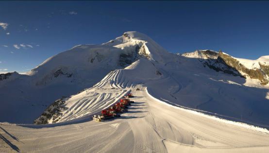
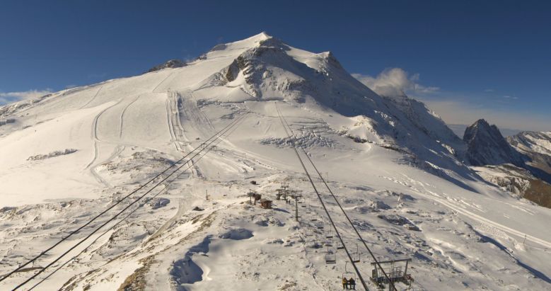
 Another magnificent day on the Austrian glaciers - Photo: pitztaler-gletscher.at
That said, there is (as there so often is at this time of year) some cloud/fog lingering in some of the lower valleys. Cloud is also thickening up more generally in the south-western Alps, heralding a significant change in the weather over the next couple of days.
Quickly looking back at yesterday, you would be forgiven for thinking that summer has returned to some parts of the Alps, with 23°C recorded near Brig in the upper Valais in Switzerland! Despite this, skiing on the glaciers remains good, though lower down the snow from the big mid-October storms continues to disappear (where it hasn’t already done so), with the situation becoming more “normal” for the time of year.
Over the next couple of days a new storm will affect the Alps, with the heaviest precipitation in the south and west. Indeed it is already starting to cloud up in the southern French and south-western Italian Alps, even though we will have to wait until later on Wednesday to see the most prolonged and intense precipitation.
The open ski areas that this storm will benefit the most are in France and western Switzerland (Les 2 Alpes, Tignes, Zermatt, Saas-Fee), especially the Swiss resorts where 50cm+ is possible at altitude. The rain/snow limit will start around 2200m but lower to well below 2000m on Wednesday night. The eastern Alps will be much less affected by this storm, particularly Austria, which will see only scattering of showers on Thursday. The fine and mild weather will then return everywhere later in the week.
By our reckoning there will be 15 ski areas open across the Alps today. In France, this means Tignes and Les 2 Alpes (at half term only), in Switzerland, Zermatt, Saas-Fee and Diavolezza near St Moritz.
In Italy, you can ski at Val Senales, Passo Stelvio and Sulden, with Cervinia set to open full-time as of this weekend. In Austria, you can ski at Hintertux, Sölden, Stubai, Pitztal, Kaunertal, Mölltal and Kaprun. Kitzbühel is scheduled to reopen this weekend but a lot depends on the snow conditions.
Updated: 7.45am Monday 26 October 2015 - Mostly fine, still very mild
The Alps are looking at another mostly fine day with some mist/low cloud, but plenty of sunshine at altitude. It will also remain very mild, with freezing levels generally above 3000m.
 Another fine day on the glacier above Saas-Fee - Photo: saas-fee.ch
These fine autumn conditions will continue for most of tomorrow, though cloud will increase in the south-western Alps later, heralding a change in the weather mid-week.
Wednesday will be more unsettled with rain in the southern and western Alps, spreading erratically north-eastwards (but losing its potency) on Thursday. Some moderate snowfalls are expected at altitude in parts of the southern and western Alps, mostly above 2200-2500m (e.g. Les 2 Alpes, Zermatt).
By our reckoning there will be 16 ski areas open across the Alps today. In France, this means Tignes and Les 2 Alpes (at half term only), in Switzerland, Zermatt, Saas-Fee and Diavolezza near St Moritz.
In Italy, you can ski at Val Senales, Passo Stelvio and Sulden, with Cervinia still open at weekends only. In Austria, you can ski at Hintertux, Sölden, Stubai, Pitztal, Kaunertal, Mölltal, Kaprun and Kitzbühel (today being the last day of its special early opening).
For more context on the snow situation in the Alps right now - see our latest season progress report
Updated: 8.20am Saturday 24 October 2015 - Dry, very mild
There’s a lovely day in store for most of the Alps, with plenty of sunshine, especially at altitude and in the south and east. Later in the day, high cloud will move into some northern and western parts but it will stay dry.
 Fine morning on the Grande Motte glacier above Tignes - Photo: tignes.net
Snow conditions on the glaciers remain good, but with very mild temperatures, any low lying snow from last week’s storms will continue to thaw. What’s more, it looks like it will remain on the mild for some time to come.
By our reckoning there will be 17 ski areas open across the Alps this weekend. In France, this means Tignes and Les 2 Alpes (at half term only), in Switzerland, Zermatt, Saas-Fee and Diavolezza near St Moritz. In Italy, you can ski at Val Senales, Passo Stelvio, Sulden and Cervinia (at weekends only). In Austria, you can ski at Hintertux, Sölden, Stubai, Pitztal, Kaunertal, Mölltal, Kaprun and Kitzbühel (at weekends only).
For more context on the snow situation in the Alps right now - see our latest season progress report
Updated: 9.50am Friday 23 October 2015 - Mostly dry, very mild
Except for a few early showers across north-eastern Austria, we are looking at a mostly dry and very mild day across the Alps, with freezing levels ranging from 3000m in the north-east to 3900m in the south and west!
 Any snow below glacier level in Cervinia is now rapidly melting - Photo: cervinia.it
Most places will see plenty of sunshine (especially at altitude), though there will be areas of cloud around, most notably early in the day in the northern and eastern Austrian Alps.
Snow conditions on the glaciers remain good, but any low lying snow from last week’s storms will continue to thaw. What’s more, it looks like it will remain mild for some time to come, though some high altitude snow might return in the southern and western Alps by the middle of next week.
13 glacier ski areas are now open across the Alps. In France, this means Tignes, in Switzerland, Zermatt, Saas-Fee and Diavolezza near St Moritz. In Italy you can ski at Val Senales and Passo Stelvio. Cervinia is open at weekends only, then full time from 31 October. In Austria, you can ski at Hintertux, Sölden, Stubai, Pitztal, Kaunertal, Mölltal and Kitzsteinhorn (Kaprun).
Kitzbühel has also announced that it will open a couple of runs on Saturday, Sunday and Monday in its Pass Thurn area, though any snow here is unlikely to see it through to the start of the proper season.
Other openings are expected this weekend, most notably Les 2 Alpes (France) for a winter preview, before it closes again on 1 November. Little known Sulden in the Italian Sud-Tirol is another, thanks to the particularly heavy snowfalls that it experienced last week. Engelberg in Switzerland, however, has postponed its opening until 31 October.
Updated: 9.25am 22 October 2015 - Mostly dry, but clouding over in the north
There’s another mostly dry day in store for the Alps today. However, cloud will thicken from the north with a few light showers possible close to the northern foothills later. The best of the sunshine will be in the southern Alps. It will be milder than of late, with freezing levels approaching 3000m in many places.
 Good skiing conditions (for the time of year) continue on the glacier above Zermatt, which will also be accessible from the Cervinia side this weekend - Photo: Cervinia.com
The next few days will remain mostly dry with variable cloud, but plenty of sunshine at altitude. It will be quite mild too, which will continue to send the snow-line (from last week’s storms) marching back up the mountains.
13 glacier ski areas are now open across the Alps. In France, this means Tignes, in Switzerland, Zermatt, Saas-Fee and Diavolezza near St Moritz. In Italy you can ski at Val Senales and Passo Stelvio. Cervinia is open at weekends only, then full time from 31 October. In Austria, you can ski at Hintertux, Sölden, Stubai, Pitztal, Kaunertal, Mölltal and Kitzsteinhorn (Kaprun).
Kitzbühel has also announced that it will open a couple of runs on Saturday, Sunday and Monday in its Pass Thurn area, though any snow here is unlikely to see it through to the start of the proper season.
Other openings are expected this weekend, most notably Les 2 Alpes (France) for a winter preview, before it closes again on 1 November. Little known Sulden in the Italian Sud-Tirol is another, thanks to the particularly heavy snowfalls that it experienced last week. Engelberg in Switzerland, however, has postponed its opening until 31 October.
Updated: 9.15am Wednesday 21 October 2015 - Mostly sunny at altitude
There’s plenty of sunshine on offer in the Alps today, though with a couple of caveats. Firstly, if you live in the bottom of a valley, particularly a low valley, you may be stuck under cloud – an all too familiar problem at this time of year, caused by temperature inversions. More generally, there are also areas of cloud lingering over the northern and eastern Austrian Alps, though these should break up as the day progresses.
 You probably haven’t heard of Sulden, but it has lots of snow and opens this weekend - Photo: sulden.it
However, for most of the open ski areas, there should be plenty of sunshine. It will also be a little milder, though still on the cool side for the time of year, with freezing levels typically between 2000 and 2600m.
A few showers are possible across the northern Alps over the next few days, but no significant precipitation is expected, and many places (especially the south) will stay dry. Temperatures will also continue to rise, without ever becoming excessively mild.
13 glacier ski areas are now open across the Alps. In France, this means Tignes, in Switzerland, Zermatt, Saas-Fee and Diavolezza near St Moritz. In Italy you can ski at Val Senales and Passo Stelvio. Cervinia is open at weekends only, then full time from 31 October. In Austria, you can ski at Hintertux, Sölden, Stubai, Pitztal, Kaunertal, Mölltal and Kitzsteinhorn (Kaprun).
Further openings are expected this weekend, most notably Les 2 Alpes (France) for a winter preview, before it closes again on 1 November. Little known Sulden in the Italian Sud-Tirol is another, thanks to the particularly heavy snowfalls that it experienced last week. Engelberg in Switzerland, however, has postponed its opening until 31 October.
Updated: 11.15am Tuesday 20 October 2015 - Fabulous skiing on the glaciers!
The last of the showers have moved away to the east and, for the first time in several days, we can expect a dry day across all parts of the Alps. There is “nuisance value” cloud trapped in some of the lower valleys, but for most it will be a gloriously sunny day, especially at altitude.
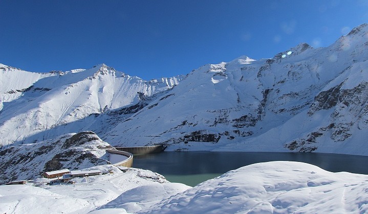 Lots of snow at Hochgebirgsstauseen (2000m) near Kaprun - Photo: verbund.com
Yesterday it snowed (1000-1500m) across large parts of the Austrian Alps, as well as the far north-eastern Alps, early in the day. However, these showers became increasingly confined to the eastern Austrian Alps as the day progressed, dying out completely later. The rest of the Alps were brighter with lots of sunshine in the south and west.
 Fresh tracks on the Mölltal glacier in Carinthia, Austria - Photo: gletscher.co.at
So, right now, the freshest snow is once again across the eastern Alps with truly fabulous skiing conditions across the Austrian glaciers, and at Passo Stelvio and Val Senales in Italy. Further west, skiing conditions in the likes of Saas-Fee and Zermatt (Switzerland), and Tignes (France) are also very good, even if snowfall totals have been more modest over the last few days.
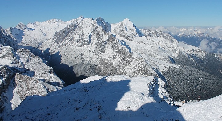 Germany’s highest mountain, the Zugspitze, close to the Austrian border - Photo: foto-webcam.eu
The weather is set to turn milder over the next few days as Atlantic air makes inroads from the west. However, it may not last that long as some models are toying with the idea of another potent wintry spell around the middle of next week. Watch this space!
13 glacier ski areas are now open across the Alps. In France, this means Tignes, in Switzerland, Zermatt, Saas-Fee and Diavolezza near St Moritz. In Italy you can ski at Val Senales and Passo Stelvio. Cervinia is open at weekends only, then full time from 31 October. In Austria, you can ski at Hintertux, Sölden, Stubai, Pitztal, Kaunertal, Mölltal and Kitzsteinhorn (Kaprun).
Updated: 9.25am Monday 19 October 2015 - Further snow for Austria
Snow showers are still widespread this morning across Austria and the far north-eastern Swiss Alps, with a rain/snow limit between 1000m and 1400m. Most other parts of the Alps are dry with increasing amounts of sunshine the further south-west you travel.
 Snowing to resort level this morning in Lech.
Looking back at Sunday and the weather was quite mixed across the Alps. Many places were dry with varying amounts of sunshine, but snow showers (1200-1600m) developed across the northern Swiss and western Austrian Alps as the day progressed, spreading to many other parts of Austria overnight.
Today, snow showers will gradually die away from the north-eastern Swiss and western Austrian Alps but will continue for much of the day in the central and eastern (Austrian) Alps.
13 glacier ski areas are now open across the Alps. In France, this means Tignes, in Switzerland, Zermatt, Saas-Fee and Diavolezza near St Moritz. In Italy you can ski at Val Senales and Passo Stelvio. Cervinia is open at weekends only, then full time from 31 October. In Austria, you can ski at Hintertux, Sölden, Stubai, Pitztal, Kaunertal, Mölltal and Kitzsteinhorn (Kaprun).
Updated: 9am Sunday 18 October 2015 - Variable cloud, a few scattered showers
It’s a mixed bag of weather across the Alps today. Many places will stay dry with bright or sunny spells, but there with be a few showers around, these most likely in the far western Austrian and far eastern Swiss Alps (snow 1400m).
 Masses of fresh snow on the Mölltal glacier in Carinthia, Austria - Photo: foto-webcam.eu
With all the recent snow, plus the fact that temperatures remain on the cold side for the time of year, skiing conditions are excellent on the glaciers, especially where the weather has cleared up.
13 glacier ski areas are now open across the Alps. In France, this means Tignes, in Switzerland, Zermatt, Saas-Fee and Diavolezza near St Moritz. In Italy you can ski at Val Senales and Passo Stelvio. Cervinia is open at weekends only, then full time from 31 October. In Austria, you can ski at Hintertux, Sölden, Stubai, Pitztal, Kaunertal, Mölltal and Kitzsteinhorn (Kaprun).
Over the next few days a little more snow is forecast to fall in the eastern Alps - mostly in Austria and to the east of Innsbruck. The western Alps will be mostly dry with sunny spells, but temperatures will remain below average across the board.
Updated: 9.25am Friday 16 October 2015 - October powder fest!
There has been plenty more snow across the Alps in the last 24 hours. Yesterday, snow showers spread further west to affect the western Swiss (e.g. Zermatt, Verbier) and western Italian Alps (e.g Cervinia, Courmayeur), also spilling over the border into France.
 Heavy snow early this morning in Livigno - Photo: tuttolivigno.com
Overall though, the heaviest snow in the last couple of days has been further east, especially in the central and eastern Italian Alps (e.g. Livigno, Passo Stelvio, Passo Tonale), and the southern and south-western Austrian Alps (e.g. Mölltal glacier, Obergurgl).
Quantities of snow in these regions over the last 48 hours are difficult to estimate, but are certainly within the 50-80cm range at altitude (locally more).
 Huge quantities of snow in the last couple of days in Passo Stelvio - Photo: passostelvio.com
Elsewhere, snowfalls have generally been more modest, but there are large variations from one region to the next. In terms of open or opening ski areas, the area around Zermatt, Cervinia and Saas-Fee has also done very well.
As for the rain/snow limit, that has remained highest in the far eastern Alps (close to 2000m) but, more generally, has been sitting between 1000m and 1500m, and as low as 600-800m in the north-western Alps.
 Fresh snow and blue skies on the glacier above Saas-Fee this morning - Photo: saas-fee.ch
12 glacier ski areas are now open across the Alps. In France, this means Tignes, in Switzerland, Zermatt and Saas-Fee. In Italy you can ski at Val Senales and Passo Stelvio, and, in Austria, at Hintertux, Sölden, Stubai, Pitztal, Kaunertal and Mölltal. The Kitzsteinhorn glacier above Kaprun opened for the season yesterday.
Next up is Diavolezza (near St Moritz), scheduled to open tomorrow (17 October), as is Cervinia, but for weekends only (at least until 31 October). Engelberg has postponed the opening of its Titlis glacier until 24 October.
Don’t be surprised, though, if one or two other resorts have impromptu openings this weekend.
Updated: 10.10am Thursday 15 October 2015 - Early wintry conditions continue
Parts of the Alps have seen further big snowfalls over the last 24 hours, with 50cm+ in one or two places. The most favoured areas have been the central and eastern Italian Alps (e.g. Passo Stelvio), the south-eastern Swiss Alps (e.g. St Moritz) and the south-western Austrian Alps (e.g. Ischgl).
 Significant snowfall to valley level in Livigno - Photo: livigno.lombardia.it
To the west (French Alps) there has, to date, been less snow from this particular storm, but this area is in the colder air and any snow showers are falling to low levels (800-1200m). To the east (central and eastern Austrian Alps), it is milder with a higher rain/snow limit - over 2000m still in the far eastern Austrian Alps.
 View from the Valluga above St Anton - Photo: stantonamarlberg.com
The heaviest snow so far has been in the central and central/eastern Alps, where the two air masses collide, but showers will develop more widely further west later today.
In short, it’s still a very messy picture across the Alps with large variations in precipitation and freezing levels from one region to the next. Overall, however, it is safe to say that this is an unusually wintry spell for mid-October.
 There is 50cm of new snow on the glacier above Passo Stelvio today - Photo: passostelvio.com
12 glacier ski areas are now open across the Alps. In France, this means Tignes, in Switzerland, Zermatt and Saas-Fee. In Italy you can ski at Val Senales and Passo Stelvio, and, in Austria, at Hintertux, Sölden, Stubai, Pitztal, Kaunertal and Mölltal. The Kitzsteinhorn glacier above Kaprun also opens for the season today.
Next up are Engelberg and Diavolezza (near St Moritz), both scheduled to open on 17 October, as is Cervinia, but for weekends only (at least until 31 October).
Updated: 9.25am Wednesday 14 October 2015 - Significant snowfall for some
There has been plenty going on with the weather in the Alps over the last 24 hours, including some significant snowfall for some - mostly in the central and eastern Alps. What’s more, it will remain unsettled and unseasonably cool over the next couple of days, with further snow in places.
 Heavy snowfall last night above Klosters in eastern Switzerland - Photo: foto-webcam.eu
The most significant new snow has fallen in eastern Switzerland, the eastern Italian Alps and some southern and western parts of Austria. However, there has been a big difference in freezing levels, with the colder air having difficulty penetrating the south-eastern quarter of the Alps.
This means that any snow on the southern side of the Alps, particularly the south-east (e.g Dolomites), has been mostly falling above 2000m. By contrast, some northern parts of the Alps (especially northern Switzerland) have seen a dusting as low as 1000m.
Today, the heaviest precipitation will fall in the southern Austrian and eastern Italian Alps where temperatures remain the mildest (snow above 1800-2300m). Further north and west, any showers will tend to be more scattered, but will fall as snow to much lower altitudes (800-1400m). Many western parts of the Alps will, however, stay dry.
Tomorrow, Thursday, snow is likely to become more widespread for a time.
11 glacier ski areas are now open across the Alps. In France, this means Tignes, in Switzerland, Zermatt and Saas-Fee. In Italy you can ski at Val Senales and Passo Stelvio, and, in Austria, at Hintertux, Sölden, Stubai, Pitztal, Kaunertal and Mölltal.
Next up is the Kitzsteinhorn glacier in Kaprun, which will open on 15 October, Engelberg and Diavolezza (near St Moritz), are then both scheduled to open on 17 October, as is Cervinia, but for weekends only (at least until 31 October).
Updated: 9.20am Tuesday 13 October 2015 - Turning increasingly wintry
Yesterday’s showers in the south-western Alps proved more widespread than expected. They also edged further north to affect parts of the northern French Alps and western Switzerland. Tignes (in the French Savoie), for example, has woken up to another 10cm of snow on the glacier, and a dusting almost to resort level.
 Further snow in Tignes overnight - Photo: tignes.net
Today, the Alpine weather is extremely complicated. Most regions will be cloudy with occasional showers or longer spells of rain/snow, but there will be some brighter spells around too - most likely in the far north-eastern Austrian Alps.
The heaviest precipitation is likely to be later today and overnight in the southern and eastern Swiss Alps (from Andermatt across to Davos and down to St Moritz), as well as the south-western Austrian Alps (e.g. Obergurgl), and perhaps some central and eastern Alpine Italian resorts, especially those close to the border (e.g. Madesimo).
The rain/snow limit will also be variable - generally at around 2300m in Austria and Italy (though dropping in western Austria later). In the northern and western Alps it will start closer to 2200m, but fall as the day progresses to reach 1500m in many places tonight.
In short, the weather in the Alps is a bit of a mess, but many places will see at least a little snow at altitude over the next 24 hours with some more significant falls in places. The unseasonably cool and unsettled conditions will continue over the next few days, with further snow to relatively low levels in places, with the central and eastern Alps probably most favoured.
11 glacier ski areas are now open across the Alps. In France, this means Tignes, in Switzerland, Zermatt and Saas-Fee. In Italy you can ski at Val Senales and Passo Stelvio, and, in Austria, at Hintertux, Sölden, Stubai, Pitztal, Kaunertal and Mölltal.
Next up is the Kitzsteinhorn glacier in Kaprun, which will open on 15 October, Engelberg and Diavolezza (near St Moritz), are then both scheduled to open on 17 October, as is Cervinia, but for weekends only (at least until 31 October).
Updated: 10.30am Monday 12 October 2015 - Turning increasingly wintry this week
With high pressure to the north and low pressure over the Mediterannean, the Alps continue to be subjected to a cool easterly airflow. Most places will be fine today, but cloud will increase in the south-west later, with a few scattered showers here and there (snow 2500m).
 Gorgeous day at altitude in the Austrian Alps. This is the Mölltal glacier - Photo: foto-webcam.eu
The weather will then become more interesting, but very complicated, over the next few days. The air-mass will becoming increasingly unstable as low pressure strengthens over the Mediterranean, turning increasingly northerly as the week progresses.
It will become unusually cold for mid-October, with snow possible to very low altitudes. How much snow will fall and where is still far from certain, but the eastern half of the Alps currently looks like being the most favoured.
11 glacier ski areas are now open across the Alps. In France, this means Tignes, in Switzerland, Zermatt and Saas-Fee. In Italy you can ski at Val Senales and Passo Stelvio, and, in Austria, at Hintertux, Sölden, Stubai, Pitztal, Kaunertal and Mölltal.
Next up is the Kitzsteinhorn glacier in Kaprun, which will open on 15 October, Engelberg and Diavolezza (near St Moritz), are then both scheduled to open on 17 October, as is Cervinia, but for weekends only (at least until 31 October).
Updated: 11am Sunday 11 October 2015 - Fine in the west, a little rain/snow in far eastern Alps
It’s a mixed bag of weather across the Alps today, with plenty of sunshine in the west but more in the way of cloud, and some showers, further east.
 Fresh snow to relatively low altitude in the south-eastern Austrian Alps - Photo: heidialm.at
These showers will deliver a little snow across the central and eastern Austrian Alps today, with a dusting as low as 1500m, and up to 10cm in places above 2000m. For the majority of the Alps, however, it will be dry with the best of the sunshine in the west.
11 glacier ski areas are now open across the Alps. In France, this means Tignes, in Switzerland,Zermatt and Saas-Fee. In Italy you can ski at Val Senales and Passo Stelvio, and, in Austria, at Hintertux, Sölden,Stubai,Pitztal, Kaunertal and Mölltal.
Next up is the Kitzsteinhorn glacier in Kaprun, which will open on 15 October, Engelberg and Diavolezza (near St Moritz), are then both scheduled to open on 17 October, as is Cervinia, but for weekends only (at least until 31 October).
The weather for next week remains interesting, with a continued but increasingly cold easterly feed across the Alps, which could bring some more significant snow for Austria mid-week. Watch this space…
Updated: 8.10am Friday 9 October 2015 - Mostly dry, variable cloud
With high pressure building to the north, the Alps are under the influence of a gentle north-easterly airflow. Many places will be dry today, but there are areas of cloud drifting around, thickest across the Italian Alps where a few showers are possible (snow 2300m) here and there.
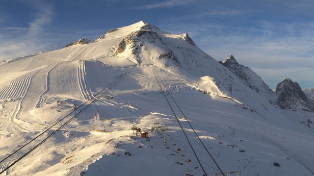
 Good conditions on the Pitztaler glacier in the Austrian Tirol this morning - Photo: pitztaler-gletcher.at
Temperatures are generally a little below normal for early October, with freezing levels typically at 2500-2700m. It is likely to cool down even more next week with the risk of some more significant snow in places, especially in Austria.
11 glacier ski areas are now open across the Alps. In France, this means Tignes, in Switzerland, Zermatt and Saas-Fee. In Italy you can ski at Val Senales and Passo Stelvio, and, in Austria, at Hintertux, Sölden, Stubai, Pitztal, Kaunertal and Mölltal.
Next up is the Kitzsteinhorn glacier in Kaprun, which announced yesterday that it will open on 15 October, Engelberg and Diavolezza (near St Moritz), are then both scheduled to open on 17 October, as is Cervinia, but for weekends only (at least until 31 October). Sölden will also expand its available terrain as of this weekend (until now the available skiing was very limited).
Updated: 9.30am Thursday 8 October 2015 - New snow for the Austrian glaciers
It was a pretty miserable day across the eastern Alps yesterday, but this was good news for the Austrian glaciers where fresh snow was falling.
 Fresh snow and sunshine for the Kaunertal glacier in the Austrian Tirol this morning – Photo: facebook.com/Kaunertaler.Gletscher
This morning, it is still cloudy with a few showers in the central and eastern Austrian Alps. Further west, it is drier with the best of any sunshine at altitude. Lower down, there are still areas of cloud around, but there will be a tendency for it to brighten up across the central and western Alps (if it hasn’t done so already).
Snow conditions on the glaciers are pretty good for the time of year, thanks to the fresh snowfalls that have affected all parts of the Alps to some degree over the last few days.
11 glacier ski areas are now open across the Alps. In France, this means Tignes, in Switzerland, Zermatt and Saas-Fee. In Italy you can ski at Val Senales and Passo Stelvio, and, in Austria, at Hintertux, Sölden, Stubai, Pitztal, Kaunertal and Mölltal.
Next up are the glaciers at Engelberg and Diavolezza (near St Moritz), both scheduled to open on 17 October, as is Cervinia, but for weekends only (at least until 31 October). Sölden will also expand its available terrain as of this weekend (until now the available skiing was very limited).
The long term weather outlook looks quite interesting, with unusually cold air (for the time of year) trying to push into Austria over the weekend, probably edging further east next week.
It is impossible to say how much snow will fall, but there is certainly a chance of some accumulations to relatively low levels over the next two weeks or so. Watch this space!
Updated: 9.55am Wednesday 7 October 2015 - Brightening up in the west, showers further east
There has been yet more snow for some higher parts of the Alps, thanks to the weather fronts that moved in from the west yesterday afternoon.
 Fresh snow and brightening skies above Zermatt - Photo: zermatt.ch
The heaviest snowfalls were in the western Alps, with typically 10-15cm above 3000m in the French Alps, and a dusting (for a time) as low as 2300m.
This morning there are still a few showers to be found across the northern French and northern Swiss Alps, but the bulk of the precipitation is now further east, across Austria, where the glaciers can expect a few cm of fresh snow during the course of the day.
Further west, skies should brighten with good sunny spells expected, especially in the south-west.
11 glacier ski areas are now open across the Alps. In France, this means Tignes, in Switzerland, Zermatt and Saas-Fee. In Italy you can ski at Val Senales and Passo Stelvio, and, in Austria, at Hintertux, Sölden, Stubai, Pitztal, Kaunertal and Mölltal.
Updated: 9.50am Tuesday 6 October 2015 - Highly changeable
After all the excitement surrounding the recent snow, the weather in the Alps turned exceptionally mild yesterday, with freezing levels reaching 3500m in the west.
 View from the Grande Motte glacier in Tignes today - Photo: tignes.net
The central and eastern Alps saw plenty of warm sunshine (in the morning at least), but there was rain further west, with only a little snow on the very highest glaciers (above 3200m or so). Net result: the snowline has been sent scurrying back up the hill (see the contrasting picture of Tignes, taken on Sunday, below).
 View from the Grande Motte glacier in Tignes on 4th October 2015 - Photo: tignes.net
The Alpine weather, however, remains interesting today as an active cold front approaches from the west. Most places will start dry, but rain will reach the French Alps by the middle of the day/early afternoon and continue to spread east this evening and overnight. This rain will be heavy at times with the chance of thunder (especially in the northern French Alps), with the rain/snow limit starting at 3000m or above, but lowering to around 2300-2500m overnight (higher in the southern Alps).
Above 3000m, a further 10-30cm of snow is possible in the western Alps over the next 24 hours. Tomorrow, Wednesday, the focus of the precipitation will be further east - notably in Austria.
11 glacier ski areas are now open across the Alps. In France, this means Tignes, in Switzerland, Zermatt and Saas-Fee. In Italy you can ski at Val Senales and Passo Stelvio, and, in Austria, at Hintertux, Sölden, Stubai, Pitztal, Kaunertal and Mölltal.
Updated: 9.20am Monday 5 October 2015 - Remaining unsettled
The weather in the Alps remains unsettled as we start the new week, with a warm front approaching from the Atlantic. This will deliver some light rain to the western Alps later on Monday, spreading further east overnight. With much milder air in place, any snowfall will be confined to above 3200m.
 Recent snowfalls have been modest in Austria, but there is still good skiing to be had here on the Pitztaler glacier in the Tirol - Photo: pitztaler-gletcher.at
Tomorrow (Tuesday), a cold front will bring heavier precipitation to the northern and western Alps with the rain/snow limit sinking back to 2600m. This front will reach Austria and the eastern Alps early on Wednesday. A relative improvement in the weather is expected later in the week.
Skiers experienced some fabulous early autumn snow conditions over the weekend, particularly in the western Alps where Tignes, Zermatt and Saas-Fee enjoyed new snow and plenty of sunshine. In Austria, recent snowfalls have been more modest, but here too there is some decent skiing to be had, considering it is only early October.
11 glacier ski areas are now open across the Alps. In France this means Tignes, in Switzerland, Zermatt and Saas-Fee. In Italy you can ski at Val Senales and Passo Stelvio, and, in Austria, at Hintertux, Sölden, Stubai, Pitztal, Kaunertal and Mölltal.
Updated: 9.55am Sunday 4 October 2015 - New snow for western glaciers!
The sun has reappeared in the western Alps this morning, following further significant snowfalls that have left the glaciers in Tignes, Zermatt and Saas-Fee in superb condition for the time of year.
 Further snow in Tignes last night - Photo: tignes.net
For the eastern half of the Alps, it’s a cloudier picture today with scattered showers and a little snow at altitude - but not in the same quantities that we have seen over the last couple of days further west
 Plenty of new snow at altitude in the Monte Rosa region - Photo: monterosa-ski.com
11 ski areas are now open across the Alps. As we mentioned earlier, France (Tignes) and Switzerland (Zermatt and Saas-Fee) have the most new snow and the best conditions. You can also ski on the glaciers at Val Senales and Passo Stelvio (Italy), and at Hintertux, Sölden, Stubai, Pitztal, Kaunertal and Mölltal (Austria).
 Snow down to (and below) Plan Maison in Cervinia - Photo: cervinia.it
The weather in the Alps will remain unsettled this week, with further showers and a little high altitude snow here and there.
Updated: 11am Saturday 3 October 2015 - Tignes opens for the 2015-16 season
The Grande Motte glacier above Tignes opened this morning to fresh snow and blue skies! The fine weather won’t last, however, with cloud thickening from the west this afternoon, ahead of another band of rain/snow that will affect much of the Alps over the next 24 hours.
 Fabulous conditions for opening day on the Grande Motte glacier in Tignes - Photo: tignes.net
Yesterday saw plenty of precipitation in the western Italian Alps, which spilled over the border into parts of France and southern Switzerland.
The heaviest snow was in the south-western Italian Alps, from the Milky Way southwards towards the Mediterranean, with reports of up to 50cm of new snow at around 2000m in the Ligurian Alps near Prato Nevoso.
In terms of the open or opening ski areas that have benefited: Tignes, Zermatt and Saas-Fee all saw a useful top-up on their glaciers, which are now in pretty good shape for the time of year. The rain/snow level rose to 2600m by the end of play yesterday in parts of France and Switzerland, but stayed closer to 2000m in the south-western Italian Alps.
This afternoon, further bad weather will reach the western Alps, spreading east to affect most parts by Sunday. The heaviest precipitation will be in the west, where the rain/snow limit will fall from around 2600m to 2000m on Saturday night.
Expect some moderate (locally significant) accumulations of new snow at altitude - great news again for Tignes, Zermatt and Saas-Fee. Further east, the Austrian glaciers will see a little snow tomorrow, but generally in lesser quantities.
Stay tuned for further updates tomorrow…
Updated: 10.20am Friday 2 October 2015 - Further snowfalls for some south-western parts of the Alps
As expected, some south-western parts of the Alps have woken up to further fresh snow this morning, heaviest in the Italian Piedmont (from about the Milky Way southwards), where at altitude we have seen up to 20cm in one or two favoured places.
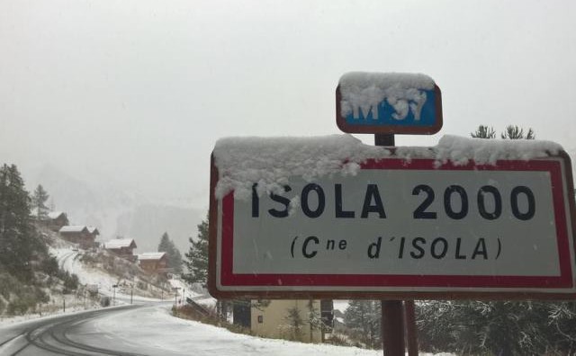 Overnight snow in Isola 2000, but it will be replaced by rain today - Photo: isola2000.com
This snow has spilled over the border into parts of France, notably the Alpes-Maritimes (Isola 2000) as well as southern Switzerland (e.g. Zermatt, Saas-Fee) but, so far at least, only in modest quantities. The overnight rain/snow, which was situated between 1700 and 2200m overnight (lowest on the Italian side), will tend to creep up during the course of Friday.
Talking of today’s weather, low pressure will remain anchored over the Mediterranean, and will continue to spin showers or longer spells of rain/snow into the western Italian Alps and some adjacent border areas. Any snow will generally fall above about 2000-2300m on the Italian side, but rising to 2300-2600m on the French/Swiss side.
 Significant snowfall at altitude in the Italian Milky Way today - Photo: vialattea.it
With the flow now more south-easterly orientated, the northern side of the Alps will benefit from an increasing Foehn effect with good sunny spells and much higher temperatures. Indeed the mercury could reach 22°C today in the lower valleys of the northern Austrian Alps.
In terms of open or opening ski areas, Zermatt, Saas-Fee and Tignes (opening tomorrow) are likely to be the only beneficiaries in the next couple of days, though some of the more eastern glaciers could also get a top-up as the bad weather moves erratically north-eastwards later in the weekend. Stay tuned for updates.
Right now you can ski on 10 Alpine glaciers. In Austria, this means Hintertux, Sölden, Stubai, Pitztal, Mölltal and today, for the first time, Kaunertal. In Italy, the two options are in Val Senales and Passo Stelvio and in Switzerland, Zermatt and Saas-Fee. The Grande Motte glacier above Tignes is scheduled to open tomorrow, Saturday.
Updated: 9.20am Thursday 1 October 2015 - A few showers for south-western Alps
Sandwiched between high pressure to the north and low pressure over the Mediterranean, the Alps remain under the influence of a cool and moderately humid easterly airstream. Many places will be dry today, but there is an increasing risk of showers in the south-western Alps, with a little snow above 1800m. The highest risk of showers is in the western Italian Alps - especially in the Piedmont region (e.g. Sestriere).
 Kaunertal, in the Austrian Tirol, opens tomorrow - Photo: kaunertaler-gletscher.at
Elsewhere in the Alps, except for one or two light showers (mostly close to the Italian border) many places will remain dry, with the best of any sunshine at altitude and in the north.
Right now you can ski on nine Alpine glaciers. In Austria, this means Hintertux, Stubai, Sölden, Pitztal and Mölltal (Kaunertal opens tomorrow). In Italy, there are two options - Passo Stelvio and Val Senales, and two more in Switzerland - Zermatt and Saas-Fee.
There is no lift-served skiing currently available in France, but Tignes will open its Grande Motte glacier on Saturday 3 October. There is the chance of a moderate snowfall up on the glacier tomorrow, which is great timing, though the weather may remain cloudy through the weekend.
Indeed, showers will become more generalised across the south-western Alps tomorrow, spilling over the border into part of the French and southern Swiss Alps (e.g. Zermatt/Saas-Fee). However, as always with these “Retour d’Est” situations, snowfall amounts are extremely difficult to forecast.
One thing we do know for sure is that temperatures will start to rise, with the rain/snow limit in the region of 2300-2700m by the end of Friday, and this warming trend continuing over the weekend.