

ARCHIVE
Today in the Alps - November 2023
Read about current weather and snow conditions in the Alps
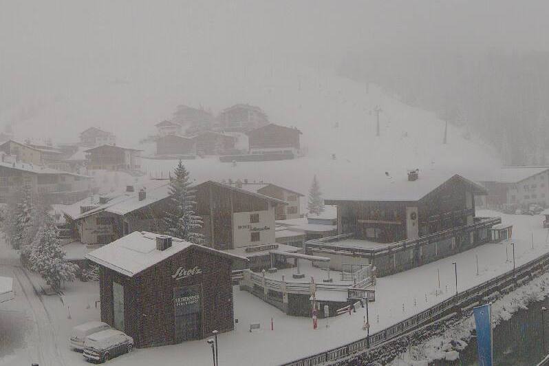
Updated: 9.30am Thursday 30 November 2023 - Snow, rain and wind in the Alps today!
A new storm is underway, this time affecting all parts of the Alps: north, south, east and west. As this storm has some milder air mixed in, it makes for a very complicated forecast, especially in relation to the rain/snow line.
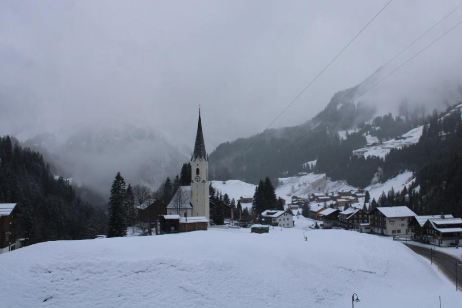
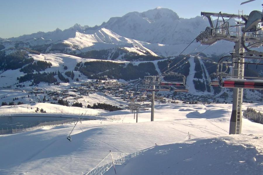
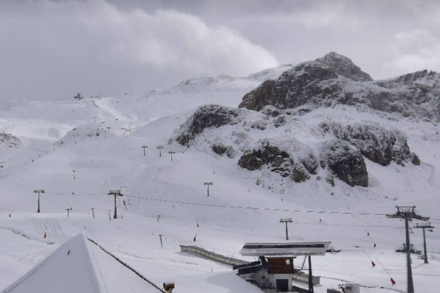
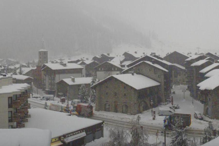 Snow in Val d’Isère this morning, which will turn to rain before turning back to snow later tomorrow - Photo: valdisere.com, 30 November 2023
The heaviest of today’s precipitation will fall in the western Alps, notably in France. Over the course of tomorrow, the focus of the storm will shift further east, with Austria taking the brunt of the precipitation late on Friday and on Saturday.
The rain/snow limit will be all over the place throughout this storm. This morning it is still quite low in some sheltered internal valleys, but generally around 2300m in the more exposed areas of the western Alps (France, western Switzerland). Further east in the Alps, it will be a bit lower but the same principles apply, namely that it will snow for longer at lower altitudes in the more sheltered internal valleys of the Alps, but turn to rain quicker in the more exposed areas as the milder air takes hold.
On Friday the rain/snow limit will lower again from the north, but it may be Saturday before most or all the Alps is back in the colder air.
A lot of new snow is expected at altitude in the Alps over the next two to three days. Lower down there will a thaw in many areas, at least temporarily, the severity of which will vary enormously from place to place.
Updated: 2pm Wednesday 29 November 2023 - Complex new storm approaching the Alps!
The weather in the Alps is about to get very interesting, with a complex new storm set to reach the western Alps tonight which will affect all areas to a greater or lesser extent over the next two or three days.
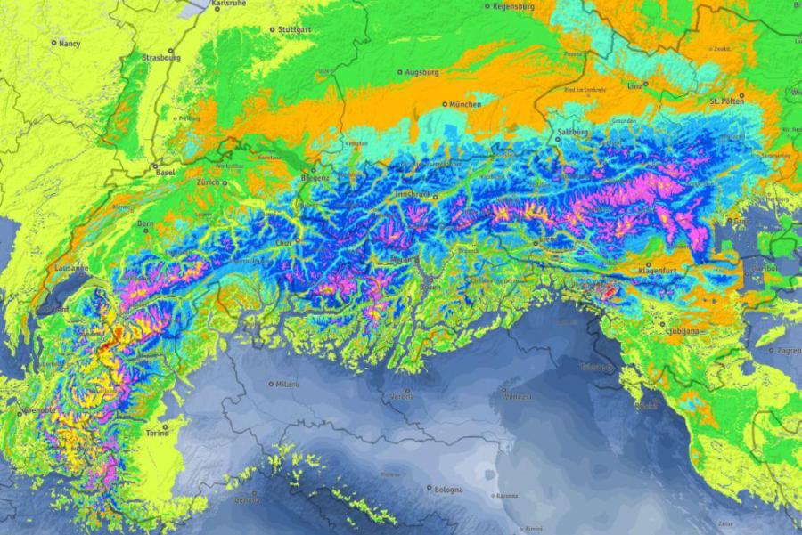 Significant accumulations of snow are expected at altitude right across the Alps across the next few days. The brighter yellows and reds in this chart show where the greatest accumulations are likely between now and Saturday - Image: bergfex.com, 29.11.20
This new storm is extremely complicated to forecast because the rain/snow line will be all over the place. It will generally start very low on Wednesday night (at which point the heaviest precipitation will fall in the western Alps) and will stay low for a while in the more enclosed valleys, including areas around Bourg Saint Maurice and Chamonix. However, on mountains more exposed to the west (e.g. Avoriaz) it will quickly rise, with rain falling to 2000m or higher later on Wednesday night.
On Thursday, the rain and snow will move steadily further east reaching most parts of the Alps over the course of the day. The rain/snow limit will again start low in the more enclosed valleys of the central and eastern Alps, but will soon rise to 2200-2400m across the western Alps (e.g. France). It will also rise further east, albeit more slowly.
All in all, a significant loss of snow can be expected at lower altitudes over the next couple of days, especially in the western Alps, though it will probably not be as acute as during the last ‘rainy thaw’ the other week. This milder interlude won’t last too long either, with rain tending to turn back to snow on Friday, at first in the north, then later further south.
Between now and Sunday morning we can expect a lot of new snow at altitude across the Alps, perhaps 60-90cm (or even more) above 2200m in parts of the western Alps, but more generally 30-50cm. The risk of avalanche will become very high and flooding could again be an issue lower down.
Updated: 9am Tuesday 28 November 2023 – More snow for many northern parts of the Alps!
As expected, a new storm has brought significant snow to many northern parts of the Alps, this time heaviest in the north-west, especially in the northern French Alps.
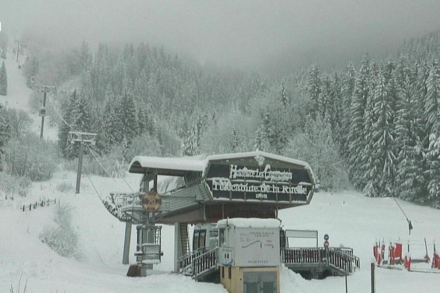 Significant snow to low levels in the northern French Alps this morning. This is Hauteluce (linked to Les Contamines) – 28 November 2023 – Photo: lescontamines.com
There are still frequent snow flurries to low levels across the northern half of the Alps this morning, which will gradually die out from the west later but will continue throughout the day in the eastern Swiss and Austrian Alps. The southern half of the Alps is drier with some sunny spells.
By the end of today, 36-hour storm totals will be in the region of 20-40cm across much of the northern Alps, but as much as 40-50cm across the Austrian Arlberg/Vorarlberg and some parts of the northern French Alps.
After a temporary lull tomorrow (Wednesday), a new storm will reach the Alps later in the day which will continue to influence proceedings on Thursday and Friday. This storm is more complicated to forecast and will affect a wider swathe of the Alps (including the south). However, it will drag some warmer air in for a time, meaning that some rain is possible to 2000m or so in places, albeit temporarily. Stay tuned!
In the meantime, snow cover is impressive for the time of year across many northern parts of the Alps, all the way from France (e.g. Val d’Isère, Flaine, Avoriaz), through the Swiss Alps (e.g. Mürren, Engelberg, Klosters) and into much of Austria (e.g. St Anton, Kitzbühel, Obertauern).
By contrast, snow cover is generally a bit more hit and miss in the southern Alps, especially in the far south-west (e.g. Bardonecchia, Auron).
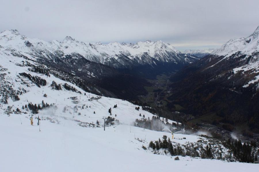
Updated: 11am Sunday 26 November 2023 – Very snowy across some northern parts of the Alps…
As expected, the current ‘northerly’ storm has dumped considerable quantities of snow across much of the northern Alps, especially the central-northern and north-eastern Swiss Alps (e.g. Engelberg) and Austrian Alps (e.g. St Anton, Kaprun, Saalbach). Indeed, parts of the western Tirol and Vorarlberg (e.g. St Anton, Lech) and the far east of Switzerland have seen as much as 1m of new snow since Friday.
 Cold and snowy this morning in Obertauern where early season snow conditions are superb – 26 November 2023 – Photo: foto-webcam.eu
Today there are still some residual flurries to low levels across the north-eastern Alps (i.e. Austria) but all eyes are already on the next storm which will move in from the north-west later tomorrow.
This new storm will deliver significant snow to the northern Alps again, late on Monday and on Tuesday. However, this time it should be the northern French Alps that will see the most snow with a secondary hotspot in and around the Austrian Arlberg/Vorarlberg area, where resorts such as Lech and Warth-Schröcken, and the likes of Avoriaz, Flaine, Val Thorens and Tignes could see another 30-40cm of snow.
The weather will then remain unsettled throughout the rest of next week, with the possibility of snow later in the week in the southern Alps, which have largely missed out on the recent snowfalls.
For more on snow conditions across the Alps, tune in later today for our first detailed snow report of the 2023-24 ski season…
Updated: 11am Friday 24 November 2023 - Significant snow for some northern parts of the Alps…
An unstable arctic airflow will reach the Alps today, bringing snow to increasingly low levels across many northern regions today and tomorrow.
 New storm today with as much as 70cm of new snow expected in the Austrian Vorarlberg over the next couple of days. This is Schröcken – 24 November 2023 – Photo: warth-schroecken.at
The central-northern and north-eastern Alps will do best from this storm, with the Arlberg/Vorarlberg (e.g. Lech, Warth-Schöcken, St Anton) likely to hit the jackpot, with 70cm+ of new snow by Sunday morning.
More generally, the northern Austrian Alps (e.g. Saalbach, Kaprun, Kitzbühel) will see around 40-60cm, as will some central/eastern parts of the northern Swiss Alps such as Engelberg and Braunwald, with a bit more in places. The north-western Alps will see less though, with perhaps just 5cm for the likes of Verbier, Avoriaz and Val d’Isère. The southern Alps will also largely miss out.
Wherever you are though it will turn noticeably colder over the next couple of days with the rain/snow limit falling from around 1300m at first today, to 400m or so tonight and tomorrow.
After a slight reprieve late on Sunday, a new storm will move in from the north-west early next week, with temperatures remaining on the cold side, and further snow set to fall on Monday and Tuesday, again mostly in the northern half of the Alps.
All things considered, it is a promising start to the season in the Alps, though it is still a month away from peak season and it is well known how fast things can unravel at this time of year.
That said, there is already a solid base at altitude in many resorts, especially in Austria where the likes of Obergurgl, Obertauern, Sölden, Ischgl, St Anton and Lech/Zürs are virtually guaranteed a good start to the season, especially given the snow that is forecast over the next few days. Many lower resorts in the eastern Alps such as Kitzbühel and Saalbach are also heading in the right direction, but it’s still far too early to be sure.
Elsewhere in the Alps, as things stand, a high-altitude ski area (e.g. Zermatt, Cervinia, Tignes, Val Thorens) is still essential to ensure decent early-season skiing conditions. Lower down, snow cover is still patchy (e.g. Portes du Soleil), though this is entirely normal at this time of year and significant snow is likely to fall in the north-western Alps early next week.
The southern Alps (e.g. Dolomites, Milky Way) may need to wait a bit longer for a good snowfall, but the Dolomites, at least, are world experts at snow-making and will benefit greatly from the expected drop in temperatures.
Updated: 9am Thursday 23 November 2023 - Calm before the new northerly storm…
It’s a quiet day of weather across the Alps, with plenty of sunshine (at least at altitude) and just some ‘nuisance-value’ cloud here and there, especially in the valleys.
 Ski tourers skiing up the yet to open pistes of Obertauern today – 23 November 2023 – Photo: foto-webcam.eu
Tomorrow, a blast of cold and unstable arctic air will start to make itself felt with some snow in the northern Alps, falling heaviest in the eastern Swiss and Austrian Alps. The rain/snow limit will descend from around 1100-1300m to very low levels by Friday night.
The snow will continue into Saturday, always heaviest in the central-northern and north-eastern Alps where as much as 50-70cm of new snow is possible by Sunday morning in the Austrian Arlberg/Vorarlberg (e.g. Warth-Schröcken, Lech). More generally, the central-eastern side of the northern Swiss Alps (e.g. Engelberg, Laax) and the northern Austrian Alps (e.g. Saalbach, Kapurn) will see 30-50cm by the early hours of Sunday.
During this period, the north-western Alps (e.g. Tignes, Avoriaz, Verbier) will see much less snow (only a few centimetres), while many southern regions will miss out completely, especially in the far south-west (e.g. Sestriere, Isola 2000).
Approximately two dozen resorts are partially open for skiing across the Alps right now, with this number set to increase significantly this weekend.
Among the best bets this week in terms of extent of open terrain are Sölden and Obergurgl in Austria, and Zermatt and Saas-Fee in Switzerland. However, Ischgl (Austria) is likely to eclipse them when it opens a large part of its very considerable ski area this weekend (weather-permitting).
As things stand, glaciers aside, the higher Austrian resorts are the ones we would be looking to if we were considering an early or mid-December ski trip (i.e. Lech, St Anton, Warth-Schröcken, Obergurgl, Ischgl, Sölden, Obertauern). That’s not to say there isn’t any good skiing elsewhere in the Alps but, given the forecast, those are the resorts that are most likely to be in excellent shape.
Updated: 10am Wednesday 22 November 2023 – Major snow to end the week in some northern parts of the Alps…
A weak cold front is currently straddling the northern Alps, bringing a few showers or flurries here and there, principally in the western Austrian Alps (e.g. Lech, St Anton), with a rain/snow limit close to 1000m. Snowfall totals will be very modest though, and most of the Alps will stay dry today with variable cloud and the best of any sunshine in the south.
 Light snow flurries in Warth-am-Arlberg this morning, where 60cm+ is set to fall between Friday and Sunday – Photo: warth-schroecken.at, 22 November 2023
After a relatively calm day on Thursday, a more active cold front will arrive from the north on Friday. This will introduce a couple of days of very wintry weather for some northern regions, chiefly the northern Swiss and northern Austrian Alps, where significant snow is expected to low levels between Friday and Sunday.
During this period we are expecting 5-10cm across the northern French and far western Swiss Alps (e.g. Avoriaz, Verbier), 25-50cm across the central northern and north-east Swiss Alps (e.g Engelberg, Klosters), 30-70cm across the northern and western Austrian Alps (e.g. Kaprun, Saalbach, Ischgl, Lech, St Anton), with the deepest falls most likely (again) in the Austrian Arlberg/Vorarlberg region (St Anton, Lech, Warth-Schröcken).
The further south and west you are in the Alps, the less snow you will see from this storm, with resorts such as Isola 2000 and Sestriere in the far south-west missing out completely, at least up to and including this weekend. The far south-east (Dolomites) will also stay largely dry, though a centimetre or two is possible here on Saturday.
Whatever the case it will also turn noticeably colder with the rain/snow limit falling to very low/all levels by Saturday.
Approximately two dozen resorts are partially open for skiing across the Alps right now, with this number set to increase significantly this weekend.
Among the best bets this week in terms of extent of open terrain are Sölden and Obergurgl in Austria, and Zermatt and Saas-Fee in Switzerland. However, Ischgl (Austria) is likely to eclipse them when it opens a large part of its very considerable ski area this weekend (weather-permitting).
As things stand, glaciers aside, the higher Austrian resorts are the ones we would be looking at if we were considering an early or mid-December ski trip (i.e. Lech, St Anton, Warth-Schröcken, Obergurgl, Ischgl, Sölden, Obertauern). That’s not to say there won’t be some good skiing elsewhere in the Alps but, given the forecast, those are the resorts that are most likely to be in excellent shape.
Updated: 2pm Monday 20 November 2023 – Temperatures are turning cooler in the Alps, after a very mild weekend…
The weather in the Alps is relatively calm today, with variable cloud cover, some good sunny spells (especially at altitude in the east) but also some stubborn areas of cloud trapped in some of the valleys.
 Some good empty piste skiing in Val Thorens today, though natural snow depths are clearly modest thanks to the very mild weekend – Photo: valthorens.com, 20 November 2023
Weak weather fronts will reach the northern Alps tonight, lingering tomorrow and bringing a few centimetres of snow in places, mostly on the north-eastern side of the Alps (Austria) with a rain/snow limit dropping to between 1000 and 1300m.
All eyes are then on next weekend, when a much more potent northerly airflow is likely to bring heavier snow to the northern Alps, especially in Switzerland and Austria. Watch this space…
As for snow conditions right now, they are very mixed. Much of the considerable snow that fell in the Arlberg last week (60cm+) has already melted again, at least at lower altitudes, thanks to another period of very mild and (for a time) rainy weather over the weekend.
That said, snow depths remain relatively impressive at higher altitudes across a good swathe of the Alps, especially in the higher resorts of the French Alps, where Tignes and Val Thorens have both opened early, despite the weekend’s milder weather having clearly thinned any natural snow cover lower down.
Glaciers aside, the best skiing right now is probably to be found in the higher intra-Alpine Austrian resorts such as Sölden and Obergurgl, whose geographical location deep in the central/eastern Alps has allowed them to escape the worst excesses of the incursions of warm Atlantic air.
Updated: 9am Friday 17 November 2023 - Up to 60cm of new snow in the Arlberg by the end of today…
The latest storm to hit the Alps is now in full swing, with heavy falling across some northern parts of central-northern regions, especially in eastern Switzerland and western Austria.
 Heavy snow in Lech this morning, where up to 60cm is possible at altitude by the end of today – 17 November 2023 – Photo: lechzuers.com
24-hour storm totals in the Austrian Arlberg (e.g. Lech, St Anton) could reach 60cm above 2000m by the end of today, with a rain/snow limit lowering to well under 1000m.
Most other northern parts of the Alps have also already benefited from this storm, or will benefit today, to a to a great or lesser extent, generally lesser in the north-western Alps (e.g. Avoriaz) which will see just a few centimetres of new snow at best, and more typically 10-30cm across a wide swathe of the northern Swiss Alps, and northern and western Austrian Alps.
The weather will remain unsettled in the Alps over the weekend, but will turn warmer again for a time, with some rain falling as high as 2500m on Saturday night across the northern Alps. Temperatures will drop again next week though, with a few light flurries in places.
Around 15 resorts are currently open for skiing in the Alps, with a few more opening at weekends. Most of these still involve glaciers, but there are a few non-glacial exceptions, notably Obergurgl which now has 15/75cm of settled snow depending on altitude and 16 lifts open. Perhaps the best option in the Alps right now though is nearby Sölden, which has over 90km of runs open on both glacial and non-glacial terrain.
Next weekend (24/25 November) will see a few “big” new winter season openings, including Ischgl, Val Thorens and Tignes, the latter two being the first of the French resorts for winter 23/24.
Updated: 11am Thursday 16 November 2023 - New storm, most favouring Arlberg tomorrow…
A new storm has reached the western Alps this morning and will progress eastwards over the next 24 hours.
 Plenty of snow at altitude in the Austrian Arlberg. This is St Anton – 16 November 2023 – Photo: foto-webcam.eu
Once again, it will mostly affect the northern half of the Alps, with a rain/snow limit generally above 2000m this afternoon, falling towards 1500m this evening, and further still to 700-1100m tomorrow.
The areas that will benefit most are the north-eastern Swiss Alps (from about Engelberg eastwards) and the western Austrian Alps, especially the Arlberg (e.g. Lech, St Anton). These regions will see 30-50cm of new snow above 1800m between tonight and tomorrow. The western Swiss Alps (e.g. Verbier) and northern French Alps (e.g Tignes) will see closer to 10cm, while the southern half of the Alps will miss most of the precipitation.
Snow depths remain decent for the time of year at higher altitudes across most of the Alps, despite Tuesday’s rain, which saw the rain/snow limit close to 3000m for a time in the north-western Alps. Lower down, snow cover is very patchy or non-existent, but this is not remotely unusual for mid-November.
We will bring you more details on what resorts are open or opening up this weekend tomorrow…
Updated: 9.30am Tuesday 14 November 2023 - Very wet in the north-west…
The threatened milder and rainier weather forecast for the north-western Alps duly arrived on Sunday night, and another new intensive period of rain is now forecast for the same region again later today.
 Rain today to 2800m or more in Villars where a lot of the lower-lying snow will disappear. This is Les Chaux at 1800m – 14 November 2023 – Photo: villars.ch
This rain will be heaviest in the northern French Alps (e.g Grand Massif, Portes du Soleil) and the western/north-western Swiss Alps (e.g. Villars, Gstaad) but will also be significant across the entire northern Swiss Alps (e.g. Mürren, Engelberg), stretching into western Austria (e.g. Arlberg, northern Tirol).
The rain/snow limit will be become very high today, between 2700-2900m in the west, but a bit lower (2500m) in western Austria, before it falls to 2000m or lower tonight.
Most of any lying snow in the more exposed parts of the north-western Alps can be expected to disappear below 1800-2000m or so, although they will see a dusting of fresh snow again tonight as temperatures drop. Flooding will be an issue in places though.
This rain will be less of an issue for the highest resorts of the north-western Alps, such as Tignes, Val d’Isère and Val Thorens, which already have a solid base at altitude. As is often the case in these rainy, warm front scenarios, the further south-east you are in the Alps, the less of an issue any rain will be, with the Dolomites escaping completely for example.
After a relative reprieve late on Wednesday and early Thursday, further storms will affect the northern and western Alps later in the week with a rain/snow limit initially quite high again. But dropping towards or below 1000m by the end of the week.
Updated: 11.20am Friday 10 November 2023 - More snow but much milder next week…
A cold front is moving across the Alps today, bringing snow to relatively low levels, heaviest in the west. After a relative reprieve tomorrow, further storms will move in from the west overnight on Saturday.
 Looking very snowy early this morning in Châtel (1200m), but don’t get too excited as rain is on the cards later in the weekend and early next week – Photo: chatel.com, 10 November 2023
The weather will remain very unsettled in the Alps on Sunday, and into the first part of next week though, with much milder air in the mix, rain will increasingly become an issue, especially in the north-west.
Over the next few days, there will be a lot more snow in the higher resorts of the western Alps, especially in the French Tarentaise (e.g. Val Thorens, Tignes), where another 50-70cm is possible above 2000m by Sunday night. Most of the rest of the Alps will also see some new snow over the next 2-3 days, but with a general rule that the further south-east you are, the less there will be.
The rain/snow limit will typically be around 1000m over the next couple of days before starting to rise on Sunday, reaching 2500-2800m in the western Alps on Monday!
So, with snow depths already quite impressive at altitude in the north-western Alps (e.g Val d’Isère, Tignes, Verbier) and more in the forecast, the upper parts of these resorts have almost certainly already secured their early bases. Lower down in areas like the Portes du Soleil, however, a lot of this early snow will disappear next week.
In general, the further south and east you are, the less of an issue any rain will be next week, with the Dolomites, for example, escaping it completely. Although resorts in the south-eastern Alps may not have as much snow at altitude as some in the north-western Alps right now, by escaping most of next week’s rain, they will more easily hang on to it, relative to their height.
Updated: 10am Wednesday 8 November 2023 – A new storm cycle starts tomorrow…
After a relatively quiet few days in the Alps, a new storm cycle is set to begin tomorrow, with a succession of weather fronts moving in from the west.
 Looking good today in Les Saisies, France, though some of this snow will melt again next week as temperatures climb – Photo: lessaisies.com, 8 November 2023
This new storm cycle will most favour the north-western Alps, with another 50-80cm of new snow possible above 2000m by Sunday in the northern French Alps (e.g. Tignes, Val Thorens, Avoriaz) as well as the western Swiss Alps (e.g. Verbier).
Other regions including parts of Switzerland away from the far south (e.g. Engelberg, Mürren), the western Austrian Alps (e.g. Lech), and the far north-west of Italy (e.g. La Thuile) will also see significant snow at altitude over the next few days (30-50cm) but, on the whole, the further south-east you are, the less snow there will be.
During this period the rain/snow limit will typically sit between 1000m and 1600m, perhaps a bit lower for a time later in the week and early next weekend. However, early next week it may rise significantly.
Right now, there is significant snow cover at altitude across much of the Alps, especially in the north-west where some sort of base is already assured in resorts such as Val d’Isère and Val Thorens. Lower down, as you would expect, the picture is much more mixed, and it is far too early to pass any judgment on how things will pan out come the season “proper” in a month or so’s time.
Today it is possible to ski (on a limited basis) in around a dozen or so resorts, most of these being glacier areas such as Zermatt, Saas-Fee, Hintertux and Sölden. Sulden in Italy is the stand-out non-glacial exception.
Updated: 10am Monday 6 November 2023 – A quieter spell in the Alps…
The weather in the Alps is entering a quieter spell which will last until Thursday, following which, new Atlantic storms will bring further snow to some regions. This will most likely be heaviest in the west, though it is too early to know exactly how potent these storms will be.
 Encouraging early season snow conditions high up in Val d’Isère which opens on 2 December 2023 – Photo: valdisere.com, 6 November 2023
Until then, the Alps will enjoy some pleasant weather with some cloud at times but also some sunny spells. There will be the odd shower or flurry around, most likely tomorrow in the northern Austrian Alps, however any snowfalls will be insignificant.
Right now, there is quite a lot of snow on the ground at higher altitudes in the Alps. Over the weekend, the heaviest snow fell in the north-western Alps, including the high resorts of the northern French Alps (e.g. Tignes, Les Arcs, La Rosiere, Chamonix), the higher resorts of the western Swiss Alps (e.g. Glacier 3000, Verbier) and the far north-west of Italy (e.g. Courmayeur, La Thuile). Some of these areas saw close to 1m of new snow above 2300m, with a rain/snow limit typically around 1500-1800m, but a bit lower later in the weekend.
Most of the rest of the Alps also have an encouraging amount of snow at altitude though, on the whole, it is nothing to get excited about below 2000m or so yet. It is only areas above about 2300m that can now be reasonably sure of a lasting base into the main season.
Updated: 10.30am Saturday 4 November 2023 – The Alps are currently between storms!
It is a bright start across the eastern Alps today, though cloud is already thickening further west, heralding the arrival of the next Atlantic storm which will bring further significant quantities of snow to some parts of the Alps.
 New snow in Lech today – 4 November 2023 - Photo: lech-zuers.com
The areas that will see the most snow this weekend are the western Alps, especially the higher French resorts, with another 40-60cm of new snow likely above 2000m in the likes of Chamonix, Tignes, La Plagne, and Val Thorens. The western Swiss Alps (e.g. Verbier) and far north-western Italian Alps (e.g. La Thuile, Courmayeur) will also do well over the next couple of days, with 30-50cm at altitude by the end of Sunday.
More generally though, the further east you are the less new snow there will be, with just a few centimetres expected in Austria and the Dolomites, for example, most of which will fall on Sunday.
The rain/snow limit will initially be on the rise, reaching 2000m or so in the more exposed resorts of the western Alps later today (but staying lower in the enclosed valleys such as in the Swiss Valais) before falling back towards 1500m again later in the weekend.
All this new snow is great news for the higher resorts of the Alps where a base is now starting to form. However, for most Alpine resorts it is still too early to be getting excited.
We will be back with a more detailed analysis of what this all means for early season snow conditions in the Alps on Monday…
Updated: 9am Friday 3 November 2023 - More snow for the Alps!
The weather in the Alps remains very unsettled. This morning, the eastern Alps are seeing showers or longer spells of snow (rain/snow limit 1000-1400m), while the western Alps have somewhat drier weather, though are still mostly cloudy.
 New snow to 1200m in Châtel this morning – 3 November 2023 – Photo: chatel.com
Later today, the rain and snow will clear the eastern Alps but showers (snow 1000-1200m) will return to the western Alps delivering a few more centimetres at altitude here and there.
Over the weekend, new, more active weather fronts will arrive from the Atlantic bringing further significant snow to the Alps, mostly in the west (i.e. the French Alps and western Swiss Alps). The rain/snow limit will temporarily rise towards 2000m in places on Saturday before falling to 1500m or lower again later in the day and on Sunday.
As mentioned in our summary yesterday, the areas that have benefited/or are benefiting most from the current storm are the higher French resorts where around 40cm of snow has fallen above 2300m in the Tarentaise (e.g. La Plagne, Tignes) and the central-southern Alps (e.g. Livigno, Obergurgl) where it is still snowing as we speak.
Over the weekend we can expect another 20-40cm of new snow at altitude in some western parts of the Alps, especially in the high French resorts but also in some western parts of Switzerland (e.g Verbier). Other Alpine regions will also see some new snow but generally less the further east and south-east you are.
All in all, it’s an encouraging start to the season if you are planning an early ski break in a high resort (with plenty of terrain above 2300m). For the vast majority of resorts, though, it is still far too early for these storms to be of any significance.
Updated: 11am Thursday 2 November 2023 - Significant snow at altitude in the Alps!
The weather in the Alps remains very unsettled today, with a new storm crossing the Alps from west to east which will deliver significant snow at altitude to many regions.
 Snow at altitude in Ischgl today, with more in the forecast – Photo: ischgl.com, 2 November 2023
This storm will particularly benefit the higher resorts of the French Alps (including Tignes, Val d’Isère, Val Thorens and Les 2 Alpes) where 30-40cm is expected above 2300m by the end of tonight with a rain/snow limit starting at around 2300m but falling to 1000m or so during the early hours of Friday.
The second main area to benefit will be a swathe of the central-southern Alps including resorts such as St Moritz, Livigno, Passo Tonale and Obergurgl. These areas should also see at least 40cm (above 2300m) later today and overnight but, due to milder air hanging on a bit longer, it will be tomorrow morning before we see the snow-line finally dip towards 1200m.
Most other parts of the Alps will also see a significant fall of snow at altitude over the next 24 hours, with typically 20-40cm above 2300m, though the far south-west (e.g. Isola 2000) will only see a few centimetres at best. The rain/snow limit will remain highest for longest in the far south-east (Dolomites) but, even here, there will be a decent fall of snow higher up tonight.
It’s still too early for all this snow to mean much in terms of how the main winter season might pan out, however, it does mean that all the glaciers will now be in good shape. Some higher non-glacial terrain (such as the higher sectors of Val d’Isère/Tignes, Val Thorens, Cervinia, Obergurgl and Ischgl) should also now have secured a lasting base.