

ARCHIVE
Today in the Alps - November 2022
Read about current weather and snow conditions in the Alps
Updated: 10.45am Wednesday 30 November 2022 - Plenty of good piste skiing on offer in the Alps…
The Alps are currently under the influence of a mostly dry but relatively cool easterly airflow. Today will see variable cloud cover and the best of any sunshine at altitude. The odd light snow flurry cannot be completely ruled out, especially in the eastern Dolomites.
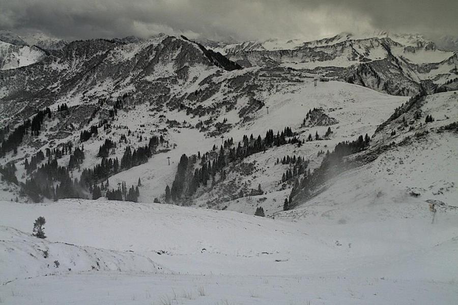
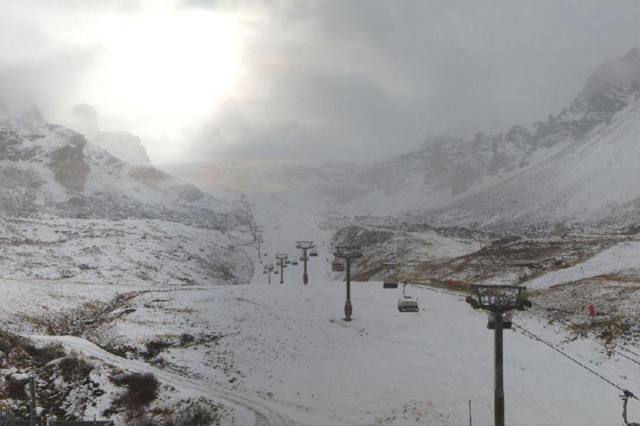
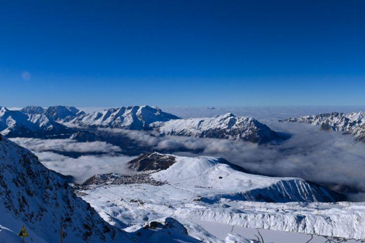 Nice weather today at altitude in Alpe d’Huez, which has snow down to resort level – 30 November 2022 – Photo: alpedhuez.com
Looking a bit further ahead, the weather in the Alps will remain mostly dry for the remainder of the week but rather cloudy at times with the chance of the odd flurry here and there, especially in the south. The weather models are currently indicating some more significant snow at the weekend across the southern Alps (e.g. Italian Alps) but this is subject to change.
As for snow conditions in the Alps, they are quite good at altitude with plenty of enjoyable on-piste skiing on offer. However, snow depths remain relatively modest with 35cm of settled snow at 2900m in Zermatt, 56cm at 3000m in Val d’Isère (opening this weekend), 40cm at 2300m in Ischgl, and 55cm at 2600m in Obergurgl.
Updated: 10am Tuesday 29 November 2022 - Another modest snowfall for many…
A weakening weather front has stalled over the Alps today, having already brought a few centimetres of snow overnight to the western Alps (5cm in Val d’Isère, for example) with a little more possible almost anywhere today.
 Val d’Isère saw another small snowfall (5cm) last night – Photo: valdisere.com, 29 November 2022
The heaviest of today’s snow is most likely to fall in the central-eastern Swiss and far western Austrian Alps, however, where resorts such as Lech may see an additional 5-10cm of snow. The rain/snow limit will typically be between 1000m and 1300m.
With winds turning to the east, for the rest of the week the weather in the Alps will be mostly dry but often rather cloudy. Some snow is possible in the southern Alps, but it won’t be widespread, most likely falling in the Dolomites. The best of any sunshine will be found the further west and south-west you are (e.g. Milky Way).
Snow conditions at altitude are quite good for the time of year, with some excellent piste skiing on offer when the fog clears in the likes of Tignes, Val Thorens, Zermatt, Engelberg, Ischgl, Sölden and Obertauern. However, snow depths do remain quite modest, so off-piste is not recommended. More snow is still needed lower down before many resorts can relax, although conditions will be conducive to snow-making which will help.
Updated: 1.15pm Sunday 27 November 2022 – Great weather and snow conditions in the Alps this weekend…
It has been a good weekend of weather for most of the Alps, which is great news for those resorts that have seen their season openings this weekend, including major ones like Tignes, Val Thorens and Ischgl.
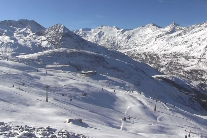
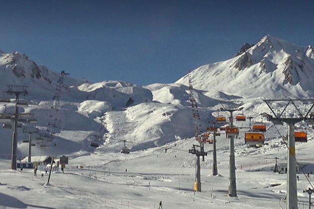 Ischgl offers the greatest extent of piste skiing of any resort in the Alps right now (101km) despite relatively modest 40cm upper snow depths – 27 November 2022 – Photo: ischgl.com
The next snow is due to fall later tomorrow and on Tuesday and although falls will be widespread, they will generally be light with just a few centimetres at most here and there.
Conditions in the Alps are pretty good right now despite there not being a huge amount of snow, with the regular small snowfalls over recent days and weeks allowing some excellent piste skiing in the 40 or so areas that are open this weekend. Skiers’ enjoyment of the slopes has no doubt also been boosted by this weekend’s fine weather.
But before we get too excited, snow depths generally remain very modest lower down, especially in the far south-western Alps, including resorts such as Bardonecchia and Auron, which have yet to open. Plenty more snow will be needed over the next few weeks to secure a good early season base.
Updated: 11.30am Friday 25 November 2022 – Looking better for a big weekend of new opening…
Much of the Alps will remain dry today with sunny spells, the best of which will be in the south. It will tend to cloud over further north, with some light showers or flurries (snow 1200-1400m) this afternoon in the northern French Alps (e.g. Avoriaz) and north-western Swiss Alps (e.g. Wengen). These will spread further east into the northern half of the Austrian Alps tonight.
 Looking good for opening tomorrow in Val Thorens thanks to a mixture of natural and artificial snow – Photo: valthorens.com, 25 November 2022
Snowfall totals in the next 24 hours will be very modest, with just 2-4cm across the northern Alps, including the likes of Tignes, Val Thorens, Flaine, Avoriaz, Wengen, Engelberg, Lech and Kaprun.
Some flurries will linger in the north-eastern Austrian Alps for a time tomorrow otherwise most of the Alps can look forward to quite a nice weekend of weather with some good sunny spells.
The weather will turn more unsettled again early next week with some further mostly light snowfalls likely in places late on Monday and on Tuesday, especially in the western Alps. Temperatures will be on the cool side with a rain/snow limit not far from 1000m.
Snow conditions in the Alps have been improving bit by bit over recent days and weeks, with many high resorts now having a nice covering of natural snow, even if depths remain modest. Lower down, some resorts are now also looking more wintry, however, there is still plenty of “work” to be done to ensure reliable good early season conditions. That said, with no abnormally mild weather on the cards any time soon, conditions for snowmaking should be excellent for the foreseeable future meaning that, on-piste at least, we can be reasonably confident that early December will offer plenty of good skiing.
Obviously, it normally pays to be on higher slopes at this time of year, with most skiers looking at resorts with glaciers and/or plenty of terrain above 2500m, however, the benefits of state-of-the art snowmaking in lower resorts should not be underestimated. This weekend sees the Dolomite resorts starting to open up, with most of the Dolomiti Superski area due to be up and running the weekend after. These resorts had a nice snowfall last Tuesday (30-40cm) which combined with the best snowmaking in the world pretty much guarantees you great piste skiing conditions in a way that even some higher resorts cannot.
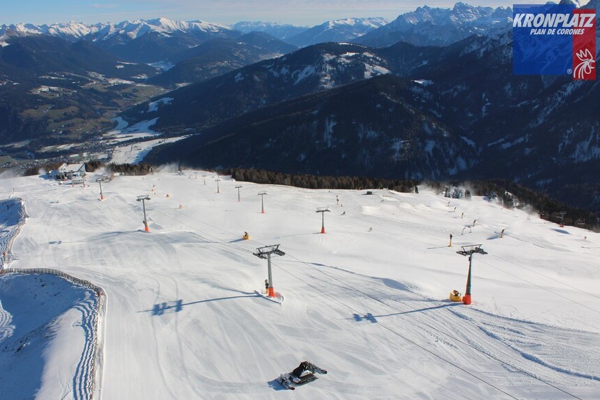 Kronplatz in the Dolomites opens tomorrow with some good piste skiing in prospect thanks to last Tuesday’s snow plus excellent snowmaking – Photo: kronplatz.com, 25 November 2022
So where should you go skiing this weekend if you are lucky enough to be able to get to the slopes at short notice?
In France, Val Thorens and Tignes are the first of the French resorts to open this weekend. Snow cover remains relatively modest though it does look like winter and both resorts will be able to offer some excellent piste skiing on a mixture of natural and artificial snow.
In Switzerland, a lot of resorts are now partially open, particularly at weekends. For the best combination of recent snowfall and number of runs open, our pick would be Engelberg, where there is 40cm/70cm of settled snow (mid/top) and at least half a dozen runs open.
In Austria, Ischgl is now open and offering the greatest extent of open entirely non-glacial skiing in the Alps, as it often does at this time of year. 82km of runs are open here this weekend with 40cm of settled snow up top. Sölden is another recommendation, with 72km pistes now open on a mix of glacial and non-glacial terrain.
In Italy, some Dolomite resorts (e.g. Kronplatz) kick off tomorrow but you might be better off waiting until the weekend after when lots more Dolomiti Superski resorts commence operations. Further west, Cervinia is the obvious choice with (as of today) skiing now possible below glacier level all the way down to Plan Maison (2500m).
Updated: 10.20am Wednesday 23 November 2022 – Improving snow conditions across the Alps…
The complex storm that brought snow to all parts of the Alps in varying quantities over the last 36 hours has now moved away to the east. However, another set of weather fronts is rapidly approaching the western Alps today, although only the north-western Alps will see any meaningful snow this time around, with about 10cm predicted later today in resorts such as Tignes, Val Thorens and Avoriaz.
 The Arabba region saw up to 45cm of windblown snow fall yesterday – Photo: dolomitisuperski.com, 23 November 2022
Other northern parts of the Alps will also see a little new snow but in smaller and smaller quantities the further east you go, with close to 4-7cm in resorts such as Mürren and Lech, and 1-3cm in Kaprun. Any snow won’t arrive in the Austrian Alps until tonight. The rain-snow limit from this new storm will start at around 1000-1300m, rising briefly towards 1600m in some exposed parts of the north-western Alps (a small warm sector) before descending again later. The southern half of the Alps will miss most, if not all, of the precipitation this time around.
Snow conditions are now looking better than they did a few days ago thanks to the snow that has fallen across virtually all parts of the Alps in recent days. The heaviest snow from yesterday’s storm fell in the south-eastern Alps, with 25-40cm in the central and southern Austrian Alps (e.g. Obertauern) and the Dolomites, and close to 50cm above Arabba and around the Marmalada glacier.
The rest of the Alps have typically seen 10-20cm of new snow in the last 36 hour, aside from the south-west (e.g. Bardonecchia) which only received a dusting.
Overall it’s an improving situation in the Alps but, before we can say it’s a convincing start to the winter season, more snow will be needed, especially lower down.
If you are planning a trip in early to mid-December, you should still be choosing your resort very carefully. Altitude is obviously important, but snowmaking capabilities should also be taken into consideration.
The Dolomites, for example, have some of the best snowmaking in the world which, combined with the significant early season snowfalls that they witnessed yesterday, should allow them to offer some great piste-skiing conditions once the season gets underway over the next couple of weeks.
Updated: 10.45am Tuesday 22 November 2022 – More snow across the Alps!
Virtually all Alpine ski areas have woken up to some fresh snow this morning, with further snowfall forecast today, especially in the eastern and south-eastern Alps.
 It’s an improving picture across much of the Alps. This is Les Saisies, which has yet to open – 22 November 2022 – Photo: lessaisies.com
The heaviest of today’s snow will fall in the central and southern Austrian Alps (e.g Obertauern) and the Dolomites (e.g. Arabba), with these regions generally likely to see 20-40cm of new snow, and 50cm+ in a few favoured spots.
Elsewhere in the Alps, between 5-15cm fell last night across the northern French Alps (e.g. Val Thorens), much of the Swiss Alps and the western Austrian Alps (e.g. Lech). Further flurries are likely in these regions today, heaviest the further east you are (e.g. eastern Switzerland, Austria).
By contrast, there was only a dusting overnight in the south-western Alps (e.g. Sauze d’Oulx), and it will tend to brighten up here today.
Wednesday will see a new weather front reach the Alps bringing a bit more snow for some, mostly across the northern and western Alps (e.g. Tignes, Avoriaz, Mürren, Klosters, Lech) where a further 5-15cm is possible.
So, the overall snow situation in the Alps is continuing to improve, though we are still generally below par for late November…
Updated: 10am Monday 21 November 2022 - More snow incoming…
As expected, many northern parts of the Alps have woken up to a few centimetres of new snow this morning. Between 1-2cm has fallen in the northern French and western Swiss Alps, with 4-7cm in some of the northern Swiss Alps, as well as the far west of Austria (Arlberg/Vorarlberg).
 Not looking too bad up top in Val d’Isère with a further 10-15cm likely to fall both tonight and on Wednesday – Photo: valdisere.com, 21 November 2022
The next more potent set of weather fronts will reach the western Alps later this afternoon and spread east overnight. A secondary storm will develop over the Gulf of Genoa tonight, also moving east to sit over the northern Adriatic by tomorrow afternoon.
Although the picture is complicated, the consensus is that most of the Alps will see at least a bit more snow falling at some point either on Monday evening/overnight and/or on Tuesday. The rain/snow limit will start at around 1200-1400m before lowering to 1000m or less in most places by Tuesday.
The greatest quantities of snow from this storm now look likely to fall in the Dolomites (e.g. Arabba, Cortina) and the central and southern Austrian Alps (e.g. Hintertux, Obertauern, Nassfeld). These areas should see 15-30cm of new snow on Tuesday, with some favoured spots maybe seeing close to 50cm.
The rest of the Alps look likely to see 5-20cm of new snow over the next 24 hours, with around 15cm possible in some of the northern French resorts such as Val d’Isère and Val Thorens, and 10-15cm in the likes of Verbier, Mürren, St Moritz and St Anton. The western Italian Alps are likely to see the least snow from this storm, with just 1-5cm for resorts such as Sestriere, Pila and the Monte Rosa region.
Another weather front is set to reach the Alps on Wednesday, this time mostly affecting the northern half of the Alps, with the heaviest snow falling in the northern French Alps where there could be another 10-15cm in the likes of Tignes and Les Arcs, for example.
Updated: 12pm Sunday 20 November 2022 - More snow chances, both north and south!
It’s a relatively calm start to the day across much the Alps with some good sunny spells around, especially in the south. Later today the next (weak) weather front will arrive from the north-west, delivering a few centimetres of snow across the northern Alps tonight.
 Stormy looking skies in Mellau in the Austrian Vorarlberg where they are expecting more snow tonight and tomorrow night – Photo: mellau.at, 20 November 2022
The rain/snow limit from this weather front will be quite low – typically between 800m and 1200m – and it will deliver no more than a dusting overnight across the northern French Alps (e.g. Avoriaz), with 2-4cm across the northern Swiss Alps (e.g. Engelberg) and a peak of 4-8cm in the north-western Austrian Alps (e.g. Lech, Warth-Schröcken). Further east, only around 1-3cm will fall in the northern/north-eastern Austrian Alps (e.g.Kaprun, Kitzbühel), while the southern Alps will miss out entirely.
Early next week the situation becomes more complicated with a new, relatively active set of weather fronts set to move in from the west late on Monday. A secondary storm will also start to form over the Gulf of Genoa, deepening rapidly in the early hours on Tuesday. The various weather models have had some difficulty getting a handle on the precise location of this deepening Mediterranean storm but one thing is for sure, it will bring some significant snow to some parts of the southern Alps. Right now it looks like the Dolomites (e.g Cortina, Arabba) and the Austrian province of Carinthia (e.g. Nassfeld) might see the heaviest snowfalls, with the potential for 50cm+ of snow at altitude on Tuesday.
Between Monday night and Tuesday most of the rest of the Alps will also see a moderate fall of snow (typically 5-30cm) but for now it’s all eyes on the south-east (e.g. Dolomites) for the best chance of any really significant snow. The rain/snow limit on Monday night/Tuesday will be between 800m and 1400m.
We will bring you further updates tomorrow…
Updated: 10am Friday 18 November 2022 - Fresh snow, especially in the north-west…
As expected, a cold front brought some moderate snowfalls to some part of the Alps last night with about 10-15cm of fresh snow at 2500m in resorts such as Val d’Isère, Val Thorens, Chamonix, Verbier, Mürren and Engelberg. With colder air digging in behind this front there has also been a dusting to as low as 1400m in places.
 10-15cm of new snow at altitude in Méribel this morning – 18 November 2022 – Photo: meribel.com
Flurries will persist to relatively low levels for a while today across the northern Swiss Alps (e.g. Engelberg) and northern Austrian Alps (e.g. Lech, Kaprun) before gradually dying out later. Further west, any early flurries in the northern French and western Swiss Alps will quickly dissipate. As predicted, the southern Alps (e.g. Dolomites) have missed out this time around.
The next significant storm is now forecast to arrive on Monday night, not Sunday night as previously forecast. The situation is complex and the detail is still subject to change but this storm is most likely to favour the western and southern Alps (i.e. France, Italy, the far south of Switzerland and the far south of Austria). Watch this space…
Updated: 11am Thursday 17 November 2022 - Obergurgl opens for skiing today…
Obergurgl opens for skiing today, with 12 lifts serving 22km of pistes (about 20% of its ski area) with a very modest 30cm upper base comprising both natural and artificial snow. These are hardly vintage early season snow conditions but, it does (in our minds at least) mark the start of the ski season proper.
 Opening day in Obergurgl – 17 November 2022 – Photo: gurgl.com
Val Thorens should have been the next big opening this weekend but has been forced to postpone until the following weekend due to very meagre snow cover. Val d’Isère has likewise had to postpone its scheduled opening from 26 November to 3 December for the same reason.
So what does this all mean for the start of the ski season? Clearly there is not a huge amount of snow in the Alps right now, even if it appears to be starting to accumulate at altitude. However, before anyone panics there are two things to consider. The first is that it is not unusual for the Alps to still be short of snow in mid-November – on average you might expect a bit more at altitude by now but there have been vintage seasons where things haven’t really got going until well into December. Secondly, a new storm is forecast to hit the western Alps this evening before spreading further east overnight and into tomorrow.
This storm will most benefit the northern French and western Swiss Alps (e.g. Val d’Isère, Flaine, Chamonix, Verbier) where between 15 to 30cm of snow will fall above 2200m by tomorrow morning. Other northern parts of the Alps (e.g. Engelberg, Davos, St Anton, Kaprun) will also see a few centimetres of snow over the next 24 hours, but most of the southern Alps (Milky Way, Monte Rosa, Livigno, Dolomites) will see very little if any snow this time around. The rain/snow limit will initially be around 1700-2000m but will fall to around 1200-1400m early on Friday.
Some showers or flurries will hang on across the north-eastern Alps for a while tomorrow as it brightens up elsewhere, at least partially further west.
After a relatively calm weekend with just a few showers or flurries here and there, another storm is set to reach the western Alps on Sunday evening heralding a very unsettled couple of days across the Alps. This storm cycle could bring significant snow to a wider swathe of the Alps, though the detail is difficult to pin down at this stage. Whatever the case, it is likely to turn drier and warmer again later next week.
Updated: 12.50pm Wednesday 16 November 2022 – Big dump early next week?
The weather in the Alps is slowly becoming more interesting, with further bits and pieces of snow due this week, mainly in the north-west, and the prospect of something more potent early next week.
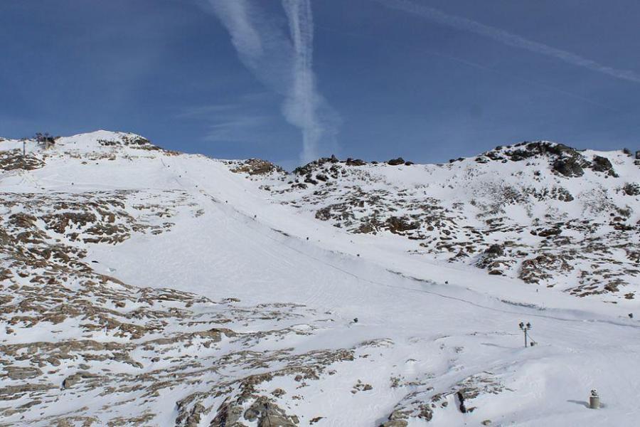
 Looking good high up in yet-to-open Alpe d’Huez today but it remains snowless at resort level for now – 16 November 2022 – Photo: alpedhuez.net
There has already been new snow at altitude this week, especially in the western and north-western Alps in resorts like Alpe d’Huez, Tignes, Glacier 3000 and Engelberg. Indeed, last night these areas saw a further top-up thanks to a cold front which is now lying across the eastern Alps, although it is now so weak that it will only bring a dusting above 1800m to the Austrian Alps today.
Further west, the weather has temporarily cleared up though a new warm front will reach the northern French Alps this evening and spread further east overnight. This new front will bring a centimetre or two of fresh snow to the northern French and western Swiss Alps but with the rain/snow limit rising back up to 2200m.
On Thursday, a new cold front will reach the north-western Alps late in the day and spread east overnight. This storm is expected to bring 10-15cm to higher parts of the northern Alps, especially the northern French and western Swiss Alps (e.g. Tignes, Val Thorens, Verbier) with a rain/snow limit descending to 1300-1500m by early on Friday morning.
The Dolomites may also see a few flurries on Friday, though the southern Alps will generally see little if any new snow this week.
Over the weekend the weather in the Alps will be relatively cool with a few flurries (1000-1300m) likely here and there across the northern Alps. Things will then start to get interesting on Sunday evening/night as more active fronts arrive from the west, which should bring some significant snow to the French and western Swiss Alps before a new Mediterranean storm puts the southern Alps (i.e. Italy) in the firing line on Tuesday. Watch this space!
All this is good news for some of the big-name resorts of the north-western Alps that have recently been forced to postpone their openings. These include Val Thorens, which should have opened this coming weekend but has now pushed this back by a week, and Val d’Isère, which has delayed its opening from 26 November to 3 December.
The first resort not relying on a glacier to open a significant amount of skiing will be Obergurgl, where operations commence tomorrow on a mixture of natural and artificial snow.
Updated: 11.40am Monday 14 November 2022 – Further mostly modest snowfalls forecast this week…
The Alps are in for an unsettled week of weather, with further snow for some regions albeit not in the quantities or to low enough altitudes for anyone to be getting too excited just yet.
 A little fresh snow in Tignes today, with more expected this week – Photo: tignes.net, 14 November 2022
The general weather situation over the next few days is quite complicated, with a succession of weather fronts set to move in from the west which will struggle to make much progress eastwards, at least initially, with the Foehn “protecting” the Austrian Alps until Wednesday.
By next weekend, however, all Alpine regions should have seen at least some new snow at altitude. Indeed, many places will see multiple snowfalls, even if most will be minor, with totals above 2200m over the next 5 days or so in the order of 5-20cm, and perhaps 20-40cm in some favoured parts of the western Alps. The rain/snow limit will fluctuate between 1400m and 2300m.
These kinds of quantities aren’t enough to get that excited about just yet, but it will give a nice top-up to both the glaciers and some soon to be opened non-glacial resorts, including Obergurgl which should offer good piste-skiing conditions once it opens on Thursday.
There are some early indications that the Alps could see some heavier and more widespread snowfall next week, but this is still too far off to be certain. Stay tuned…
Updated: 1pm Saturday 12 November 2022 – 17 ski areas are open in the Alps this weekend…
This weekend there is plenty of fine weather across the Alps, and it will feel very mild too, especially at altitude. Next week will turn more unsettled again with most of the Alps expected to receive at least a few centimetres of snow (at altitude).
 The Mölltal glacier is one of eight skiing options in the Austrian Alps just now – 12 November 2022 –Photo: moelltaler-glacier.at
There are no season defining winter storms in the forecast just yet though, and temperatures will fluctuate with the rain/snow limit expected to be between 1500m and 2200m.
Back to this weekend, and seventeen Alpine ski areas are now open, most of which are glacial although a handful of entirely non-glacial options also now available, albeit still on a very limited basis.
In Austria you can ski on the glaciers in Hintertux, Stubai, Pitztal, Kaunertal, Sölden, Mölltal and Kaprun. Kitzbühel has also just opened a couple of non-glacial runs (at weekends only). Hintertux currently offers the greatest extent of skiing in the Alps, with about 38km of pistes open.
In Switzerland you can ski on the glaciers at Zermatt, Saas-Fee, Glacier 3000 and Diavolezza. There are also two very limited non-glacial options in Verbier and Mürren (both only open at weekends).
In Italy you can ski on the glaciers at Val Senales and Cervinia (shared with Zermatt). There is also now one non-glacial option by way of Sulda am Ortler.
There is no lift-served skiing currently available in France, with Val Thorens planning to be the first to open next weekend.
We will bring you updates on where is likely to see the most snow on Monday...
Updated: 9.30am Thursday 10 November 2022 – A bit more snow for some…
A relatively weak weather front brought a few centimetres of snow to some parts of the Alps yesterday, mostly in the north-west (including Val d’Isère, pictured below). However, with pressure now rising again we are in for a few days of drier weather with increasingly mild temperatures, especially at altitude.
 A few centimetres of new snow have fallen at altitude in Val d’Isère, where operations begin on 26 November – Photo: valdisere.com, 10 November 2022
This weekend will see several new openings, including Glacier 3000 in the western Swiss Alps which was among the most favoured areas for snow yesterday, with at least 20cm of fresh. Verbier will also begin operations this weekend (at weekends only), opening a non-glacial slope in its Lacs des Vaux area, thanks to a mixture of natural and artificial snow.
Several other glacial areas are also available for skiing across the Alps, mostly in Austria (including Hintertux, Stubai and Sölden). France is the only one of the “big four” Alpine countries not to be offering any skiing yet, with Val Thorens set to be the first French resort to open on 19 November. However, if no more snow falls soon, artificial help may be needed, as there is only a thin covering of natural snow in resort, which won’t last long lower down.
Next week, the weather in the Alps will turn more unsettled again, with some further snow in places, most likely in the western and southern Alps. It won’t be especially cold though. Stay tuned for further details over the weekend…
Updated: 12.25pm Friday 4 November 2022 – Snow!
As expected, snow has fallen across many parts of the Alps over the last 24 hours, with a bit more still to come today for some areas.
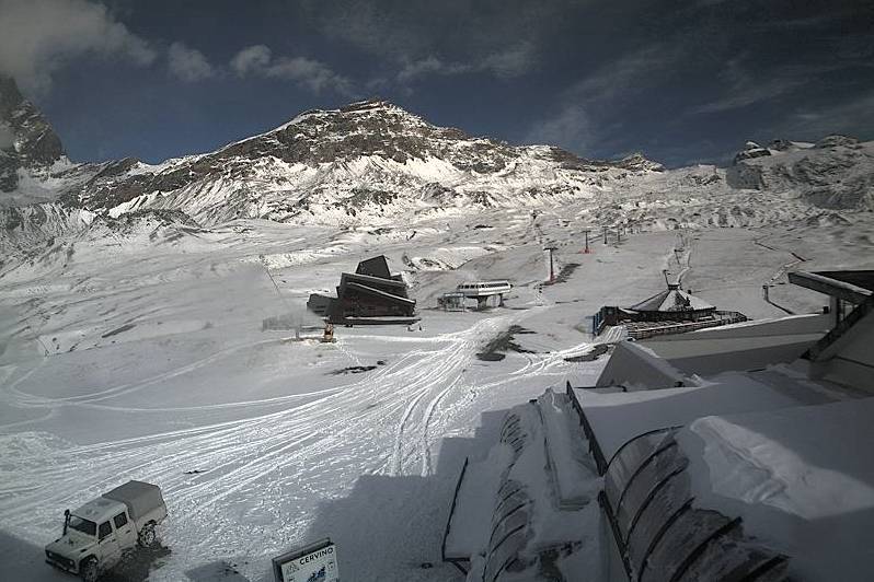 Fresh snow at Cervinia’s Plan Maison, but for now the only skiing here is still on the higher glacier areas the resort shares with Zermatt – 4 November 2022 – Photo: cervinia.it
Before anyone gets too excited, this is NOT a “season defining” storm – not by any stretch of the imagination – but with 10 to 30cm of sometimes quite windblown snow falling quite widely above 2500m, and a dusting to as low as 1200m in the northern Alps, it is certainly a sign that winter proper is not far away. It is also great news for the glaciers, for which an exceptionally mild Autumn has meant generally average pre-season snow conditions to date.
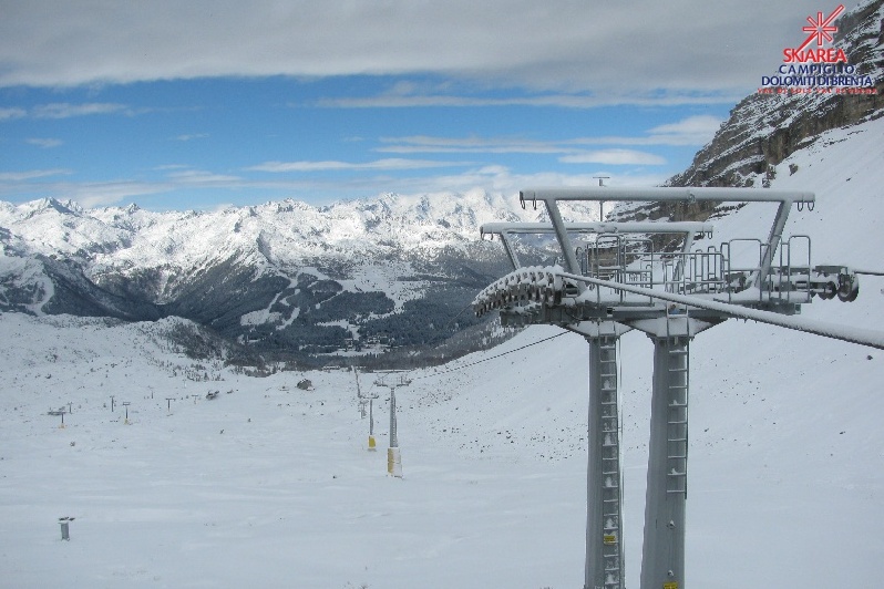 Fresh snow in the Dolomites. This is Madonna di Campiglio, which has not yet opened for the season – 4 November 2022 – Photo: funivie.campliglio.it
A dozen glaciers are open for skiing in the Alps right now, albeit on a very limited basis. Six of these are in Austria (Kaunertal, Pitztal, Stubai, Kaprun, Sölden and Hintertux), and three in Switzerland (Engelberg, Zermatt and Saas-Fee) where a fourth, Diavolezza near St Moritz, is also due to open tomorrow.
Two glaciers are currently open in Italy (Val Senales and Cervinia), while Val Thorens hopes to be the first French resort to open its (albeit mostly non-glacial) slopes on 19 November.
Looking a bit further ahead, next week looks like being relatively dry and mild, with the possibility of a little snow in the northern Alps above 2200m or so mid-week, but nothing significant.
 Alpe d’Huez is one resort where it is still snowing right now (Friday lunchtime) – 4 November 2022 – Photo: alpedhuez.net
Updated: 12.20pm Wednesday 2 November 2022 - Significant snow for the Alps?
Following a very mild October with only a few modest snowfalls, most of which were at high altitude, a more significant storm is on its way to the Alps later tomorrow and on Friday.
 A little new snow has improved conditions on the glacier above Saas-Fee in recent days with a much bigger fall expected overnight on Thursday – 2 November 2022 – Photo: saas-fee.ch
This storm will arrive from the north-west but will spawn an additional area of low pressure over the northern Mediterranean, meaning that the entire Alps are in with a good chance of getting a decent covering of snow, at least at altitude.
The bulk of the precipitation will reach the western Alps on Thursday afternoon before reaching all regions overnight on Thursday and early on Friday morning. The rain/snow limit will initially lie well over 2000m before descending towards 1000m on Friday morning in the northern and western Alps but will remain higher the further south-east you are.
By the end of Friday, between 10 to 30cm of new snow is expected above 2000m across a wide swathe of the Alps, with perhaps 40cm or more in the high border areas between Switzerland and Italy, including at altitude in the Zermatt-Cervinia and Monte Rosa regions.
Before anyone gets too excited though, it doesn’t look like this storm will be followed by any additional significant snowfalls for some time. Indeed, with high pressure and relatively mild temperatures re-establishing themselves next week, much of any lower-lying snow will melt again. So this storm will only really mean anything significant for anyone planning to ski on the glaciers in the next couple of weeks.
Right now, there are a dozen glaciers open for skiing in the Alps, albeit on a very limited basis. Six of these are in Austria (Kaunertal, Pitztal, Stubai, Kaprun, Sölden and Hintertux), three in Switzerland (Engelberg, Zermatt and Saas-Fee) and three in Italy (Val Senales, Passo Stelvio and Cervinia). In France, Val Thorens hopes to be the first resort to open (mostly non-glacial slopes) on 19 November.