

ARCHIVE
Today in the Alps - November 2021
Read about current weather and snow conditions in the Alps
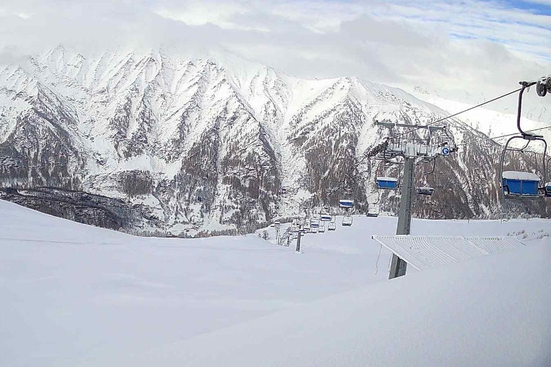
Updated: 10am Tuesday 30 November 2021 – More snow for the Alps…
Snow showers will continue to low levels across some northern and north-eastern parts of the Alps today (e.g. Engelberg, Flims, Lech, Kaprun), where another 10-30cm is possible by tomorrow morning.
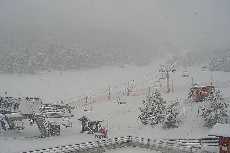
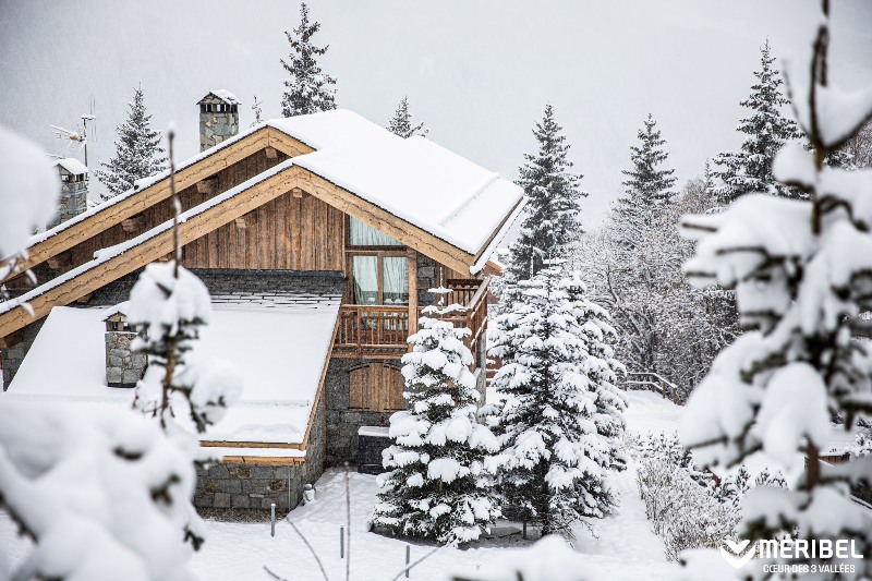 Winter wonderland in Méribel following recent snowfall – 30 November 2021 – Photo: facebook.com/meribel3vallees
Elsewhere in the Alps it is drier and brighter, with the best of the sunshine in the south-west. The rest of the week then looks unsettled, with further weather fronts moving in from the north-west tomorrow followed by an unstable and cold northerly airstream on Thursday.
Friday may see a temporary improvement in the weather across the Alps before yet more storms move in from the north-west on Saturday.
The region that will therefore see the most snow over the next five days, with perhaps another 40-80cm quite widely and even more in places, is the north-western Alps – including:
- the northern French Alps roughly north of Grenoble, including the 3 Valleys, the Grand Massif, the Chamonix valley and the Portes du Soleil;
- most of the Swiss Alps apart from some southern regions like Ticino and the southern Engadin; and
- the Vorarlberg (e.g. Lech) and western Tirol (e.g. St Anton).
Most southern Alpine regions including the Italian Alps (but excluding some resorts close to the border such as Courmayeur) will, however, see much more modest amounts of snow this week with some places even staying completely dry.
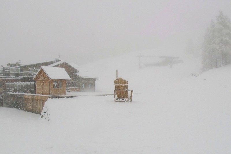
Updated: 11am Monday 29 November 2021 – The Alps are in full winter mode!
As expected, lots of snow has fallen across the Alps over the weekend with plenty more in the forecast for this week.
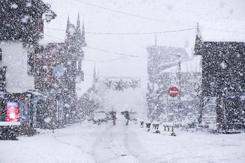 Serious snow in Morzine over the weekend – 29 November 2021 – Photo: facebook.com/morzineavoriaz
With the wind in the north today, most of the snow showers will be in the northern Alps (e.g. Engelberg, Lech, Kaprun), where it will fall at all levels, however, flurries will tend to die away from the northern French Alps (e.g. 3 Valleys) as the day progresses. By contrast, the southern side of the Alps will remain dry, with the best of any sunshine being away from the high border areas.
The rest of the week then looks unsettled, with further snow at times, generally favouring the northern half of the Alps. After a very chilly start to the week, temperatures will rise briefly mid-week (but not excessively) before it turns very cold again later in the week.
Over the weekend, between 30-60cm of fresh snow has fallen across quite a wide swathe of the central and northern Alps, with even more in places, particularly in the foothills (e.g. Vercors, the Chartreuse near Grenoble, and parts of the Jura close to Geneva). On the whole, the southern Alps have seen much less snow, with some places (especially the far south-west, e.g. Isola 2000) missing out completely this time around.
What is notable about the current storm cycle is the very cold temperature (for November), with snow falling to low levels right across the Alps and even into some of the major cities (e.g. Grenoble). This means that even in areas that haven’t seen a huge amount of new snow in recent days (such as parts of the southern Alps, notably the southern French Alps) it has been cold enough for the snow cannons to operate at full capacity. So, all in all, from a purely snow-related perspective (and pandemic aside), it is looking like a very promising start to the season.
Note that the whole of the Pyrenees has also seen significant snow in recent days, with close to 1m over the weekend in some western resorts (e.g. Gourette), meaning that resorts in this region can also look forward to an excellent start to the season.
Updated: 9.50am Friday 26 November 2021 – Increasingly snowy in the Alps…
The weather in the Alps will be mostly cloudy today, with a scattering of snow flurries here and there, heaviest and most prolonged in the south-eastern Alps (e.g. Dolomites, Carinthia).
 Cloudy today with snow flurries in Arabba – 26 November 2021 – Photo: arabba.it
These areas will see around 10-15cm by tonight though, otherwise today’s snowfall will generally not amount to much. This morning the rain/snow limit will initially sit between 700m and 1000m, before descending as the day progresses. The best of any sunshine today will be in the southern French and south-western Italian Alps.
Snow will become heavier and more widespread over the weekend, with more details coming in our weather & snow forecast for the Alps later today. For the latest on snow conditions across the Alps and beyond, check out our weekly snow report, also updated later today.
Updated: 10am Thursday 25 November 2021 - Winter incoming!
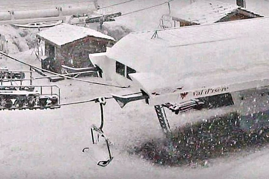
As expected, snow has fallen overnight in some south-western parts of the Alps, especially in the Alpes Maritimes (e.g. Auron, Isola 2000) which saw 10-20cm above 1500m, and the southern Piedmont (e.g. Limone, Prato Nevoso).
 10-15cm of fresh snow in Auron in the Alpes Maritimes this morning – 25 November 2021 – Photo: auron.com
Over the course of the day, snow flurries will move steadily further north and east, reaching Austria tonight, however, any accumulations will be very modest. The rain/snow limit, initially around 1200-1500m, will fall to very low levels later today and overnight. Further light flurries are then expected in places tomorrow, with falls set to become heavier and more widespread across the Alps over the weekend.
This upcoming storm cycle is welcome news for the Alps, after a protracted spell of mild weather has left most non-glacial ski areas with little natural snow. There are some exceptions, such as Obergurgl in Austria (albeit temporarily closed due to Austria’s current lockdown) which has a good amount of natural snow, as do some resorts in the south-western Alps such as Montgenèvre (currently open at weekends).
However, most of the non-glacial areas that have opened to date (such as Val Thorens, Davos-Klosters and Schladming) have done so heavily reliant on artificial snow.
Over in the Pyrenees, there has already been lots of snow in the east this week (e.g. Font Romeu, La Molina). This weekend the heaviest snow will transfer towards the western side of the chain (e.g. Gourette) where up to 1m of fresh snow is possible at altitude by the beginning of next week. All in all, it is an excellent start to the season for the Pyrenees.
Updated: 10.40am Wednesday 24 November 2021 - Becoming steadily wintrier over the next few days…
The weather in the Alps is turning more wintry, with significant snow forecast for most regions over the coming days.
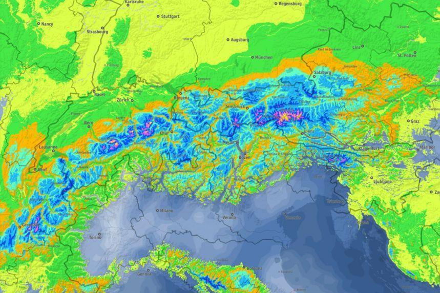 Significant accumulated snowfall is predicted across the Alps during the next six days, with the brightest colours (purple, yellow) suggesting 50-70cm or more is possible in places – Image: bergfex.com, 24 November 2021
Before we see any fresh snow though, much of the Alps will enjoy a sunny day today with freezing levels typically around 2000m. Later today cloud will increase in the far south-west, bringing a few centimetres of snow (1200m) overnight in the southern Piedmont (e.g. Limone) and across the border in the French Alpes Maritimes (e.g. Isola 2000).
On Thursday some mostly light snow showers will move north-eastwards across the Alps, first affecting the south-west (e.g Piedmont) before finally reaching the north-east (i.e. Austria) on Thursday night. The rain/snow limit will initially sit at around 1000-1300m before falling to low levels by Friday, especially in the western Alps.
On Friday, a new but still rather weak weather front will move slowly across the Alps, this time from north-west to south-east, bringing further mostly light flurries (to relatively low levels) to many regions.
Saturday and Sunday will then see more active weather fronts move in from the north-west, with more significant and widespread snow expected across the Alps. The rain/snow limit will briefly rise on Saturday before returning to very low levels across most of the Alps later in the weekend. The weather will then remain unsettled on Monday, with further snow in many areas.
This upcoming storm cycle is welcome news for the Alps, after a protracted spell of mild weather has left most non-glacial ski areas with little natural snow. There are some exceptions, such as Obergurgl in Austria (albeit temporarily closed due to Austria’s current lockdown), which has a good amount of natural snow, as do some resorts in the south-western Alps such as Montgenèvre (currently open at weekends).
However, most of the non-glacial areas that have opened to date (such as Val Thorens, Davos-Klosters and Schladming) have done so heavily reliant on artificial snow.
Over in the Pyrenees, it is already snowing with plenty more in the forecast. The current storm is mostly favouring the eastern Pyrenees (e.g. Formigueres pictured) right now, but most other parts of the chain are expected to see significant snow over the coming days.
 Snowing heavily today in Formiguères in the eastern French Pyrenees – 24 November 2021 – Photo: snoweye.com
Updated: 10.30am Tuesday 23 November 2021 - It’s turning increasingly wintry in the Alps…
The weather in the Alps is turning wintrier with significant snowfall likely for many regions by the weekend.
 Snow cover in Madonna di Campiglio in the Brenta Dolomites is better than in most parts of the Alps, which will allow some slopes to open this weekend – 23 November 2021 – Photo: funiviecampiglio.it
Even before then some places will see a little snow this week. Today it will be the far south-west that will see a few flurries (1200-1400m), especially in the southern Piedmont (e.g. Prato Nevoso), though it won’t amount to much.
Tomorrow night will see more substantial snow in these same areas (10-15cm), with some falls also possible in some resorts in the far south of the French Alps, such as Isola 2000.
Elsewhere in the Alps, it should remain mostly dry until Thursday with some sunshine in places, especially at altitude, but also a lot of cloud, especially lower down.
On Thursday, flurries (to relatively low levels) may be possible further north and east. It will then turn increasingly unsettled on Friday, Saturday and Sunday, with many parts of the Alps seeing some snow at times. It will also turn colder, with snow falling to very low levels, even right down into the lowlands by the weekend.
This snow will be very welcome for most areas of the Alps as, although many resorts are now partially open, snow cover is for the most part still quite patchy below glacier level with most areas very much reliant on artificial help.
Updated: 11.30am Friday 19 November 2021 - Quiet weather across the Alps today…
It’s a fine day today across most of the Alps, with some low cloud (although less than in recent days) and plenty of sunshine at altitude. It is mild too, with freezing levels above 3000m in most regions.
 Val Thorens opens tomorrow, although skiing will be mostly on artificial snow – 19 November 2021 – Photo: valthorens.com
The weather will also remain dry for most of the weekend, but weather fronts will encroach both from the north and the south late on Sunday, heralding the start of a more unsettled week in the Alps next week (see our detailed weather & snow forecast out later today).
This weekend, a handful of resorts will be opening for the first time this season, the biggest name being Val Thorens, which begins operations on Saturday. Natural snow cover is still very thin but some enjoyable piste skiing will be possible with the help of artificial snow. Further south, Montgenèvre will also open (at weekends only) and is currently in better shape thanks to the 40cm or so that fell here at altitude earlier in the week.
For more on snow conditions across the Alps please see yesterday’s detailed country by country snow report.
For more on the weather forecast for the Alps, our updated detailed snow forecast for the Alps will be out later today.
Updated: 10am Thursday 18 November 2021 - Obergurgl opens today!
High pressure is currently in charge in the Alps, meaning mostly dry weather over the next few days, with plenty of sunshine at altitude but also some cloud/fog trapped under temperature inversions lower down.
 Excellent early season snow coverage in Obergurgl which opened for the season today – 18 November 2021 - Photo: obergurgl.com
Early next week, low pressure in the Mediterranean will bring a little snow (1300-1500m) to some southern parts of the Alps, before a more pronounced return to winter looks likely later in the week, with an increasing chance of widespread significant snow. It is still far too early to go into any details on this potentially major wintry onslaught, but we will be discussing it further in our detailed forecast tomorrow.
In the meantime, today sees the start of skiing in Obergurgl, the first major entirely non-glacial resort to open a substantial number of runs (85km) this season. Snow conditions are very good for November thanks to heavy snowfalls last week backed up comprehensive artificial snow coverage.
Another major resort about to open is Val Thorens on 20 November. Although it has less natural snow than Obergurgl, some enjoyable piste skiing is still likely thanks to the snow cannons, not to mention some excellent work by the pisteurs.
Updated: 1pm Wednesday 17 November 2021 – Calm but often quite cloudy today in the Alps…
The weather in the Alps has now settled down but there is a lot of cloud around today, with both low-level stratus and some higher-level cloud meaning that you would have to be lucky to see any extended periods of bright sunshine. Most places will be dry, though the odd shower or flurry (1800m) can’t be ruled out here and there, most likely in the western Italian Alps.
 Calm but often quite cloudy weather today in the Alps. This is the Warth-Schröcken ski area – 17 November 2021 – Photo: foto-webcam.eu
The weather will remain relatively calm over the next few days with variable cloud cover and the best of any sunshine at altitude. Overall, there should be plenty of good skiing to be had in the increasing number of resorts across the Alps that are open or opening, albeit partially.
New openings this weekend include France’s Val Thorens (20 November). Snow cover here is still meagre but some good piste skiing will be possible on (mostly) artificial snow. Another opening just announced for this weekend is Montgenèvre. Snow conditions here are more favourable thanks to the 40cm or so that fell earlier this week.
In Austria, Obergurgl will the first entirely non-glacial resort to open a significant amount of terrain tomorrow (18 November). Snow conditions are expected to be good for November with significant natural snow as well as comprehensive artificial back-up.
A handful of other, mostly minor resorts will also open this weekend, with many more (including Val d’Isère and Ischgl) opening the weekend after.
We will have more details on snow conditions in the Alps in our full snow report tomorrow…
Updated: 10.30am Tuesday 16 November 2021 - More than 1m of fresh snow in some south-western parts of the Alps…
Skies have now cleared following the latest ‘Retour d’Est’, revealing huge snowfalls across some south-western parts of the Alps.
 1m of fresh snow at altitude in Prali in the Italian Piedmont – 16 November 2021 – Photo: facebook.com/Praliski
Areas hardest hit include the Italian Piedmont, (e.g. Prali, Sestriere), the Queyras (e.g. Ristolas, Abriès, St Veran), the upper Maurienne (e.g. Bonneval sur Arc) and the far south-east of the upper Tarentaise (specifically the Pisaillas glacier in Val d’Isère).
These regions have all seen at least 80cm of fresh snow at altitude over the last 24 to 36 hours, with as much as 110-120cm reported in the Haut-Guil valley in the Queyras on the French-Italian border.
 Plenty of new snow across Val d’Isère, with up to 80cm on the Pisaillas glacier, but considerably less here on the Bellevarde sector – 16 November 2021 – Photo: valdisere.com
Other ski areas that did well, albeit with less exceptional snow quantities, are Isola 2000, Montgenèvre, Bardonecchia, Cervinia, Zermatt, Saas-Fee and the Monte Rosa region.
However, most of the Alps did not see any snow from this latest storm and will have to wait for at least five or six days before they see their next top-up.
Updated: 11am Monday 15 November 2021 – Close to 1m of fresh snow for some lucky parts of the Alps!
One of this autumn’s biggest snowstorms is currently in progress in the Alps, though unfortunately it is only benefiting certain parts of the south-western Alps.
 Winter has returned to Bardonecchia – 15 November 2021 – Photo: facebook.com/bardonecchia
This type of weather pattern is known as the 'Retour d’Est' (return from the east), a phenomenon occurring when an area of low pressure is stationary in the Gulf of Genoa. As storms rotate counter-clockwise, moisture-laden winds off the Mediterranean move across the Po valley from south-east to north-west before slamming straight (perpendicularly) into the high mountains of the Italian Piedmont. The orographic (or forcing) effect of the mountains causes the air to rise very suddenly, leading to rapid condensation and heavy precipitation on the Italian side of the Alps.
Some of this heavy precipitation (rain or snow) spills over into France, but a true Retour d’Est will rarely make it very far over the border. So, while Val d’Isère can see a lot of snowfall from a Retour d’Est (as can Tignes, to a lesser extent), Les Arcs or La Plagne may see next to nothing from the same storm.
 Heavy snow in progress in Prali, not far from Sestriere – 15 November 2021 – Photo: facebook.com/praliski
So, looking at what is happening today, it is indeed snowing this morning in both Val d’Isère and Tignes, where 5-10cm of snow is expected close to resort level but possibly as much as 50cm or even more up on Val d’Isère’s Pisaillas glacier. Other French ski areas that will see significant snow from the current storm include Bonneval-sur-Arc, Val Cenis and the Queyras area, all of which could see 40-80cm at altitude. Montgenèvre and Isola 2000 will also benefit, but to a lesser extent, possibly seeing around 15-30cm at altitude.
On the Italian side of the Alps, resorts that should do well include Prato Nevoso, Limone, Bardonecchia, Sestriere and Prali, all of which should see 40-80cm at altitude. The north-eastern Piedmont (e.g. Alagna) should also see significant snow, with more moderate falls expected in the rest of the Monte Rosa region (e.g. Champoluc). Further west, Cervinia (and Zermatt and Saas-Fee, just over the Swiss border) will also see some snow.
The rest of the Alps will not see any benefit from this “Retour d’Est”, although most areas did at least see a little snow from storms late last week, especially in the Austrian and eastern Italian Alps (e.g. Dolomites). The north-western Alps (e.g. Portes du Soleil, Chamonix, Villars, Gstaad), however, have seen very little (if any) snow over the last week.
Updated: 8am Friday 12 November 2021 - Dry today, snow for some this weekend…
Today will be a dry day in the Alps, with plenty of sunshine (especially at altitude) and very mild temperatures. Saturday will also start fine for most regions, but a cold front will cross the Alps later in the day and overnight bringing a little snow for some.
 Blues skies across much of the Alps today. This is the Grossglockner, Austria’s highest mountain (3798m) – 12 November 2021 – Photo: foto-webcam.eu
The cold front will be weak in the western Alps, delivering just a dusting of snow to some north-western areas, including Chamonix and the Portes du Soleil. The front will be a little stronger further east, where there could be between 5cm and 20cm of fresh snow on Saturday night in the likes of Davos, St Anton and Obergurgl.
Later in the weekend the cold front will reach, interact with and help deepen an area of low pressure over the Mediterranean, meaning that many southern parts of the Alps will also see some snow. The heaviest of this will fall later in the weekend in the high border areas between the Italian Piedmont and the French Alps from about (and including) Val d’Isère southwards, where resorts including Val d’Isère, Val Cenis, Sestriere, Prali, Prato Nevoso, Queyras and Isola 2000 could see 20-40cm of new snow at altitude by Monday.
For more on snow conditions in general across the Alps please see yesterday’s detailed snow report…
Please also tune in later today for this weekend’s weather and snow forecast for the Alps…
Updated: 10am Thursday 11 November 2021 – Mostly fine in the Alps but further snow in places over the weekend…
It is still cloudy this morning in some of the south-western Alps, with a few showers or high-altitude flurries here and there. However, most regions will have a dry day, with some low cloud in places but plenty of sunshine at altitude, with freezing levels around or above 3000m.
 Some piste preparation underway in Alpe d’Huez but more snow is clearly needed before the start of the season, as it is in most resorts across the Alps – 11 November 2021 – Photo: alpedhuez.com
Significant snow has fallen above 2300-2500m in the far south-western Alps over the last 24 to 36 hours, notably in the Piedmont. This snow hasn’t been of much use to the ski resorts in this region, most of which sit below this altitude, although it has been benefited the higher sectors of some resorts (yet to open), including Sestriere, Prali and Isola 2000.
Further north, there were also a few centimetres of fresh snow on the Pisaillas glacier in Val d’Isère, but otherwise most of the Alps have been having a dry and relatively mild week so far.
After a mostly sunny Friday, the weather will turn more unsettled over the weekend as a cold front moves down from the north-west, at the same time as a new storm forms in the western Mediterranean.
This has the potential to bring further heavy snow to some south-western parts of Alps, especially the Piedmont (e.g. Sestriere, Prato Nevoso) and adjacent border areas from about Val d’Isère southwards (e.g. Val Cenis, Queyras, Isola 2000). We will bring you a more detailed weekend weather forecast tomorrow, but do check out our first detailed snow report for the Alps later today!
Updated: 11.50am Wednesday 10 November 2021 - Fresh snow at altitude in the far south-western Alps…
For most of the Alps, today will be another dry day, with sunny spells and freezing levels close to 3000m. Skies will be cloudier in the far south-west though, with some rain or snow in places.
 Fresh snow at altitude in Prali in the Italian Piedmont – 10 November 2021 – Photo: facebook.com/Prali
The focus of this precipitation will be the high border areas between the Italian and the southern French Alps, notably the eastern Mercantour, the Queyras and the southern Piedmont.
Some snow has already fallen here at high altitude in the last 12-24 hours, and more is expected above 2300m both today and for a time tomorrow. Due to the relatively high rain/snow line, this storm won’t be of much significance to most of the ski resorts in this area (e.g. Prato Nevoso, Isola 2000, Abriès), which do not extend much above this height, however, it may dump as much as 60cm in some high parts of the southern Piedmont (e.g. Monte Viso). It may also extend its influence far enough north to deliver a few centimetres of fresh snow at altitude on the Pisaillas glacier in Val d’Isère.
Looking a bit further ahead, most Alpine regions are forecast to be dry and mild for the rest of the week, apart from a few more showers in the far south-west on Thursday.
Later in the weekend the weather will then turn more unsettled again in the west, with the chance of rain or snow in places, though the details are still uncertain. Tune in tomorrow for a detailed weekend weather forecast for the Alps…
Updated: 10am Tuesday 9 November 2021 - A relatively quiet week in the Alps, but…
With high pressure in charge this week, the Alps are going through a relatively quiet period of weather, although it won’t be completely dry.
 Great piste skiing on the Austrian glaciers this week, this is Stubai – 9 November 2021 – Photo: facebook.com/schifahren-stubaier.gletscher
Low pressure in the Mediterranean will be close enough for some precipitation to fall in the south-western Alps later today and on Wednesday, notably in the Alpes Maritimes (e.g. Isola 2000) and the southern Piedmont (e.g. Prato Nevoso), where 20cm or more could fall above 2200m.
For most of the Alps though it will be dry and mild this week, with freezing levels close to or even above 3000m. There may be some showers over the weekend, though it is currently looking unlikely that these will bring any significant fresh snow. Later next week there is a chance of heavy and widespread snow from the north but, again, this is too far away to be getting excited just yet.
In the meantime, there is lots of good skiing to be had for those lucky enough to be out in the Alps. Most of it is on the glaciers (e.g. Tignes, Zermatt, Saas-Fee, Hintertux, Stubai, Kaprun) but some non-glacial terrain is also open, even if in many cases it is still only at weekends (e.g. Davos/Klosters).
Updated: 10am Friday 5 November 2021 - Skies are clearing – so what now for the Alps?
The latest storm cycle is now over, having dumped 70cm or more of fresh snow across some southern/south-eastern parts of the Alps. So what's next for the Alps, and what does this all mean for the coming season?
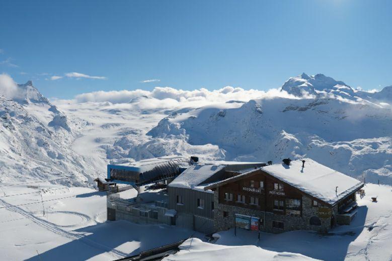
 Sun and fresh snow in Zermatt today – 5 November 2021 – Photo: zermatt.ch
Firstly, it is important to remember that we are only at the beginning of November and that lots can happen between now and “winter proper”, which for most resorts means the middle of December onwards.
All parts of the Alps have seen a nice covering of snow this week, at altitude at least, but no significant snow is now forecast for at least a week, or probably longer.
High pressure will generally be in charge, meaning lots of dry weather and plenty of sunshine at altitude, with some low-level cloud in places, although there is a chance of a few showers or flurries early next week in the far eastern Alps, and maybe also the southern Piedmont. Nights will be cold (and very cold over the next couple of days), but the general trend will be for temperatures to increase, especially at altitude.
So what does this mean for the snow? The good news is that with relatively low humidity over the coming days (more specifically low dew points) there won’t be any sudden thaw. The sun is now quite low in the sky meaning that any significant snow will hang on for a while, even in the lower valleys, so long as it is mostly in the shade.
However, snow will melt easily on steep south-facing slopes almost perpendicular to the low sun. At this time of year, there would only be a sudden and general thaw if the weather were to become windier and more humid.
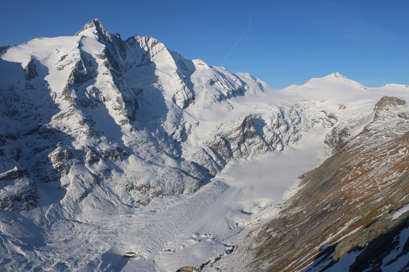
So, at high altitude, where there has been significant snowfall, there is every chance that we now have a base, especially on north-facing slopes, and the glaciers are clearly now in excellent nick.
One entirely non-glacial resort that would be a good bet early in the season is Obergurgl, which is due to open in less than a fortnight’s time. Two other Austria resorts to consider for an early season holiday are Ischgl (opening 25 November) and Sölden (already open). The glaciers would also good options, though Hintertux and Kaprun are the only two with obvious village bases. Don’t forget that all of these resorts also have artificial snow-making (to a lesser or greater extent), which will be able to ramped up over the next few days thanks to the colder temperatures.
There has also been significant snow in many Italian resorts, including Cervinia which will soon be open down to mid-mountain. Cover is still a bit thin lower down, but the base should now be secure above 2500m. Other Italian resorts to consider for an early season break are Livigno (scheduled to open on 28 November) and Passo Tonale (opening tomorrow - 6 November), both of which have sufficient altitude and snow for their bases to see it through until “winter proper”.
The Dolomites have also seen quite a bit of snow which, combined with their world-leading snow-making capability, should mean they have no problem in opening as planned later in November/early December.
 Significant snowfall in Bardonecchia in the Italian Piedmont – 5 November 2021 – Photo: facebook.com/Bardonecchiaski
In Switzerland, Zermatt and Saas-Fee are nearly always the best early season bets, which continues to be the case this year. Both resorts are already open and have seen significant snow this week. Other Swiss resorts that traditionally do well and are true to form right now include Andermatt (already open at weekends), Engelberg (already open), Davos/Klosters (already open), Arosa (opening tomorrow - 6 November) and St Moritz (the Diavolezza area is already open on certain days).
French resorts have also seen snow this week, although (with some exceptions) generally not as much as further east. Les 2 Alpes has fared best out of the bigger high resorts, with enough snow on the upper half of the mountain to at least see it through to the start of its main season at the end of this month. It is currently open for glacier skiing, but this closes again on Sunday.
Another of the bigger high French resorts, Tignes, is currently open daily and has superb snow conditions on its glacier. However, despite the Val d’Isère/Tignes area having snow at all levels, more would be needed for the area to have a bumper start to its main season, which officially begins on 27 November. Val Thorens is set to open a little earlier than this on 20 November, likely with a mixture of natural and artificial snow – pretty much what you would expect at that time of year.
So, all in all, November has got off to an encouraging start, with plenty of snow at altitude, especially in the southern and eastern Alps. However, for most resorts (as you would expect at this time of year) it is still far too early to be drawing any conclusions as to how the “main season” will play out, especially as we are now expecting a lengthy spell of relatively settled weather.
Updated: 10am Thursday 4 November 2021 - Up to 70cm of fresh snow in the Alps!
Significant snow has fallen across most parts of the Alps in the last few days during two separate storms, the second of which peaked last night.
 The sun is out again in Zermatt where significant fresh snow has fallen at altitude this week – 4 November 2021 – Photo: zermatt.ch
In just the last 24 hours, between 20cm and 50cm of snow has fallen at altitude across a wide swathe of the Alps, with up to 70cm in places in the southern Alps. The heaviest snow has fallen in the southern Swiss Alps (e.g. Zermatt, Andermatt, Saas-Fee, St Moritz), in the central and eastern Italian Alps (e.g. Livigno, Passo Tonale, Dolomites) and in the higher Austrian resorts, such as Obergurgl and on the glaciers in Hintertux and Stubai.
Thanks to falling temperatures, the snow has settled to relatively low levels for November, as low as 600m in some northern parts of the Alps (e.g. Salzburgland).
 Looking good in Cervinia. This is Plan Maison (2500m) – 4 November 2021 – Photo: cervinia.it
Thanks to falling temperatures, the snow has settled to relatively low levels for November, as low as 600m in some northern parts of the Alps (e.g. Salzburgland).
Flurries will continue to relatively low levels (700-1000m) today across the north-eastern half of the Alps, particularly in Austria, while the weather will remain mostly fine and sunny in the south-western half of the Alps. The forecast is also looking pretty good for the weekend across the Alps, with dry weather for most, with some areas of cloud but also plenty of sunshine.
 Wintry scenes in Val Thorens – 4 November 2021 – Photo: facebook.com/ValThorens.resort
Weather-permitting, resorts currently open for skiing include:
- France – Tignes and Les 2 Alpes, the latter closing again on 7 November.
- Austria – Hintertux, Pitztal, Kaunertal, Sölden, Stubai, Kitzsteinhorn (Kaprun) and Mölltal.
- Switzerland – Zermatt, Saas-Fee, Engelberg and the Diavolezza glacier near St Moritz (on Wednesdays and weekends only), Andermatt (weekends only) and Glacier 3000.
- Italy - Val Senales, Sulden am Ortler and Cervinia.
Updated: 10am Wednesday 3 November 2021 – Second storm underway!
The second storm of the week is already underway in the southern and western Alps, with rain and snow set to spread further north and east later today, before it finally reaches the north-eastern Austrian Alps overnight.
 It’s snowing heavily at resort level in Les Gets this morning – 3 November 2021 – Photo: lesgets.com
This morning, snow has already fallen to as low as 1000-1200m across some western parts of the Alps (e.g. Les Gets, pictured) with snow possible to 800m in places across the western Alps later today. The rain/snow limit will be higher further east, at least to start with, before also descending towards 1000m later in the day or overnight.
Thursday will see skies begin to brighten across the south-western Alps, though most areas will still be cloudy with flurries to relatively low levels. Friday and Saturday should see a more general improvement in the weather, with excellent snow conditions expected in the small (but increasing) number of open ski areas across the Alps.
Another 10-30cm of snow is expected to fall quite widely at altitude over the next 24 hours, with 40cm or more in a few favoured spots, especially in the southern Alps and close to the main Alpine Ridge (including the likes of Zermatt/Cervinia, Saas-Fee, Andermatt, St Moritz, Livigno, Passo Tonale and the Dolomites).
Weather-permitting, resorts currently open for skiing include:
- France – Tignes and Les 2 Alpes, the latter closing again on 7 November.
- Austria – Hintertux, Pitztal, Kaunertal, Sölden, Stubai, Kitzsteinhorn (Kaprun) and Mölltal.
- Switzerland – Zermatt, Saas-Fee, Engelberg and the Diavolezza glacier near St Moritz (on Wednesdays and weekends only), Andermatt (weekends only) and Glacier 3000.
- Italy - Val Senales, Sulden am Ortler and Cervinia.
Updated: 12pm Tuesday 2 November 2021 - Second snowstorm incoming!
The weather in the Alps remains unsettled with a new storm expected to drop significant quantities of snow across a wide swathe of the Alps on Wednesday and Thursday. Friday will then see the weather settle down with some exceptional snow conditions for anyone lucky enough to be in the Alps this weekend.
 New snow has transformed Lech into a winter wonderland, for now at least! – 2 November 2021 – Photo: facebook.com/lech-zuers
In the last 36 hours, between 10cm and 40cm of new snow has fallen above 2500m across the Alps, with 40cm on the glaciers of Hintertux and Mölltal, and snow falling to as low as 1200m in places. Tomorrow and Thursday we can expect another 15-50cm, with the highest snowfall figures likely to be in the central and eastern/south-eastern Alps in resorts such as St Moritz, Livigno, Passo Tonale, Sölden, Obergurgl, Stubai, Hintertux and Mölltal. This time the rain/snow limit will drop to below 1000m, first in the western Alps, then across most other parts of the Alps late on Thursday.
With the weather clearing up on Friday, snow conditions in the Alps will be fabulous across all open areas this weekend. Resorts currently open for skiing include:
- France – Tignes and Les 2 Alpes, the latter closing again on 7 November.
- Austria – Hintertux, Pitztal, Kaunertal, Sölden, Stubai, Kitzsteinhorn (Kaprun) and Mölltal.
- Switzerland – Zermatt, Saas-Fee, Engelberg and the Diavolezza glacier near St Moritz (on Wednesdays and weekends only), Andermatt (weekends only) and Glacier 3000.
- Italy - Val Senales, Sulden am Ortler (non-glacial) and Cervinia.
We will bring you updates on the rapidly improving snow conditions in the Alps (and their bearing on the start of the season) as the week goes on…
Updated: 11am Monday 1 November 2021 - Significant snowfall at altitude in the Alps…
As expected, the weather in the Alps has become much more unsettled, with significant snowfall forecast over the next few days, particularly mid-week, mostly at altitude but also to relatively low elevations in places.
 It’s looking more like winter up top in Val d’Isère this morning – 1 November 2021 – Photo: valdisere.com
Indeed, some snow has already fallen over the weekend, particularly in the southern French and western Italian Alps where it settled to as low as 1500m for a short time in one or two places. Further north and east, the weather was drier and warmer due to the Foehn.
Today an active weather front is moving from west to east across the Alps, meaning that most places will see at least a few centimetres of snow at altitude, with considerably more in places. The heaviest snow is set to fall later on today and overnight in the central-southern and south-eastern Alps (Passo Tonale, Mölltal glacier and the Dolomites), which will likely see 30cm of snow above 2500m by tomorrow morning.
The rain/snow level is currently highly variable. Snow is already falling below 2000m in some western parts of the Alps but further east the rain/snow limit will generally be higher, although it will lower across the board as the day goes on.
After a relative reprieve in the weather tomorrow, a new storm is set to bring further significant snow to the Alps on Wednesday and Thursday, with the heaviest falls in the west where snow may settle to relatively low altitudes for a time.