

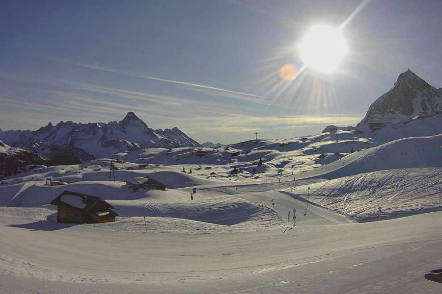
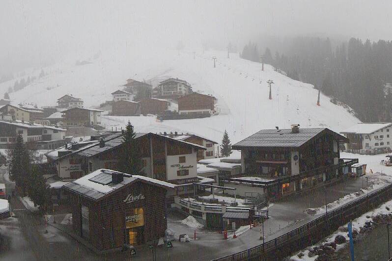
Updated: 10am Wednesday 29 March 2023 - Much milder in the Alps today!
The weather in the Alps has flipped again as very mild and quite humid air moves in from the south-west. Today will see much more in the way of cloud compared with yesterday, with some showers or longer spells of rain/snow, mostly across the northern Alps.
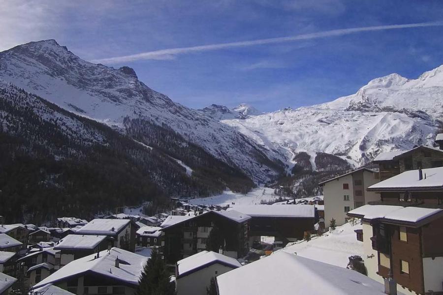
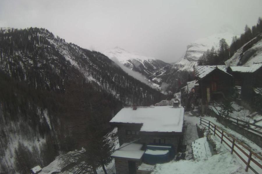 Cloudy with a chance of some light precipitation in Zermatt today – 29 March 2023 – Photo: zermatt.ch
The rain/snow limit may start relatively low in some internal valleys of the northern Alps but later today will rise to between 1800m and 2400m, highest in the west. The southern Alps will be mostly dry with some sunny spells.
Tomorrow will again be mostly cloudy across the northern Alps, with the chance of showers (snow around 2000m). Friday and Saturday will then see more active fronts and more significant precipitation. It will also turn colder with the rain/snow limit descending towards 1000m late on Friday, possibly lower still over the weekend.
During this period the greatest quantities of snow will fall at altitude in the north-western Alps where another 50cm+ is likely above 1800m in places on Friday and Saturday.
Updated: 10am Tuesday 28 March 2023 – Great snow conditions in the northern Alps but not for very long!
There are still a few snow showers to low levels across the northern and eastern Austrian Alps today, but for most of the Alps it is dry with plenty of sunshine.
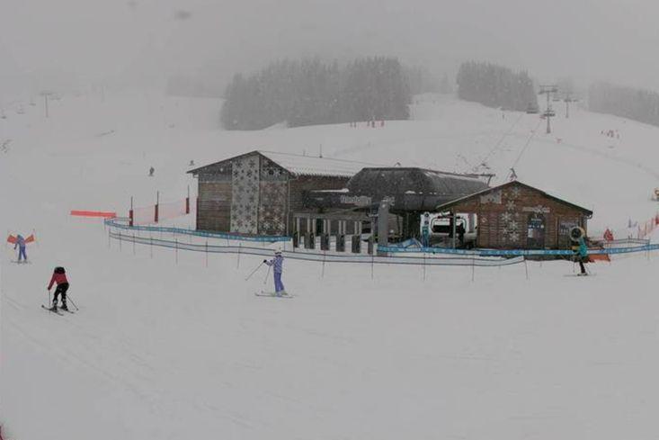
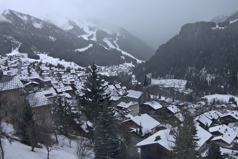
 Evidence of yesterday’s fresh snow to low levels in Châtel – Photo: chatel.com, 28 March 2023
Tomorrow, a weak warm front will mean plenty of cloud and a few showers across the northern fringes of the Alps, with a rain/snow limit rising to between 1500m and 2000m. Further south it will stay mostly dry and bright. Further weather fronts will bring some rain or snow to the northern Alps on Thursday and Friday, with a fluctuating rain/snow limit, on the high side - possibly as high as 2400m for a time on Friday.
The weather will remain very unsettled but turn cooler again over the weekend, with the prospect of some heavy and widespread snow returning to the Alps, again heaviest in the north.
 Fresh snow yesterday in Les Arcs – Photo: Drew Tetlow, 28 March 2023
Snow conditions are excellent today in the northern half of the Alps, where 30-50cm of new snow has fallen widely over the last three days, with as much as 80cm in some favoured spots. The snow fell to quite low levels (800-1200m) on Monday although any benefits will be very temporary lower down. Higher up you will also need to make the most of today, as milder cloudier conditions are set to return tomorrow.
As is always the case after any major storm cycle, be particularly careful off-piste in the northern Alps, where the risk of avalanche is currently very high.
If you are still considering booking a late season ski holiday then there is plenty of snow at altitude in the northern Alps, with a lot more to come this weekend, even to quite low levels. That said, it is still best to aim for resorts where there is lots of skiing above 2000m.
Updated: 8.50am Friday 24 March 2023 – Unsettled weather in the Alps!
The weather in the Alps has turned more unsettled. Today, a cold front is moving in from the west with rain or snow set to arrive in the north-western Alps over the course of the day, before spreading further east this evening and overnight.
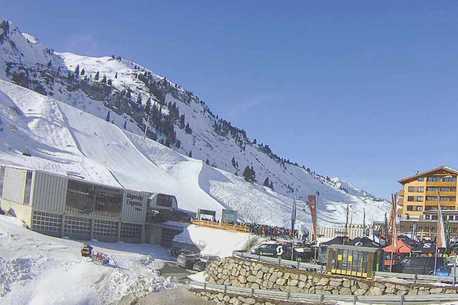
 Cloudy in Lech today, with rain then snow expected later – 24 March 2023 – Photo: lech.com
The heaviest precipitation will fall in the north-western Alps (e.g. Chamonix valley, Grand Massif) where around 20cm of snow is likely at altitude by tomorrow morning. The further south-east you are, the lighter and patchier any precipitation will be. The rain/snow limit will initially be quite high, at around 2200m, before falling towards 1500m later in the day and overnight.
Saturday will see a lot of cloud and some further mostly light showers or flurries (1200-1400m), mostly across the northern half of the Alps and early in the day. Another, more potent, storm will then reach the western Alps in the early hours of Sunday and continue to influence the weather in the Alps on Monday. Many northern and western parts of the Alps will see significant snow, with the northern half of the Alps being most favoured – first the north-west, then the north-east later on Monday.
Between Saturday night and Monday evening, snowfall totals of 30-50cm are likely in the likes of the 3 Valleys, L’Espace Killy, Paradiski, Chamonix valley, Grand Massif, Portes du Soleil, Jungfrau Region, Engelberg, Arlberg and the resorts of the Tirol and Salzburgland. The rain/snow level will initially be between 1200m and 1600m on Sunday, before falling to very low levels everywhere by Monday.
Updated: 10am Wednesday 22 March 2023 – Mostly fine and very mild, then unsettled to end the week…
With the Alps currently under the influence of a dry and very mild south-westerly airflow, all areas can expect some warm sunshine over the next couple of days. However, high cloud will make the sun hazy at times, especially in the northern Alps.
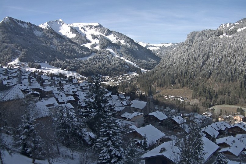
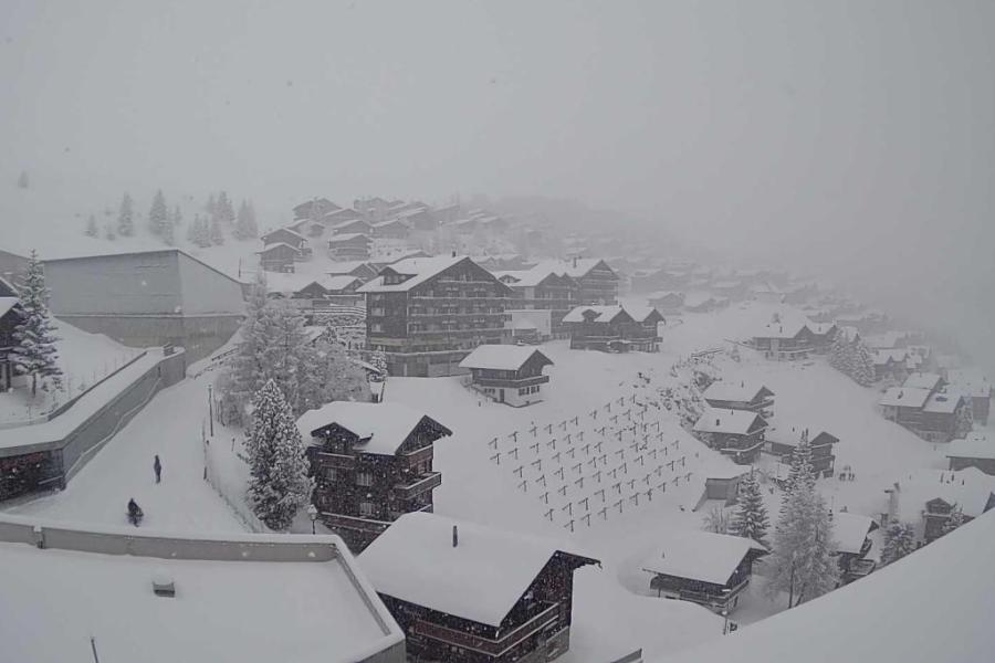
 Spring snow conditions rule across much of the Alps right now, but widespread snow is forecast later in the weekend. This is Warth-Schröcken – 22 March 2023 – Photo: warth-schroecken.at
The weather will change on Friday as Atlantic weather fronts sweep in from the west, with some rain or snow expected in the western Alps later in the day. The rain/snow will move further east overnight but will always be heaviest in the north-west. The rain/snow limit will start above 2000m but drop to around 1500m on Friday night.
The weather will remain unsettled over the weekend with some more widespread snow to lower levels later on Sunday, again heaviest in the north-west (e.g. Val d’Isère, Chamonix, Avoriaz, Verbier, Mürren). Early next week, the heaviest snow is likely to transfer to the north-eastern Alps (i.e. Austria) where it will fall to low levels. Stay tuned for details!
In the meantime, the very mild weather means that conditions will be typically spring-like across the Alps over the next couple of days with the snow often hard in the mornings (if it has been clear overnight), followed by increasingly soft or slushy snow as the day progresses.
This evolution will be more pronounced at lower altitudes and on south-facing slopes. Note that natural snow cover is generally very patchy or non-existent at low altitudes, so if you are looking to book a late season holiday, it remains prudent to book a resort with plenty or most of its skiing well above 2000m. Examples include Val Thorens, Val d’Isère, Tignes, La Plagne, Arc 2000, Cervinia, Saas-Fee, Sölden, Obergurgl and Ischgl.
Updated: 11am Monday 20 March 2023 - A mild week ahead in the Alps…
It’s a mostly dry day in the Alps today, though there is quite a lot of cloud around in places, especially across the far northern and north-eastern Alps where there is still the odd shower or flurry (1400m). The best of the sunshine will be at altitude in the south-western half of the Alps.
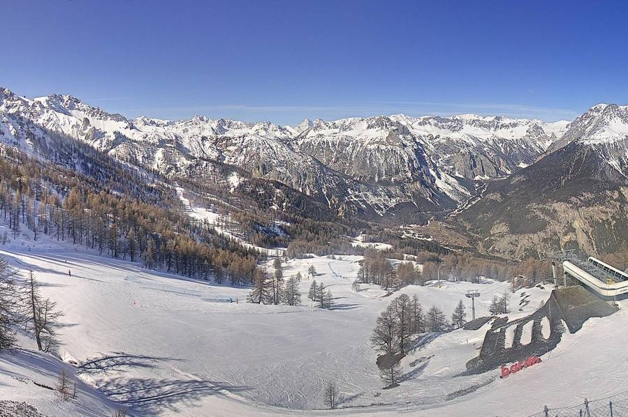 Sunny today with good piste-skiing in Bardonecchia in the south-western Italian Alps – 20 March 2023 – Photo: bardonecchia.it
The rest of the week will be mostly dry with some spells of warm sunshine around, especially in the southern Alps. However, there will also be some areas of cloud around, particularly in the northern Alps where the odd shower or flurry (2000m) is possible. Some more widespread snow is on the cards towards the back end of next weekend, but it is still too far away to be certain.
In the meantime, snow conditions remain very mixed across the Alps with generally below par snow depths, especially at low altitude where natural cover is often very patchy. Some areas did see a few centimetres of snow over the weekend above 1500m or so, especially in the north-western Alps (e.g. Portes du Soleil), but any benefits will be very temporary.
If you are planning a late season ski trip, you will want to be aiming for a resort with lots of skiing above 2000m, such as Val d’Isère, Tignes, Val Thorens, Cervinia, Saas-Fee, Obergurgl or Ischgl, to name just a few.
Updated: 11am Friday 17 March 2023 – Mostly fine, very mild…
It’s a dry, mostly fine day in the Alps, with the best of the sunshine in the east. Further west, there will be quite a lot of high cloud around, occasionally thick enough to obscure the sun. It will be very mild, with a Foehn blowing across some central and northern Alpine valleys.
 Bright but hazy in many western Alpine resorts today including here in Limone Piedmonte in the far south-western Italian Alps – 17 March 2023 – Photo: snoweye.com
Over the weekend, it will turn a fraction cooler (albeit still mild) with variable cloud amounts and the odd shower or flurry here and there above 1600-1900m, though not amounting to anything. It will probably stay mostly dry and quite mild for most of next week as well.
Snow conditions in the Alps are generally quite good at altitude right now but very mixed lower down – see our full detailed snow report out later today.
Updated: 9.50am Thursday 16 March 2023 – Mostly fine, good snow at altitude…
High pressure is currently in charge of the weather in the Alps, meaning there is lots of sunshine across the board today. Tomorrow will remain mostly fine and increasingly mild, especially so on the northern side of the Alps where a moderate Foehn wind will start to blow.
 Mostly sunny today in the Alps. This is Bettmeralp in the Swiss Valais, where you can still some of the fresh snow that fell earlier this week – 16 March 2023 – Photo: bettmeralp.ch
Late on Saturday and on Sunday, a weak weather front will bring a few showers or flurries here and there (with a rain-snow limit of 1400-1800m), mostly in the northern Alps, although no significant snow is expected.
Recent snowfalls have improved snow conditions across much of the Alps, significantly so at altitude where resorts such as Tignes, La Plagne, Chamonix, Verbier and Zermatt saw between 60cm and 120cm (with even more in places) above 2200m between Friday and Tuesday. At more modest altitudes, any benefits to ski areas were shorter-lived thanks to the strong March sun quickly melting most or all of any lower-lying fresh snow.
If you are planning a late season ski holiday in the Alps, you should therefore still be looking at resorts with lots of terrain above 2000m. Good bets for the Easter holidays include Val Thorens, Val d’Isère, Tignes, La Plagne, Cervinia, Zermatt, Sölden, Ischgl and Obergurgl.
Updated: 3.20pm Tuesday 14 March 2023 - Fresh snow for many resorts in the Alps…
Most (but not all) parts of the Alps have seen fresh snow over the last 24 hours, and it still snowing across some regions today, especially in the north-west (e.g Grand Massif, Porte du Soleil, Jungfrau Region, Engelberg, Arlberg) where the rain-snow limit is between 900m and 1300m.
 Lots of snow at altitude in the Portes du Soleil today. This is Les Gets – 14 March 2023 – Photo: lesgets.com
By the end of today, some northern parts of the French Alps (e.g. Chamonix valley) could have seen 36-hour snowfall totals of between 40cm and 60cm above 2000m.
Flurries will continue to relatively slow levels in some north-eastern areas tomorrow, mostly in Austria, otherwise most regions will be dry with the best of any sunshine the further south and west you are.
On Thursday and Friday, it will be mostly fine across all Alpine regions, with increasingly mild temperatures and a moderate Foehn developing across some central and northern parts.
Updated: 11.30am Monday 13 March 2023 – Highly changeable, with snow for many tomorrow…
It’s a mostly dry day in the Alps today, though there is quite a lot of high cloud around making any sunshine quite hazy in places. It will also feel quite warm, with freezing levels typically around 3000m and Foehn conditions in the central/northern Alps, especially this afternoon and this evening.
 Bright this morning in Saas-Fee, where a lot of snow fell late last week – 13 March 2023 – Photo: saas-fee.com
Tonight, the Foehn will ease as some active weather fronts move in from the north-west, bringing heavy snow to the French, western Italian, Swiss and later western Austrian Alps. Some thunderstorms are also possible in the northern Alps at first. The rain/snow limit will start at around 1800-2000m but will quickly drop to 1000-1200m in the middle of the night.
Tuesday will see further snow showers across much of the Alps, both in the north and south, though the far south-west (e.g. Sestriere, Isola 2000) will largely miss out. The rain/snow limit will be around 800-1000m, and perhaps a bit higher in the south for a time.
By Wednesday morning, between 20-40cm of snow should have fallen above 1600m across a wide swathe of the Alps, with a bit more in some northern-western areas (e.g. Avoriaz) and a bit less in some in the south-west (e.g. Sauze d’Oulx, Risoul).
Updated: 10am Saturday 11 March 2023 – Big storm continues in the Alps!
It’s another very snowy day across the north-western Alps, where the wild weather is causing some disruption this morning. The risk of avalanche has led to Zermatt being cut off due to the closure of the railway, and many of the higher ski areas across the western Alps remain closed while the situation is assessed.
 Heavy snow in the Swiss Valais this morning. This is Bettmeralp – 11 March 2023 – Photo: bettmeralp.ch
Snow will continue to fall across many north-western parts of the Alps today, roughly north of a line from Les 2 Alpes/Alpe d’Huez to the Arlberg, heaviest (again) in the northern French and far western and south-western Swiss Alps. The rain/snow limit will rise towards 1300-1600m (and even 1800m+ in places close to the western foothills, e.g. Alpe d’Huez) but will remain lower in the more enclosed internal valleys.
The storm will peter out early tomorrow, by which time well over 1m of new snow will have fallen at altitude in some parts of the northern French and western Swiss Alps (e.g. Tignes, Chamonix, Zermatt), with as much as 1.5m or more in places.
Updated: 10.30am Friday 10 March 2023 - Big 48 hours coming up in the north-western Alps!
It’s a wild day in the north-western Alps, with heavy snow and high winds at altitude and heavy rain lower down.
 Raining in Châtel this morning, with the rain/snow limit clearly visible at about 1400m – 10 March 2023 – Photo: chatel.com
This morning the rain/snow limit is around 1500m but it will descend to 1000m or lower tonight. The bad weather will continue in the north-western Alps tomorrow, with a rain/snow limit initially quite low (700-900m) rising again to 1500m or higher later in the day, although it will remain lower for longer in the more enclosed valleys.
48-hour snowfalls totals for Friday and Saturday combined are likely to be around 60-100cm (with 120cm in places) above 2200m in the western Swiss and northern French Alps. Higher parts of the Haute-Tarentaise (Val d’Isère, Tignes, La Rosière) and the Chamonix valley are most likely to be at the upper end of this scale.
Over the next couple of days, any precipitation will generally be lighter and more intermittent the further south-east in the Alps you are, with areas like the Dolomites and the far south of the French Alps (Isola 2000) staying mostly or even completely dry.
For more detail about the forecast for the Alps over the next few days, see our latest country by country weather & snow forecast, and for more on snow conditions, see our latest snow report.
Updated: 10am Thursday 9 March 2023 - Breather before the main event!
The weather in the Alps remains very unsettled, with huge amounts of snow still in the forecast for the north-west over the next couple of days, especially at altitude.
 Sleet this morning at resort level in Lech – 9 March 2023 – Photo: lech-zuers.at
In the last 24 hours, there have already been falls of 20-50cm above 2000m quite widely across the northern French Alps (e.g. Tarentaise) and western Swiss Alps (e.g. Verbier) but, thanks to milder air in the mix, it did also rain to between 1800m and 2000m last night, which has washed away any of the fresh snow lower down.
There are still some showers (snow 1400m) this morning across some of the north-eastern Swiss Alps and the far west of Austria (e.g. Lech), otherwise much of the north-western Alps have a small weather window before the next storm rattles in tonight.
It is this next storm that will drop really big quantities of snow across the north-western Alps on Friday and Saturday, with a rain/snow limit thankfully lower than originally forecast, probably between 1200m and 1500m on Friday, possibly dropping to 1000m or lower on Friday night/Saturday morning, before rising again to 1500m in places later on Saturday.
Clearly there is still a lot of uncertainty over the snowline but, whatever the case, it is unlikely to get anywhere near as high as the 2300m or so that was on the cards just a couple of days ago.
On Friday and Saturday, some really serious quantities of snow will fall above 2000m in the northern French and western Swiss Alps in particular, with higher parts of the Chamonix valley and Haute-Tarentaise (Val d’Isère/Tignes) likely to see the most, with perhaps as much as 1m.
Throughout this period, any rain or snow will be lighter and more intermittent the further south-east you are. Much of the Swiss Alps (away from the far south), the north-western Italian Alps (e.g. Courmayeur, La Thuile) and the western Austrian Alps (e.g. Arlberg) will also see significant precipitation, but the south-east (e.g. Dolomites) will stay mostly dry.
Updated: 11am Wednesday 8 March 2023 – More uncertainty in the forecast!
There has been yet another change in the weather forecast for the Alps in terms of what is going to happen towards the end of this week - the general consensus being that this has been the hardest week of weather to forecast in the Alps that we have seen for a very long time!
 Sunny this morning in Isola 2000, where snow conditions have been reliably good this winter – 7 March 2023 – Photo: isola2000.com
It will still be stormy, and there will still be lot of precipitation for the north-west, but the good news as that we have now lost the very warm air that had threatened to take the rain/snow limit to 2300m or so on Friday and Saturday. Instead, as things stand, the snowline will be at its highest (around 1800m) either later today or tonight, and possibly again at the same altitude (or possibly lower) on Saturday.
Either way, between now and Saturday there is going to be an awful lot of snow at altitude in the north-western Alps - i.e. the northern French Alps (north of Grenoble), the far north-western Italian Alps (e.g. La Thuile), much of Switzerland (away from the far south-south-east) and the far west of Austria (e.g Arlberg).
This week the most snow will fall in the Haute Tarentaise (e.g. Val d’Isère/Tignes) and around the Massif du Mont Blanc (e.g. Chamonix) where we are expecting well over 1m of snow above 2200m over the next 3-4 days, and perhaps as much as 1.5m.
There will still also be a lot of rain lower down, especially later today and again on Friday/Saturday but it now looks like it won’t rain to nearly as high altitudes later in the week as had previously been feared.
Updated: 10.15am Tuesday 7 March 2023 - An increasingly stormy week in the Alps, especially in the north-west, but remaining mild…
It’s a mostly fine start to the day across the Alps, with plenty of sunshine but also some areas of cloud drifting around here and there. The one exception this morning is the far south-east (e.g. Dolomites) where there are a few showers or flurries (1000-1200m).
 Sunny this morning in Isola 2000, where snow conditions have been reliably good this winter – 7 March 2023 – Photo: isola2000.com
Later today a weather front will move into the north-western Alps, bringing a few centimetres of snow to parts of the French and western Swiss Alps overnight, with a rain/snow limit between 700m and 1000m. It will continue to rain or snow across much of the western and north-western Alps tomorrow but, with increasingly mild air in the mix, the rain/snow limit will rise from about 1000m in the morning to around 1800m in the afternoon.
The weather will remain unsettled for the rest of the week, with rain or snow at times, always most frequent in the northern and western Alps with a rain/snow limit typically between 1400m and 1800m. Late on Friday and over the weekend, it will become warmer though, with rain likely to 2200m or higher in places.
Between now and Sunday we are likely to see some serious quantities of snow at high altitude in the north-western Alps, with 1m to 1.5m of snow possible above 2300m in the likes of Val d’Isère, Tignes, Val Thorens, La Plagne, Les Arcs and Chamonix. Some western Italian resorts (e.g. La Thuile), and northern and western Swiss resorts (e.g. Verbier, Mürren, Engelberg), as well as the far west of Austria (e.g St Anton) could also see significant quantities of snow above 2000-2300m.
In general though, the further south-east you are this week, the lighter and patchier any precipitation will be, with the best of the weather generally being in the far south of Austria (Carinthia) and in the Dolomites.
Lower down, there will be plenty of rain this week, especially in the north-western half of the Alps. This will be heaviest and most problematic later this week and this weekend. This is obviously not great news for the likes of Megève, Morzine, Samoëns, Villars, Gstaad and Grindelwald, where natural snow cover is already patchy.
Updated: 10.30am Monday 6 March 2023 - Turning more unsettled but staying mild…
If you are confused as to how the weather in the Alps will pan out this week, you are not the only one! Never has there been more chopping and changing by the various weather models, certainly not at such short notice.
 Sunny today in Chamrousse (above Grenoble) but the lean season is starting to tell – Photo: chamrousse.com, 6 March 2023
The reason for this model volatility is ‘Sudden Stratospheric Warming’ (“SSW”). SSW is a sudden and extreme warming of the stratosphere that happens every now and again (and not necessarily every year) which has a knock-on-effect on the troposphere below.
In short, SSW increases the chance of disruption to the conveyor-belt of mild westerly winds that are the default pattern over north-western Europe, and can lead to a greater chance of a ‘blocking high’ over Greenland or Scandinavia and outbreaks of cold arctic/polar air from the north or east.
Because it doesn’t happen very often and is still not fully understood, weather models struggle to properly accommodate SSW events into their forecast, which is one of the reasons why there has been so much uncertainty as to how things will pan out in the Alps this week.
Until a few days ago it seemed likely that a surge of arctic air would make it all way down over the Alps and that any snow would be falling to very low levels. Over the last few days, however, things have changed and, while it still looks likely to become much more unsettled (especially later in the week), the rain/snow limit is now forecast to be much more volatile, and potentially quite high at times.
As things stand, the Alps are going to end up in a mild westerly airflow this week, with snow at altitude in the northern and western Alps, but with an increasing risk of rain lower down. In fact, quantities of snow could be very significant, as could quantities of rain. High winds are also likely to cause disruption at altitude.
In the meantime, snow depths remain considerably below average across most of the Alps, especially in the Swiss and northern French Alps. The only part of the Alps with near or even above normal snow depths for early March is close to the southern French/Italian border where the resorts of the Queyras, Isola 2000, Prato Nevoso, Limone Piedmonte and Prali all deserve a special mention.
It is still possible to find some perfectly good skiing in other parts of the Alps but, as a general rule, natural snow cover is now patchy or non-existent at low altitudes. If you are planning to book a late season ski holiday you really need to be looking at somewhere where most of the skiing is above 2000m, if not higher.
Updated: 10.15am Saturday 4 March 2023 – Change in the forecast!
Next week’s predicted major change in the weather pattern in the Alps has had a spanner thrown in the works, with the models no longer favouring the arrival of a blast of unstable polar air.
 Sunny skies and good on-piste skiing in the Austrian Vorarlberg today. This is Warth am Arlberg – 4 March 2023 – Photo: warth-schroecken.at
This polar air should have brought at least a moderate fall of snow to low altitudes in the snow-starved north-western Alps, however, the latest models suggest that this airmass won’t really make it to the Alps at all, at least not in a way that will deliver the widespread heavy snow that we had been hoping for.
Instead, the Alps are left with a huge amount of uncertainty over what will happen next week, with cold air trying to move in from the north, warmer air trying to move in from the south, with bits and pieces of rain and snow in places and highly unpredictable freezing levels.
There is little point trying to pin down any further detail at this stage, other than concluding that some places will still see some useful snow, but that it is unlikely to be nearly as widespread or as low as once hoped. It will also be milder than expected, especially later in the week.
Updated: 9.30am Friday 3 March 2023 – Possibility of snow in the north-western Alps, at last
It’s another mostly dry day in the Alps today, with just the odd shower/flurry in the far south-east (e.g. Carinthia). Most areas will also see plenty of sunshine, though there are some areas of cloud around, notably at low altitude close to the northern foothills.
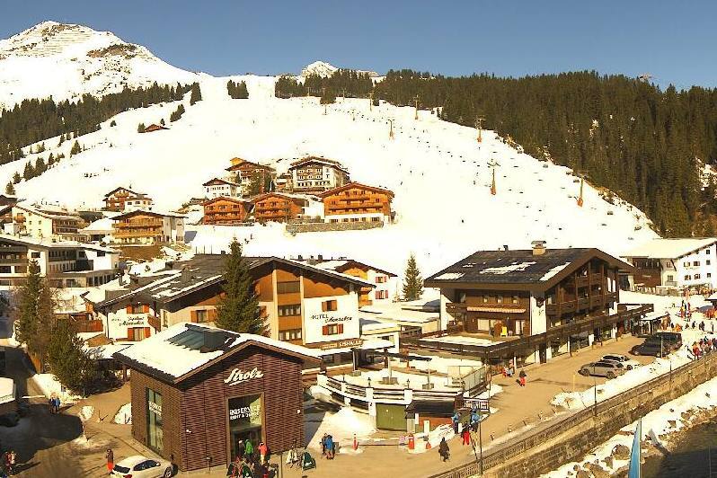 Sunny in Lech today with snow expected on Tuesday night – Photo: lech-zuers.at, 3 March 2023
It will remain mostly dry and relatively cool this weekend before the much-anticipated change in the weather pattern early next week. We should stress that there is still a lot of uncertainty as to how things will pan out next week, with various weather models predicting different scenarios. However, what does seem probable is that any change will be quite slow at first with most regions remaining dry on Monday, and just a few snow flurries starting to develop in the south-eastern Alps, especially in the Dolomites.
On Tuesday, a cold and unstable polar airmass will start to move in from the north, a little more slowly than originally forecast, with only the northern fringes of the Alps likely to see snow showers later in the day. A cold front will then sweep through the Alps on Tuesday night, with a moderate fall of snow (5-15cm) possible to low altitudes across the northern Alps (e.g. Avoriaz, Mürren, Lech).
Thereafter, things become very uncertain, though more snow is likely at times, at this stage heaviest in the northern and western Alps on Thursday/Friday.
So, as things stand, we still can’t promise that next week will see any really big dumps in the snow-starved north-western Alps, but we can be almost certain that there will be at least some useful snow falling to low altitudes mid-week.
In the meantime, snow depths remain considerably below average across much of the Alps, especially in the northern French, and southern and western Swiss Alps. Broadly speaking, Austria still has the best snow conditions right now, but the very best snow is close to the southern French-Italian border where huge amounts of snow fell in resorts such as Prali, Prato Nevoso and Limone Piedmonte earlier this week.
The better-known resorts of the Milky Way (Sestriere, Sauze d’Oulx) also did well from this storm, as did some resorts just over the border in France, especially those in the Queyras, and Isola 2000.
Updated: 12.15pm Thursday 2 March 2023 – The big south-western storm is fizzling out but all eyes are now on next week…
Some snow flurries are lingering across the far south-western Alps today, the remnants of an impressive ‘Retour d’est’ which delivered huge amounts of snow to some Alpine regions over the past week.
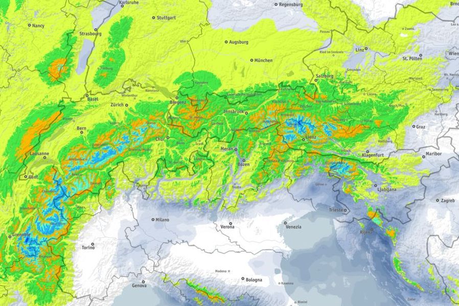 Snow due at last in the north-western Alps on Tuesday? The blue areas on the map show predicted snowfall accumulations on Tuesday 7 March being in the range of 20-40cm – Image: bergfex.com, 2 March 2023
Resorts that benefited included those in the southern Piedmont (such as Prali, Prato Nevoso and Limone Piedmonte) which saw falls of up to 1m. The Milky Way (e.g. Sestriere), the Queyras (France), Bardonecchia and Isola 2000 also did well.
Away from the south-west, most Alpine regions are dry today with variable cloud cover, with the best of the sunshine to be found at altitude in the northern half of the Alps.
Over the next few days, it will stay mostly dry with variable cloud and some sunny spells before the weather starts to turn more unsettled early next week. The first indications of this will be some light snow on Monday in the south-eastern Alps (e.g. Dolomites) before some more widespread and significant snow moves into the north-western Alps later on Tuesday and on Wednesday.
It remains uncertain how much snow will fall, but this is definitely great news for the snow-starved north-western Alps where most resorts haven’t seen any serious snow since January.