

Updated: 11am Tuesday 31 January 2023 – Mostly sunny, with some fresh snow in the north-eastern Alps…
It’s a mostly dry day today across the Alps, with plenty of sunshine, apart from in the far north-east (Upper/Lower Austria, northern Styria, northern Salzburgland) where there is more in the way of cloud and even the odd flurry, especially this morning.
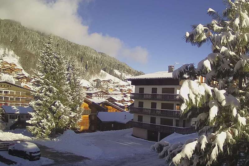
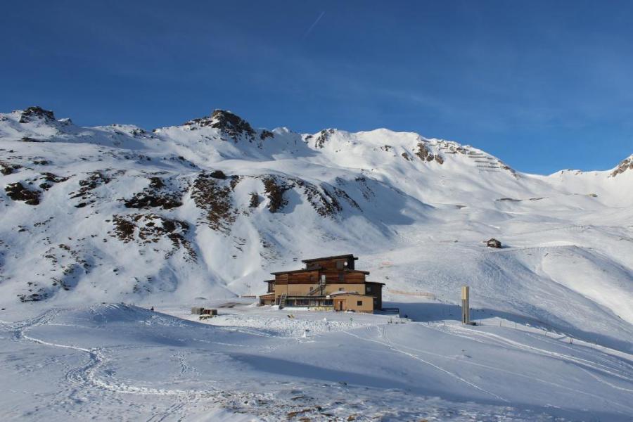
 Sunny skies in the Monte Rosa region, which will continue all week. This is Antagnod – 31 January 2023 – Photo: visitmonterosa.it
The cloud in the north-eastern Alps is the legacy of a weather front that brought a few centimetres of snow last night to many northern parts of the Austrian Alps (10cm in Lech, for example) and the far east of Switzerland.
Further weather fronts will reach the northern Alps late on Wednesday, this time more potent and hanging around for longer although this storm has been downgraded somewhat since yesterday’s forecasts. Between Wednesday evening and Friday morning, between 15-30cm could fall in many Austrian resorts, with less in the south. Some eastern Swiss resorts (e.g. Klosters) could also see a few centimetres of snow. The rain/snow limit will be around 600-800m.
Snow conditions remain pretty good across most of the Alps right now, especially in the areas that have seen most of the recent fresh snow, namely the northern Austrian Alps (e.g. Lech, Kitzbühel, Schladming). That said, some pistes are becoming quite hard-packed or even icy in places, especially in the shadier, lower altitude areas that see a lot of skier traffic and where it hasn’t snowed for a while.
Updated: 10.50am Monday 30 January 2023 – Snow for some north-eastern parts of the Alps later today…
The Alps are starting the week with a change in the weather pattern, as weather fronts begin moving in from the north-west.
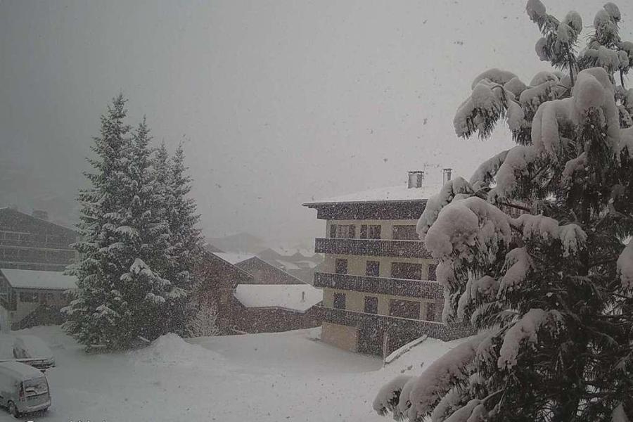
 Cloud is spreading into the northern Austrian Alps this morning, ahead of a weather front that will bring some snow showers to the north-eastern Alps later today. This is Hochkönig – 30 January 2023 – Photo: hochkoenig.at
Today it remains dry and bright across a good part of the Alps, however cloud will thicken across some northern parts as the day progresses, especially in the north-east where some snow flurries are expected later in the day across the northern half of the Austrian Alps (e.g. Lech, Seefeld, Kaprun, Schladming) and perhaps some north-eastern Swiss resorts (e.g. Flumserberg, Klosters).
Snowfall totals will be modest with 5-15 cm expected in the northern Austrian Alps by tomorrow morning and just 2-8cm in the north-eastern Swiss Alps. The rain/snow limit will be around 500-700m.
New weather fronts will then arrive from the north late on Wednesday. These will generally affect the same areas but will be more potent and hang around through Thursday and into Friday. This time we can expect 20-40cm across a wide swathe of the Austrian Alps (away from the south), as well as the central and eastern Swiss Alps (e.g. Engelberg, Laax, Klosters).
Some favoured areas (such as the Austrian Arlberg) could see much more, with some models predicting as much as 80cm by Friday.
Updated: 10.50am Sunday 29 January 2023 - Mostly fine, some snow for the north-east tomorrow…
There’s a dry day in store for the Alps with plenty of sunshine at altitude, but still with some nuisance-value low cloud trapped in some of the valleys, albeit not as much as in recent days.
 Blue skies and just a bit of valley mist in the northern Austrian Alps today. This is St Johann in Tirol – 29 January 2023 – Photo: foto-webcam.eu
A cold front will bring some snow to the northern Alps tomorrow, especially in Austria where around 10cm is possible in the likes of Lech, Seefeld and Kaprun. The northern Swiss Alps (e.g. Engelberg) will only see a dusting at best, however, with the northern French Alps (e.g. Avoriaz) probably missing out entirely. The southern half of the Alps will stay completely dry and mostly sunny.
Another more active set of fronts will arrive from the north late on Wednesday and on Thursday, likely bringing some heavier and more widespread snow across the northern half of the Alps. We will bring you more details on this tomorrow…
Meanwhile, snow conditions remain pretty good across most of the Alps, certainly on-piste at least. There are also still pockets of powder to be found off-piste, if you know where to look, especially in the areas that saw the most snow last week (e.g. Milky Way).
Updated: 10am Thursday 26 January 2023 – Mostly sunny with lots of good skiing on offer in the Alps…
It’s a mostly fine but still relatively cold day in the Alps, with plenty of sunshine but also some nuisance-value low cloud trapped in some of the valleys, especially in the northern Alps. There is also some more significant cloud cover in the far eastern Austrian Alps (e.g. Semmering), and the odd light flurry.
 Sunny skies and great snow today in St Anton, as is the case across most of the Alps – 26 January 2023 – Photo: foto-webcam.eu
Over the next two or three days there will be little change in the weather in the Alps, with mostly sunny skies (at least at altitude) and just the odd flurry in the far east/north-eastern Austrian Alps. Next week though, a new blast of arctic air is expected to bring snow to the northern Alps, especially on Monday and then mid-week.
It’s still too far off to be sure on the detail, but it seems likely that the north-eastern Swiss (e.g. Flumserberg, Klosters) and Austrian Alps (away from the south) will be most affected, with 10-30cm of new snow possible during the first wave and the same, or even more, in the second wave. The northern French and north-western Swiss Alps (e.g. Portes du Soleil) should also see a bit of snow but not as much as further east (where the pressure will be higher).
Snow conditions remain very good across most of the Alps with the very best skiing in resorts close to the French-Italian border from about Val d’Isère southwards, including Bonneval sur Arc, Sestriere, Prali, the resorts of the Queyras and Isola 2000.
Updated: 9am Tuesday 24 January 2023 – Big snowfalls for a select few in the south-western Alps!
As expected, a ‘Retour d’Est’ has dumped significant snow across some south-western ski areas both yesterday and overnight, with 50cm or more in places.
 Big overnight snowfalls in Bonneval sur Arc – Photo: bonneval-sur-arc.com, 24 January 2023
The areas most favoured by this Retour d’Est are the southern Piedmont (e.g. Sestriere, Prali, Prato Nevoso, Limone) and some resorts just across the border in France, including those in the eastern Maurienne (e.g. Bonneval sur Arc), the Queyras (e.g. St Veran) and the eastern Mercantour (e.g Isola 2000). Most of these areas have seen upwards of 50cm of fresh snow, with 70cm+ in some spots, with a bit more to come today, though not nearly as much as last night.
Val d’Isère has also done quite well from this Retour d’Est, with 20cm of fresh snow at resort level at 9am this morning and 50cm on the Pisaillas glacier. Other Tarentaise resorts (e.g. Paradiski) have seen little if any new snow, however.
Some fresh snow has also fallen in the south-east (Carinthia, Dolomites), however, most of the Alps have stayed dry if still rather cold over the last 24 hours. The far south-east will see some further light flurries today, otherwise most of the Alps will again be dry with plenty of sunshine the further north you are.
Snow conditions are now somewhere between good and excellent across most of the Alps. They are especially good in the French Alps, the south-western Italian Alps (e.g. the Milky Way) and the far south-eastern Alps (e.g. Nassfeld, Dolomites), all of which have fresh snow to varying degrees.
It will remain on the cold side in Alps for the foreseeable future, with bits and pieces of snow over the next few days, mostly in the southern and eastern Alps. Heavy and widespread snow is then likely to affect the northern Alps on Monday or Tuesday next week. Watch this space…
Updated: 10am Monday 23 January 2023 - Retour d’est!
The weather in the Alps remains cold. Most areas will be dry today, but a developing ‘Retour d’Est’, more potent than originally forecast, will bring significant snow to some of the south-western Alps later today.
 Heavy snow forecast for Isola 2000 today – 23 January 2023 – Photo: isola2000.com
This Retour d’Est will most favour the southern Piedmont (e.g. Sestriere, Prali, Prato Nevoso, Limone) and adjacent resorts across the border in France, especially the Queyras (e.g. Abries) and eastern Mercantour (e.g. Isola 2000), which could see 30-50cm of new snow by tomorrow morning. Other resorts that could do well, with around 20-30cm, include Montgenèvre, Bardonecchia, Val Cenis and Bonneval-sur-Arc. A few centimetres are also likely in Val d’Isère.
Some other parts of the southern Alps will see a little snow today, especially the Dolomites and the southern Austrian Alps (Carinthia, Osttirol), however, most of the Alps (especially the northern half) will be dry and cold with plenty of sunshine, at least above any low-lying valley cloud.
Updated: 10am Sunday 22 January 2023 - Remaining wintry in the Alps…
It’s another very cold day in the Alps, with temperatures struggling to get above freezing anywhere, even very low down. Most areas will be dry with plenty of sunshine, but it will be cloudier close to the northern foothills (e.g. Flumserberg, Berwang) where the odd light flurry is possible. The eastern Austrian Alps (e.g. Styria) will also see some light snow from time to time.
 Freezing cold morning in the central Austrian Alps. This is the Lucknerhaus in the Grossglockner region – 22 January 2023 –Photo: foto-webcam.eu
On Monday, a little ‘Retour d’Est’ will bring some snow to the southern Piedmont (e.g. Milky Way) and adjacent resorts across the French border from about Val d’Isère southwards, especially in the Queyras and Mercantour (e.g. Isola 2000). The south-eastern Alps (Carinthia, Dolomites) should also see some snow, especially later in the day, but for most of the Alps it will be another dry, bright and cold day.
Looking ahead to the rest of the week, it will remain cold. Most of the Alps will be dry and bright (above any low-level cloud plaguing some valleys) but there will be a little light snow here and there, again in the far south-west (e.g. Isola 2000) and far south-east (e.g. Nassfeld) on Tuesday, then in the far north-east (e.g. Schladming) later in the week. The low temperatures mean that virtually none of the recent snow will melt anywhere, and that skiing conditions will generally continue to be very good.
Updated: 11.30am Saturday 21 January 2023 - Very cold, with more snow for the north-eastern Alps…
The Alps continue to be affected by a very cold north-easterly airflow which will bring further snow at times to parts of Austria, notably the north and heaviest close to the German border. The further south and west you are, the brighter it will be, with lots of sunshine in the western Swiss Alps, central and western Italian Alps, and the French Alps.
 Further snow for the northern Austrian Alps today. This is Lofer in the Salzburgland – 21 January 2023 – Photo: snoweye.com
There is some excellent skiing to had across the Alps right now. The very freshest snow can be found in Austria where many resorts saw at least few centimetres of snow yesterday, especially in the north and east, and it is snowing again today, especially in the north. However, the western Alps (in particular, France) currently have the best combination of snow and weather right now, with mostly blue skies and lots of fresh snow from earlier in the week.
Snow depths are generally modest in the Italian Alps but there is also some excellent skiing on offer here, especially on-piste. Wherever you are though, it is bitterly cold and the weather in the Alps is set to remain cold for the foreseeable future.
Updated: 9.50am Friday 20 January 2023 – Flurries in the north-east, bluebird in the west…
A cold north-easterly airflow is currently affecting the Alps and will continue to influence the weather for some days to come.
 Deep blue skies and perfect powdery snow right now in Châtel – 20 January 2023 – Photo: chatel.com
Today there is an east-west split in the weather. Most of Austria is cloudy with some snow flurries, mostly in the north and east (Salzburgland, Styria, Upper & Lower Austria), while the far west (Vorarlberg) and far south (Carinthia) remain mostly dry with some brighter spells. Between 5-15cm of cold powdery snow can be expected to low levels today in resorts such as Kaprun, Schladming and Obertauern.
Elsewhere in the Alps, it is mostly dry and much brighter with virtually unbroken sunshine in the west (e.g. France). Here too though it is very cold, with a keen north-easterly breeze in exposed areas.
Tomorrow has a virtually identical set-up, with further snow due to low levels in the north-eastern Alps and mostly sunny skies further west and south.
The areas of Austria seeing snow falling today and tomorrow are the ones that saw the least snow earlier this week, which will partially address the balance across the northern Alps. Overall though, it is the French Alps that are now in the best shape, with deep blue skies and powdery snow at all levels.
Updated: 10am Thursday 19 January 2023 - End of storm cycle for most areas, but very cold…
The snow in the north-western Alps has finally fizzled out, with a bright but bitterly cold day expected today across the French Alps, the central and western Swiss Alps, and the central and western Italian Alps. The eastern half of the Alps (i.e. Austria, Dolomites) has more cloud, and a few mostly light flurries here and there.
 Magnificent snow conditions in the French Alps this morning. This is Les Saisies – 19 January 2023 –Photo: lessaisies.com
Over the next few days, the Alps will remain under a very cold north-easterly airflow which will bring some flurries from time to time to the northern/north-eastern fringes of the Alps, especially in Austria (e.g. Kaprun, Schladming). Most of the Alps will be dry and bright however, with the best of the sunshine at altitude in the southern and western Swiss Alps (e.g. Zermatt), the French Alps and the central and western Italian Alps (e.g. Milky Way).
The recent storms have brought a lot of snow to some of the Alps, notably the north-west (e.g. Portes du Soleil, Grand Massif, La Clusaz) where around 60-70cm has fallen since Sunday at 1200m and close to 1m at altitude! The rest of the Alps have seen at least some fresh snow this week but in varying quantities, with the least new snow in the northern Austrian Alps (e.g. Tirol).
We will bring you more details on snow conditions in the Alps in our latest detailed snow report later today…
Updated: 9.45am Wednesday 18 January 2023 – Wintry weather continuing in the Alps!
There’s another very cold day in store for the Alps today, with further snow set to fall in the north-west (e.g. Portes du Soleil). The further south and east you are, the drier it will be, with some good sunny spells in the southern Alps (e.g. Madonna di Campiglio), especially this morning.
 At least 60cm of snow has fallen at resort level in Les Gets this week – 18 January 2023 – Photo: lesgets.com
This snowy spell in the north-western Alps will end later tonight, but not until areas like the Portes du Soleil, the Grand Massif and the Chamonix valley see another 15-20cm of snow.
Tomorrow, aside from some flurries in the eastern Austrian Alps (e.g. Obertauern), most areas will be drier but still very cold tomorrow. Flurries will continue at times on Friday and Saturday across some of the Austrian Alps, mainly in the north and east (e.g. Kaprun, Schladming, Obertauern), otherwise most areas will be dry but still very cold, with variable cloud cover and the best of any sunshine in the south.
Snow conditions have been utterly transformed this week in the north-western Alps where, less than a week ago, some major ski areas like Morzine were virtually unskiable. Now they have just about the best snow conditions in the Alps, with snowfall totals since Sunday likely to be close to 1m at altitude once the storm comes to an end later tonight. Note that the risk of avalanche will be sky high off-piste though, not least due to the wind which has been particularly strong at altitude.
Snow has also fallen elsewhere in the Alps this week, albeit not nearly as much as had been hoped in some of the lower resorts of northern Austria (e.g. Ski Welt). The cold weather is allowing the snow cannons to operate at full capacity though, meaning that snow conditions should now be good just about everywhere in the Alps, on-piste at least.
Update: 10.50am Tuesday 17 January 2023 – More snow for the Alps, heaviest in the west…
A cold and unstable polar airmass remains in place across the Alps, with more snow in places today, heaviest in the west.
 Lots of fresh snow this morning in Hauteluce (between Les Contamines and Les Saisies) with plenty more in the forecast – 17 January 2023 – Photo: lessaisies.com
Another 15-30cm of new snow is expected today across much of the French Alps, with the greatest falls in the north (e.g. Grand Massif, Mont Blanc) but the southern French Alps (e.g. Risoul) getting a bit more in on the action than yesterday. The western Swiss Alps (e.g Villars), the far western Italian Alps (e.g. Bardonecchia) and the eastern Italian Alps (Dolomites) will also see a moderate fall of snow today (10-15cm), although it will arrive a bit later in the latter. The eastern Swiss Alps (e.g. Davos) and Austria will stay mostly dry during daylight hours but can expect some snow tonight.
Further snow is also expected in places tomorrow, chiefly in the north-western Alps (e.g. Portes du Soleil, Jungfrau region, Arlberg). Both today and tomorrow, any snow will fall to very low levels, often right into the “lowlands”.
Not very long ago there was almost no snow in the lower resorts of the north-western Alps, but this week these areas (e.g. Samoens, Les Carroz, Megeve, La Clusaz, Les Gets, Morzine, Villars, Gstaad) have seen a dramatic turn-around, with yet more snow to come both today and tomorrow. Conditions here are now excellent or, at least, will be once the weather settles down. It’s worth noting though that at altitude the risk of avalanche is high, partly due to all the new snow but also due to the wind, which was particularly strong yesterday.
Elsewhere in the Alps, most other regions have enjoyed at least some fresh snow this week with the far south-east (Carinthia) doing best. That said, the northern Austrian Alps (e.g. Zell am See, Kitzbühel) have missed most of the action so far.
These areas will get a few centimetres over the next couple of days with an increasing chance of some more substantial snow this weekend. The low temperatures also mean that snowmaking is now able to operate at full throttle.
Updated: 10am Monday 16 January 2023 – Winter is back in control of the Alps!
This morning, a band of snow is pushing into the western Alps with snow also falling in the far south-eastern Austrian Alps (Carinthia) and some eastern parts of the Dolomites. This follows yesterday’s arrival of a cold front, ushering in a dramatic drop in temperature sending the rain/snow limit in the western Alps tumbling from 1700-1900m to 600m or lower in just one day!
 Chucking it down with snow this morning in the lower resorts of the north-western Alps, just where it is most needed. This is Les Gets – 16 January 2023 – Photo: lesgets.com
In the west, the snow will be heaviest in the French Alps where 20-30cm is possible in some favoured spots (e.g. Avoriaz, Flaine) at the end of the day. Some Swiss and western Italian resorts, such as Verbier and Courmayeur, will also see some significant snowfall today, but the eastern Swiss Alps (e.g. St Moritz), most of Austria (apart from the far south) and the central Italian Alps (e.g Livigno) will see little, if any. Today’s rain/snow limit will be low, generally between 300m and 700m.
Tuesday’s weather will be fairly similar, with yet another storm pushing into the western Alps and favouring the French Alps most. There will be bits and pieces of snow further east, with some more persistent falls again possible in the far south-east, notably in Carinthia. Some other eastern parts of the Austrian Alps (e.g. Obertauern) will get more in on the action on Tuesday night. The rain/snow limit will remain very low everywhere.
Snow conditions are clearly improving across most of the Alps this week, especially in the north-west where, at lower altitudes at least, the situation had been so dire up to now. Resorts like Morzine, Les Gets, Samoëns, Les Carroz, La Clusaz, Megève, Villars, Gstaad and Adelboden will be completely transformed over the next couple of days, though patience may be needed while the authorities properly prepare the lower pistes.
Updated: 9.10am Sunday 15 January 2023 - Winter incoming!
A big change is happening to the weather in the Alps today with an unstable and increasingly frigid arctic airmass moving down from the north, bringing a wintry spell of weather that will last all week.
 Cloud is thickening in the French Isère this morning, with some rain/snow expected later. This is Chamrousse near Grenoble – 15 January 2023 – Photo: chamrousse.com
The colder air comes courtesy of a cold front that will move across the Alps today bringing a spell of rain/snow to many areas, heaviest in the north-west (e.g Portes du Soleil) this afternoon.
Any precipitation will generally be lighter and patchier the further south-east you are, except in the far south of Austria and parts of the Dolomites where some Mediterranean air is likely to bring some heavy snow tonight. The rain/snow limit will start at around 1500m in the north-western Alps this morning but will fall steadily to reach 600m or so later.
The rest of this week will be cold with significant snow for many. For more details, check out our detailed snow forecast for the Alps…
Updated: 8am Thursday 12 January 2023 – Mostly dry today but all eyes are on next week!
It’s a mostly dry day in the Alps today, though there will be quite a lot of cloud around, thickest this afternoon in the north-west where the odd light shower or flurry (1400m) cannot be ruled out. The best of any sunshine will be found the further south-east you are.
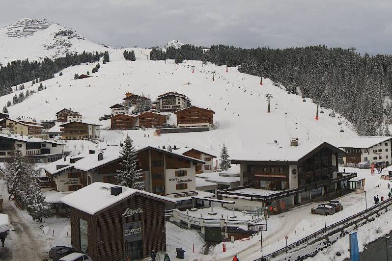 Mostly dry in Lech today but with quite a lot of cloud – 12 January 2023 – Photo: lech-zuers.com
Tomorrow, a new weather front will deliver just a few centimetres of snow to some of the north-western Alps above about 1400m (e.g. Avoriaz, Mürren), but things start to get really interesting from Sunday onwards with a succession of storms moving into the Alps from the north-west.
It will be mild at first with some rain possible to 1700-1900m early on Sunday before it turns colder later in the day and remains on the cold side for much of next week. This “conveyor belt” of storms has the potential to bring huge amounts of snow to some parts of the Alps from Sunday onwards, with more than 1m possible by mid-week, especially in the west. Stay tuned!
Snow conditions are much improved from this time last week thanks to the widespread snowfalls on Sunday and Monday (and a small top-up yesterday in the north-western Alps). However, more snow is needed lower down, especially in the north-west, where many resorts are still trying to rebuild their base below 1600m or so after December’s mild, and at times rainy, weather.
If the weather models are correct though, everything will be back on track soon…
Updated: 11am Wednesday 11 January 2023 - A little rain/snow later today, mostly in the north-western Alps…
Most of the Alps are off to a dry and bright start this morning, with the best of any sunshine the further east and south you are. Cloud is starting to appear in the north-western Alps, ahead of some weather fronts that will bring a little rain/snow to some parts (chiefly the north-west) later today.
 Clouding over again in Engelberg with some rain/snow forecast for later today – 11 January 2023 – Photo: titlis.ch
The areas mainly set to be affected by these latest weather fronts are the northern French Alps (e.g. 3 Valleys, Grand Massif, Portes du Soleil), the northern and western Swiss Alps (e.g. Verbier, Gstaad, Jungfrau region) and the west of Austria (Arlberg). These areas will see another 5-15cm of snow above 2000m later today or overnight. However, with milder air in the mix, the rain/snow limit could start as high as 1600-1900m in some places before lowering towards 1000m everywhere later tonight.
The further south-east you are, the less precipitation there will be from this latest storm, with the far southern French Alps, the far southern Swiss Alps, the southern Austrian Alps and much of Italy (away from the north-west) staying dry.
As for the rest of this week, Thursday will be mainly dry then, on Friday, a few more centimetres of snow are likely to fall in the north-western Alps with a rain/snow limit around 1200-1600m. From Saturday onwards, the weather will become very unsettled indeed as a succession of storms invade the Alps from the west then north-west, lasting well into next week.
It will be mild at first on Saturday, with the risk of rain to 1800-200m in the north-western Alps, before turning colder everywhere with a chance of significant snow for much of the Alps from Sunday onwards. Indeed, some weather models are predicting huge amounts of snow next week, almost anywhere, although the detail is still hard to pin down at this stage.
In the meantime, snow conditions are much improved across much of the Alps following the storm earlier this week. That said, it wasn’t enough to get many of the lowest areas in the north-western Alps open again, including lower parts of the Portes du Soleil and Grand Massif.
Updated: 10.20am Tuesday 10 January 2023 – Remaining unsettled but turning a bit milder…
There is quite a lot of cloud across the northern Alps this morning, with a few residual flurries to 600m, most persistent in the north-east (e.g. Salzburgland) where they could last well into the afternoon. Elsewhere in the northern Alps it should brighten up this morning, and the southern Alps should be mostly sunny all day.
 Looking more like winter this morning in Les Gets, but it remains to be seen how much can be opened – 10 January 2023 – Photo: lesgets.com
This improvement in the weather follows the recent, much-anticipated storm which dumped a significant, but not exceptional, amount of snow across most of the Alps. Most areas saw around 20-40cm above 2000m over the last 48 hours, with 50cm+ in a few favoured spots, including close to the Massif du Mont Blanc.
The snow fell to as low as 600m in parts of the northern Alps, although accumulations were generally modest below 1000m. While this storm alone was not be enough to radically change the situation at very low altitude in the north-western Alps (where there was no base at all), it has brought significantly improved conditions to those areas that were already skiable.
We will have a better idea by tomorrow morning how much (if any) of the previously snowless terrain (i.e. the lower parts of the Portes du Soleil and Grand Massif) can be opened.
As for the forecast, further weather fronts will bring more snow to parts of the Alps between Wednesday and Friday, with the heaviest falls in the northern French, and northern and western Swiss Alps. The rain/snow limit will fluctuate between 1000m and 1600m, meaning that there will also be some rain at times in the lower resorts.
By Friday though we can expect a further 10-15cm, possibly even 20cm of snow, above 1600m in resorts such as La Plagne, Flaine, Avoriaz, Mürren, Engelberg and Lech.
Updated: 9.30am Monday 9 January 2023 – Snow conditions are improving in the Alps!
It’s a complicated weather picture across the Alps today with some bright, and even sunny spells, but generally a lot of cloud, snow showers or longer spells of snow to relatively low levels.
 Snowing at last in Les Gets – 9 January 2023 – Photo: facebook.com/LesGetsOfficiel
The one part of the Alps where the storm has now completely finished is the extreme south-west (e.g. Isola 2000, Prato Nevoso) where it is expected to stay mostly sunny today. Just about everywhere else is likely to see some more snow to varying degrees. The lightest of today’s snowfall will generally fall in the southern Alps (e.g. Sestriere, Livigno, Alta Badia) but, even here they will see another 5-10cm today/tonight.
The heaviest snow will be in the northern Alps (e.g. Avoriaz, Mürren, Engelberg, Lech, Kaprun) later today and tonight, where another 20-30cm of new snow will fall above 1500m by tomorrow morning. The rain/snow limit will start around 1200m in some south-eastern parts of the Alps but will more generally be between 600m and 900m today, perhaps as low as 400m during some of the heavier showers close to the northern fringes of the Alps.
The snow today and tonight will add to the significant snow that this storm has already delivered to many parts of the Alps. Storm totals up to 8am this morning include 17cm at 1850m in Val d’Isère, 35cm at 2500m in Flaine and Chamonix, 37cm at 2500m in Alpe d’Huez, 15cm at 1450m in Lech, and 20cm at 1800m in Alta Badia.
By tomorrow morning, we can expect 48-hour storm totals of around 20-50cm across most the Alps with some favoured spots (such as the Grand Montets in the Chamonix valley) looking at 60cm or more.
This new snow probably won’t be enough to reopen lower slopes in the north-western Alps in areas such as the Grand Massif and the Portes du Soleil but, with 10-15cm forecast at 1000-1200m and 30-50cm above 2000m, it will certainly help the higher areas that are open, and make it feel more like winter lower down.
Another storm is due to hit the northern and western Alps mid-week bringing more significant snow at altitude. However, there will be some milder air in the mix, and rain for a time below 1500-1700m.
Updated: 11.30am Sunday 8 January 2023 – Here comes the snow!
The much-anticipated storm has arrived in the Alps, but it won’t be until later tonight that all areas get in on the action.
 Significant snow has already fallen today in some south-western parts of the Alps and will spread to most other regions later today and overnight. This is Auron – 8 January 2023 – Photo: auron.com
With the angle of attack initially from the south-west, it is the southern Alps (especially the south-west) that will get first dibs on the heaviest snow. At least 15cm has already fallen in Auron/Isola 2000 in the far southern French Alps, for example, with a rain/snow limit around 1400m.
Further north, there have been bits and pieces of snow in the northern French Alps (e.g. Portes du Soleil) and western Swiss Alps (e.g. Zermatt) but with a higher rain/snow limit, which started at around 1500-1700m but is set to drop lower during the middle part of the day.
This storm will reach the eastern Italian Alps (Dolomites), the eastern Swiss Alps (e.g. Davos) and the Austrian Alps later today and overnight. The rain/snow limit will drop to 1000m or lower in many areas by Monday morning but will remain slightly higher for a time in the far south-east (Dolomites).
Monday will see snow continuing at times across many parts of the Alps though precipitation will be more sporadic and lighter in the south (e.g. Sestriere, Monte Rosa, Livigno) than in the north (e.g. Avoriaz, Engelberg, Lech). The rain/snow limit will continue to fall, especially in the northern Alps where it may drop as low as 400-600m in places later in the day.
By Tuesday morning, between 25-50cm of fresh snow is expected across a good portion of the Alps, with a bit less in the extreme south-west (e.g. Isola 2000) and extreme north-east (e.g. Schladming). The greatest accumulations of snow are likely to be at altitude in the northern French Alps with 60cm possible at higher altitudes close to the Massif du Mont Blanc, in resorts such as Chamonix and Flaine.
Lower down in the north-western Alps, where the snow is most needed, around 10-20cm is expected at 1000m by Tuesday morning in resorts such as Morzine. Megève, Villars, Gstaad and Grindelwald.
After a better weather day in the Alps on Tuesday, a new storm will arrive on Wednesday, this time mostly affecting the northern and especially north-western Alps. The rain/snow limit will briefly rise towards 1600-1800m before falling to 1000-1300m later in the day.
Updated: 8.30am Friday 6 January 2023 – Fine today, with snow forecast for Sunday…
Weathertoski is currently in Serre Chevalier where we are looking forward to another sunny day with freezing levels at around 2800m or so. It is also mostly fine elsewhere in the Alps and, after a cold start, will feel pleasantly mild in the sunshine later in the day.
 Sunny skies and good piste-skiing in Serre Chevalier in the southern French Alps – Photo: weathertoski.co.uk
After another dry and mostly fine day tomorrow, the much-anticipated storm will hit the Alps on Sunday and/or Monday bringing snow to all regions in varying quantities. Between 20-40cm is expected above 1800m by the end of Monday across a wide swathe of the Alps, with 50cm+ in places, the heaviest snow generally likely to fall at altitude in the northern French Alps. The north-eastern Alps (e.g. Salzburgland, Styria) will probably see the least snow from this storm.
The snow from this storm probably won’t be enough to get the lower areas of the north-western Alps that have lost most or all of their snow (e.g. Samoëns, Les Gets) back on track, but it’s a start.
After a milder drier interlude mid-week, the jury is still out as to what will happen with the weather in the Alps later next week, with some models pointing towards another major storm and others less convinced. Watch this space…
For our full country by country round-up of snow conditions in the Alps and beyond, please see our latest snow report...
Updated: 7.50am Wednesday 4 January 2023 - Sunny in Serre Chevalier...
Weathertoski is currently in Serre Chevalier where there is plenty of snow and we are expecting lots of sunshine today. Indeed, it will be a fine day for most of the Alps, with only a little nuisance-value low-level cloud in places, mostly in the valleys of the northern and north-eastern Alps. After a cold start, it will feel quite mild in the sunshine (but not excessively warm) during the middle part of the day.
 Clear skies in Serre Chevalier this morning where there is plenty of snow at all levels – 4 January 2023 - Photo: serre-chevalier.com
The weather in the Alps will remain mostly fine for the rest of this week before it turns much more unsettled from the west on Sunday. This much anticipated change in the weather is likely to bring significant snow to the north-western Alps (exactly where it is most needed) late on Sunday and on Monday. Whether it is followed by further storms remains somewhat uncertain, however, as is the rain/snow limit, which is likely to fluctuate considerably due to milder air always being close by or in the mix.
In the meantime, snow conditions remain very poor across much of th north-western Alps, especially the northern French Alps (e.g. Grand Massif, Portes du Soleil, Mont Blanc area) and the northern and western Swiss Alps (e.g. Villars, Gstaad, Jungfrau region) where there is very little natural snow below 1600m or so, and some small resorts in the region are already closed. To find any extensive skiing in the north-western Alps, you need to be in a resort with lots of terrain above 2000m or so such as L’Espace Killy, the 3 Valleys and the Paradiski.
Elsewhere in the Alps, snow depths are also below par but the situation is not quite as critical as it is lower down in the north-western Alps. Snow cover is patchy in the lower resorts of the Austrian Tirol and Salzburgland, for example, though there are still quite a decent number of pistes open.
Better still are the Dolomites, which avoided all the recent rain and whose world-beating snowmaking has allowed them to offer some very consistent on-piste snow quality all season.
Updated: 10.30am Tuesday 3 January 2023 - There is snow in France, even lower down, you just need to know where to look!
Weathertoski is currently in Serre Chevalier in the southern French Alps, where we are pleased to confirm there is plenty of snow, even at resort level where we are in Chantemerle (1350m).
 Plenty of snow, even low down in the Serre Chevalier area. This is Chantemerle at 1350m – 3 January 2023 – Photo: weathertoski.co.uk
The weather is somewhat cloudy this morning in Serre Chevalier, but it is expected to clear up later with a mostly sunny and mild week to come.
Elsewhere, there will be quite a lot of cloud and the odd shower/flurry across some northern parts of the Alps in the next day or two, but no significant snow is expected until Sunday at least. Things get interesting next week though, with the prospect of some much-needed heavy snow for many parts of the Alps.
Back to Serre Chevalier, there is still excellent cover at all levels despite the recent mild temperatures, thanks to this corner of the Alps getting a lot of snow a few weeks back. Other nearby resorts in France that are in pretty good shape right now include Montgenèvre and Puy St Vincent.
By contrast, aside from some high resorts (such as Val d’Isère, Tignes and Val Thorens), many resorts in the northern French Alps are struggling, with only very patchy snow below about 1600m or so. Morzine, for example, is now down to just two runs, and the likes of Les Gets and Megève are not faring much better. The situation is also pretty dire in the lower resorts of western and northern Switzerland such as Villars, Leysin, Gstaad, the Jungfrau region and countless lesser-known resorts, many of which are closed.
On the whole, the further south and east you are in the Alps, the better the conditions relative to altitude. As previously mentioned, parts of the southern French Alps (including Serre Chevalier) have plenty of snow right snow, and many Italian resorts are also offering plenty of decent piste skiing, even if snow depths remain modest. The Dolomites (e.g Madonna di Campiglio, Arabba) is a case in point. Excellent snow-making, and avoiding the recent rain, has allowed them to offer good piste-skiing all season so far.
Conditions in eastern Switzerland and Austria are a bit more mixed, with patchy natural snow cover in the classic lower resorts of the Austrian Tirol and Salzburgland (e.g. Söll and Zell am See) although a good number of pistes remain open. For the most consistent snow conditions you need to be higher and/or further south in resorts such as Sölden, Obergurgl or even Bad Kleinkirchheim.
As already mentioned, there is a major pattern change coming next week though, with the prospect of some significant snow for many parts of the Alps. Stay tuned for details…
Updated: 2pm Sunday 1 January 2023 – Remaining mild for the first week of January, with little in the way of fresh snow in the forecast…
It’s a mostly dry and very mild day in the Alps today, with plenty of sunshine and freezing levels close to 3000m. It will remain mostly dry for much of this week too, although very weak weather fronts will flirt with the northern Alps from time to time bringing the odd shower or flurry here and there. Temperatures will also become a little cooler mid-week, though they will still be mild overall.
 A mild and mostly sunny start to 2023 in the Alps. This is near Heiligenblut in the central Austrian Alps – 1 January 2023 – Photo: foto-webcam.eu
Snow conditions remain substandard for early January across most of the Alps. As has been the case for some time now, the lower resorts of the north-western Alps are in the most trouble, including (but not limited to) areas such as Megève, La Clusaz, the Portes du Soleil, Villars, Gstaad and the Jungfrau region.
Resort authorities have done an amazing job at keeping some runs open in these areas but the relentlessly warm weather is limiting what they are able to do, and some resorts are now hanging on by the skin of their teeth, including Les Gets where only two runs remain open. Other lesser-known low resorts in the Savoie and Haute-Savoie have already closed, as have most in the Jura, the Vosges and the Massif Central.
Higher resorts in the north-western Alps (such as Val d’Isère, Tignes, Val Thorens, Les Arcs and La Plagne) are still offering plenty of skiing, though the lack of snow lower down will inevitably be putting pressure on the higher runs.
Elsewhere in the Alps, the situation gradually gets better the further south-east you go, although snow depths are below par everywhere. The most consistent on-piste snow conditions continue to be found in the Dolomites or the higher resorts of the central and eastern Alps, such as Obergurgl, Sölden and Obertauern.
So, to the all-important question - when we will we see the next serious snow?
Weather models are fairly consistently predicting a major pattern change sometime around 8-11 January, with an increasing probability of widespread significant snow across the Alps. However, it is still way too far out to be sure how things will pan out and, right now, we can only tell you that there is a reasonable but not definite chance that things will improve considerably in about 10 days or so. Until then, stay tuned...