

ARCHIVE
Today in the Alps - February 2018
Read about current weather and snow conditions in the Alps
Updated: 10am Tuesday 27 February 2018 - Bitterly cold but turning milder later in the week
The cold spell in the Alps is pretty much at its peak right now with a temperature of -36°C recorded first thing this morning at Glattalp, a famous “frost pocket” in the Swiss canton of Schwyz. Expect maximum temperatures of around -14°C to -18°C at 2000m today, and -20°C to -25°C at 3000m.
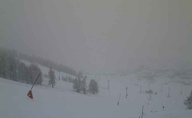
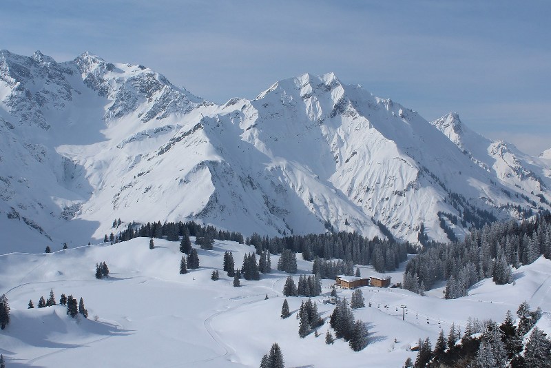 Sunny but bitterly cold in the Austrian Vorarlberg today. This is Warth-Schröcken – 27 February 2018 – Photo: warth-schroecken.at
There are some areas of cloud around in the Alps today, especially in the eastern Austrian Alps where there are even a few light flurries, but there is generally plenty of sunshine, especially at altitude.
On Wednesday and Thursday we are expecting some significant snow across the southern French and south-western Italian Alps (e.g. Risoul, Isola 2000, Prato Nevoso, Sestriere).
Snow conditions remain good across the Alps, especially on-piste, but watch out for the cold which will peak today before it starts to ease tomorrow.
Updated: 10.10am Monday 26 February 2018 - Bitterly cold!
As expected it has turned bitterly cold in the Alps, as it has across much of central and northern Europe.
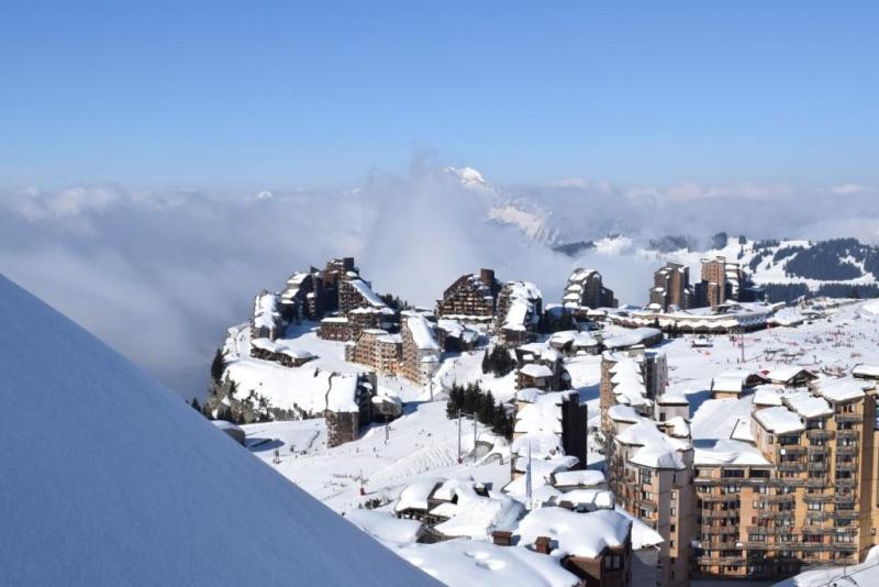 Bitterly cold today in the Alps but mostly sunny at altitude at least. This is Avoriaz – 26 February 2018 – Photo: avoriaz.com
In the eastern Alps it is mostly sunny. Further west, there is quite a bit of low cloud around but also sunshine at altitude. Except for the odd light flurry here and there, it is mainly dry.
The main talking point today and for the next couple of days is the temperature. As a guide, expect maximum temperatures of around -15°C to -18°C at 2000m today, and -20°C to -26°C at 3000m - without wind chill!
The weather in the Alps will start to turn milder in the second half of the week (with significant snow for the south-west) but for the next two or three days the main message is to wrap up warm!
Updated: 9.45am Saturday 24 February 2018 - Fresh snow in the south-western Alps then bitterly cold everywhere next week
There is a lot of fresh snow in the far south-western Alps right now (e.g. Sestriere, Prato Nevoso, Limone). Snow has also spilled over the French border into resorts such as Val Cenis and Val d’Isère where there is 70cm of fresh snow on the Pisaillas glacier this morning, and 15cm in town.
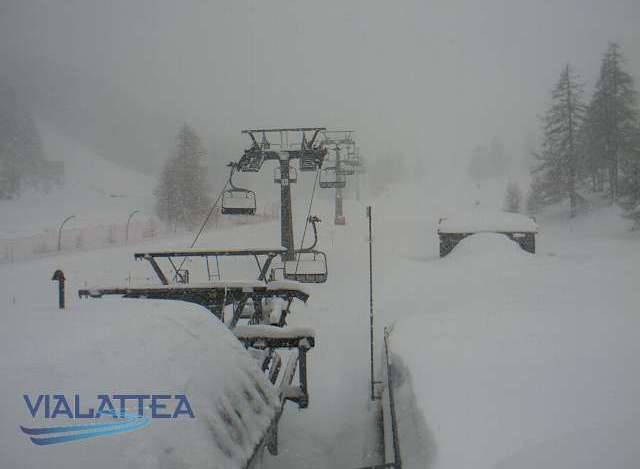 Lots of fresh snow in the south-western Alps. This is Sestriere – 24 February 2018 – Photo: vialattea.it
Elsewhere in the Alps there a few flurries here and there but also plenty of dry weather, with the best of the sunshine at altitude in the northern and eastern Alps.
Next week it is set to turn much colder everywhere, with daytime maximums below zero at all levels and temperatures as low as -20°C to -25°C at high altitude. If you are skiing in the Alps from Monday onwards, make sure you are very well wrapped up!
Updated 9.10am Friday 23 February 2018 - Warning for severe cold next week!
A serious warning about the temperature in the Alps next week - it’s going to be extremely cold, on a level we haven’t seen for a few years.
 Looking wintry in the Portes du Soleil. This is Châtel – 23 February 2018 – Photo: chatel.com
The extreme cold will arrive on Monday, then peak on Tuesday and Wednesday, but will probably continue to some degree for the rest of the week. Maximum daytime temperatures during this period are likely to be between -2°C and -8°C in the lowlands, -8°C to -11°C at 1000m, -13°C to -18°C at 2000m and -20°C to -25°C at 3000m. Note that these temperatures are without wind chill. There will be quite a strong breeze at times at altitude which could make it “feel like” -30°C to -40°C above 3000m.
Needless to say, if you are skiing in the Alps next week, you should be prepared, take extra layers, make sure your gloves are of high quality (and/or wear inners) and take some sort of face mask.
 New snow this morning in the Milky Way. This is Sestriere – 23 February 2018 – Photo: vialattea.it
Back to today and we have some significant snow in the forecast for some south-western parts of the Alps, especially the southern Piedmont (e.g. Milky Way, Prato Nevoso). Elsewhere in the southern Alps there will be a scattering of flurries but the northern half of the Alps should stay mostly dry with variable cloud.
Saturday will be a repeat performance with further significant snow for some south-western parts of the Alps, but drier with just isolated flurries further north and east.
As for snow conditions, if it’s powder you are after this weekend then you need to head to the likes of Sestriere, Sauze d’Oulx, Bardonecchia, Prali, Prato Nevoso, Limone and Isola 2000, to name just a few. Elsewhere in the Alps new snow will be more scarce but you can still be sure of some good piste skiing. This weekend won’t be particularly cold either, as we are not expecting the Siberian air to really bite until Sunday night/Monday.
Updated: 9.10am Thursday 22 February 2018 - Snow for some today
There is a lot of cloud across the Alps today. Many places are dry again but there are some flurries, mostly in the southern and eastern Alps, with the southern Piedmont (e.g. Prato Nevoso, Limone) likely to see the most significant snow.
 Cloudy with light snow flurries in Zell am See today – 22 February 2018 – Photo: zellamsee-kaprun.com
Other the next couple of days the weather pattern will remain broadly the same. However, snowfall in the western Italian Alps (especially the Piedmont) will become more significant, perhaps spilling over the border to affect some adjacent French resorts such as Val d’Isère, Val Cenis and Montgenèvre.
As we have been mentioning over the last few days, watch out for a big drop in temperature later on Sunday and into the first part of next week. This impending cold spell has the potential to be extreme, especially in Austria, with temperatures of -25°C or below likely at high altitude.
Updated: 9.50am Wednesday 21 February 2018 – Cool with variable cloud and a few flurries
Cloud cover is highly variable across the Alps today. Many resorts will be dry with some good sunny breaks in places, but there will also be some flurries, mostly in the eastern Austrian Alps (e.g. Obertauern) and the far south-western Italian Alps (e.g. Prato Nevoso).
 Variable cloud cover across the Alps today, this is Schröcken – 21 February 2018 – Photo: warth-schroecken.com
Some more significant snow is expected over the next couple of days in both the southern Austrian Alps (e.g. Nassfeld) and the southern Piedmont (e.g. Prato Nevoso, Limone, Setriere) while the northern and western Alps (i.e. most of the French, Swiss and western Austrian Alps) will stay mostly dry.
Later in the weekend some very cold Siberian air will draw in from the east and continue to influence the weather in the Alps early next week. Don’t expect widespread snow, but do expect some very frigid temperatures!
Snow conditions in the Alps remain generally good with the freshest snow currently in the eastern Austrian Alps. But if it’s deep powder you are after, later this week/this weekend you might want to consider heading to resorts in the extreme south-western Alps such as Prato Nevoso and Limone in Italy, and perhaps even Isola 2000 across the border in France.
Updated: 10am Tuesday 20 February 2018 - Early warning for severe cold next week
There is a lot of cloud around the Alps today with a scattering of snow flurries, mostly in the east (i.e. Austria). The best of any sunshine is in the southern French Alps.
 A sunny spell early this morning in the Astental, but for most of Austria it will be a cloudy day with snow flurries – 20 February 2018 – Photo: foto-webcam.eu
Over the next few days there will be little change in the weather. It will be relatively cold with variable cloud and some snow flurries, still mostly in the eastern Alps, especially in eastern Austria. However, the southern Piedmont (e.g. Prato Nevoso) also has the potential to see some moderate snow from time to time.
All eyes then turn to later in the weekend and next week when intense cold is set to flood into western Europe from Siberia. There will also be further snow, probably most significant across the southern Alps, but it is the cold that we are most concerned about as it could be quite extreme.
If you are skiing in the Alps next week, watch this space!
Updated: 1pm Monday 19 February 2018 - Siberian blast incoming!
There is quite a lot of low cloud around the Alps today but it is mostly sunny at altitude, with some excellent snow conditions on offer.
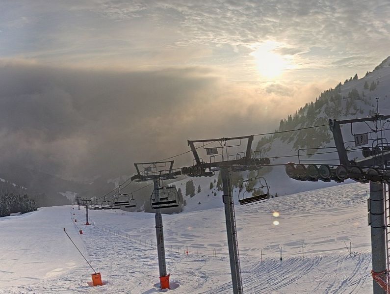
 Fabulous weather and snow conditions at altitude in the Skicircus today. This is Leogang – 19 February 2018 – Photo: saalfelden-leogang.com
Over the next few days we are going to see some increasingly cold Siberian air arrive from the east. Many places will stay dry but there will also be some snow flurries, particularly in the eastern Austrian Alps (e.g. Obertauern) as well as the southern Piedmont (e.g Prato Nevoso).
Later in the week and next weekend watch out for some extreme cold, especially in the eastern half of the Alps where the wind-chill could reach -30°C in places.
Generally speaking, snow conditions in the Alps remain good despite the warm spell at the end of last week, which saw rain to 2200m for a time in the west. Much colder weather is also on the way and set to last for some time, so prospects for Easter are also good. This is especially true for anywhere above 1500m where the snow-pack remains deep across the board, and exceptionally deep in places.
Updated: 9am Friday 16 February 2018 – Mild with further rain/snow for some northern and western areas
Weathertoski is in Les Arcs where it is cloudy with occasional rain this morning and a rain/snow limit of around 2000m. The weather is expected to slowly improve as the day goes on but it will remain very mild for the time of year.
 A mild and damp start in the northern French Alps. This is Les Arcs – 16 February 2018 – Photo: weathertoski.co.uk
It is also raining or snowing across many northern parts of the Alps with a rain/snow limit between 1800-2000m in France, 1400-1800m in Switzerland and 600-1200m in Austria (with the coldest air always furthest east).
Generally speaking the weather is drier across the southern Alps with some good sunny breaks, especially in the south-east (Dolomites) and extreme south-west (e.g. Prato Nevoso).
Snow conditions in the Alps this half term were generally excellent up to and including Wednesday but have since become more variable due to the milder air. Here in Les Arcs, for example, there is fresh snow at high altitude but the snow-pack is now very wet below 2200m or so.
The milder air has had less of an effect the further south-east you go with the most consistent snow quality, at least in the short term, now in the central/eastern Italian and southern Austrian Alps (e.g. Passo Tonale, Dolomites, Nassfeld).
The weather in the Alps will stay changeable on Saturday with further precipitation in the west and a rain/snow limit dropping from 1800m or so to under 1000m later.
Updated: 9am Thursday 15 February 2018 - Milder with a mix of rain and snow for the northern and western Alps
Weathertoski is in Les Arcs where we have seen around 8cm of fresh snow overnight but it is now turning to rain!
 Early snow this morning in Les Arcs has now turned to rain below 2000m – 15 February 2018 – Photo: weathertoski.co.uk
This change in the weather is due to the arrival of a warm front which has proved a bit more active than forecast this time yesterday, and is mostly affecting the north-western Alps – i.e. the northern French Alps (roughly north of Les 2 Alpes), much of Switzerland (away from the far south, the west of Austria (e.g. Arlberg) and the far north-west of Italy (e.g. Courmayeur).
These areas will all see precipitation from time to time today, as well as rising temperatures. Here in Les Arcs the snow is already turning to rain below 2000m, and the rain/snow limit could reach 2200m in the middle of the day. Further into the interior (e.g. the Swiss Valais) it is snowing to much lower levels, but rain will eventually win out lower down here too.
After several days of excellent skiing in the Alps, conditions are clearly not as good today, especially where it is raining at low levels in the west. As a rule, the further south-east you are in the Alps today the better the weather will become, with the best of any sunshine in the Dolomites.
The next few days will remain unsettled and mild with the heaviest precipitation always in the north-western Alps and a relatively elevated rain/snow limit of between 1200m and 2000m.
Updated: 9am Wednesday 14 February 2018 - Another great day’s skiing expected in the Alps
Weathertoski is in Les Arcs where it is cloudy this morning with a temperature of around -7°C. Last night’s weather front didn’t produce any snow here in the Tarentaise, just a few centimetres in some northern and western foothills of the French Alps and the far west of Switzerland.
 Cloud in Les Arcs already starting to break up this morning – 14 February 2018 – Photo: weathertoski.co.uk
Any cloud in the western Alps is expected to break up this morning leaving most of the French Alps with a sunny if still rather cold day. Elsewhere in the Alps it will also be mostly fine today but slightly less cold than yesterday, at least in the west.
Tomorrow, however, a warm front is set to arrive from the west which will bring some rain/snow to some northern and western parts of the Alps, especially France and Switzerland. This front is not expected to be particularly active but it will raise the rain/snow limit from low levels to as high as 2000m in places later in the day.
The further south and east you are in the Alps, the less likely you are to see any significant perception tomorrow with many parts of Austria and Italy (away from the far west) staying dry.
For the moment, snow conditions in the Alps remain excellent, especially on-piste.
Updated: 9.30am Tuesday 13 February 2018 - Fabulous conditions continue across the Alps…
Weathertoski is in Les Arcs where it is clear and cold, with a temperature of around -13°C at 8am this morning!
 Deep blue skies and cold temperatures today in Les Arcs – 13 February 2018 – Photo: weathertoski.co.uk
The weather is expected to stay fine in the French Alps for most of the day with just a little high cloud arriving from the north-west later in the afternoon. With the exception of some early snow showers in the eastern Austrian Alps, most other regions will also see plenty of sunshine today.
A weak weather front will produce a few flurries in the far western Alps tonight. These will clear early on Wednesday then most regions will again be fine with plenty of sunshine. Thursday will see more unsettled but milder weather moving into the western Alps, then further east on Friday. The rain/snow limit will start low on Thursday but will rise to 1800m in some exposed parts of the French and western Swiss Alps as the day progresses.
Right now snow conditions are superb across most of the Alps, especially in the north where most of yesterday’s fresh snow fell (up to 40cm in some parts of Switzerland and Austria). Given the forecast, be aware that snow conditions will become more variable on Thursday and Friday, especially in the northern and western Alps where it will turn very mild with a mixture or rain and snow.
Updated: 9.30am Monday 12 February 2018 - Fresh snow for many parts of the Alps
Weathertoski is in Les Arcs where we have had 10-15cm of snow overnight. This morning it is still partly cloudy with flurries and a temperature of about -7°C.
 10-15cm of new snow overnight here in Les Arcs – 12 February 2018 – Photo: weathertoski.co.uk
Last night’s snow was accompanied by a big drop in temperature which means that the new snow is extremely light in consistency. Snow conditions are therefore excellent today in Les Arcs, both on and off-piste.
Snow showers will die away from the north-western Alps today but will continue further east, notably in Austria. Some central and eastern parts of the Italian Alps (e.g. Livigno, Dolomites) will also see some snow showers today but the south-western Alps (e.g. Sestriere, Isola 2000) will be mostly dry with sunny spells. Tuesday will be a better weather day all-round but it will be cold.
Snow conditions this half-term have turned out very favourably, especially on-piste, with few if any weaknesses anywhere. The Pyrenees are also in excellent shape.
Updated: 8.40am Sunday 11 February 2018 – Mixed weather but good snow conditions
Weathertoski is in Les Arcs, where it is cloudy with light snow flurries this morning and a temperature of about -2°C.
 Cloudy with light snow flurries in Les Arcs this morning – 11 February 2018 - Photo: weathertoski.co.uk
Flurries are expected right across the north-western Alps today, heaviest later in the day in the northern French and Swiss Alps (e.g. Portes du Soleil, Engelberg). The rain/snow limit will start very low but will rise towards 1000m or more in some exposed areas of the west as the day progresses. The further south and east you are in the Alps, the less likely you are to see any snow today, with many central and eastern Italian resorts (e.g. Dolomites) staying dry and bright all day.
Tonight and tomorrow morning snow showers will become a bit more widespread across the Alps before they die out from the west later tomorrow. Tuesday will be a better weather day with plenty of sunshine across the Alps.
Snow conditions are very good across both the Alps and the Pyrenees as we begin the busiest week of the season, with few if any real weaknesses, especially on-piste. Off-piste the situation is a little more mixed but there is still plenty of excellent skiing to be found.
Updated: 10am Thursday 8 February 2018 – Looking good for half term
There is a lot of cloud around in the Alps today but also some sunshine, especially at high altitude in the western Alps. Most places will be dry, but expect a few flurries (to low altitude) across the eastern Austrian Alps this morning.
 Lots of low cloud in the western Alps this morning but sunny at high altitude – 8 February 2018 – Photo: laplagne.com
The next few days will be rather mixed with some occasional, mostly light to moderate snow showers across the northern and western Alps (i.e. the French Alps roughly north of Grenoble, most of the Swiss Alps away from the far south - notably away from Ticino - and the Austrian Alps away from Carinthia and Osttirol).
The southern Alps will see the best of any sunshine and stay mostly dry. It will be chilly but not excessively cold with freezing levels typically between 500m and 1000m.
Snow conditions for the busy half term week are expected to be very good across most of the Alps, especially on-piste. Off-piste the situation is more variable but there is still plenty of good skiing to be found, especially with a guide.
Updated: 10.30am Wednesday 7 February 2018 - Mixed weather but excellent snow conditions in the Alps
The weather in the Alps is very mixed today with a lot of cloud, some flurries in places, but also some sunny breaks.
 Lots of cloud around the Alps today. This is Innsbruck – 7 February 2018 – Photo: foto-webcam.eu
Most of today’s flurries will be in the Austrian Alps, especially in the east. They will fall to low levels but will remain light. There is a lot of low cloud elsewhere in the Alps but there will also be some decent sunny spells, especially at altitude and in the west.
Over the next couple of days there will be a few light flurries here and there but also plenty of fine dry weather. It will remain relatively cold.
All in all, as we approach the busiest week of the season snow conditions are excellent, especially on-piste. Right now, the best of any powder in the Alps is in the far south-west, close to the French/Italian border from about Sestriere southwards (e.g. Prato Nevoso, Limone, Isola 2000). There is also significant fresh snow in the Pyrenees.
Updated: 10.30am Tuesday 6 February 2018 – Further snow for some south-western parts of the Alps
The weather in the Alps is being controlled by an area of low pressure in the western Mediterranean that is dragging humid air and some snow into the south-western Alps.
 Fresh snow in Sestriere – 6 February 2018 – Photo: vialattea.it
Yesterday we saw around 20-30cm of snow in the far southern French and south-western Italian Alps (e.g. Auron, Isola 2000, Prato Nevoso). Elsewhere, there were a few flurries here and there but most of the northern half of the Alps was dry with sunny spells.
Today there will be further snow showers (300-500m) in the south-western Alps, heavy at times close to the southern border regions (e.g. Prato Nevoso, Isola 2000), while the northern half of the Alps stays mostly dry. It will be relatively cold across most of the Alps, but a bit milder in some Foehn-affected valleys in the central and northern Alps, especially in Switzerland (e.g. Bernese Oberland).
Snow flurries may become a little bit more generalised across the Alps on Wednesday though will generally remain light. The end of the week should then be mostly dry with just a few isolated flurries here and there. The ambient temperature will remain relatively but not excessively cold.
Updated: 9am Monday 5 February 2018 - Snow for south-western Alps
Some south-western parts of the Alps have fresh snow this morning, particularly the southern French Alps (e.g. Auron, Isola 2000, Val d’Allos) but also the likes of Prato Nevoso, Limone and Sestriere on the Italian side.
 Heavy snow this morning in the southern French Alps. This is Auron – 5 February 2018 – Photo: auron.com
Elsewhere in the Alps, except for a few flurries here and there, most places are dry with the best of any sunshine the further north and east you are (e.g. Austria).
Tuesday will see further snow showers across the south-western Alps while on Wednesday and Thursday any snow will be more focused on the south-eastern side of the Alps (e.g. Dolomites), as well as parts of Austria.
It will turn a little milder for a time but certainly nothing to worry about, with snow conditions looking excellent, especially on-piste, as we approach the busy half term period.
 Sunny today in the north-eastern Alps. This is Leogang in Austria – 5 February 2018 – Photo: foto-webcam.eu
Updated: 12pm Sunday 4 February 2018 - Great snow conditions across the Alps
It’s a cold but mostly fine day across the Alps with just the odd flurry here and there. Tonight and tomorrow some more significant snow will affect parts of the southern French and western Italian Alps.
 The Dolomites have some of the best snow conditions in the Alps right now. This is Kronplatz – 4 February 2018 – Photo: kronplatz.com
Snow conditions in the Alps are generally very good, especially on-piste. Off-piste the situation is more mixed, with the deepest fresh snow currently in the south-eastern Alps. Indeed, parts of the Dolomites as well as the far south of Austria (Carinthia) have seen between 50cm and 100cm of new snow in the last couple of days.
The coming week will be relatively cold, with lots of dry fine weather around but also some snow in places, chiefly across the southern Alps. All in all, it’s a very positive picture in the run up to half term!
Updated: 9.50am Friday 2 February 2018 - Further snow in places, heaviest in the far south-east
As expected, the deepest fresh snow this morning is across the far south-eastern Alps where Nassfeld (Carinthia) reports 60cm of fresh since yesterday afternoon! The Dolomites have also done well overnight, with as much as 40cm of new snow in places (e.g. Kronplatz).
 Serious snow in Carinthia this morning – 2 February 2018 – Photo: bergimdrautal.at
Many other parts of the Alps have also seen some snow to varying degrees over the last 24-36 hours, with the other main hotspot being the north-western Alps. Flaine, Avoriaz and Chamonix, for example, all saw around 40cm of snow at altitude with the rain/snow limit descending to very low levels during the day yesterday.
It will continue to snow today for a while in the far south-eastern Alps. Elsewhere, except for a few flurries here and there, there will be plenty of dry if rather chilly weather with some spells of sunshine.
The next few days will remain cold with some patchy light snow in places, chiefly across the southern Alps, but further spells of sunshine for many, particularly at altitude.
All in all, the snow situation is an extremely encouraging one as we approach the busy half term week, with no real weak spots anywhere across the Alps.
Updated: 9am Thursday 1 February 2018 - Snow for many
The weather in the Alps has changed, with some resorts waking up to fresh snow this morning. So far most of the snow has been in the north-western Alps (e.g. Avoriaz) but as the day wears on the heaviest falls will transfer to the south-east (e.g. Cortina, Nassfeld).
 Snowing to relatively low levels in the north-western Alps this morning. This is La Clusaz – 1 February 2018 – Photo: laclusaz.com
The rain/snow limit started at around 1300m last night in the north-west but has since fallen to 600-800m and will lower further later on. As we mentioned earlier, the heaviest of the precipitation so far has been in the north-western Alps with at least 20cm at 1800m in the Haute-Savoie (e.g. Avoriaz, La Clusaz, Flaine).
However, with a secondary area of low pressure forming over the Mediterranean, the Dolomites and the far south of Austria will also see a significant fall of snow later today and tonight. These areas, especially the south-east of Carinthia, could see 50cm+ by Friday. Most other areas of the Alps will see at least a bit of snow over the next 24 hours, but it is the above mentioned areas that will see the most.
Over the weekend and into the first part of the next week it will remain cold with further patchy snow in places, though not generally in any significant quantities.
Snow conditions in the Alps look excellent as we approach the busy half term period, particularly on-piste - which is what the vast majority of people will be concerned about that week! Off-piste it’s more of a mixed bag thanks to recent wind and fluctuating temperatures.
If it is deep powder you want and you can get away this weekend, head to Carinthia (e.g. Nassfeld) or even Slovenia.