

ARCHIVE
Today in the Alps - February 2017
Read about current weather and snow conditions in the Alps
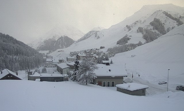
Updated: 9.55am Tuesday 28 February 2017 - Stormy, snow for many
After a couple of spring-like days the weather in the Alps has turned very unsettled, with Atlantic weather fronts moving west to east during the course of day.
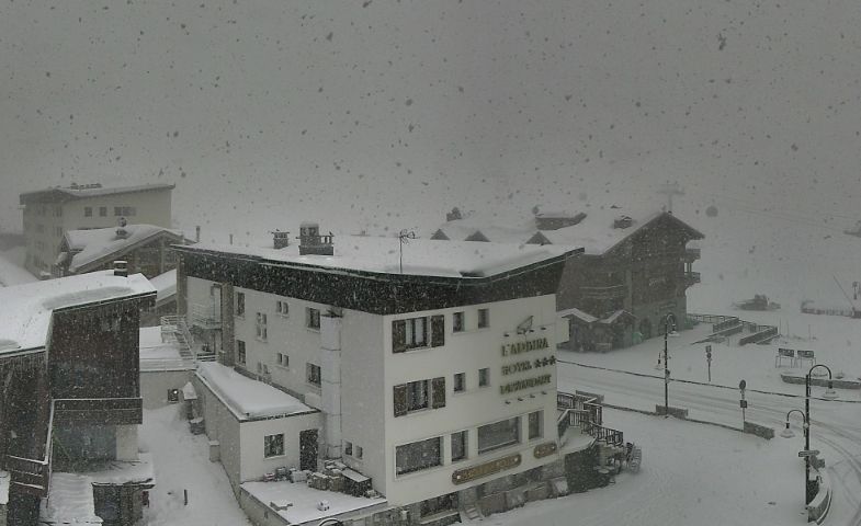 Heavy snow in Tignes this morning – 28 February 2017 – Photo: tignes.net
Most regions will see snow over the next 36 hours, though intensities and freezing levels will vary. This morning the rain/snow limit is generally between 1100m and 1400m but will drop steadily to under 1000m in most places later.
The greatest snowfall totals will be at altitude in the western and southern Alps, with 50cm+ possible above 1800m in resorts as far apart as Chamonix and Passo Tonale. More generally, most resorts are looking at between 10cm and 40cm.
It will remain unsettled for the rest of the week with bits and pieces of snow in places. However, temperatures will creep up again which means that some rain is also possible at times lower down. Many regions will also enjoy some drier, brighter interludes, especially on Thursday and Friday.
Updated: 1.55pm Monday 27 February 2017 - An unsettled week
It’s a very unsettled week in store for the Alps, with a succession of weather fronts moving in from the Atlantic. The heaviest snow will be in the western and southern Alps, the least precipitation in the north-east. Temperatures will fluctuate, which means that some rain is also possible at times lower down.
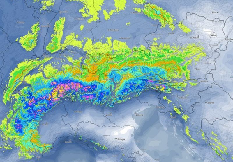 Predicted snowfall totals this week in the Alps clearly favour southern and western regions – Photo: bergfex.com
The first and biggest storm will begin tonight and peak tomorrow. This will deliver at least some snow to most of the Alps but will be most potent in the west and south, with the least snow falling in the northern and eastern Austrian Alps. The rain/snow limit will start quite high – typically around 1500m tonight, before falling gradually to under 1000m later tomorrow. Snowfall totals will vary enormously from region to region, but Avoriaz and Passo Tonale are just two examples of resorts in the western and southern Alps that could see 50cm or more above 1800m.
The rest of the week will remain unsettled with further precipitation at times, heaviest in the western Alps. However it will turn milder again with some rain also likely at lower altitudes. There will also be some drier and brighter interludes, with the best overall weather day likely to be on Friday.
Updated: 9.45am Friday 24 February 2017 - Fresh snow for some, especially in the northern Alps
A cold front has introduced colder, cloudier weather today with snow in places, mostly across the northern half of the Alps. The best of any brightness will be in the far southern Alps. This will come as a welcome contrast to yesterday’s balmy weather, when temperatures reached 10°C in Val d’Isère and 22°C in Salzburg!
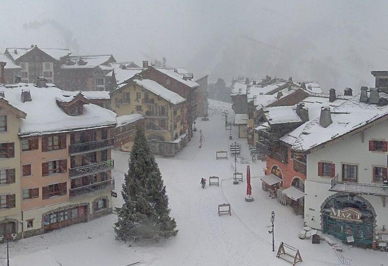 Light snow in Arc 1950 this morning, but it won’t amount to much – 24 February 2017 – Photo: lesarcs.com
It may be much colder today but snowfall totals across the northern half of the Alps are expected to be fairly modest, generally just a few centimetres here and there, and perhaps 10-20cm in some favoured parts of the Swiss and western Austrian Alps. The rain/snow limit will drop to under 1000m as the day progresses.
Not surprisingly, snow conditions have been very mixed over recent days with spring-like snow quality at low altitude. Today’s drop in temperature will temporarily improve matters but it will turn milder again over the weekend. The next significant snow is expected on Tuesday and Wednesday, mostly in the western Alps.
Updated: 10am Wednesday 22 February 2017 - Mild, some new snow at altitude in the north-eastern Alps
Apart from a few residual clouds in the north-eastern Alps, yesterday’s bad weather has cleared, leaving many parts of the Alps with a fine and sunny day.
 New snow at altitude in Ischgl – 22 February 2017 – Photo: ischgl.com
The rain/snow line was a bit higher than anticipated yesterday, typically between 1700m and 2000m. However, above 2000m there was 15-30cm of new snow in the northern and western Austrian Alps, and few centimetres in some northern and north-eastern parts of the Swiss Alps. The southern Alps stayed mainly dry.
After a couple of mostly dry and very mild days, the next significant snowfall is due on Friday, again mostly across the northern Alps but this time affecting the northern French and Swiss Alps as well as Austria.
Snow conditions remain very mixed across the Alps, with generally soft or even wet snow at low altitude, especially where it has rained. Higher up, however, there is still some good skiing to be found, especially above 2000m in Austria (away from the south) where it snowed yesterday. Generally speaking, however, snow depths are below par.
Updated: 9.30am Tuesday 21 February 2017 - Some snow at altitude for the north-eastern Alps
The weather has taken a turn for the worse today across the northern Alps, with rain and snow in places. The southern Alps will remain mostly dry, however, with variable cloud and some sunny spells here and there.
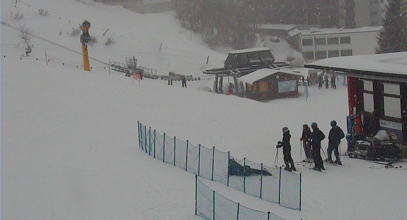
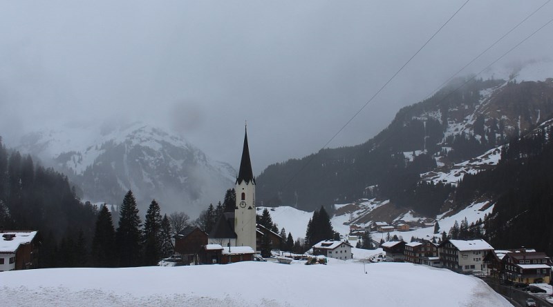 Bad weather day in the Austrian Vorarlberg, with a mix of rain and snow. This is Schröcken – 21 February 2017 – Photo: warth-schroecken.com
The most significant precipitation today will be in Austria, north of the main Alpine ridge (i.e. Vorarlberg, Tirol, Salzburgland), with a rain/snow limit between 1200m and 1600m (east to west). Above 1800m, 10-20cm of snow is possible here and there, locally a bit more.
The eastern Swiss Alps will also see a few centimetres of snow at altitude, but the western Swiss and northern French Alps will see little if any. The entire southern half of the Alps should also stay mostly dry.
Snow conditions in the Alps are, unsurprisingly, quite mixed at the moment. Some higher Austrian and eastern Swiss resorts will benefit from fresh snow today, but lower down it will fall as rain and, more generally speaking, mild temperatures mean that the snow is turning a bit spring-like in places.
With no sign of a sustained return to winter any time soon, altitude will be the key to good snow quality if you are skiing in the Alps over the next week or so.
Updated: 9.30am Monday 20 February 2017 - Mostly dry, best of the sunshine in the west
The weather in the Alps will slowly turn more unsettled this week, but it won’t be until Friday until there is any chance of any widespread or significant snowfall.
 Sunny skies in the French Alps this morning. This is Val d’Arly – Photo: valdarly-mtblanc.com
Today will be mostly dry with just one or two showers (snow 1200m) in the eastern Austrian Alps, while the western Alps will see the best of the sunshine.
On Tuesday, showers will become more widespread across the eastern Alps, especially in Austria. However, with milder air in the mix, the rain/snow limit will rise to 1500-1700m. Above 2000m, 10-20cm (locally more) of snow is possible here and there (e.g. Kitzsteinhorn glacier). Later in the week (probably Friday) heavier and more widespread snow is likely across the Alps.
Snow conditions in the Alps remain pretty good for most recreational skiers happy to stay on the piste. However, off-piste conditions are more mixed and, generally speaking, snow depths remain below par for mid-February, especially at low altitude and in the western Alps.
Updated: 9.30am Sunday 19 February 2017 - Mostly sunny
It’s mostly sunny across the Alps today. Tomorrow and Tuesday weak weather fronts will bring a little snow (1200-1500m) to some northern and north-eastern parts of the Alps, but quantities will be extremely modest.
 Sunny in the French Alps today. This is Montalbert – 19 February 2017 – Photo: montalbert.com
There is hope of some more significant and widespread snow towards the end of the week but this is still to be confirmed.
Snow conditions in the Alps have been pretty good for most recreational skiers in recent days. However, the off-piste remains very mixed and snow depths in most regions remain below par. This will be of increasing concern to low altitude ski areas if there isn’t a major dump soon.
Updated: 12pm Saturday 18 February 2017 - Clearing skies and fresh snow in the north-eastern Alps
There is still some cloud in the eastern Austrian Alps this morning, but elsewhere it is mostly sunny. This follows yesterday’s snowfall across the northern Alps, which delivered 10-25cm to parts of Austria (20cm in Lech, for example) as well as the northern and eastern Swiss Alps (e.g. Engelberg).
 Fresh snow and clearing skies in Mellau in the Austrian Vorarlberg – 18 February 2017 – Photo: mellau.at
The western Swiss Alps saw much less snow, the northern French Alps almost nothing. Most of the southern Alps also stayed dry. The next couple of days will be mostly fine, with the next snow due to affect the north-eastern Alps (mostly Austria and the far east of Switzerland) on Tuesday, probably in relatively modest quantities.
The best snow conditions in the Alps are the higher resorts of western Austria right now, such as Lech-Zürs, where skies have cleared and there is 20cm of fresh snow.
Most other parts of the Alps are also skiing quite well, at least on-piste. However, off-piste conditions are more mixed and, generally speaking, snow depths remain modest, especially lower down which is a concern for later in the season.
Updated: 10am Friday 17 February 2017 - Snow for some northern parts of the Alps
The fine and sunny weather that most of the Alps has enjoyed this week will be temporarily interrupted as a cold front moves down from the north today, delivering some snow to the northern half of the Alps.
 Snow for Lech today – 17 February 2017 – Photo: snow-eye.com
Most of today’s snow will be in the Swiss and Austrian Alps, heaviest between the central northern Swiss Alps (e.g. Engelberg) and the Austrian Arlberg (e.g. St Anton) where 20-30cm is likely at altitude.
Elsewhere in the northern Alps a few centimetres are possible here and there, though the French Alps may see little or no snow. The southern half of the Alps will also stay mostly dry.
As for the rain/snow limit, it will start at around 1200-1500m but will drop to under 1000m later in the day. The fine weather will return tomorrow and hang around for some time.
Updated: 9.15am Wednesday 15 February 2017 - A glorious day in the Alps
It’s a glorious day across the Alps with almost wall to wall sunshine and freezing levels typically between 2000m and 2700m. After another mostly fine day tomorrow some snow will reach the northern Alps on Friday, but generally in modest quantities.
 Wall to wall sunshine for the Austrian Alps today. This is Hochkönig – 15 February 2017 – Photo: hochkoenig.at
Given that it is one of the peak holiday weeks of the season, and that the vast majority of skiers in the Alps right now are happy to remain on-piste, conditions are just about ideal. It is sunny, and has been all week in many places. It also feels mild, especially in the middle of the day and on south-facing slopes where, lower down, the snow is turning spring-like in places.
Some snow is forecast on Friday, especially in the northern Alps, but there is no sign of any really significant widespread snow in the Alps until the end of next week at the earliest.
This is a little worrying given that the sun is getting much stronger and that snow levels are, give or take, still below par in most places. For now though, enjoy the glorious weather but be wary off-piste where the situation remains complicated in many places.
Updated: 10.30am Monday 13 February 2017 - Snow in the far south-western Alps, otherwise mostly fine
There is some fresh snow across the far south-western Alps this morning (e.g. Sestriere), but otherwise it is mostly sunny (above any low-lying cloud) and relatively mild, with freezing levels surpassing 2000m this afternoon across the northern Alps.
 Good pistes in Morgins in the Portes du Soleil – 13 February 2017 – Photo: tele-morgins.ch
Tomorrow will be similar with cloudy skies and a few flurries in the far south-western Alps but mostly sunny elsewhere. Then all regions can expect largely clear skies on Wednesday and Thursday, with chilly nights but pleasantly mild afternoons.
Snow conditions are generally good for the vast majority of half term skiers who are happy to remain on-piste and who will appreciate the (mostly) sunny weather.
 Fresh snow in Sestriere this morning – 13 February 2017 – Photo: vialattea.it
Off-piste conditions are more mixed, however, but it is still possible to find powder with a bit of effort and a good guide, especially at altitude in the western Alps. Note that it is also still snowing on and off in the far south-western Alps (e.g. Sestriere, Limone).
Updated: 9.20am Saturday 11 February 2017 - Mostly fine, a few flurries in the southern Alps…
There is a scattering of light snow flurries across some southern parts of the Alps today, mostly in western Italy. Elsewhere in the Alps it is mostly dry with variable cloud, but also some good spells of sunshine, especially at altitude.
 Sunny skies this morning over Laax – 11 February 2017 – Photo: laax.com
The weather won’t change much over the next two or three days with plenty of sunshine for most, but more in the way of cloud in the western Italian Alp,s where some snow showers are still likely. It should be sunny across the board by the middle of next week, however. What’s more temperatures will be on the rise so it could feel quite spring-like at times, especially towards next weekend.
All in all this first half term week isn’t a bad one to be in the Alps, with plenty of sunshine for most. There is also plenty of snow for most, though off-piste conditions remain very mixed. Watch out for some increasingly spring-like snow conditions on lower and/or south-facing slopes as the week wears on…
Updated: 10.50am Thursday 9 February 2017 - The weather in the Alps is beginning to settle down
It’s rather cloudy across the western Alps this morning, especially in the southern French and south-western Italian Alps where there are still a few flurries here and there. By contrast, the eastern Alps are quite sunny, at least above any low level cloud.
 Brightening up today in Warth am Arlberg – 9 February 2017 – Photo: warth-schroecken.com
Looking a bit further ahead, a little light snow is possible across parts of the Alps over the next couple of days, mostly in the southern French and Italian Alps, but in very modest quantities.
Generally speaking though, half term week will be dry and increasingly mild. There may be quite a lot of cloud in the southern Alps at first (especially in the south-west) but overall there should be plenty of sunshine, and it could even feel quite spring-like at times later next week.
Recent snowfalls mean that snow conditions are fairly good in most ski resorts right now, especially on-piste. However, the off-piste remains mixed and snow depths remain below average in most areas, something that could become an issue later in the season.
Updated: 10.50am Wednesday 8 February 2017 - A little more snow, mostly in the western Alps
There has been further (mostly light) snowfall across some northern and western parts of the Alps in the last 24 hours – no more than a dusting for the big resorts of the Tarentaise (e.g. 3 Valleys), but 12cm at altitude in Verbier and 15cm in Avoriaz, for example.
 Snowing today in the southern Piedmont. This is Artesina – 8 February 2017 – Photo: artesina.com
Today there will be further flurries across the western Alps, mostly light and scattered but heavier for a time in the southern Piedmont (e.g. Prato Nevoso, Limone) with a rain/snow limit generally around 700-1000m. Most of Austria (except perhaps the far west) and the central and eastern Italian Alps will be mostly dry today, with variable cloud but also some decent sunny spells.
Over the last few days most of the Alps have seen some significant snowfall, especially in the west. Also deserving a special mention are the Dolomites, where things finally look much more wintry after their exceptionally dry early season.
Snow conditions are therefore looking fairly good in most resorts as we approach one of the busiest periods of the season, very good even at altitude, especially in the west.
However, the fact remains that snow levels are still below par across most (though not all) parts of the Alps, especially low down where more snow is needed to avoid problems during warmer spells later in the season.
For now, though there is plenty of good skiing to enjoy, especially on-piste. There are also some good off-piste opportunities, especially in the western half of the Alps, but the situation is quite complicated so taking a good guide is always recommended.
Updated: 12.30am Tuesday 7 February 2017 - Further snow incoming for western Alps
A new set of weather fronts is approaching the Alps from the north-west, bringing some light to moderate snow across the northern French Alps (e.g. 3 Valleys, Portes du Soleil) and the western Swiss Alps (e.g. Villars, Crans Montana) today and tonight. However, the fronts will stall before making too much eastward progress, meaning that most of Austria will miss out.
 Cloud thickening with further light snow expected in Les Saisies later today – 7 February 2017 – Photo: lessaisies.com
These flurries will continue across the western Alps at times tomorrow but, with low pressure forming over the Gulf of Genoa, the focus for the heaviest falls will shift to the western Italian Alps – from about the Milky Way southwards.
The rain/snow limit will be at its highest (1400m) in the northern French Alps this afternoon, lowering to well under 1000m tomorrow.
Over the next 48 hours snowfall totals will be relatively modest in these western areas – typically 5-15cm – but as much as 40cm+ in the southern Piedmont (e.g. Limone).
Updated: 9.35am Monday 6 February 2017 - Lots of new snow, especially in the western Alps
Lots of new snow has fallen across the Alps this weekend. The heaviest falls have been in the western Alps – that’s to say the French Alps (both north and south), the western Swiss Alps (e.g. the Jungfrau Region, Portes du Soleil) and some central and western parts of the Italian Alps (e.g. Livigno, Courmayeur).
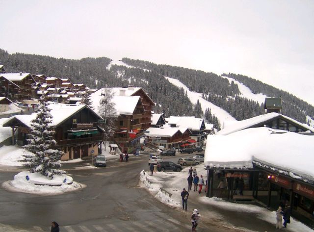
 Significant new snow for the French Alps. This is Méribel – 6 February 2017 – Photo: merinet.com
These regions have seen between 35cm and 70cm of new snow since Friday (at least above 1500m), with locally close to 1m. Below 1500m or so there has also been some rain at times, but snow did eventually reach much lower levels later on Sunday.
There has also been some snow further east across Austria and the eastern Italian Alps, though generally in more modest quantities.
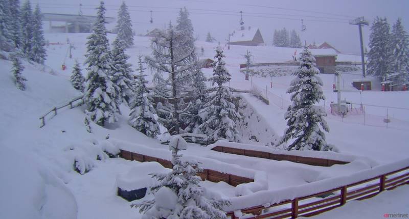
 Still snowing early this morning in La Plagne – 6 February 2017 – Photo: winter.champagny.com
Overall, however, it is looking much more wintry across the Alps this morning, which is good news in the run up to the busy half term period, especially considering that base depths were unusually low in many areas just a few days ago (and still are in places).
This morning snow flurries will continue for a while across many northern parts of the Alps before gradually easing off later. Some further mostly light snow is expected across the western Alps mid-week.
Updated: 8.40am Friday 3 February 2017 - Fresh snow for some this morning
There are bits and pieces of new snow across the Alps this morning, mostly in the west and south. Over the next few days the weather will remain very unsettled with further snow in many areas, heaviest in the western Alps. It will never be particularly cold, however, with some rain still possible at the lowest elevations.
 A little new snow in Les Saisies this morning – 3 February 2017 – Photo: lessaisies.com
This morning there are a few centimetres of fresh snow above about 1300m in many French resorts, and rather more in some western and especially central Italian resorts (e.g. Madesimo, Livigno). Some resorts in the far south of Switzerland (e.g. St Moritz) also have some fresh snow.
Today some light snow may linger for a while in the central and western Italian Alps. Elsewhere it will be mostly dry with variable cloud for a time but further cloud, rain and snow (1200m) will reach the French, western Swiss and north-western Italian Alps later in the day. Further storms will affect the Alps over the weekend, with most of the snow in the west.
Snow conditions remain very mixed across the Alps but are, on the whole, disappointing for early February, with a noticeable deterioration at low altitude (particularly across the northern half of the Alps) thanks to the mild weather in the last few days.
Updated: 9.15am Thursday 2 February 2017 - Very unsettled over the next few days, but never particularly cold
A succession of Atlantic storms will affect the Alps over the next few days. They will bring significant snow to many parts of the Alps but, with milder air in the mix, there will also be some rain at low altitude.
 Fabulous skiing high up in Ischgl thanks to the recent storm – 2 February 2017 – Photo: ischgl.com
Today it is very mild on the northern side of the Alps (e.g. Portes du Soleil, Bernese Oberland, Engelberg, St Anton, Kitzbühel) thanks to the Foehn. On the southern side of the Alps it is cooler and cloudier with the chance of snow showers (1300-1600m), especially late in the day.
Tonight, showers will become a bit more widespread across the southern and western Alps while the north-east (i.e. Austria) remains mostly dry. This front will try to move further east on Friday but will lose its intensity as it does so. A more active storm will sweep across the entire Alps on Saturday, followed by another later on Sunday and into the first part of next week.
Generally speaking it is the central and western Alps that are likely to see the most snow, with 40-80cm possible at altitude in resorts as far apart as Alpe d’Huez and St Moritz. However, it needs to be remembered that there will be also be some rain at times lower down, especially below 1500m and in the north-western Alps. The weather should have settled down a bit by the middle of next week, when it will also turn colder.
In the meantime, some of the best snow conditions right now are high up in the eastern Swiss and western Austrian Alps, where 30-50cm of new snow fell on Tuesday (e.g. Davos, Ischgl).
Updated: 9.30am Wednesday 1 February 2017 - Highly variable weather and snow conditions in the Alps
It’s a complicated weather and snow picture across the Alps this morning, especially in the north where there has been more rain and snow from the latest storm than originally forecast.
 Lots of snow in Samnaun on the Swiss/Austrian border near Ischgl – 1 February 2017 – Photo samnaun.ch
According to the Tirol Avalanche service there is up to 50cm of new snow at altitude in the Silvretta region of Austria (e.g. Iscghl, Montafon), with similar amounts confirmed by the Swiss Institute for Snow and Avalanche Research in the far east of Switzerland – with 47cm of new snow, for example, at the top of Weissfluhjoch above Davos.
Generally speaking, there has been between 10cm and 40cm of new snow above 2000m in the northern half of the Alps, least in the northern French and western Swiss Alps, most in the eastern Swiss and western Austrian Alps. However, rain has also been a nuisance, falling as high as 2000m in the north-western Alps, and 1500m in the north-eastern Alps.
This morning there is still a little rain/snow across some eastern parts of the Alps, but this should gradually die away. Elsewhere it is mostly dry and quite mild with variable cloud. The best of any sunshine today will be in the south-western half of the Alps.
 Snowpack looking a little threadbare in Morzine, following the recent mild weather – 1 February 2017 – Photo: chilloutmountain.com
Snow conditions are understandably highly variable right now. At altitude in the north there is quite a lot of powder, especially in eastern Switzerland and western Austria (e.g. Davos, Arosa, Ischgl, St Anton, Montafon, Sölden). Lower down, however, rain has significantly affected the snow quality in areas such as the Portes du Soleil, Villars, Gstaad, the Jungfrau region, Kitzbühel and the Skiwelt.
Snow has got through to some parts of the southern Alps – Livigno, for example, has seen a decent fall from this latest storm. The Dolomites have also seen a few centimetres here and there. Generally speaking, however, the south has seen little if any precipitation, especially the south-west (e.g. the Milky Way).
For more on what the weather has in store later in the week, check out our latest forecast which will be updated this afternoon.