

ARCHIVE
Today in the Alps - February 2016
Updated: 9.30am Monday 29 February 2016 - Further heavy snow for some southern Alpine regions
There has been plenty more snow overnight for most (but not all) southern Alpine regions, with the heaviest falls again in the Italian Piedmont, spilling into some border areas of France and southern Switzerland.
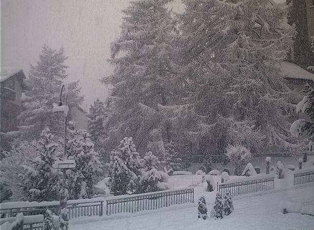
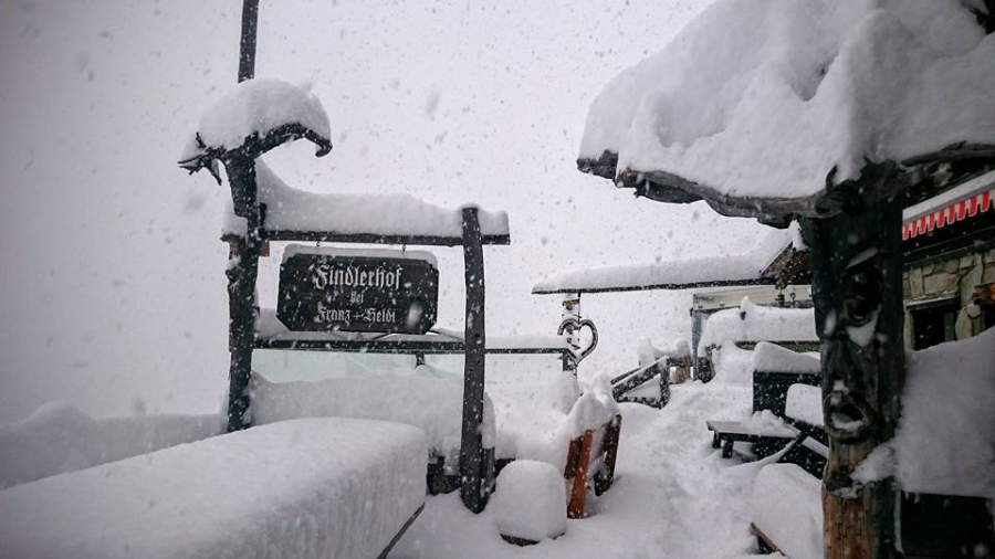 Heavy snow yesterday afternoon in Findeln, Zermatt - Photo: facebook.com/zermatt.matterhorn
Examples of resorts that have seen the heaviest snowfall this weekend (70-120cm) include the Monte Rosa region, Zermatt, Saas-Fee, Sestriere and Bonneval-sur-Arc. Very locally some places may have seen more still, especially in the southern Piedmont.
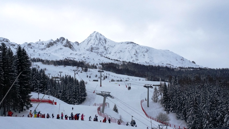
 Huge snowfalls this weekend in the Monte Rosa region - Photo: facebook.com/MonterosaSki
The Dolomites (e.g. Arabba) and some southern parts of Austria (e.g. Nassfeld) have also seen useful falls of snow, generally 20-50cm - not as much as originally hoped.
Some parts of the southern French Alps will also feel hard done by this morning, after so much talk of this “southern storm”. Here the snow was more hit and miss, generally favouring the border areas (e.g. Isola 2000 and the Queyras).
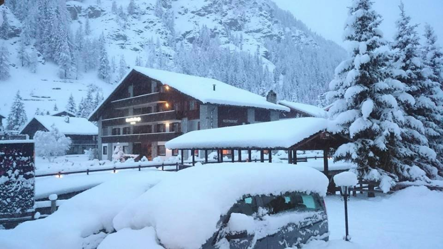
 Brightening up in Val d’Isère this morning, following 55cm of snow at village level this weekend - Photo: valdisere.com
Under the influence of the Foehn, the northern Alps also saw little or new snow this weekend (Val d’Isère being one notable exception), however, snow will return to the north this week, heaviest in the north-west mid-week onwards.
Back to today, and it’s still snowing in parts of the southern Alps, though it will tend to die away later in the day. By contrast, snow flurries will be begin to appear further north, especially in Austria and northern and eastern Switzerland.
The rain/snow limit will be highly variable, still 1200-1500m at first in the Dolomites (but dropping as the day goes on), but closer to 400-700m on the northern side of the Alps this afternoon.
For more on snow conditions across the Alps, check out our latest detailed snow report later today…
Updated: 9.25am Sunday 28 February 2016 - “Big southern storm” delivers
As expected, some southern parts of the Alps have seen a lot of snow in the last 24 hours, with plenty more to come today.
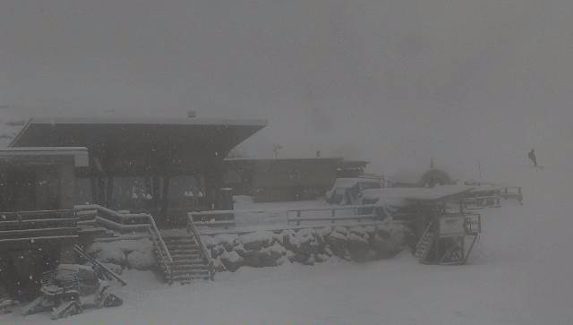
 Lots of snow this morning in the Monte Rosa region - Photo: facebook.com/MonteRosaSki
The heaviest snowfalls so far have been in the Piedmont (e.g. Prato Nevoso in the south, and Val Formazza in the north). We don’t yet know exactly how much has fallen here, but there has certainly been between 40cm and 80cm in places, perhaps locally even more.
 Huge snowfalls in the Italian Piedmont. This is the Val Formazza - Photo: valformazza.it
Many other southern Alpine areas have also seen, or are seeing, a significant fall of snow, but so far it is the south-western Italian Alps that has had the most from this storm.
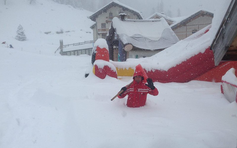 It's deep in the Monte Rosa region this morning! - Photo: facebook.com/MonteRosaSki
This snow has also spilled over the border into southern Switzerland (45cm already at Gornergrat in Zermatt), and into parts of the French Haute-Maurienne and Haute-Tarentaise (30-40cm already in Val d’Isère).
Today the southern Alps, as well as some adjacent border areas further north (e.g. Zermatt, Val d’Isère) will see further snow, heavy at times. The rain/snow limit will be variable - generally quite low in the west (600-900m), but perhaps rising to 1200-1400m in the Dolomites later.
 Snowing heavily first thing this morning in Zermatt - Photo: zermatt.ch
This evening and overnight, the snow is likely to become particularly intense again in the south-west, from Val d’Isère southwards close to the French/Italian border. By tomorrow, some places will no doubt have clocked 150cm+ of new snow!
Under the influence of the Foehn, the northern Alps have missed most of this recent snow, and will continue to do for much of the day. That said, some flurries will get through in places, especially later this afternoon, and the northern Alps will be more generally favoured next week.
Updated: 10.50am Saturday 27 February 2016 - “Southern storm” underway
The much anticipated big “southern storm” has begun, though not all southern parts of the Alps will see significant snow right away.
 Heavy snow in the southern Piedmont region this morning. This is Prato Nevoso - Photo: pratonevoso.com
This morning, the heaviest snowfall is in the southern Piedmont (e.g. Prato Nevoso), with more scattered flurries across western (and some central) parts of the Italian Alps. Some snow showers are also evident in the southern French Alps, especially close to the Italian border, as well as in central southern Switzerland, especially in Ticino.
As the day progresses, snow showers will become more widespread across the southern Alps, always heaviest in the Italian Piedmont region, but spreading a little further east to also affect the Dolomites later in the day. The rain/snow limit will generally be between 600m and 1000m.
By contrast, under the influence of the Foehn, the northern Alps will be drier, brighter and milder today. Tomorrow, Sunday, further heavy snow will affect much of the southern Alps, though the rain/snow limit will creep up a little (1200-1400m) in the Dolomites. The north will again stay mostly dry, at least until later in the day.
Updated: 9.20am Friday 26 February 2016 - Calm before the (southern) storm
We are looking at a relatively benign weather day in the Alps today. However, the first signs of this weekend’s “big southern storm” will become apparent in the south-western Alps later in the day.
 Surface pressure chart for Sunday showing bad weather piling into the southern half of the Alps, while, under the influence of the Foehn, much of the north remains dry - Image: meteociel.com
Looking back at yesterday, there was further snow across the northern Alps, heaviest from the French Haute-Savoie (e.g. Flaine) across to the central-northern Swiss Alps (e.g. Engelberg), both of which areas saw 20cm of fresh at 2000m. The snow line stayed at around 1200-1400m in the northern French Alps, a little lower further east, and much lower in the lowlands of northern Switzerland and southern Germany, where an unexpected 25cm+ was recorded.
The northern and western Austrian Alps also saw some snow, though generally in lesser quantities (5-10cm for the Arlberg for example).
Back to the here and now, and there is lots of low cloud this morning in certain Alpine valleys, especially close to the foothills. However, in the more central valleys and at high altitude generally it is quite bright, and this sunnier weather will extend to many parts as the day wears on. The main exception will be the south-western Alps - especially the southern French (e.g. Isola 2000), western Italian (e.g. Sestriere) and southern Swiss Alps (e.g. Zermatt), where cloud will thicken up this afternoon with some flurries (400-800m) here and there later.
 It’s a relatively fine day for many resorts today, before this weekend’s much anticipated “big southern storm”. This is Zell-am-See - Photo: foto-webcam.eu
This weekend it’s all eyes on the southern Alps where they are expecting their biggest snowfall of the season, by some margin. Generally speaking, the Italian Alps will see the most snow.
Precise detail is still difficult to pin down but it looks like the heaviest falls will be in the Piedmont and lower Aosta region (e.g. Alagna, Pila) on Saturday/early Sunday, then eastern Lombardy (e.g. Passo Tonale) and the Dolomites (e.g. Selva, Arabba) on Sunday and into Monday. These regions have the potential to see between 60cm and 100cm of new snow above 1500m, locally more.
The one corner of the Italian Alps that probably won’t see that much snow is the upper Aosta (e.g. Courmayeur, La Thuile), but these resorts can’t complain as they have lots of snow from earlier in the season.
By contrast, the northern side of the Alps will be protected by the Foehn, and stay mostly dry and relatively mild this weekend, at least until later on Sunday.
The one exception may be the Maurienne and Haute Tarentaise region of France (e.g. Val Cenis, Val d’Isère) where the famous “retour d’est” may spill some significant snow over the border from Italy - one to watch!
We will have more detailed weather forecast for the Alps out later today…
Updated: 9.25am Thursday 25 February 2016 - All eyes on the south this weekend!
There’s something a bit special brewing for the weekend - a major storm for the southern Alps, something we haven’t really seen this winter yet!
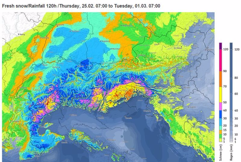 Over 1m of new snow expected in parts of the southern Alps this weekend - Image: bergfex.com
Before we get there, however, there’s plenty of weather to get through in the Alps today, with further snow in places, heaviest in the northern French (e.g. Chamonix, Avoriaz) and western Swiss Alps (e.g. Gstaad, Morgins), where we can expect around 10-20cm of new snow above 1500m, and 30cm very locally.
The north-eastern Swiss Alps (e.g. Flumserberg), the western and northern Austrian Alps (e.g. St Anton, Lermoos) and perhaps the far north-west of Italy (e.g. Courmayeur) will also see a little snow but, generally speaking, the further south and east you are, the less precipitation there will be, with most of the Italian Alps, the south-east of Switzerland, the southern French and the southern Austrian Alps staying dry with variable cloud.
The rain/snow limit will be variable - generally around 1000-1300m in the French Alps, and 600-1000m in the Swiss and Austrian Alps, but tending to fall everywhere later in the day.
 Further snow in the north-western Alps at times today. This is Les Saisies - Photo: lessaisies.com
After a relatively benign day on Friday, heavy snow is expected across much of the southern Alps this weekend, especially later on Saturday and Sunday. By the southern Alps we mean most Italian ski resorts, but especially the northern Piedmont, eastern Lombardy and the Dolomites (e.g. Alagna, Passo Tonale, Madonna di Campiglio), the southern French Alps - particularly the far south and close to the Italian border - and the far south of both Switzerland (e.g. Saas-Fee) and Austria, especially close to the Italian border (e.g Nassfeld).
We may also see a “retour d’est”, a weather phenomenon whereby heavy snow spills over the Italian border into some more northern French resorts, such as Val d’Isère.
Exact detail and timing is still to be nailed, however, all the above areas have the potential to see 50-150cm of new snow between Saturday and Monday ,with a rain/snow limit generally between 600m and 1200m, perhaps a little higher at times in the eastern Italian Alps.
By contrast, the Foehn will be blowing in the northern Alps, at least during the first part of the weekend, which will mean mostly dry but often quite cloudy and mild conditions. Later on and early next week, colder weather with some snow will also extend further north.
Updated: 9.10am Wednesday 24 February 2016 - Sunny in the east, further snow in the north-west later
It’s a lovely start to the day in many central and eastern parts of the Alps, with fresh snow in the north (e.g. Engelberg, Lech). By contrast, it is cloudy again in the far west (especially in the northern French Alps), where further snow showers are expected later in the day.
 Fresh tracks in Golm this morning - Photo: golm.at
Looking back at yesterday and it snowed across much of the northern Alps, especially at altitude where between 10cm and 30cm fell above 1800m, locally a bit more. Below 1500m or so there was also some rain for a time, especially in the west, before the rain/snow limit lowered to under 1000m overnight. The southern Alps have seen little or no precipitation in the last 24 hours.
Later today, further showers are expected to spread into the northern French and western Swiss Alps, with a rain/snow limit initially around 800-1100m, rising to 1200-1500m later (perhaps a bit lower in the more internal Swiss valleys).
Above 1600m we can expect another 10-20 cm quite widely in these north-western parts of the Alps by tomorrow morning (e.g. Avoriaz, Mürren), and a bit more in some favoured spots. However, these showers won’t really affect the eastern Alps until tomorrow, by which time they will be lighter and more scattered.
 Bluebird in the north-eastern Swiss Alps today. This is Amden - Photo: amden-weesen.ch
So weather and snow conditions in the Alps remain highly variable this week. There are some good powder opportunities to be found, especially at altitude and in the north. Extensive local knowledge is essential for any off-piste forays, however, especially given the high avalanche danger and changeable weather.
Generally speaking, it has been a frustrating week so far for the average holiday-maker (piste skier) with lots of cloud and relatively little sunshine. Make the most of the brighter skies if you are in the central or eastern Alps today!
Looking even further ahead, all eyes are on some potentially very snowy weather for the southern Alps this weekend, particularly on Sunday, when current models suggest that between 50cm and 100cm of snow could fall in parts of Italy (e.g. the Dolomites).
Updated: 9.55am Tuesday 23 February 2016 - Changeable, turning colder from the north
A slow moving cold front will gradually introduce colder air to the Alps from the north today. There will also be some snow, heaviest later in the day in the north-western Alps.
 Stormy looking skies in Laax, where some snow is expected later today - Photo: laax.com
Looking back at yesterday and it wasn’t a great skiing day in the Alps with lots of cloud, very little sunshine and mild temperatures. There was also some rain around, especially in the southern French Alps where it fell as high as 2300m in places. Further east, there was less precipitation but here too it was warm, with soft spring snow conditions below about 2400m.
Today, the cold front will start to make itself felt in the northern Alps with scattered showers. These will become heavier and more persistent this afternoon. The rain/snow limit will start at between 1200m and 1500m, but will lower steadily to reach 600-1000m in the north tonight. At 1800m we could see 15-30cm by tomorrow morning quite widely across the northern Alps, and locally 40cm in some favoured spots in the northern French Alps (e.g. Argentière).
The southern Alps will miss the heaviest precipitation, but their turn may come this weekend as a potent storm forms in the western Mediterranean. In between (i.e. Wednesday to Friday), the weather in the Alps will remain variable with bits and pieces of snow here and there, especially at altitude. Temperatures will not be far off normal for late February.
As for snow conditions, fluctuating temperatures and changeable weather means that they are now much more variable then they were in the Alps last week. That said, there is still some good skiing around, especially at altitude and if you are lucky enough to get a break in the generally cloudy weather.
Updated: 9.50am Monday 22 February 2016 - Still very mild, but turning colder and more unsettled as the week goes on…
After generally excellent snow conditions this half term, it has been a complicated weekend of weather in the Alps, with some exceptionally mild temperatures and a mixture of sun, snow, and rain.
 Quite a lot of snow was lost at low altitude in the northern Alps this weekend. This is Pass Thurn near Kitzbühel - Photo: foto-webcam.eu
Looking back at Saturday - snow quickly reached the northern Alps (especially Switzerland and Austria). However, with much milder air in the mix, the rain/snow level rose from a relatively low altitude to between 1400m and 2000m later in the day, a bit lower in some inner Alpine valleys.
Sunday was exceptionally mild with freezing levels reaching or surpassing 3000m and temperatures close to 20°C in some lower northern valleys! It continued to rain for a while in the eastern Austrian Alps, with a rain/snow limit around 2300m, but was generally quite sunny further west. Quite a lot of low altitude snow has therefore been lost this weekend, especially in the northern Alps where the effects of the “warm sector” were greatest.
In our updates late last week we mentioned that a cold front would introduce much colder air later today. However, the situation has since evolved and become quite complex. The cold front is still on its way, but is moving much slower than originally anticipated, which means that’s its full effects will not be felt until later tomorrow, with the heaviest snow in the northern Alps. At the same time, a week disturbance will affect the south-western Alps today, with some showers (snow 1700-2000m) moving a little further north tonight, but not amounting to much.
Later in the week, and especially over the weekend, a more powerful storm will form in the Mediterranean which could bring some really heavy snow to the southern Alps - one to keep a close eye on…
Updated: 8.40am Friday 19 February 2016 - Cold with light flurries in the northern Alps
Weathertoski is in Les Arcs where it is cloudy this morning with light snow flurries, which have amounted to 2cm so far. These flurries (which are falling to very low altitudes) will continue for a while this morning before it brightens up later.
 Cold and cloudy this morning in Les Arcs, with light snow flurries - Photo: weathertoski.co.uk
Elsewhere in the Alps, light snow flurries are widespread across the north-west this morning, that’s to say the northern French, northern Swiss and western Austrian Alps, where between 1cm and 5cm is expected (very locally 10cm). With temperatures remaining on the cold side, any snow will fall to low altitudes (400-700m generally).
On the southern side of the Alps it is mostly dry, though still rather cloudy in places, especially in the south-east (e.g. Dolomites). The best of the sunshine this morning is in the southern French and western Italian Alps, away from the border areas.
 Sunny skies for much of the southern French Alps. This is Risoul - Photo: risoul.com
Looking a bit further ahead and it will turn much milder this weekend. Saturday will see further showers across some northern parts of the Alps, especially the north-east, but with the rain/snow limit rising to 1500m or more. The southern Alps will remain mostly dry and bright.
On Sunday it will be mostly fine but exceptionally mild across the board. Later on Monday/Tuesday it will turn much colder again with further snow in places, heaviest in the north and north-east.
As for current snow conditions in the Alps, they remain generally pretty good as we near the end of this busy half term week. Not everyone has seen wall to wall sunshine but, on balance, there has been little to complain about for the majority of holiday-makers.
Updated: 10.25am Thursday 18 February 2016 - Powder day for the far south-eastern Alps!
Weathertoski is in Les Arcs this week, where it’s another cold but fine start to the day with just a little high cloud. The cloud cover will thicken up this afternoon, with a little light snow (700m) expected tonight.
 Powder day in Cortina! - Photo: dolomitisuperski.com
Looking back at Wednesday and there were huge contrasts in the Alpine weather. It was snowing in the south-east, especially in the far south of Austria and the Dolomites, where as much as 50cm+ was reported close to the Slovenian border. Elsewhere in the Alps there was a lot of low cloud around yesterday, but also some sunshine at altitude - and more generally across the western Alps, especially in the inner-Alpine areas such as the Valais and Tarentaise.
Today, there are still some areas of cloud around but, generally speaking, it is a better weather day across the Alps and snow conditions remain pretty good. In the south-eastern Alps it’s a powder day for resorts such as Cortina (eastern Dolomites) and Nassfeld (southern Austria). Elsewhere, much of the obvious fresh snow from earlier in the week may have been tracked out, but on-piste at least the skiing is still very good.
 View from the slopes of Arc 1600 first thing this morning - Photo: weathertoski.co.uk
Tonight a weak front will bring a little snow to the western Alps, spreading further east tomorrow. However, snowfall totals will remain very modest, with many southern parts of the Alps remaining dry.
Over the weekend, further weather fronts will flirt with the northern Alps, but with little if any significant precipitation. The next major snowfall is due next week on Monday/Tuesday, and set to favour the northern Alps.
Updated: 8.45am Wednesday 17 February 2016 - Snow for the south-eastern Alps
Weathertoski is in Les Arcs where it is a clear and cold at 1800m, but with a sea of fog in the valley below. This low cloud should gradually dissipate and most of the French Alps can expect another glorious day, with just a few clouds close to the Italian border.
 Clear skies above a sea of fog in Les Arcs this morning - Photo: weathertoski.co.uk
Elsewhere in the Alps it’s a more complicated weather picture. It’s snowing in the south-eastern Alps, principally in the Dolomites (e.g. Cortina) and the southern Austrian Alps (e.g. Nassfeld), where 20-40cm is possible at altitude (locally more close to the Slovenian border).
Some snow showers are also affecting other parts of Austria, though these are lighter and more scattered than in the south.
 Snowing today in the Dolomites. This is Colfosco - Photo: altabadia.org
As we have already touched upon, the sunniest weather today is at altitude in the French Alps, extending into western Switzerland and some north-western parts of Italy.
Snow conditions remain generally very good in the Alps this busy half term week, though poor visibility will be an issue at times in the south-eastern Alps today.
Updated: 9am Tuesday 16 February 2016 - Variable weather, generally excellent skiing conditions
Weathertoski is in Les Arcs where it is partly cloudy first thing this morning with a temperature of -5°C at 1800m. The sun is expected to break through quite quickly today, as it is at altitude across most of the French Alps, at least away from the southern French/Italian border where some light flurries are possible.
 Early cloud beginning to break up in Les Arcs - Photo: weathertoski.co.uk
Elsewhere in the Alps it’s a complicated weather picture, and one that is difficult to summarise. Some areas have bright sunshine this morning, especially at altitude and in the more internal valleys. Other areas are cloudier with the chance of snow showers. These scattered snow showers (600-900m) are mostly across Austria this morning, but will also affect some southern parts of the Alps today, heaviest in the eastern Italian Alps (Dolomites) later.
The south-western Italian Alps (e.g. Limone) and far southern French Alps (e.g. Isola 2000) may also see some heavier snow showers this afternoon.
Generally speaking then, snow conditions remain very favourable this busy half term week. Temperatures are cool without being excessively cold, the on-piste snow quality is very good and there is still plenty of powder to be found (with a good guide) off-piste.
Tomorrow (Wednesday) many places will be fine, but there will be further showers, these concentrated in the south-eastern Alps, especially in the Dolomites.
Updated: 9.15am Monday 15 February 2016 - Generally very good conditions in the Alps
Weathertoski is in Les Arcs, where it is cloudy but dry first thing this morning with a temperature of -4°C at 1800m. Snow conditions are excellent, with plenty of untracked powder off-piste if you know where to look. A good guide is essential, however, given that avalanche danger remains considerable.
 Bluebird this morning in the central Italian Alps. This is Santa Caterina - Photo: santacaterina.it
Yesterday, snow showers moved west to east across the Alps, generally lighter than expected but with some useful top-ups in places - 20cm in Avoriaz, for example, and 10cm in Lech and Selva. Here in Les Arcs we saw just 3-4cm of new snow before it brightened up unexpectedly in the afternoon.
Today there is more in the way of sunshine across the Alps (especially in the south-west), but also areas of cloud (especially in the north and east) with a scattering of light snow flurries possible, especially later in the day. It will be a touch colder than yesterday across the board, with freezing levels somewhere between 1000m and 1400m, generally speaking.
 Cloudy but dry this morning in Arc 1800 - Photo: weathertoski.co.uk
Over the next couple of days the weather will be relatively benign across much of the Alps, with variable cloud, some sunshine and just a scattering of mostly light snow flurries. One notable exception may be the eastern Italian Alps (Dolomites), where some heavier snow could spill over from Slovenia for a time. Temperatures will remain relatively, but certainly far from exceptionally cold.
As for snow conditions in the Alps this busy half term week, they remain pretty good in most areas, even excellent in places. Just about everywhere has seen some useful snow over the last few days, heaviest in the western Swiss and northern French Alps, where there was 50-100cm of new snow. Temperatures are now also cool without being too cold, which will suit most recreational skiers very well.
Updated: 9.30am Sunday 14 February 2016 - Generally snowy!
Weathertoski is in Les Arcs, where the weather is cloudy with light snow flurries this morning. Snow conditions are excellent across the area following several falls of snow in recent days (most notably 40cm on Friday), with a few more cm expected today.
 Lots of snow at altitude in the French Alps right now. This is Les Arcs - Photo: weathertoski.co.uk
Indeed, snow flurries (1000-1200m) will continue to affect many parts of the Alps today, heaviest in France, western Switzerland and some central and eastern parts of the Italian Alps. There will also be some drier and sunnier interludes, most prevalent in Austria, especially early in the day.
On the whole, there is very little for half term skiers to complain about in the Alps, apart from poor visibility in places. Further snow showers are expected across most regions over the next couple of days (and to increasingly low levels), before the weather gradually settles down later in the week.
Updated: 12.15pm Saturday 13 February 2016 – Further snow, heaviest in the west
The weather in the Alps remains very unsettled this weekend, with further snow at times, especially in the south and west.
 Lots of snow in the French Alps. This is Méribel - Photo: meribel.net
Looking back at yesterday, we saw between 15cm and 40cm of new snow across the western Alps, which fell to relatively low altitudes. Today it has been snowing again in the west, and will continue to do so on and off for much of the day.
The heaviest snow will again be in the French, western Swiss and far north-western Italian Alps, but (with slightly milder air in the mix) the rain/snow limit may rise to 1200-1500m in parts of the French Alps later. The further east you are, the patchier the snow will be, but the lower it will fall.
There will be further snow tomorrow (Sunday), heaviest in the south and west, and it will remain unsettled into the first part of next week.
Generally speaking, snow conditions in the Alps look very good for half-term week, even if the weather will be highly variable at times. Watch out for the high risk of avalanche off-piste, especially in the west.
Updated: 8am Friday 12 February 2016 - Further snow for the western Alps
The western Alps will see further snowfall today, starting later this morning and intensifying this afternoon/evening. The eastern Alps, that’s to say Austria, the eastern Swiss and the central and eastern Italian Alps, will see little or no snowfall from this particular storm.
 Looking very snowy in Les Saisies, with further snow expected today and tomorrow - Photo: lessaisies.com
Later tonight the snow should die away, by which time we may have seen another 15-30cm (locally more) above 1800m across much of the French Alps. Some western parts of Switzerland and the far north-west of Italy will also see a significant snowfall. The rain/snow limit will start low, but will rise to 1000m more in the southern French Alps later.
Saturday may see a temporary reprieve, but further snow will arrive in the western Alps during the morning, again intensifying later in the day. It will remain unsettled on Sunday, with occasional snow showers, again mostly in the west.
Early next week some heavier snow may affect the southern Alps in particular, but there is still lots of uncertainty over this at present.
Updated: 9.35am Thursday 11 February 2016 - Weather window!
Early snow flurries will clear the far eastern Austrian Alps this morning, to leave most regions with a dry day with plenty of sunshine. However, cloud will thicken up again in the west later, with a few light snow flurries likely in the French and western Swiss Alps later this afternoon or this evening.
 Gorgeous morning in Val d’Isère, but cloud will thicken again later - Photo: valdisere.com
Today will therefore be an excellent skiing day for much of the Alps, though note that avalanche danger remains high off-piste, even very high in places.
On Friday, further snow will reach the western Alps, while the eastern Alps remain dry and bright. This snow will intensify on Saturday and linger through much of Sunday, again heaviest in the western Alps, with only patchy precipitation further east.
Temperatures will fluctuate, with the rain/snow limit generally quite low, but perhaps reaching 1500m or so for a time in far west on Saturday.
Later on Monday and Tuesday there are indications that the southern Alps may see some very significant snow. Watch this space...
Updated: 9.45am Wednesday 10 February 2016 - Wintry!
It’s a wintry looking picture in the Alps today with further snow in places, chiefly across the north where it will fall to between 400m and 700m.
 Lots of snow in the last 24 hours in Courmayeur - Photo: lovecourmayeur.com
Looking back over the last 24 hours, we saw some significant falls of snow across the Alps (both north and south) but also some rain lower down (chiefly in the north-west), before an active cold front finally moved in and lowered the temperatures on Tuesday evening.
The highest snowfall totals during this period have been at altitude in the western Alps, especially in the northern French Alps (e.g. Chamonix), the western Swiss Alps (e.g. Verbier) and the far north-western Italian Alps (e.g. Courmayeur). These areas have seen 35-60cm of new snow above 2000m.
Most other parts of the Alps have also seen a decent fall of snow, including much of the southern side (e.g. Livigno, Madonna di Campiglio).
 Further snowfalls in Madesimo, Lombardy - Photo: madesimo.com
Another feature of this storm has been the wind, which has been gusting up to 150km/hr at altitude. Needless to say, off-piste is once again very dangerous in many parts of the Alps.
Today, snow flurries will die away from the southern Alps but continue across many northern parts, where they snow will fall to low levels.
There will be something of a reprieve in the Alpine weather on Thursday and Friday, though further light snow is possible in the west later in the day on both days. Saturday will then see another active storm affect the French and western Swiss Alps, moving further east later.
After a temporary rise in temperatures, it looks like turning much colder again early next week.
Updated: 9.35am Tuesday 9 February 2016 - Turning wild in the north-western Alps
The weather in the Alps remains very unsettled, with plenty of snow in the forecast, especially at altitude in the north-west. However, we also have high winds and rain (lower down) to contend with, which means less than ideal skiing conditions at times.
 Turning wild in Val Thorens today, with heavy snow and high winds expected later - Photo: valthorens.com
Overnight there has been some showery rain in the French (mostly northern French) and western Swiss Alps with snow above 1400/1700m. This precipitation will continue today, intensifying later, with the rain/snow limit descending to around 1000m this evening - lower still overnight. Above 2000m we could see 40-60cm of new snow in the north-western Alps by dawn tomorrow, however, it will be extremely windy, making for pretty wild conditions up on the mountain. Expect lots of lift closures and stay on the piste!
The rain/snow will quickly become lighter and patchier the further east you are today with much of Austria, protected by the Foehn wind, staying dry and mild.
The situation in the southern Alps is more complicated, but it seems like the far north-west of Italy (e.g. Courmayeur) will see some heavy snow at altitude today, as will the central and eastern areas (e.g. Livigno, Sella Ronda) later today and overnight. By contrast the south-western Alps (e.g. Sestriere, Isola 2000) will miss the heaviest of the precipitation.
Tonight, with the cold air, the snow-line will drop to low levels in the north-western Alps while remaining above 1000m for a time further east. Tomorrow will be cold with further snow showers to low levels, but these will tend to become increasingly confined to the northern Alps.
We will have more details in our detailed forecast later today…
Updated: 9.25am Monday 8 February 2016 - Very unsettled week ahead
Yesterday, the southern Alps finally saw a proper dump, with 30-50cm of snow falling quite widely, and a bit more in one or two favoured locations such as the extreme south of the French Alps (near Isola 2000), and the far east of Lombardy/western Dolomites (near Passo Tonale).
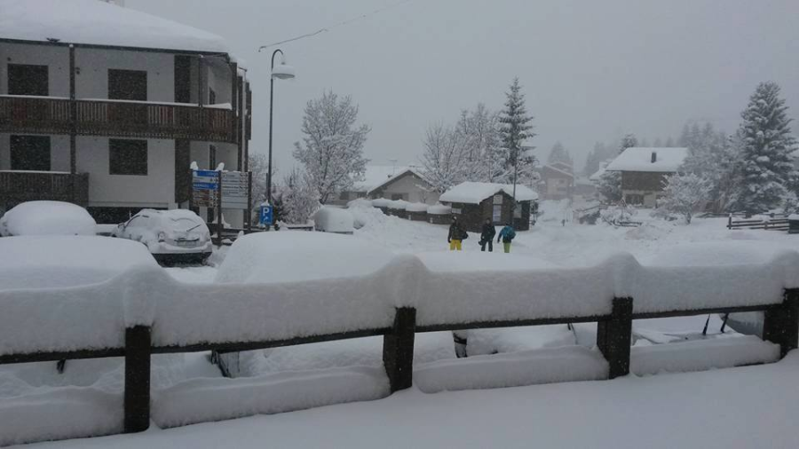
 Significant snow for the southern Alps at last! This is Auron near Nice - Photo: Pascal Lequenne
The western Alps also saw some snow yesterday, though not quite as much as the south (10-30cm generally), while the north-east (including much of Austria) missed the heaviest precipitation this time around.
The weather remains very unsettled today. The last of the showers will quickly move away from the far eastern Alps this morning, but further rain/snow will reach the French and western Swiss Alps during the middle part of the day, moving east to reach western Austria tonight. It will be relatively mild with a rain/snow limit between 1200m and 1500m, but will be very windy at altitude.
Snow quantities will be relatively modest, with typically 10-20cm of new snow above 1800m in the north-western Alps by the end of tonight. The southern Alps will generally see the best of the weather today, with variable cloud and some sunny spells.
Tomorrow, a very potent storm will reach the Alps with heavy snow and high winds for many regions later in the day, especially in the west where an additional 40-70cm of new snow is likely at altitude by Wednesday morning. It will then remain unsettled for the rest of the week with further snow for many areas.
Updated: 12.05pm Sunday 7 February 2016 - Snow for the south at last!
Yes, it’s really happening! For once this winter, it will be the southern side of the Alps that will be most favoured from this latest storm, with significant snowfalls expected today. Western regions will also see snow, but the north-eastern quarter (protected by the Foehn) will stay mostly dry, at least to begin with.
 Significant snow for the southern Alps at last! This is Ariveux in the French Queyras - Photo: ariveux-izoard.com
The heaviest snow is likely to be between Lombardy and the western Dolomites (e.g. Passo Tonale), where 50cm or more is possible today. Most other Italian resorts will also see significant snow, as will much of the French Alps and the southern and western Swiss Alps. The north-eastern Alps, especially the northern and eastern Austrian Alps, will stay driest for longest and, generally speaking, will see less snow when it finally arrives later.
The rest of the week will remain very unsettled, with further snow at times, heaviest in the west and south where some further significant accumulations are likely. However, it will never be particularly cold, with some wetter snow or even rain possible at times at low altitude.
Updated: 11.25am Saturday 6 February 2016 - Mostly dry today, but very windy in places
The Alps are under the influence of a strengthening south-westerly airflow today. Most places will be dry, but a few showers (snow 1200m) will reach the southern French and western Italian Alps later in the day. By contrast, the northern Alps will remain dry, bright and very mild, with an increasingly gusty Foehn wind.
 Signs of a change in the weather in Isola 2000 in the southern French Alps this afternoon, where a much needed heavy snowfall is expected tomorrow - Photo: isola2000.com
Tomorrow, the southern Alps will see their first significant widespread snow in a while, with the heaviest falls reserved for the southern French Alps, the Swiss-Italian border regions (e.g. Zermatt, Monte Rosa), Ticino, Lombardy and the western Dolomites. Other western parts of the Alps will also see a moderate fall of snow, but the north-east (including much of Austria) will see less this time around.
It will remain very unsettled next week with further snow at times, probably heaviest in the west and south. It will never be particularly cold, however, with the chance of some wetter snow or even rain at low altitudes from time to time.
Updated: 9.40am Friday 5 February 2016 - Lots of fresh snow in the northern Alps
The northern Alps have seen lots more snow in the last 24 hours, with 30cm in Lech (Austria) and 40cm in Mürren (Switzerland), for example.
 Bluebird in the Portes du Soleil this morning. This is La Chapelle d’Abondance – Photo: lachapelle74.com
Since Wednesday we have seen 30-50cm of new snow above 1500m in many northern parts of the Alps, and 70cm+ in a few favoured locations. Some southern parts of the Alps have also seen at least a little snow, but here it has been more hit and miss, with many areas staying dry. Their turn will come this weekend.
Back to today, and there are still some snow showers across Austria and the far east of Switzerland this morning. However, most other places are dry and increasingly bright (especially at altitude), and this brightness should extend to most of the Alps later in the day. It will also be milder, with freezing levels as high as 2600m in the west.
Looking a bit further ahead, the weather will turn very unsettled again over the weekend. However, this time the angle of attack will be from the south-west, with the heaviest precipitation in the southern Alps which will bring some much needed significant snowfall.
Further north, we can expect Foehn conditions (mild, dry but windy) on Saturday, before it snows here as well on Sunday.
It will remain very changeable next week with a series of Atlantic depressions moving across the Alps from the west. Expect plenty more snow (especially in the western Alps), but the snow may be rather wet at times low down due to the fluctuating temperatures.
Updated: 10am Thursday 4 February 2016 - More snow for some, heaviest in the north-eastern Alps
Yesterday we saw 15-40cm of new snow across many northern parts of the Alps. Some of the southern Alps also saw some snow but, generally speaking, not nearly as much. With colder air digging in, the rain/snow limit lowered to around 500m in places late in the day.
 Magnificent morning in Val Thorens, but cloud will return later in the day - Photo: valthorens.com
Today, further snow will reach the northern Alps later, heaviest in the eastern Swiss and Austrian Alps where another 25-40cm is possible by tomorrow morning. However, the snow won’t be quite as heavy in the northern French and western Swiss Alps as it was yesterday. Temperatures will be on the rise today, especially in the west, where the rain/snow limit will exceed 1000m in places by this evening.
Generally speaking, the southern Alps will again see less snow. Bits and pieces will get through in places (especially in the central and eastern Italian Alps), but the south-west will stay mostly dry.
After something of a reprieve on Friday, the weather in the Alps will turn unsettled again over the weekend (especially Sunday) and into next week, with significant snow in many places, especially at altitude.
Updated: 8.05am Wednesday 3 February 2016 - Colder with snow, mostly across the northern Alps
Weathertoski is currently in Zermatt, where it is cloudy this morning with light snow expected to arrive soon. This snow comes courtesy of a cold front which will bring some significant snow and a big (but temporary) drop in temperature to many northern parts of the Alps today. The southern Alps will again only see bits and pieces of snow.
 Snowing this morning in Les Saisies in France - Photo: lessaisies.com
The rain/snow limit will begin at above 1000m in some places early this morning, before descending to all levels later in the day. Above 1500m, some 15-30cm of snow is expected quite widely across the northern Alps by tonight, locally a bit more.
On Thursday, further snow will affect the northern Alps, especially later in the day, with the heaviest falls concentrated across the eastern Alps, notably Austria where another 30cm+ is likely in places. It will also turn a little milder, with the rain/snow limit rising to 1000m or more in the west.
After something of a reprieve on Friday, the weather will turn very unsettled again over the weekend with further snow, first in the south-west then more generally later. It won’t be particularly cold, however, which means some rain is also possible low down.
Updated: 8am Tuesday 2 February 2016 - Still mild, but colder with some snow in places mid-week
It’s another mild day in the Alps today. Most places will be dry, but there is a lot of high cloud around. The best of any sunshine will be later in the day and in the central and southern Alps.
 A typical scene in the Alps this morning - dry but with lots of high cloud around - Photo: kronplatz.com
Snow conditions are highly variable right now, especially in the northern Alps, which bore the brunt of Sunday’s storm. At high altitude there is still plenty of fresh snow around, but you need an experienced guide if you are skiing off-piste as the situation is still very dangerous.
Lower down, snow quality is poor, due to being humidified by a combination of rain and high daytime temperatures. There was also a lot of high cloud around last night which meant there was only a partial refreeze at low altitude - all of which adds up to some highly variable snow conditions right now.
The good news is that it will turn colder tomorrow with at least a little fresh snow for many northern parts of the Alps, and some moderate falls in places. There will be further snow showers around on Thursday, before it temporarily settles down again towards the weekend. The southern Alps will again miss most of the snow, a theme which has become all too familiar this winter!
Updated: 2.05pm Monday 1 February 2016 - Exceptionally mild
Weathertoski has arrived in Zermatt today, where it is largely sunny and exceptionally mild for early February. This follows large quantities of rain and snow across the northern Alps yesterday, which has created a high risk of avalanche of off-piste.
 Fine but exceptionally mild in Zermatt today - Photo: apartment-zermatt.ch
Snowfall totals were very significant at altitude in the northern Alps yesterday, with 30-60cm falling quite widely above 2300m and 80cm+ in a few favoured locations in the north-west. Unfortunately the rain/snow line increased steadily throughout the day, surpassing 2000m in the west later. This meant that a lot of snow was lost in the lower resorts of the northern French and western Swiss Alps (e.g. Morzine).
After a much better but exceptionally mild day for most parts today, the good news is that it will turn significantly cooler mid-week, with some snow showers to much lower altitudes across the northern Alps in particular.