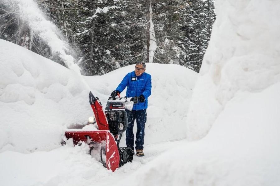
Latest snow report
Updated: 9pm Friday 23 February 2024
Snow conditions have improved in the Alps over recent days thanks to a combination of falling temperatures and fresh snow. The south-eastern Alps (including St Moritz, Livigno, Passo Tonale, Nassfeld and the Dolomites) have seen the most snow from the current storm cycle with around 40-70cm, but just about everywhere has benefited to some degree.
The situation remains problematic though in some lower ski areas, which have already either partially or fully lost their “natural base”, which is increasingly difficult to rebuild at this time of year due to the increasing strength of the sun. Despite this, artificial snow and careful piste management means that most resorts are still managing to keep the pistes to the valley open, even if any natural snow beside of the pistes has long since gone. However, any improvement to snow conditions at lower altitudes may prove relatively transient.
For now though, most areas are offering much better snow conditions than a few days ago. What’s more, it should stay relatively cool over the coming days, with more snow in places, especially in the southern Alps.
Across the pond, Utah is the stand out area thanks to bumper February snowfalls…
Austria
All Austrian ski resorts have seen snow today, with the heaviest falls in Carinthia where resorts such as Nassfeld (20/160cm) are expecting storm totals in excess of 60cm by Saturday morning.
There has also been significant snow further north, albeit not in quite the same quantities, with some excellent skiing in prospect over the next few days in the likes of the Ski Welt (30/100cm).
Higher ski areas such as Obergurgl (80/165cm) and Ischgl (30/130cm) will still be the best bets if you are planning to ski later in the season though.
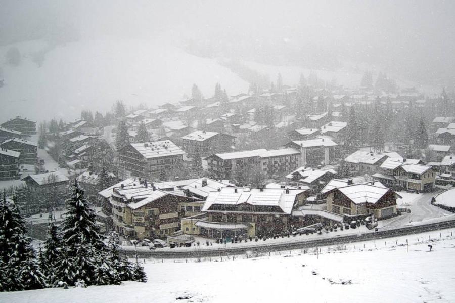 Snowing today in Hinterthal in the eastern Austrian Alps – 23 February 2024 – Photo: snow-eye.com
France
Most French ski resorts have seen fresh snow from the latest storm although some rain did fall lower down for a while on Thursday.
The best conditions remain at high altitude in resorts such as Tignes (130/380cm) and Val Thorens (150/220cm). Lower down, there has certainly been an improvement in the likes of Les Gets (10/100cm) and La Clusaz (5/195cm), but any new snow close to resort level probably won’t last long.
The southern Alps haven’t seen as much new snow as hoped, but resorts close to the Italian border such as Isola 2000 (90/120cm) are expected to see significant snow next week from a ‘Retour d’Est’, which may also bring some snow to Val d’Isère (110/215cm).
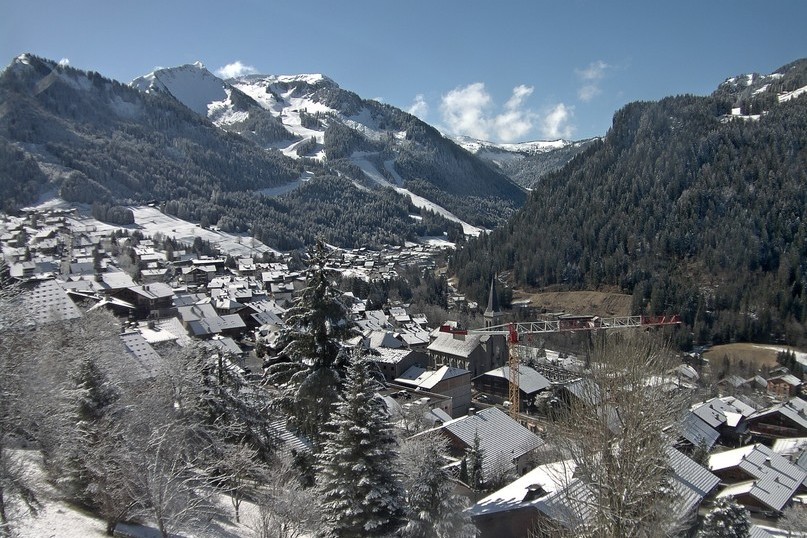 Last night’s fresh snow has improved conditions higher up in Châtel – Photo: chatel.com, 23 February 2024
Italy
The central and eastern Italian Alps have done very well from this new storm, including resorts such as Livigno (70/140cm) and Madonna di Campiglio (65/100cm), both of which will be skiing superbly once the weather calms down on Saturday.
Further west, Cervinia (100/220cm) and La Thuile (65/210cm) have also seen new snow, albeit in slightly lesser quantities, but the far south-west, including Bardonecchia (5/70cm) will be disappointed for now, having largely missed out. This area is likely to get heavier snow early next week though.
 Heavy snow in the Dolomites today. This is Ritten – 23 February 2024 – Photo: foto-webcam.eu
Switzerland
Snow has fallen across most Swiss resorts in recent days, heaviest in the south-east where St Moritz (65/215cm) has done particularly well and will be skiing superbly once the skies clear.
In the south-west, Zermatt (15/110cm) has also seen a useful snowfall in what has been a rather lean season to date. However, the northern resorts of Engelberg (5/305cm) and Grindelwald (10/170cm) might be disappointed with the few centimetres they received this time around. Both can still offer plenty of good piste-skiing higher up, but lower down there is no natural base and any new snow is unlikely to last long.
 Looking much more wintry in Zermatt today thanks to fresh snow yesterday and last night – Photo: zermatt.ch, 23 February 2024
Rest of Europe
The Pyrenees have seen some snow in recent days, but not enough to transform the fortunes of the lower resorts, many of which are barely or completely unable to operate after weeks of very mild weather. It is still possible to find some reasonable piste-skiing higher up, in both Spain’s Baqueira Beret (95cm upper base) and Andorra’s Pas de La Casa (20/55cm) and, with quite a lot of snow in the forecast over the next week, conditions should improve considerably.
Not surprisingly there is plenty of snow across the Scandinavian resorts, following a succession of storms in recent weeks, with particularly healthy depths in Norway’s Voss (175/195cm).
Scotland, by contrast, continues to struggle, with only Glencoe (70cm upper base) offering any proper lift-served skiing, albeit still on a limited basis.
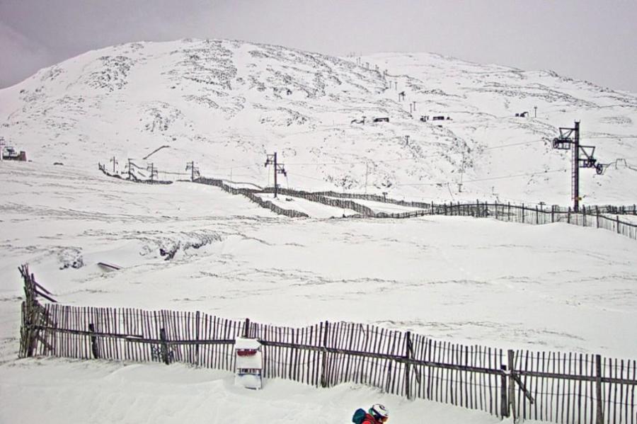 Looking a bit more wintry in Glencoe following some snow in recent days – Photo: winterhighland.org, 23 February 2024
USA
Utah leads the way in the western US, with at least 8 feet of snow having fallen already this February in Snowbird (3m mid-mountain base) and more snow in the forecast early next week.
Over in California, Mammoth (245cm upper base) has seen around 50cm of new snow in the last three days and has been skiing much better in recent weeks after a very poor early season.
In Colorado, Breckenridge (145cm mid-mountain base) also has new snow and is skiing well, although snow depths remain below par for the end of February.
 Lots of snow has fallen this week in Snowbird, Utah – Photo: facebook.com/SnowbirdUT, 23 February 2024nridge.com
Canada
Base depths remain below average in Whistler (151cm mid-mountain), which may not have seen much snow in the last week but does have some in the forecast for much of next week, which will improve conditions considerably.
Further inland, snow is also forecast on Sunday in Lake Louise (110cm upper base) although snow depths remain modest for the time of year.
Our next full snow report will be on
Friday 15 March 2024
If you enjoy reading our updates - please feel free to support us: