

Latest snow report
Updated: 3.50pm Friday 23 December 2022
Snow conditions are less than ideal across much the Alps right now. Not only is it very mild, but it is also very wet in in places, especially in the north-western Alps where it is raining heavily to well over 2000m today.
The worst of today’s rain is falling in the northern French Alps, including (but not limited to) L’Espace Killy, the Paradiski, the 3 Valleys, the Grand Massif, the Chamonix Valley and the Portes du Soleil. These areas will see 60-100mm of rain today alone, with 50-80cm of new snow falling above 2500m and 100cm or more in some prone spots, including at higher altitude in the Massif du Mont Blanc.
Significant rain/snow will also fall across much of Switzerland – except the far south (Ticino) and the south-east (Upper Engadin) – and across the north and west of Austria (especially in the Arlberg) and the far north-west of Italy (e.g. Courmayeur). Generally, the further south-east you are, the more likely you will avoid rain. The Dolomites, for example, will stay dry and partly sunny today.
So where does this leave us in terms of snow conditions?
Not surprisingly, conditions have deteriorated significantly across many parts of the Alps, especially in the lower resorts of the north-west where natural snow cover is now very patchy below 1600m. Resorts in areas with plenty of skiing above 2500m will have seen significant fresh snow, but there is only a limited amount of terrain at this kind of altitude (in resorts such as Tignes, Val d’Isère and Val Thorens, for example) and the risk of avalanche is now sky high.
So, in the short term at least, the resorts offering the best snow conditions, or at least the most uniform on-piste snow quality, are in the far southern or south-eastern Alps, where they have avoided the rain completely – most obviously in the Dolomites (e.g. Madonna, Selva, Arabba, Cortina).
As for the weather forecast, it will be a much brighter but still very mild Christmas for much of the Alps, though there is the threat of further rain (and high altitude snow) in the northern and western Alps towards the middle of next week.
Meanwhile, across the pond, it has been abnormally cold in both western Canada and the western US with temperatures as low as -40°C in places!
Austria
It’s a wet day today across the western and northern Austrian Alps, with rain top to bottom in resorts such as Söll (25/60cm) and Saalbach (40/50cm) where, in the short term at least, pistes will obviously become very wet.
There is some fresh snow at high altitudes but generally not in large quantities, with any benefit limited to the uppermost sections of a small number of resorts such as Ischgl (10/45cm) and St Anton (35/45cm).
For the most consistent snow quality you need to head south. Nassfeld (20/80cm) has avoided the rain altogether and can still offer some good skiing on-piste.
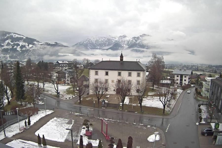 Mild and damp weather across many northern and western parts of the Alps today. This is Saasfelden in the Austrian Salzburgland – 23 December 2022 – Photo: saasfelden-leogang.com
France
It’s a washout below 2300-2500m today in the northern French Alps, which is bad news for all resorts but especially those whose skiing is mostly (if not all) below this, such as Megève (20/60cm) and Les Gets (25/95cm). There will still be some piste skiing on offer when the weather improves over the weekend, though natural snow cover will be patchy.
Higher resorts, such as Val Thorens 60/120cm) are obviously better equipped to withstand such weather events but, wherever you are, do not be lulled into skiing off-piste as the risk of avalanche is now sky high.
Perhaps the best on-piste skiing in France right now is in the extreme south, where resorts such as Isola 2000 (70/90cm) have avoided the rain.
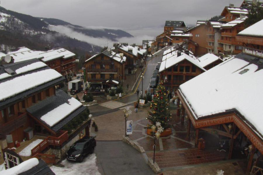 Rainy in Méribel today – 23 December 2022 – Photo: meribel.com
Italy
Many Italian resorts have escaped the worst (if not all) of today’s rain, aside from those in the far north-west, notably Courmayeur (0/30cm) and La Thuile (35/60cm), where it has been wet lower down today.
There is a bit of fresh snow higher up though, especially in Cervinia (10/110cm) whose ski area is mostly above the rain/snow limit of about 2300m.
However, for the most consistent snow quality you need to head further east, where the Dolomite resorts of Madonna di Campiglio (55/75cm) and Selva (30/60cm) have stayed dry today and continue to offer good piste skiing.
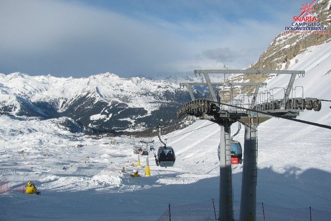 Drier and brighter weather in the south-eastern Alps. This is Madonna di Campiglio – 23 December 2022 – Photo: funiviecampiglio.it
Switzerland
It’s raining across many parts of the Swiss Alps today, especially in the north and west, with a rain/snow limit well above 2000m.
This means that pistes are very wet lower down in Verbier (20/60cm), though there is at least also some fresh snow higher up. There is also a mix of rain and snow depending on altitude in Zermatt (10/110cm), but don’t be tempted to venture off-piste in either resort any time as soon as the avalanche risk will be high.
For more consistent snow conditions, you need to head to the far south-east of Switzerland, where the effect of any rain in the likes of St Moritz (30/50cm) will be minimal.
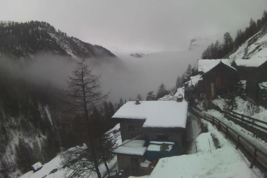 Cloudy with some rain in the lower reaches of the Zermatt ski area today – 23 December 2022 – Photo: apartment-zermatt.ch
Rest of Europe
It’s also very mild in the Pyrenees today, with freezing levels above 3000m. At least it’s not raining though, which means there is plenty of good piste skiing on offer in the likes of Andorra’s Soldeu (20-45cm) even if snow depths are on the meagre side.
Up in Scandinavia the really cold weather that many resorts experienced earlier in the month is now over, and there is some excellent early season skiing on offer in both Norway’s Geilo (60/120cm) and Sweden’s Salen (35/42cm).
The situation in Scotland, however, is highly changeable. After last week’s big snowfalls, it has been much milder this week with a rapid thaw. However, most of the Scottish ski centres have just about enough snow to be able to offer at least some limited skiing in the coming days (especially the Lecht). Check the status of each resort regularly before committing!
 Nice weather but relatively meagre snow cover in the French Pyrenees right now. This is Peyragudes – 23 December 2022 – Photo: snow-eye.com
USA
Early season snow depths remain pretty good across most western US resorts, though it has been exceptionally cold with temperatures (even without windchill) between -20°C and -35°C in places (e.g. Wyoming, Montana, Colorado).
The good news is that the extreme cold is already easing, meaning that skiing conditions are starting to become more tolerable across the board. Utah’s Alta currently has 220cm of consolidated snow up top, while Colorado’s Vail has 110cm.
Canada
Inland parts of western Canada have seen some really extreme cold this week, with temperatures of between -35°C and -40°C in the likes of Banff and Jasper, both of which have upper bases of about 70cm. The good news though is that it has already turned much milder, meaning that there will be plenty of good skiing on offer over the Christmas period even if snow depths are unremarkable for late December.
Further west, it has been very cold in Whistler too, just not quite as extreme. A lot of snow is expected here over the coming days which will add significantly to the 120cm mid-mountain snowpack.
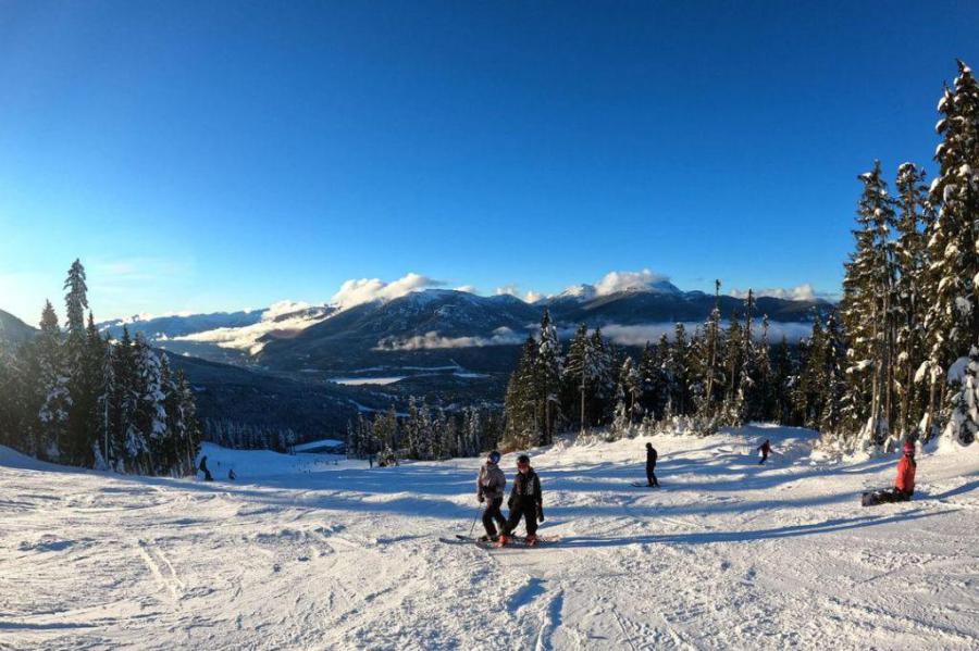 Cold and sunny weather in Whistler earlier this week, but snow is on its way – Photo: facebook.com/whistlerblackcomb
Our next full snow report will be on
Saturday 31 December 2022
If you enjoy reading our updates - please feel free to support us: