

Latest snow report
Updated: 7pm Thursday 2 February 2023
Snow conditions in the Alps are quite mixed right now. There is fresh snow in the north-east (i.e. Austria), with lots more to come over the next few days, however, in most other parts of the Alps it hasn’t snowed for some time now, meaning that pistes are hard-packed and, in some cases, icy.
The snow in the north-eastern Alps will continue on and off until Sunday, by which time storm totals could be in excess of 1m in some eastern Austrian resorts such as Obertauern. In Austria more generally, we are expecting between 30cm and 70cm of new snow over the next few days, at least away from the far south (Carinthia).
Some snow will also fall over the next few days in the eastern Swiss Alps (e.g. Klosters), perhaps also extending further west into the north-western Swiss Alps (e.g. Jungfrau region) this weekend, but in most of the rest of the Alps it will stay dry and bright for the foreseeable future.
Across the pond, snow conditions remain exceptional in Utah…
Austria
Austria is receiving the lion’s share of snow from this latest storm, with the heaviest snow falling in the north and east, especially in Salzburgland, Styria, and Upper and Lower Austria, where some resorts such as Obertauern (120/180cm) could see storm totals in excess of 1m by Sunday.
Further west, Lech (75/150cm) won’t see quite as much snow over the next few days, but still has plenty enough to further improve the already excellent conditions.
The slight caveats to this snowy spell of weather in Austria are that there will be some milder air in the mix at times, especially on Saturday when the rain/snow level could rise to 1000-1200m for time, and that the far south (e.g. Nassfeld) will miss most of the action.
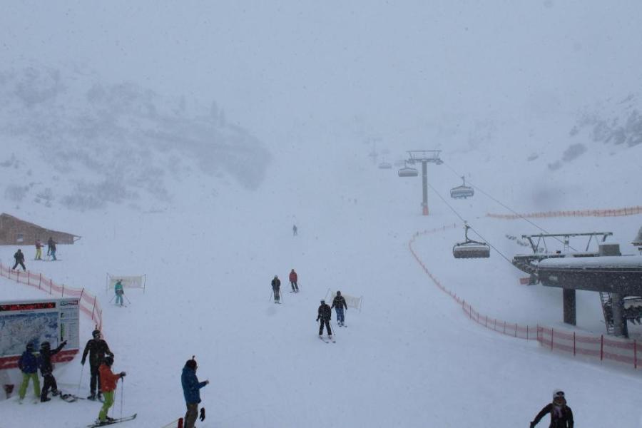 Heavy snow in Obertauern where storm totals may exceed 1m by Sunday – Photo: foto-webcam.eu, 2 February 2023
France
Snow conditions are increasingly mixed across the French Alps as the mostly sunny weather continues.
The best conditions are to be found at higher altitudes in the resorts that have seen the most recent snowfall, including Val d’Isère (92/270cm), Montgenèvre (200/270cm) and Serre Chevalier (55/175cm), where you can still find pockets of fresh powder with the help of a good guide. The pistes are mostly hardpacked though, even here, and icy runs are becoming a more widespread issue in the French resorts, especially in the shadier lower areas that have seen a lot of skier traffic.
More snow would be welcome to freshen things up but very little is forecast over the next days, with only the far north (e.g. Portes du Soleil) in with a chance on Sunday – albeit a small one.
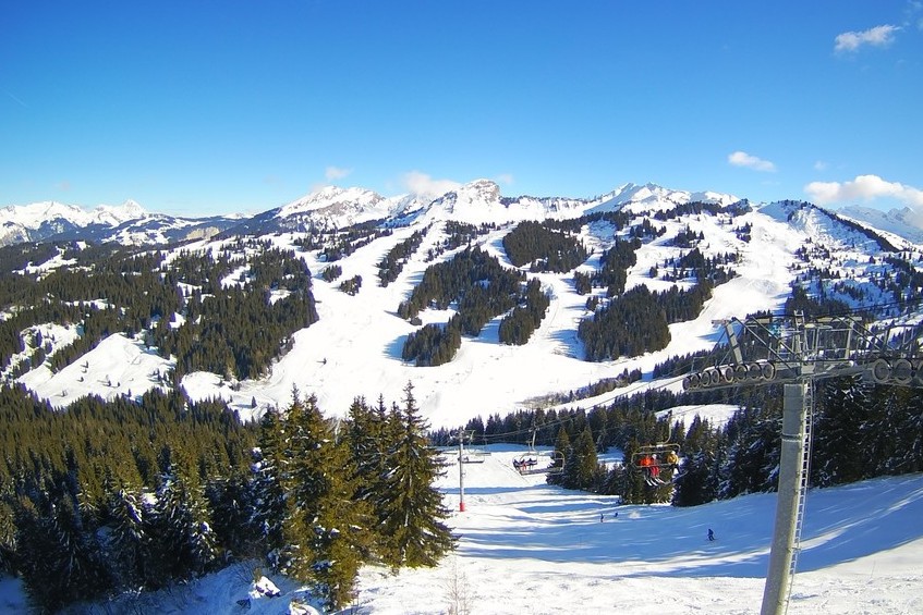 Sunny skies in Les Gets today – 2 February 2023 – Photo: lesgets.com
Italy
There is still plenty of good piste skiing on offer across the Italian Alps right now, although many of the pistes have now become hard-packed or even icy. This is especially true at lower altitudes in the resorts that haven’t seen significant snow for some time, such as Livigno (35/55cm) and Pila (30/55cm).
Conditions are better in the far south-western Italian Alps, where Sestriere (70/110cm) saw significant snow late last week. The Dolomites are also skiing pretty well, though some of the runs are also becoming a bit hard and new snow would be welcome. Madonna di Campiglio currently has settled snow depths of 65/110cm, while Arabba has 40/100cm.
 Mostly sunny in the Monte Rosa region, where no new snow is forecast over the next few days – Photo: visitmonterosa.it, 2 February 2023
Switzerland
Snow conditions are a bit mixed across the Swiss Alps right now. In the far east, there has been a bit of fresh snow in resorts such as Klosters (30/100cm), which has helped to freshen up the pistes. However, for most other resorts, there hasn’t been any new snow for some time meaning that, although there is plenty of decent piste skiing on offer in the likes of St Moritz (30/50cm) and Zermatt (15/110cm), there are also some hard and icy patches, especially lower down.
More fresh snow is expected across some north-eastern areas over the next few days, but most Swiss resorts will remain dry with the best of any sunshine to be found the further south-west you are.
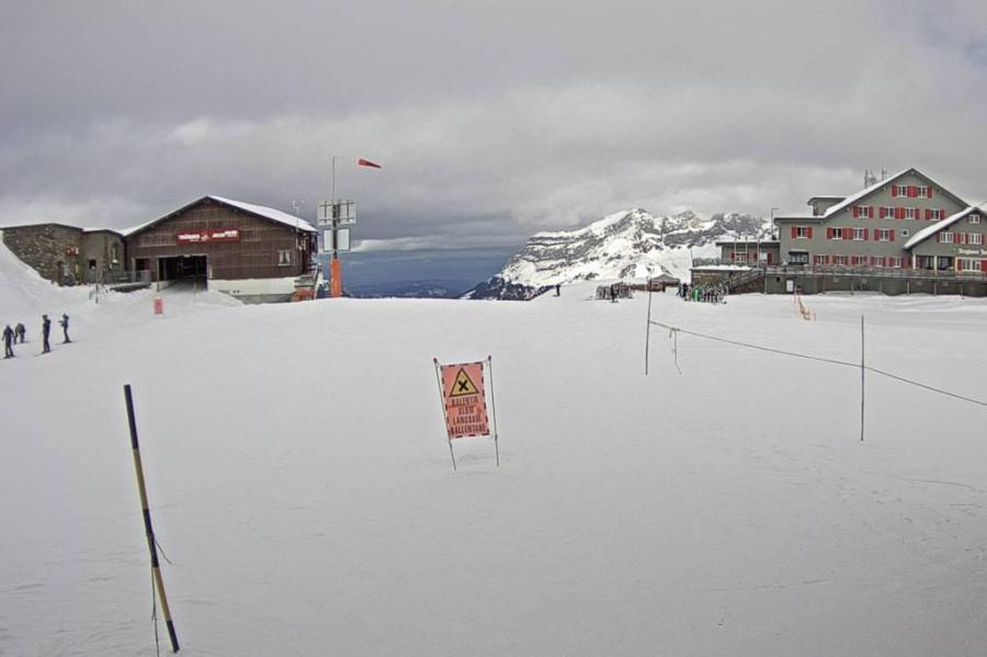 Cloudy but probably very little, if any, fresh snow today in Engelberg – 2 February 2023 – Photo: titlis.ch
Rest of Europe
The Pyrenees currently have some reasonable piste-skiing on offer though, as in parts of the Alps, the pistes are hardpacked and/or icy in places. Andorra’s Soldeu currently has settled snow depths of 25/70cm depending on altitude, while Spain’s Baqueira Beret has 115/165cm.
Norway continues to offer the best snow conditions in Scandinavia, with fresh snow in Voss (150cm upper mountain) and Hemsedal (70/130cm), where base depths remain considerably above average for this part of the world.
In Scotland, by contrast, snow conditions are suffering from high winds and rain meaning that any openings this weekend are likely to be limited. The highest snow depths remain on the upper mountain in Glencoe where there is over 1m of compacted snow in some of the more sheltered gullies. More generally across the Scottish ski areas, base depths are less than 20cm, even at altitude.
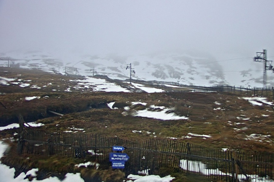 Rain and high winds have led to deteriorating snow conditions in Scotland. This is Glencoe – 2 February 2023 – Photo: winterhighland.info
USA
Utah continues to lead the way in the US, with 353cm of settled snow mid-mountain in Alta, where cumulative snowfall totals up to the end of January were at a record-breaking 11.99m.
Over in Colorado, snow depths are less spectacular but still generally a bit above average – 20% above in Winter Park, for example, where the mid-mountain base is 157cm.
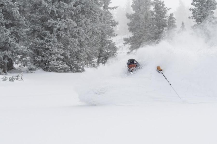 It’s been deep in Snowbird this week! – Photo: facebook.com/SnowbirdUT, 2 February 2023
Canada
The interior resorts of Banff/Lake Louise remain considerably below par in terms of snow depths (89cm mid-mountain in Lake Louise), however, there is still some enjoyable skiing to be had, on-piste at least. Significant snowfall will be needed before any serious off-piste can be considered here.
Further west, Whistler (186cm mid-mountain base) is also below par but does have snow in the forecast, both early this weekend and early next week, which will improve conditions, especially at altitude.
Our next full snow report will be on
Friday 10 February 2023
If you enjoy reading our updates - please feel free to support us: