

Latest snow forecast
Updated: 10am Thursday 5 January 2023
High pressure has been dominating the weather in the Alps this week, bringing lots of dry and sunny weather. However, some weak fronts have also been flirting with the northern Alps from time to time, the latest delivering some light and patchy rain/snow to some areas overnight last night and this morning) but not in any meaningful quantity – with just a dusting above 1800m in places, and perhaps 5cm in the Austrian Arlberg.
The next major (and much anticipated) storm is due to hit the western Alps on Sunday, affecting most regions by Monday. This should lead to the start of significant improvement in snow conditions in the north-western Alps, where the current lack of snow (at least at mid- and lower altitudes) is most acute. It won’t be especially cold though, with the rain/snow level unlikely to drop much below 1000m for any length of time.
It should then become mostly sunny and very mild again mid-week before a new storm arrives later in the week with the possibility of further snow and a drop in temperature.
The first storm on Sunday/Monday is likely to deliver 30-50cm above 2000m across most of the Alps, though the situation is complex and no doubt some places will see a bit more, some a bit less. A few centimetres will also fall here and there to 1000m but there generally won’t be much below this. With the second storm, both the rain/snow level and how much snow will fall remain uncertain.
Detailed weather & snow forecast:
Austria
Thursday will see a lot of cloud across the Austrian Alps with a few showers/flurries (snow 1500-1700m), mostly in the north and west (e.g. Arlberg). The driest and sunniest weather will be found further south (e.g Carinthia).
Friday will be mostly sunny with freezing levels between 2000m and 2500m.
Saturday will also be mostly sunny and relatively mild.
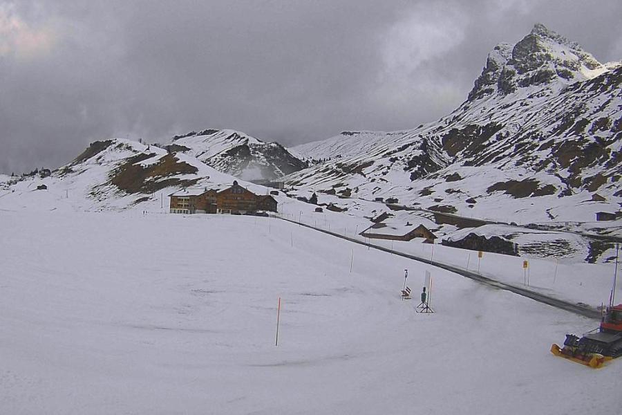 Cloudy skies in the Austrian Vorarlberg this morning but not much in the way of new snow until later this weekend – Photo: warth-schroecken.at, 5 January 2023
France
The northern French Alps will start quite cloudy on Thursday, with the odd light shower or flurry (2000m) in places. The southern French Alps will be brighter from the get-go, with sunnier skies expected across the entire French Alps by the end of the day. It will be mild with freezing levels between 2200 and 2600m.
After a cold start, Friday will be mostly sunny and very mild, with freezing levels close to 3000m later.
Saturday will also be dry and mild, with sunshine giving way to high cloud from the west later in the day.
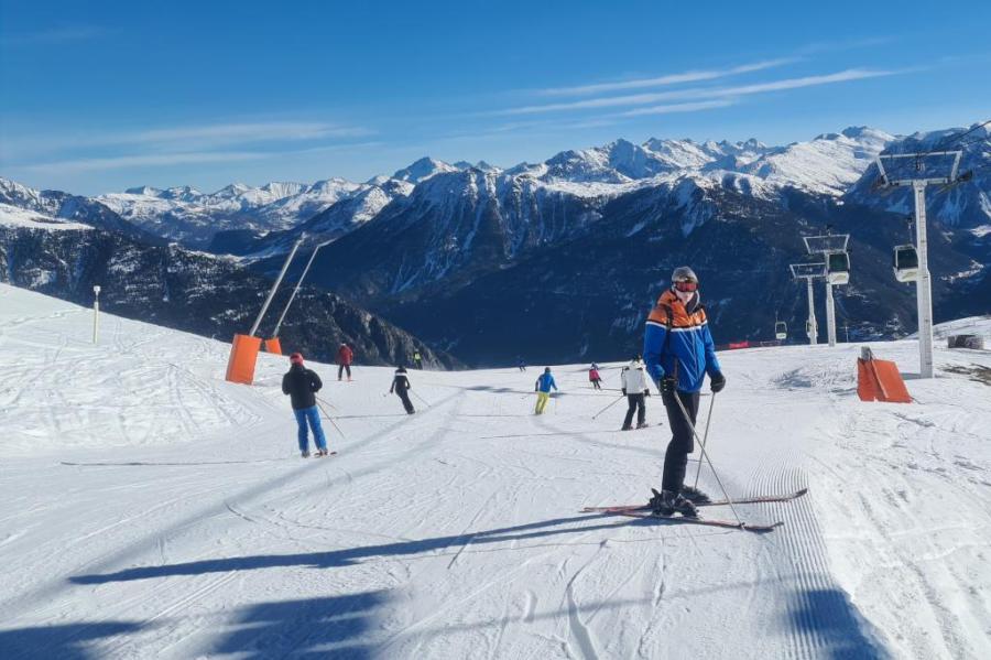 Sunny skies and great piste skiing in Serre Chevalier right now with fresh snow expected on Sunday/Monday – Photo: weathertoski.co.uk, 4 January 2023
Italy
Thursday will be a fine day across most Italian resorts with just a little cloud here and there close to the border areas. It will be mild with freezing levels typically around 2500m.
Friday and Saturday will remain mostly fine and mild across the Italian Alps.
Switzerland
Thursday will start mostly cloudy in the Swiss Alps, with some light showers (snow 1800m) across the north. Further south, it will be drier and brighter with sunnier skies extending to most other regions (except the north-east) by the end of the day.
Friday will be mostly sunny, at least above any low-lying valley cloud in some northern parts. It will be mild with freezing levels close to 3000m.
Saturday will remain fine and mild, with just some high cloud moving into the west later in the day.
Outlook:
On Sunday, active weather fronts will begin to approach the Alps from the west. Some sheltered internal valleys may stay mostly dry but showers or longer spells of snow will affect much of the French, western Swiss and far western Italian Alps as the day progresses, heaviest and most persistent on Sunday night. The rain/snow limit will start at around 1500-1700m but will fall towards 1000 later in the day and overnight.
Many southern parts of the Alps will also see some snow, especially the Dolomites on Sunday night, but precipitation will be lighter and patchier the further north-east you are, with not much reaching the Austrian Salzburgland, for example, at least until Monday.
On Monday, further precipitation is expected across many parts of the Alps, heaviest in the north-west, with a rain/snow limit close to 1000m and perhaps lower in places.
Our next detailed weather & snow forecast will be on
Sunday 15 January 2023
If you enjoy reading our updates - please feel free to support us: