


ARCHIVE
Today in the Alps - May to October 2025
Read about current weather and snow conditions in the Alps
Update: 11.30am Friday 31 October 2025 – Mostly fine in the Alps, with the next snow on Sunday…
It’s a mostly dry day in the Alps today with plenty of sunshine but also some significant areas of cloud drifting around, especially in the south (e.g. Dolomites) where the odd spot of rain is possible.
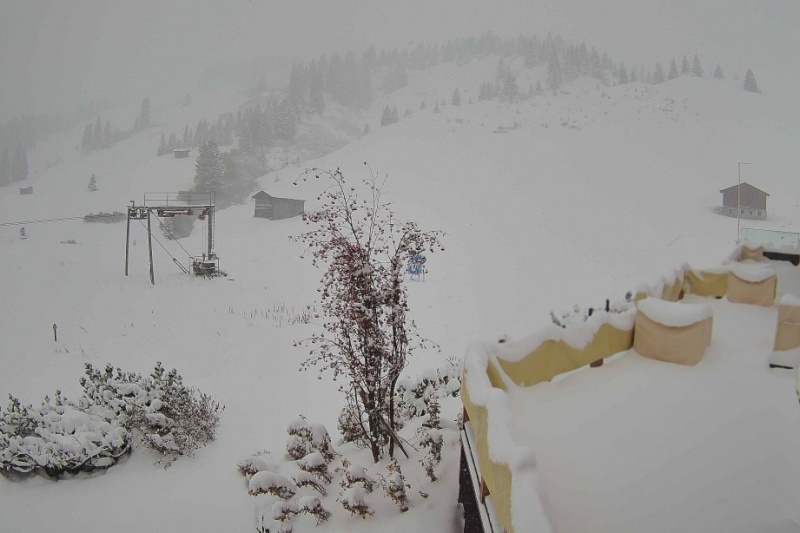
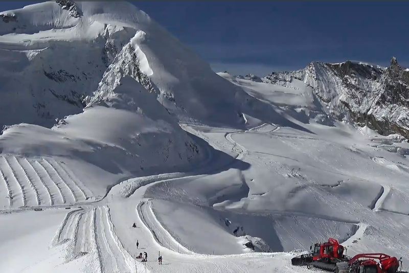
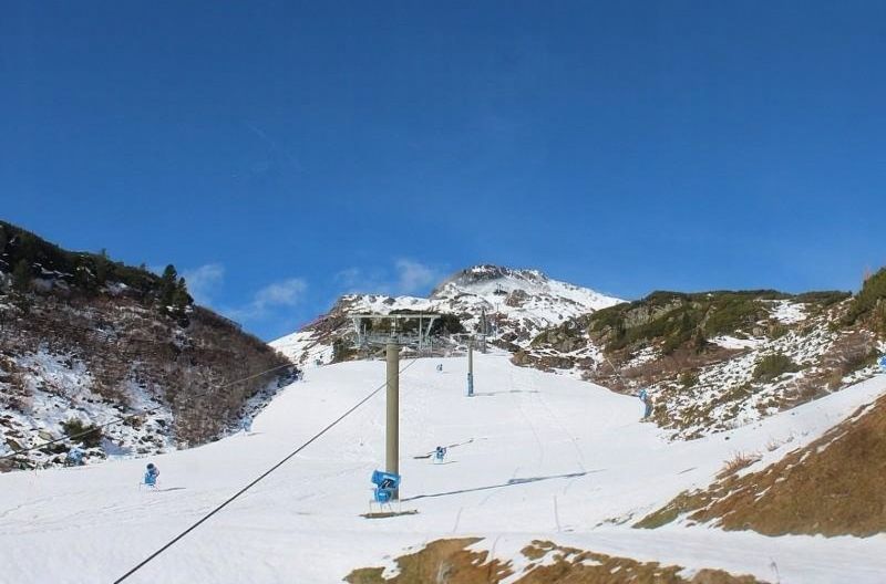 Sunshine today in Obertauern, which is scheduled to open towards the end of November – Photo: foto-webcam.eu, 31 October 2025
The next storm of any significance will cross the Alps on Sunday, delivering light to moderate snowfall at altitude across many regions with a rain/snow limit between 1600m and 2200m. This time it looks like Austria will see, the most snow with around 15-20cm forecast above 2000m in Obertauern, for example.
Around a dozen resorts in the Alps have been open this week, with the terrain still mostly focussed on glaciers, but with some non-glacial terrain open as well here and there, including in Sölden.
More ski resorts are expected to open this weekend, the highest profile of which is Verbier where the terrain available will be entirely non-glacial. Cervinia will also open some non-glacial slopes above Plan Maison tomorrow, adding to the skiing already available on the glacier it shares with Zermatt. However, for now the two areas will remain unconnected.
Updated: 9am Thursday 30 October 2025 – More snow at altitude in the western Alps but trending mild…
Another weather front moved through the Alps last night bringing rain and high-altitude snow to western regions, including the French Alps, the western Swiss Alps and the western Italian Alps.
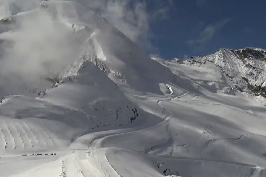
 Sunny skies above Alpe d’Huez this morning following another overnight dump of snow – 30 October 2025 – Photo: alpedhuez.com
The rain/snow limit this time around was high – generally above 2500m in the southern Alps (e.g. Isola 2000) and between 2000m and 2300m further north. Above 2500m, though, another 10-30cm of new snow fell in resorts including Tignes, Val d’Isère, Chamonix and Cervinia.
The eastern Alps (e.g. Austria) missed out this time around.
Of the ski areas in the Alps that are currently open, the western resorts of Zermatt-Cervinia and Saas-Fee have the best snow and the best weather today. Further east, the snow isn’t as fresh and there is more in the way of cloud, but the sun should break through in the likes of Sölden and Hintertux later today with some enjoyable skiing on offer.
The next storm is due on Sunday but again it won’t be cold with a rain/snow limit around 2500m falling to 1800m briefly later. The first part of November looks very mild with plenty of sunshine and just occasional showers in places with a little snow at very high altitude.
Updated: 10am Wednesday 29 October 2025 – Mostly fine, with some rain or snow in the western and south-western Alps tonight…
After yesterday’s glorious sunshine, it’s another fine start across most of the Alps. However, cloud will thicken up across the south-western Alps with rain and some high-altitude snow. This will reach the southern French Alps and south-west Italian Alps this afternoon, with snow above 2400-2700m.
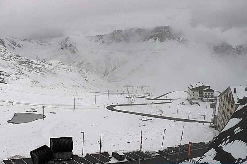
 Mostly fine weather across the eastern Alps today. This is Hochkönig in Austria – 29 October 2025 - Photo: foto-webcam.eu
Rain will become more widespread across the western Alps for a time tonight, heaviest in the south-west (e.g. Isola 2000) with a rain/snow limit typically around 2600m in the far south but perhaps 2200m for a time in the northern French Alps.
At high altitude, the likes of Tignes, Val d’Isère, Val Thorens, Les 2 Alpes, Alpe d’Huez and Sestriere can all expect a bit more snow (5-20cm above 2500m), with as much as 30cm in places, including high up in the Écrins (southern French Alps).
These weather fronts will lose their intensity as they push further east, with very little precipitation getting past eastern Switzerland or the central Italian Alps.
Any rain or snow will die out early on Thursday, leaving a couple of days of mostly dry and very mild weather across the Alps. New weather fronts will then arrive in the Alps later in the weekend, bringing a bit more snow in places but with a rain/snow limit mostly above 2000m.
Around a dozen resorts are offering skiing in the Alps today, all still based around their glaciers but with some additional non-glacial terrain also available in places (e.g. Sölden, Hintertux). Of these areas, Sölden currently offers the most extensive terrain with around 30km of pistes.
Updated: 9am Tuesday 28 October 2025 – The big storm is over, so what next?
The big storm is over, with the last of the clouds breaking up across the east, leaving most of the Alps in for a day of glorious sunshine.
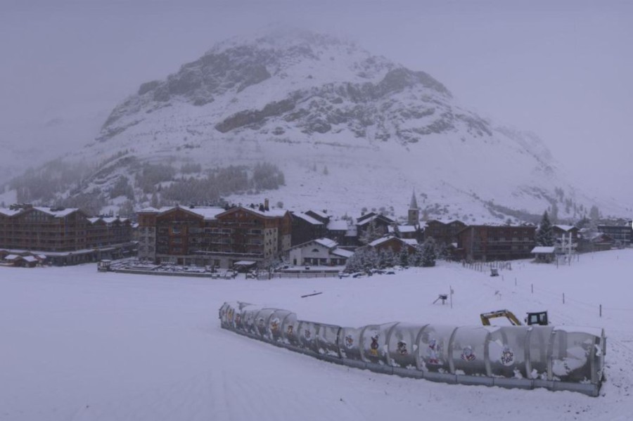
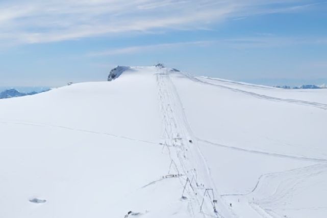
 Blue skies and deep snow at altitude in Val d’Isère, which opens for the 2025/26 season on 29 November 2025 – Photo: valdisere.com, 28 October 2025
Over the last 5 days there has been a lot of snow at altitude across the north-western Alps. The very highest snowfall totals have been across the northern French Alps with well in excess of 1m above 2500m in areas like Val d’Isère and Tignes, although it may not always look like this due to the wind-blown nature of the snow.
Many Swiss ski resorts also saw a lot of snow, including the likes of Verbier, Mürren and Engelberg, as did some north-western Italian resorts including Courmayeur and Cervinia. The west of Austria also benefited, especially the Arlberg area (St Anton, Lech etc) where 75cm fell above 2000m in the last 24-hours alone. On the whole, snowfall was much less significant in the eastern Austrian and southern Alps, alhough many resorts still saw some moderate falls at altitude.
So, what does this all mean for snow conditions in the Alps?
For some very high ski resorts, this storm will have some significance in relation to the beginning of the season “proper”, which is now only a month or so away. Resorts like Tignes, Val d’Isère and Val Thorens, for example, have all had enough snow at altitude to make some sort of lasting base almost inevitable at higher altitude, especially in L’Espace Killy.
Other high areas like Cervinia will also keep some of their higher-level snow and are likely to open some non-glacial terrain soon. However, with the weather in the Alps set to warm up and stay on the mild side for some time, most of the lower-lying ski areas will quickly lose their snow.
In short, this very significant (but not exceptional) Autumn storm is fantastic news for the glaciers and some higher-altitude resorts, especially in the short term, but it is still too early to be of any benefit to the majority of resorts in the Alps.
Updated: 9am Monday 27 October 2025 - New storm hitting the north-western Alps!
A new storm – the last in the current storm cycle – has hit the north-western Alps. This storm will deliver further significant snowfalls to the north-western Alps both today and tonight before the weather settles down again on Tuesday.
 Heavy snow today in Oberlech, Austria – 27 October 2025 – Photo: lechzuers.com
The rain/snow limit this morning is around 1100m but will rise to between 1500m and 1800m later today, before falling a little again tonight.
Storm totals for Monday/Monday night are likely to be around 15-30cm above 1800m across a wide swathe of the north-western Alps (e.g. Avoriaz, Verbier, Mürren, Engelberg, St Anton). The north-eastern Alps (e.g. Schladming, Obertauern) will see slightly less snow – typically 10-15cm above 1800m. The southern Alps will be a bit more ‘hit and miss’, with some significant snow in places close to the main Alpine ridge (e.g. Cervinia) but much less snow further south, where the snowline will also be higher (e.g. Dolomites).
5-day snowfall totals for this storm will (as forecast) exceed 1m above 2600m in parts of the north-western Alps (e.g. L’Espace Killy and the upper reaches of the Massif du Mont Blanc). However, this might not always be apparent where it has been windswept.
This makes this October storm very significant but NOT exceptional in the grand scheme of things. As for what it means for the coming ski season, it is still not much unfortunately. Were another big storm cycle to follow this, there would be a good chance that a firm base would be consolidated at altitude in some ski resorts. However, the weather is set to turn much milder from Tuesday onwards.
Snow is likely to remain for some time at higher altitudes in those resorts fortunate enough to have received big dumps over the last few days (e.g. Tignes), but any low-lying snow will quickly melt. This will be exacerbated by the Foehn, which will make an appearance in the central/northern Alps mid-week.
In short, this storm is great news for the glacier ski areas and could still be of considerable benefit to some higher resorts as they approach the main part of the season in a month or so time. For the vast majority of resorts, however, it won’t make any material difference.
Updated: 10am Saturday 25 October 2025 - Snow piling up at altitude in the north-western Alps…
The weather in the Alps remains very unsettled, with showers again affecting many western/north-western areas today. These will be heaviest later in the day and in the northern French Alps, and northern and western Swiss Alps. With some milder air in the mix, the rain/snow limit will initially be at 1600-2000m before falling again to 1100-1400m overnight. The south-eastern Alps will remain dry with sunny spells.
 Snowy scenes in Val d’Isère where at least 60cm of windswept snow has already fallen above 2700m, with more to come over the next 3 days – Photo: valdisere.com, 25 October 2025
Sunday will see further showers or longer spells of rain or snow, with a rain/snow limit around 1000-1400m. These will again be mostly across the north-western Alps – i.e. in the French Alps north of Grenoble, across much of the Swiss Alps apart from the far south (i.e. excluding Ticino and most of the Engadin) and in the far west of Austria.
 Brighter skies in the eastern and south-eastern Alps this morning. This is Turracher Höhe – 25 October 2025 – Photo: foto-webcam.eu
On Monday yet another storm will move in from the north-west, this time affecting the northern Alps more generally (meaning that more Austrian ski resorts will get in on the action). The rain/snow limit will start at around 800-1200m but will rise towards 2000m in the west later.
Between now and Monday night, another 20-40cm can be expected above 2000m across a wide swathe of the north-western Alps, with more than 50cm in a few favoured spots. This means that 5-day storm totals will be close to or above 1m of fresh snow (albeit windswept) at high altitude in some parts of the northern French Alps, including on the Grande Motte above Tignes and on the higher slopes above Chamonix.
The last of the precipitation will move away from the eastern Alps early on Tuesday, with drier and milder weather expected across all parts of the Alps mid-week.
Updated: 9am Friday 24 October 2025 - Serious snow at altitude across some parts of the Alps…
There’s lots of fresh snow at altitude in the north-western Alps today, with plenty more in the forecast, and the weather in the Alps set to remain very unsettled until Tuesday. The first phase of a major autumn storm cycle may be over, but there is plenty more action to come over the next few days, especially in the north-western Alps.
 It's still snowing first thing this morning in Tignes, where there are significant accumulations of snow at altitude – 24 October 2025 – Photo: tignes.net
Yesterday, a very active cold front swept across the Alps delivering copious precipitation to the north-western Alps and a sharp drop of temperature. The rain/limit began at around 2700m but dropped steadily later in the day to reach 1200m or lower in places overnight, as seen by the dusting of snow in Les Gets (1172m) this morning (pictured below).
In higher parts of the north-western Alps, including Tignes (pictured above), Val Thorens, the mountains above Chamonix, and the far west of Switzerland, there has already been a lot of snow – perhaps 60cm or more above 2700m. Many other parts of the Alps have also seen at least a little snow at altitude, though it is the northern French and northern and western Swiss Alps that have seen the most.
 There has been a dusting of snow at village level in Les Gets first thing this morning – 24 October 2025 – Photo: lesgets.com
Over the next few days there will be further bands of rain or snow moving in from the north-west with a rain/snow limit mostly between 1200m and 1700m but even lower at times. Again, it will be the north-western Alps that will benefit most (roughly north of a line between Grenoble and Innsbruck) with the higher resorts of the Tarentaise (e.g. Val d’Isère, Tignes, Val Thorens) benefiting most.
The most intense of the upcoming phases of snow is likely to be on Monday, by the end of which 5-day storm totals could exceed 1m at high altitude.
Once this current storm cycle comes to an end on Tuesday, the weather in the Alps is expected to warm up significantly.
Right now, weather-permitting (which in many cases it is not) it is still mostly glaciers that are open for skiing, with Hintertux and Sölden offering the most extensive terrain, including some non-glacial runs.
However, given the significant snow that is currently falling across some parts of the Alps, more non-glacial ski areas may be tempted to open soon, albeit on a very limited basis.
Updated: 10.40am Thursday 23 October 2025 – First major “winter” storm of the season!
As expected, the weather in the Alps is turning very unsettled, with a powerful cold front sweeping through the region today.
 Snowfall accumulations of up to 80cm (indicated by the brighter colours) are predicted in the northern French and western Swiss Alps between today and Saturday - Image: bergfex.com, 23 October 2025
Already this week we have seen fresh snow at high altitude across some parts of the Alps (especially in the north-west), with some moderate accumulations above 2700m or so. Today a very vigorous cold front is moving through the Alps bringing widespread heavy precipitation across the northern and western Alps, as well as a dramatic fall in temperatures. The rain/snow limit will start at around 2700m but later today will fall to 1500m and even close to 1000m in places tonight – at least in the north-west, with milder air hanging on in the south-east until tomorrow morning.
The weather will continue unsettled on Friday with scattered showers or flurries again. These will become more frequent later in the day and on Friday night, always heaviest in the north-western Alps.
By Saturday morning, snowfall totals should be in the region of 40-80cm above 2800m in the northern French Alps (e.g. Tignes, Chamonix), western Swiss Alps (e.g. Verbier, Mürren) and far north-western Italian Alps (e.g. Courmayeur). At 1800m, snowfall totals in these areas could be in the region of 20-40cm, with snow settling to as low as 1000-1200m in places, albeit temporarily.
On the whole, over the next few days, the further south and east you are in the Alps the less significant any snowfalls will be.
The weather will remain cool and unsettled over the weekend with further snowfalls (1400-1800m) especially on Sunday and early next week, again mostly in the north-west.
Updated: 11am Tuesday 21 October 2025 - Significant snow for some parts of the Alps this week…
The lengthy period of calm autumn weather has come to an end in the Alps, with Atlantic weather fronts having already delivered fresh snow to some higher parts of the west yesterday. The weather will now remain unsettled all week in the Alps with significant snow expected to increasingly low altitudes from Thursday.
 Fresh snow high above Les 2 Alpes, with plenty more to come this week – Photo: les2alpes.com, 21 October 2025
On Tuesday and Wednesday, any snow is expected to fall above 2500-2700m and mostly in the west, with 10-20cm possible at 3000m by the end of Wednesday on the glaciers of Tignes and Les 2 Alpes (neither of which are currently open). On Thursday, much more active fronts will sweep in from the west/north-west lowering the rain/snow limit to 1500m or so.
The weather will remain cool and changeable on Friday and Saturday with further showers and snow falling to relatively low levels.
Over the next few days, the heaviest precipitation will fall in the western and north-western Alps, where 50-80cm of snow is likely above 2800m by the end of the week in parts of France and western Switzerland. However, eastern regions could also see some significant snow over the weekend and into next week.
Watch this space!
Updated: 11am Friday 10 October 2025 - Settled weather in the Alps as more glaciers open…
A huge area of high pressure centred over the UK is currently extending its influence across the Alps and will continue to do so for some days to come. This means the Alps will see lots of dry and relatively mild weather for the foreseeable future.
 Great skiing this week on the Hintertux glacier in Austria – Photo: facebook.com/HintertuxGletscher, 8 October 2025
It won’t always be sunny in the Alps though, with areas of cloud drifting around and some more general low cloud plaguing certain valleys, particularly close to the foothills of the Alps.
With the opening of the Mölltal area today, 10 glacier ski areas are now open across the Alps. This will increase to 11 tomorrow, with the opening of the Kitzsteinhorn glacier in Kaprun.
So, from this weekend you will be able to ski in the following areas in the Alps:
- in Austria: Sölden, Stubai, Kaunertal, Pitztal, Hintertux, Mölltal and Kaprun;
- in Switzerland: Zermatt and Saas-Fee; and
- in Italy: Val Senales and Passo Stelvio.
Of these, the most extensive terrain can currently be found in Hintertux, which has 24km of pistes open, and in Sölden, which has 21km.
Snow conditions on the alpine glaciers are generally good, especially on the northern Austrian glaciers where the heaviest of the recent snow has fallen. However, with no new snow in prospect for quite some time, piste conditions may become more hard-packed or scratchy over the next few days but, all in all, conditions should remain pretty reasonable for the time of year.
Updated: 10am Monday 6 October 2025 – Significant snow for the Austrian glaciers…
Many parts of the Alps saw at least a little snow over the weekend, with some significant falls at altitude in the north-east, i.e. Austria, where it will continue at times today, especially in the northern and eastern Austrian Alps where this is a dusting as low as 1200-1400m.
 Snow falling today in Obertauern in the central-eastern Austrian Alps – 6 October 2025 – Photo: foto-webcam.eu
The last of the flurries will die away from the north-eastern Alps early tomorrow, with plenty of dry sunny weather forecast across the Alps for the rest of the week. However, a weak front may bring some cloud and a few showers in from the north-west on Thursday.
Snow conditions should be fabulous on the Austrian glaciers once the weather settles down, with storm totals (between Saturday and Tuesday) likely to be in the region of 15-30cm above 2800m in the likes of Sölden and Pitztal. The greatest snowfall totals from this storm will likely be over 50cm, further east in the Höhe Tauern area, though no ski areas will be open here any time soon.
Both Saas-Fee and Zermatt, and Italian glacier areas like Passo Stelvio and Val Senales also saw some fresh snow over the weekend albeit in lesser quantities, with typically 5-15cm.
This week, the following 9 glacier ski areas will be open in the Alps, weather permitting:
- in Austria: Stubai, Sölden, Hintertux, Pitztal and Kaunertal;
- in Switzerland: Zermatt and Saas-Fee; and
- in Italy: Passo Stelvio and Val Senales.
Of these, Hintertux is likely to be offering the most extensive terrain, with over 20km of pistes already open.
Updated: 12pm Saturday 4 October 2025 - More snow on its way to the Alps!
A new storm is approaching the Alps, which is a bit more potent than we previously forecast on Wednesday, with some moderate snowfalls in places, especially at altitude and in the northern/north-eastern Alps.
 Expected snowfall in the Alps between today and Monday 6 October, with the greatest amounts (15-30cm) expected at altitude in the north-eastern Alps (shown in orange and blue) – Image: bergfex.com, 4 October 2025
Weather fronts from this storm are already knocking on the door of the north-western Alps this Saturday lunchtime and will move across all regions later today and overnight. The heaviest precipitation will fall in the northern Swiss and Austrian Alps (e.g. Engelberg, Lech, Kaprun) with the rain/snow limit starting above 3000m early this afternoon but falling rapidly to as low as 1500m in the northern Alps tonight.
It will remain showery on Sunday with the heaviest precipitation again in the northern and north-eastern Alps where the rain/snow limit will be around 1400-1600m. Throughout this period the south-western Alps will see the lightest and patchiest precipitation, with the far south-west (e.g. Isola 2000) staying completely dry.
Over the next 36 hours or so between 15cm and 25cm of new snow can be expected to fall on the Austrian glaciers, including Sölden, Stubai and Hintertux, with closer to 10cm falling on the Italian glaciers of Passo Stelvio and Val Senales, and a maximum of 5-10cm in Zermatt and Saas-Fee.
Next week any lower-lying snow will quickly melt as the weather turns warmer and sunnier. However, the glaciers will be enjoying some excellent snow conditions for the time of year.
Updated: 10am Wednesday 1 October 2025 – A little more snow forecast this weekend for some of the 9 alpine glacier ski areas that will be open…
The weather in the Alps is a little mixed right now with plenty of sunshine for most areas, but rather more in the way of cloud in the east, especially in the eastern Austrian Alps, where there is the odd flight flurry to 1800m or lower.
 Evidence of some fresh snow above Obertauern, in the eastern Austrian Alps, where a few light flurries are forecast today – 1 October 2025 – Photo: foto-webcam.eu
More organised but relatively weak weather fronts will reach the Alps late on Friday and over the weekend, but with any precipitation mostly reserved for the northern and north-eastern Alps. On Saturday, a warm front will raise the rain/snow limit to above 3000m to begin with, before a cold front from the north-west lowers it again a fraction later in the day. This will deliver a little top-up of snow for some of the glaciers, especially in Austria.
Right now, there are still 6 glacier ski areas open in the Alps: Hintertux and Pitztal in Austria, Saas-Fee and Zermatt in Switzerland, and Val Senales and Passo Stelvio in Italy.
These will be joined by further Austrian glacier ski areas over the next week or so, starting with Sölden tomorrow (2 October), followed by Stubai and Kaunertal on Friday (3 October), Mölltal on 10 October, and Kaprun on 11 October.
Updated: 12pm Sunday 28 September 2025 - Six alpine glaciers are open this weekend, with great snow conditions…
The fresh snow that fell at altitude in the Alps last week has vastly improved conditions in the Alps, with half a dozen glaciers now open for skiing this weekend.
 Of the glacier areas open for skiing in the Alps, Passo Stelvio probably saw the most snow, with at least 30-40cm – 28 September 2025 – Photo: passostelvio.eu
In Austria, Sölden has postponed its opening until next weekend. However, the Hintertux glacier is back up and running, after an unscheduled late summer break due to poor snow. It is joined by the Pitztal glacier, which opened this weekend. In Switzerland, you can ski in Zermatt and Saas-Fee, and in Italy you can ski at Val Senales and Passo Stelvio.
Note that the extent of skiing available in all the glacier areas open remains very limited. Indeed, at this time of year the glaciers are mostly used by race training camps with only the odd tourist.
 Significant new snow and great skiing conditions on the glacier above Saas-Fee – 28 September 2025 – Photo: saas-fee.ch
Nonetheless, snow conditions are much improved, especially in Passo Stelvio, Val Senales, Zermatt and Saas Fee, all of which are located either on or to the south of the “main alpine ridge”, a natural dividing line between weather coming from the north and the south. As last week’s storms mostly came from the south, these were the glaciers that saw the most snow.
Pitztal and Hintertux are to the north of the ridge and, while they also saw some improvements, the direction of the storm meant that they received less snow than their counterparts further south.
Next week, the weather in the Alps is expected to be mostly dry to start with but, later in the week, cooler and more unstable conditions will approach the eastern Alps (i.e Austria), where there could be a few snow flurries at altitude.
 Perfect snow conditions on the highest piste in the Alps in Zermatt (3899m), which is only open in the summer and autumn – 28 September 2025 – Photo: matterhornparadise.ch
Updated: 12pm Thursday 25 September 2025 – More openings in the Alps with improving snow conditions on the glaciers…
As forecast a few days ago, it has been a relatively cool and unsettled week in the Alps with some moderate falls of snow high up on the glaciers.
 Fresh snow on the Passo Stelvio pass, with considerably more up on the glacier – 25 September 2025 – Photo: pirovano.it
Just to be clear, these snow falls will have no bearing on how the main winter season might pan out, but they have greatly improved skiing conditions on the glaciers, more of which are due to open over the coming days/weeks.
Right now, you can ski on 4 glaciers in the Alps: in Switzerland, in Zermatt and Saas-Fee; and in Italy, in Passo Stelvio and Val Senales.
It is very unusual to have no Austrian glacier area open at this time of year, but this will soon change when Sölden kicks things off tomorrow (26 September) and Hintertux reopens on 27 September (after having been forced to close in early August due to insufficient snow).
The Pitztal glacier will also open for skiing from 27 September, with other Austrian glaciers like Stubai, Kitzsteinhorn and Mölltal scheduled to open in October.
Updated: 11am Monday 22 September 2025 – Some welcome snow for the glaciers…
After another eye-catching warm spell at the end of last week, when temperatures again hit 30˚C in some lower alpine valleys, the weather broke again yesterday with showers and storms breaking out across much of the Alps.
 Thanks to yesterday’s storm, snow conditions on the glacier above Saas-Fee are much improved today – 22 September 2025 – Photo: saas-fee.ch
So far this September the weather in the Alps has seen notable hot spells interspersed with brief cooler periods with a few showers. This time around, the more autumnal weather looks set to stay for a while, with relatively cool temperatures and showers on the cards for most of the Alps this coming week.
This is good news for the glaciers, most of which will see welcome top-ups of snow over the next few days, with Hintertux and Pitztal expected to open for skiing on Saturday. These areas join Zermatt, Saas-Fee, Passo Stelvio and most recently Val Senales which opened last Friday.
Note that in adverse weather and snow conditions glacier ski areas are subject to closure at short notice. Always check with the relevant tourist office or lift company before committing.
Updated: 1pm Monday 8 September 2025 – Changeable weather in the Alps…
The weather in the Alps remains changeable. After occasional high altitude snowfalls last week, summer returned to the Alps at the weekend, with temperatures close to 30˚C in some lower valleys. However, this hot spell was briefer than originally forecast.
 Cloudy with a dusting of new snow on the Saas-Fee glacier today, but snow conditions remain less than ideal – 8 September 2025 – Photo: saas-fee.ch
More ‘normal’ temperatures and showers are on the cards over the coming days, meaning more bits and pieces of snow falling at high altitude. This may temporarily improve conditions again on some of the glacier though, fundamentally, they remain in poor shape after another exceptionally hot alpine summer.
Right now, weather-permitting, you can only ski on 3 European glaciers:
- In Italy, the Passo Stelvio glacier is scheduled to close on 2 November 2025.
- In Switzerland, both Saas-Fee and Zermatt are set to remain open throughout autumn. Note that access from the Italian side to the glacier area which Zermatt shares with Cervinia closed on 7 September.
As glacier ski areas are subject to closure at short notice in adverse weather and snow conditions, always check with the relevant tourist office or lift company before committing.
Updated: 3pm Monday 1 September 2025 - Snow is falling across some higher parts of the Alps…
After another very hot summer in the Alps, the weather has now turned more autumnal in recent days, with fresh snow falling at high altitude. This unsettled weather will continue until Friday before warmer and sunnier conditions return at the weekend.
 Fresh snow at 3000m in La Plagne – 1 September 2025 – Photo: laplagne.com
While any fresh snow on the glaciers at this time of year is welcome, it can’t disguise the fact that the Alps have endured yet another torrid summer, with increasingly poor conditions in the few alpine resorts which still offer summer skiing.
Indeed, the glacier at Hintertux – traditionally one of the most reliable for snow in the Alps and usually open 365 days a year – was forced to suspend operations shortly after our last report in early August and is set to reopen at an unconfirmed date in September.
Right now, weather-permitting, you can only ski on 3 European glaciers:
- In Italy, the Passo Stelvio glacier is scheduled to close on 2 November 2025.
- In Switzerland, both Saas-Fee and Zermatt are set to remain open throughout autumn. Note that access from the Italian side to the glacier area which Zermatt shares with Cervinia is only open until 7 September.
Note that glacier ski areas are subject to closure at short notice in adverse weather and snow conditions. Always check with the relevant tourist office or lift company before committing.
Updated: 10am Friday 1 August 2025 – Summer skiing conditions in the Alps are temporarily improved…
Thanks to July snowfalls, summer skiing conditions are temporarily improved in the four summer ski areas currently open in in the Alps: namely Hintertux in Austria, Passo Stelvio in Italy, and Saas-Fee and Zermatt in Switzerland, the latter also accessible via Cervinia in Italy.
 Fresh snow has improved snow conditions on the glacier in Saas-Fee, for now at least – 1 August 2025 – Photo: saas-fee.ch
After a very hot start to the Alpine summer, which saw rapidly deteriorating snow conditions on the glaciers, the weather in the Alps turned cooler in the second week of July, allowing for temperatures more like the long-term average, making July 2025 an outlier compared with recent years.
Thanks to generally above average precipitation and some fresh snowfalls at high altitudes, summer snow conditions have improved and, for now, are not as bad as had been feared a few weeks ago.
That’s the good news. The bad news is that the improvement to snow conditions on the Alpine glaciers is only temporary and that August is likely to be hot, and potentially very hot, again.
Summer skiing will continue in the four ski areas currently open, but snow conditions will deteriorate again as temperatures rise, with the glaciers likely to look increasingly threadbare again as the month progresses.
Read more in our blog on the Top 5 places to ski in the Alps in August…