Updated: 11.30am Sunday 30 November 2025 – A small top-up of snow for the north-western Alps later today...
After a largely sunny day in the western Alps yesterday, it is cloudier today ahead of a weak weather front that will bring a little snow to the north-western Alps later today and overnight. The
eastern Alps will be dry today, though high cloud will make skies hazy or even mask the sun at times.
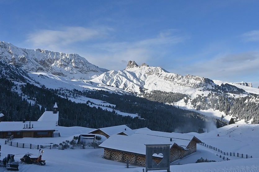
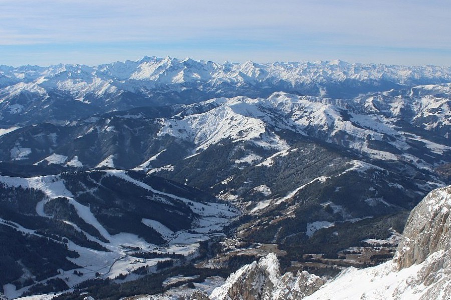
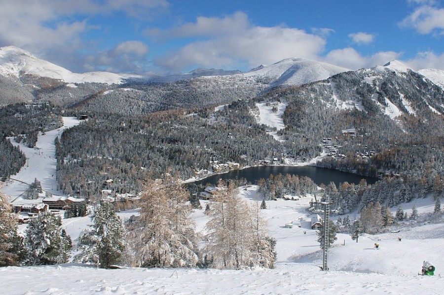
Plenty of early snow in Obertauern in the central-eastern Austrian Alps – 30 November 2025 –Photo: foto-webcam.eu
This latest front will bring only modest amounts of snow – typically 2-10cm in the northern French Alps (e.g. Avoriaz, Flaine, 3 Valleys), the northern and western Swiss Alps (e.g. Verbier,
Wengen, Engelberg) and the far west of Austria (e.g. Lech).
Further to the south and east there will be little (if any) snow. The rain/snow limit will typically start at around 1500–1700m before dropping to around 1000m .
Over the next few days, the weather in the Alps will be mostly dry, however, there remains some uncertainty about the forecast for later in the week, when a few showers or flurries are possible in
places.
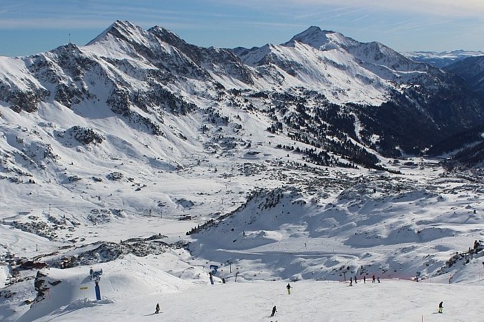
This weekend, nearly 150 ski areas are open in the Alps, many being unscheduled openings thanks to recent snowfalls, including Avoriaz, Megève and La Clusaz. Despite modest snow depths, Ischgl is
currently offering the greatest extent of terrain (152km) – as it usually does at this time of year.
Minor resorts in mountain ranges outside the Alps, including the Jura and the Vosges, have also opened terrain – great news for these lower, often forgotten, regions which have had a tough time in
recent years.
Updated: 12pm Saturday 29 November 2025 – Lots more ski resorts opening in the Alps, including some big names…
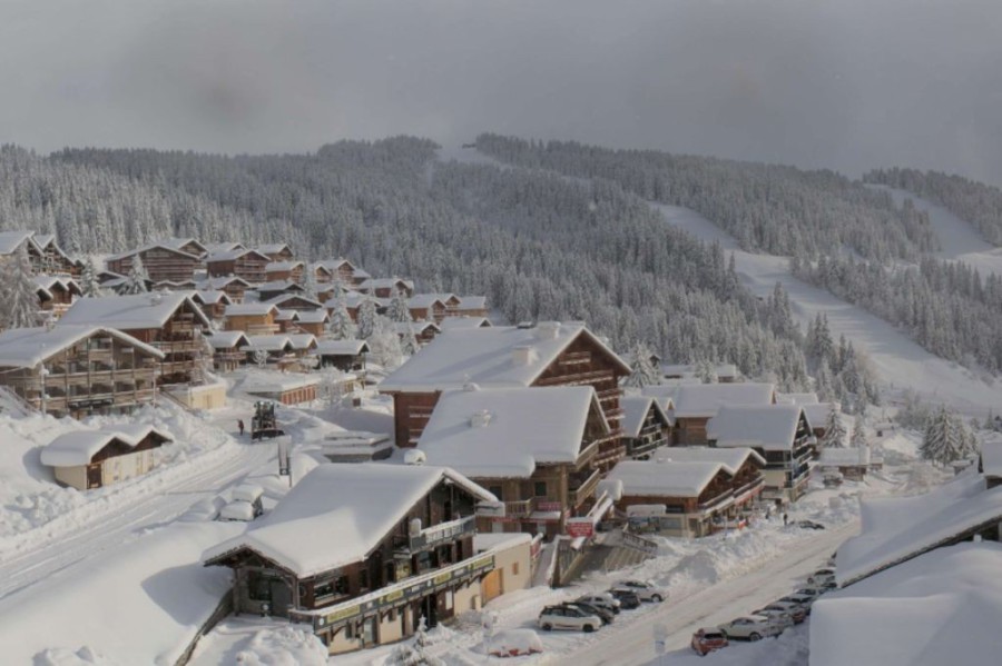
Two more big name ski resorts, Val d’Isère and Les 2 Alpes, open today with perfect weather and snow conditions as good as you could wish for in November!
Fabulous weather and snow conditions on opening day in Val d’Isère today. This is the Solaise sector – 29 November 2025 – Photo: valdisere.com
Nearly 150 ski areas in the Alps are open this weekend, many of them unscheduled openings thanks to the recent snowfalls, including Avoriaz, Megève and La Clusaz, to name just a few.
Despite modest snow depths, though, Ischgl continues to offer the greatest extent of terrain (152km) – as it usually does at this time of year.
Notably, some minor resorts in mountain ranges outside the Alps, like the Jura and the Vosges, have also managed to open up some terrain – great news for these lower, often forgotten, regions
which have had a tough time in recent years!
Most parts of the Alps are sunny , with some exceptions, especially Austria which has plenty of cloud cover and even a few light flurries in the west. The
northern and eastern Swiss Alps also have some cloud , though this should break up later.
A weak weather front will deliver a dusting of snow here and there across some western parts of the Alps , with further weak fronts affecting the Alps at
times, though these will not produce much in the way of snow.
Updated: 10am Thursday 27 November 2025 – Winter wonderland in the Alps!
The big storm in the Alps is now over and, at altitude at least, the sun is back! It will remain mostly dry for a couple of days now, but will turn more unsettled again over the weekend, with
further snow in some western parts of the Alps, especially on Sunday.
Sun and snow in Warth-Schröcken today, which is scheduled to open on 5 December 2025 – Photo: warth-schroecken.at, 27 November 2025
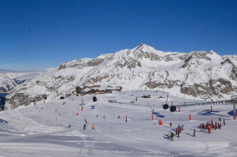
’s big opening is Austria’s Ischgl, which immediately claims top spot for the number of km of runs open in the Alps (and in the world) with 143km!
Ischgl joins at least 30 ski resorts open in the Alps – in any of which you can expect blue skies and silky-smooth pistes! Two other good options right now
in terms of extent of terrain are Sölden (with 98km) and Zermatt (with 86km). But, as good as conditions may be in these resorts , they are not actually the
areas with exceptional snow.
The really big snow snowfalls have been in the north-western Alps, more specifically the northern French and western Swiss Alps. These regions have seen 1m of snow at altitude since
, including in ski areas and resorts such as L’Espace Killy, 3 Valleys, Paradiski, La Rosière, La Clusaz, Portes du Soleil, Chamonix valley, Gstaad-Glacier
3000 area, parts of the Bernese Oberland and as far east as Engelberg.
Indeed 1.5m+ was recorded in a few spots, with 174cm between and in L’Ecreleuse (at 2252m), an official Swiss
measuring station near the Dents du Midi just to the south of the Portes du Soleil.
In light of these very significant snowfalls, a number of unscheduled openings are also now planned for this weekend, including Avoriaz, Champéry-Les Crosets and La Clusaz, to name just a few.
Updated: 9.45am Wednesday 26 November 2025 – Final flurries of this epic November storm!
It’s still snowing across some northern parts of the Alps this morning, especially close to the northern foothills. These flurries will continue to low levels on and off for much of the day before
finally dying away later, but not before we see several more centimetres of snow.
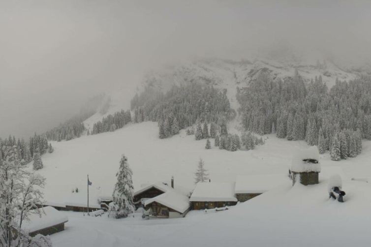
Masses of snow in Villars which, along with many other alpine ski resorts, will open some previously unscheduled skiing this weekend – Photo: villars.ch, 26 November 2025
The weather in the Alpine interior is drier, however, and it is mostly sunny on the southern side of the Alps.
The weather in the Alps will settle down on and before a new storm arrives over the weekend. However, this
storm will be a weak affair with just a few centimetres of snow here and there across some western areas.
Sunnier today on the southern side of the Alps. This is Seiser Alm/Alpe di Siusi in the Dolomites – 26 November 2025 – Photo: foto-webcam.eu
Snow conditions in the Alps are generally excellent for late November, and exceptional even in some north-western parts of the Alps.
Indeed, it is difficult to remember there having been more snow at this time of year in the lower resorts in this region, including the likes of Morzine, Les Gets, Chatel, Megève, La Clusaz,
Villars and Gstaad, to name just a few.
We will look more closely at just how ‘historic’ this November snow is in these regions later in the week.
Elsewhere in the Alps, early season snow conditions are also generally good although not everywhere has masses of snow. This includes some very high inner Alpine resorts, like Zermatt and
Saas-Fee, which missed out on the heaviest snow and have more “normal” snow conditions for the time of year.
26 ski areas in the Alps are reported to be open today with LOTS more opening later this week or this weekend. This includes several scheduled big-name openings, such as Ischgl and Val d’Isère,
but also numerous unscheduled openings thanks to all the fresh snow, including Villars and Avoriaz. More on this in our detailed snow report tomorrow!
Updated: 11.30am Tuesday 25 November 2025 – Yet more heavy snow for the Alps!
It’s another very snowy day for parts of the Alps today. Unlike yesterday, when most of the action was in the western and north-western Alps, this time the whole of the northern Alps (including
Austria) will see flurries or longer periods of snow, and to lower levels than yesterday too, with a rain/snow limit typically around 500-800m. Except for in some border areas, the southern Alps will
see fewer flurries.
Les Saisies, in the French Savoie region, has seen a lot of snow in recent days, with well over a metre at altitude – 25 November 2025 – Photo: lessaisies.com
, flurries will continue to low levels across some northern parts of the Alps, mostly in eastern Switzerland and Austria, before slowly dying out. A
window of drier weather is then expected before another storm reaches the Alps over the weekend.
alone will see between 15cm and 40cm of new snow above 1000m across a wide swathe of the northern Alps, with another 10–20cm likely , especially in the Swiss and Austrian Alps. This means that storm totals between and will likely exceed 1 metre at altitude in many north-western parts of the Alps and approach 1.5m in a few places.
Needless to say, snow conditions are going to be exceptional for the time of year when the weather settles down, especially in the northern and north-western Alps, which have seen the heaviest of
the recent snow.
Off-piste is strongly discouraged, however, as the danger level is high or extremely high in many areas.
Updated: 9.30am Monday 24 November 2025 – Big storm now underway in the Alps...
The much-anticipated big storm is now underway in the Alps, with heavy snow (but also some rain lower down) falling across the western Alps this morning.
Lots of fresh snow in Les Saisies (1600m), which is just above the rain/snow limit this morning – 24 November 2025 – Photo: lessaisies.com
The bad weather will move further east as progresses, but with the heaviest precipitation always in the north-western Alps. The rain/snow limit is highly
variable – currently as high as 1700m in some exposed parts of the western Alps, but still very low in the more internal valleys where pools of cold air are harder to shift.
The milder air will make some progress eastwards, at least for a time, but will always be most keenly felt closest to the foothills of the western and northern Alps. Temperatures will start to
drop again from the north-west later and especially overnight .
will see further snow in the Alps, again heaviest in the north-west where the rain/snow limit will be lower again (600-800m). Further east and
south-east, the rain/snow limit will remain higher for a time.
Further flurries are forecast to low levels across the northern Alps on , though they will be lighter. Areas that saw lots of rain (e.g. the lower parts of the Portes du Soleil) will be covered with snow again .
Storm totals between and are likely to be over 1m above 2000m in parts of the
northern French Alps (e.g. Tignes, Avoriaz), but more generally 50-80cm across the north-western Alps.
Many other parts of the Alps will see at least some snow, although some north-western parts of Italy (e.g. La Thuile) and the southern Alps will see much less.
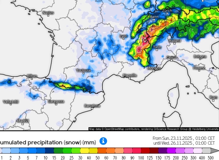
Updated: 11am Sunday 23 November 2025 – Major new storm will hit the Alps tonight!
Get ready – the next storm is fast approaching the Alps and will be the most potent yet of this current spell of unsettled weather, potentially bringing 1m of new snow to some western parts of the
Alps between now and Wednesday!
Big snowfalls expected across the Alps over the next few days, with over 1m possible in some French ski areas – Image: kachelmannwetter.com, 23 November 2025
The storm will hit the French Alps this evening before moving slowly eastwards to affect most parts of the Alps by the end of Monday, but probably not reaching some parts of the eastern Austrian
Alps until early on Tuesday. It will be a complex storm with multiple fronts and air masses, so expect some huge discrepancies in snowfall and rain/snow limits from place to place.
When the storm first hits the Alps this evening, snow will fall at all levels in the more internal valleys where cold air is embedded, but in the western foothills the rain/snow limit is likely to
start at around 1000-1200m. Overnight and early tomorrow, it will slowly rise to 1400-1600m in the more exposed ranges of the western Alps (e.g. Portes du Soleil) but could remain much lower for
longer in the more internal valleys (e.g. Haute Tarentaise, Valais, Aosta).
The snowline will generally also remain lower in the eastern Alps but could reach 1400m for a time in some more exposed ranges later on Monday (e.g. Arlberg). Later on Monday, colder air will
start to return from the north-west spreading to most parts on Tuesday, at which point any snowfall could be back as low as 500m in some northern parts of the Alps.
Between now and Wednesday morning, we should see 50-80cm of new snow above 1600m across a wide swathe of the western Alps, with 1m possible in some parts of the French Alps. Across the eastern
Alps, accumulations will more likely be in the 20-40cm range, but with some possible surprises.
The Italian Alps and the southern Alps will generally also see more moderate snowfall totals, in the range of 10-40cm, but with some exceptions (e.g the far north-west).
Around 40 ski areas in the Alps are open this weekend, mostly still on a very limited basis but with some more extensive options also now on the table including Obergurgl, Tignes and Val
Thorens.
Snow conditions in the Alps are clearly quite impressive for late November, especially in the context of recent years. Whether this constitutes “one of the best starts to the season in recent
memory”, as some are now claiming, is still up for debate and will depend on where you are in the Alps, but it is something we might be able to pinpoint in more detail next week. Watch this
space!
Updated: 1pm Saturday 22 November 2025 – Excellent weather and snow conditions for the opening of Tignes and Val Thorens today!
You couldn’t ask for better conditions on an opening weekend in Val Thorens and Tignes, which opened today with fresh snow, clear blue skies and freezing cold temperatures.
Perfect weather and snow conditions (on-piste at least) for the opening day of Tignes– 22 November 2025 – Photo: tignes.net
This weather window won’t last though, with cloud thickening up across the western Alps tomorrow ahead of the next storm which will deliver significant quantities of snow to many parts of the Alps
early next week.
Snow will reach the French Alps late on Sunday, before spreading slowly east, with the heaviest precipitation set to be falling across Austria and the Dolomites by Tuesday.
Val Thorens also has great weather and snow conditions for its opening day – 22 November 2025 – Photo: valthorens.com
This weather window won’t last though, with cloud thickening up across the western Alps tomorrow ahead of the next storm which will deliver significant quantities of snow to many parts of the Alps
early next week.
Snow will reach the French Alps late on Sunday, before spreading slowly east, with the heaviest precipitation set to be falling across Austria and the Dolomites by Tuesday.
The rain/snow limit will be highly variable, starting quite low and remaining very low for some time in the internal valley of the western Alps (e.g Haute-Tarentaise, Aosta, Valais) where the cold
air won’t be easy to dislodge.
Eventually it will reach 1400-1600m early on Monday in the more exposed parts of the western Alps, before falling again from the north-west late in the day. Further east in Austria, the rain/snow
limit will be lower, generally remaining below 1000m.
Over the next 48 hours or so we can expect 40-70cm of fresh snow above 1600m across much of the French Alps, but much less in the far south. Most other parts of the Alps can expect 15-40cm, aside
from some south-western areass (e.g Isola 2000) where there will only be a few centimetres.
Updated: 10.30am Friday 21 November 2025 – Very cold, further snow flurries in places…
The Alps are under the influence of a bitterly cold north-easterly airflow today with some flurries in places. These are mostly light, but with some further moderate accumulations in places,
especially close the western foothills (e.g. Vercors) and the northern foothills e.g. Engelberg.
Cold and snowy in Lech this morning – 21 November 2025 – Photo: lechzuers.com
There will also be some sunny spells, these most likely in the more internal Alpine valleys.
Over the weekend, there will be lots of fine, sunny but cold weather in the Alps before a new storm approaches from the west on Sunday.
The first half of next week will again be very unsettled with significant snow for many, heaviest in the west. The rain/snow limit may briefly rise to 1400m in some exposed western parts of the
Alps early on Monday but, for the most part, the rain/snow limit will stay relatively low.
Updated: 10am Thursday 20 November 2025 – Cold with flurries for many parts of the Alps…
Winter is firmly in control of the weather in the Alps, with many regions seeing some flurries to very low levels today. This snow will generally be light, though there will be some significant
accumulations today in places.
Cold with snow to resort level this morning in Les Gets, with plenty more to come, especially tonight – 20 November 2025 – Photo: lesgets.com
One of the areas that will see significant accumulations is just to the south and east of Lake Geneva, due to the “Lake Effect” phenomena, whereby snowfall is enhanced by cold air moving over warm
waters.
Ski areas that will benefit from today’s snow include the Portes du Soleil, the Gstaad area and parts of the Jura, all of which could see accumulations of 25-30cm by tomorrow morning, most of
which will fall this evening and overnight.
More generally, the Alps are looking at closer to 5-15 cm of fresh snow falling today, with the lightest falls usually in the inner Alpine valleys of the western Alps (e.g. Zermatt, Val d’Isère).
The far south-western Alps (e.g. Sestriere, Risoul) will also see very little snow today.
Today Obergurgl becomes the first entirely non-glacial ski resort in the 2025/26 ski season to open a significant number of slopes, with 69km of runs open on a mix or natural and artificial snow.
Two more very significant openings will be Tignes and Val Thorens on Saturday.
Updated: 9.20am Wednesday 19 November 2025 – More snow on its way to the Alps!
The weather in the Alps is cold and bright this morning, with temperatures generally well below freezing. It will remain fine today across most of the Alps, but cloud will thicken up in the west
later heralding the arrival of a cold front that will bring snow to many parts of the Alps tonight and tomorrow, lasting into Friday in places.
Bright and cold in Austria today but more snow is on its way tomorrow. This is Hochkönig, Austria – 19 November 2025 – Photo: foto-webcam.eu
This new storm will most benefit the northern Alps and eastern Alps where between 15 and 30cm is likely on Thursday and Friday with the snow falling to very low levels. This will be encouraging
for areas like the Portes du Soleil where 20cm or more is likely even at 1000m, something barely seen in the last couple of seasons, let alone in November.
A secondary “low” in the northern Mediterranean will also pep up the precipitation in the south-east tomorrow, meaning that the Dolomites should also do quite well.
Areas that will see the least snow over the next couple of days will be in the inner Alpine western Alps (including Zermatt) but, even here, a few centimetres of cold powdery snow are
forecast.
The weather in the Alps will remain cold for the foreseeable future, turning sunny for a while over the weekend before snow returns from the west on Sunday night, with a very snowy week expected
next week.
Needless to say, snow conditions in the Alps continue to improve as we approach the main winter season and, with lots of snow in the forecast, there is good reason to suggest that the 2025-26 ski
season will have one of the better “season openings” of recent years.
What really stands out about the current set-up in the Alps is that cold air is locked in now, with no prospect of any the sudden or dramatic thaws that have been so troublesome in recent
years!
Today, around 15 ski areas in the Alps are partially open with several big names about to join them, notably Obergurgl tomorrow, and Tignes and Val Thorens on Saturday.
Updated: 10am Tuesday 18 November 2025 – Much colder weather in the Alps!
It’s a cold and mostly sunny start to the day in the Alps this morning. Not everywhere has a huge amount of snow just yet but, with arctic air now firmly in place across western Europe, the next
round of storms that are due to kick off on Wednesday night will see any snow stick to much lower levels.
20cm or so of fresh snow above 2000m in Lech – 18 November 2025 – Photo: foto-webcam.eu
After a mild weekend which saw any fresh snow mostly limited to above 2200-2500m or so, yesterday saw a cold front crossing the Alps, delivering frigid weather and
lowering the rain/snow limit to under 1000m in the east.
The next storm will hit the western Alps on Wednesday night and continue to influence the weather in the Alps on Thursday and Friday, with snow showers forecast to very
low levels in most areas.
Looking much more wintry this morning in Engelberg – 18 November 2025 – Photo: engelberg.ch
None of these snow events have been or will be ‘huge’ in their own right, but they are all contributing to the build-up of snow at altitude, and increasingly lower down now too.
The colder weather is also allowing snow-making to operate at full capacity, meaning that there is plenty of room for optimism about early season snow conditions in the Alps as we approach the
main season.
Sunny skies and fresh snow in Bad Kleinkirchheim in Austria – 18 November 2025 – Photo: foto-webcam.eu
Around 13 ski areas are open in the Alps today, still mostly revolving around glaciers but with some big names due to open for the season over the next few days, including Obergurgl on Thursday,
followed by Tignes and Val Thorens on Saturday.
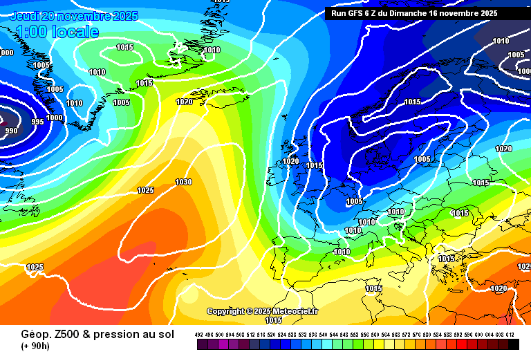
Updated: 10am Sunday 16 November 2025 – An early winter is on its way to the Alps!
Following an extraordinarily warm end to last week with temperatures exceeding 20˚C in some lower valleys, the weather in the Alps is now changing, with much colder conditions expected this week.
Most regions will also see some snow, and to increasingly low altitudes as the week goes on.
Current weather models indicate that very cold and unstable air will flood right across this Alps this week, with any snow falling to very low altitudes – Image: meteociel.fr, 16 November 2025
Today it is still relatively mild in the Alps, with rain pushing into western and south-western areas, and snow only falling above 2000-2400m or so. The eastern Alps will stay mostly dry. Tonight,
precipitation will reach many other Alpine regions as fronts from the south-west combine with a cold front moving down from the north.
The temperature will also start to drop, more noticeably on Monday when the rain/snow limit will descend to 1000m or so on the northern side of the Alps, and possibly as low as 500m in the
north-east. The milder air will hang on longer in the south but will eventually give way to the cold on Monday night.
After a quieter spell on Tuesday, new weather fronts will move down from the north-west on Wednesday and continue to influence the weather in the Alps for the rest of the week. The exact position
of these fronts is still not certain and is key in determining which parts of the Alps will see the most snow. However, what is clear, is that any snow will fall to very low levels (all
skiing levels) and the colder air will allow snowmaking to operate at full throttle across the Alps.
On the whole, we are not expecting huge amounts of snow in this first wintry wave - generally 5-30cm above 1800m by Monday night, with more in a few favoured places. However, what is more
interesting is that it is going to stay cold next week, with indications that the weather patterns in the Alps will continue to remain favourable (for cold and snow) beyond that.
Indeed, some models are predicting significant accumulations of snow to relatively low altitudes across a wide swathe of the Alps by the end of November, which could make for excellent early
season snow conditions in the Alps. Watch this space!
Updated: 8.45am Friday 14 November 2025 – Still unseasonably warm in the Alps, but still on track for colder weather next week…
The Alps are currently under the influence of a warm southerly airflow, with Foehn conditions and further increasing temperatures in some of the northern Alps where 20˚C or more is possible in
places. The weather will turn more unsettled over the weekend, but it won’t be until Monday that it becomes significantly colder.
Today the weather in the Alps will be mostly dry and bright but increasing hazy (partly from Saharan dust), with more general cloud cover in the south-west later as weak Atlantic fronts attempt to
move in. These fronts will bring showers and high-altitude flurries to some south-western parts of the Alps tonight and tomorrow.
Some more widespread precipitation and decreasing temperatures are then expected late on Sunday, and especially on Monday.
In the meantime, a dozen or so ski areas in the Alps are open today with more open over the weekend. The most extensive areas of skiing open in the Alps are Sölden, Hintertux and Zermatt, all of
which are operating between 35 and 40km of pistes.
Given the lack of fresh snow in recent days, expect snow conditions to be hard-packed, before they improve again next week.
Updated: 1.20pm Thursday 13 November 2025 – Exceptionally mild in the Alps, before it turns colder next week…
The weather in the Alps is mostly sunny and exceptionally mild today, with temperatures reaching or exceeding 20˚C in some lower valleys. It will remain very mild tomorrow but with increasing
cloud in the west and a few showers (flurries above 2500-2700m) in the south-western Alps later and overnight.
Bright skies and mild temperatures in the Alps today. This is the Ortler mountain in the Italian Sud-Tirol – 13 November 2025 – Photo: foto-webcam.eu
Over the weekend the weather will be more changeable, though there remains much uncertainty over the detail. On both days, showers or flurries are likely in places, mostly in the south-western
Alps (e.g. Isola 2000, Sestriere) and/or close to the main Alpine ridge (e.g. Cervinia). These will probably be heaviest on Sunday. At this point, the rain/snow limit will remain relatively high –
typically between 2000m and 2600m.
On Monday, a cold front will move down from north and bump into the fronts moving up from the south-west. This may enhance the precipitation across the Alps while also introducing colder air from
the north, with the possibility of snow falling to 1000m in places.
In the meantime, a dozen or so ski areas in the Alps are open today, with more open over the weekend. The most extensive areas of skiing open in the Alps are Sölden, Hintertux and Zermatt, all of
which are operating between 35 and 40km of pistes.
Updated: 11am Wednesday 12 November 2025 – Very mild in the Alps but turning much colder next week…
High pressure is still dominating the weather in the Alps even if it is gradually slipping away eastwards. This means mostly dry but increasingly warm and Foehny conditions will prevail over the
next couple of days before weather fronts arrive from the south-west this weekend. Next week it will turn much colder with the chance of snow to low altitudes in places.
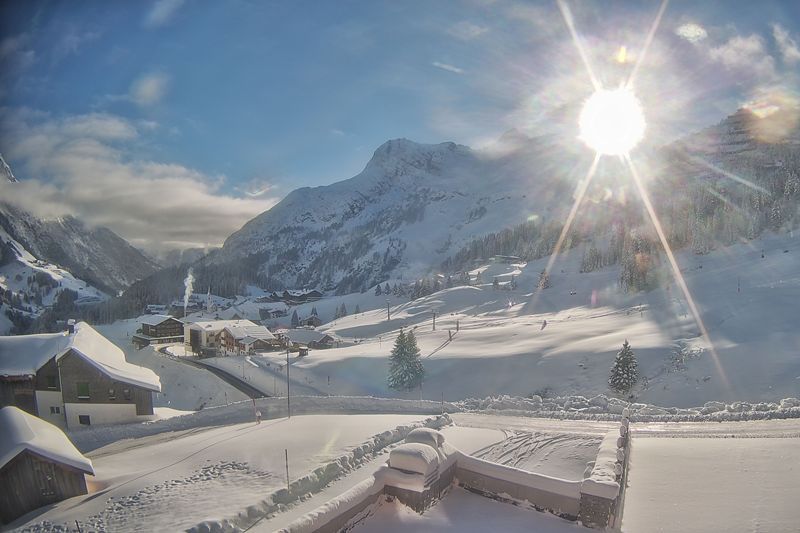
Very mild in the Alps today and turning even milder later this week before winter makes a return on Monday. This is Schröcken in the Austrian Vorarlberg – 12 November 2025 – Photo: foto-webcam.eu
Temperatures in some Foehn-affected valleys of the northern Alps could reach 20˚C or more on Thursday and Friday before cooler air starts to filter in over the weekend. Any snow this weekend will
mostly fall above 2000m and be relatively localised – mostly in the south-western Alps and close to the main Alpine ridge between Switzerland and Italy (e.g. Cervinia).
However, by Monday it could be snowing more widely across the Alps, and to 1000m or lower. Watch this space!
In the meantime, 13 ski areas in the Alps are open today with more open over the weekend. The most extensive terrain open in the Alps is in Sölden, Hintertux and Zermatt, all of which are
operating between 35 and 40km of pistes.
Updated: 10.20am Monday 10 November 2025 – No fresh snow this week, but the longer term forecast is more promising…
Now that the weekend is over, we are back to a dozen or so open ski areas in the Alps – compared with the 19 that were open on Saturday and Sunday.
Fine weather today in Cervinia, where skiing is possible both on the glacier and here in the non-glacial Plan Maison area – 10 November 2025 – Photo: cervinia.it
No fresh snow is expected in the Alps this week, indeed with a strengthening southerly airflow it will become very warm again, especially on the north side of the Alps where the Foehn will make
itself known mid-week.
Temperatures will peak on Thursday, after which the weather in the Alps will start to cool down again with the chance of a little snow in places this weekend.
Next week looks more promising, with cooler temperatures and the increasing chance of snow, though it’s still too early to pin down any details.
In the meantime, the most extensive areas of skiing open in the Alps are Sölden, Hintertux and Zermatt, all of which are operating between 35 and 40km of pistes.
Updated: 11.50am Sunday 9 November 2025 – 19 ski areas are open in the Alps this weekend!
The weather in the Alps is mostly dry today though there is a lot of cloud across the north with the odd shower close to the foothills, especially near the border between Germany and
Austria.
Bright skies today in the southern Alps. This is Kronplatz, Italy – 9 November 2025 – Photo: foto-webcam.eu
It will remain mostly in the Alps next week dry, with rising temperatures, especially in the northern Alps where the Foehn will get going and it could hit 18˚C in some lower valleys later in the
week.
Next week’s warmer weather will mean that any of the lower-lying snow from recent storms will continue to melt. There are, however, some signs that some more wintry weather could return in the
second half of the month.
This weekend 19 ski areas are open in the Alps, mostly involving glaciers and on a very limited basis. Some non-glacial terrain is open in the likes of Verbier, Davos, Mürren, Adelboden,
Kitzbühel, and Arosa, but each with only one or two runs.
The greatest extent of skiing for now remains in Austria’s Sölden, where nearly 40km of pistes are available both on and off the glaciers.
Updated: 10am Friday 7 November 2025 – Fresh snow in extreme south-western Alps!
A small disturbance in the northern Mediterranean has brought a little fresh snow to the far-south-western Alps, including resorts such as Isola 2000, Auron, Limone Piemonte and Prato
Nevoso.
Updated: 10am Friday 7 November 2025 – Fresh snow in extreme south-western Alps! A small disturbance in the northern Mediterranean has brought a little fresh snow to the far-south-western Alps, including resorts such as Isola 2000, Auron, Limone Piemonte
These areas have seen about 5-10cm above 2200m, with a temporary dusting to 1500m or so. The Pyrenees also have some fresh snow, with more forecast tomorrow, though it will melt again next
week.
The weather across the rest of the Alps will be dry today with significant cloud in the south-west but plenty of sunshine further north and east. It will remain mostly dry over the next few days
with freezing levels rising again next week.
14 ski areas are open for skiing in the Alps today, with Sölden still leading the way in terms of extent of open terrain, with nearly 40km of pistes in operation.
More resorts will open this weekend, though in most cases on a very limited basis.
Updated: 9.30am Wednesday 5 November 2025 – Good snow conditions in the Alps this week, but with rising temperatures…
High pressure is dominating the Alps right now, meaning lots of dry weather over the next few days. However, the centre of this High will gradually slip further east as the week goes on drawing up
increasingly warm air from the south.
Beautiful weather and great piste-skiing today on the glacier in Saas-Fee – 5 November 2025 Photo: saas-fee.ch, Switzerland
Weather fronts will also clip the extreme south-west late on Thursday and on Friday, bringing a few centimetres of snow above about 2000m to the likes of Isola 2000 and Limone Piedmonte.
Snow conditions in the Alps have generally been very good this week thanks to the fresh snowfall we saw at altitude last weekend. Rising temperatures this week will melt any remaining lower-lying
snow in the Alps, but skiing conditions should remain pretty good higher up.
About a dozen ski areas in the Alps are open today, most still revolving around glaciers but with some entirely non-glacial areas also open, albeit on a very limited basis, including Italy’s
Sulden am Ortler.
For now, the most extensive open terrain is in Sölden and Hintertux, where just over 30km of pistes are available on a mix of glacial and non-glacial terrain.
Updated: 11.30am Monday 3 November 2025 – Sun and fresh snow! Higher up at least…
The latest weather front has cleared off to the east, leaving many parts of the Alps with a mostly fine day, and just a few areas of cloud drifting around. Higher up, there is also more fresh snow
– with as much as 30cm in a few favoured spots.
Fresh snow in Carinthia in the southern Austrian Alps. This is Turracher Höhe – 3 November 2025 – Photo: foto-webcam.eu
Just about all parts of the Alps saw some fresh snow on Sunday. The northern Alps (e.g. Tignes, Chamonix, Verbier, Mürren, Engelberg, St Anton, Kaprun) saw about 15-25cm of new snow above 2300m
with a dusting to as low as 1500m in places.
Some central southern and south-eastern parts of the Alps saw a bit more still, with around 30cm at 2500m in parts of Carinthia and the Dolomites. Here, though, the rain/snow limit remained higher
for longer.
Around a dozen ski areas in the Alps are open today (with more open at the weekend), still mostly involving glaciers. The greatest extent of skiing available is in Sölden and Hintertux, where over
30km of pistes are open in both resorts, including some non-glacial terrain.
The weather in the Alps will remain mostly dry and relatively mild this week with plenty of sunshine, though there will also be some areas of cloud from time to time.
Updated: 9.30am Sunday 2 November 2025 – More snow, but with a relatively high snow-line…
A new weather front has reached the Alps, as forecast, with most regions seeing some rain or snow today.
Deteriorating weather conditions this morning near Kaprun, where rain and snow are expected soon – 2 November 2025 – Photo: foto-webcam.eu
Initially it will be the more exposed areas of the northern Alps (e.g. Mürren, Engelberg, Arlberg) that will see the heaviest precipitation, however, the interaction of the weather front with the
warm Mediterranean will inject renewed energy into the storm from the south later in the day. This means that the Dolomites and southern Austrian Alps will see the most intense rain/snow on Sunday
evening/night before calmer weather returns to all regions tomorrow.
This storm’s rain/snow limit will start high today, typically between 2200m and 2600m, before falling to around 1500m later today and overnight, with the milder air hanging on for longest in the
south-east.
Snowfall totals over the next 24-hours are likely to be in the range of 10-20cm (with 25cm+ in places) above 2300m across the northern Alps (e.g. Val d’Isère, Chamonix, Verbier, Mürren, Engelberg,
Arlberg, Kaprun). Snowfall totals could be 25-30cm above 2500m in the south-eastern Alps, including the Dolomites and Carinthia in southern Austria.
Elsewhere – that’s to say the south-western Alps (e.g. southern French Alps, western Italian Alps) – there will be just a few centimetres at high altitude.
This weekend up to 17 resorts are theoretically open in the Alps although the deteriorating weather today means that some of these are likely to be closed. Most of the open areas still revolve
around glaciers, but there are several non-glacial openings too, including (as of yesterday) Verbier. Of the areas open, Sölden currently offers the most extensive terrain, with over 30km of pistes
available.
Next week will be mild and mostly dry at first but with a little high-altitude snow on Thursday.
Updated: 2pm Saturday 1 November 2025 – New weather front approaching the Alps…
A new weather front is approaching the western foothills of the Alps today. This will cross the entire region from west to east over the course of tonight and tomorrow, before the weather in the
Alps settles down again on Monday.
Cloud thickening over Engelberg ahead of a new weather front that will deliver around 15-20cm of new snow above 2500m between now and Monday morning – Photo: engelberg.ch, 1 November 2025
This latest storm will deliver some rain or snow to almost everywhere in the Alps, with the heaviest precipitation set to initially fall in the north (e.g. Avoriaz, Engelberg, St Anton) and, later
in the weekend, in the south-east (Dolomites).
The rain/snow limit will start high, typically around 2500m, but closer to 3000m in some southern parts of the Alps, before falling to 1500-1800m during Sunday, firstly in the north-west, then in
the south-east later in the day.
Between now and Monday morning, between 15-20cm of new snow can be expected above 2500m in the north and south-east of the Alps. Many other regions will also see a few centimetres of snow at
altitude, but there will generally be less in the south-west and in the interior of the Alps, with only around 5cm expected at altitude in Zermatt, for example.
Today, 17 ski areas are open in the Alps. These are still mostly focussed around glaciers but we are seeing more non-glacial terrain opening, including (as of today) Verbier and the Plan Maison
sector in Cervinia.