


After a very warm start to November, the weather in the Alps has now turned much colder. This early onset of winter is thanks to a mass of arctic air that engulfed the Alps on Monday and looks set to stay (more or less) until at least the end of next week.
At the time of writing, snowfall accumulations from this wintry spell have been relatively modest, but this will change as multiple weather fronts hit the Alps over the next few days.
What is unusual (by recent standards) about the current Alpine weather forecast is that the colder air is expected to remain over or close to the Alps for an extended period.
Unlike in pre-season periods in recent years, where snow to low levels has been very transient, there are not forecast to be any dramatic thaws, which should allow a good base to start to form across a wide swathe of the Alps...
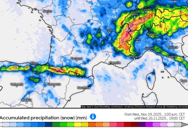 Snowfall accumulations across the Alps in the next 7 days are predicted to be 1m+ in some parts of the northern French Alps (e.g. Avoriaz) – Image: kachelmannwetter.com, 19 November 2025
Austria
Thursday will see snow reaching the western Austrian Alps early on, spreading to most areas during the day. It will be cold, with snow falling at all levels except in some parts of the south where the snowline could be between 600-700m for a time. Around 10-20cm of snow is expected above 700m across most of the Austrian Alps, with a few centimetres possible into the lowlands in the north and east.
Friday will see very little change in the weather in the Austrian Alps, with further snow at times across most regions though it may brighten up in the far south later. The rain/snow level will be at the valley bottoms in the northern Austrian Alps, but perhaps up to 600-700m at times in the far south. Another 10-20cm of snow is expected above 700m across a wide swathe of the Austrian Alps.
Saturday will remain mostly cloudy in the Austrian Alps with further snow flurries at all levels across the east. Further west, some sunny spells may develop as the day progresses but it will remain very cold everywhere.
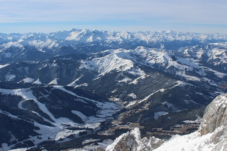 Bright this morning in Hochkönig in Austria, but snow is forecast here tomorrow – Photo: foto-webcam.eu, 19 November 2025
France
Thursday will be mostly cloudy in the French Alps, with snow to very low levels, mostly in the north. The heaviest falls will be in the Chablais (e.g. Portes du Soleil), where 25cm is possible above 1000m between Wednesday night and Thursday night. More generally, between 10-20cm will fall in the northern French Alps – the least snow falling in the more inner-alpine areas (e.g. Haute-Maurienne). Snow flurries will be lighter and more scattered in the southern French Alps, though they may become a bit more notable later in the day, especially close to the Italian border (e.g. Isola 2000).
Friday will see further snow flurries at all levels, again mostly in the northern half of the French Alps but also close to the southern border areas with Italy. All these areas could see another 5-10cm above 800m.
Saturday should see brighter weather in the French Alps, at least at altitude, with some good spells of sunshine although some cloud may still plague the lower valleys. It will feel very cold in a brisk northerly wind.
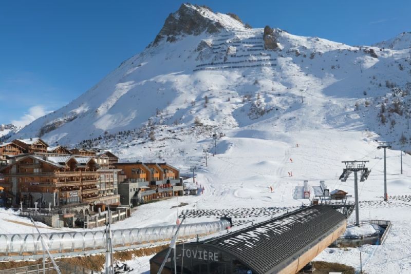 Tignes already has one of the better early bases this season and will see more snow on Thursday and Friday – Photo: tignes.net, 19 November 2025
Italy
Thursday will see variable cloud cover in the Italian Alps, with bright spells in places but also some flurries to low levels, these being most likely close to the border areas and later in the day in the east (e.g. Dolomites) where they will become heavier later in the day. Snowfall accumulations will mostly be quite modest, but with 2-8cm possible in some border areas in the west (e.g. La Thuile) and 10cm or more by the end of the day in the Dolomites.
Friday will see further flurries in places in Italy. These will mostly die away later in the day though the far south-west (e.g. Prato Nevoso) may see a heavier spell of snow for a while. Snowfall totals for Friday are likely to be around 1-5cm in most areas, but with 15cm possible in the far south-west.
Saturday is expected to be mostly sunny in the Italian Alps, but still very cold.
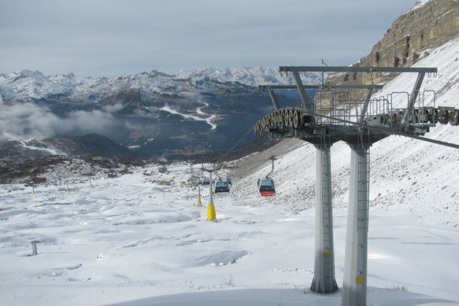 Snowmaking is underway in Madonna di Campiglio, where natural snow is also forecast over the next few days – Photo: funiviecampiglio.it, 19 November 2025
Switzerland
Thursday will be mostly cloudy with snow to very low levels across much of the Swiss Alps. Snowfalls will be heaviest in the far west (close to Lake Geneva), and lighter further east and south. The far south (Ticino) will be mostly dry and even quite sunny at times. Between 10-20cm of fresh snow is expected above 800m across the northern and western Swiss Alps, possibly with 25cm or more in the far west.
Friday will see similar weather in the Swiss Alps, with snow flurries to all levels in most areas apart from in the far south where there will again be some sunny spells. Another 5-10cm can be expected above 800m quite widely across Switzerland, with 20cm in a few favoured spots close to the northern foothills.
Saturday will see a few flurries to low levels across the eastern Swiss Alps for a time, otherwise it will be mostly dry with plenty of sunshine in the west and south, especially at altitude. It will feel very cold in all regions.
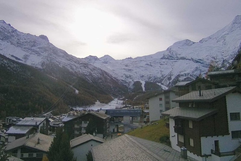 Clouding over this afternoon in Saas-Fee ahead of approaching weather fronts that will deliver some snow flurries here tomorrow – Photo: saas-fee.ch, 19 November 2025
Outlook:
After a mostly fine but still cold day on Sunday, a new storm will reach the western Alps on Sunday night and influence the weather in the Alps for the first part of next week.
This storm will deliver further snow to low levels across most of the Alps, with some significant falls in many areas.

Our next detailed weather & snow forecast will be
on Friday 28 November 2025
If you enjoy reading our updates - please feel free to support us: