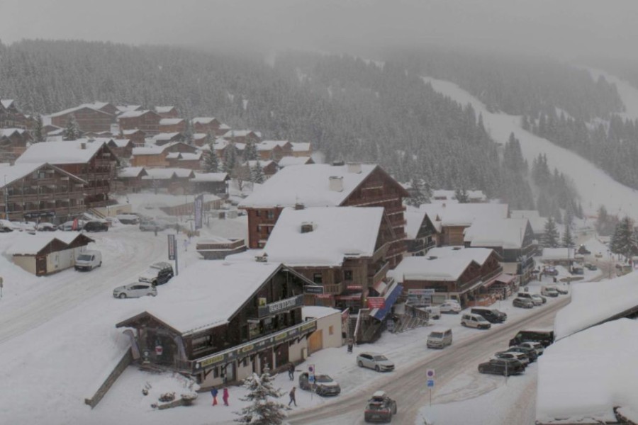
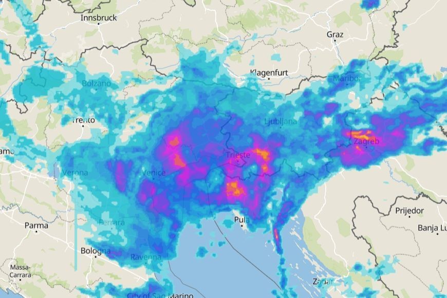
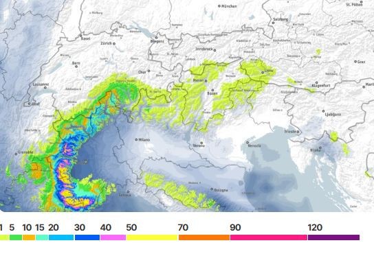
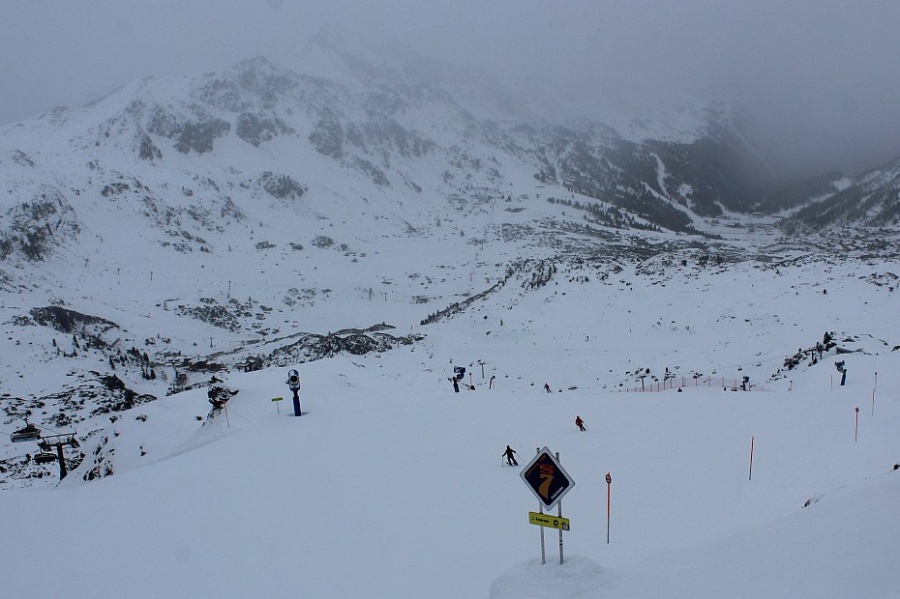
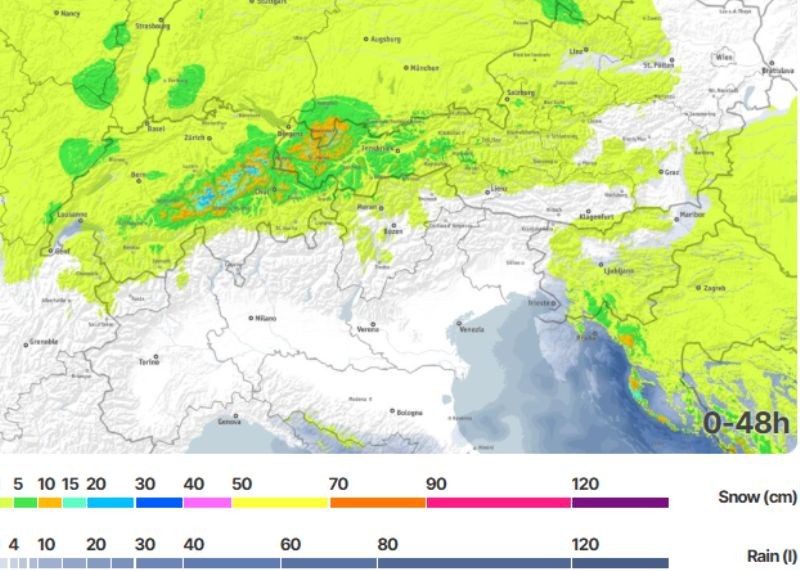
Updated: 11.30am Friday 30 January 2026 – Some snow for the north-western Alps...
After a fairly quiet day in the Alps yesterday, with excellent snow conditions in many western and southern regions, a new weather front has now reached the Alps today. This will mostly affect the
north-western Alps, delivering a few centimetres of snow (600-900m) to the northern French and far western Swiss Alps.
Cloudy with outbreaks of snow this morning in Les Saisies – 30 January 2026 – Photo: lessaisies.com
This front will move further east during the day but will become weaker in the process, with just a sprinkling of snow here and there by the time it reaches the eastern Swiss and far western
Austrian Alps. For most of the southern and eastern Alps, it will remain dry today with sunny spells.
Over the weekend, some further weak weather fronts will bring very small amounts of snow to some of the western Alps, with most areas staying dry with variable cloud. The best of the sunshine will
be further east.
Next week we are then looking at a major storm for the southern Alps, which is set to start late on Monday. Stayed tuned for details…
Updated: 9.30am Wednesday 28 January 2026 – More fresh snow for many parts of the Alps!....
As expected, another storm hit the western Alps yesterday afternoon, moving further east overnight but weakening in the process.
Big overnight snowfall in the southern French Alps. This is Auron – 28 January 2026 – Photo: auron.com
This morning, there is a lot of fresh snow across the southern French Alps (e.g. Puy St Vincent, Risoul, Auron), the western foothills of the Alps (e.g. Vercors region) and some western Italian
resorts, especially in the Piemonte (e.g Prali, Prato Nevoso). These regions have seen 30-50cm of snow since yesterday afternoon, with a bit more in places.
Today, snow will tend to die away from the south-western Alps but will continue, and even intensify later, in the south-east (e.g. Carinthia, Dolomites). It will also continue in some
north-western parts of the Alps (e.g. Portes du Soleil), gradually spreading further east across the northern Alps during the day.
The more central internal Alpine valleys (e.g. Saas-Fee, Andermatt, Obergurgl, Obertauern) will probably only see a dusting to a few centimetres at best.
Right now, the best snow conditions in the Alps are in the southern French Alps (roughly south of Grenoble) but note that the avalanche danger off-piste is sky high.
More generally, in recent days snow conditions are much improved across most of the Alps, especially in the south, including the Dolomites which had so little snow earlier in the season. That
said, snow depths remain below par in many areas.
Check out our full detailed snow report later this week...
Updated: 12.30pm Tuesday 27 January 2026 – New storm approaching the western Alps...
It’s a glorious day across the eastern Alps. Further west, cloud is thickening with rain and snow reaching the western foothills early this afternoon before progressing further east overnight.
Clouding over this afternoon in Alpe d’Huez, where snow is expected later today and overnight – 27 January 2026 – Photo: alpedhuez.com
The heaviest snow from this storm will fall in the southern French Alps (e.g. Les 2 Alpes, Risoul, Isola 2000) and the south-western Italian Alps (e.g. Limone Piemonte), which should see 20-40cm
of fresh snow above 1800m by tomorrow morning.
Tonight and tomorrow, the weather fronts will continue to move eastwards delivering some snow to many other parts of the Alps, heaviest in the south, but in increasingly modest quantities the
further north-east you go, with some northern parts of Austrian staying mostly dry.
The rain/snow limit will briefly reach 1500-2000m in some western parts of the Alps this evening before lowering significantly again overnight. It may also briefly reach 1200-1400m further east on
Wednesday before lowering here too later in the day.
Snow conditions in the Alps have improved markedly in recent days, with varying quantities of fresh snow in all regions and more in the forecast.
Some of the best overall snow conditions over the next few days are likely to be in the southern French and south-western Italian Alps, including resorts like Les 2 Alpes, Risoul, Isola 2000,
Prato Nevoso and Sestriere.
Updated: 10.30am Monday 26 January 2026 – Improving snow conditions across the Alps!
A few flurries (600-900m) are lingering this morning across parts of the north-eastern Swiss Alps (e.g. Braunwald) and western Austrian Alps (e.g. Lech), otherwise most of the Alps are dry with
plenty of sunshine.
Fresh snow from this weekend’s falls in Krakau, Styria (in the central-eastern Austrian Alps) – Photo: foto-webcam.eu, 26 January 2026
All Alpine regions have seen some snow over the last few days although amounts have varied. The southern Alps have done best, with the Dolomites seeing 15-40cm on Sunday, their first significant
snowfall for many weeks. Base depths remain below par here, as they are across many parts of the Alps, but the overall picture is much improved with more snow forecast this week.
The next storm is due late on Tuesday and on Wednesday with the heaviest snow set to fall in the southern French and far south-western Italian Alps, where resorts such as Les 2 Alpes, Risoul,
Isola 2000 and Limone Piemonte could see in the region of 30-50cm.
Updated: 11.30am Sunday 25 January 2026 – Snow for the Dolomites at last!
It’s snowing properly in the Dolomites today, for the first time in many weeks, which will be a relief to the Olympic organisers in Cortina and other nearby resorts.
Today’s precipitation will be focussed on the south-eastern Alps and the Dolomites – Image: meteoblue.com, 25 January 2026
Although it won’t amount to anything extraordinary, with 15-30cm of snow falling quite widely across the Dolomites today (with 40cm+ in some favoured spots close to the southern foothills) and
another moderate dump expected on Wednesday, it is certainly a timely intervention from the weather gods!
It is also snowing quite heavily today in parts of Austria, especially in the far south (e.g. Nassfeld) while the western Alps are drier and brighter.
Bit by bit, this rather unusual winter season is coming together, with fresh snow for just about all parts of the Alps over the last few days and more forecast next week, especially in the
southern and western Alps.
Updated: 10.30am Friday 23 January 2026 – A little snow for some western and south-western parts of the Alps tonight...
It’s a fine start across much of the Alps but cloud is thickening in the west heralding the arrival or a weak weather front that will deliver a little snow to some western and south-western parts
of the Alps tonight.
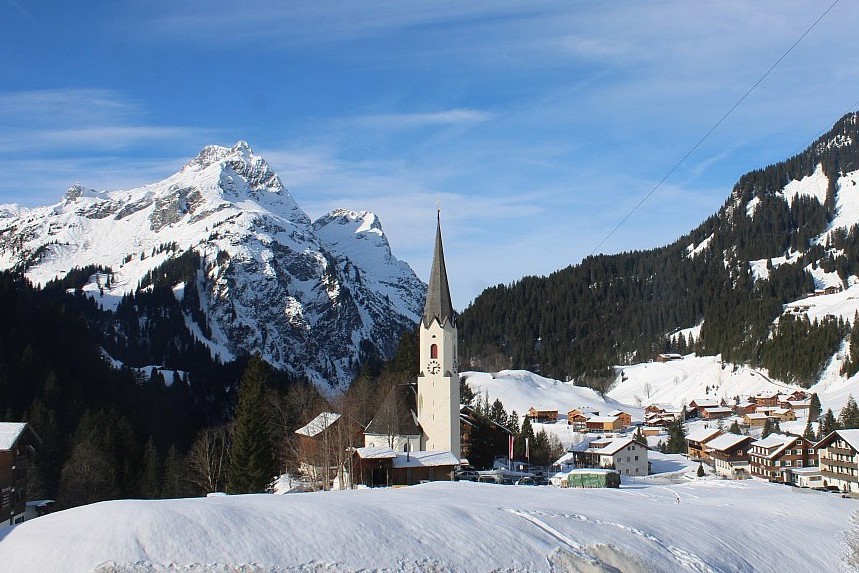
Largely sunny in the eastern Alps today. This is Lech – 23 January 2026 – Photo: lechzuers.com
By Saturday morning we can expect a few centimetres of snow across the French Alps – perhaps 10-15cm in some southern resorts, especially those exposed to the west (e.g. SuperDévoluy), but with
probably no more than a dusting in the more internal Tarentaise resorts (e.g. Tignes).
Other western Swiss, central and western Italian ski resorts will also see a little snow but no more than a dusting to a few centimetres at best. The eastern Alps will stay largely dry until later
in the weekend. The rain/snow line tonight will start at around 1000m but will drop towards 600m or so later.
Updated: 11.30am Thursday 22 January 2026 – The weather in the Alps is slowly turning more unsettled...
The weather situation in the Alps is quite complicated, as weather fronts attempt to move in from the west but are being weakened, diverted or split by a huge area of blocking high pressure over
north-eastern Europe.
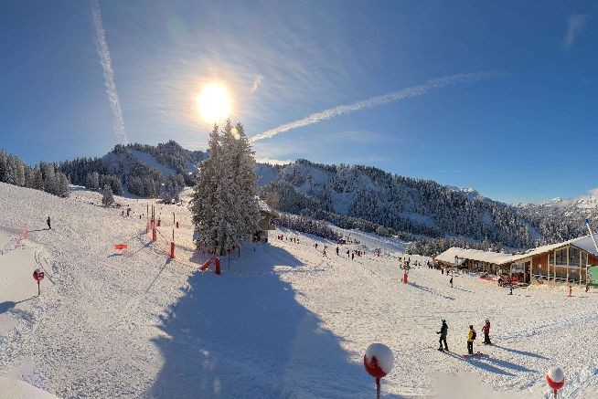
Lots of snow in Prato Nevoso, with more forecast over the next few days – Photo: pratonevoso.com, 22 January 2026
Over the next few days, most of the Alps will see at least a little fresh snow, with some more moderate accumulations in places.
Until Saturday, the best chance of meaningful snow remains in the western and south-western Alps.
Cloudy today in Les Gets, ahead of slow-moving weather fronts approaching from the west – 22 January 2026 – Photo: lesgets.com
By Sunday though, some eastern areas could also come into play, including the Dolomites. The far north-east, however, (e.g. Salzburg area, Lower/Upper Austria) may well see little, if any,
snow.
Check out our full detailed snow forecast tomorrow…
Updated: 1pm Wednesday 21 January 2026 – Mostly sunny in the Alps today, with a new storm cycle starting tomorrow...
It’s another largely sunny day across the Alps today with just a few areas of high cloud circulating here and there. Tomorrow, a new storm cycle will get underway, mostly affecting the
south-western Alps, at least to start with.
Clear skies again today in the Austrian Alps. This is St Johann in Tirol – 21 January 2026 – Photo: foto-webcam.eu
Over the next few days, the most snow will again fall in the southern Piemonte (e.g. Prato Nevoso, Limone Piemonte) where 50cm+ is possible by the end of the weekend. Across the border in France,
Isola 2000 could see 40cm or so.
Elsewhere in the Alps, there will be “bits and pieces” of snow over the next few days, generally in modest quantities but with 15-20cm possible here and there, and the most widespread snow likely
to fall on Saturday night.
After this there is a very complicated weather set-up on its way to the Alps, meaning that details are very hard to pin down at this stage.
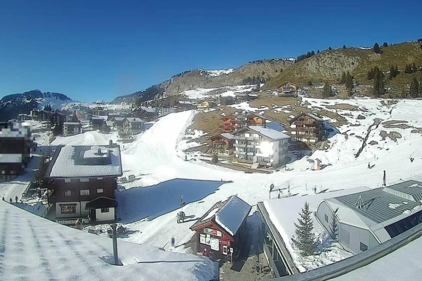
Updated: 10.50am Tuesday 20 January 2026 – Beautiful weather across most of the Alps, with snow returning to the south-west later this week...
It’s a beautiful day across just about all the Alps today, with only the far south-west (e.g. Limone Piemonte) seeing much in the way of cloud and the odd flurry. With freezing levels typically
close to 1000m it’s on the cool side but certainly not especially cold for the middle of January.
Fabulous weather but meagre snow coverage in the southern Austrian Alps. This is the Mölltal glacier – 20 January 2026 – Photo: foto-webcam.eu
After another mostly sunny day tomorrow, a new disturbance will bring a little snow to the far south-western Alps late on Thursday, with more widespread snow forecast for the southern Alps on
Friday and over the weekend, likely heaviest again in the far south-west (Limone Piemonte, Prato Nevoso, Isola 2000).
As for snow conditions in the Alps right now, they are again best in the far south-western regions that have seen the most fresh snow in recent days. Elsewhere in the Alps there is plenty of good
piste skiing on offer, all the better for the fabulous weather. Note, however, that extreme caution should be taken if considering skiing off-piste as the risk of avalanche remains relatively
high.
Away from the far south-west, snow depths remain mostly below par but are pretty healthy in the French Alps, some western Swiss areas (e.g. Verbier) and some north-western Italian areas (e.g. La
Thuile).
Further east though, snow depths are considerably below par, especially in the south-east of Switzerland (e.g. St Moritz), the southern Austrian Alps (e.g. around Lienz), and the central and
eastern Italian Alps (e.g. Dolomites). In fact, the Dolomites have very little natural snow at lower altitudes and are very reliant on their world-class snowmaking.
Updated: 9.30am Monday 19 January 2026 – Lots of fresh snow in the far south-western Alps!
It’s another cloudy day in the south-western Alps today, with further flurries in places, mostly in the far southern Piemonte (Prato Nevoso, Limone Piemonte). There are also some light flurries in
the northern Piemonte and into the Swiss Ticino but not in any meaningful quantities. For most other parts of the Alps it is dry with plenty of sunshine.
Significant snow over the weekend has left Prali in the Italian Piemonte in great condition – 19 January 2026 – Photo: neveitalia.it
The flurries in the south-west will largely die out by tomorrow, leaving the Alps with a couple of days of mostly dry weather with variable cloud but also plenty of sunshine. However, snow will
return to parts of the south-western Alps on Thursday and Friday, again most favouring the southern Piemonte!
Not surprisingly, the best snow conditions in the Alps right now are in the far south-west, including the likes of Isola 2000, the Queyras region, Limone Piemonte, Prato Nevoso and Prali.
Elsewhere in the Alps, there is also plenty of good piste skiing on offer despite snow depths generally remaining below average, and considerably below average across large parts of Switzerland,
Austria and the central and eastern Italian Alps.
Updated: 4.15pm Saturday 17 January 2026 – Fresh snow for the south-western Alps...
A new storm got underway yesterday in the south-western Alps, with snow expected to continue on and off today, and over the next few days.
Heavy snow has returned to the southern Piemonte. This is Prato Nevoso – 17 January 2026 – Photo: pratonevoso.com
Already we have seen snowfalls of 10-30cm across many southern French ski resorts (e.g. Serre Chevalier, Risoul, Isola 2000), the Italian Piemonte (e.g. Prali, Prato Nevoso, Alagna) and the
eastern Aosta (e.g. Gressoney).
Over the next few days, the heaviest of the snow will focus more on the far south-west, from Prali down to Prato Nevoso, Limone Piemonte and across to Isola 2000, all of which could pick up an
additional 20-40cm by Monday afternoon.
A dusting of snow has spilled over the border here and there further north, into the likes of Val d’Isère, Zermatt and Saas-Fee, but generally the northern and eastern Alps have remained dry and
will continue dry over the next few days.
Needless to say, the best of the snow (if it’s fresh you are after) is in the south-west right now, especially in the southern Piemonte.
Updated: 10am Friday 16 January 2026 – New storm but focussed on the south-western Alps...
It’s a cloudy morning in the south-western Alps, with showers or flurries (1500m) in the southern French Alps which will extend to some western Italian resorts (mostly in the southern Piemonte) as
the day goes on. For most other parts of the Alps, it is dry, with more sunshine the further east you are.
This next storm is focussed on the south-western Alps, with the southern Piemonte seeing the biggest snowfalls over the next few days – Image: bergfex.com, 16 January 2026
Over the next few days, the Alps will remain in a southerly airflow, with further snow at times for some south-western areas while most regions again stay dry, with the best of the sunshine to the
north-east.
Between today and Monday, storm totals will be highest in the southern Piemonte where Prato Nevo and Limone Piemonte could see 60-90cm of fresh snow adding to their already considerable base.
Other resorts that should do well include Isola 2000 and Prali, which might see around 40cm.
More generally, the “south-western” Alps will see 10-30cm, benefiting resorts like Orcière and Risoul in the southern-French Alps, and Sauze d’Oux and the Monte Rosa region in the western Italian
Alps. A few centimetres could also creep into the far south-east of the Savoie (e.g. Val Cenis, Val d’Isère) and the far south-west of Switzerland (e.g. Zermatt, Saas-Fee), but probably only in very
modest quantities.
As for snow conditions in the Alps, check out our detailed snow report for the Alps and beyond, out later today.
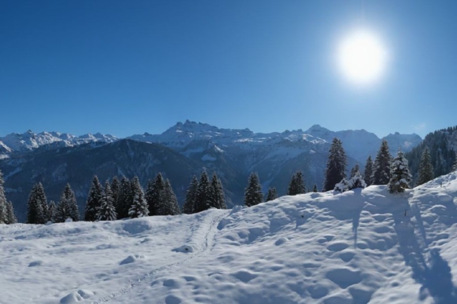
Updated: 11am Wednesday 14 January 2026 – Mostly fine again in the Alps, with snow in the south-west this weekend...
The weather in the Alps remains mostly dry and relatively mild, with plenty of sunshine today, though a few areas of high cloud are drifting around. This benign weather pattern will continue until
Friday, at which point the weather will begin to destabilise in the south-west.
Another calm and mostly sunny day in the Alps. This is Warth-Schröcken – 14 January 2026 –Photo: foto-webcam.eu
Starting on Friday, and lasting for several days, we are expecting intermittent snowfall in the south-western Alps. Its intensity and distribution remains uncertain, but the region likely to see
the heaviest snow is the southern Piemonte (e.g. Prato Nevoso, Limone) and the far south-eastern Alpes Maritimes (Isola 2000).
Other regions that could see useful snowfall include the Milky Way and the Monte Rosa region, with snow perhaps even spilling over some border areas into Val d’Isère in France, and Zermatt and
Saas-Fee in Switzerland, although this is far from certain.
Whatever the case, this new storm will be limited to the southern Alps (mostly the south-west), with the vast majority of the rest of the Alps, including the whole of the northern half of the
Alps, missing out.
Updated: 12pm Tuesday 13 January 2026 – Very mild weather in the Alps!
It’s a very mild day in the Alps today, with some sunshine in places but also a lot of high cloud around especially in the east.
Sunny skies and plentiful snow in Tignes – 13 January 2026 – Photo: tignes.net
This follows the passage of a warm front yesterday which brought a few centimetres of snow to some of the northern Alps yesterday (mostly in Austria) but also some rain lower down.
The next significant snow is forecast for this weekend, mainly for the southern Alps and especially the south-west (e.g. Isola 2000, Monte Rosa).
In the meantime, the best snow conditions are at altitude in the western Alps (e.g. Val d’Isère, Val Thorens, Cervinia, Verbier), but be careful off-piste as the avalanche risk remains relatively
high.
Updated: 2pm Sunday 11 January 2026 – Sun and fresh snow in the Alps today...
The big storm in the Alps is over, with the last of the clouds breaking up across the north and most regions left with a gloriously sunny, if still very cold, day today.
Sunny skies and lots of fresh snow this afternoon in Châtel in the Portes du Soleil – 11 January 2026 – Photo: chatel.com
Storm totals since Wednesday evening have been over 1m at altitude across parts of the French Alps (e.g. Val Thorens, La Rosière), the far western Swiss Alps (e.g. Les Diablerets/Glacier 3000) and
some north-eastern Swiss areas such as the Glarus Alps.
Most other French and Swiss Alpine regions, the west of Austria (e.g. Arlberg) and the north-west of Italy (e.g. Courmayeur, Cervinia) have also seen significant snow, with between 40cm and 80cm
since Wednesday night. The far south-east of Switzerland (e.g. St Moritz) and other parts of Austria have seen less though, typically with between 10cm and 30cm. The least snow fell in the eastern
Italian Alps, with just a few centimetres in the Dolomites.
On Monday, a warm front will drift across the northern Alps bringing much milder conditions and some rain or snow to the northern Swiss Alps, and the Austrian Alps (e.g. St Anton, Kaprun) in
particular, with the snowline starting low but rising towards 1500m or so later.
Between 5-15cm of fresh snow can be expected above 1500m in the Austrian Alps north of the main Alpine ridge. The northern Swiss Alps (e.g. Engelberg) might see 1-3cm, while the northern French
Alps (e.g. Portes du Soleil) will turn cloudy but should avoid most of the precipitation. The southern Alps will have better weather on Monday, with sunny spells and some cloudier interludes in
places later in the day.
Naturally, snow conditions are superb across much of the Alps right now, however, the risk of avalanche is sky high, especially in the western Alps, as already seen by the recent tragedy in Val
d’Isère (not far from the pistes). Off-piste should not even be considered without a fully qualified local guide.
Updated: 11am Saturday 10 January 2026 – Cold with more snow, mostly in the northern half of the Alps...
The weather in the Alps remains stormy, with a very cold and unstable north-westerly airflow bringing more snow today, mostly to the northern half of the Alps, before things settle down
tomorrow.
Very snow scenes this morning across the French Alps. This is Méribel – 10 January 2026 – Photo: facebook.com/meribel3vallees
the heaviest snowfalls will be close to the foothills of the north-western Alps, including the likes of the Portes du Soleil (e.g. Avoriaz), the Jungfrau
region (e.g. Mürren), Engelberg, Braunwald and the Austrian Arlberg (Lech, St Anton). These areas could see in the region of 20–30cm of additional snow by
morning.
More generally across the northern Alps we will see another 5–20cm snow falling to all levels. On the whole, the southern Alps will be drier and brighter ,
with lots of sunshine in the far south (e.g. Isola 2000).
Storm totals since already exceed 1m above 1800m in some of the western Alps, notably in France but also in some western Swiss regions. The notoriously
snowy L’Ecreuleuse weather station in the far west of Switzerland just south of the Portes du Soleil, for example, has recorded 114cm in 3 days.
On , the weather will improve more generally but will remain cold in the short term, making for some potentially incredible snow conditions in the ski
areas that are safe and open. We stress safe because the avalanche danger will be sky high, not only due to the amount of snow that has fallen in some parts of the Alps, but also because of it
falling onto ground that lacks any, or only a very hard base.
Add to that some high winds and you have all the ingredients for a very unstable snowpack. This is not, therefore, a time to be tempted to venture off-piste – it is inevitable that there will be
numerous avalanches over the coming days, some of which will be spontaneous.
Updated: 11am Friday 9 January 2026 – More snow in the Alps, and turning colder again...
The weather in the Alps remains very unsettled today, with further snow for many, again heaviest in the west and adding to the 40-70cm or so that has already fallen above 1500m across many parts
of the French Alps (e.g. Tignes, Les 2 Alpes), the north-western Italian Alps (e.g. Courmayeur, Cervinia) and the western Swiss Alps (e.g. Verbier).
A very snowy looking Val d’Isère this morning – 9 January 2026 – Photo: valdisere.com
The forecast warm sector has now passed through the Alps, meaning that the rain/snow limit is on its way down again, having briefly reached 1300-1700m in the western Alps last night. at By
lunchtime today it will be around 1000m in the western Alps before lowering again to 600m this evening, and lower still overnight into Saturday.
The heaviest snow today and tonight will be in the French Alps, especially in the Tarentaise (e.g. Val d’Isère, La Rosière) and the Isère (Les 2 Alpes, Alpe d’Huez) where another 40cm of snow is
possible by tomorrow morning. The far north-west of Italy (e.g. Courmayeur, La Thuile) could see similar amounts.
More generally, another 20-30cm of snow will fall by tomorrow morning across the western and north-western Alps, and 10-20cm across the eastern Swiss and Austrian Alps. Some snow will also get
through to the central and eastern Italian Alps (e.g. Livigno, Passo Tonale, Dolomites) but probably no more than a few centimetres.
On Saturday, there will be yet more snow, falling to very low altitudes, with the heaviest falls across the northern and north-western Alps (e.g. Avoriaz, Engelberg, Lech).
By the end of this storm, snowfall totals by Saturday night will easily reach the anticipated 1-metre in parts of the western Alps, however, it will come at a cost, as the risk of avalanche is
very high.
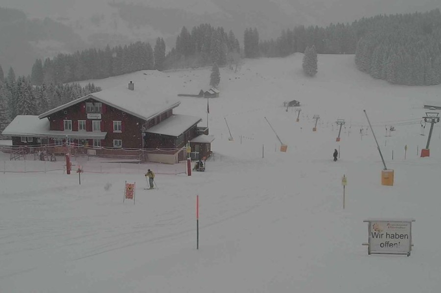
Updated: 12pm Thursday 8 January 2026 – Storm cycle in progress in the Alps!
The weather in the Alps has finally broken, with significant snowfalls for the north-west over the next 2 to 3 days.
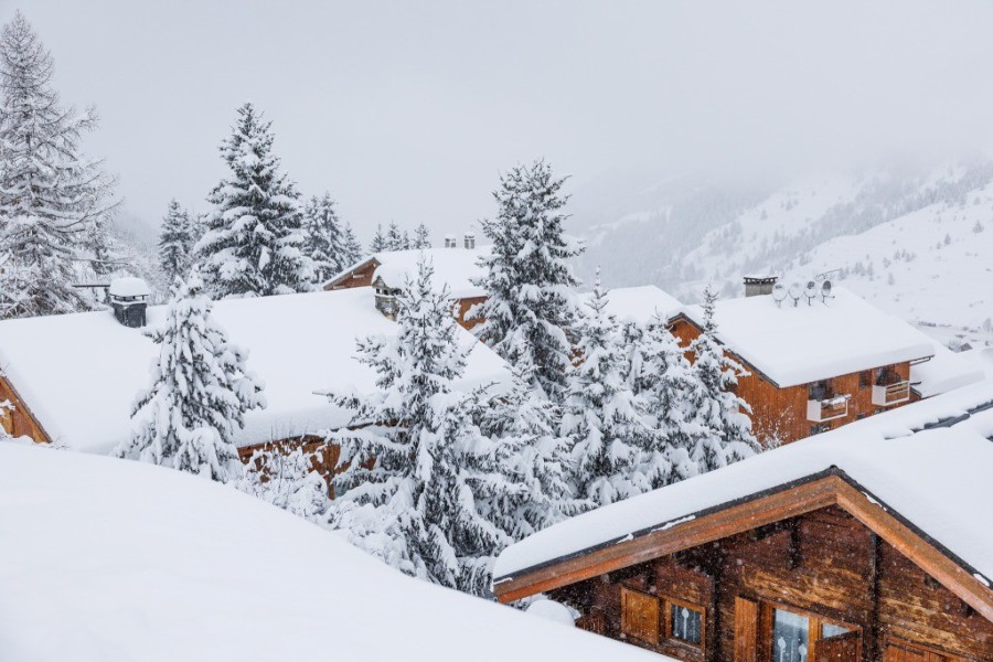
Heavy snow falling in Les Saisies right now – 8 January 2026 – Photo: lessaisies.com
Overnight we have already seen bands of (mostly light) snow crossing the western Alps and falling to very low altitudes. the snow will become heavier and
more persistent across the western and especially north-western Alps, albeit with a complicated rain/snow limit.
With so much cold air in place over the Alps, snow will initially fall to very low altitudes in all areas. However, the warm sector of the storm approaching later today will replace this snow with
rain in the more exposed areas of the western Alps this afternoon and evening, with a maximum rain/snow limit of around 1500–1800m. However, the cold air will hold on with snow falling to low
altitudes for longer in the enclosed valleys, and the further east and deeper into the Alps you go.
Much needed snow this morning in Les Gets, with plenty more to come although it will turn to rain at resort level for a time later today – 8 January 2026 – Photo: lesgets.com
Later tonight, it will start to turn colder again from the north-west, with the rain/snow limit returning to around 1000–1200m in the areas that have seen some rain,
but it will probably never exceed this in the more internal Alpine valleys (e.g. upper Valais).
Then, later on , much colder air will filter back across most of the Alps with the rain/snow limit returning to the
lowlands by Friday night and staying there on .
By the end of , we should have seen 60–80cm of new snow at 1800m across the northern French Alps (with more in places),
with 40–70cm likely in the western Swiss Alps (e.g. Verbier) and the far north-western Italian Alps (e.g. La Thuile, Courmayeur). More on this in our detailed weather & snow forecast for the
Alps, out later today!
Not surprisingly, snow conditions in the snow-starved north-western Alps will improve considerably over the next few days, with caveats. Firstly, there is little or no
base to speak of at lower altitudes, meaning that there won’t suddenly be a miraculous improvement in the off-piste.
Secondly, the risk of avalanche will become very high, partly because of the heavy snow itself, but also due to the lack of any cohesive surface onto which it is
falling (because of the absence of snow or very hard/icy base). Wind will further complicate the situation, so the advice is to stick to the pistes for now.
The best skiing conditions for anyone in the Alps this weekend are likely to be in the western Alps on when the
storm will be easing, the sun should start to come out, and there will be lots of cold powdery snow around. However, once again, this is not a time to be venturing off-piste. Stick to the open runs
for now!
Updated: 12pm Wednesday 7 January 2026 – 1 metre of fresh snow possible in the north-western Alps by Saturday night!
The weather in the Alps is about to change, with significant snow due in the north-west over the next few days.
Weather models are suggesting that close to 1m of snow is possible between now and Saturday night across some north-western parts of the Alps, notably in France – Image: kachelmannwetter.com, 7 January 2026
Before that happens, we have one last day of mostly dry weather in the Alps (albeit with cloud thickening in the west later in the day) ahead of weather fronts that will bring snow to many regions
from Thursday onwards.
Thursday itself will see snow spreading across the western and north-western Alps, heaviest later in the day in the northern French Alps (Espace Killy, 3 Valleys, Grand Massif, Portes du Soleil),
the western Swiss Alps (e.g Verbier, Glacier 3000) and the far north-west of Italy (e.g. Courmayeur, La Thuile). The snow will start and remain at very low levels in some internal valleys (e.g.
Valais), but will be replaced by rain to around 1500m for a time in more exposed areas later in the day before it turns colder again on Thursday night.
Friday will see further snow, again heaviest in the north-west with a rain/snow limit around 1000m but falling to very low levels later in the day.
Further flurries are forecast to very low levels across many northern parts of the Alps on Saturday before the weather improves from the north-west on Sunday. As a rule of thumb, over the coming
days there will be less snow the further south-east you are, though the extreme south-east (e.g. Nassfeld) may see a pocket of enhanced snowfall on Friday.
Between Thursday and Saturday night we can expect 50-100cm of fresh snow above 1500m across many western and north-western parts of the Alps, including Alpe d’Huez, Val d’Isère, Val Thorens,
Chamonix, La Thuile, Verbier and Glacier 3000.
Snowfalls will be more modest but still useful (15-40cm) in the southern French Alps (e.g. Risoul), the Milky Way (e.g Sestriere), the central and eastern Swiss Alps (e.g Flims) and the northern
Austrian Alps (e.g. Saalbach), although Austria may see a spike on Saturday night, especially in the far west (Arlberg).
For the rest of the southern Alps, it will be a bit hit and miss, with only a few centimetres likely in Livigno, Passo Tonale and the Dolomites, for example, but perhaps 20cm or more in Nassfeld
in the east of Carinthia.
Updated: 1pm Tuesday 6 January 2026 – The weather in the Alps is about to change, with up to 50-70cm of snow forecast later this week!
It’s another mostly dry but cold day in the Alps today, aside from in the far south-east (eastern Carinthia) where is it snowing! The best of the sunshine will be found the further north-west you
go, although there will still be some areas of cloud drifting around.
Cloudy with the odd light snow shower today in Obertauern in the eastern Austrian Alps – 6 January 2026 – Photo: obertauern.com
After another mostly dry day , the much-anticipated change to the weather will arrive in the Alps early on ,
with the first weather fronts reaching the north-western Alps (e.g. Portes du Soleil). The bad weather will then go on to affect much of the northern and western Alps, with several waves of
precipitation lasting through and before it brightens up again on .
On , the rain/snow limit will start very low before rising towards 1200–1500m in places. On , it will then start
dropping from the north-west to reach very low levels again on and into .
Between and we could see between 50–70cm of new snow above 1500m
in the northern French Alps (e.g. 3 Valleys, Flaine, Avoriaz), the western Swiss Alps (e.g. Verbier) and the Arlberg (e.g. Lech, St Anton). More generally, most of the northern and western Alps
should see 25–50cm. The southern Alps will see much less, and in some cases no snow at all.
Updated: 12pm Monday 5 January 2026 – Still cold and mostly fine in the Alps, before a change of weather pattern later this week...
It’s another cold and mostly fine day across the Alps, though it is not wall to wall sunshine everywhere, with more cloud in the southern Austrian Alps and the odd flurry possible in eastern
Carinthia.
Clear skies but very cold temperatures today in Riederalp in the Swiss Valais – 5 January 2026 –Photo: aletscharena.ch
Tomorrow could again see a few flurries in the far south-eastern Alps otherwise most regions will be dry with plenty of sunshine, albeit very cold.
The weather in the Alps will then become much more unsettled from Thursday onwards, with weather fronts moving in from the west, delivering more widespread and heavier snow on Thursday, Friday and
possibly into the weekend. This time the north-western Alps are likely to see the heaviest snow, especially the northern French and western Swiss Alps. Watch this space!
For now, snow levels remain significantly below par just about everywhere for early January, with only parts of the far south-west (e.g. Prato Nevoso, Isola 2000) close to or above average.
There are still some enjoyable on-piste conditions here and there, especially at altitude, but also plenty of very hard-packed or icy slopes, especially lower down. There is very little off-piste
to speak of.
Updated: 11am Sunday 4 January 2026 – Mostly sunny but very cold in the Alps!
It’s another mostly sunny but decidedly chilly day in the Alps, with temperatures at 2000m typically around -10 to -12˚C!
Sunny but very cold in Braunwald in the north-eastern Swiss Alps, with evidence of Friday night’s snowfall on the ground – 4 January 2026 – Photo: braunwald.ch
It will remain mostly fine but cold over the next few days, but with more in the way of cloud in the south-east (Dolomites, Carinthia), where some flurries are likely later on Monday and
especially on Tuesday.
Later this week there is then a good chance that we will see more significant and widespread snow as storms begin to pile into the Alps from the north-west. Stay tuned!
In the meantime, snow depths continue to be way below normal for early January across most of the Alps, still aside from parts of the far south-west (e.g. Prato Nevoso).
That’s not to say there isn’t still some good piste skiing around but, following the New Year crowds, the snow is typically hard-packed with icy patches, especially lower down.
The most recent snowfalls of any note were in the central northern Alps where around 10-20cm (and up to 40cm in places) fell on Friday night in an area roughly between Engelberg and the Arlberg
including resorts such as Mythen, Stoos, Flumserberg, Braunwald, Damüls, Warth-Schröcken, Lech and St Anton. However, most of the Alps haven’t seen any significant snow for some weeks and off-piste
opportunities remain very limited for now.
Updated: 9.30am Saturday 3 January 2026 – Fresh snow for some northern parts of the Alps!
As expected, there has been overnight snow across some northern parts of the Alps – mostly in very modest quantities, but with about 15cm in some central northern locations (roughly between
Engelberg in Switzerland, and the Arlberg in western Austria).
Fresh snow this morning in Engelberg – 3 January 2026 – Photo: engelberg.ch
For most other parts of the Alps, it has again stayed dry, but it is cold which means that the snow cannons are able to operate at full capacity.
The next significant snow is likely to fall on Tuesday or Wednesday and in the south-eastern Alps (i.e. the south and east of Austria, and the Dolomites). More widespread snow is also on the cards
for later next week but, again, it’s too early to be sure at this stage.
Updated: 3pm Friday 2 January 2026 – Fresh snow for a lucky few...
A new weather disturbance has reached the south-western Alps today and will continue to affect this region for several days. This morning there are already showers across the southern French Alps
and south-western Italian Alps but with a high rain/snow limit of around 2000m.
Snowfall accumulations over the next 48 hours are predicted to be highest (around 15cm) between the central northern Swiss Alps and far western Austrian Alps – Image: bergfex.com, 2 January 2026
For most of the northern Alps this will only amount to a few centimetres at most, and barely a dusting in the northern French Alps. However, if you are lucky enough to be close to the northern
foothills of the Alps (roughly between Engelberg in Switzerland and St Anton/Lech in Austrian) you could see up to 15cm or more by tomorrow morning. Either way, any snow will fall to very low levels
and will be “dry” in nature.
For most of the Alps though, the wait for the next snowfall continues. Regular followers will know that the weather models have been particularly volatile in recent days with the latest suggesting
that the eastern Alps (parts of Austria and the Dolomites) could be in line for some significant snow around next Tuesday but as things stand, the reliability of any forecasts remains middling to
low.
In the very short term, it will be ski resorts like Engelberg, Mythen, Flumserberg, Lech, Damüls, Warth-Schröcken and St Anton that will offering the best piste-conditions this weekend.
Updated: 3pm Thursday 1 January 2026 – Mostly fine today in the Alps, with snow for some northern areas later tomorrow...
It’s another mostly fine if rather chilly day in the Alps today. A weak weather front will bring snow to some of the northern Alps later tomorrow and tomorrow night, heaviest in the central
northern and north-eastern Swiss Alps (e.g. Engelberg, Santis) and the far western Austrian Alps (Lech, Warth-Schröcken).
Lech should do as well as anywhere from the next storm, with 15cm of snow expected between tomorrow afternoon and Saturday morning – Photo: lechzuers.com, 1 January 2026
These areas are likely to see close to 15cm of fresh snow between Friday afternoon and Saturday morning. More generally we will see falls of 5-10cm across the northern fringes of the Alps (e.g.
Wengen, Zugspitz Arena, Kaprun), but probably only a dusting in the far northern French Alps (e.g. Portes du Soleil). The central and southern Alps will remain dry.
Once this front moves away on Saturday morning, most of the Alps can expect several days of cold, dry and sunny weather (above any valley cloud at least). The first real chance of any widespread
significant snow now looks to be around 9 January but, this far out, forecasts are far from certain.
Snow conditions remain rather poor across the Alps in general. There is still plenty of enjoyable piste skiing on offer but, aside from in the far south-west, snow depths are way below average for
early January meaning that off-piste opportunities are very limited or non-existent.
For anyone heading out to the Alps this weekend, the “freshest” on-piste conditions are likely to be in the far northern or north-eastern Swiss Alps (e.g. Engelberg, Mythen, Santis region,
Flumserberg), the far north-western Austrian Alps (e.g. St Anton, Lech, Warth-Schröcken, Damüls, Klein Walsertal) and adjacent border areas in Germany (e.g. Oberstdorf).