


Updated: 8.50am Friday 31 January 2025 – Mixed weather conditions today in the Alps…
There is a lot of cloud across the Alps today, with some showers or flurries (800-1300m) - stretching in a C-shape from the northern edge of the Alps (Garmisch, Engelberg) through the western Alps (i.e. French Alps) and back across parts of the Italian Alps, especially the south-west (e.g. Sestriere). The best of any sunshine will be in the more internal parts of the central and eastern Alps.
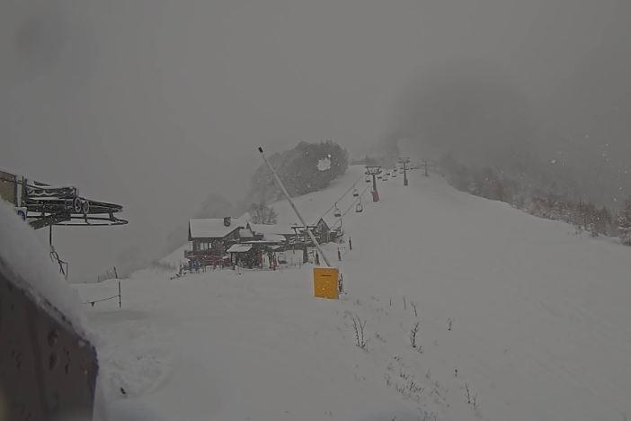
 Fresh snow in Auron in the southern French Alps – 31 January 2025 – Photo: auron.com
On Saturday, snow flurries will tend to be more focussed on the south-western Italian Alps (e.g. Prato Nevoso, Sestriere) and up towards Cervinia and the Monte Rosa region. By Sunday, it should be fine just about everywhere.
The best of the last couple of days’ fresh snow has fallen in the far south-west, where resorts such as Isola 2000 and Auron (pictured) are looking much more wintry than they have done for much of this season.
Updated: 11am Wednesday 29 January 2025 - Much improved snow conditions for most of the Alps…
After a stormy couple of days, the weather in the Alps is much improved today with broken cloud and some good sunny spells for most. A veil of cloud will return to the western Alps later in the day, heralding the arrival of a new storm. This will deliver localised snowfalls over the next few days to some western parts of the Alps, especially in the south-west (e.g. Piedmonte).
 Much improved weather and snow conditions this morning in Crest Voland in the French Savoie – 29 January 2025 – Photo: crestvoland.com
After the past couple of days’ significant snowfalls, conditions are much improved across most of the Alps, especially at altitude.
Many lower areas have also seen improved conditions although, with so much milder air in the mix at the beginning of the storm (and some rain in places), not everywhere has seen a significant net increase in snow.
Updated: 10am Tuesday 28 January 2025 – Significant snow for many parts of the Alps!
As mentioned in our recent updates, the current storm affecting the Alps is highly complex, with huge variations in snowfalls and rain/snow limits from place to place.
 Lots of fresh snow this morning in Zermatt – 28 January 2025 – Photo: zermatt.ch
This storm is effectively the result of the merging of two storms, one from the west and the other forming over the Mediterranean, throwing up moisture from the south. With lots of mild air in place yesterday, it rained to 2000m or higher for a time across many southern and western parts of the Alps. As we expected, there were a few “surprises”, most notably in Courmayeur where a local “micro-weather” situation allowed heavy snow to fall right down to resort level from the get-go, delivering 50-60cm of snow to the ski area in a relatively short space of time.
More generally, later in the afternoon colder air started to arrive in the north-western Alps (e.g. Portes du Soleil), with the rain/snow limit rapidly descending to between 1000-1400m. This cooler ambient air has been spreading slowly south and east overnight but will not reach the far south-eastern Alps (Dolomites) until later today.
In terms of precipitation, this morning the heaviest is falling across the eastern/south-eastern Swiss Alps (e.g. St Moritz), the western and southern Austrian Alps (e.g. Obergurgl) and the central-northern Italian Alps (e.g. Madesimo). The north-eastern Alps (e.g. Salzburg area) will also see some showers/flurries, albeit with less significant accumulations. Over in the western Alps (e.g. France), snow has turned more showery this morning, though it will become a bit more consequential later in the day.
Today’s rain/snow limit will typically be close to 1000m in the western Alps, and between 1400m and 1800m in the south-eastern half of the Alps where it will descend steadily throughout the day.
Updated: 8.50am Monday 27 January 2025 – A new storm is arriving in the Alps, but with highly variable rain/snow limits!
The weather in the Alps remains very unsettled, with a new storm arriving from the west today, which will continue to be significant until Tuesday night.
 Stormy-looking skies this morning over Alpe d’Huez, where rain is expected at resort level before turning to snow this evening – 27 January 2025 – Photo: alpedhuez.com
Ahead of this storm, the air is very mild with Foehn conditions across some central/northern parts of the Alps. The first precipitation has already reached some western and southern parts of the Alps but with a highly variable rain/snow limit. This morning it will rain to 2000m or higher in the more exposed parts of the western and southern Alps, but lower in some sheltered internal valleys – especially the upper Aosta (e.g Courmayeur).
Protected by the Foehn, many central and northern Alpine valleys will remain dry for much of the day but rain/snow will tend to become heavier and more persistent in the southern and western Alps later in the day, reaching more eastern areas tonight.
The rain/snow limit will start to drop later this afternoon, first in the north-western Alps (e.g. Portes du Soleil) where the snow will fall to around 1500m this evening then to 1000-1200m later tonight. Further south and east, the milder air will hang on for longer but the cooler conditions will eventually win out tomorrow.
The biggest snowfall totals from this storm are likely to be in two different areas.
The first will be the high French resorts, including the likes of Tignes, Val Thorens, Alpe d’Huez and Les 2 Alpes. The second area will be in the central-southern Alps, including resorts such as St Moritz and Madesimo. All these areas could see 40-70cm of new snow above 2000m by the end of tomorrow.
Many other parts of the Alps will also see some useful snow higher up but, with so much mild air and rain in the mix at first, many lower areas won’t see much if any net gain.
Updated: 10am Sunday 26 January 2025 – Highly changeable weather and snow conditions in the Alps…
It’s a mostly cloudy morning in the eastern Alps, with a little snow (1000-1300m) clearing away later in the day. This snow is thanks to a weakening cold front that brought a useful top-up of snow to the western Alps last night.
 It’s snowing this morning in Warth am Arlberg in the Austrian Vorarlberg – 26 January 2025 – Photo: warth-schroecken.com
This follows an exceptionally mild couple of days (on Friday and Saturday) which saw Foehn winds bring record-breaking January temperatures to some parts of the Alps, with -22°C in Grenoble, for example.
The Foehn will return tomorrow ahead of a new storm that will bring heavier and more widespread snow to the Alps on Tuesday.
With such changeable weather conditions in the Alps in recent days, snow conditions are also changing from day to day, currently best at altitude in the western Alps (e.g. Val d’Isère) but set to improve significantly across much of the Alps over the coming week.
Updated: 11am Friday 24 January 2025 – Mostly fine, snow for some later in the weekend…
The weather in the Alps remains changeable. Today will be mild and mostly dry, with plenty of sunshine, especially in the more central and southern regions.
 Mostly fine and mild today in the Alps. This is St Johann in Tirol – 24 January 2025 – Photo: foto-webcam.eu
After a mostly dry day tomorrow, with very mild Foehn conditions in the northern Alps, weather fronts will bring some precipitation to the western and southern Alps overnight, reaching Austria on Sunday. The rain/snow limit will start high on Saturday, but will quickly fall to around 1000m late on Saturday night and on Sunday, lowering in the west first.
The weather will then remain unsettled next week with significant snow for some, especially in the south and west.
Updated: 2pm Wednesday 22 January 2025 – Further snow for some south-western parts of the Alps…
The weather in the Alps is running along a similar theme to recent days, with rather cloudy skies in the south-western Alps where there is some snow in places, especially in the far south-west. By contrast, the eastern Alps are brighter, albeit with a lot of high cloud, and the best of any sunshine in the eastern Austrian Alps.
 Further significant snow for Limone Piedmonte today – 22 January 2025 – Photo: snoweye.com
The heaviest of today’s snow will again fall in the southern Piedmonte where resorts such as Limone and Prato Nevoso could catch another 10-15cm. Some southern French resorts like Risoul and Isola 2000 could also see a few centimetres of snow today but elsewhere in the south-western/western Alps any precipitation will be rather patchy, with any snow probably not amounting to much.
Tomorrow, showers will become more widespread across the western Alps, starting with some rain to 1800m in places before it turns colder later in the day.
Updated: 1pm Monday 20 January 2025 - Further snow for some lucky south-western parts of the Alps…
There has been little change to the weather in the Alps since the weekend, with lots of cloud in the southern Alps, especially in the south-west where some further snowfalls are likely in places. Further north, it is mostly dry with plenty of sunshine, but also some areas of cloud spilling northwards across the border areas.
 Snowing again today in Limone in the Piedmonte – 20 January 2025 – Photo: bergfex.com
As was the case over the weekend, most of today’s snow will fall in the far south-western Italian Alps, where resorts including Limone Piedmonte and Prato Nevoso may see another 20-30cm!
Over the French border, Isola 2000 might also pick up 10cm today, otherwise there will be no more than a few centimetres at best in other south-western Italian resorts like Sestriere and Bardonecchia. The Monte Rosa region may also see a dusting. However, for most of the Alps it will be another dry day, albeit rather cloudy in the south.
Updated: 10.20am Saturday 18 January 2025 – Mostly fine again in the Alps, but with localised snowfalls in the south-west…
With high pressure still in charge, the Alps continue to enjoy plenty more dry and sunny weather today. However, a small disturbance linked to low pressure over the Mediterranean will bring snow to some south-western regions over the next few days.
 Clouding over in Limone in the Piedmonte, where significant snow is expected (and needed) over the next few days – 18 January 2025 – Photo: ilmeteo.it
The chief beneficiary of this localised snowfall will be the far southern Piedmont (exactly where it is most needed), where resorts such as Prato Nevoso and Limone could see 30-40cm of snow between today and Monday evening. Other resorts that should see some snow, albeit in more modest quantities, include Isola 2000, Val Cenis, Val d’Isère, Cervinia, Zermatt, and the resorts of the Queyras, the Milky Way and the Monte Rosa region.
For the vast majority of the Alps, however, no new snow is expected over the next few days, and it will remain dry with good sunny spells.
Updated: 9.30am Friday 17 January 2025 – Another fine day in the Alps, but some snow for the south-west this weekend…
High pressure is dominant across the Alps, meaning plenty more sunshine today, at least at altitude, but also some areas of cloud or fog plaguing some of the lower valleys.
 Lots of sunshine today across the Alps. This is Zell am See – 17 January 2025 – Photo: foto-webcam.eu
The weather will stay mostly fine over the weekend too, except for in the far south-west (e.g. Isola 2000, Sestriere) where some snow is likely to fall, possibly also extending over the French border into the likes of Montgenèvre, Val Cenis, Val d’Isère and Tignes.
For more on snow conditions in the Alps and beyond, check out our detailed snow report out later today.
Updated: Wednesday 15 January 2025 – Light snow in parts of Austria today…
It’s a mostly sunny day in the western Alps today, with more cloud cover further east and some flurries in the eastern Austrian Alps (e.g. Obertauern), albeit not delivering more than a few centimetres.
 A few very light flurries today in St Johann in Tirol – 15 January 2025 – Photo: foto-webcam.eu
It will be chilly in the eastern Alps with any snow flurries falling to very low levels, but a bit milder further west, with freezing levels typically around 1700m in the French Alps.
Apart from the odd flurry tomorrow in the far south-western Alps (e.g. Prato Nevoso), the next few days will remain fairly settled with plenty of sunshine for most, at least above any stubborn low cloud trapped in some of the valleys. It will remain cool in the east, but freezing levels will creep to above 2000m further west this weekend.
The last few days have seen very little (if any) fresh snow and plenty of sun, at least at altitude, meaning that pistes across the Alps are generally quite hard-packed and a little scratchy or icy in places, especially lower down. That said, most holidaymakers will find conditions pretty good and quite pleasant thanks to the sunshine.
As things stand, the Alps are due for at least another week (and probably more) of mostly dry weather, with variable cloud cover but plenty of sunshine, especially at altitude.
Updated: 9am Friday 10 January 2025 – The weather in the Alps is starting to settle down…
After a very volatile week of weather in the Alps which has seen a lot of snow, rain and wind, especially in the north-west, the weather is now beginning to settle down, but not before some northern regions see a little more snow (and low-level rain).
 Plenty of snow in Val d’Isère, which has managed to avoid much of this week’s rain – Photo: valdisere.com, 10 January 2025
This last set of weather fronts already reached the north-western Alps early this morning and will spread a bit further east later, tonight reaching the far west of Austria (e.g Arlberg) but probably no further. The rain/snow limit will start quite low but rise again, this time to around 1500m in the north-western Alps (e.g Portes du Soleil) before it descends again this evening. Away from some north-western border areas, the southern Alps will stay mostly dry.
On Saturday the last of any flurries will die away from the northern Alps, after which all regions can look forward to a few days of more settled weather with plenty of sunshine at altitude but quite a lot of low cloud to contend with in places.
After such a volatile week, snow conditions in the Alps are extremely mixed; generally poor again at low altitude in the north-west, which has seen quite a lot of rain in recent days, but potentially quite good higher up, which has mostly seen snow. For a full country by country round-up of snow conditions, check out our full detailed snow report later today…
Updated: 12pm Wednesday 8 January 2025 – Rain or snow in the north-western Alps today…
A warm front is currently lying across the northern Alps, most active in the north-west (e.g. Portes du Soleil) where it is raining to 2000m or higher today. The further east (and especially south) you are today, the better the weather will be.
 Cloudy and mild in the northern Austrian Alps today. This is St Johann in Tirol – 8 January 2025 – Photo: foto-webam.eu
The unsettled theme will continue on Thursday and Friday, with further precipitation at times, mostly across the northern half of the Alps. The rain/snow limit will continue to vary, typically between 1000m and 2000m in the north-west, but generally a bit lower in the north-east.
Not surprisingly, snow conditions in the Alps are highly variable right now, and often quite wet lower down, especially in the northern French and northern and western Swiss Alps. Higher up there is lots of fresh snow but, given the stormy weather this week, it’s difficult to enjoy it yet.
In the southern Alps, which also saw some snow earlier this week, the weather has now settled down and snow conditions are more consistent, even if depths remain generally modest.
From Saturday on, most of the Alps are likely to see a more extended period of settled weather.
Updated: 11.30am Tuesday 7 January 2025 – Remaining very unsettled in the Alps…
The weather in the Alps remains very changeable, with one storm clearing from the eastern Alps while a new warm front approaches the west.
 Weather window in the Fornet sector of Val d’Isère before new weather fronts arrive tonight – 7 January 2025 – Photo: valdisere.com
The bulk of any of today’s snow will fall in the eastern Austrian Alps (e.g. Obertauern) where another 15cm of snow is possible with a rain/snow limit around 1000m. Tonight rain or snow will reach the western Alps, spreading a bit further east later albeit dying out as it does. In the western Alps it could rain to above 2000m for a time, though.
After another break in the weather during the middle of Wednesday yet another front will reach the western Alps on Wednesday evening, bringing further rain at low altitudes but further snow higher up, this time above about 1700-1900m.
The weather will remain very unsettled on Thursday and Friday, with further weather fronts arriving from the west. Temperatures will yo-yo but, on the whole, it will remain mild with further rain lower down and significant quantities of snow in the north-western Alps higher up.
Not surprisingly, snow conditions are very mixed across the Alps this week. At high altitude there has been fresh snow just about everywhere, whereas lower down there has been a mixture of rain and snow, especially in the west where lower slopes are starting to suffer.
Updated: 12pm Monday 6 January 2025 – Unsettled weather this week in the Alps, with rain, snow and wind…
The Alps are under the influence of an Atlantic airstream that will bring very changeable weather conditions over the next few days. Most places will see some fresh snow, especially at altitude, but yo-yoing temperatures mean that rain will also be in the mix at times, as will strong winds.
 The recent milder weather has thinned snow cover a little in Les Gets, where a mix of rain and snow is forecast over the next few days – Photo: lesgets.com, 6 January 2025
This follows a mild weekend that has seen rain in places, which has already led to a deterioration in snow conditions in some lower parts of the Alps.
Today the weather will deteriorate over the southern and western Alps, bringing rain or snow. This is already falling in some southern areas and will spread to all regions later today or overnight. The rain/snow limit will start quite high in the western Alps (above 2000m in places), but lower in the more central Alpine valleys and in the south, before descending further overnight.
This current storm will deliver 10-30cm above 1800m to many parts of the Alps over the next 24 hours, with 40cm+ possible in some central southern regions, including Madesimo.
Tomorrow the bulk of any precipitation will fall in the eastern Alps before a new (warm) storm reaches the western Alps tomorrow night, which will linger into Wednesday. This means more rain in the mix for some before it turns colder again on Thursday!
All in all, we are looking at lots of snow at altitude in the Alps this week but with some tricky skiing conditions, partly due to wind and poor visibility but also due to some wet snow conditions at time at lower altitudes.
Updated: 10am Friday 3 January 2025 – Fresh snow in the northern Alps!
The northern Alps are this morning waking up to a nice covering of fresh snow, following an extended period of mostly sunny weather dating back to before Christmas. The southern Alps have again largely missed out, however.
 Fresh snow and brightening skies over Méribel – 3 January 2025 – Photo: merinet.com
Yesterday and last night’s storm was relatively short-lived but quite intense, dumping 10-30cm of fresh snow across a wide swathe of the northern Alps, especially in the north-west, with up to 40cm in a few favoured spots including at altitude in Engelberg.
Any lingering flurries across the northern Alps will die away this morning, leaving most places with a bright but cold day. Over the weekend, a warm front will bring a bit more snow at altitude to some northern and western parts of the Alps but also some rain for a time lower down, most likely on Saturday night.
The weather in the Alps will remain unsettled next week with the chance of further snow for many, but also fluctuating temperatures. Later in the week it should turn colder more generally though.
Updated: 1pm Thursday 2 January 2025 – Snow for the northern Alps tonight…
After a long spell of mostly sunny weather since before Christmas, a new storm is now approaching the Alps from the north-west today.
 Snow forecast in Val d’Isère tonight – 2 January 2025 – Photo: valdisere.com
This storm will deliver a moderate fall of snow to many northern Alpine regions (especially the north-west) this evening and overnight, with typically 10-20cm falling in the area between the northern French Alps (e.g. Avoriaz) and the western Austrian Alps (e.g. Lech), but as much as 30cm in one or two favoured spots such as the northern Swiss Alps (e.g Engelberg).
The rain/snow limit may temporarily rise to between 120m0 and 1500m in some exposed parts of the north-western Alps, but will remain lower in the more internal valleys, and descend to between 600m and 900m more generally overnight. The southern Alps will again miss most of the snow.
Some flurries will linger across the northern Alps for a time tomorrow, otherwise most regions can expect a brighter but chilly day with sunny spells. A warm front will then approach the Alps on Saturday, with the threat of rain falling as high as 2300m in some western parts of the Alps on Saturday night/Sunday.
Snow conditions in the Alps were generally good over Christmas (helped by the excellent weather), deteriorating a fraction by New Year mostly due to the volume of skier traffic rendering many pistes increasingly hard-packed and/or a little icy in places, especially lower down.
Overall, though, most resorts can reflect on a successful holiday period, especially the lower ones of the north-western Alps (e.g. Morzine, Megève, Villars), which were in infinitely better condition than in the last couple of years.