Weather to Skiweathertoski.co.ukDetailed snow report for 9 January 2026 covering the Alps, other European ski resorts, and North American (US and Canada) ski resorts, including current snow depths,
conditions, and forecasts.
Snow conditions are rapidly improving across most of the Alps, thanks to the much-anticipated storm that reached the western Alps on night and will
continue to influence the weather in the Alps until morning. This follows a spell of around 6 weeks without any really serious snowfall for all bar some
south-western parts of the Alps.
At the time of writing, the current storm has already dropped 50–80cm of snow above 1800m across many of the major French ski areas, especially in the Tarentaise (e.g. Val Thorens, Tignes, La
Rosière) and Dauphiné (e.g. Les 2 Alpes), and in the far west of Switzerland (the higher parts of the Portes du Soleil) and some north-western Italian resorts (e.g. Cervinia).
What’s more, it’s not over yet! Another 20–40cm is likely to fall across many of these areas by the end of . Note that the risk of avalanche is very high
in the areas that have seen significant snow and may remain so for some time.
On the whole, there has been less snow the further south and east you are in the Alps, but with some notable falls here and there, for example, around 40cm in the Austrian Arlberg where more is to
come over the weekend. The Dolomites have probably done worst from this storm but, as ever, can still offer lots of good piste-skiing thanks to their world class snow-making.
Across the pond, new snow is improving conditions in many western US ski resorts, but the Banff/Lake Louise area remains the gold standard...
Austria
Snow Report: Austria – 9 January 2026This
section covers the 9 January 2026 snow report for Austria, including current snow depths at key ski resorts, the condition of slopes and pistes, which areas are open, and a brief forecast of snow
over the next few days.
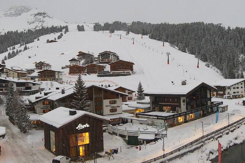
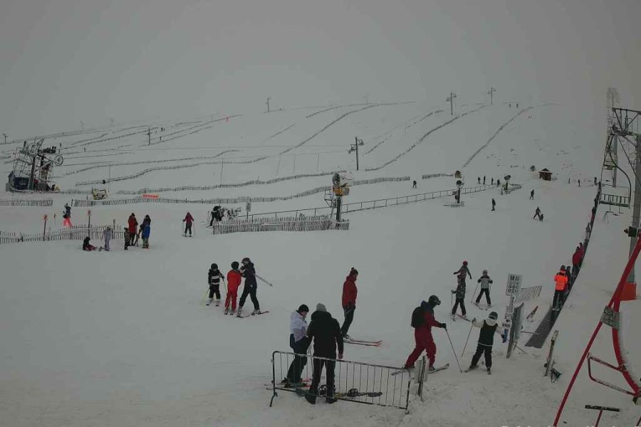
Austrian ski resorts haven’t seen as much snow from the recent storm as further west, but there have been some significant falls in places. Lech, for example, has seen 40cm so
far, now has base depths of 55/125cm with more in the forecast, especially late on Saturday.
Elsewhere in the Austrian Alps, snowfalls have been more modest, but on-piste conditions are still much improved in Obergurgl (20/60cm) and Obertauern (40/80cm),
with further moderate snowfalls forecast until Sunday morning.
Lower down, conditions are also improving in Saalbach (20/90cm) although snow depths remain below average, as they are across the whole of Austria.
Much improved conditions in the Austrian Arlberg, with further snow forecast. This is Lech – 9 January 2026 – Photo: lechzuers.at
France
Snow Report: France – 9 January 2026This
section covers the 9 January 2026 snow report for France, including current snow depths at key ski resorts, the condition of slopes and pistes, which areas are open, and a brief forecast of snow over
the next few days.
Heavy snow has returned to the French Alps which in many cases haven’t seen a significant dump since the end of November!
Both the northern and the southern Alps have benefited from the recent storm, with settled snow depths of 120/180cm in Val Thorens, 90/150cm in Alpe d’Huez and
70/140cm in Serre Chevalier.
Lower ski resorts, including Les Gets (30/100cm), saw some rain to 1500m on Thursday night but this has turned back to snow today. With further snow forecast to very low levels
tonight and on Saturday, prospects look good here too once the weather improves on Sunday.
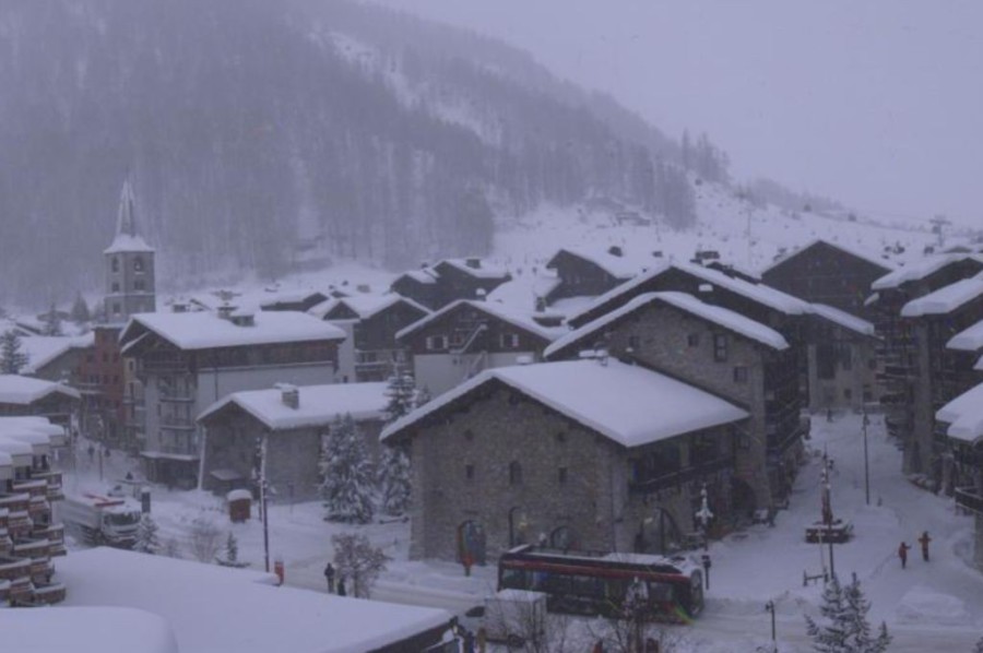
Heavy snow today in Val d’Isère, where storm totals of over 1m are forecast by the end of Saturday – Photo: valdisere.com, 9 January 2026
Italy
Snow Report: Italy – 9 January 2026This
section covers the 9 January 2026 snow report for Italy, including current snow depths at key ski resorts, the condition of slopes and pistes, which areas are open, and a brief forecast of snow over
the next few days.
The north-western Italian Alps have seen significant snow from the current storm, especially the Aosta region where at least 60cm has fallen in Cervinia (95/180cm), with more on
its way over the next 24 hours.
Further south, Bardonecchia (40/120cm) has also seen improved conditions following some moderate snowfalls.
However, there has only been a dusting so far further east in the Dolomites, where Selva (20/50cm) can still offer good piste skiing but has very little natural snow.
Significant fresh snow in the north-western Italian Alps, including here in Courmayeur – 9 January 2026 – Photo: webtv.feratal.com
Switzerland
Snow Report: Switzerland – 9 January 2026This section covers the 9 January 2026 snow report for Switzerland, including current snow depths at key ski resorts, the condition of slopes and pistes, which areas are open, and a
brief forecast of snow over the next few days.
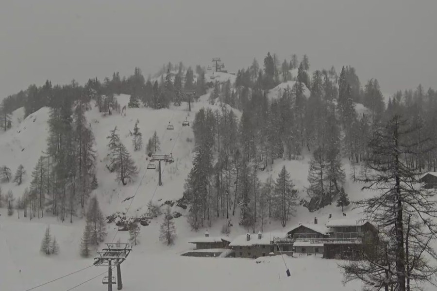
Fresh snow has been falling across Switzerland, heaviest so far in the west where snow conditions in Champéry-Les Crosets (65/160cm) in the Portes du Soleil are much improved,
with more snow in the forecast on Saturday.
Further north, Wengen (20/60cm) has also seen new snow, albeit not quite as much but, with more snow forecast on Saturday, conditions should be superb once skies clear later in
the weekend.
The east and particularly the south-east of the Swiss Alps have seen less snow, but still enough to significantly improve the pistes in St Moritz (20/60cm).
Moderate snowfalls have improved conditions in Saas-Fee – 9 January 2026 – Photo: saas-fee.com
Rest of Europe
Snow Report: Rest of Europe – 9 January 2026This section covers the 9 January 2026 snow report for European ski resorts outside of the Alps, including current snow depths at key resorts, the condition of slopes and pistes, which
areas are open, and a brief forecast of snow over the next few days.
Snow conditions are excellent across much of the Pyrenees, thanks to multiple snowfalls in recent weeks, with a lot more snow forecast tonight and tomorrow! Right now, base depths in Spain’s
Baqueira Beret are 60/90cm while in Andorra’s Grandvalira they are 50/80cm.
Scottish ski resorts have also seen snow this week, with proper skiing now underway in the eastern resorts. Cairngorm (25/35cm) is currently offering the most extensive terrain,
with 18 runs open today including top to bottom skiing.
Snow depths remain modest across most of Scandinavia but there is still plenty of good piste skiing on offer in both Norway’s Trysil (25/35cm) and Sweden’s Sälen
(15/35cm), both of which will see moderate snowfalls next week.
Full snow cover in the Lecht in Scotland - a rare but welcome sight in recent years! – 9 January 2026 – Photo: thelecht.co.uk
USA
Snow Report: USA – 9 January 2026This
section covers the 9 January 2026 snow report for the USA, including current snow depths at key ski resorts, the condition of slopes and pistes, which areas are open, and a brief forecast of snow
over the next few days.
New snow has improved snow conditions in many areas in the US, especially in Utah where around 1.5m has fallen in Snowbird this week, which now has a more respectable 195cm
mid-mountain base.
Mammoth (240cm upper base) is also skiing well thanks to significant new snow earlier this month. However, while Colorado resorts have also seen new snow, amounts here have been
more modest, and resorts including Vail (75cm mid-mountain) remain considerably below par.
Canada
Snow Report: Canada – 9 January 2026This
section covers the 9 January 2026 snow report for Canada, including current snow depths at key ski resorts, the condition of slopes and pistes, which areas are open, and a brief forecast of snow over
the next few days.
Snow conditions remain superb across the western Canadian resorts with a further 45cm in Whistler (182cm mid-mountain base) since our last report and another major storm just
starting.
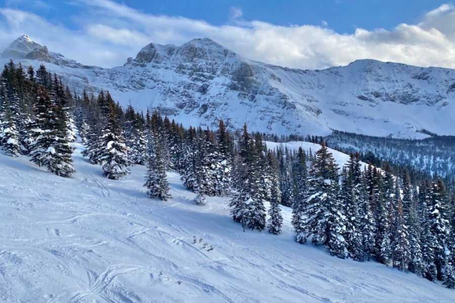
Further inland, the Banff/Lake Louise area (130/160cm) continues to offer some of the best skiing in North America, with another 50cm or so having fallen this week and further
flurries forecast for later in the weekend.
Fabulous snow conditions continue in the Banff area – Photo: planetski.eu, 9 January 2026